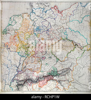
 General map of Germany in 1789. Atlas de l'Histoire du Consulat et de l'Empire. History of the Consulate and the Empire of France under Napoleon by Marie Joseph Louis Adolphe Thiers (1797-1877). Drawings by Dufour, engravings by Dyonnet. Edited in Paris, 1864. Stock Photohttps://www.alamy.com/image-license-details/?v=1https://www.alamy.com/general-map-of-germany-in-1789-atlas-de-lhistoire-du-consulat-et-de-lempire-history-of-the-consulate-and-the-empire-of-france-under-napoleon-by-marie-joseph-louis-adolphe-thiers-1797-1877-drawings-by-dufour-engravings-by-dyonnet-edited-in-paris-1864-image231501141.html
RMRCHP1W–General map of Germany in 1789. Atlas de l'Histoire du Consulat et de l'Empire. History of the Consulate and the Empire of France under Napoleon by Marie Joseph Louis Adolphe Thiers (1797-1877). Drawings by Dufour, engravings by Dyonnet. Edited in Paris, 1864.
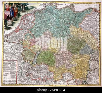 18th century Map of Imperial Germany Stock Photohttps://www.alamy.com/image-license-details/?v=1https://www.alamy.com/18th-century-map-of-imperial-germany-image504914456.html
RM2M9CRF4–18th century Map of Imperial Germany
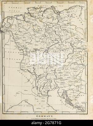 18th Century map of Germany Copperplate engraving From the Encyclopaedia Londinensis or, Universal dictionary of arts, sciences, and literature; Volume VIII; Edited by Wilkes, John. Published in London in 1810. Stock Photohttps://www.alamy.com/image-license-details/?v=1https://www.alamy.com/18th-century-map-of-germany-copperplate-engraving-from-the-encyclopaedia-londinensis-or-universal-dictionary-of-arts-sciences-and-literature-volume-viii-edited-by-wilkes-john-published-in-london-in-1810-image434742940.html
RM2G7871G–18th Century map of Germany Copperplate engraving From the Encyclopaedia Londinensis or, Universal dictionary of arts, sciences, and literature; Volume VIII; Edited by Wilkes, John. Published in London in 1810.
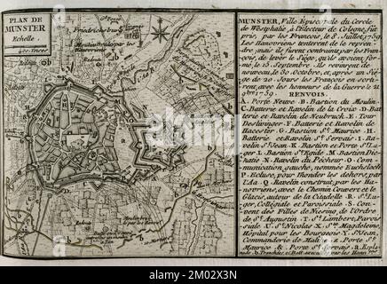 War of the Seven Years (1756-1763). Plan of Münster, 1759. Episcopal city of the imperial circle of Westphalia. It was taken by the French on 8 July 1759. The Hanoverians tried to retake Munster, but on 15 September the French succeeded in lifting the siege of the town. The Hanoverians returned again on 30 October, and after a 20-day siege, the French had to abandon it, leaving with the honours of war on 21 November 1759. Published in 1765 by the cartographer Jean de Beaurain (1696-1771) as an illustration of his Great Map of Germany, with the events that took place during the Seven Years War. Stock Photohttps://www.alamy.com/image-license-details/?v=1https://www.alamy.com/war-of-the-seven-years-1756-1763-plan-of-mnster-1759-episcopal-city-of-the-imperial-circle-of-westphalia-it-was-taken-by-the-french-on-8-july-1759-the-hanoverians-tried-to-retake-munster-but-on-15-september-the-french-succeeded-in-lifting-the-siege-of-the-town-the-hanoverians-returned-again-on-30-october-and-after-a-20-day-siege-the-french-had-to-abandon-it-leaving-with-the-honours-of-war-on-21-november-1759-published-in-1765-by-the-cartographer-jean-de-beaurain-1696-1771-as-an-illustration-of-his-great-map-of-germany-with-the-events-that-took-place-during-the-seven-years-war-image499165065.html
RM2M02X3N–War of the Seven Years (1756-1763). Plan of Münster, 1759. Episcopal city of the imperial circle of Westphalia. It was taken by the French on 8 July 1759. The Hanoverians tried to retake Munster, but on 15 September the French succeeded in lifting the siege of the town. The Hanoverians returned again on 30 October, and after a 20-day siege, the French had to abandon it, leaving with the honours of war on 21 November 1759. Published in 1765 by the cartographer Jean de Beaurain (1696-1771) as an illustration of his Great Map of Germany, with the events that took place during the Seven Years War.
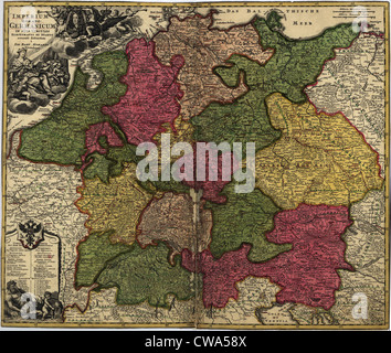 Map of German States, then the Holy Roman Empire, from the early 18th century. Stock Photohttps://www.alamy.com/image-license-details/?v=1https://www.alamy.com/stock-photo-map-of-german-states-then-the-holy-roman-empire-from-the-early-18th-50010826.html
RMCWA58X–Map of German States, then the Holy Roman Empire, from the early 18th century.
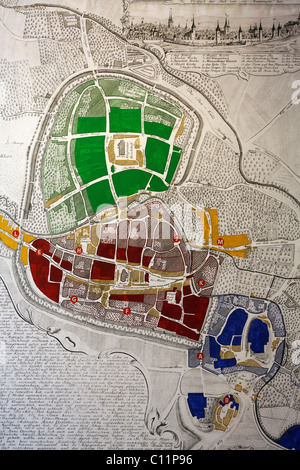 Historical map of Quedlinburg, 18th century, castle museum, Harz, Saxony-Anhalt, Germany, Europe Stock Photohttps://www.alamy.com/image-license-details/?v=1https://www.alamy.com/stock-photo-historical-map-of-quedlinburg-18th-century-castle-museum-harz-saxony-35074850.html
RMC11P96–Historical map of Quedlinburg, 18th century, castle museum, Harz, Saxony-Anhalt, Germany, Europe
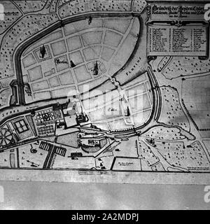 Reproduktion aus der Sammlung Erich Retzlaff: Plan der Stadt Berlin aus dem 18. Jahrhundert, Deutschland 1930er Jahre. Reproduktion from the Erich Retzlaff collection: map of the city of Berlin, 18th century, Germany 1930s. Stock Photohttps://www.alamy.com/image-license-details/?v=1https://www.alamy.com/reproduktion-aus-der-sammlung-erich-retzlaff-plan-der-stadt-berlin-aus-dem-18-jahrhundert-deutschland-1930er-jahre-reproduktion-from-the-erich-retzlaff-collection-map-of-the-city-of-berlin-18th-century-germany-1930s-image328676170.html
RM2A2MDPJ–Reproduktion aus der Sammlung Erich Retzlaff: Plan der Stadt Berlin aus dem 18. Jahrhundert, Deutschland 1930er Jahre. Reproduktion from the Erich Retzlaff collection: map of the city of Berlin, 18th century, Germany 1930s.
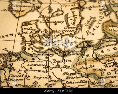 Old Map Northern Europe Stock Photohttps://www.alamy.com/image-license-details/?v=1https://www.alamy.com/old-map-northern-europe-image632065084.html
RF2YM91D0–Old Map Northern Europe
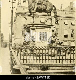 The story of the map of Europe, its making and its changing . ^4^^.,fil. THE GREAT ELECTOR OF BRANDENBURG The Map of Europe 95 borough, aided by the emperors army, put anend to the further expansion of the French. Prussia The 18th century also saw the rise of a new kingdom in Europe. You will recall that there was a county in Germany named Brandenburg, whose count was one of the seven electors who chose the emperor. The capital of this county Hohen- was Berlin. It so happened that a number of zollernsof^ Branden- Counts of Brandenburg, of the family of burg Hohenzollern, had been men of ambiti Stock Photohttps://www.alamy.com/image-license-details/?v=1https://www.alamy.com/the-story-of-the-map-of-europe-its-making-and-its-changing-4fil-the-great-elector-of-brandenburg-the-map-of-europe-95-borough-aided-by-the-emperors-army-put-anend-to-the-further-expansion-of-the-french-prussia-the-18th-century-also-saw-the-rise-of-a-new-kingdom-in-europe-you-will-recall-that-there-was-a-county-in-germany-named-brandenburg-whose-count-was-one-of-the-seven-electors-who-chose-the-emperor-the-capital-of-this-county-hohen-was-berlin-it-so-happened-that-a-number-of-zollernsof-branden-counts-of-brandenburg-of-the-family-of-burg-hohenzollern-had-been-men-of-ambiti-image342891429.html
RM2AWT1ED–The story of the map of Europe, its making and its changing . ^4^^.,fil. THE GREAT ELECTOR OF BRANDENBURG The Map of Europe 95 borough, aided by the emperors army, put anend to the further expansion of the French. Prussia The 18th century also saw the rise of a new kingdom in Europe. You will recall that there was a county in Germany named Brandenburg, whose count was one of the seven electors who chose the emperor. The capital of this county Hohen- was Berlin. It so happened that a number of zollernsof^ Branden- Counts of Brandenburg, of the family of burg Hohenzollern, had been men of ambiti
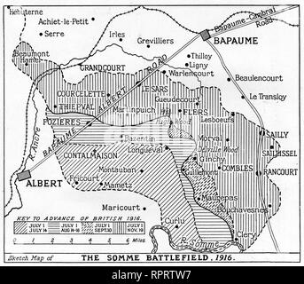 A map of the Somme Battlefield, 1916. The Battle of the Somme, also known as the Somme Offensive, was a battle of the World War I fought by the armies of the British Empire and French Third Republic against the German Empire. It took place between 1st July and 18th November 1916. Stock Photohttps://www.alamy.com/image-license-details/?v=1https://www.alamy.com/a-map-of-the-somme-battlefield-1916-the-battle-of-the-somme-also-known-as-the-somme-offensive-was-a-battle-of-the-world-war-i-fought-by-the-armies-of-the-british-empire-and-french-third-republic-against-the-german-empire-it-took-place-between-1st-july-and-18th-november-1916-image237781635.html
RMRPRTW7–A map of the Somme Battlefield, 1916. The Battle of the Somme, also known as the Somme Offensive, was a battle of the World War I fought by the armies of the British Empire and French Third Republic against the German Empire. It took place between 1st July and 18th November 1916.
 Vintage hand drawn Homann's map of Germany from 18th century. All maps are beautifully colored and illustrated showing known world at moment. Stock Photohttps://www.alamy.com/image-license-details/?v=1https://www.alamy.com/vintage-hand-drawn-homanns-map-of-germany-from-18th-century-all-maps-are-beautifully-colored-and-illustrated-showing-known-world-at-moment-image418993492.html
RF2F9JPD8–Vintage hand drawn Homann's map of Germany from 18th century. All maps are beautifully colored and illustrated showing known world at moment.
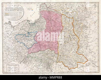 . English: This important 1794 map by Thomas Kitchin depicts the Kingdom of Poland during the brief transitional period between the second and third partitions. Covers from Brandenburg to Russia and from the Gulf of Livonia to Moldova and Hungary, including all of Poland and the Grand Duchy of Lithuania, parts of Prussia, Russia, Livonia, Hungary, Germany and Austria. This map depicts Poland in 1794, immediately following the Second Partition of Poland in 1793. By the mid 18th century Poland, due to an inefficient and corrupt internal bureaucracy, had lost much of its autonomy to its aggressi Stock Photohttps://www.alamy.com/image-license-details/?v=1https://www.alamy.com/english-this-important-1794-map-by-thomas-kitchin-depicts-the-kingdom-of-poland-during-the-brief-transitional-period-between-the-second-and-third-partitions-covers-from-brandenburg-to-russia-and-from-the-gulf-of-livonia-to-moldova-and-hungary-including-all-of-poland-and-the-grand-duchy-of-lithuania-parts-of-prussia-russia-livonia-hungary-germany-and-austria-this-map-depicts-poland-in-1794-immediately-following-the-second-partition-of-poland-in-1793-by-the-mid-18th-century-poland-due-to-an-inefficient-and-corrupt-internal-bureaucracy-had-lost-much-of-its-autonomy-to-its-aggressi-image184898008.html
RMMMPR88–. English: This important 1794 map by Thomas Kitchin depicts the Kingdom of Poland during the brief transitional period between the second and third partitions. Covers from Brandenburg to Russia and from the Gulf of Livonia to Moldova and Hungary, including all of Poland and the Grand Duchy of Lithuania, parts of Prussia, Russia, Livonia, Hungary, Germany and Austria. This map depicts Poland in 1794, immediately following the Second Partition of Poland in 1793. By the mid 18th century Poland, due to an inefficient and corrupt internal bureaucracy, had lost much of its autonomy to its aggressi