 Cartographic, Maps. 1938 - 1957. Lionel Pincus and Princess Firyal Map Division. Real property , New York (State) , New York (N.Y.), Bronx (New York, N.Y.) , Maps Double Page Plate No. 10, Part of Section 11, Borough of the Bronx: Bounded by E. 181st Street, Mapes Avenue, E. Tremont Avenue and Bathgate Avenue Stock Photohttps://www.alamy.com/image-license-details/?v=1https://www.alamy.com/cartographic-maps-1938-1957-lionel-pincus-and-princess-firyal-map-division-real-property-new-york-state-new-york-ny-bronx-new-york-ny-maps-double-page-plate-no-10-part-of-section-11-borough-of-the-bronx-bounded-by-e-181st-street-mapes-avenue-e-tremont-avenue-and-bathgate-avenue-image483590856.html
RM2K2ND20–Cartographic, Maps. 1938 - 1957. Lionel Pincus and Princess Firyal Map Division. Real property , New York (State) , New York (N.Y.), Bronx (New York, N.Y.) , Maps Double Page Plate No. 10, Part of Section 11, Borough of the Bronx: Bounded by E. 181st Street, Mapes Avenue, E. Tremont Avenue and Bathgate Avenue
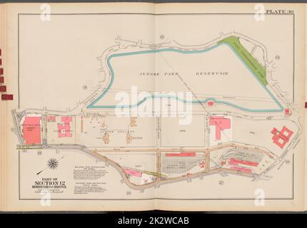 Cartographic, Maps. 1938 - 1957. Lionel Pincus and Princess Firyal Map Division. Real property , New York (State) , New York (N.Y.), Bronx (New York, N.Y.) , Maps Double Page Plate No. 30, Part of Section 12, Borough of the Bronx: Bounded by Reservoir Avenue, Sedgwick Avenue, W. Mosholu Parkway South, Jerome Avenue and W. Kingsbridge Road Stock Photohttps://www.alamy.com/image-license-details/?v=1https://www.alamy.com/cartographic-maps-1938-1957-lionel-pincus-and-princess-firyal-map-division-real-property-new-york-state-new-york-ny-bronx-new-york-ny-maps-double-page-plate-no-30-part-of-section-12-borough-of-the-bronx-bounded-by-reservoir-avenue-sedgwick-avenue-w-mosholu-parkway-south-jerome-avenue-and-w-kingsbridge-road-image483678115.html
RM2K2WCAB–Cartographic, Maps. 1938 - 1957. Lionel Pincus and Princess Firyal Map Division. Real property , New York (State) , New York (N.Y.), Bronx (New York, N.Y.) , Maps Double Page Plate No. 30, Part of Section 12, Borough of the Bronx: Bounded by Reservoir Avenue, Sedgwick Avenue, W. Mosholu Parkway South, Jerome Avenue and W. Kingsbridge Road
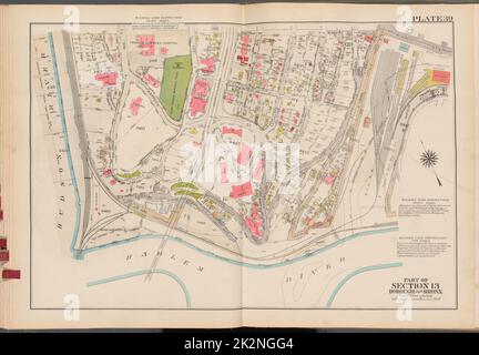 Cartographic, Maps. 1938 - 1957. Lionel Pincus and Princess Firyal Map Division. Real property , New York (State) , New York (N.Y.), Bronx (New York, N.Y.) , Maps Double Page Plate No. 39, Part of Section 13, Borough of the Bronx: Bounded by W. 230th Street, Terrace View Avenue, Teunissen Place, Harlem River and (Hudson River) Palisade Avenue Stock Photohttps://www.alamy.com/image-license-details/?v=1https://www.alamy.com/cartographic-maps-1938-1957-lionel-pincus-and-princess-firyal-map-division-real-property-new-york-state-new-york-ny-bronx-new-york-ny-maps-double-page-plate-no-39-part-of-section-13-borough-of-the-bronx-bounded-by-w-230th-street-terrace-view-avenue-teunissen-place-harlem-river-and-hudson-river-palisade-avenue-image483593604.html
RM2K2NGG4–Cartographic, Maps. 1938 - 1957. Lionel Pincus and Princess Firyal Map Division. Real property , New York (State) , New York (N.Y.), Bronx (New York, N.Y.) , Maps Double Page Plate No. 39, Part of Section 13, Borough of the Bronx: Bounded by W. 230th Street, Terrace View Avenue, Teunissen Place, Harlem River and (Hudson River) Palisade Avenue
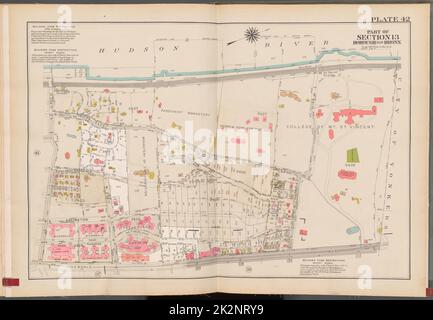 Cartographic, Maps. 1938 - 1957. Lionel Pincus and Princess Firyal Map Division. Real property , New York (State) , New York (N.Y.), Bronx (New York, N.Y.) , Maps Double Page Plate No. 42, Part of Section 13, Borough of the Bronx: Bounded by (Hudson River) Palisade Avenue, (City of Yonkers) W. 261st Street, Riverdale Avenue and W. 254th Street Stock Photohttps://www.alamy.com/image-license-details/?v=1https://www.alamy.com/cartographic-maps-1938-1957-lionel-pincus-and-princess-firyal-map-division-real-property-new-york-state-new-york-ny-bronx-new-york-ny-maps-double-page-plate-no-42-part-of-section-13-borough-of-the-bronx-bounded-by-hudson-river-palisade-avenue-city-of-yonkers-w-261st-street-riverdale-avenue-and-w-254th-street-image483599405.html
RM2K2NRY9–Cartographic, Maps. 1938 - 1957. Lionel Pincus and Princess Firyal Map Division. Real property , New York (State) , New York (N.Y.), Bronx (New York, N.Y.) , Maps Double Page Plate No. 42, Part of Section 13, Borough of the Bronx: Bounded by (Hudson River) Palisade Avenue, (City of Yonkers) W. 261st Street, Riverdale Avenue and W. 254th Street
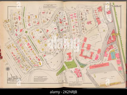 Cartographic, Maps. 1938 - 1957. Lionel Pincus and Princess Firyal Map Division. Real property , New York (State) , New York (N.Y.), Bronx (New York, N.Y.) , Maps Double Page Plate No. 36, Part of Section 13, Borough of the Bronx: Bounded by W. 246th Street, Broadway, W. 240th Street, Irwin Avenue, Spuyten Duyvil Parkway and Henry Hudson Parkway Stock Photohttps://www.alamy.com/image-license-details/?v=1https://www.alamy.com/cartographic-maps-1938-1957-lionel-pincus-and-princess-firyal-map-division-real-property-new-york-state-new-york-ny-bronx-new-york-ny-maps-double-page-plate-no-36-part-of-section-13-borough-of-the-bronx-bounded-by-w-246th-street-broadway-w-240th-street-irwin-avenue-spuyten-duyvil-parkway-and-henry-hudson-parkway-image483599155.html
RM2K2NRJB–Cartographic, Maps. 1938 - 1957. Lionel Pincus and Princess Firyal Map Division. Real property , New York (State) , New York (N.Y.), Bronx (New York, N.Y.) , Maps Double Page Plate No. 36, Part of Section 13, Borough of the Bronx: Bounded by W. 246th Street, Broadway, W. 240th Street, Irwin Avenue, Spuyten Duyvil Parkway and Henry Hudson Parkway
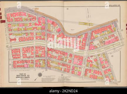 Cartographic, Maps. 1938 - 1957. Lionel Pincus and Princess Firyal Map Division. Real property , New York (State) , New York (N.Y.), Bronx (New York, N.Y.) , Maps Double Page Plate No. 25, Part of Section 12, Borough of the Bronx: Bounded by Jerome Avenue, E. 204th Street, Grand Concourse, E. 202nd Street, Briggs Avenue and E. 196th Street Stock Photohttps://www.alamy.com/image-license-details/?v=1https://www.alamy.com/cartographic-maps-1938-1957-lionel-pincus-and-princess-firyal-map-division-real-property-new-york-state-new-york-ny-bronx-new-york-ny-maps-double-page-plate-no-25-part-of-section-12-borough-of-the-bronx-bounded-by-jerome-avenue-e-204th-street-grand-concourse-e-202nd-street-briggs-avenue-and-e-196th-street-image483590860.html
RM2K2ND24–Cartographic, Maps. 1938 - 1957. Lionel Pincus and Princess Firyal Map Division. Real property , New York (State) , New York (N.Y.), Bronx (New York, N.Y.) , Maps Double Page Plate No. 25, Part of Section 12, Borough of the Bronx: Bounded by Jerome Avenue, E. 204th Street, Grand Concourse, E. 202nd Street, Briggs Avenue and E. 196th Street
 Cartographic, Maps. 1938 - 1957. Lionel Pincus and Princess Firyal Map Division. Real property , New York (State) , New York (N.Y.), Bronx (New York, N.Y.) , Maps Double Page Plate No. 11, Part of Section 11, Borough of the Bronx: Bounded by E. 180th Street, Webster Avenue, E. 181st Street, Bathgate Avenue, E. Tremont Avenue and Grand Concourse Stock Photohttps://www.alamy.com/image-license-details/?v=1https://www.alamy.com/cartographic-maps-1938-1957-lionel-pincus-and-princess-firyal-map-division-real-property-new-york-state-new-york-ny-bronx-new-york-ny-maps-double-page-plate-no-11-part-of-section-11-borough-of-the-bronx-bounded-by-e-180th-street-webster-avenue-e-181st-street-bathgate-avenue-e-tremont-avenue-and-grand-concourse-image483585579.html
RM2K2N69F–Cartographic, Maps. 1938 - 1957. Lionel Pincus and Princess Firyal Map Division. Real property , New York (State) , New York (N.Y.), Bronx (New York, N.Y.) , Maps Double Page Plate No. 11, Part of Section 11, Borough of the Bronx: Bounded by E. 180th Street, Webster Avenue, E. 181st Street, Bathgate Avenue, E. Tremont Avenue and Grand Concourse
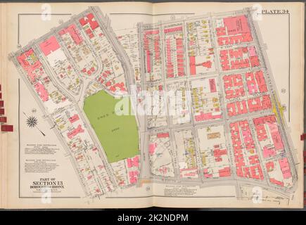 Cartographic, Maps. 1938 - 1957. Lionel Pincus and Princess Firyal Map Division. Real property , New York (State) , New York (N.Y.), Bronx (New York, N.Y.) , Maps Double Page Plate No. 34, Part of Section 13, Borough of the Bronx: Bounded by W. 235th Street, Riverdale Avenue, Irwin Avenue, W. 234th Street, Broadway, W. 230th Street and Netherland Avenue Stock Photohttps://www.alamy.com/image-license-details/?v=1https://www.alamy.com/cartographic-maps-1938-1957-lionel-pincus-and-princess-firyal-map-division-real-property-new-york-state-new-york-ny-bronx-new-york-ny-maps-double-page-plate-no-34-part-of-section-13-borough-of-the-bronx-bounded-by-w-235th-street-riverdale-avenue-irwin-avenue-w-234th-street-broadway-w-230th-street-and-netherland-avenue-image483591436.html
RM2K2NDPM–Cartographic, Maps. 1938 - 1957. Lionel Pincus and Princess Firyal Map Division. Real property , New York (State) , New York (N.Y.), Bronx (New York, N.Y.) , Maps Double Page Plate No. 34, Part of Section 13, Borough of the Bronx: Bounded by W. 235th Street, Riverdale Avenue, Irwin Avenue, W. 234th Street, Broadway, W. 230th Street and Netherland Avenue
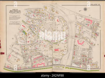 Cartographic, Maps. 1938 - 1957. Lionel Pincus and Princess Firyal Map Division. Real property , New York (State) , New York (N.Y.), Bronx (New York, N.Y.) , Maps Double Page Plate No. 37, Part of Section 13, Borough of the Bronx: Bounded by Delafield Avenue, W. 250th Street, Henry Hudson Parkway, Riverdale Avenue, W. 256th Street, Broadway and W. 246th Street Stock Photohttps://www.alamy.com/image-license-details/?v=1https://www.alamy.com/cartographic-maps-1938-1957-lionel-pincus-and-princess-firyal-map-division-real-property-new-york-state-new-york-ny-bronx-new-york-ny-maps-double-page-plate-no-37-part-of-section-13-borough-of-the-bronx-bounded-by-delafield-avenue-w-250th-street-henry-hudson-parkway-riverdale-avenue-w-256th-street-broadway-and-w-246th-street-image483592600.html
RM2K2NF88–Cartographic, Maps. 1938 - 1957. Lionel Pincus and Princess Firyal Map Division. Real property , New York (State) , New York (N.Y.), Bronx (New York, N.Y.) , Maps Double Page Plate No. 37, Part of Section 13, Borough of the Bronx: Bounded by Delafield Avenue, W. 250th Street, Henry Hudson Parkway, Riverdale Avenue, W. 256th Street, Broadway and W. 246th Street
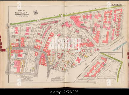 Cartographic, Maps. 1938 - 1957. Lionel Pincus and Princess Firyal Map Division. Real property , New York (State) , New York (N.Y.), Bronx (New York, N.Y.) , Maps Double Page Plate No. 33, Part of Section 12, Borough of the Bronx: Bounded by Van Cortlandt Park South, Saxon Avenue, Sedgwick Avenue, W. 238th Street, Bailey Avenue, W. 236th Street and Broadway Stock Photohttps://www.alamy.com/image-license-details/?v=1https://www.alamy.com/cartographic-maps-1938-1957-lionel-pincus-and-princess-firyal-map-division-real-property-new-york-state-new-york-ny-bronx-new-york-ny-maps-double-page-plate-no-33-part-of-section-12-borough-of-the-bronx-bounded-by-van-cortlandt-park-south-saxon-avenue-sedgwick-avenue-w-238th-street-bailey-avenue-w-236th-street-and-broadway-image483592208.html
RM2K2NEP8–Cartographic, Maps. 1938 - 1957. Lionel Pincus and Princess Firyal Map Division. Real property , New York (State) , New York (N.Y.), Bronx (New York, N.Y.) , Maps Double Page Plate No. 33, Part of Section 12, Borough of the Bronx: Bounded by Van Cortlandt Park South, Saxon Avenue, Sedgwick Avenue, W. 238th Street, Bailey Avenue, W. 236th Street and Broadway
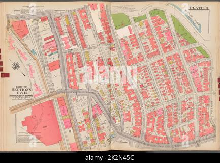 Cartographic, Maps. 1938 - 1957. Lionel Pincus and Princess Firyal Map Division. Real property , New York (State) , New York (N.Y.), Bronx (New York, N.Y.) , Maps Double Page Plate No. 31, Part of Sections 11 & 12, Borough of the Bronx: Bounded by Broadway, W. 230th Street, Reservoir Avenue, W. Kingsbridge Road, W. 193rd Street and Bailey Avenue Stock Photohttps://www.alamy.com/image-license-details/?v=1https://www.alamy.com/cartographic-maps-1938-1957-lionel-pincus-and-princess-firyal-map-division-real-property-new-york-state-new-york-ny-bronx-new-york-ny-maps-double-page-plate-no-31-part-of-sections-11-12-borough-of-the-bronx-bounded-by-broadway-w-230th-street-reservoir-avenue-w-kingsbridge-road-w-193rd-street-and-bailey-avenue-image483583896.html
RM2K2N45C–Cartographic, Maps. 1938 - 1957. Lionel Pincus and Princess Firyal Map Division. Real property , New York (State) , New York (N.Y.), Bronx (New York, N.Y.) , Maps Double Page Plate No. 31, Part of Sections 11 & 12, Borough of the Bronx: Bounded by Broadway, W. 230th Street, Reservoir Avenue, W. Kingsbridge Road, W. 193rd Street and Bailey Avenue
 Cartographic, Maps. 1938 - 1957. Lionel Pincus and Princess Firyal Map Division. Real property , New York (State) , New York (N.Y.), Bronx (New York, N.Y.) , Maps Double Page Plate No. 24, Part of Section 12, Borough of the Bronx: Bounded by Briggs Avenue, E. Mosholu Parkway South, Webster Avenue, E. 197th Street, Bainbridge Avenue and E. 196th Street Stock Photohttps://www.alamy.com/image-license-details/?v=1https://www.alamy.com/cartographic-maps-1938-1957-lionel-pincus-and-princess-firyal-map-division-real-property-new-york-state-new-york-ny-bronx-new-york-ny-maps-double-page-plate-no-24-part-of-section-12-borough-of-the-bronx-bounded-by-briggs-avenue-e-mosholu-parkway-south-webster-avenue-e-197th-street-bainbridge-avenue-and-e-196th-street-image483590733.html
RM2K2NCWH–Cartographic, Maps. 1938 - 1957. Lionel Pincus and Princess Firyal Map Division. Real property , New York (State) , New York (N.Y.), Bronx (New York, N.Y.) , Maps Double Page Plate No. 24, Part of Section 12, Borough of the Bronx: Bounded by Briggs Avenue, E. Mosholu Parkway South, Webster Avenue, E. 197th Street, Bainbridge Avenue and E. 196th Street