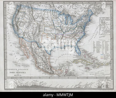
 . English: This fascinating 1862 map by Justus Perthes and Stieler depicts the United States, Mexico and the West Indies. Made at the height of the Civil War, this map separates the Union and Confederate States. The Union is Blue – as is the whole. The Confederate states are pink. Undeclared states and territories are depicted in Yellow. In cartographic flourish unique to Perthes, land profiles decorate the bottom of the map. All text is in German. Unlike other cartographic publishers of the period, the Justus Perthes firm, did not transition to lithographic printing techniques. Instead, all Stock Photohttps://www.alamy.com/image-license-details/?v=1https://www.alamy.com/english-this-fascinating-1862-map-by-justus-perthes-and-stieler-depicts-the-united-states-mexico-and-the-west-indies-made-at-the-height-of-the-civil-war-this-map-separates-the-union-and-confederate-states-the-union-is-blue-as-is-the-whole-the-confederate-states-are-pink-undeclared-states-and-territories-are-depicted-in-yellow-in-cartographic-flourish-unique-to-perthes-land-profiles-decorate-the-bottom-of-the-map-all-text-is-in-german-unlike-other-cartographic-publishers-of-the-period-the-justus-perthes-firm-did-not-transition-to-lithographic-printing-techniques-instead-all-image184964940.html
RMMMWTJM–. English: This fascinating 1862 map by Justus Perthes and Stieler depicts the United States, Mexico and the West Indies. Made at the height of the Civil War, this map separates the Union and Confederate States. The Union is Blue – as is the whole. The Confederate states are pink. Undeclared states and territories are depicted in Yellow. In cartographic flourish unique to Perthes, land profiles decorate the bottom of the map. All text is in German. Unlike other cartographic publishers of the period, the Justus Perthes firm, did not transition to lithographic printing techniques. Instead, all
 . English: This fascinating 1862 map by Justus Perthes and Stieler depicts the physical geography of central Europe (or as it is called greater Deutschland) from the Adriatic to the Baltic and as far west as Beligum. Cities are noted, but there are not political distinctions. In a display of cartographic flair unique to Perthes maps, a land elevation profiles decorate the bottom and sides of the map. Unlike other cartographic publishers of the period, the Justus Perthes firm, did not transition to lithographic printing techniques. Instead, all of his maps are copper plate engravings and hence Stock Photohttps://www.alamy.com/image-license-details/?v=1https://www.alamy.com/english-this-fascinating-1862-map-by-justus-perthes-and-stieler-depicts-the-physical-geography-of-central-europe-or-as-it-is-called-greater-deutschland-from-the-adriatic-to-the-baltic-and-as-far-west-as-beligum-cities-are-noted-but-there-are-not-political-distinctions-in-a-display-of-cartographic-flair-unique-to-perthes-maps-a-land-elevation-profiles-decorate-the-bottom-and-sides-of-the-map-unlike-other-cartographic-publishers-of-the-period-the-justus-perthes-firm-did-not-transition-to-lithographic-printing-techniques-instead-all-of-his-maps-are-copper-plate-engravings-and-hence-image184964769.html
RMMMWTCH–. English: This fascinating 1862 map by Justus Perthes and Stieler depicts the physical geography of central Europe (or as it is called greater Deutschland) from the Adriatic to the Baltic and as far west as Beligum. Cities are noted, but there are not political distinctions. In a display of cartographic flair unique to Perthes maps, a land elevation profiles decorate the bottom and sides of the map. Unlike other cartographic publishers of the period, the Justus Perthes firm, did not transition to lithographic printing techniques. Instead, all of his maps are copper plate engravings and hence
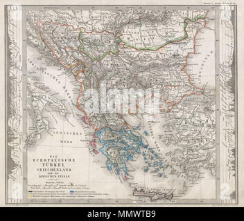 . English: This fascinating 1862 map by Justus Perthes and Stieler depicts Greece, the Balkans, parts of Turkey, and the islands of the Adriatic as far south as Crete or Candia. Extends as far north as Croatia, Bosnia, Serbia, Bulgaria, Rumania and Macedonia. In a cartographic flourish unique to Perthes, elevation profile charts decorate the right and left borders of the map. Unlike other cartographic publishers of the period, the Justus Perthes firm, did not transition to lithographic printing techniques until the early 1870s. Instead, all of his maps are copper plate engravings and hence of Stock Photohttps://www.alamy.com/image-license-details/?v=1https://www.alamy.com/english-this-fascinating-1862-map-by-justus-perthes-and-stieler-depicts-greece-the-balkans-parts-of-turkey-and-the-islands-of-the-adriatic-as-far-south-as-crete-or-candia-extends-as-far-north-as-croatia-bosnia-serbia-bulgaria-rumania-and-macedonia-in-a-cartographic-flourish-unique-to-perthes-elevation-profile-charts-decorate-the-right-and-left-borders-of-the-map-unlike-other-cartographic-publishers-of-the-period-the-justus-perthes-firm-did-not-transition-to-lithographic-printing-techniques-until-the-early-1870s-instead-all-of-his-maps-are-copper-plate-engravings-and-hence-of-image184964733.html
RMMMWTB9–. English: This fascinating 1862 map by Justus Perthes and Stieler depicts Greece, the Balkans, parts of Turkey, and the islands of the Adriatic as far south as Crete or Candia. Extends as far north as Croatia, Bosnia, Serbia, Bulgaria, Rumania and Macedonia. In a cartographic flourish unique to Perthes, elevation profile charts decorate the right and left borders of the map. Unlike other cartographic publishers of the period, the Justus Perthes firm, did not transition to lithographic printing techniques until the early 1870s. Instead, all of his maps are copper plate engravings and hence of
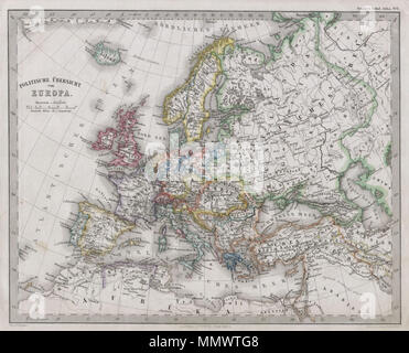 . English: This fascinating 1862 map by Justus Perthes and Stieler continent of Europe. Unlike other cartographic publishers of the period, the Justus Perthes firm, did not transition to lithographic printing techniques. Instead, all of his maps are copper plate engravings and hence offer a level of character and depth of detail that was impossible to find in lithography or wax-process engraving. Issued in the 1862 edition of Stieler’s Schul-Atlas. Politische Ubersicht von Europa.. 1862. 1862 Stieler Map of Europe - Geographicus - EuropaPoli-perthes-1862 Stock Photohttps://www.alamy.com/image-license-details/?v=1https://www.alamy.com/english-this-fascinating-1862-map-by-justus-perthes-and-stieler-continent-of-europe-unlike-other-cartographic-publishers-of-the-period-the-justus-perthes-firm-did-not-transition-to-lithographic-printing-techniques-instead-all-of-his-maps-are-copper-plate-engravings-and-hence-offer-a-level-of-character-and-depth-of-detail-that-was-impossible-to-find-in-lithography-or-wax-process-engraving-issued-in-the-1862-edition-of-stielers-schul-atlas-politische-ubersicht-von-europa-1862-1862-stieler-map-of-europe-geographicus-europapoli-perthes-1862-image184964872.html
RMMMWTG8–. English: This fascinating 1862 map by Justus Perthes and Stieler continent of Europe. Unlike other cartographic publishers of the period, the Justus Perthes firm, did not transition to lithographic printing techniques. Instead, all of his maps are copper plate engravings and hence offer a level of character and depth of detail that was impossible to find in lithography or wax-process engraving. Issued in the 1862 edition of Stieler’s Schul-Atlas. Politische Ubersicht von Europa.. 1862. 1862 Stieler Map of Europe - Geographicus - EuropaPoli-perthes-1862
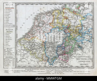 . English: This fascinating 1862 map by Justus Perthes and Stieler depicts Holland (the Netherlands) and Belgium as well as parts of western Germany. Statistical information to the bottom and left of the map proper. Unlike other cartographic publishers of the period, the Justus Perthes firm, did not transition to lithographic printing techniques. Instead, all of his maps are copper plate engravings and hence offer a level of character and depth of detail that was impossible to find in lithography or wax-process engraving. All text in German. Issued in the 1862 edition of Stieler’s Schul-Atlas Stock Photohttps://www.alamy.com/image-license-details/?v=1https://www.alamy.com/english-this-fascinating-1862-map-by-justus-perthes-and-stieler-depicts-holland-the-netherlands-and-belgium-as-well-as-parts-of-western-germany-statistical-information-to-the-bottom-and-left-of-the-map-proper-unlike-other-cartographic-publishers-of-the-period-the-justus-perthes-firm-did-not-transition-to-lithographic-printing-techniques-instead-all-of-his-maps-are-copper-plate-engravings-and-hence-offer-a-level-of-character-and-depth-of-detail-that-was-impossible-to-find-in-lithography-or-wax-process-engraving-all-text-in-german-issued-in-the-1862-edition-of-stielers-schul-atlas-image184964884.html
RMMMWTGM–. English: This fascinating 1862 map by Justus Perthes and Stieler depicts Holland (the Netherlands) and Belgium as well as parts of western Germany. Statistical information to the bottom and left of the map proper. Unlike other cartographic publishers of the period, the Justus Perthes firm, did not transition to lithographic printing techniques. Instead, all of his maps are copper plate engravings and hence offer a level of character and depth of detail that was impossible to find in lithography or wax-process engraving. All text in German. Issued in the 1862 edition of Stieler’s Schul-Atlas
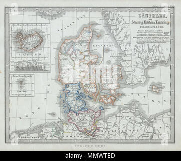 . English: This fascinating 1862 map by Justus Perthes and Stieler depicts Denmark, Schleswig, Holstein, Iceland, and the Faeroe Islands. There are inset maps of Ireland and the Faeroe Islands. In a display of cartographic flair unique to Perthes maps, a land elevation profile is depicted on the bottom of the Iceland map. Unlike other cartographic publishers of the period, the Justus Perthes firm, did not transition to lithographic printing techniques. Instead, all of his maps are copper plate engravings and hence offer a level of character and depth of detail that was impossible to find in l Stock Photohttps://www.alamy.com/image-license-details/?v=1https://www.alamy.com/english-this-fascinating-1862-map-by-justus-perthes-and-stieler-depicts-denmark-schleswig-holstein-iceland-and-the-faeroe-islands-there-are-inset-maps-of-ireland-and-the-faeroe-islands-in-a-display-of-cartographic-flair-unique-to-perthes-maps-a-land-elevation-profile-is-depicted-on-the-bottom-of-the-iceland-map-unlike-other-cartographic-publishers-of-the-period-the-justus-perthes-firm-did-not-transition-to-lithographic-printing-techniques-instead-all-of-his-maps-are-copper-plate-engravings-and-hence-offer-a-level-of-character-and-depth-of-detail-that-was-impossible-to-find-in-l-image184964821.html
RMMMWTED–. English: This fascinating 1862 map by Justus Perthes and Stieler depicts Denmark, Schleswig, Holstein, Iceland, and the Faeroe Islands. There are inset maps of Ireland and the Faeroe Islands. In a display of cartographic flair unique to Perthes maps, a land elevation profile is depicted on the bottom of the Iceland map. Unlike other cartographic publishers of the period, the Justus Perthes firm, did not transition to lithographic printing techniques. Instead, all of his maps are copper plate engravings and hence offer a level of character and depth of detail that was impossible to find in l
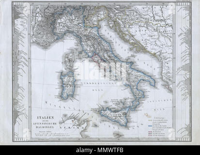 . English: This fascinating 1862 map by Justus Perthes and Stieler depicts Italy. In cartographic flourish unique to Perthes, land profiles decorate either side o the map. When this map was made Italy was in the midst of its national struggle for solidarity. The regional capitol was Florence and Rome and the Papal States alone maintained their independence. All text is in German. Unlike other cartographic publishers of the period, the Justus Perthes firm, did not transition to lithographic printing techniques. Instead, all of his maps are copper plate engravings and hence offer a level of cha Stock Photohttps://www.alamy.com/image-license-details/?v=1https://www.alamy.com/english-this-fascinating-1862-map-by-justus-perthes-and-stieler-depicts-italy-in-cartographic-flourish-unique-to-perthes-land-profiles-decorate-either-side-o-the-map-when-this-map-was-made-italy-was-in-the-midst-of-its-national-struggle-for-solidarity-the-regional-capitol-was-florence-and-rome-and-the-papal-states-alone-maintained-their-independence-all-text-is-in-german-unlike-other-cartographic-publishers-of-the-period-the-justus-perthes-firm-did-not-transition-to-lithographic-printing-techniques-instead-all-of-his-maps-are-copper-plate-engravings-and-hence-offer-a-level-of-cha-image184964847.html
RMMMWTFB–. English: This fascinating 1862 map by Justus Perthes and Stieler depicts Italy. In cartographic flourish unique to Perthes, land profiles decorate either side o the map. When this map was made Italy was in the midst of its national struggle for solidarity. The regional capitol was Florence and Rome and the Papal States alone maintained their independence. All text is in German. Unlike other cartographic publishers of the period, the Justus Perthes firm, did not transition to lithographic printing techniques. Instead, all of his maps are copper plate engravings and hence offer a level of cha
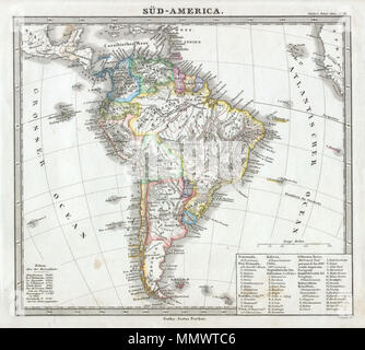 . English: This fascinating 1862 map by Justus Perthes and Stieler depicts the continent of South America. Unlike other cartographic publishers of the period, the Justus Perthes firm, did not transition to lithographic printing techniques until the early 1870s. Instead, all of his maps are copper plate engravings and hence offer a level of character and depth of detail that was impossible to find in lithography or wax-process engraving. All text in German. Issued in the 1862 edition of Stieler’s Schul-Atlas. Sud-America.. 1862. 1862 Perthes map of South America - Geographicus - SudAmerica-pe Stock Photohttps://www.alamy.com/image-license-details/?v=1https://www.alamy.com/english-this-fascinating-1862-map-by-justus-perthes-and-stieler-depicts-the-continent-of-south-america-unlike-other-cartographic-publishers-of-the-period-the-justus-perthes-firm-did-not-transition-to-lithographic-printing-techniques-until-the-early-1870s-instead-all-of-his-maps-are-copper-plate-engravings-and-hence-offer-a-level-of-character-and-depth-of-detail-that-was-impossible-to-find-in-lithography-or-wax-process-engraving-all-text-in-german-issued-in-the-1862-edition-of-stielers-schul-atlas-sud-america-1862-1862-perthes-map-of-south-america-geographicus-sudamerica-pe-image184964758.html
RMMMWTC6–. English: This fascinating 1862 map by Justus Perthes and Stieler depicts the continent of South America. Unlike other cartographic publishers of the period, the Justus Perthes firm, did not transition to lithographic printing techniques until the early 1870s. Instead, all of his maps are copper plate engravings and hence offer a level of character and depth of detail that was impossible to find in lithography or wax-process engraving. All text in German. Issued in the 1862 edition of Stieler’s Schul-Atlas. Sud-America.. 1862. 1862 Perthes map of South America - Geographicus - SudAmerica-pe
 . English: This fascinating 1862 map by Justus Perthes and Stieler depicts France. There is an inset map of Paris and vicinity. In a display of cartographic flair unique to Perthes maps, a land elevation profile is depicted on the bottom of the map. Unlike other cartographic publishers of the period, the Justus Perthes firm, did not transition to lithographic printing techniques. Instead, all of his maps are copper plate engravings and hence offer a level of character and depth of detail that was impossible to find in lithography or wax-process engraving. All text in German. Issued in the 186 Stock Photohttps://www.alamy.com/image-license-details/?v=1https://www.alamy.com/english-this-fascinating-1862-map-by-justus-perthes-and-stieler-depicts-france-there-is-an-inset-map-of-paris-and-vicinity-in-a-display-of-cartographic-flair-unique-to-perthes-maps-a-land-elevation-profile-is-depicted-on-the-bottom-of-the-map-unlike-other-cartographic-publishers-of-the-period-the-justus-perthes-firm-did-not-transition-to-lithographic-printing-techniques-instead-all-of-his-maps-are-copper-plate-engravings-and-hence-offer-a-level-of-character-and-depth-of-detail-that-was-impossible-to-find-in-lithography-or-wax-process-engraving-all-text-in-german-issued-in-the-186-image184964721.html
RMMMWTAW–. English: This fascinating 1862 map by Justus Perthes and Stieler depicts France. There is an inset map of Paris and vicinity. In a display of cartographic flair unique to Perthes maps, a land elevation profile is depicted on the bottom of the map. Unlike other cartographic publishers of the period, the Justus Perthes firm, did not transition to lithographic printing techniques. Instead, all of his maps are copper plate engravings and hence offer a level of character and depth of detail that was impossible to find in lithography or wax-process engraving. All text in German. Issued in the 186
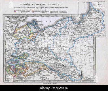 . English: This fascinating 1862 map by Justus Perthes and Stieler depicts Prussia and the states of northeastern Germany. Unlike other cartographic publishers of the period, the Justus Perthes firm, did not transition to lithographic printing techniques. Instead, all of his maps are copper plate engravings and hence offer a level of character and depth of detail that was impossible to find in lithography or wax-process engraving. All text in German. Issued in the 1862 edition of Stieler’s Schul-Atlas. Nordostliches Deutschland.. 1862. 1862 Stieler Map of Prussia and Northeastern Germany - G Stock Photohttps://www.alamy.com/image-license-details/?v=1https://www.alamy.com/english-this-fascinating-1862-map-by-justus-perthes-and-stieler-depicts-prussia-and-the-states-of-northeastern-germany-unlike-other-cartographic-publishers-of-the-period-the-justus-perthes-firm-did-not-transition-to-lithographic-printing-techniques-instead-all-of-his-maps-are-copper-plate-engravings-and-hence-offer-a-level-of-character-and-depth-of-detail-that-was-impossible-to-find-in-lithography-or-wax-process-engraving-all-text-in-german-issued-in-the-1862-edition-of-stielers-schul-atlas-nordostliches-deutschland-1862-1862-stieler-map-of-prussia-and-northeastern-germany-g-image184963888.html
RMMMWR94–. English: This fascinating 1862 map by Justus Perthes and Stieler depicts Prussia and the states of northeastern Germany. Unlike other cartographic publishers of the period, the Justus Perthes firm, did not transition to lithographic printing techniques. Instead, all of his maps are copper plate engravings and hence offer a level of character and depth of detail that was impossible to find in lithography or wax-process engraving. All text in German. Issued in the 1862 edition of Stieler’s Schul-Atlas. Nordostliches Deutschland.. 1862. 1862 Stieler Map of Prussia and Northeastern Germany - G
 . English: This fascinating 1862 map by Justus Perthes and Stieler depicts Europe’s physical geography. Although major cities are labeled, political distinctions are not. Unlike other cartographic publishers of the period, the Justus Perthes firm, did not transition to lithographic printing techniques. Instead, all of his maps are copper plate engravings and hence offer a level of character and depth of detail that was impossible to find in lithography or wax-process engraving. Issued in the 1862 edition of Stieler’s Schul-Atlas. Europa.. 1862. 1862 Stieler Physical Map of Europe - Geographi Stock Photohttps://www.alamy.com/image-license-details/?v=1https://www.alamy.com/english-this-fascinating-1862-map-by-justus-perthes-and-stieler-depicts-europes-physical-geography-although-major-cities-are-labeled-political-distinctions-are-not-unlike-other-cartographic-publishers-of-the-period-the-justus-perthes-firm-did-not-transition-to-lithographic-printing-techniques-instead-all-of-his-maps-are-copper-plate-engravings-and-hence-offer-a-level-of-character-and-depth-of-detail-that-was-impossible-to-find-in-lithography-or-wax-process-engraving-issued-in-the-1862-edition-of-stielers-schul-atlas-europa-1862-1862-stieler-physical-map-of-europe-geographi-image184964951.html
RMMMWTK3–. English: This fascinating 1862 map by Justus Perthes and Stieler depicts Europe’s physical geography. Although major cities are labeled, political distinctions are not. Unlike other cartographic publishers of the period, the Justus Perthes firm, did not transition to lithographic printing techniques. Instead, all of his maps are copper plate engravings and hence offer a level of character and depth of detail that was impossible to find in lithography or wax-process engraving. Issued in the 1862 edition of Stieler’s Schul-Atlas. Europa.. 1862. 1862 Stieler Physical Map of Europe - Geographi
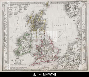 . English: This fascinating 1862 map by Justus Perthes and Stieler depicts the British Isles including England, Scotland and Ireland. In a cartographic flourish unique to Perthes, land profiles of the region are depicts to the left and right of the map proper. Unlike other cartographic publishers of the period, the Justus Perthes firm, did not transition to lithographic printing techniques. Instead, all of his maps are copper plate engravings and hence offer a level of character and depth of detail that was impossible to find in lithography or wax-process engraving. Issued in the 1862 edition Stock Photohttps://www.alamy.com/image-license-details/?v=1https://www.alamy.com/english-this-fascinating-1862-map-by-justus-perthes-and-stieler-depicts-the-british-isles-including-england-scotland-and-ireland-in-a-cartographic-flourish-unique-to-perthes-land-profiles-of-the-region-are-depicts-to-the-left-and-right-of-the-map-proper-unlike-other-cartographic-publishers-of-the-period-the-justus-perthes-firm-did-not-transition-to-lithographic-printing-techniques-instead-all-of-his-maps-are-copper-plate-engravings-and-hence-offer-a-level-of-character-and-depth-of-detail-that-was-impossible-to-find-in-lithography-or-wax-process-engraving-issued-in-the-1862-edition-image184964906.html
RMMMWTHE–. English: This fascinating 1862 map by Justus Perthes and Stieler depicts the British Isles including England, Scotland and Ireland. In a cartographic flourish unique to Perthes, land profiles of the region are depicts to the left and right of the map proper. Unlike other cartographic publishers of the period, the Justus Perthes firm, did not transition to lithographic printing techniques. Instead, all of his maps are copper plate engravings and hence offer a level of character and depth of detail that was impossible to find in lithography or wax-process engraving. Issued in the 1862 edition