···
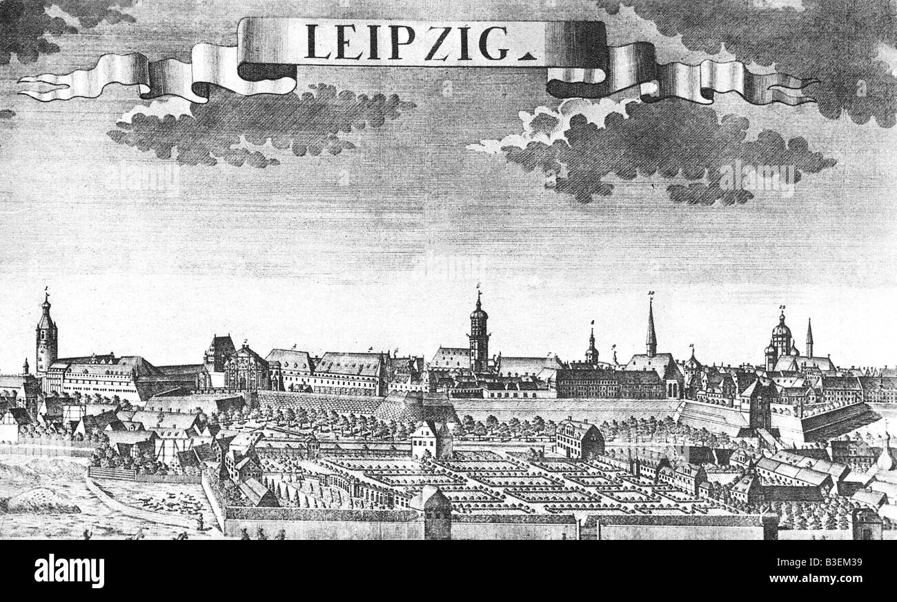
geography / travel, Germany, Leipzig, city views / cityscapes, engraving by F. B. Werner, late 18th century, historic, historical, Europe, citywall, moat, city view, cityscape, inscript, Image details File size:
13.9 MB (2 MB Compressed download)
Open your image file to the full size using image processing software.
Dimensions:
2841 x 1712 px | 24.1 x 14.5 cm | 9.5 x 5.7 inches | 300dpi
More information:
This image could have imperfections as it’s either historical or reportage.
Additional-Rights-Clearances-NA
Search stock photos by tags
Similar stock images geography / travel, Germany, Leipzig, city views / cityscapes, Pleißenburg, engraving by Franz Hogenberg, circa 1650, Stock Photo https://www.alamy.com/image-license-details/?v=1 https://www.alamy.com/stock-photo-geography-travel-germany-leipzig-city-views-cityscapes-pleienburg-19377021.html RM B3EKGD – geography / travel, Germany, Leipzig, city views / cityscapes, Pleißenburg, engraving by Franz Hogenberg, circa 1650, City map of Leipzig and its surroundings, Leipzig, Saxony, Southern Germany, Central Europe Stock Photo https://www.alamy.com/image-license-details/?v=1 https://www.alamy.com/city-map-of-leipzig-and-its-surroundings-leipzig-saxony-southern-germany-central-europe-image540985514.html RM 2PC40F6 – City map of Leipzig and its surroundings, Leipzig, Saxony, Southern Germany, Central Europe Leipzig, Germany, Saxony, N 51 20' 22'', E 12 22' 16'', map, Timeless Map published in 2021. Travelers, explorers and adventurers like Florence Nightingale, David Livingstone, Ernest Shackleton, Lewis and Clark and Sherlock Holmes relied on maps to plan travels to the world's most remote corners, Timeless Maps is mapping most locations on the globe, showing the achievement of great dreams Stock Photo https://www.alamy.com/image-license-details/?v=1 https://www.alamy.com/leipzig-germany-saxony-n-51-20-22-e-12-22-16-map-timeless-map-published-in-2021-travelers-explorers-and-adventurers-like-florence-nightingale-david-livingstone-ernest-shackleton-lewis-and-clark-and-sherlock-holmes-relied-on-maps-to-plan-travels-to-the-worlds-most-remote-corners-timeless-maps-is-mapping-most-locations-on-the-globe-showing-the-achievement-of-great-dreams-image439326224.html RM 2GEN128 – Leipzig, Germany, Saxony, N 51 20' 22'', E 12 22' 16'', map, Timeless Map published in 2021. Travelers, explorers and adventurers like Florence Nightingale, David Livingstone, Ernest Shackleton, Lewis and Clark and Sherlock Holmes relied on maps to plan travels to the world's most remote corners, Timeless Maps is mapping most locations on the globe, showing the achievement of great dreams Germany, officially Federal Republic of Germany, gray political map. Country in Central Europe with capital Berlin. Stock Photo https://www.alamy.com/image-license-details/?v=1 https://www.alamy.com/germany-officially-federal-republic-of-germany-gray-political-map-country-in-central-europe-with-capital-berlin-image604390642.html RF 2X38AC2 – Germany, officially Federal Republic of Germany, gray political map. Country in Central Europe with capital Berlin. Vector road map of the city of Leipzig in Germany on a white background. Stock Photo https://www.alamy.com/image-license-details/?v=1 https://www.alamy.com/vector-road-map-of-the-city-of-leipzig-in-germany-on-a-white-background-image554314065.html RF 2R5R56W – Vector road map of the city of Leipzig in Germany on a white background. Saxony, a state in Germany, political map with capital Dresden, borders, and largest cities. Officially the Free State of Saxony. Stock Photo https://www.alamy.com/image-license-details/?v=1 https://www.alamy.com/saxony-a-state-in-germany-political-map-with-capital-dresden-borders-and-largest-cities-officially-the-free-state-of-saxony-image620519939.html RF 2Y1F3EB – Saxony, a state in Germany, political map with capital Dresden, borders, and largest cities. Officially the Free State of Saxony. Map of St. Petersburg. Publication of the book 'Meyers Konversations-Lexikon', Volume 7, Leipzig, Germany, circa 1910 Stock Photo https://www.alamy.com/image-license-details/?v=1 https://www.alamy.com/stock-photo-map-of-st-petersburg-publication-of-the-book-meyers-konversations-48229764.html RF CPD1FG – Map of St. Petersburg. Publication of the book 'Meyers Konversations-Lexikon', Volume 7, Leipzig, Germany, circa 1910 Saxony, a state in Germany, gray political map with capital Dresden, borders, and largest cities. Officially the Free State of Saxony. Stock Photo https://www.alamy.com/image-license-details/?v=1 https://www.alamy.com/saxony-a-state-in-germany-gray-political-map-with-capital-dresden-borders-and-largest-cities-officially-the-free-state-of-saxony-image621304398.html RF 2Y2PT2P – Saxony, a state in Germany, gray political map with capital Dresden, borders, and largest cities. Officially the Free State of Saxony. Street parade in Leipzig, Germany, during Engros-Messe, late nineteenth century. Peterstrasse. Stock Photo https://www.alamy.com/image-license-details/?v=1 https://www.alamy.com/stock-photo-street-parade-in-leipzig-germany-during-engros-messe-late-nineteenth-147067508.html RM JF7E30 – Street parade in Leipzig, Germany, during Engros-Messe, late nineteenth century. Peterstrasse. Germany, officially the Federal Republic of Germany, political map. Country in Central Europe with capital Berlin. Consisting of 16 constituent states. Stock Photo https://www.alamy.com/image-license-details/?v=1 https://www.alamy.com/germany-officially-the-federal-republic-of-germany-political-map-country-in-central-europe-with-capital-berlin-consisting-of-16-constituent-states-image602444382.html RF 2X03KXP – Germany, officially the Federal Republic of Germany, political map. Country in Central Europe with capital Berlin. Consisting of 16 constituent states. City Leipzig map with streets rivers and lakes germany Stock Photo https://www.alamy.com/image-license-details/?v=1 https://www.alamy.com/city-leipzig-map-with-streets-rivers-and-lakes-germany-image554879711.html RF 2R6MXMF – City Leipzig map with streets rivers and lakes germany Brandenburg, a state in northeastern Germany, political map with capital and largest city Potsdam, borders, and largest cities. Stock Photo https://www.alamy.com/image-license-details/?v=1 https://www.alamy.com/brandenburg-a-state-in-northeastern-germany-political-map-with-capital-and-largest-city-potsdam-borders-and-largest-cities-image620222616.html RF 2Y11G7M – Brandenburg, a state in northeastern Germany, political map with capital and largest city Potsdam, borders, and largest cities. Leipzig City red highlighted in map of Saxony Germany DE Stock Photo https://www.alamy.com/image-license-details/?v=1 https://www.alamy.com/leipzig-city-red-highlighted-in-map-of-saxony-germany-de-image261963269.html RF W65CR1 – Leipzig City red highlighted in map of Saxony Germany DE 