Quick filters:
Babylonia map Stock Photos and Images
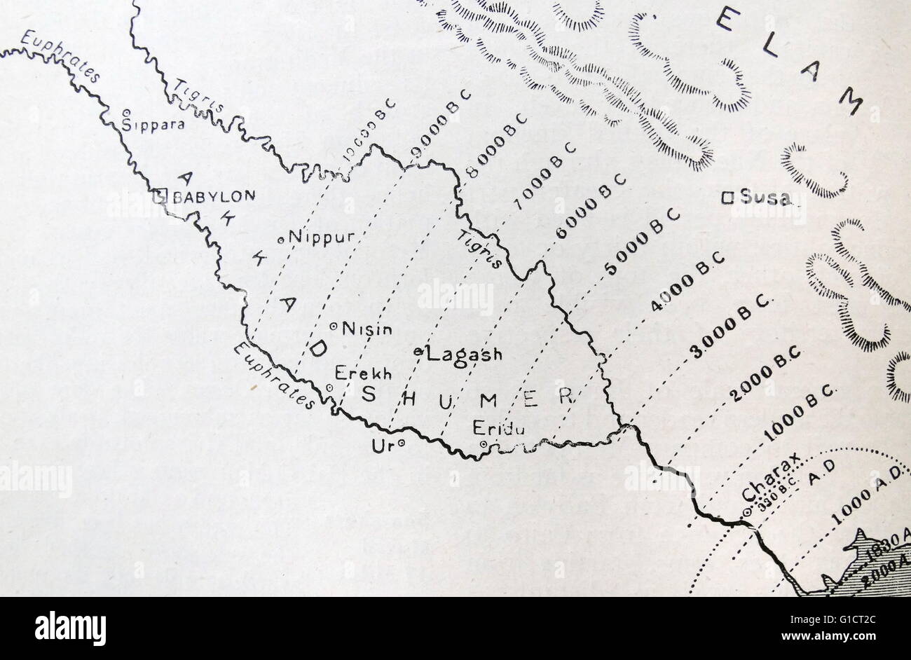 Map of Babylonia and it's extent at different periods in history. Dated 19th Century Stock Photohttps://www.alamy.com/image-license-details/?v=1https://www.alamy.com/stock-photo-map-of-babylonia-and-its-extent-at-different-periods-in-history-dated-104159172.html
RMG1CT2C–Map of Babylonia and it's extent at different periods in history. Dated 19th Century
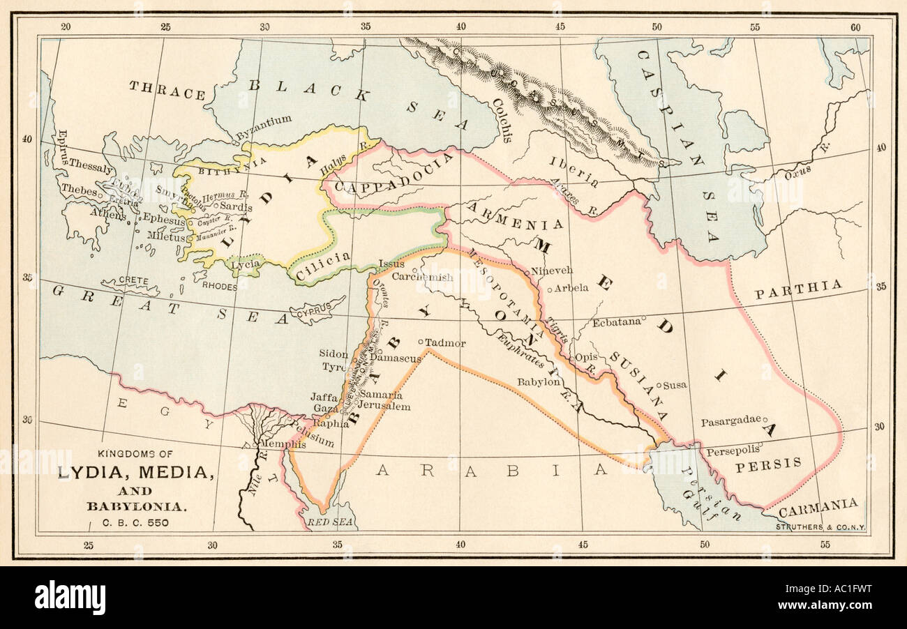 Map of ancient Babylonia and of the kingdoms of Lydia and Medea circa 550 BC. Color lithograph Stock Photohttps://www.alamy.com/image-license-details/?v=1https://www.alamy.com/stock-photo-map-of-ancient-babylonia-and-of-the-kingdoms-of-lydia-and-medea-circa-13010339.html
RMAC1FWT–Map of ancient Babylonia and of the kingdoms of Lydia and Medea circa 550 BC. Color lithograph
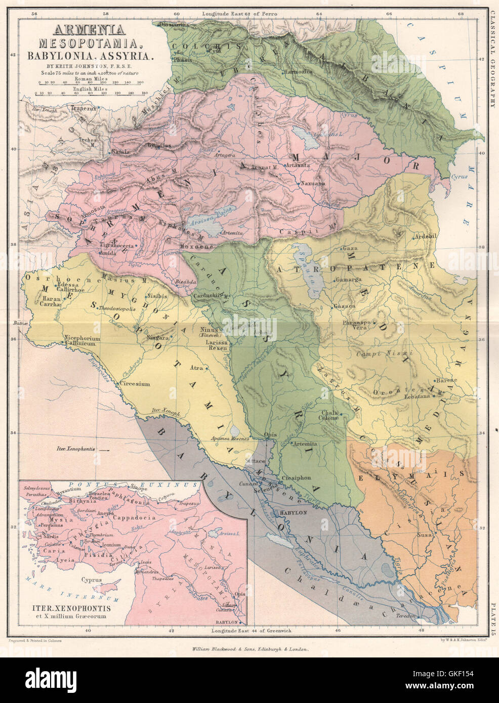 Ancient 'Armenia Mesopotamia, Babylonia, Assyria'. Iraq. JOHNSTON, 1855 map Stock Photohttps://www.alamy.com/image-license-details/?v=1https://www.alamy.com/stock-photo-ancient-armenia-mesopotamia-babylonia-assyria-iraq-johnston-1855-map-115270880.html
RFGKF154–Ancient 'Armenia Mesopotamia, Babylonia, Assyria'. Iraq. JOHNSTON, 1855 map
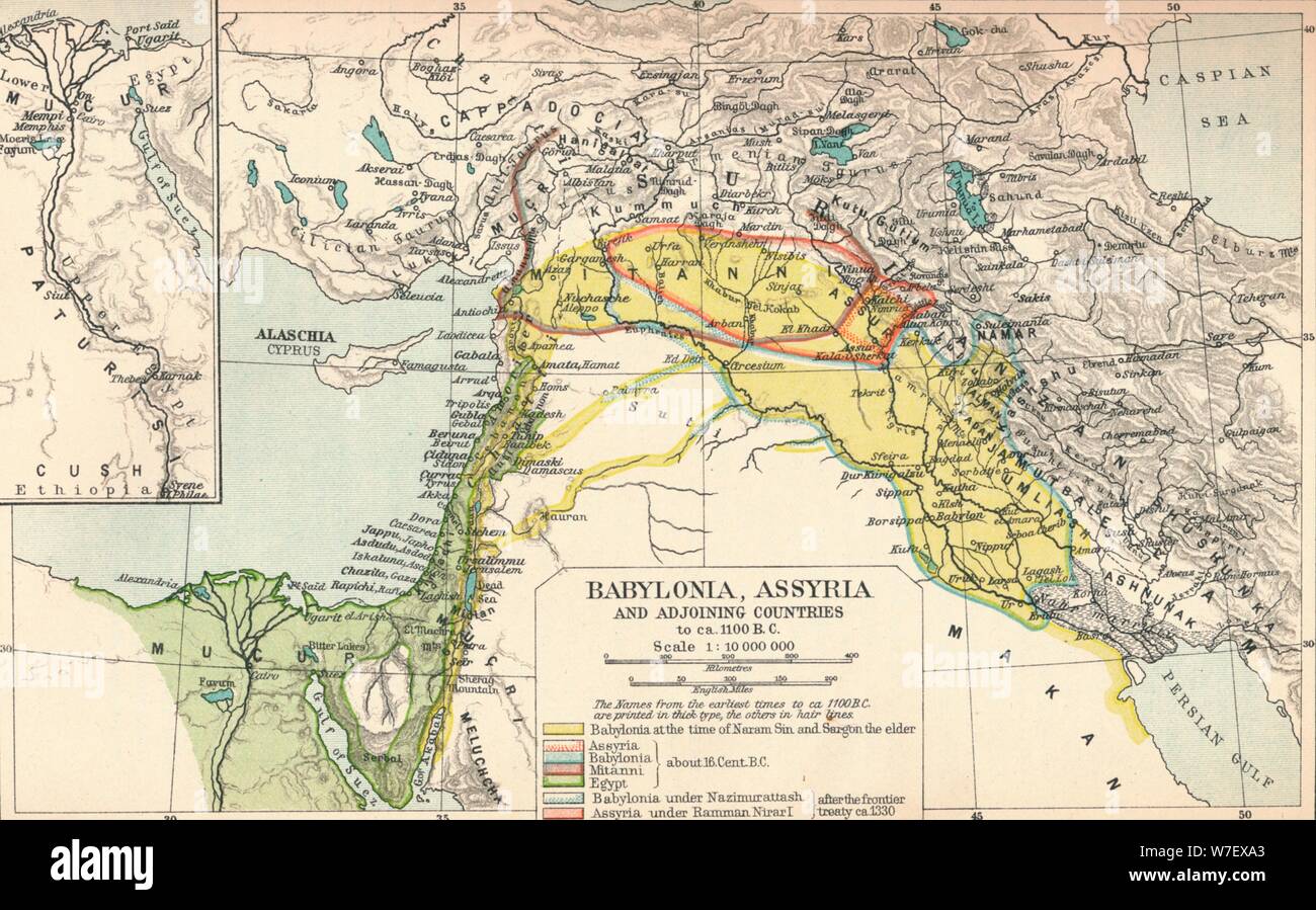 'Babylonia, Assyria and Adjoining Countries', c1902, (1903). Artist: Unknown. Stock Photohttps://www.alamy.com/image-license-details/?v=1https://www.alamy.com/babylonia-assyria-and-adjoining-countries-c1902-1903-artist-unknown-image262786107.html
RMW7EXA3–'Babylonia, Assyria and Adjoining Countries', c1902, (1903). Artist: Unknown.
![Syria, Cyprus, Balestina, Mesopotamia, Babylonia, Chaldea, and two Arabia with mountains, water, stetten, Map of the Middle East from the 16th century, Fig. 18, after S. viv, 1544, Sebastian Münster: Cosmographia. Beschreibung aller Lender durch Sebastianum Münsterum: in welcher begriffen aller Voelker, Herrschaften, Stetten, und namhafftiger Flecken, herkommen: Sitten, Gebreüch, Ordnung, Glauben, Secten und Hantierung durch die gantze Welt und fürnemlich Teütscher Nation [...]. Basel: durch Henrichum Petri, 1544 Stock Photo Syria, Cyprus, Balestina, Mesopotamia, Babylonia, Chaldea, and two Arabia with mountains, water, stetten, Map of the Middle East from the 16th century, Fig. 18, after S. viv, 1544, Sebastian Münster: Cosmographia. Beschreibung aller Lender durch Sebastianum Münsterum: in welcher begriffen aller Voelker, Herrschaften, Stetten, und namhafftiger Flecken, herkommen: Sitten, Gebreüch, Ordnung, Glauben, Secten und Hantierung durch die gantze Welt und fürnemlich Teütscher Nation [...]. Basel: durch Henrichum Petri, 1544 Stock Photo](https://c8.alamy.com/comp/2A2RWAD/syria-cyprus-balestina-mesopotamia-babylonia-chaldea-and-two-arabia-with-mountains-water-stetten-map-of-the-middle-east-from-the-16th-century-fig-18-after-s-viv-1544-sebastian-mnster-cosmographia-beschreibung-aller-lender-durch-sebastianum-mnsterum-in-welcher-begriffen-aller-voelker-herrschaften-stetten-und-namhafftiger-flecken-herkommen-sitten-gebrech-ordnung-glauben-secten-und-hantierung-durch-die-gantze-welt-und-frnemlich-tetscher-nation-basel-durch-henrichum-petri-1544-2A2RWAD.jpg) Syria, Cyprus, Balestina, Mesopotamia, Babylonia, Chaldea, and two Arabia with mountains, water, stetten, Map of the Middle East from the 16th century, Fig. 18, after S. viv, 1544, Sebastian Münster: Cosmographia. Beschreibung aller Lender durch Sebastianum Münsterum: in welcher begriffen aller Voelker, Herrschaften, Stetten, und namhafftiger Flecken, herkommen: Sitten, Gebreüch, Ordnung, Glauben, Secten und Hantierung durch die gantze Welt und fürnemlich Teütscher Nation [...]. Basel: durch Henrichum Petri, 1544 Stock Photohttps://www.alamy.com/image-license-details/?v=1https://www.alamy.com/syria-cyprus-balestina-mesopotamia-babylonia-chaldea-and-two-arabia-with-mountains-water-stetten-map-of-the-middle-east-from-the-16th-century-fig-18-after-s-viv-1544-sebastian-mnster-cosmographia-beschreibung-aller-lender-durch-sebastianum-mnsterum-in-welcher-begriffen-aller-voelker-herrschaften-stetten-und-namhafftiger-flecken-herkommen-sitten-gebrech-ordnung-glauben-secten-und-hantierung-durch-die-gantze-welt-und-frnemlich-tetscher-nation-basel-durch-henrichum-petri-1544-image328751093.html
Syria, Cyprus, Balestina, Mesopotamia, Babylonia, Chaldea, and two Arabia with mountains, water, stetten, Map of the Middle East from the 16th century, Fig. 18, after S. viv, 1544, Sebastian Münster: Cosmographia. Beschreibung aller Lender durch Sebastianum Münsterum: in welcher begriffen aller Voelker, Herrschaften, Stetten, und namhafftiger Flecken, herkommen: Sitten, Gebreüch, Ordnung, Glauben, Secten und Hantierung durch die gantze Welt und fürnemlich Teütscher Nation [...]. Basel: durch Henrichum Petri, 1544 Stock Photohttps://www.alamy.com/image-license-details/?v=1https://www.alamy.com/syria-cyprus-balestina-mesopotamia-babylonia-chaldea-and-two-arabia-with-mountains-water-stetten-map-of-the-middle-east-from-the-16th-century-fig-18-after-s-viv-1544-sebastian-mnster-cosmographia-beschreibung-aller-lender-durch-sebastianum-mnsterum-in-welcher-begriffen-aller-voelker-herrschaften-stetten-und-namhafftiger-flecken-herkommen-sitten-gebrech-ordnung-glauben-secten-und-hantierung-durch-die-gantze-welt-und-frnemlich-tetscher-nation-basel-durch-henrichum-petri-1544-image328751093.htmlRM2A2RWAD–Syria, Cyprus, Balestina, Mesopotamia, Babylonia, Chaldea, and two Arabia with mountains, water, stetten, Map of the Middle East from the 16th century, Fig. 18, after S. viv, 1544, Sebastian Münster: Cosmographia. Beschreibung aller Lender durch Sebastianum Münsterum: in welcher begriffen aller Voelker, Herrschaften, Stetten, und namhafftiger Flecken, herkommen: Sitten, Gebreüch, Ordnung, Glauben, Secten und Hantierung durch die gantze Welt und fürnemlich Teütscher Nation [...]. Basel: durch Henrichum Petri, 1544
 Map of the Babylonian Ruins, 19th century Stock Photohttps://www.alamy.com/image-license-details/?v=1https://www.alamy.com/map-of-the-babylonian-ruins-19th-century-image366540052.html
RM2C899G4–Map of the Babylonian Ruins, 19th century
 Map of Babylonia 600 Stock Photohttps://www.alamy.com/image-license-details/?v=1https://www.alamy.com/map-of-babylonia-600-image184208241.html
RMMKKBDN–Map of Babylonia 600
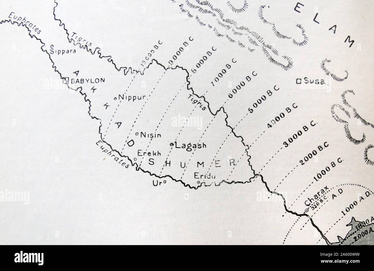 Map of Babylonia and it's extent at different periods in history. Dated 19th Century Stock Photohttps://www.alamy.com/image-license-details/?v=1https://www.alamy.com/map-of-babylonia-and-its-extent-at-different-periods-in-history-dated-19th-century-image330685653.html
RM2A600WW–Map of Babylonia and it's extent at different periods in history. Dated 19th Century
 ARMENIA: Mesopotamia, Babylonia, Assyria, 1880 antique map Stock Photohttps://www.alamy.com/image-license-details/?v=1https://www.alamy.com/stock-photo-armenia-mesopotamia-babylonia-assyria-1880-antique-map-103773531.html
RFG0R85F–ARMENIA: Mesopotamia, Babylonia, Assyria, 1880 antique map
 Map of the central part of ancient Assyria. Old 19th century engraved illustration, Le Tour du Monde 1863 Stock Photohttps://www.alamy.com/image-license-details/?v=1https://www.alamy.com/map-of-the-central-part-of-ancient-assyria-old-19th-century-engraved-illustration-le-tour-du-monde-1863-image397942778.html
RM2E3BT22–Map of the central part of ancient Assyria. Old 19th century engraved illustration, Le Tour du Monde 1863
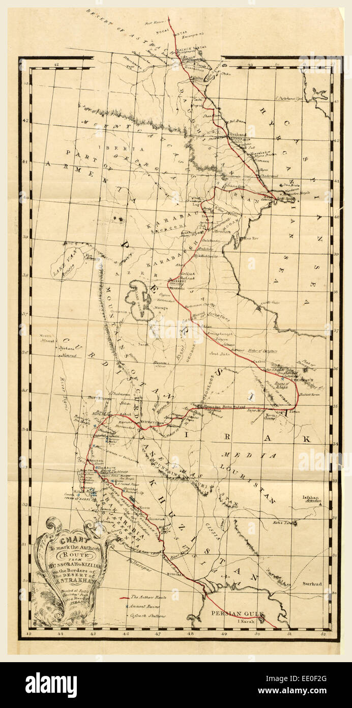 Map, Personal Narative of travels in Babylonia, Assyria, Media, and Scythia, in the year 1824, 19th century engraving Stock Photohttps://www.alamy.com/image-license-details/?v=1https://www.alamy.com/stock-photo-map-personal-narative-of-travels-in-babylonia-assyria-media-and-scythia-77458488.html
RMEE0F2G–Map, Personal Narative of travels in Babylonia, Assyria, Media, and Scythia, in the year 1824, 19th century engraving
 Map in Antique 19th Century Self-Explanatory Family Bible (New Edition) Depiction of the Countries of the Jewish Captivities - Babylonia, Assyria, Med Stock Photohttps://www.alamy.com/image-license-details/?v=1https://www.alamy.com/map-in-antique-19th-century-self-explanatory-family-bible-new-edition-depiction-of-the-countries-of-the-jewish-captivities-babylonia-assyria-med-image612031029.html
RM2XFMBR1–Map in Antique 19th Century Self-Explanatory Family Bible (New Edition) Depiction of the Countries of the Jewish Captivities - Babylonia, Assyria, Med
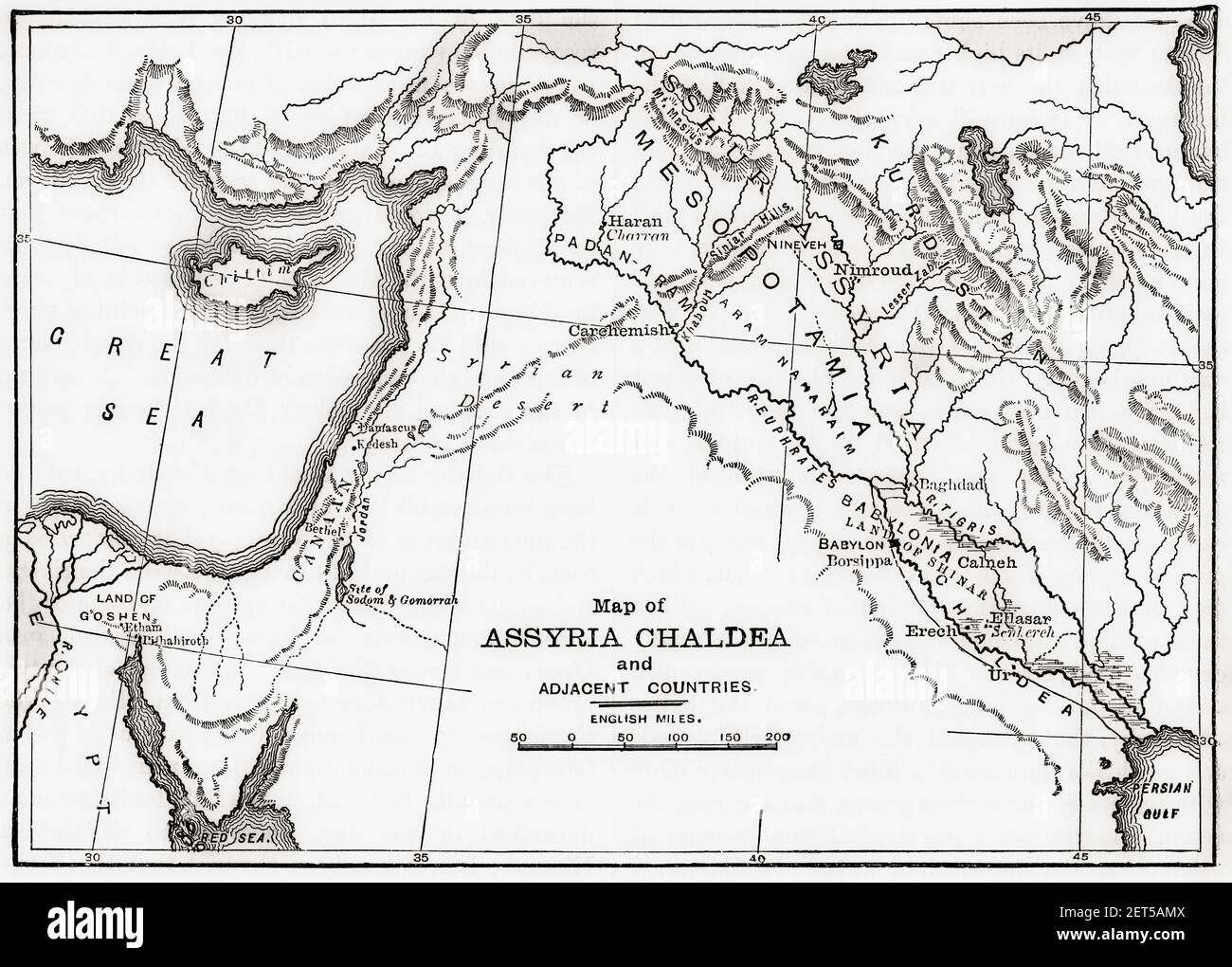 Map of Assyria Chaldea and adjacent countries. From Cassell's Universal History, published 1888. Stock Photohttps://www.alamy.com/image-license-details/?v=1https://www.alamy.com/map-of-assyria-chaldea-and-adjacent-countries-from-cassells-universal-history-published-1888-image410708394.html
RM2ET5AMX–Map of Assyria Chaldea and adjacent countries. From Cassell's Universal History, published 1888.
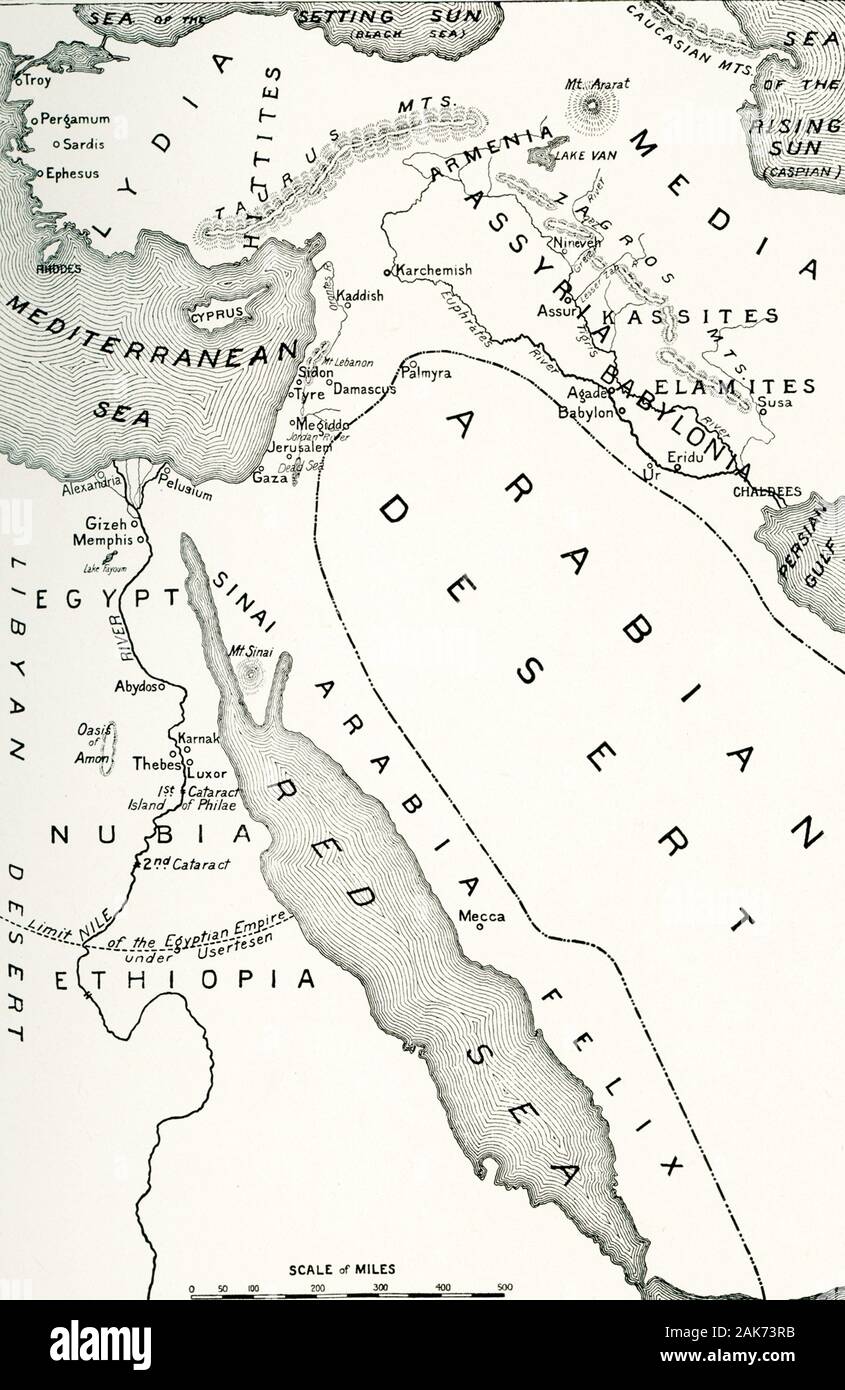 This map detailing the area of the world in the middle east known as the “Cradle of Civilization” dates to the early 1900s. Included on this map are: Arabian Desert, Egypt, Nubia, Ethiopia, Libyan Desert, Red Sea, Persian Gulf, Babylonia, Assyria, Armenia, Media, Lydia, Hittites, Mediterranean Sea, Sea of the Setting Sun (present-day Black Sea), Sea of the Rising Sun (present-day Caspian Sea). Stock Photohttps://www.alamy.com/image-license-details/?v=1https://www.alamy.com/this-map-detailing-the-area-of-the-world-in-the-middle-east-known-as-the-cradle-of-civilization-dates-to-the-early-1900s-included-on-this-map-are-arabian-desert-egypt-nubia-ethiopia-libyan-desert-red-sea-persian-gulf-babylonia-assyria-armenia-media-lydia-hittites-mediterranean-sea-sea-of-the-setting-sun-present-day-black-sea-sea-of-the-rising-sun-present-day-caspian-sea-image338832127.html
RF2AK73RB–This map detailing the area of the world in the middle east known as the “Cradle of Civilization” dates to the early 1900s. Included on this map are: Arabian Desert, Egypt, Nubia, Ethiopia, Libyan Desert, Red Sea, Persian Gulf, Babylonia, Assyria, Armenia, Media, Lydia, Hittites, Mediterranean Sea, Sea of the Setting Sun (present-day Black Sea), Sea of the Rising Sun (present-day Caspian Sea).
 18th century map of Babylon - Mesopotamia - Aleppo (Iraq) and the Mediterranean region showing the route of Leendert Rouwolf's route from Cyprus to Babylonia Stock Photohttps://www.alamy.com/image-license-details/?v=1https://www.alamy.com/18th-century-map-of-babylon-mesopotamia-aleppo-iraq-and-the-mediterranean-region-showing-the-route-of-leendert-rouwolfs-route-from-cyprus-to-babylonia-image504917094.html
RM2M9CXWA–18th century map of Babylon - Mesopotamia - Aleppo (Iraq) and the Mediterranean region showing the route of Leendert Rouwolf's route from Cyprus to Babylonia
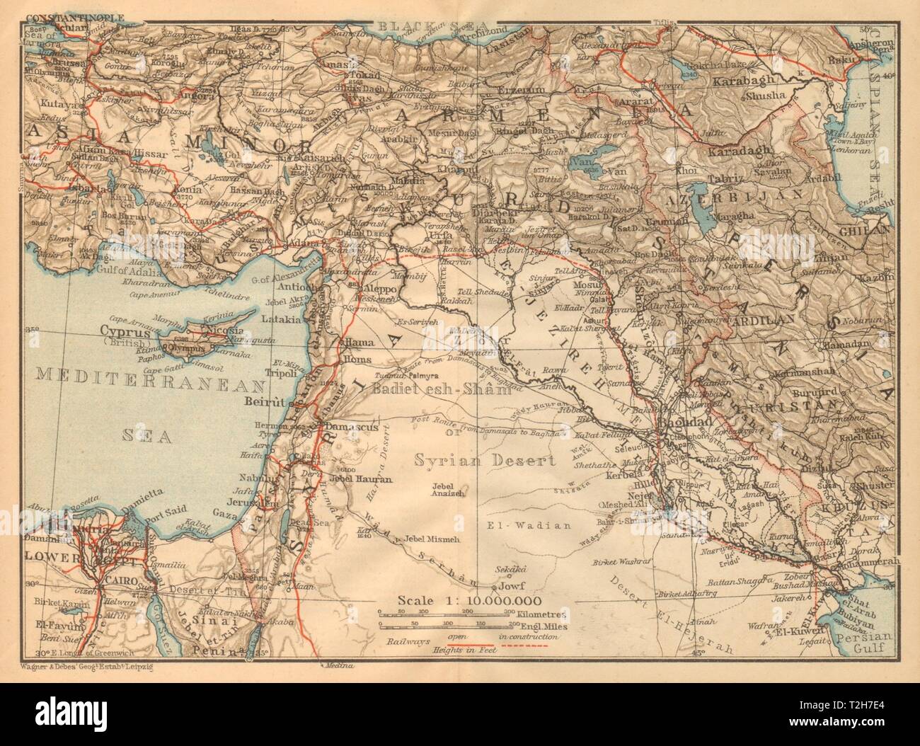 Syria, Mesopotamia & Babylonia. Iraq Levant Turkey Jordan Middle East 1912 map Stock Photohttps://www.alamy.com/image-license-details/?v=1https://www.alamy.com/syria-mesopotamia-babylonia-iraq-levant-turkey-jordan-middle-east-1912-map-image242553532.html
RFT2H7E4–Syria, Mesopotamia & Babylonia. Iraq Levant Turkey Jordan Middle East 1912 map
 Map of the excavations in Babylonia and Assyria Stock Photohttps://www.alamy.com/image-license-details/?v=1https://www.alamy.com/map-of-the-excavations-in-babylonia-and-assyria-image568313346.html
RF2T0GWD6–Map of the excavations in Babylonia and Assyria
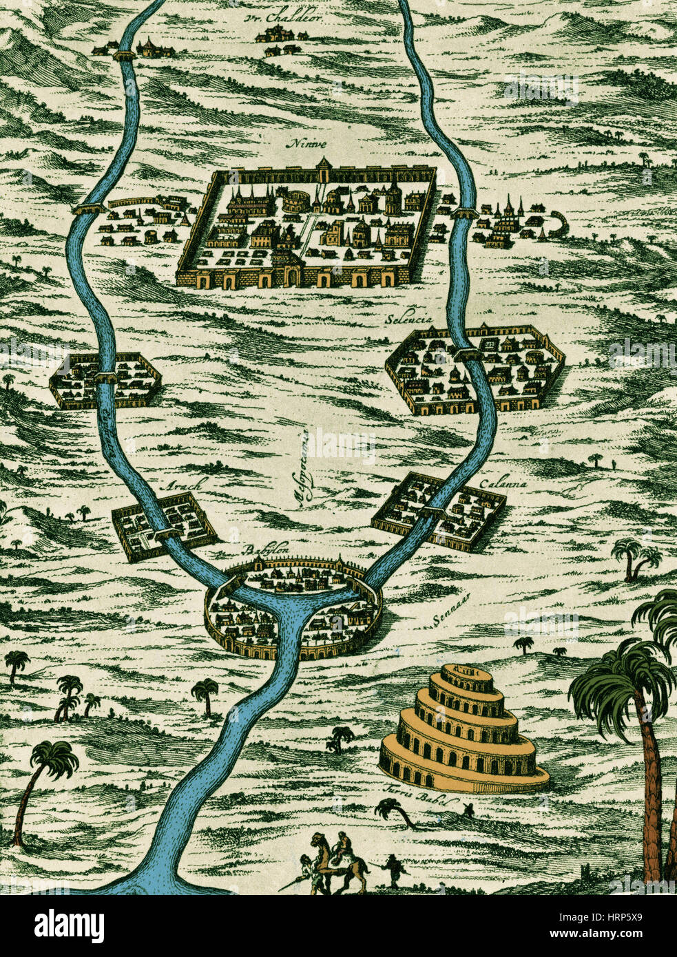 Tigris and Euphrates, Babylonia Stock Photohttps://www.alamy.com/image-license-details/?v=1https://www.alamy.com/stock-photo-tigris-and-euphrates-babylonia-135097265.html
RMHRP5X9–Tigris and Euphrates, Babylonia
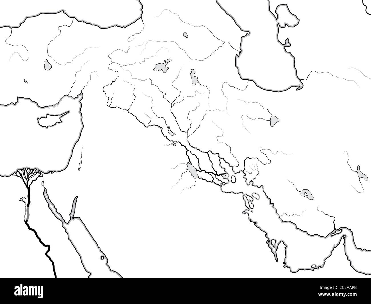 World Map of MESOPOTAMIA: Šumer, Akkad, Babylonia, Assyria, Tigris & Euphrates. Geographic historical chart of Ancient Persian Stock Photohttps://www.alamy.com/image-license-details/?v=1https://www.alamy.com/world-map-of-mesopotamia-umer-akkad-babylonia-assyria-tigris-euphrates-geographic-historical-chart-of-ancient-persian-image362875027.html
RM2C2AAPB–World Map of MESOPOTAMIA: Šumer, Akkad, Babylonia, Assyria, Tigris & Euphrates. Geographic historical chart of Ancient Persian
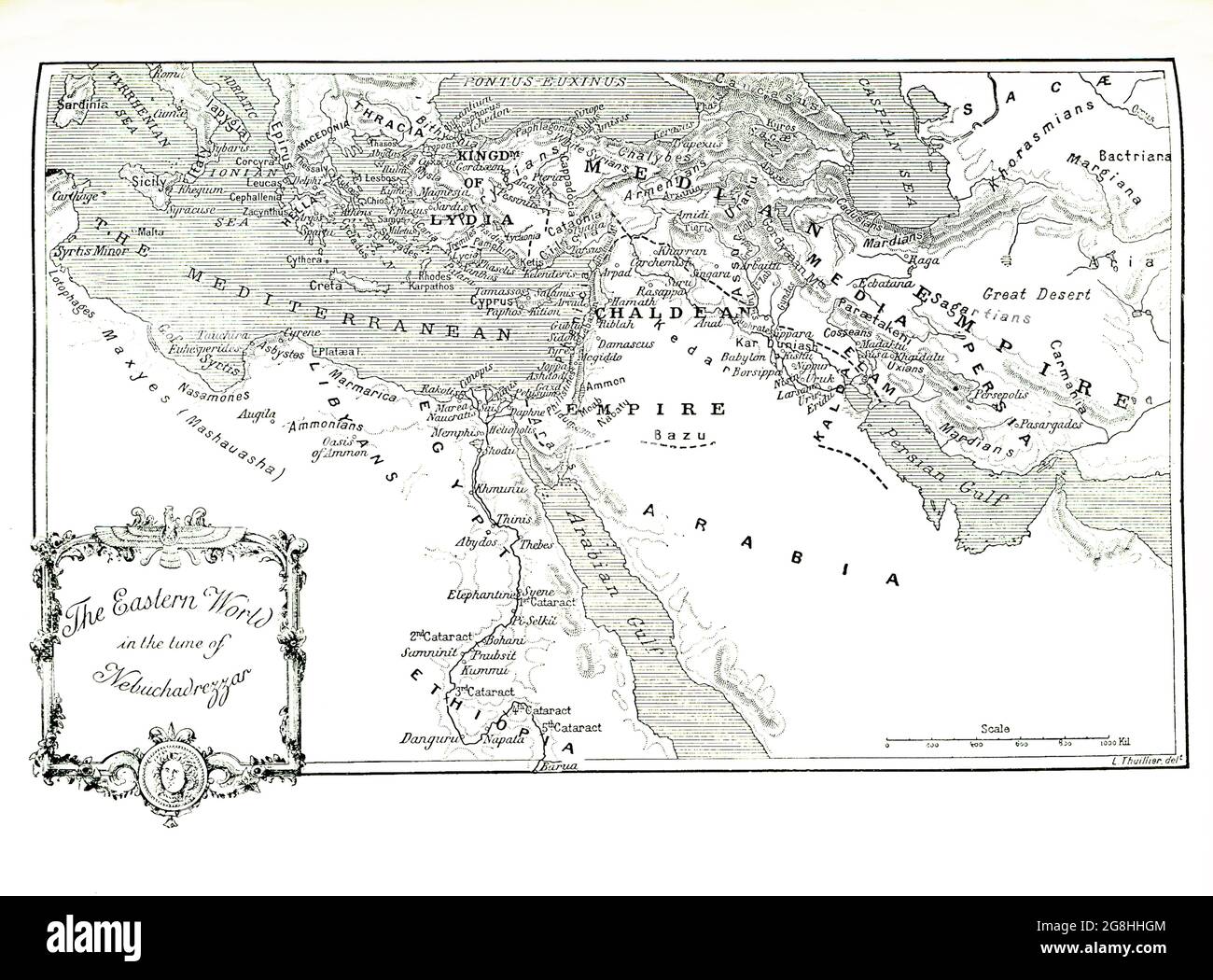 This 1903 illustration shows a map of the eastern world in the time of Nebuchadrezzar. Nebuchadnezzar was king of Babylon 605-562 B.C. He determined to make his capital city of Babylon the finest in the world. He is known for the area of his palace in Babylon that came to be known as the Hanging Gardens and was considered one of the seven ancient wonders of the world. Scholars differ on their size, but archaeological excavations do attest to some type of grandiose structure. Stock Photohttps://www.alamy.com/image-license-details/?v=1https://www.alamy.com/this-1903-illustration-shows-a-map-of-the-eastern-world-in-the-time-of-nebuchadrezzar-nebuchadnezzar-was-king-of-babylon-605-562-bc-he-determined-to-make-his-capital-city-of-babylon-the-finest-in-the-world-he-is-known-for-the-area-of-his-palace-in-babylon-that-came-to-be-known-as-the-hanging-gardens-and-was-considered-one-of-the-seven-ancient-wonders-of-the-world-scholars-differ-on-their-size-but-archaeological-excavations-do-attest-to-some-type-of-grandiose-structure-image435563428.html
RF2G8HHGM–This 1903 illustration shows a map of the eastern world in the time of Nebuchadrezzar. Nebuchadnezzar was king of Babylon 605-562 B.C. He determined to make his capital city of Babylon the finest in the world. He is known for the area of his palace in Babylon that came to be known as the Hanging Gardens and was considered one of the seven ancient wonders of the world. Scholars differ on their size, but archaeological excavations do attest to some type of grandiose structure.
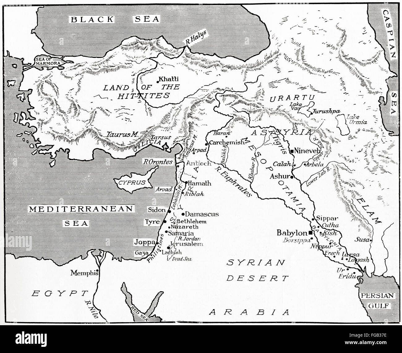 Map of the Babylonian, Assyrian and Hittite empires. Stock Photohttps://www.alamy.com/image-license-details/?v=1https://www.alamy.com/stock-photo-map-of-the-babylonian-assyrian-and-hittite-empires-96130370.html
RMFGB37E–Map of the Babylonian, Assyrian and Hittite empires.
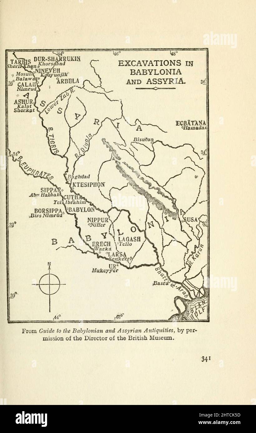 Map of the Excavations in Babylonia and Assyria From the book ' Myths and legends of Babylonia & Assyria ' by Lewis Spence, Published London : Harrap 1916 Stock Photohttps://www.alamy.com/image-license-details/?v=1https://www.alamy.com/map-of-the-excavations-in-babylonia-and-assyria-from-the-book-myths-and-legends-of-babylonia-assyria-by-lewis-spence-published-london-harrap-1916-image462499785.html
RF2HTCK5D–Map of the Excavations in Babylonia and Assyria From the book ' Myths and legends of Babylonia & Assyria ' by Lewis Spence, Published London : Harrap 1916
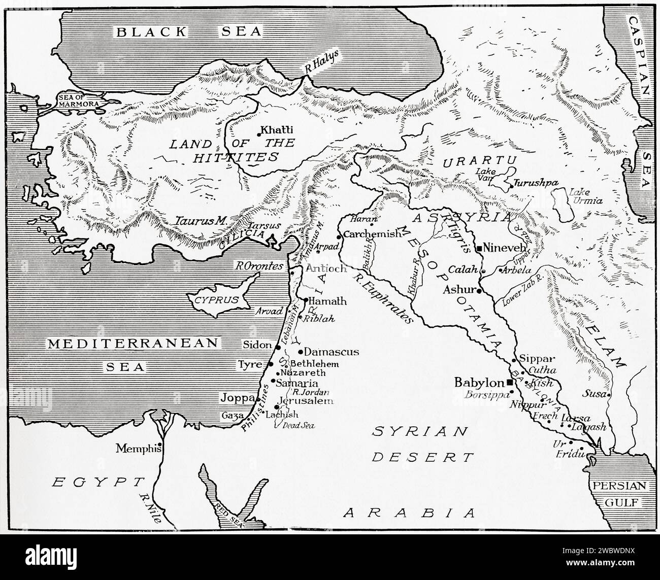 Map of the Babylonian, Assyrian and Hittite empires. Stock Photohttps://www.alamy.com/image-license-details/?v=1https://www.alamy.com/map-of-the-babylonian-assyrian-and-hittite-empires-image592473334.html
RM2WBWDNX–Map of the Babylonian, Assyrian and Hittite empires.
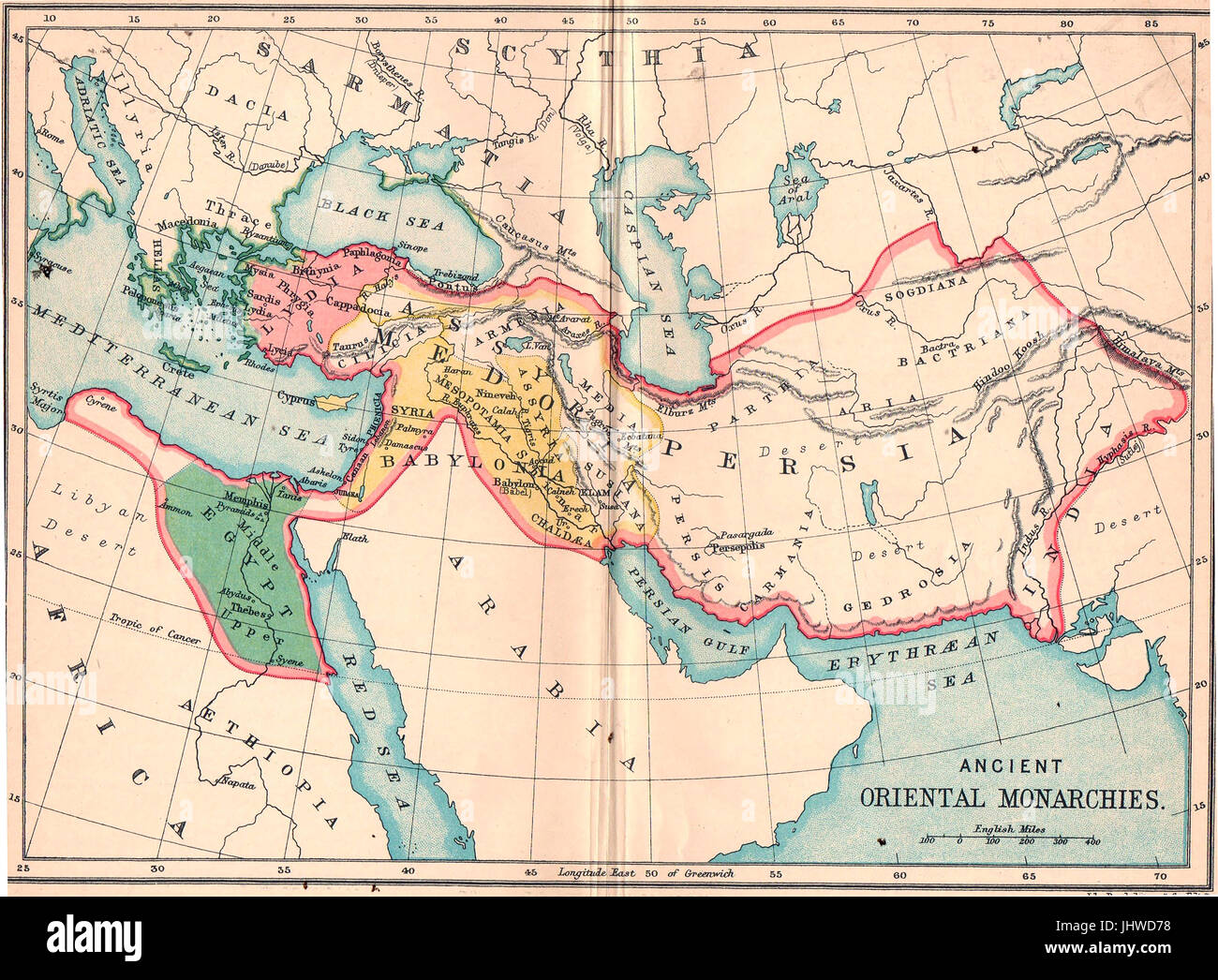 Pre-war school atlas showing map ANCIENT ORIENTAL MONARCHIES Stock Photohttps://www.alamy.com/image-license-details/?v=1https://www.alamy.com/stock-photo-pre-war-school-atlas-showing-map-ancient-oriental-monarchies-148691292.html
RMJHWD78–Pre-war school atlas showing map ANCIENT ORIENTAL MONARCHIES
 A sketch-map of Alexander's Chief exploratory marches from Athens to Hyderabad and Gaza. The dotted line shows the course of Nearchus' voyage down the river Indus, along the northern shores of the Indian Ocean, and up the Persian Gulf to Babylonia. Stock Photohttps://www.alamy.com/image-license-details/?v=1https://www.alamy.com/stock-photo-a-sketch-map-of-alexanders-chief-exploratory-marches-from-athens-to-104967867.html
RMG2NKGB–A sketch-map of Alexander's Chief exploratory marches from Athens to Hyderabad and Gaza. The dotted line shows the course of Nearchus' voyage down the river Indus, along the northern shores of the Indian Ocean, and up the Persian Gulf to Babylonia.
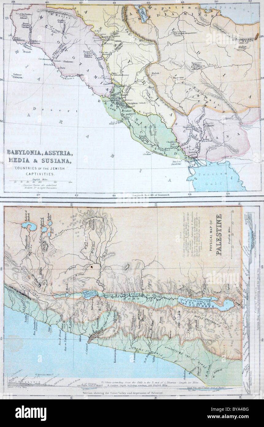 Two Maps In An Old Bible One Showing Babylonia, Assyria, Media And Susiana Countries Of The Jewish Captivities Stock Photohttps://www.alamy.com/image-license-details/?v=1https://www.alamy.com/stock-photo-two-maps-in-an-old-bible-one-showing-babylonia-assyria-media-and-susiana-34029060.html
RMBYA4BG–Two Maps In An Old Bible One Showing Babylonia, Assyria, Media And Susiana Countries Of The Jewish Captivities
 Map of the World of the Mesopotamian world. (599-500 BC). Assyrian Empire, Iraq.British Museum. London. GBR Stock Photohttps://www.alamy.com/image-license-details/?v=1https://www.alamy.com/stock-image-map-of-the-world-of-the-mesopotamian-world-599-500-bc-assyrian-empire-164020905.html
RMKERP9D–Map of the World of the Mesopotamian world. (599-500 BC). Assyrian Empire, Iraq.British Museum. London. GBR
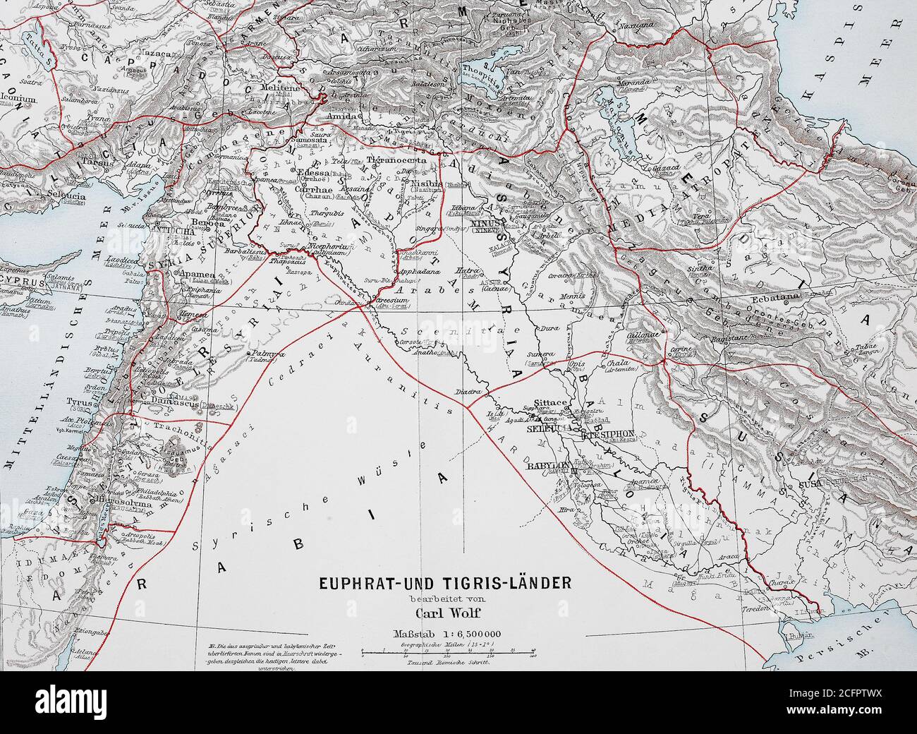 Map of countries around the Tigris and Euphrates of about 1,870, Babylonia, Arabia, Syria / Landkarte der Länder um Euphrat und Tigris von ca 1870, Babylonien, Arabien, Syrien, Historisch, historical, digital improved reproduction of an original from the 19th century / digitale Reproduktion einer Originalvorlage aus dem 19. Jahrhundert, Stock Photohttps://www.alamy.com/image-license-details/?v=1https://www.alamy.com/map-of-countries-around-the-tigris-and-euphrates-of-about-1870-babylonia-arabia-syria-landkarte-der-lnder-um-euphrat-und-tigris-von-ca-1870-babylonien-arabien-syrien-historisch-historical-digital-improved-reproduction-of-an-original-from-the-19th-century-digitale-reproduktion-einer-originalvorlage-aus-dem-19-jahrhundert-image371140054.html
RF2CFPTWX–Map of countries around the Tigris and Euphrates of about 1,870, Babylonia, Arabia, Syria / Landkarte der Länder um Euphrat und Tigris von ca 1870, Babylonien, Arabien, Syrien, Historisch, historical, digital improved reproduction of an original from the 19th century / digitale Reproduktion einer Originalvorlage aus dem 19. Jahrhundert,
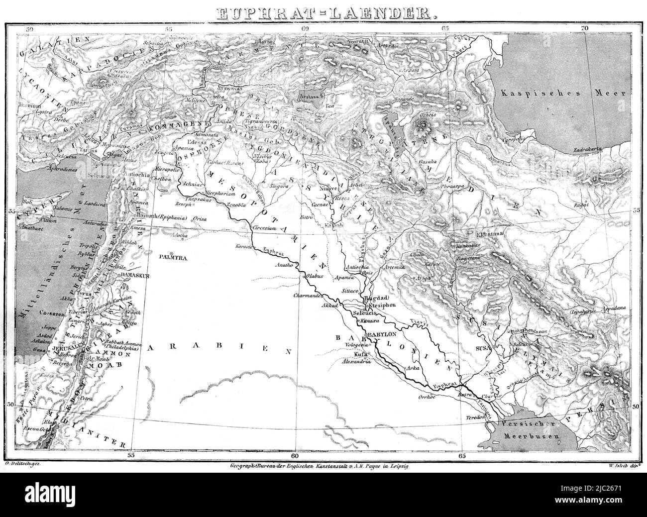 Map of the Euphrates countries, Bible, Old Testament, First Book of Moses, Genesis, historical Illustration 1850 Stock Photohttps://www.alamy.com/image-license-details/?v=1https://www.alamy.com/map-of-the-euphrates-countries-bible-old-testament-first-book-of-moses-genesis-historical-illustration-1850-image472104613.html
RM2JC2671–Map of the Euphrates countries, Bible, Old Testament, First Book of Moses, Genesis, historical Illustration 1850
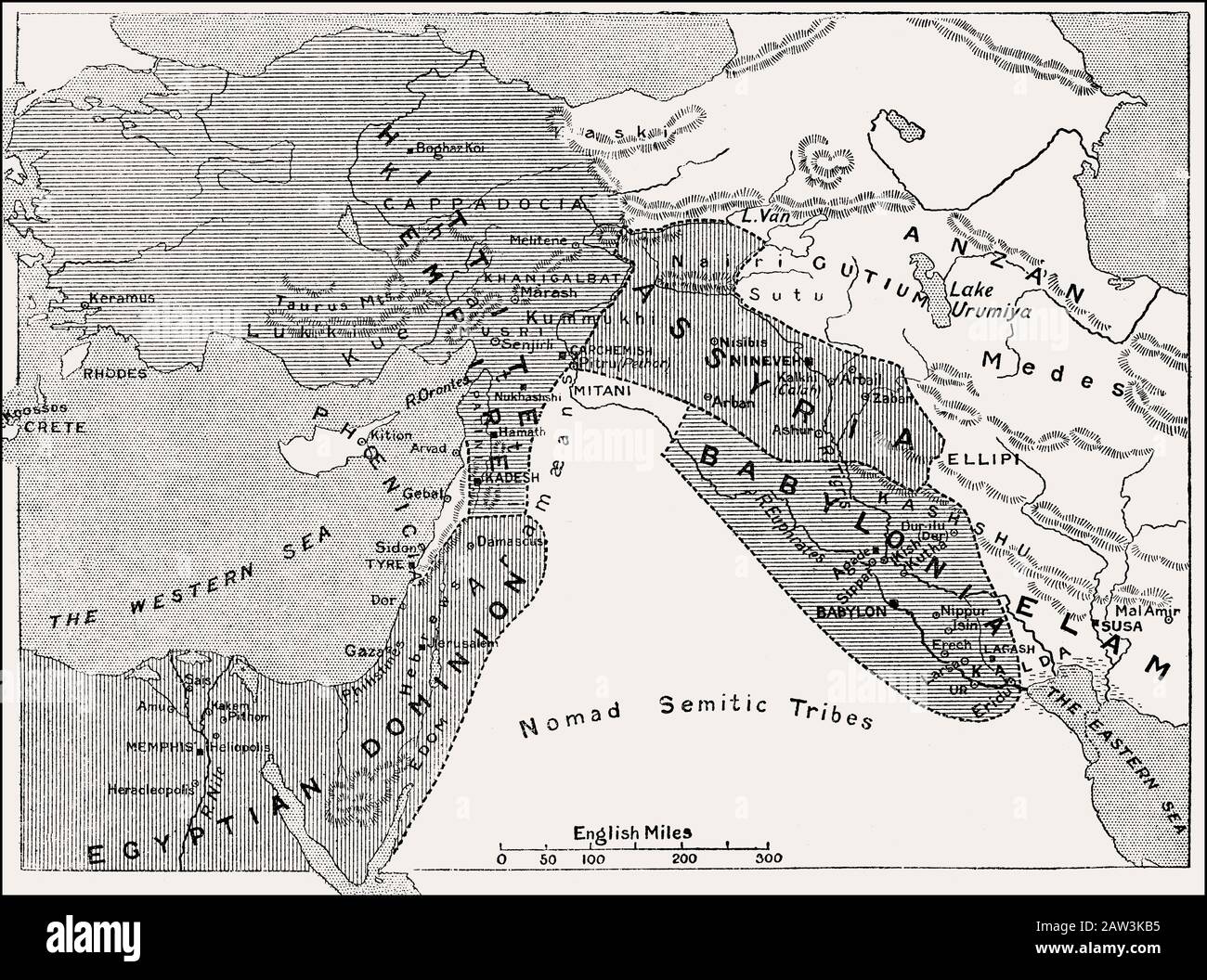 Map of the Babylonian Empire, 1500 BC until 1000 BC Stock Photohttps://www.alamy.com/image-license-details/?v=1https://www.alamy.com/map-of-the-babylonian-empire-1500-bc-until-1000-bc-image342444457.html
RM2AW3KB5–Map of the Babylonian Empire, 1500 BC until 1000 BC
 Babylonia old plan Stock Photohttps://www.alamy.com/image-license-details/?v=1https://www.alamy.com/stock-photo-babylonia-old-plan-50337460.html
RFCWW1XC–Babylonia old plan
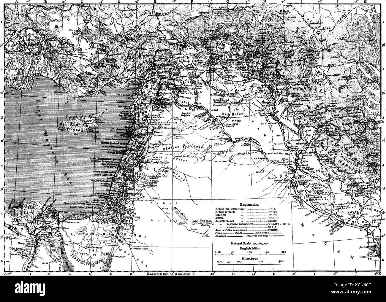 Encyclopaedia Biblica map of Syria, Mesopotamia, Babylonia, and Assyria Stock Photohttps://www.alamy.com/image-license-details/?v=1https://www.alamy.com/stock-image-encyclopaedia-biblica-map-of-syria-mesopotamia-babylonia-and-assyria-162734892.html
RMKCN60C–Encyclopaedia Biblica map of Syria, Mesopotamia, Babylonia, and Assyria
![MESOPOTAMIA ET BABYLONIA FLVMINIBVS SECVNDVM VETEREM tabVLAM DVCTIS. Author Cellarius, Christoph 2.1.VIII.a. Place of publication: [Leipzig?] Publisher: [publisher not identified] Date of publication: [1701-1732?] Item type: 1 map Medium: hand-coloured copperplate engraving Dimensions: 19.6 x 29.1 cm Former owner: George III, King of Great Britain, 1738-1820 Stock Photo MESOPOTAMIA ET BABYLONIA FLVMINIBVS SECVNDVM VETEREM tabVLAM DVCTIS. Author Cellarius, Christoph 2.1.VIII.a. Place of publication: [Leipzig?] Publisher: [publisher not identified] Date of publication: [1701-1732?] Item type: 1 map Medium: hand-coloured copperplate engraving Dimensions: 19.6 x 29.1 cm Former owner: George III, King of Great Britain, 1738-1820 Stock Photo](https://c8.alamy.com/comp/2E9HD3P/mesopotamia-et-babylonia-flvminibvs-secvndvm-veterem-tabvlam-dvctis-author-cellarius-christoph-21viiia-place-of-publication-leipzig-publisher-publisher-not-identified-date-of-publication-1701-1732-item-type-1-map-medium-hand-coloured-copperplate-engraving-dimensions-196-x-291-cm-former-owner-george-iii-king-of-great-britain-1738-1820-2E9HD3P.jpg) MESOPOTAMIA ET BABYLONIA FLVMINIBVS SECVNDVM VETEREM tabVLAM DVCTIS. Author Cellarius, Christoph 2.1.VIII.a. Place of publication: [Leipzig?] Publisher: [publisher not identified] Date of publication: [1701-1732?] Item type: 1 map Medium: hand-coloured copperplate engraving Dimensions: 19.6 x 29.1 cm Former owner: George III, King of Great Britain, 1738-1820 Stock Photohttps://www.alamy.com/image-license-details/?v=1https://www.alamy.com/mesopotamia-et-babylonia-flvminibvs-secvndvm-veterem-tabvlam-dvctis-author-cellarius-christoph-21viiia-place-of-publication-leipzig-publisher-publisher-not-identified-date-of-publication-1701-1732-item-type-1-map-medium-hand-coloured-copperplate-engraving-dimensions-196-x-291-cm-former-owner-george-iii-king-of-great-britain-1738-1820-image401753850.html
MESOPOTAMIA ET BABYLONIA FLVMINIBVS SECVNDVM VETEREM tabVLAM DVCTIS. Author Cellarius, Christoph 2.1.VIII.a. Place of publication: [Leipzig?] Publisher: [publisher not identified] Date of publication: [1701-1732?] Item type: 1 map Medium: hand-coloured copperplate engraving Dimensions: 19.6 x 29.1 cm Former owner: George III, King of Great Britain, 1738-1820 Stock Photohttps://www.alamy.com/image-license-details/?v=1https://www.alamy.com/mesopotamia-et-babylonia-flvminibvs-secvndvm-veterem-tabvlam-dvctis-author-cellarius-christoph-21viiia-place-of-publication-leipzig-publisher-publisher-not-identified-date-of-publication-1701-1732-item-type-1-map-medium-hand-coloured-copperplate-engraving-dimensions-196-x-291-cm-former-owner-george-iii-king-of-great-britain-1738-1820-image401753850.htmlRM2E9HD3P–MESOPOTAMIA ET BABYLONIA FLVMINIBVS SECVNDVM VETEREM tabVLAM DVCTIS. Author Cellarius, Christoph 2.1.VIII.a. Place of publication: [Leipzig?] Publisher: [publisher not identified] Date of publication: [1701-1732?] Item type: 1 map Medium: hand-coloured copperplate engraving Dimensions: 19.6 x 29.1 cm Former owner: George III, King of Great Britain, 1738-1820
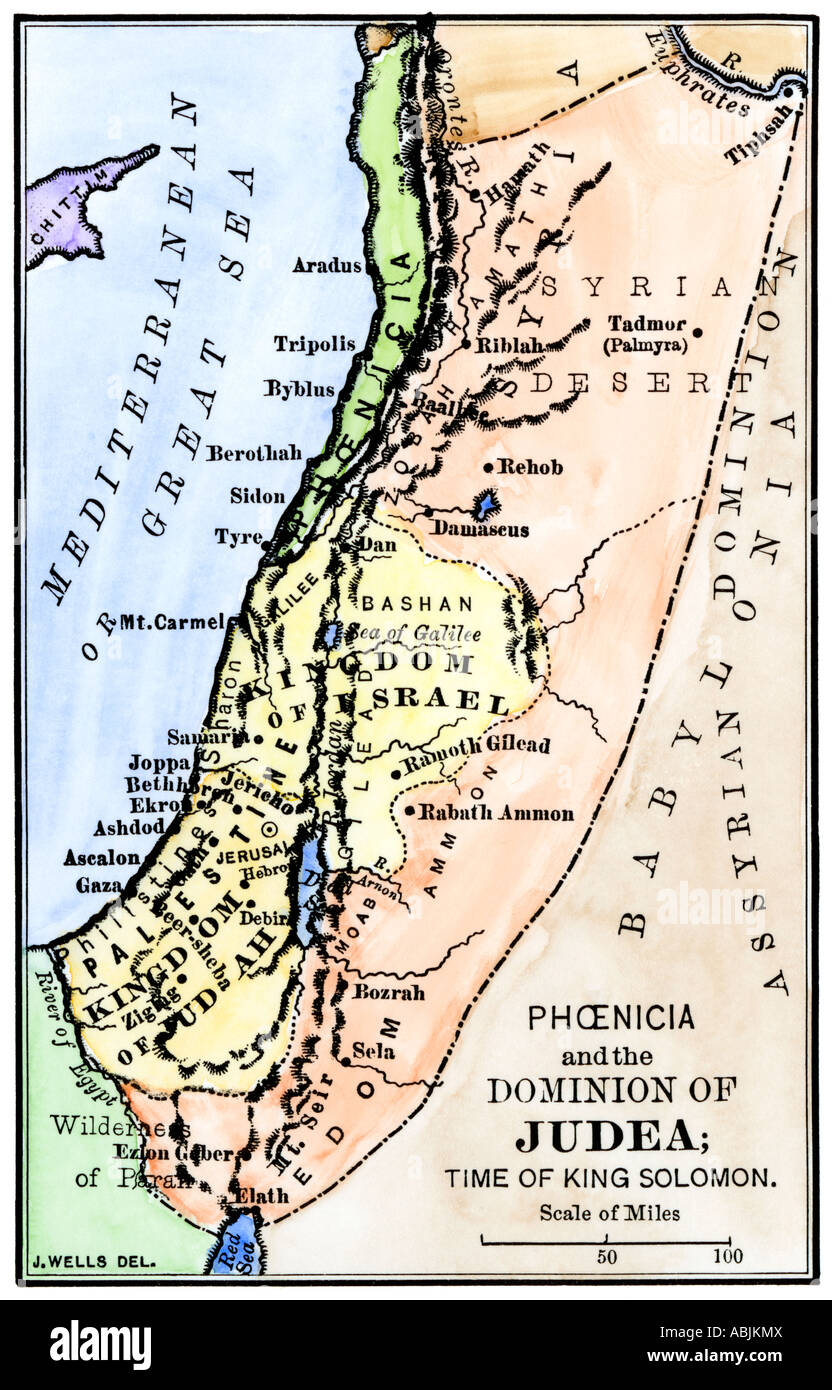 Phoenicia and Judea in the time of King Solomon 10th century BC. Hand-colored woodcut Stock Photohttps://www.alamy.com/image-license-details/?v=1https://www.alamy.com/stock-photo-phoenicia-and-judea-in-the-time-of-king-solomon-10th-century-bc-hand-12908137.html
RMABJKMX–Phoenicia and Judea in the time of King Solomon 10th century BC. Hand-colored woodcut
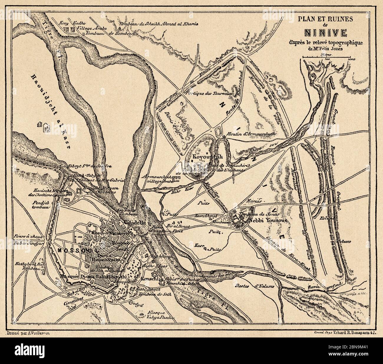 Map of the ruins of Nineveh. Old 19th century engraved illustration, Le Tour du Monde 1863 Stock Photohttps://www.alamy.com/image-license-details/?v=1https://www.alamy.com/map-of-the-ruins-of-nineveh-old-19th-century-engraved-illustration-le-tour-du-monde-1863-image357328497.html
RM2BN9M41–Map of the ruins of Nineveh. Old 19th century engraved illustration, Le Tour du Monde 1863
 Plan of Nineveh Stock Photohttps://www.alamy.com/image-license-details/?v=1https://www.alamy.com/plan-of-nineveh-image568313332.html
RF2T0GWCM–Plan of Nineveh
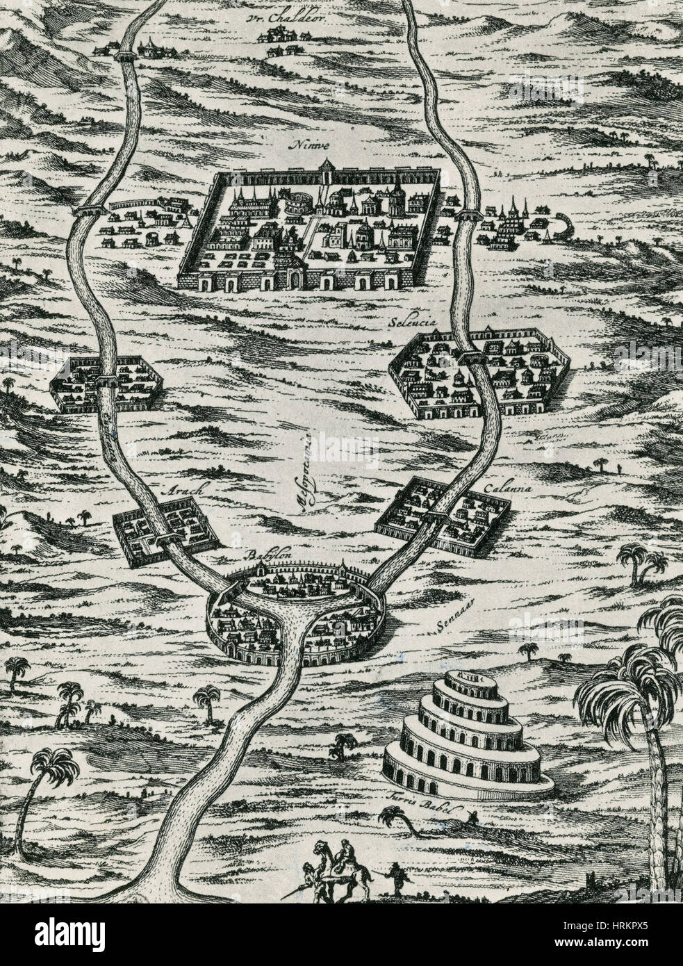 Tigris and Euphrates, Babylonia Stock Photohttps://www.alamy.com/image-license-details/?v=1https://www.alamy.com/stock-photo-tigris-and-euphrates-babylonia-135044733.html
RMHRKPX5–Tigris and Euphrates, Babylonia
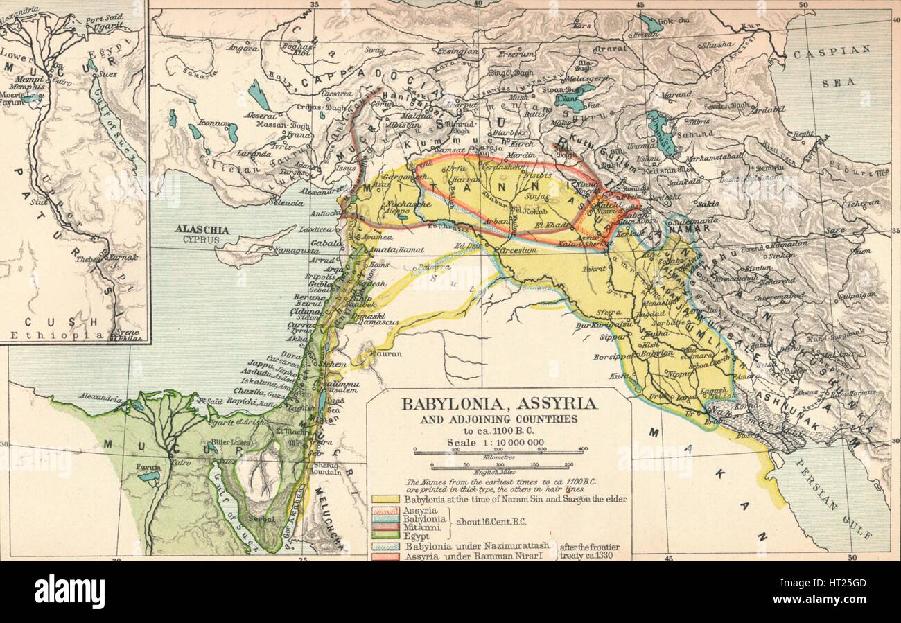 'Babylonia, Assyria and Adjoining Countries', c1902, (1903). Artist: Unknown. Stock Photohttps://www.alamy.com/image-license-details/?v=1https://www.alamy.com/stock-photo-babylonia-assyria-and-adjoining-countries-c1902-1903-artist-unknown-135272605.html
RMHT25GD–'Babylonia, Assyria and Adjoining Countries', c1902, (1903). Artist: Unknown.
!['Pre-Persian, circa 600 B.C.', c1915. Map of the eastern Mediterranean and near East, showing the ancient civilisations of empires of Lydia, Media, Babylonia, Independent States, and free Greek cities. From "The Caliphs' Last Heritage, a short history of the Turkish Empire" by Lt.-Col. Sir Mark Sykes. [Macmillan & Co, London, 1915] Stock Photo 'Pre-Persian, circa 600 B.C.', c1915. Map of the eastern Mediterranean and near East, showing the ancient civilisations of empires of Lydia, Media, Babylonia, Independent States, and free Greek cities. From "The Caliphs' Last Heritage, a short history of the Turkish Empire" by Lt.-Col. Sir Mark Sykes. [Macmillan & Co, London, 1915] Stock Photo](https://c8.alamy.com/comp/2A8E6PE/pre-persian-circa-600-bc-c1915-map-of-the-eastern-mediterranean-and-near-east-showing-the-ancient-civilisations-of-empires-of-lydia-media-babylonia-independent-states-and-free-greek-cities-from-quotthe-caliphs-last-heritage-a-short-history-of-the-turkish-empirequot-by-lt-col-sir-mark-sykes-macmillan-amp-co-london-1915-2A8E6PE.jpg) 'Pre-Persian, circa 600 B.C.', c1915. Map of the eastern Mediterranean and near East, showing the ancient civilisations of empires of Lydia, Media, Babylonia, Independent States, and free Greek cities. From "The Caliphs' Last Heritage, a short history of the Turkish Empire" by Lt.-Col. Sir Mark Sykes. [Macmillan & Co, London, 1915] Stock Photohttps://www.alamy.com/image-license-details/?v=1https://www.alamy.com/pre-persian-circa-600-bc-c1915-map-of-the-eastern-mediterranean-and-near-east-showing-the-ancient-civilisations-of-empires-of-lydia-media-babylonia-independent-states-and-free-greek-cities-from-quotthe-caliphs-last-heritage-a-short-history-of-the-turkish-empirequot-by-lt-col-sir-mark-sykes-macmillan-amp-co-london-1915-image332226902.html
'Pre-Persian, circa 600 B.C.', c1915. Map of the eastern Mediterranean and near East, showing the ancient civilisations of empires of Lydia, Media, Babylonia, Independent States, and free Greek cities. From "The Caliphs' Last Heritage, a short history of the Turkish Empire" by Lt.-Col. Sir Mark Sykes. [Macmillan & Co, London, 1915] Stock Photohttps://www.alamy.com/image-license-details/?v=1https://www.alamy.com/pre-persian-circa-600-bc-c1915-map-of-the-eastern-mediterranean-and-near-east-showing-the-ancient-civilisations-of-empires-of-lydia-media-babylonia-independent-states-and-free-greek-cities-from-quotthe-caliphs-last-heritage-a-short-history-of-the-turkish-empirequot-by-lt-col-sir-mark-sykes-macmillan-amp-co-london-1915-image332226902.htmlRM2A8E6PE–'Pre-Persian, circa 600 B.C.', c1915. Map of the eastern Mediterranean and near East, showing the ancient civilisations of empires of Lydia, Media, Babylonia, Independent States, and free Greek cities. From "The Caliphs' Last Heritage, a short history of the Turkish Empire" by Lt.-Col. Sir Mark Sykes. [Macmillan & Co, London, 1915]
 620 Encyclopaedia Biblica map of Syria, Mesopotamia, Babylonia, and Assyria Stock Photohttps://www.alamy.com/image-license-details/?v=1https://www.alamy.com/620-encyclopaedia-biblica-map-of-syria-mesopotamia-babylonia-and-assyria-image212678084.html
RMPA091T–620 Encyclopaedia Biblica map of Syria, Mesopotamia, Babylonia, and Assyria
 Plan of Nineveh (Nippur) From the book ' Myths and legends of Babylonia & Assyria ' by Lewis Spence, Published London : Harrap 1916 Stock Photohttps://www.alamy.com/image-license-details/?v=1https://www.alamy.com/plan-of-nineveh-nippur-from-the-book-myths-and-legends-of-babylonia-assyria-by-lewis-spence-published-london-harrap-1916-image462499873.html
RF2HTCK8H–Plan of Nineveh (Nippur) From the book ' Myths and legends of Babylonia & Assyria ' by Lewis Spence, Published London : Harrap 1916
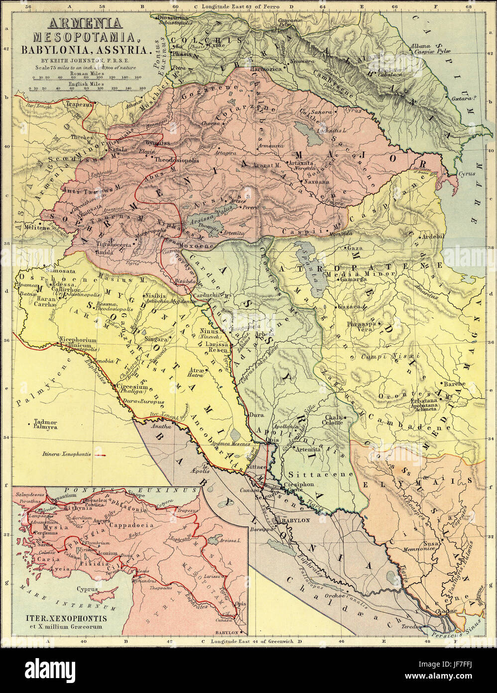 Map of Armenia, Mesopotamia, Babylonia and Assyria, showing the route of Xenophon and the Ten Thousand ( 5th century BC ). Drawn by Keith Johnston F.R.S.E. Published in The Unrivalled Classical Atlas by W. and A.K. Johnston in 1877. Stock Photohttps://www.alamy.com/image-license-details/?v=1https://www.alamy.com/stock-photo-map-of-armenia-mesopotamia-babylonia-and-assyria-showing-the-route-147068646.html
RMJF7FFJ–Map of Armenia, Mesopotamia, Babylonia and Assyria, showing the route of Xenophon and the Ten Thousand ( 5th century BC ). Drawn by Keith Johnston F.R.S.E. Published in The Unrivalled Classical Atlas by W. and A.K. Johnston in 1877.
 The Babylonian Map of the World, c. 510-c. 500 BC. Artist: Assyrian Art Stock Photohttps://www.alamy.com/image-license-details/?v=1https://www.alamy.com/stock-photo-the-babylonian-map-of-the-world-c-510-c-500-bc-artist-assyrian-art-135253883.html
RMHT19KR–The Babylonian Map of the World, c. 510-c. 500 BC. Artist: Assyrian Art
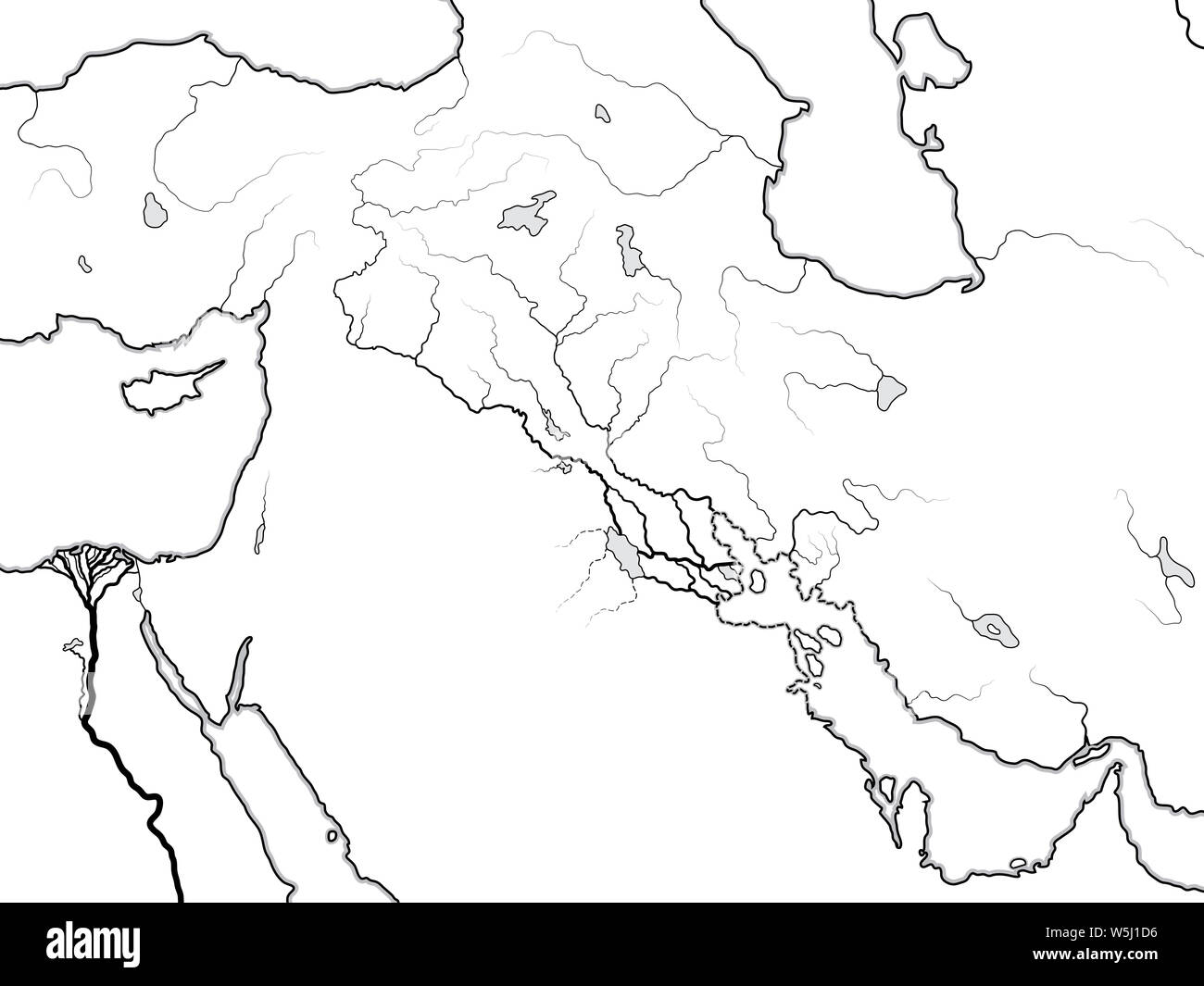 World Map of The TIGRIS & EUPHRATES Valley: Mesopotamia, Assyria, Babylonia, Sumer (Sennaar/Canaan), Akkad, Elam, Persis. Ancient coastline chart. Stock Photohttps://www.alamy.com/image-license-details/?v=1https://www.alamy.com/world-map-of-the-tigris-euphrates-valley-mesopotamia-assyria-babylonia-sumer-sennaarcanaan-akkad-elam-persis-ancient-coastline-chart-image261625090.html
RFW5J1D6–World Map of The TIGRIS & EUPHRATES Valley: Mesopotamia, Assyria, Babylonia, Sumer (Sennaar/Canaan), Akkad, Elam, Persis. Ancient coastline chart.
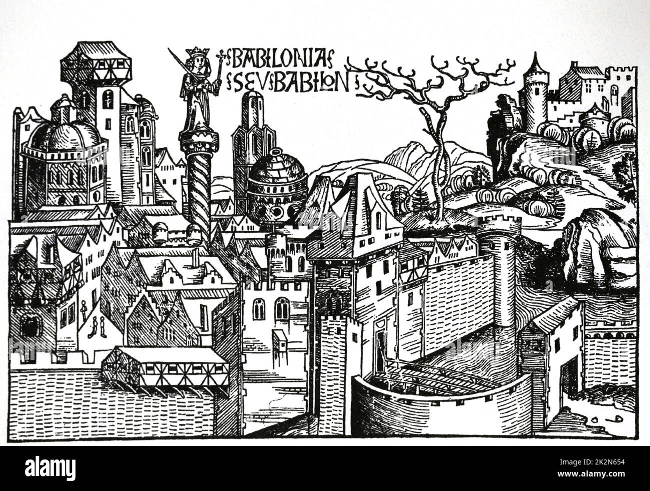 Mesopotamia. Babylon city. The Nuremberg Chronicles. 15th century. Stock Photohttps://www.alamy.com/image-license-details/?v=1https://www.alamy.com/mesopotamia-babylon-city-the-nuremberg-chronicles-15th-century-image483585456.html
RM2K2N654–Mesopotamia. Babylon city. The Nuremberg Chronicles. 15th century.
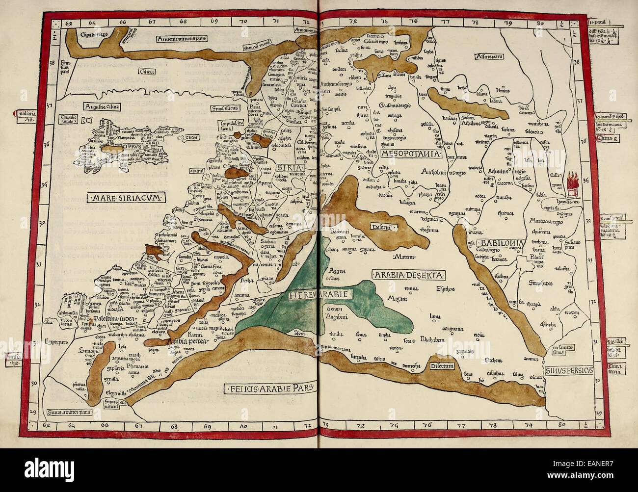 Map of Mesopotamia from ‘Cosmographia’ by Claudius Ptolemy (Ptolemaeus) (90-168AD). See description for more information. Stock Photohttps://www.alamy.com/image-license-details/?v=1https://www.alamy.com/stock-photo-map-of-mesopotamia-from-cosmographia-by-claudius-ptolemy-ptolemaeus-75460651.html
RMEANER7–Map of Mesopotamia from ‘Cosmographia’ by Claudius Ptolemy (Ptolemaeus) (90-168AD). See description for more information.
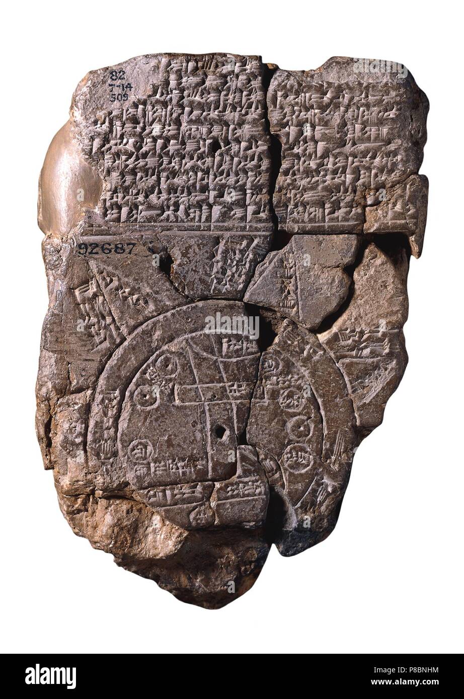 The Babylonian Map of the World. Museum: BRITISH MUSEUM. Stock Photohttps://www.alamy.com/image-license-details/?v=1https://www.alamy.com/the-babylonian-map-of-the-world-museum-british-museum-image211700096.html
RMP8BNHM–The Babylonian Map of the World. Museum: BRITISH MUSEUM.
 ANCIENT PERSIAN EMPIRE. Shows retreat of 10,000 Greeks. Cyrus Younger, 1876 map Stock Photohttps://www.alamy.com/image-license-details/?v=1https://www.alamy.com/stock-photo-ancient-persian-empire-shows-retreat-of-10000-greeks-cyrus-younger-102714644.html
RFFY31G4–ANCIENT PERSIAN EMPIRE. Shows retreat of 10,000 Greeks. Cyrus Younger, 1876 map
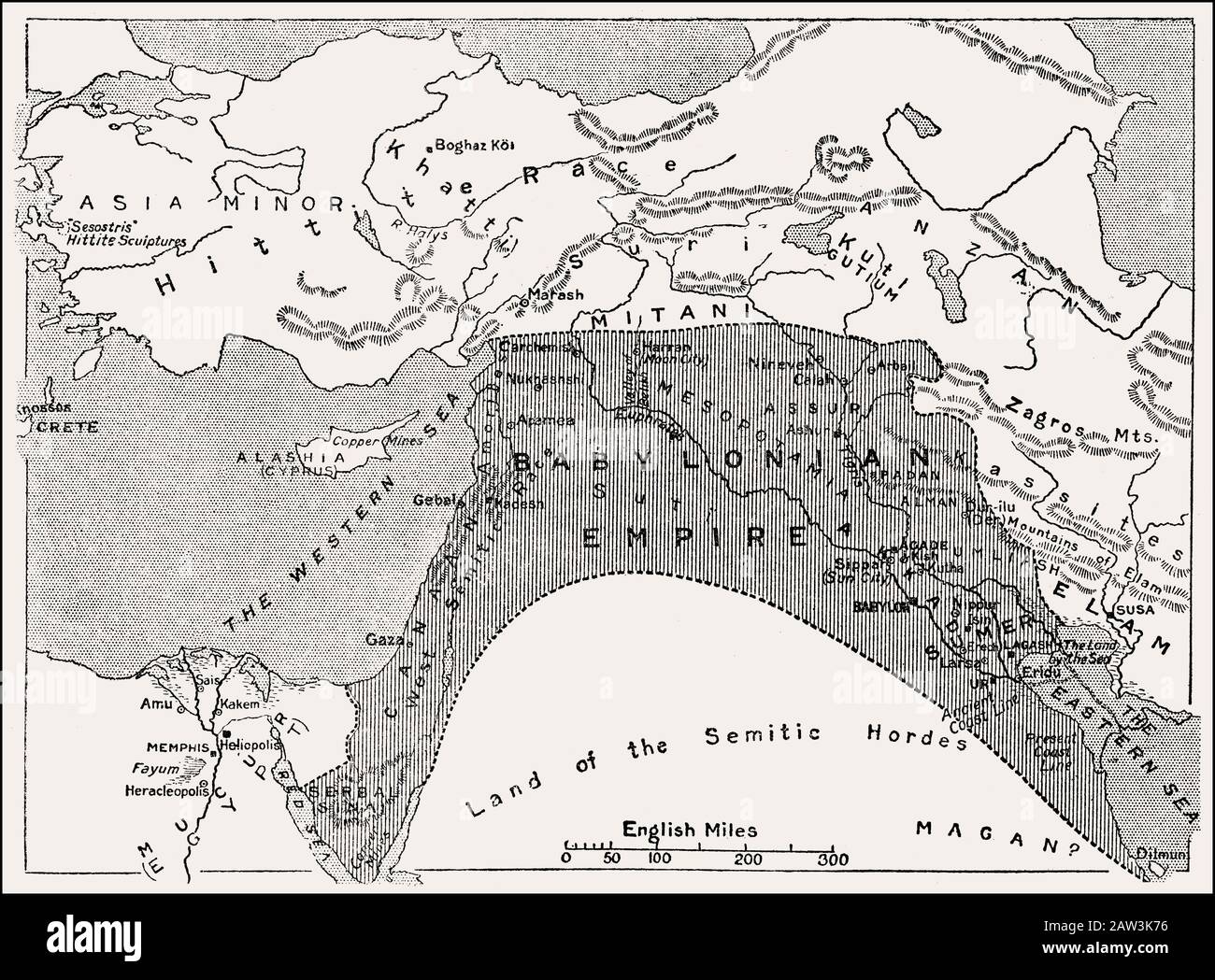 Map of the Babylonian Empire, cradle of civilization, 25th century BC Stock Photohttps://www.alamy.com/image-license-details/?v=1https://www.alamy.com/map-of-the-babylonian-empire-cradle-of-civilization-25th-century-bc-image342444346.html
RM2AW3K76–Map of the Babylonian Empire, cradle of civilization, 25th century BC
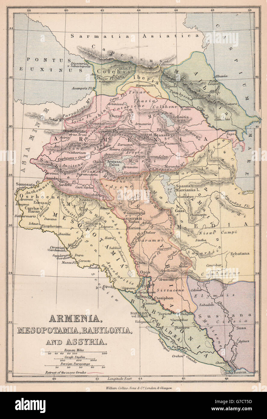 ANCIENT PERSIAN EMPIRE. Shows retreat of 10,000 Greeks. Cyrus Younger, 1878 map Stock Photohttps://www.alamy.com/image-license-details/?v=1https://www.alamy.com/stock-photo-ancient-persian-empire-shows-retreat-of-10000-greeks-cyrus-younger-107847193.html
RFG7CT5D–ANCIENT PERSIAN EMPIRE. Shows retreat of 10,000 Greeks. Cyrus Younger, 1878 map
 'Map of Assyria, Chaldea and Adjacent Countries', 1890. Creator: Unknown. Stock Photohttps://www.alamy.com/image-license-details/?v=1https://www.alamy.com/map-of-assyria-chaldea-and-adjacent-countries-1890-creator-unknown-image248906667.html
RMTCXJYR–'Map of Assyria, Chaldea and Adjacent Countries', 1890. Creator: Unknown.
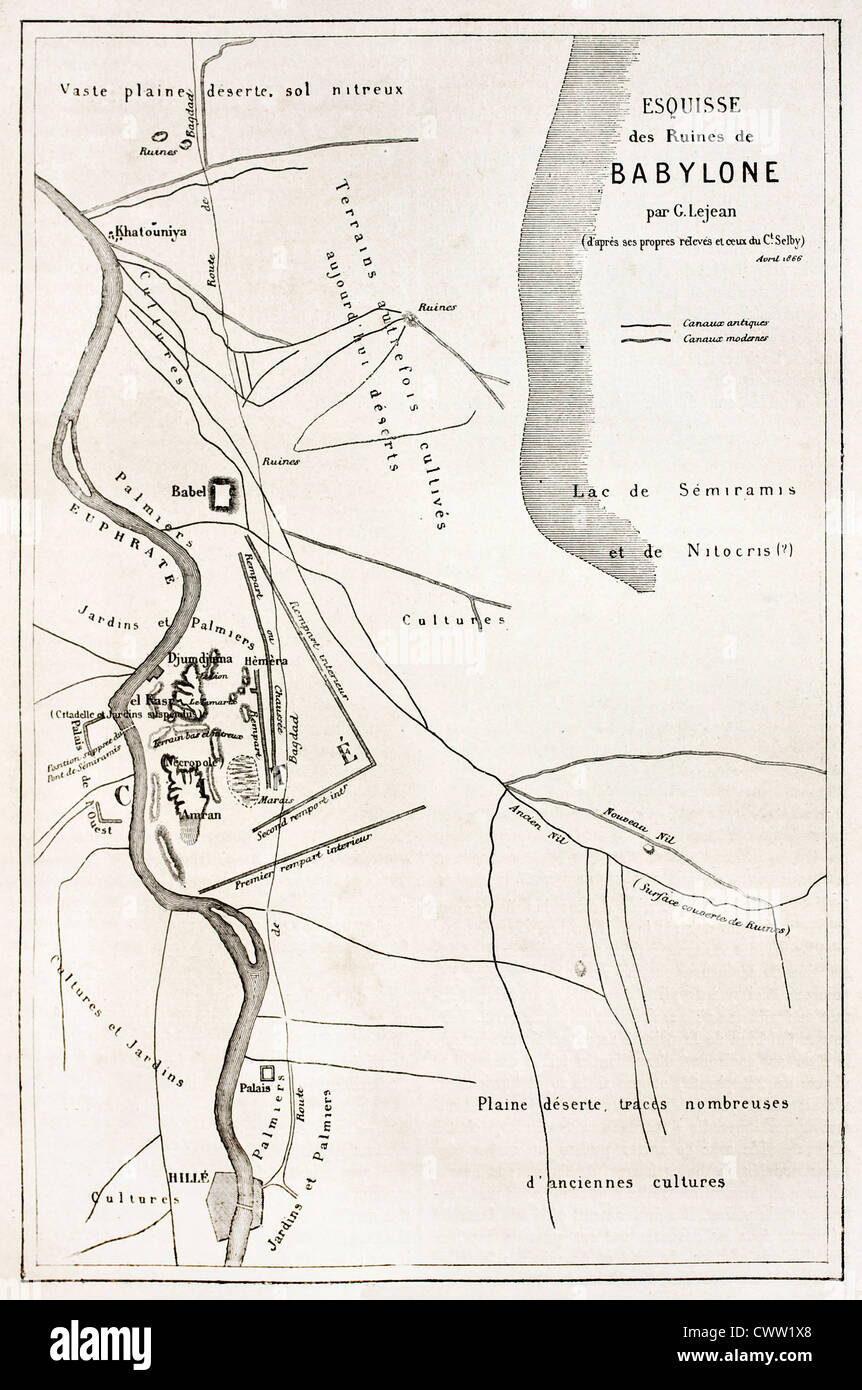 Babylon old plan Stock Photohttps://www.alamy.com/image-license-details/?v=1https://www.alamy.com/stock-photo-babylon-old-plan-50337456.html
RFCWW1X8–Babylon old plan
!['A Map of the Situation of the Terrestial Paradise'. The Garden of Eden is shown by the river south of Babylonia. A treatise of the Situation of Paradise ... Translated from the French original [by T. Gale]. London, 1694. Source: 1017.e.21, opposite B1. Language: English. Stock Photo 'A Map of the Situation of the Terrestial Paradise'. The Garden of Eden is shown by the river south of Babylonia. A treatise of the Situation of Paradise ... Translated from the French original [by T. Gale]. London, 1694. Source: 1017.e.21, opposite B1. Language: English. Stock Photo](https://c8.alamy.com/comp/R5DH1P/a-map-of-the-situation-of-the-terrestial-paradise-the-garden-of-eden-is-shown-by-the-river-south-of-babylonia-a-treatise-of-the-situation-of-paradise-translated-from-the-french-original-by-t-gale-london-1694-source-1017e21-opposite-b1-language-english-R5DH1P.jpg) 'A Map of the Situation of the Terrestial Paradise'. The Garden of Eden is shown by the river south of Babylonia. A treatise of the Situation of Paradise ... Translated from the French original [by T. Gale]. London, 1694. Source: 1017.e.21, opposite B1. Language: English. Stock Photohttps://www.alamy.com/image-license-details/?v=1https://www.alamy.com/a-map-of-the-situation-of-the-terrestial-paradise-the-garden-of-eden-is-shown-by-the-river-south-of-babylonia-a-treatise-of-the-situation-of-paradise-translated-from-the-french-original-by-t-gale-london-1694-source-1017e21-opposite-b1-language-english-image227106818.html
'A Map of the Situation of the Terrestial Paradise'. The Garden of Eden is shown by the river south of Babylonia. A treatise of the Situation of Paradise ... Translated from the French original [by T. Gale]. London, 1694. Source: 1017.e.21, opposite B1. Language: English. Stock Photohttps://www.alamy.com/image-license-details/?v=1https://www.alamy.com/a-map-of-the-situation-of-the-terrestial-paradise-the-garden-of-eden-is-shown-by-the-river-south-of-babylonia-a-treatise-of-the-situation-of-paradise-translated-from-the-french-original-by-t-gale-london-1694-source-1017e21-opposite-b1-language-english-image227106818.htmlRMR5DH1P–'A Map of the Situation of the Terrestial Paradise'. The Garden of Eden is shown by the river south of Babylonia. A treatise of the Situation of Paradise ... Translated from the French original [by T. Gale]. London, 1694. Source: 1017.e.21, opposite B1. Language: English.
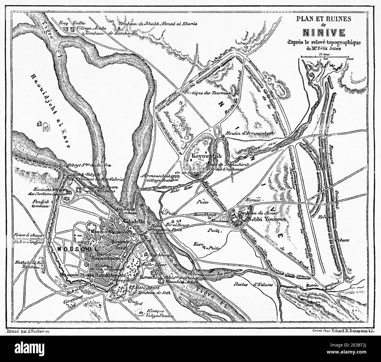 Map of the ruins of Nineveh. Old 19th century engraved illustration, Le Tour du Monde 1863 Stock Photohttps://www.alamy.com/image-license-details/?v=1https://www.alamy.com/map-of-the-ruins-of-nineveh-old-19th-century-engraved-illustration-le-tour-du-monde-1863-image397942794.html
RM2E3BT2J–Map of the ruins of Nineveh. Old 19th century engraved illustration, Le Tour du Monde 1863
 MACCOUN(1899) p027 EARLY BABYLONIA Stock Photohttps://www.alamy.com/image-license-details/?v=1https://www.alamy.com/stock-photo-maccoun1899-p027-early-babylonia-73540177.html
RME7J16W–MACCOUN(1899) p027 EARLY BABYLONIA
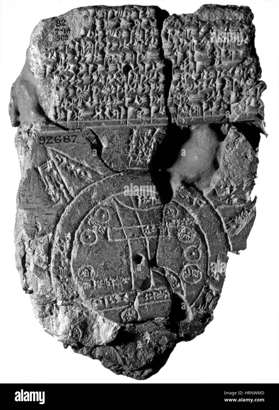 Babylonian World Map, 5th Century BC Stock Photohttps://www.alamy.com/image-license-details/?v=1https://www.alamy.com/stock-photo-babylonian-world-map-5th-century-bc-135090829.html
RMHRNWMD–Babylonian World Map, 5th Century BC
 Ancient map of Babylon, Iraq. Journey to Babylon by Guillaume Lejean 1866 from Le Tour du Monde 1867 Stock Photohttps://www.alamy.com/image-license-details/?v=1https://www.alamy.com/ancient-map-of-babylon-iraq-journey-to-babylon-by-guillaume-lejean-1866-from-le-tour-du-monde-1867-image479853942.html
RM2JTK6GP–Ancient map of Babylon, Iraq. Journey to Babylon by Guillaume Lejean 1866 from Le Tour du Monde 1867
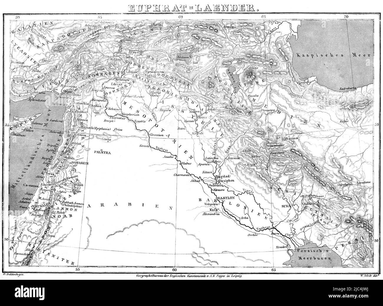 Euphrates countries, map, cartography, Near East, Mediterranean Sea, Caspian Sea, Mesopotamia, Tigris, Palmyra, Arabia, Babylonia, Damascus Stock Photohttps://www.alamy.com/image-license-details/?v=1https://www.alamy.com/euphrates-countries-map-cartography-near-east-mediterranean-sea-caspian-sea-mesopotamia-tigris-palmyra-arabia-babylonia-damascus-image472158446.html
RM2JC4JWJ–Euphrates countries, map, cartography, Near East, Mediterranean Sea, Caspian Sea, Mesopotamia, Tigris, Palmyra, Arabia, Babylonia, Damascus
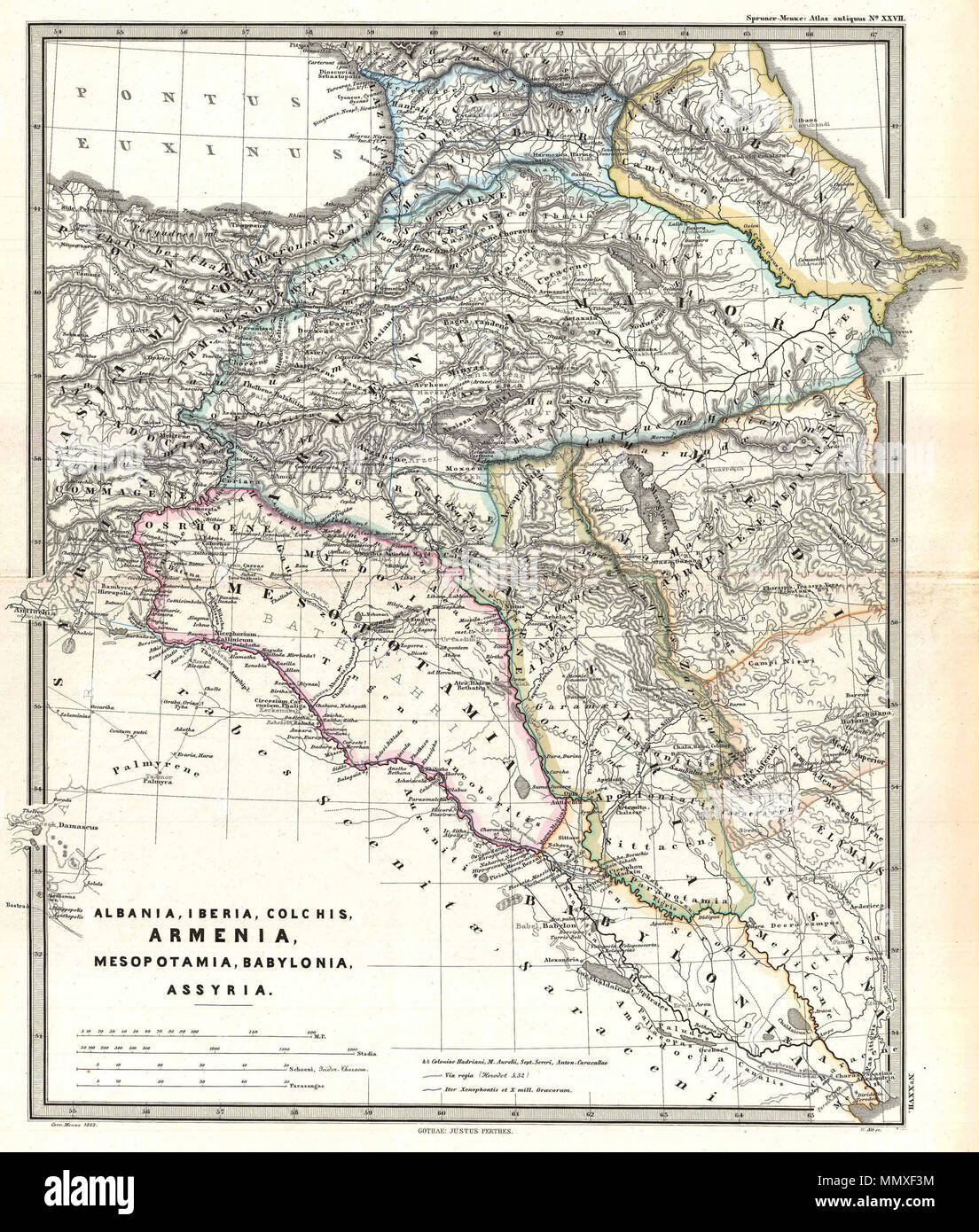 . English: A particularly interesting map, this is Karl von Spruner’s 1865 rendering of the Caucasus and Mesopotamia in antiquity. Centered on Lake Van (modern day eastern Turkey), this map covers the Caucasus region between the Black Sea and the Caspian Sea, then southwards to the Fertile Crescent as far as the Euphrates River, Babylonia, and the head of the Persian Gulf. These regions include the modern day countries of Iraq, Armenia, Georgia, Azerbaijan, and adjacent parts of Syria, Turkey, Iran, and the North Caucasus. Like most of Spruner’s work this example overlays ancient political ge Stock Photohttps://www.alamy.com/image-license-details/?v=1https://www.alamy.com/english-a-particularly-interesting-map-this-is-karl-von-spruners-1865-rendering-of-the-caucasus-and-mesopotamia-in-antiquity-centered-on-lake-van-modern-day-eastern-turkey-this-map-covers-the-caucasus-region-between-the-black-sea-and-the-caspian-sea-then-southwards-to-the-fertile-crescent-as-far-as-the-euphrates-river-babylonia-and-the-head-of-the-persian-gulf-these-regions-include-the-modern-day-countries-of-iraq-armenia-georgia-azerbaijan-and-adjacent-parts-of-syria-turkey-iran-and-the-north-caucasus-like-most-of-spruners-work-this-example-overlays-ancient-political-ge-image184979416.html
RMMMXF3M–. English: A particularly interesting map, this is Karl von Spruner’s 1865 rendering of the Caucasus and Mesopotamia in antiquity. Centered on Lake Van (modern day eastern Turkey), this map covers the Caucasus region between the Black Sea and the Caspian Sea, then southwards to the Fertile Crescent as far as the Euphrates River, Babylonia, and the head of the Persian Gulf. These regions include the modern day countries of Iraq, Armenia, Georgia, Azerbaijan, and adjacent parts of Syria, Turkey, Iran, and the North Caucasus. Like most of Spruner’s work this example overlays ancient political ge
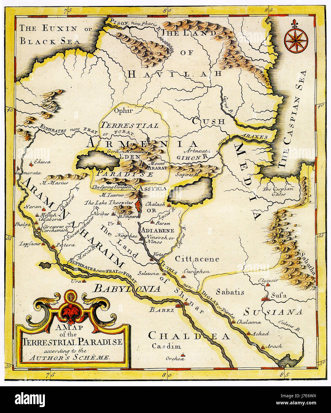 Map of ancient Armenia Stock Photohttps://www.alamy.com/image-license-details/?v=1https://www.alamy.com/stock-photo-map-of-ancient-armenia-142298294.html
RFJ7E6WX–Map of ancient Armenia
![Tabula IIII Asiae. Map of Palestine, Mesopotamia and Babylonia in present day Middle East. Relief shown pictorially. Includes names of places and natural features. Descriptive text within ornamental borders on verso. Appears in the author's Geographia, translated by Willibald Pirckheimer, with annotations by Joannes Regiomontanus. Argentoragi [i.e. Strasbourg] : Iohannes Grieningerus, communibus Iohannis Koberger impensis excudebat, anno a Christi Natiuitate 1525 tertio Kal[endas] Apriles. Text in Latin. Cataloging, conservation, and digitization made possible in part by The National Endowment Stock Photo Tabula IIII Asiae. Map of Palestine, Mesopotamia and Babylonia in present day Middle East. Relief shown pictorially. Includes names of places and natural features. Descriptive text within ornamental borders on verso. Appears in the author's Geographia, translated by Willibald Pirckheimer, with annotations by Joannes Regiomontanus. Argentoragi [i.e. Strasbourg] : Iohannes Grieningerus, communibus Iohannis Koberger impensis excudebat, anno a Christi Natiuitate 1525 tertio Kal[endas] Apriles. Text in Latin. Cataloging, conservation, and digitization made possible in part by The National Endowment Stock Photo](https://c8.alamy.com/comp/2M5WE1A/tabula-iiii-asiae-map-of-palestine-mesopotamia-and-babylonia-in-present-day-middle-east-relief-shown-pictorially-includes-names-of-places-and-natural-features-descriptive-text-within-ornamental-borders-on-verso-appears-in-the-authors-geographia-translated-by-willibald-pirckheimer-with-annotations-by-joannes-regiomontanus-argentoragi-ie-strasbourg-iohannes-grieningerus-communibus-iohannis-koberger-impensis-excudebat-anno-a-christi-natiuitate-1525-tertio-kal-endas-apriles-text-in-latin-cataloging-conservation-and-digitization-made-possible-in-part-by-the-national-endowment-2M5WE1A.jpg) Tabula IIII Asiae. Map of Palestine, Mesopotamia and Babylonia in present day Middle East. Relief shown pictorially. Includes names of places and natural features. Descriptive text within ornamental borders on verso. Appears in the author's Geographia, translated by Willibald Pirckheimer, with annotations by Joannes Regiomontanus. Argentoragi [i.e. Strasbourg] : Iohannes Grieningerus, communibus Iohannis Koberger impensis excudebat, anno a Christi Natiuitate 1525 tertio Kal[endas] Apriles. Text in Latin. Cataloging, conservation, and digitization made possible in part by The National Endowment Stock Photohttps://www.alamy.com/image-license-details/?v=1https://www.alamy.com/tabula-iiii-asiae-map-of-palestine-mesopotamia-and-babylonia-in-present-day-middle-east-relief-shown-pictorially-includes-names-of-places-and-natural-features-descriptive-text-within-ornamental-borders-on-verso-appears-in-the-authors-geographia-translated-by-willibald-pirckheimer-with-annotations-by-joannes-regiomontanus-argentoragi-ie-strasbourg-iohannes-grieningerus-communibus-iohannis-koberger-impensis-excudebat-anno-a-christi-natiuitate-1525-tertio-kal-endas-apriles-text-in-latin-cataloging-conservation-and-digitization-made-possible-in-part-by-the-national-endowment-image502733766.html
Tabula IIII Asiae. Map of Palestine, Mesopotamia and Babylonia in present day Middle East. Relief shown pictorially. Includes names of places and natural features. Descriptive text within ornamental borders on verso. Appears in the author's Geographia, translated by Willibald Pirckheimer, with annotations by Joannes Regiomontanus. Argentoragi [i.e. Strasbourg] : Iohannes Grieningerus, communibus Iohannis Koberger impensis excudebat, anno a Christi Natiuitate 1525 tertio Kal[endas] Apriles. Text in Latin. Cataloging, conservation, and digitization made possible in part by The National Endowment Stock Photohttps://www.alamy.com/image-license-details/?v=1https://www.alamy.com/tabula-iiii-asiae-map-of-palestine-mesopotamia-and-babylonia-in-present-day-middle-east-relief-shown-pictorially-includes-names-of-places-and-natural-features-descriptive-text-within-ornamental-borders-on-verso-appears-in-the-authors-geographia-translated-by-willibald-pirckheimer-with-annotations-by-joannes-regiomontanus-argentoragi-ie-strasbourg-iohannes-grieningerus-communibus-iohannis-koberger-impensis-excudebat-anno-a-christi-natiuitate-1525-tertio-kal-endas-apriles-text-in-latin-cataloging-conservation-and-digitization-made-possible-in-part-by-the-national-endowment-image502733766.htmlRM2M5WE1A–Tabula IIII Asiae. Map of Palestine, Mesopotamia and Babylonia in present day Middle East. Relief shown pictorially. Includes names of places and natural features. Descriptive text within ornamental borders on verso. Appears in the author's Geographia, translated by Willibald Pirckheimer, with annotations by Joannes Regiomontanus. Argentoragi [i.e. Strasbourg] : Iohannes Grieningerus, communibus Iohannis Koberger impensis excudebat, anno a Christi Natiuitate 1525 tertio Kal[endas] Apriles. Text in Latin. Cataloging, conservation, and digitization made possible in part by The National Endowment
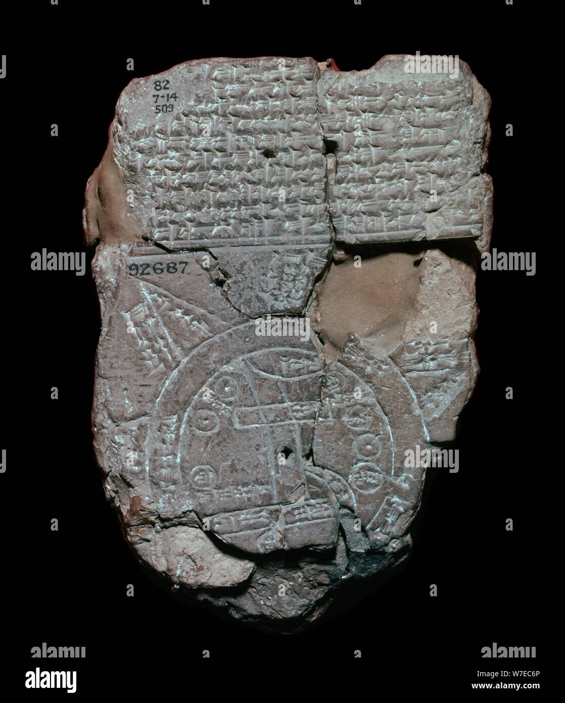 Map of the World, probably from Sippar, southern Iraq, Babylonian, c700-c500 BC. Artist: Unknown Stock Photohttps://www.alamy.com/image-license-details/?v=1https://www.alamy.com/map-of-the-world-probably-from-sippar-southern-iraq-babylonian-c700-c500-bc-artist-unknown-image262775038.html
RMW7EC6P–Map of the World, probably from Sippar, southern Iraq, Babylonian, c700-c500 BC. Artist: Unknown
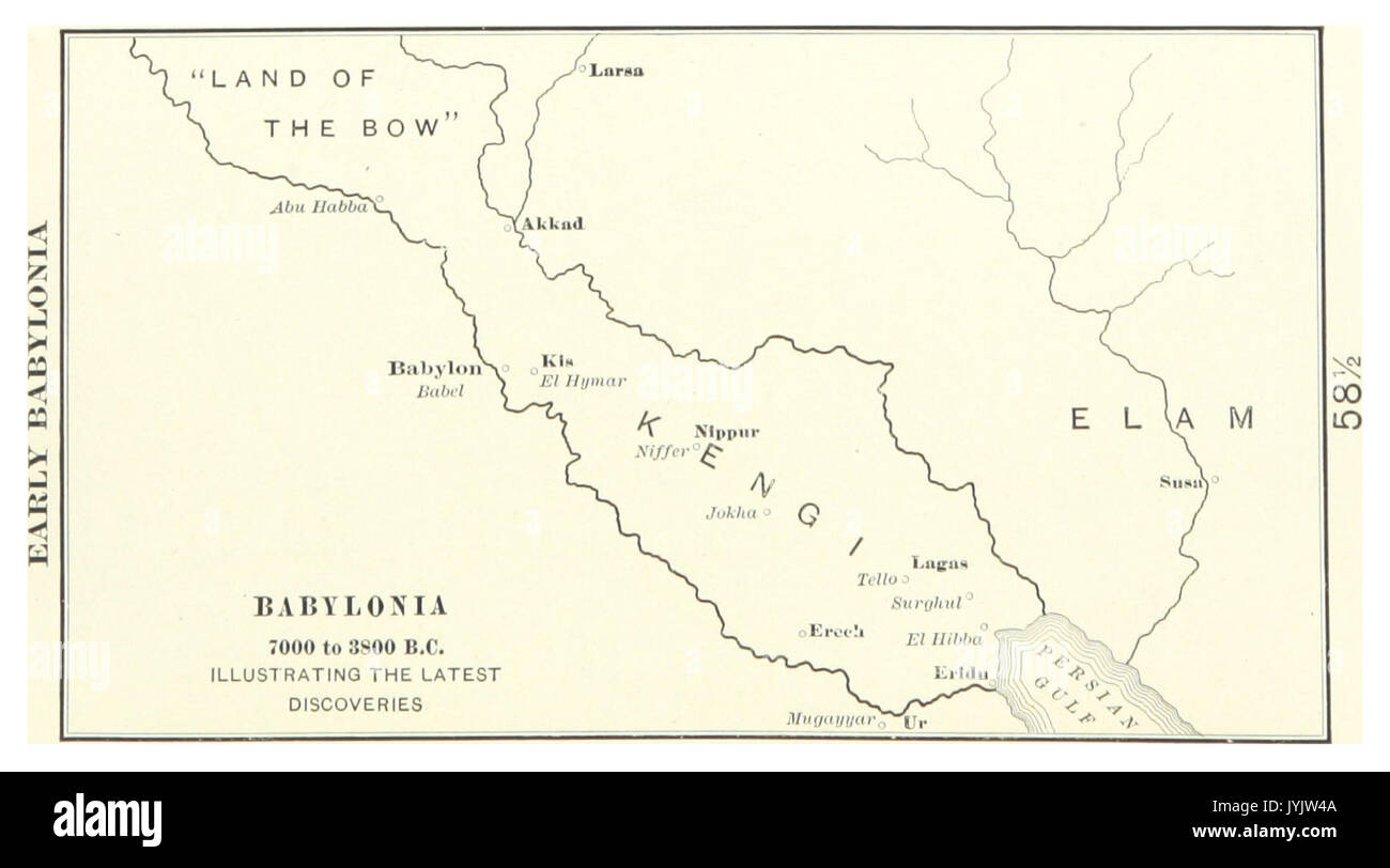 MACCOUN(1899) p027 EARLY BABYLONIA Stock Photohttps://www.alamy.com/image-license-details/?v=1https://www.alamy.com/maccoun1899-p027-early-babylonia-image154693514.html
RMJYJW4A–MACCOUN(1899) p027 EARLY BABYLONIA
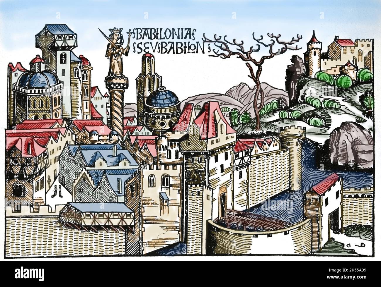 Mesopotamia. Babylon city. The Nuremberg Chronicles. 15th century. Stock Photohttps://www.alamy.com/image-license-details/?v=1https://www.alamy.com/mesopotamia-babylon-city-the-nuremberg-chronicles-15th-century-image485081445.html
RM2K55A99–Mesopotamia. Babylon city. The Nuremberg Chronicles. 15th century.
!['Persian, circa 500 B.C.', c1915. Map of the eastern Mediterranean and Near East, showing the ancient Persian empire and Independent States. From "The Caliphs' Last Heritage, a short history of the Turkish Empire" by Lt.-Col. Sir Mark Sykes. [Macmillan & Co, London, 1915] Stock Photo 'Persian, circa 500 B.C.', c1915. Map of the eastern Mediterranean and Near East, showing the ancient Persian empire and Independent States. From "The Caliphs' Last Heritage, a short history of the Turkish Empire" by Lt.-Col. Sir Mark Sykes. [Macmillan & Co, London, 1915] Stock Photo](https://c8.alamy.com/comp/2A8E6NY/persian-circa-500-bc-c1915-map-of-the-eastern-mediterranean-and-near-east-showing-the-ancient-persian-empire-and-independent-states-from-quotthe-caliphs-last-heritage-a-short-history-of-the-turkish-empirequot-by-lt-col-sir-mark-sykes-macmillan-amp-co-london-1915-2A8E6NY.jpg) 'Persian, circa 500 B.C.', c1915. Map of the eastern Mediterranean and Near East, showing the ancient Persian empire and Independent States. From "The Caliphs' Last Heritage, a short history of the Turkish Empire" by Lt.-Col. Sir Mark Sykes. [Macmillan & Co, London, 1915] Stock Photohttps://www.alamy.com/image-license-details/?v=1https://www.alamy.com/persian-circa-500-bc-c1915-map-of-the-eastern-mediterranean-and-near-east-showing-the-ancient-persian-empire-and-independent-states-from-quotthe-caliphs-last-heritage-a-short-history-of-the-turkish-empirequot-by-lt-col-sir-mark-sykes-macmillan-amp-co-london-1915-image332226887.html
'Persian, circa 500 B.C.', c1915. Map of the eastern Mediterranean and Near East, showing the ancient Persian empire and Independent States. From "The Caliphs' Last Heritage, a short history of the Turkish Empire" by Lt.-Col. Sir Mark Sykes. [Macmillan & Co, London, 1915] Stock Photohttps://www.alamy.com/image-license-details/?v=1https://www.alamy.com/persian-circa-500-bc-c1915-map-of-the-eastern-mediterranean-and-near-east-showing-the-ancient-persian-empire-and-independent-states-from-quotthe-caliphs-last-heritage-a-short-history-of-the-turkish-empirequot-by-lt-col-sir-mark-sykes-macmillan-amp-co-london-1915-image332226887.htmlRM2A8E6NY–'Persian, circa 500 B.C.', c1915. Map of the eastern Mediterranean and Near East, showing the ancient Persian empire and Independent States. From "The Caliphs' Last Heritage, a short history of the Turkish Empire" by Lt.-Col. Sir Mark Sykes. [Macmillan & Co, London, 1915]
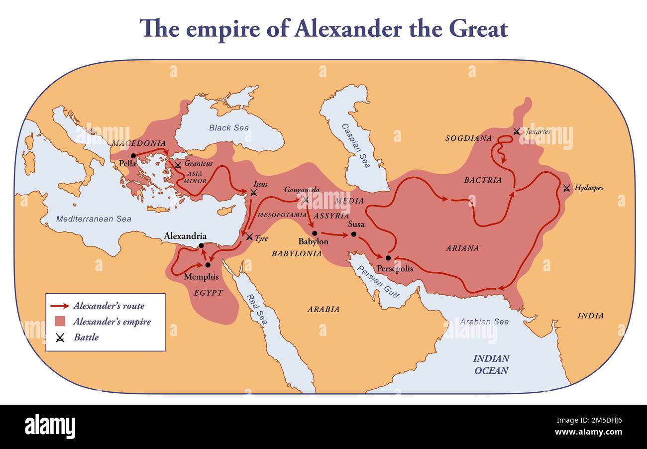 The empire, route and battles of Alexander the great from Greece to India Stock Photohttps://www.alamy.com/image-license-details/?v=1https://www.alamy.com/the-empire-route-and-battles-of-alexander-the-great-from-greece-to-india-image502473166.html
RF2M5DHJ6–The empire, route and battles of Alexander the great from Greece to India
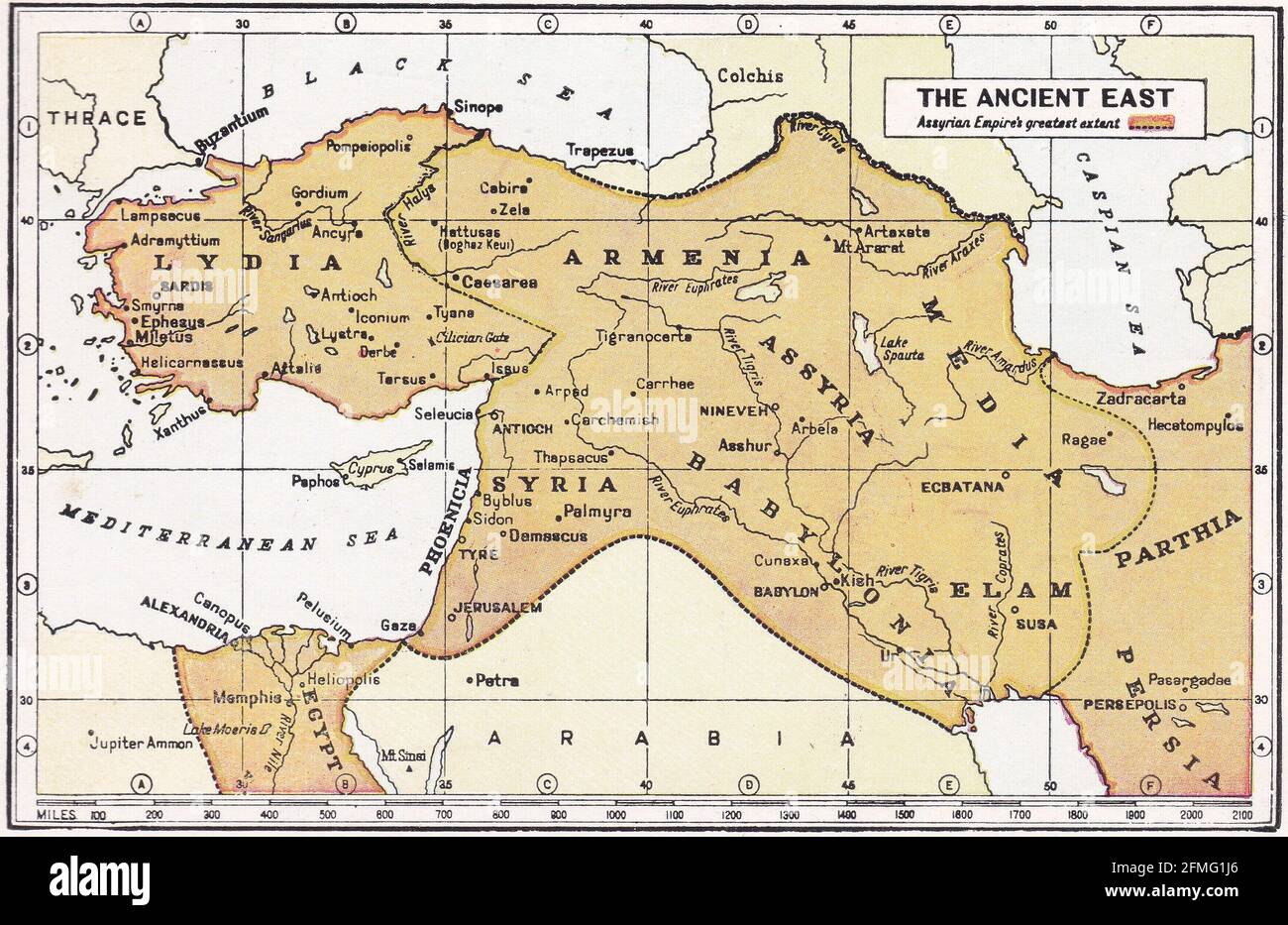 Vintage map of The Ancient East. Stock Photohttps://www.alamy.com/image-license-details/?v=1https://www.alamy.com/vintage-map-of-the-ancient-east-image425694478.html
RF2FMG1J6–Vintage map of The Ancient East.
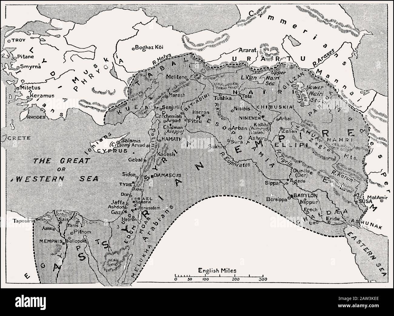 Map of the Assyrian Empire, 1000 BC until 700 BC Stock Photohttps://www.alamy.com/image-license-details/?v=1https://www.alamy.com/map-of-the-assyrian-empire-1000-bc-until-700-bc-image342444550.html
RM2AW3KEE–Map of the Assyrian Empire, 1000 BC until 700 BC
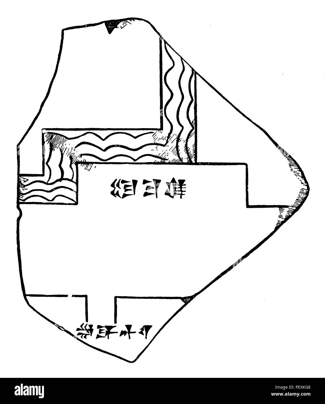 Fragment of a city plan of Babylon. After caution, 1902 Stock Photohttps://www.alamy.com/image-license-details/?v=1https://www.alamy.com/fragment-of-a-city-plan-of-babylon-after-caution-1902-image215715704.html
RMPEXKG8–Fragment of a city plan of Babylon. After caution, 1902
 . Palestine and Syria with the chief routes through Mesopotamia and Babylonia; handbook for travellers;. ad to Nabulus,lies Sarona (see Map, p. 8), another colony of the Temple. Theplain of Sharon, which extends along the seaboard between Joppaand Caesarea, was famed in ancient times for its luxuriant fertilityand pastures (Is. Ixv. 10). Excellent soil is found at a depth of11/2 or 2 ft. beneath the surface of the sand, and water is foundeverywhere. Vines thrive admirably (comp. p. liii). Apiculture alsois pursued with succc^ss. A beautiful excursion may be made along the Nabulus road as far a Stock Photohttps://www.alamy.com/image-license-details/?v=1https://www.alamy.com/palestine-and-syria-with-the-chief-routes-through-mesopotamia-and-babylonia-handbook-for-travellers-ad-to-nabuluslies-sarona-see-map-p-8-another-colony-of-the-temple-theplain-of-sharon-which-extends-along-the-seaboard-between-joppaand-caesarea-was-famed-in-ancient-times-for-its-luxuriant-fertilityand-pastures-is-ixv-10-excellent-soil-is-found-at-a-depth-of112-or-2-ft-beneath-the-surface-of-the-sand-and-water-is-foundeverywhere-vines-thrive-admirably-comp-p-liii-apiculture-alsois-pursued-with-succcss-a-beautiful-excursion-may-be-made-along-the-nabulus-road-as-far-a-image336839002.html
RM2AG09GA–. Palestine and Syria with the chief routes through Mesopotamia and Babylonia; handbook for travellers;. ad to Nabulus,lies Sarona (see Map, p. 8), another colony of the Temple. Theplain of Sharon, which extends along the seaboard between Joppaand Caesarea, was famed in ancient times for its luxuriant fertilityand pastures (Is. Ixv. 10). Excellent soil is found at a depth of11/2 or 2 ft. beneath the surface of the sand, and water is foundeverywhere. Vines thrive admirably (comp. p. liii). Apiculture alsois pursued with succc^ss. A beautiful excursion may be made along the Nabulus road as far a
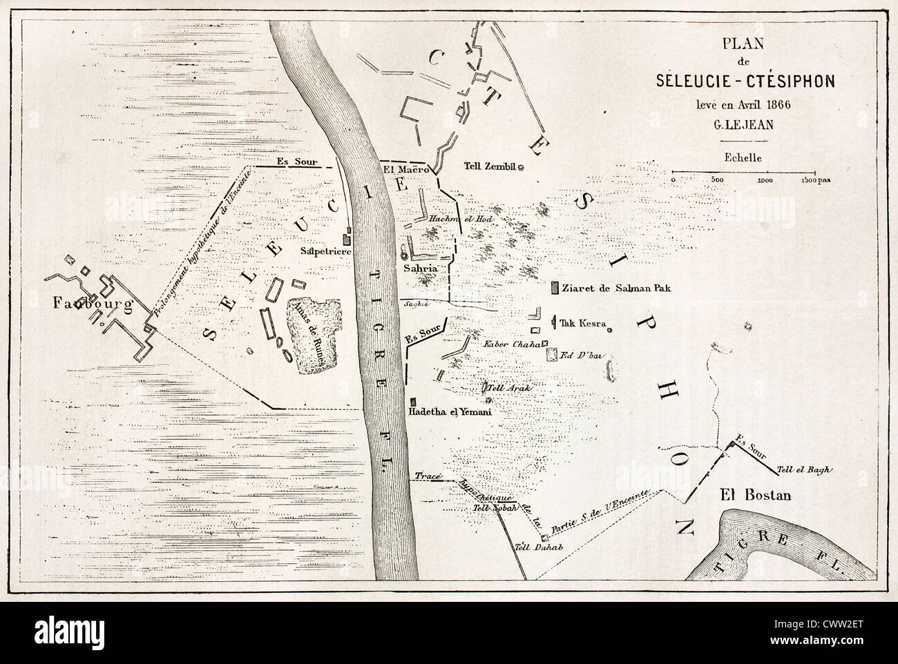 Seleucia and Ctesiphon old plan, Mesopotamia Stock Photohttps://www.alamy.com/image-license-details/?v=1https://www.alamy.com/stock-photo-seleucia-and-ctesiphon-old-plan-mesopotamia-50337920.html
RFCWW2ET–Seleucia and Ctesiphon old plan, Mesopotamia
 A floor plan or drawing of a structure, from a book about travels in Babylonia Persia and the Caucasus. The Caucasus, Persia, Babylonia, etc. The Caucasus, Persia, Babylonia, etc., with notes, maps, plans, surveys, views, and other drawings of interesting objects; by Sir Robert Ker Porter, K.C.H., during his travels in those countries in the years 1817-1820. Source: Add. 14758 vol.2 f.144. Stock Photohttps://www.alamy.com/image-license-details/?v=1https://www.alamy.com/a-floor-plan-or-drawing-of-a-structure-from-a-book-about-travels-in-babylonia-persia-and-the-caucasus-the-caucasus-persia-babylonia-etc-the-caucasus-persia-babylonia-etc-with-notes-maps-plans-surveys-views-and-other-drawings-of-interesting-objects-by-sir-robert-ker-porter-kch-during-his-travels-in-those-countries-in-the-years-1817-1820-source-add-14758-vol2-f144-image226794930.html
RMR4YB6X–A floor plan or drawing of a structure, from a book about travels in Babylonia Persia and the Caucasus. The Caucasus, Persia, Babylonia, etc. The Caucasus, Persia, Babylonia, etc., with notes, maps, plans, surveys, views, and other drawings of interesting objects; by Sir Robert Ker Porter, K.C.H., during his travels in those countries in the years 1817-1820. Source: Add. 14758 vol.2 f.144.
 MACCOUN(1899) p027 EARLY BABYLONIA Stock Photohttps://www.alamy.com/image-license-details/?v=1https://www.alamy.com/stock-photo-maccoun1899-p027-early-babylonia-74687507.html
RME9E8JY–MACCOUN(1899) p027 EARLY BABYLONIA
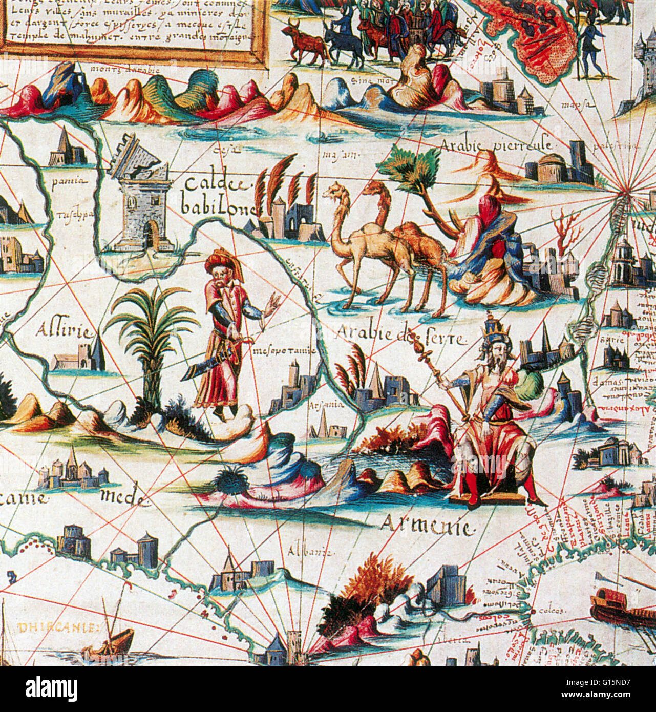 Central Asia ('Arabia') on Pierre Desceliers's World Map, 1550. Pierre Desceliers (c. 1500 - c. 1558) was a French cartographer of the Renaissance and an eminent member of the Dieppe School of Cartography. He is considered the father of French hydrograph Stock Photohttps://www.alamy.com/image-license-details/?v=1https://www.alamy.com/stock-photo-central-asia-arabia-on-pierre-descelierss-world-map-1550-pierre-desceliers-104003459.html
RMG15ND7–Central Asia ('Arabia') on Pierre Desceliers's World Map, 1550. Pierre Desceliers (c. 1500 - c. 1558) was a French cartographer of the Renaissance and an eminent member of the Dieppe School of Cartography. He is considered the father of French hydrograph
 Ancient map of Babylon, Iraq. Journey to Babylon by Guillaume Lejean 1866 from Le Tour du Monde 1867 Stock Photohttps://www.alamy.com/image-license-details/?v=1https://www.alamy.com/ancient-map-of-babylon-iraq-journey-to-babylon-by-guillaume-lejean-1866-from-le-tour-du-monde-1867-image474191020.html
RM2JFD7DG–Ancient map of Babylon, Iraq. Journey to Babylon by Guillaume Lejean 1866 from Le Tour du Monde 1867
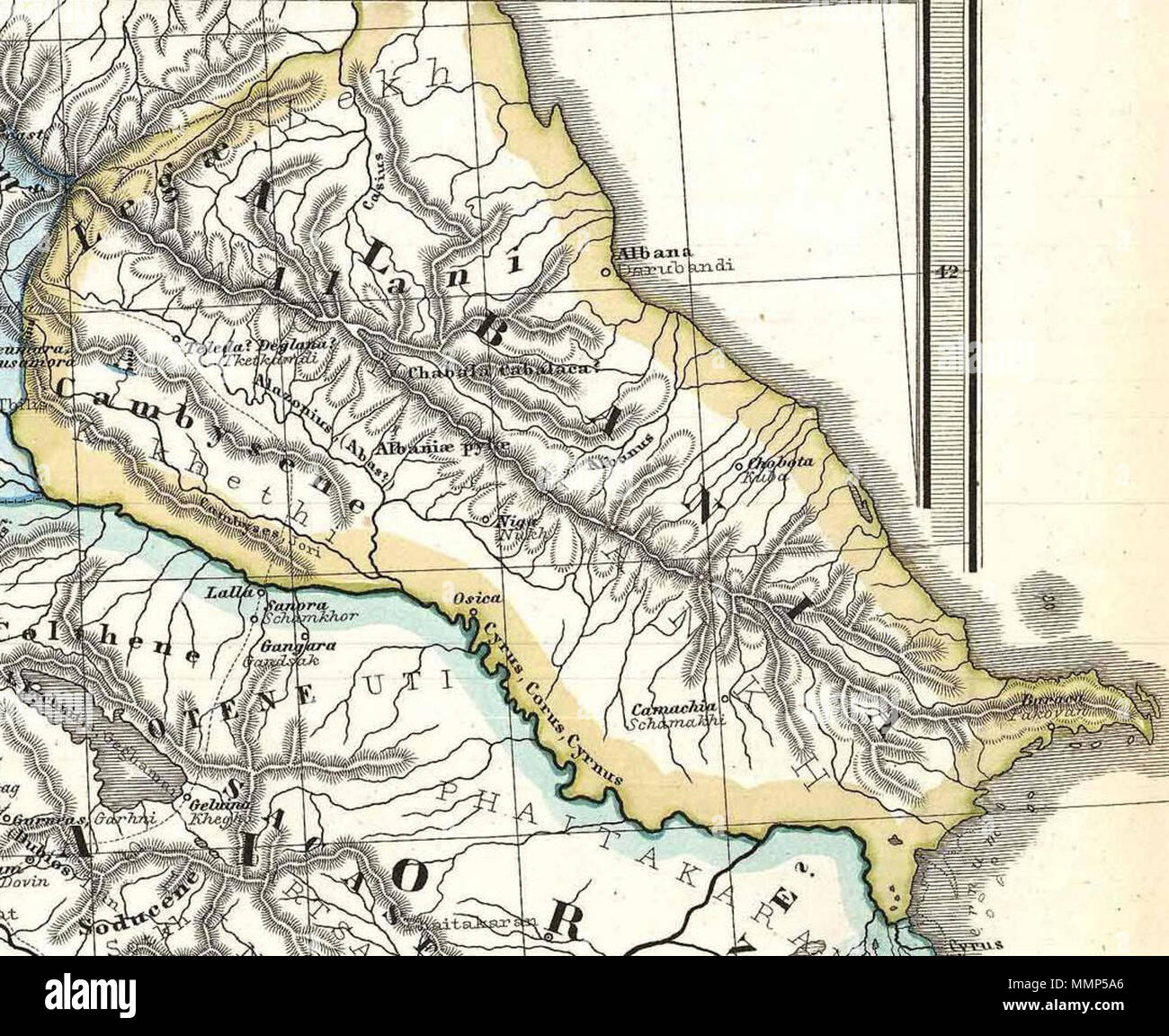 . English: Albania on a particularly interesting map, this is Karl von Spruner’s 1865 rendering of the Caucasus and Mesopotamia in antiquity. Centered on Lake Van (modern day eastern Turkey), this map covers the Caucasus region between the Black Sea and the Caspian Sea, then southwards to the Fertile Crescent as far as the Euphrates River, Babylonia, and the head of the Persian Gulf. These regions include the modern day countries of Iraq, Armenia, Georgia, Azerbaijan, and adjacent parts of Syria, Turkey, Iran, and the North Caucasus. Like most of Spruner’s work this example overlays ancient p Stock Photohttps://www.alamy.com/image-license-details/?v=1https://www.alamy.com/english-albania-on-a-particularly-interesting-map-this-is-karl-von-spruners-1865-rendering-of-the-caucasus-and-mesopotamia-in-antiquity-centered-on-lake-van-modern-day-eastern-turkey-this-map-covers-the-caucasus-region-between-the-black-sea-and-the-caspian-sea-then-southwards-to-the-fertile-crescent-as-far-as-the-euphrates-river-babylonia-and-the-head-of-the-persian-gulf-these-regions-include-the-modern-day-countries-of-iraq-armenia-georgia-azerbaijan-and-adjacent-parts-of-syria-turkey-iran-and-the-north-caucasus-like-most-of-spruners-work-this-example-overlays-ancient-p-image184883950.html
RMMMP5A6–. English: Albania on a particularly interesting map, this is Karl von Spruner’s 1865 rendering of the Caucasus and Mesopotamia in antiquity. Centered on Lake Van (modern day eastern Turkey), this map covers the Caucasus region between the Black Sea and the Caspian Sea, then southwards to the Fertile Crescent as far as the Euphrates River, Babylonia, and the head of the Persian Gulf. These regions include the modern day countries of Iraq, Armenia, Georgia, Azerbaijan, and adjacent parts of Syria, Turkey, Iran, and the North Caucasus. Like most of Spruner’s work this example overlays ancient p
 Map of Nimrud (Kalkhu, Calaj, Kalakh) was one of the capitals of Assyria, located along the Tigris River. Old 19th century engraved illustration, Le Tour du Monde 1863 Stock Photohttps://www.alamy.com/image-license-details/?v=1https://www.alamy.com/map-of-nimrud-kalkhu-calaj-kalakh-was-one-of-the-capitals-of-assyria-located-along-the-tigris-river-old-19th-century-engraved-illustration-le-tour-du-monde-1863-image397942785.html
RM2E3BT29–Map of Nimrud (Kalkhu, Calaj, Kalakh) was one of the capitals of Assyria, located along the Tigris River. Old 19th century engraved illustration, Le Tour du Monde 1863
 Quarta Asiae taubla continet Cyprum & Syrium & Iudea & vtraq. Arabia petream & deserta ac Mesopotamia & Babilonia. Title from verso. Map of Palestine, Mesopotamia and Babylonia in present day Middle East. Relief shown by brown coloring. Engraved on wood with place names in moveable type. Includes names of places and natural features. In margin: notes on latitude. Descriptive text within ornamental borders on verso. Appears in the author's Geographia. Ulm : Lienhart Hol, 16 July 1482. Cataloging, conservation, and digitization made possible in part by The National Endowment for the Humanities: Stock Photohttps://www.alamy.com/image-license-details/?v=1https://www.alamy.com/quarta-asiae-taubla-continet-cyprum-syrium-iudea-vtraq-arabia-petream-deserta-ac-mesopotamia-babilonia-title-from-verso-map-of-palestine-mesopotamia-and-babylonia-in-present-day-middle-east-relief-shown-by-brown-coloring-engraved-on-wood-with-place-names-in-moveable-type-includes-names-of-places-and-natural-features-in-margin-notes-on-latitude-descriptive-text-within-ornamental-borders-on-verso-appears-in-the-authors-geographia-ulm-lienhart-hol-16-july-1482-cataloging-conservation-and-digitization-made-possible-in-part-by-the-national-endowment-for-the-humanities-image502708019.html
RM2M5T95R–Quarta Asiae taubla continet Cyprum & Syrium & Iudea & vtraq. Arabia petream & deserta ac Mesopotamia & Babilonia. Title from verso. Map of Palestine, Mesopotamia and Babylonia in present day Middle East. Relief shown by brown coloring. Engraved on wood with place names in moveable type. Includes names of places and natural features. In margin: notes on latitude. Descriptive text within ornamental borders on verso. Appears in the author's Geographia. Ulm : Lienhart Hol, 16 July 1482. Cataloging, conservation, and digitization made possible in part by The National Endowment for the Humanities:
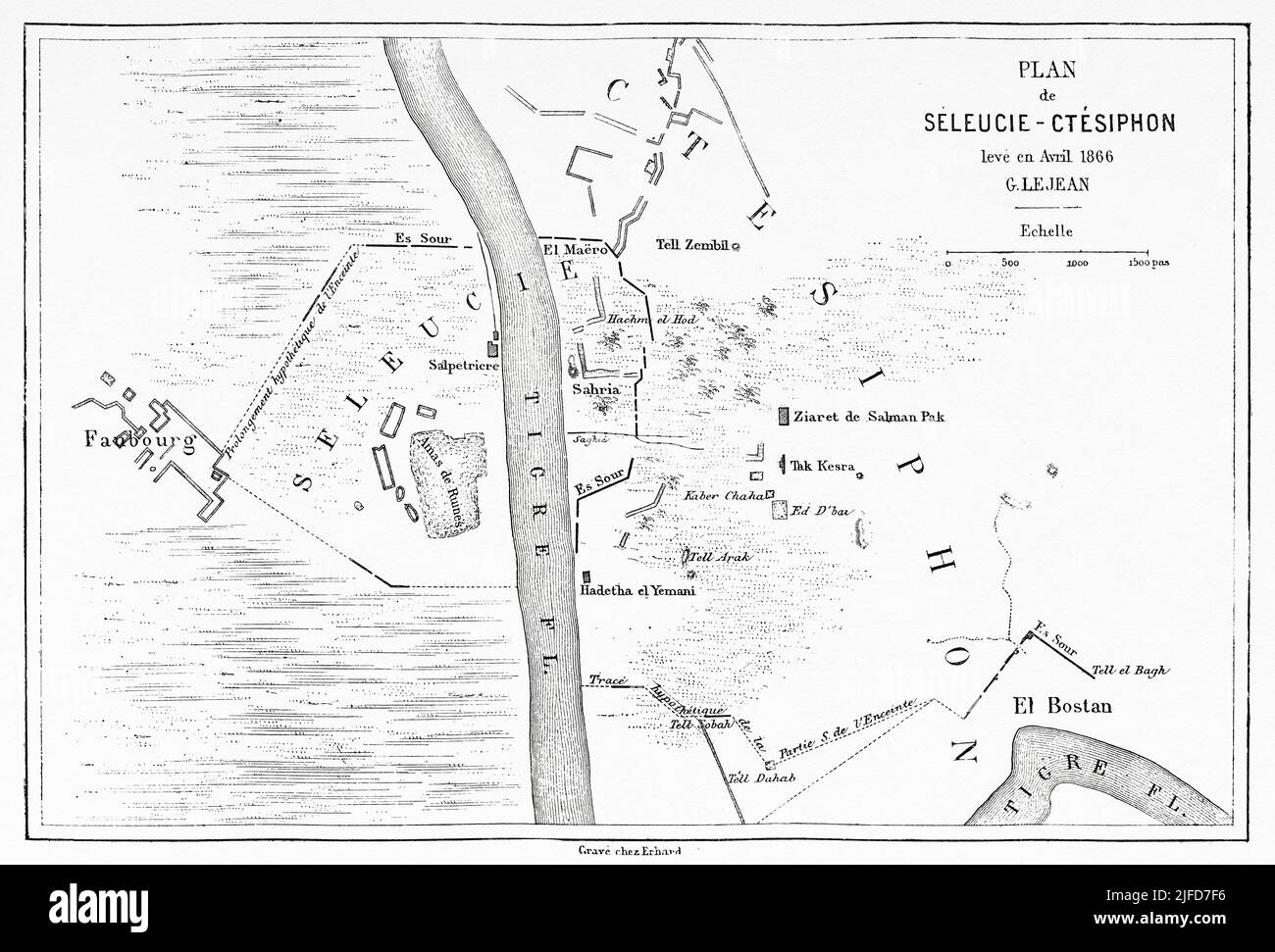 Seleucia and Ctesiphon old plan, Mesopotamia, Iraq. Journey to Babylon by Guillaume Lejean 1866 from Le Tour du Monde 1867 Stock Photohttps://www.alamy.com/image-license-details/?v=1https://www.alamy.com/seleucia-and-ctesiphon-old-plan-mesopotamia-iraq-journey-to-babylon-by-guillaume-lejean-1866-from-le-tour-du-monde-1867-image474191066.html
RM2JFD7F6–Seleucia and Ctesiphon old plan, Mesopotamia, Iraq. Journey to Babylon by Guillaume Lejean 1866 from Le Tour du Monde 1867
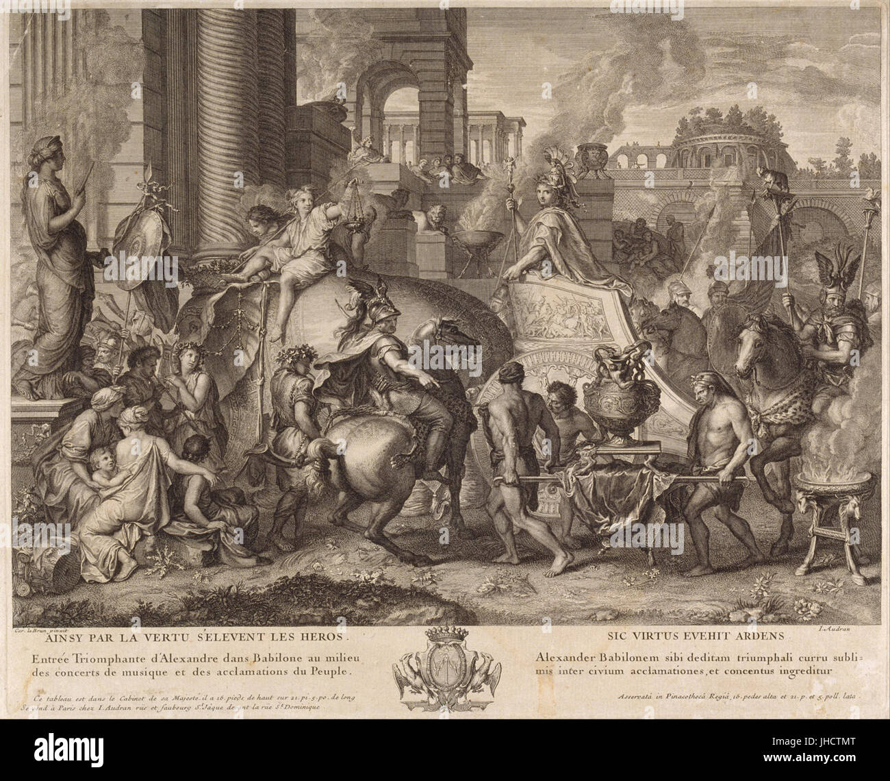 Jean Audran - Alexander the Great Enters Babylonia - Stock Photohttps://www.alamy.com/image-license-details/?v=1https://www.alamy.com/stock-photo-jean-audran-alexander-the-great-enters-babylonia-148414920.html
RMJHCTMT–Jean Audran - Alexander the Great Enters Babylonia -
!['Rome v. Persia (Sassanian), circa 300 A.D.', c1915. Map of the eastern Mediterranean and Near East, showing the ancient empires of Rome, Persia, and Armenia. From "The Caliphs' Last Heritage, a short history of the Turkish Empire" by Lt.-Col. Sir Mark Sykes. [Macmillan & Co, London, 1915] Stock Photo 'Rome v. Persia (Sassanian), circa 300 A.D.', c1915. Map of the eastern Mediterranean and Near East, showing the ancient empires of Rome, Persia, and Armenia. From "The Caliphs' Last Heritage, a short history of the Turkish Empire" by Lt.-Col. Sir Mark Sykes. [Macmillan & Co, London, 1915] Stock Photo](https://c8.alamy.com/comp/2A8E6P0/rome-v-persia-sassanian-circa-300-ad-c1915-map-of-the-eastern-mediterranean-and-near-east-showing-the-ancient-empires-of-rome-persia-and-armenia-from-quotthe-caliphs-last-heritage-a-short-history-of-the-turkish-empirequot-by-lt-col-sir-mark-sykes-macmillan-amp-co-london-1915-2A8E6P0.jpg) 'Rome v. Persia (Sassanian), circa 300 A.D.', c1915. Map of the eastern Mediterranean and Near East, showing the ancient empires of Rome, Persia, and Armenia. From "The Caliphs' Last Heritage, a short history of the Turkish Empire" by Lt.-Col. Sir Mark Sykes. [Macmillan & Co, London, 1915] Stock Photohttps://www.alamy.com/image-license-details/?v=1https://www.alamy.com/rome-v-persia-sassanian-circa-300-ad-c1915-map-of-the-eastern-mediterranean-and-near-east-showing-the-ancient-empires-of-rome-persia-and-armenia-from-quotthe-caliphs-last-heritage-a-short-history-of-the-turkish-empirequot-by-lt-col-sir-mark-sykes-macmillan-amp-co-london-1915-image332226888.html
'Rome v. Persia (Sassanian), circa 300 A.D.', c1915. Map of the eastern Mediterranean and Near East, showing the ancient empires of Rome, Persia, and Armenia. From "The Caliphs' Last Heritage, a short history of the Turkish Empire" by Lt.-Col. Sir Mark Sykes. [Macmillan & Co, London, 1915] Stock Photohttps://www.alamy.com/image-license-details/?v=1https://www.alamy.com/rome-v-persia-sassanian-circa-300-ad-c1915-map-of-the-eastern-mediterranean-and-near-east-showing-the-ancient-empires-of-rome-persia-and-armenia-from-quotthe-caliphs-last-heritage-a-short-history-of-the-turkish-empirequot-by-lt-col-sir-mark-sykes-macmillan-amp-co-london-1915-image332226888.htmlRM2A8E6P0–'Rome v. Persia (Sassanian), circa 300 A.D.', c1915. Map of the eastern Mediterranean and Near East, showing the ancient empires of Rome, Persia, and Armenia. From "The Caliphs' Last Heritage, a short history of the Turkish Empire" by Lt.-Col. Sir Mark Sykes. [Macmillan & Co, London, 1915]
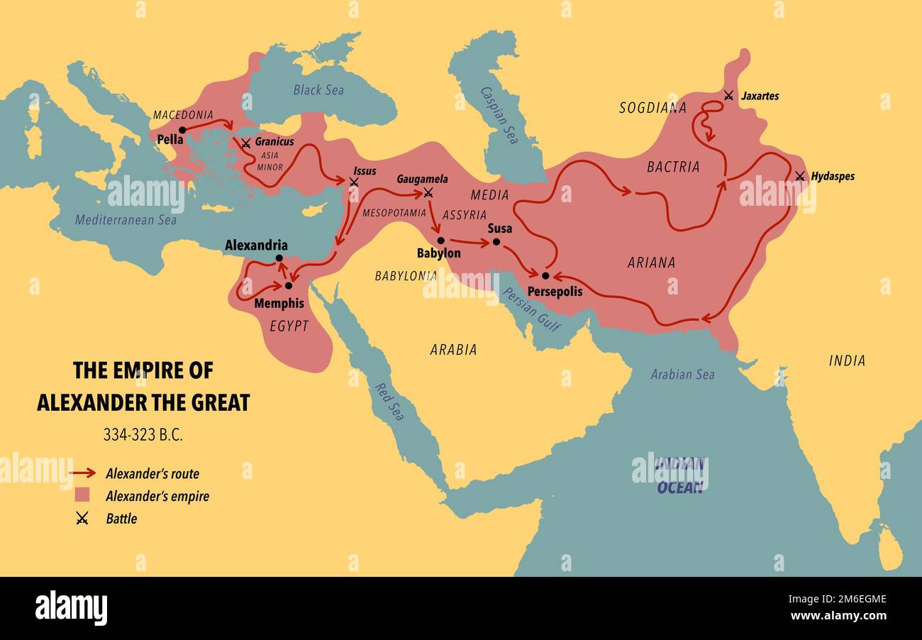 The empire, route and battles of Alexander the great from Greece to India Stock Photohttps://www.alamy.com/image-license-details/?v=1https://www.alamy.com/the-empire-route-and-battles-of-alexander-the-great-from-greece-to-india-image503109054.html
RF2M6EGME–The empire, route and battles of Alexander the great from Greece to India
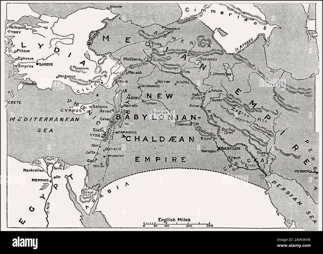 Map of the Empires after the fall of Assyria, 600 BC until 400 BC Stock Photohttps://www.alamy.com/image-license-details/?v=1https://www.alamy.com/map-of-the-empires-after-the-fall-of-assyria-600-bc-until-400-bc-image342444634.html
RM2AW3KHE–Map of the Empires after the fall of Assyria, 600 BC until 400 BC
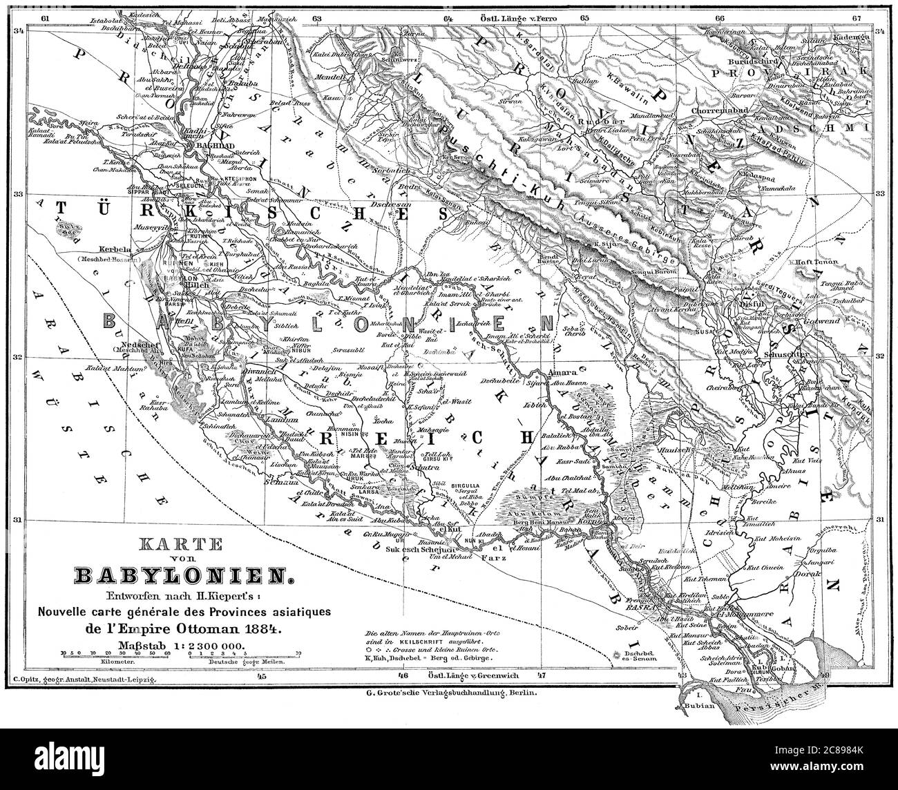 Map of the Babylonian Empire Stock Photohttps://www.alamy.com/image-license-details/?v=1https://www.alamy.com/map-of-the-babylonian-empire-image366538947.html
RM2C8984K–Map of the Babylonian Empire
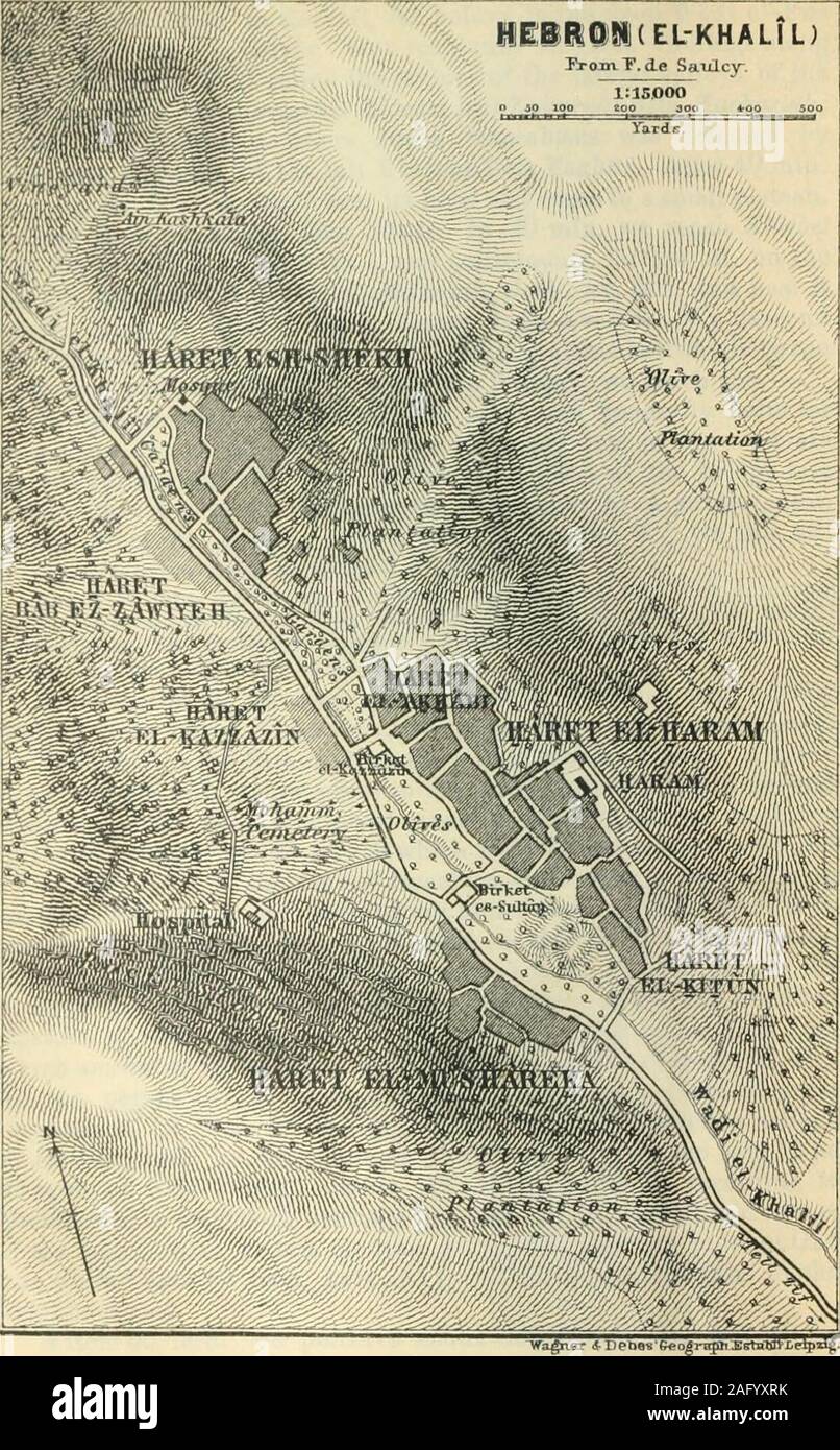 . Palestine and Syria with the chief routes through Mesopotamia and Babylonia; handbook for travellers;. the mosaic map of Madeba (p. 147). The traces of anancient Christian church were formerly visible. A little way to theS. there are tomb-chambers in the artificially hewn and levelledstratum of rock. At the top of the hill are ruins called Belt Sur,which answer to the ancient Beth-Zur (Josh. xv. 58; Nehem. iii. 16).At the period of the Maccabees Beth-Zur was a place of greatimportance. A little farther on (5 min.) the Mohammedan villageof Halhid (Josh. xv. 58) becomes visible on a hill to th Stock Photohttps://www.alamy.com/image-license-details/?v=1https://www.alamy.com/palestine-and-syria-with-the-chief-routes-through-mesopotamia-and-babylonia-handbook-for-travellers-the-mosaic-map-of-madeba-p-147-the-traces-of-anancient-christian-church-were-formerly-visible-a-little-way-to-thes-there-are-tomb-chambers-in-the-artificially-hewn-and-levelledstratum-of-rock-at-the-top-of-the-hill-are-ruins-called-belt-surwhich-answer-to-the-ancient-beth-zur-josh-xv-58-nehem-iii-16at-the-period-of-the-maccabees-beth-zur-was-a-place-of-greatimportance-a-little-farther-on-5-min-the-mohammedan-villageof-halhid-josh-xv-58-becomes-visible-on-a-hill-to-th-image336830583.html
RM2AFYXRK–. Palestine and Syria with the chief routes through Mesopotamia and Babylonia; handbook for travellers;. the mosaic map of Madeba (p. 147). The traces of anancient Christian church were formerly visible. A little way to theS. there are tomb-chambers in the artificially hewn and levelledstratum of rock. At the top of the hill are ruins called Belt Sur,which answer to the ancient Beth-Zur (Josh. xv. 58; Nehem. iii. 16).At the period of the Maccabees Beth-Zur was a place of greatimportance. A little farther on (5 min.) the Mohammedan villageof Halhid (Josh. xv. 58) becomes visible on a hill to th
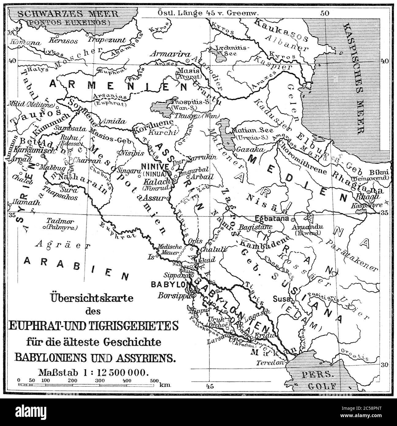 Map of the Assyrian Empire Stock Photohttps://www.alamy.com/image-license-details/?v=1https://www.alamy.com/map-of-the-assyrian-empire-image364684484.html
RM2C58PNT–Map of the Assyrian Empire
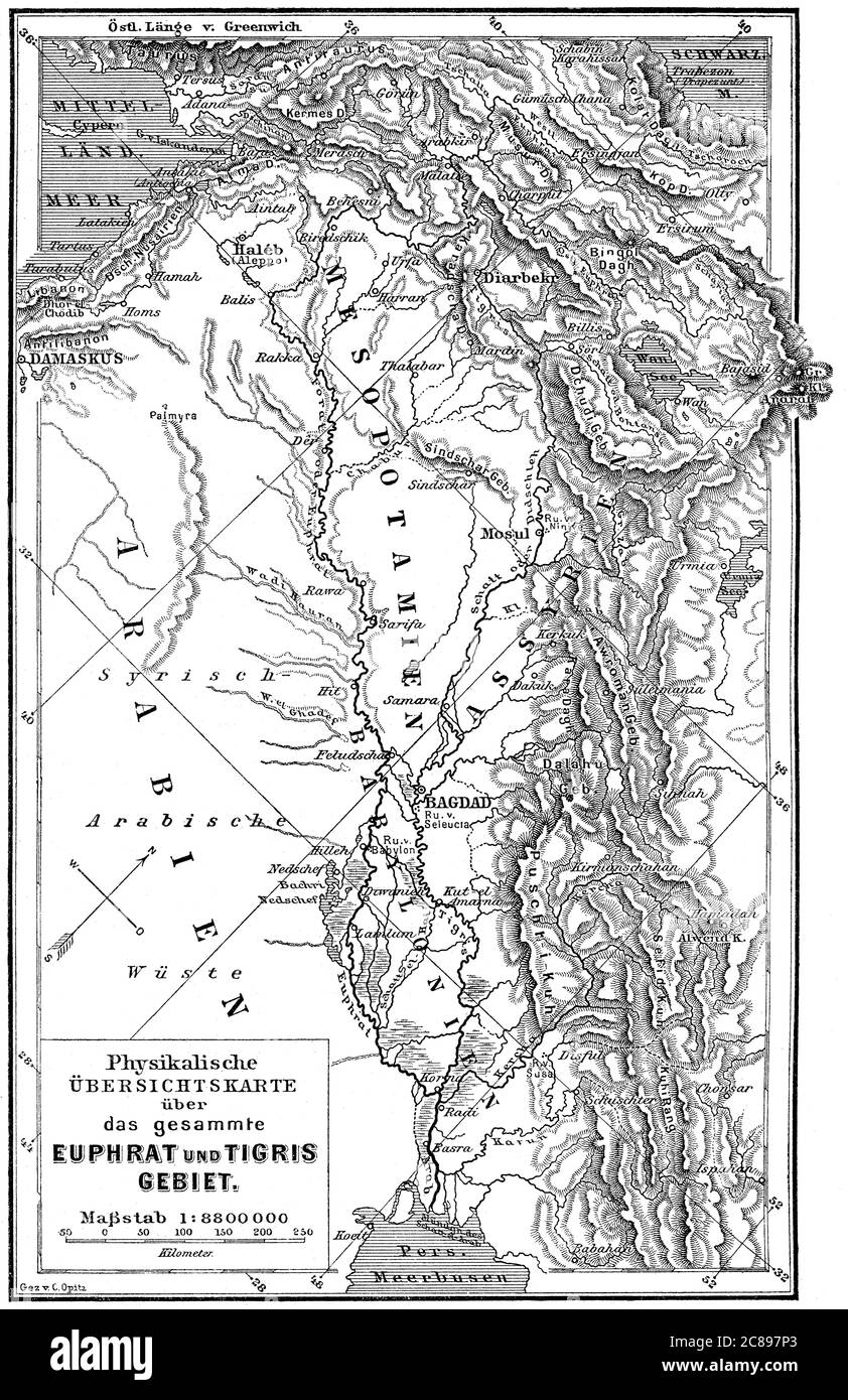 Map of Mesopotamia, 19th century Stock Photohttps://www.alamy.com/image-license-details/?v=1https://www.alamy.com/map-of-mesopotamia-19th-century-image366538651.html
RM2C897P3–Map of Mesopotamia, 19th century
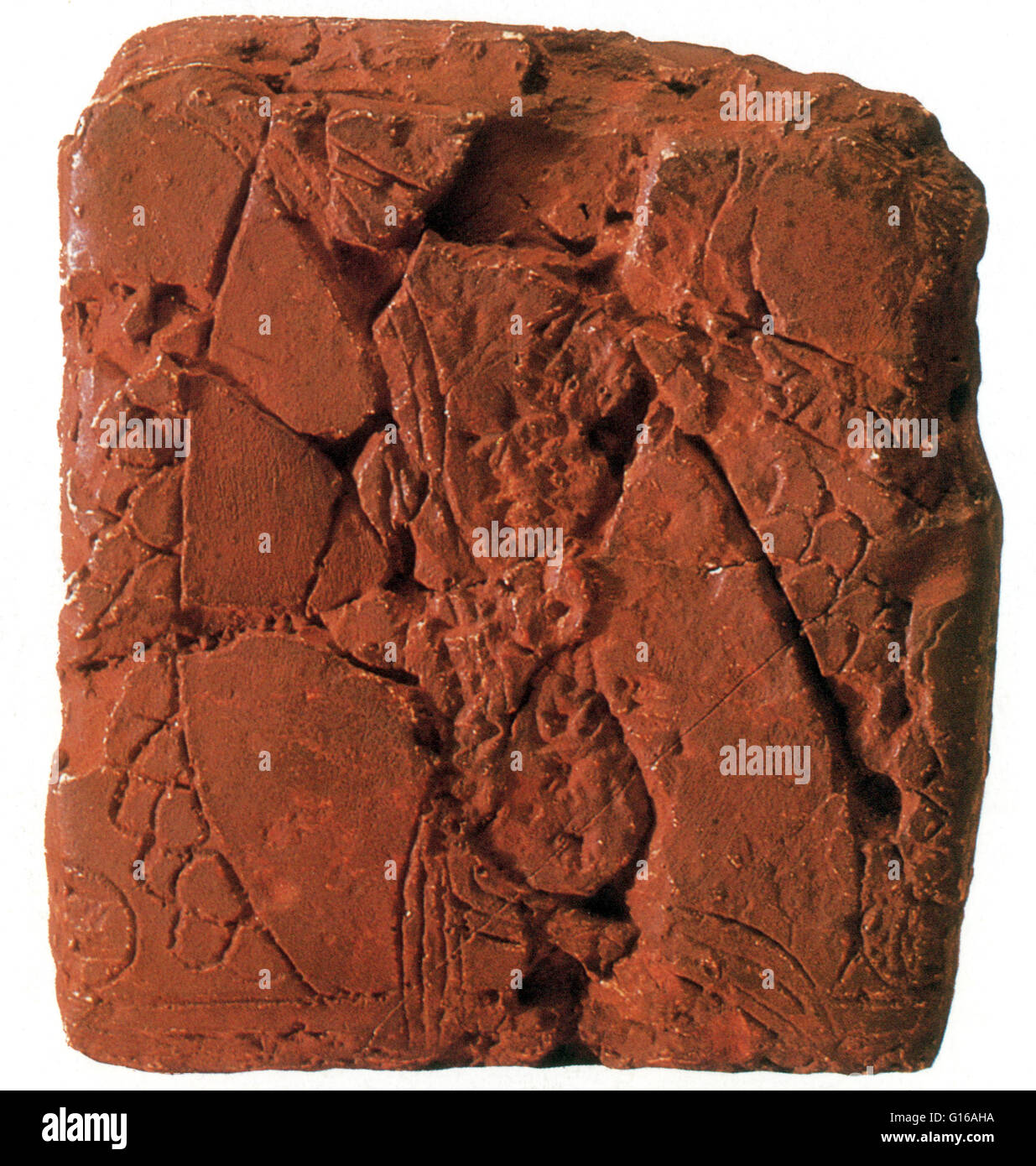 Babylonian clay tablet that has been generally accepted as 'the earliest known map' is the artifact unearthed in 1930 at the excavated ruined city of Ga-Sur. The surface of the tablet is inscribed with a map of a district bounded by two ranges of hills an Stock Photohttps://www.alamy.com/image-license-details/?v=1https://www.alamy.com/stock-photo-babylonian-clay-tablet-that-has-been-generally-accepted-as-the-earliest-104016902.html
RMG16AHA–Babylonian clay tablet that has been generally accepted as 'the earliest known map' is the artifact unearthed in 1930 at the excavated ruined city of Ga-Sur. The surface of the tablet is inscribed with a map of a district bounded by two ranges of hills an
 Myths and legends of Babylonia and Assyria (1916) Stock Photohttps://www.alamy.com/image-license-details/?v=1https://www.alamy.com/stock-photo-myths-and-legends-of-babylonia-and-assyria-1916-99619114.html
RMFP215E–Myths and legends of Babylonia and Assyria (1916)
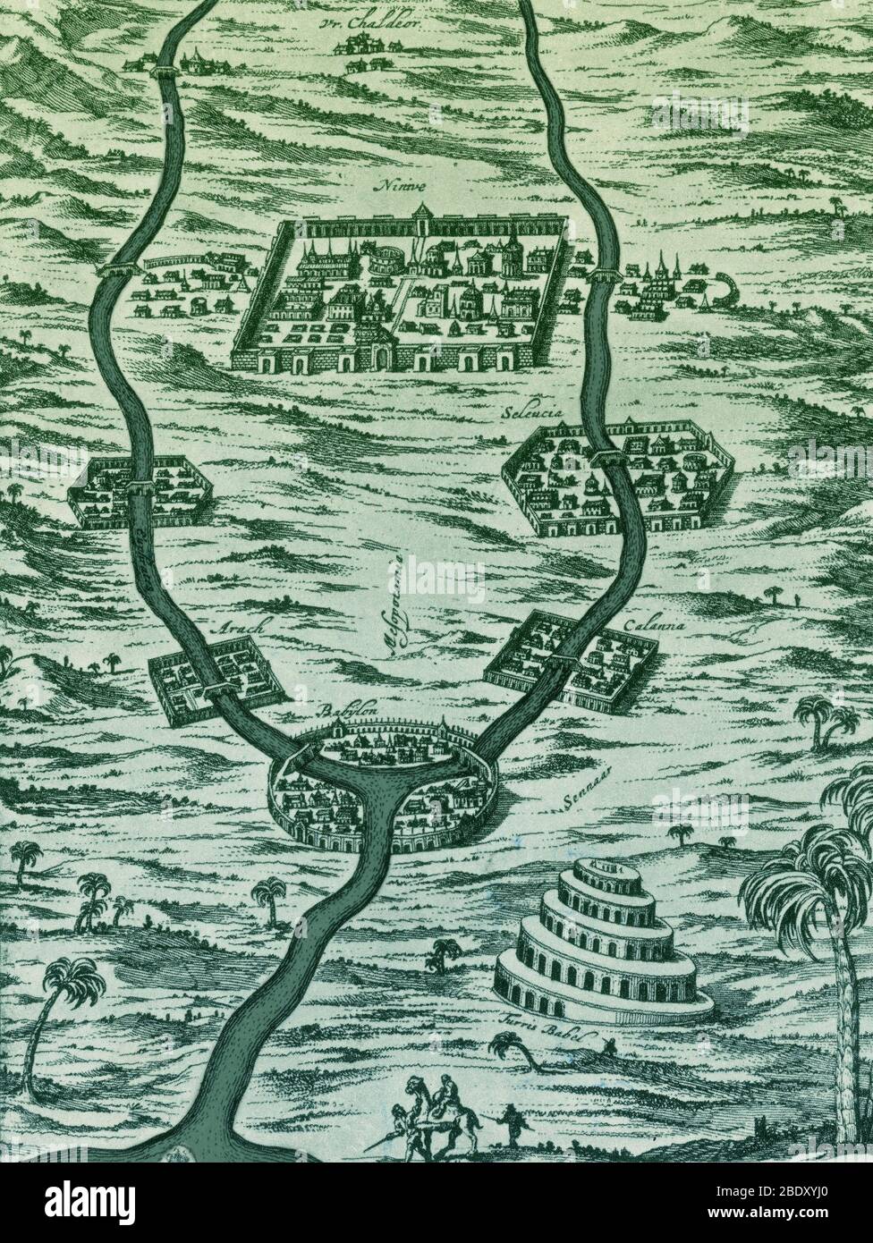 Tigris and Euphrates, Babylonia Stock Photohttps://www.alamy.com/image-license-details/?v=1https://www.alamy.com/tigris-and-euphrates-babylonia-image352790312.html
RM2BDXYJ0–Tigris and Euphrates, Babylonia
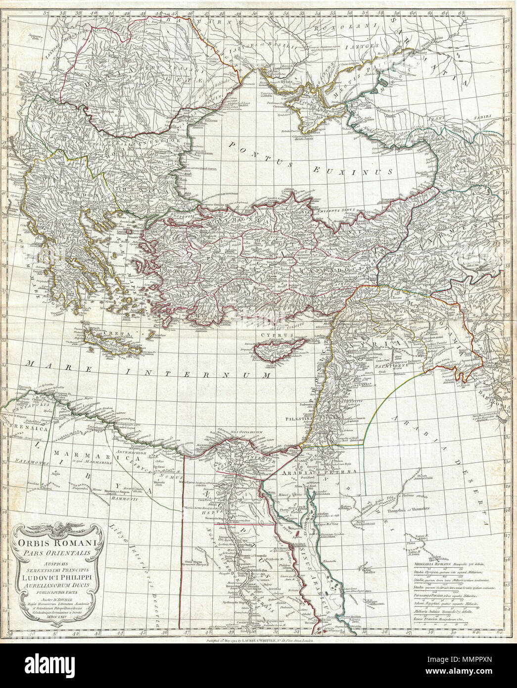 . English: A large and dramatic J. B. B. D'Anville map of the eastern part of the Roman Empire. Covers from Greece (Graecia) and Dacia east as far as Babylonia, Arabia and Armenia. Extends south as far as Thebes in Upper Egypt. Includes the eastern part of the Mediterranean (Mare Internum) and the Black Sea (Pontus Euxinus). Details mountains rivers, cities, roadways, and lakes with political divisions highlighted in outline color. Decorative title cartouche bearing the Roman Eagle appears in the lower left quadrant. Includes eight distance scales, bottom right, referencing various measuremen Stock Photohttps://www.alamy.com/image-license-details/?v=1https://www.alamy.com/english-a-large-and-dramatic-j-b-b-danville-map-of-the-eastern-part-of-the-roman-empire-covers-from-greece-graecia-and-dacia-east-as-far-as-babylonia-arabia-and-armenia-extends-south-as-far-as-thebes-in-upper-egypt-includes-the-eastern-part-of-the-mediterranean-mare-internum-and-the-black-sea-pontus-euxinus-details-mountains-rivers-cities-roadways-and-lakes-with-political-divisions-highlighted-in-outline-color-decorative-title-cartouche-bearing-the-roman-eagle-appears-in-the-lower-left-quadrant-includes-eight-distance-scales-bottom-right-referencing-various-measuremen-image184897741.html
RMMMPPXN–. English: A large and dramatic J. B. B. D'Anville map of the eastern part of the Roman Empire. Covers from Greece (Graecia) and Dacia east as far as Babylonia, Arabia and Armenia. Extends south as far as Thebes in Upper Egypt. Includes the eastern part of the Mediterranean (Mare Internum) and the Black Sea (Pontus Euxinus). Details mountains rivers, cities, roadways, and lakes with political divisions highlighted in outline color. Decorative title cartouche bearing the Roman Eagle appears in the lower left quadrant. Includes eight distance scales, bottom right, referencing various measuremen
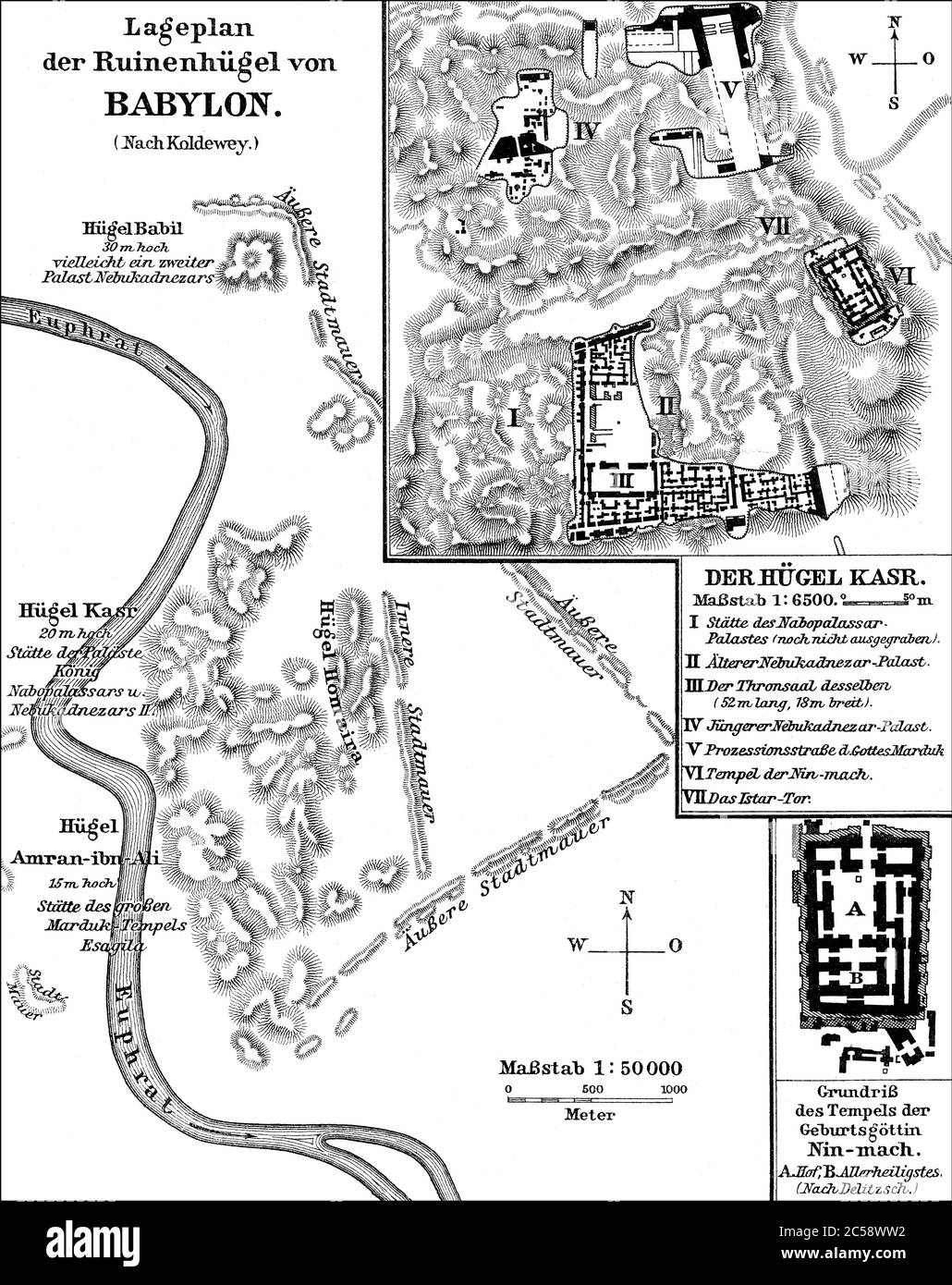 Plan of the ruins of ancient Babylon Stock Photohttps://www.alamy.com/image-license-details/?v=1https://www.alamy.com/plan-of-the-ruins-of-ancient-babylon-image364686926.html
RM2C58WW2–Plan of the ruins of ancient Babylon
![Latina: In quarta tabula[:] Cyprus insula[,] Syria Curua[,] Syria Phoenicea[,] Iudea Palestina[,] Arabia Petrea[,] Arabia deserta[,] Mesopotamia[,] Babylonia. Quarta Asie tabula continet Cyprum & Syrium & Iudea & vtraq[ue], Arabia petream & deserta ac Mesopotamia & Babilonia English: The 4th Asian map (Quarta Asiae Tabula) from Jacopo Pencio's 1511 edition of Ptolemy's Geography. Publisher Pencio, Jacopo Scale c. 1:3,300,000 Description English: Includes Cyprus, Syria, Judea, Arabia Petra, Arabia Deserta, Mesopotamia, and Babylonia. Date 1511 Dimensions 34 × 50 cm (13.3 × 19.6 in) Acce Stock Photo Latina: In quarta tabula[:] Cyprus insula[,] Syria Curua[,] Syria Phoenicea[,] Iudea Palestina[,] Arabia Petrea[,] Arabia deserta[,] Mesopotamia[,] Babylonia. Quarta Asie tabula continet Cyprum & Syrium & Iudea & vtraq[ue], Arabia petream & deserta ac Mesopotamia & Babilonia English: The 4th Asian map (Quarta Asiae Tabula) from Jacopo Pencio's 1511 edition of Ptolemy's Geography. Publisher Pencio, Jacopo Scale c. 1:3,300,000 Description English: Includes Cyprus, Syria, Judea, Arabia Petra, Arabia Deserta, Mesopotamia, and Babylonia. Date 1511 Dimensions 34 × 50 cm (13.3 × 19.6 in) Acce Stock Photo](https://c8.alamy.com/comp/MP3X0D/latina-in-quarta-tabula-cyprus-insula-syria-curua-syria-phoenicea-iudea-palestina-arabia-petrea-arabia-deserta-mesopotamia-babylonia-quarta-asie-tabula-continet-cyprum-syrium-iudea-vtraq-ue-arabia-petream-deserta-ac-mesopotamia-babilonia-english-the-4th-asian-map-quarta-asiae-tabula-from-jacopo-pencios-1511-edition-of-ptolemys-geography-publisher-pencio-jacopo-scale-c-13300000-description-english-includes-cyprus-syria-judea-arabia-petra-arabia-deserta-mesopotamia-and-babylonia-date-1511-dimensions-34-50-cm-133-196-in-acce-MP3X0D.jpg) Latina: In quarta tabula[:] Cyprus insula[,] Syria Curua[,] Syria Phoenicea[,] Iudea Palestina[,] Arabia Petrea[,] Arabia deserta[,] Mesopotamia[,] Babylonia. Quarta Asie tabula continet Cyprum & Syrium & Iudea & vtraq[ue], Arabia petream & deserta ac Mesopotamia & Babilonia English: The 4th Asian map (Quarta Asiae Tabula) from Jacopo Pencio's 1511 edition of Ptolemy's Geography. Publisher Pencio, Jacopo Scale c. 1:3,300,000 Description English: Includes Cyprus, Syria, Judea, Arabia Petra, Arabia Deserta, Mesopotamia, and Babylonia. Date 1511 Dimensions 34 × 50 cm (13.3 × 19.6 in) Acce Stock Photohttps://www.alamy.com/image-license-details/?v=1https://www.alamy.com/latina-in-quarta-tabula-cyprus-insula-syria-curua-syria-phoenicea-iudea-palestina-arabia-petrea-arabia-deserta-mesopotamia-babylonia-quarta-asie-tabula-continet-cyprum-syrium-iudea-vtraq-ue-arabia-petream-deserta-ac-mesopotamia-babilonia-english-the-4th-asian-map-quarta-asiae-tabula-from-jacopo-pencios-1511-edition-of-ptolemys-geography-publisher-pencio-jacopo-scale-c-13300000-description-english-includes-cyprus-syria-judea-arabia-petra-arabia-deserta-mesopotamia-and-babylonia-date-1511-dimensions-34-50-cm-133-196-in-acce-image185712365.html
Latina: In quarta tabula[:] Cyprus insula[,] Syria Curua[,] Syria Phoenicea[,] Iudea Palestina[,] Arabia Petrea[,] Arabia deserta[,] Mesopotamia[,] Babylonia. Quarta Asie tabula continet Cyprum & Syrium & Iudea & vtraq[ue], Arabia petream & deserta ac Mesopotamia & Babilonia English: The 4th Asian map (Quarta Asiae Tabula) from Jacopo Pencio's 1511 edition of Ptolemy's Geography. Publisher Pencio, Jacopo Scale c. 1:3,300,000 Description English: Includes Cyprus, Syria, Judea, Arabia Petra, Arabia Deserta, Mesopotamia, and Babylonia. Date 1511 Dimensions 34 × 50 cm (13.3 × 19.6 in) Acce Stock Photohttps://www.alamy.com/image-license-details/?v=1https://www.alamy.com/latina-in-quarta-tabula-cyprus-insula-syria-curua-syria-phoenicea-iudea-palestina-arabia-petrea-arabia-deserta-mesopotamia-babylonia-quarta-asie-tabula-continet-cyprum-syrium-iudea-vtraq-ue-arabia-petream-deserta-ac-mesopotamia-babilonia-english-the-4th-asian-map-quarta-asiae-tabula-from-jacopo-pencios-1511-edition-of-ptolemys-geography-publisher-pencio-jacopo-scale-c-13300000-description-english-includes-cyprus-syria-judea-arabia-petra-arabia-deserta-mesopotamia-and-babylonia-date-1511-dimensions-34-50-cm-133-196-in-acce-image185712365.htmlRMMP3X0D–Latina: In quarta tabula[:] Cyprus insula[,] Syria Curua[,] Syria Phoenicea[,] Iudea Palestina[,] Arabia Petrea[,] Arabia deserta[,] Mesopotamia[,] Babylonia. Quarta Asie tabula continet Cyprum & Syrium & Iudea & vtraq[ue], Arabia petream & deserta ac Mesopotamia & Babilonia English: The 4th Asian map (Quarta Asiae Tabula) from Jacopo Pencio's 1511 edition of Ptolemy's Geography. Publisher Pencio, Jacopo Scale c. 1:3,300,000 Description English: Includes Cyprus, Syria, Judea, Arabia Petra, Arabia Deserta, Mesopotamia, and Babylonia. Date 1511 Dimensions 34 × 50 cm (13.3 × 19.6 in) Acce
 Sketch of the ruins of Babylon, Iraq. Journey to Babylon by Guillaume Lejean 1866 from Le Tour du Monde 1867 Stock Photohttps://www.alamy.com/image-license-details/?v=1https://www.alamy.com/sketch-of-the-ruins-of-babylon-iraq-journey-to-babylon-by-guillaume-lejean-1866-from-le-tour-du-monde-1867-image479853963.html
RM2JTK6HF–Sketch of the ruins of Babylon, Iraq. Journey to Babylon by Guillaume Lejean 1866 from Le Tour du Monde 1867
!['Rome v. Parthia, circa 50 B.C.', c1915. Map of the eastern Mediterranean and Near East, showing the ancient empires of Rome, Parthia, Armenia, and Protected and Independent States. From "The Caliphs' Last Heritage, a short history of the Turkish Empire" by Lt.-Col. Sir Mark Sykes. [Macmillan & Co, London, 1915] Stock Photo 'Rome v. Parthia, circa 50 B.C.', c1915. Map of the eastern Mediterranean and Near East, showing the ancient empires of Rome, Parthia, Armenia, and Protected and Independent States. From "The Caliphs' Last Heritage, a short history of the Turkish Empire" by Lt.-Col. Sir Mark Sykes. [Macmillan & Co, London, 1915] Stock Photo](https://c8.alamy.com/comp/2A8E6PC/rome-v-parthia-circa-50-bc-c1915-map-of-the-eastern-mediterranean-and-near-east-showing-the-ancient-empires-of-rome-parthia-armenia-and-protected-and-independent-states-from-quotthe-caliphs-last-heritage-a-short-history-of-the-turkish-empirequot-by-lt-col-sir-mark-sykes-macmillan-amp-co-london-1915-2A8E6PC.jpg) 'Rome v. Parthia, circa 50 B.C.', c1915. Map of the eastern Mediterranean and Near East, showing the ancient empires of Rome, Parthia, Armenia, and Protected and Independent States. From "The Caliphs' Last Heritage, a short history of the Turkish Empire" by Lt.-Col. Sir Mark Sykes. [Macmillan & Co, London, 1915] Stock Photohttps://www.alamy.com/image-license-details/?v=1https://www.alamy.com/rome-v-parthia-circa-50-bc-c1915-map-of-the-eastern-mediterranean-and-near-east-showing-the-ancient-empires-of-rome-parthia-armenia-and-protected-and-independent-states-from-quotthe-caliphs-last-heritage-a-short-history-of-the-turkish-empirequot-by-lt-col-sir-mark-sykes-macmillan-amp-co-london-1915-image332226900.html
'Rome v. Parthia, circa 50 B.C.', c1915. Map of the eastern Mediterranean and Near East, showing the ancient empires of Rome, Parthia, Armenia, and Protected and Independent States. From "The Caliphs' Last Heritage, a short history of the Turkish Empire" by Lt.-Col. Sir Mark Sykes. [Macmillan & Co, London, 1915] Stock Photohttps://www.alamy.com/image-license-details/?v=1https://www.alamy.com/rome-v-parthia-circa-50-bc-c1915-map-of-the-eastern-mediterranean-and-near-east-showing-the-ancient-empires-of-rome-parthia-armenia-and-protected-and-independent-states-from-quotthe-caliphs-last-heritage-a-short-history-of-the-turkish-empirequot-by-lt-col-sir-mark-sykes-macmillan-amp-co-london-1915-image332226900.htmlRM2A8E6PC–'Rome v. Parthia, circa 50 B.C.', c1915. Map of the eastern Mediterranean and Near East, showing the ancient empires of Rome, Parthia, Armenia, and Protected and Independent States. From "The Caliphs' Last Heritage, a short history of the Turkish Empire" by Lt.-Col. Sir Mark Sykes. [Macmillan & Co, London, 1915]
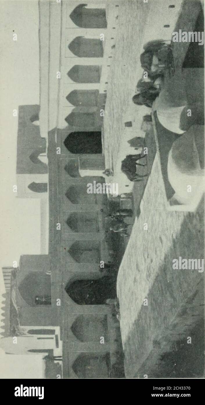 . Nippur; or, Explorations and adventures on the Euphrates : the narrative of the University of Pennsylvania expedition to Babylonia in the years 1888-1890 . d our way by means of a map and com-pass. We examined the excavations at Abu Habba withsome care, but saw no evidence of the private diggingwhich we had suspected was being conducted there. Abu Habba represents the ruins of ancient Sippara,supposed to be the Sepharvaim of the Bible (2 Kings,xvii., 31). Hormuzd Rassams excavations at this pointproduced most remarkable results, the inscriptions foundexceeding in number and antiquity those f Stock Photohttps://www.alamy.com/image-license-details/?v=1https://www.alamy.com/nippur-or-explorations-and-adventures-on-the-euphrates-the-narrative-of-the-university-of-pennsylvania-expedition-to-babylonia-in-the-years-1888-1890-d-our-way-by-means-of-a-map-and-com-pass-we-examined-the-excavations-at-abu-habba-withsome-care-but-saw-no-evidence-of-the-private-diggingwhich-we-had-suspected-was-being-conducted-there-abu-habba-represents-the-ruins-of-ancient-sipparasupposed-to-be-the-sepharvaim-of-the-bible-2-kingsxvii-31-hormuzd-rassams-excavations-at-this-pointproduced-most-remarkable-results-the-inscriptions-foundexceeding-in-number-and-antiquity-those-f-image371935284.html
RM2CH3370–. Nippur; or, Explorations and adventures on the Euphrates : the narrative of the University of Pennsylvania expedition to Babylonia in the years 1888-1890 . d our way by means of a map and com-pass. We examined the excavations at Abu Habba withsome care, but saw no evidence of the private diggingwhich we had suspected was being conducted there. Abu Habba represents the ruins of ancient Sippara,supposed to be the Sepharvaim of the Bible (2 Kings,xvii., 31). Hormuzd Rassams excavations at this pointproduced most remarkable results, the inscriptions foundexceeding in number and antiquity those f
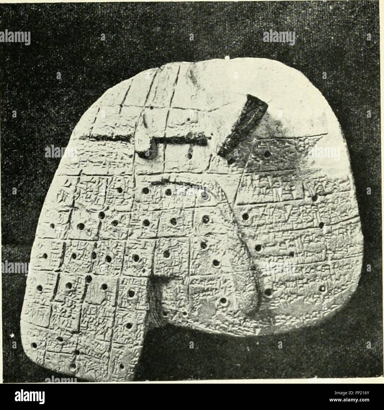 Myths and legends of Babylonia and Assyria (1916) Stock Photohttps://www.alamy.com/image-license-details/?v=1https://www.alamy.com/stock-photo-myths-and-legends-of-babylonia-and-assyria-1916-99619155.html
RMFP216Y–Myths and legends of Babylonia and Assyria (1916)
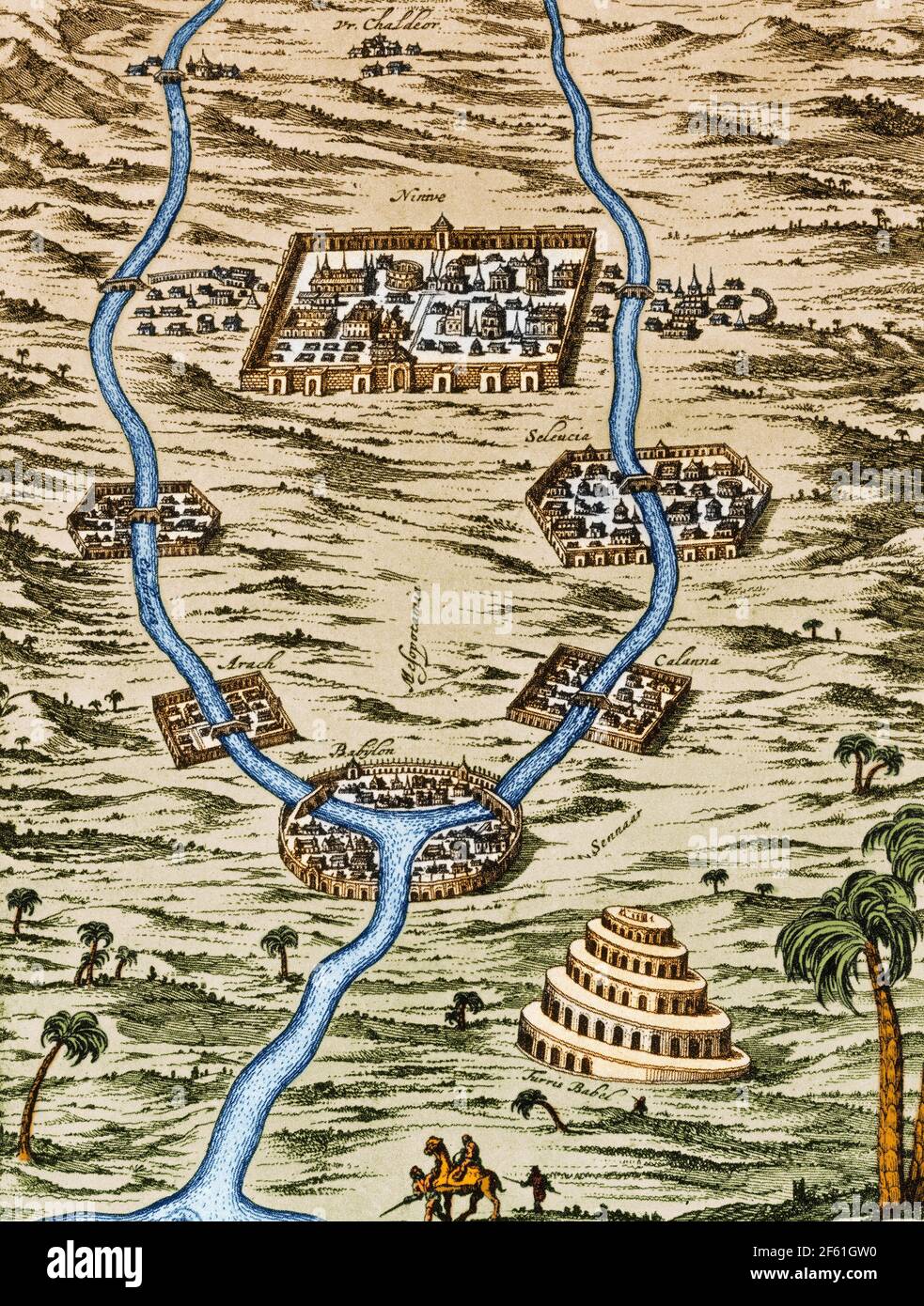 Tigris and Euphrates Valleys, Ancient Babylonia Stock Photohttps://www.alamy.com/image-license-details/?v=1https://www.alamy.com/tigris-and-euphrates-valleys-ancient-babylonia-image416771964.html
RM2F61GW0–Tigris and Euphrates Valleys, Ancient Babylonia
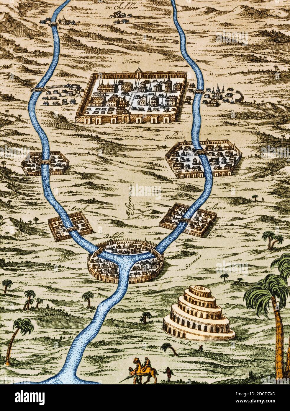
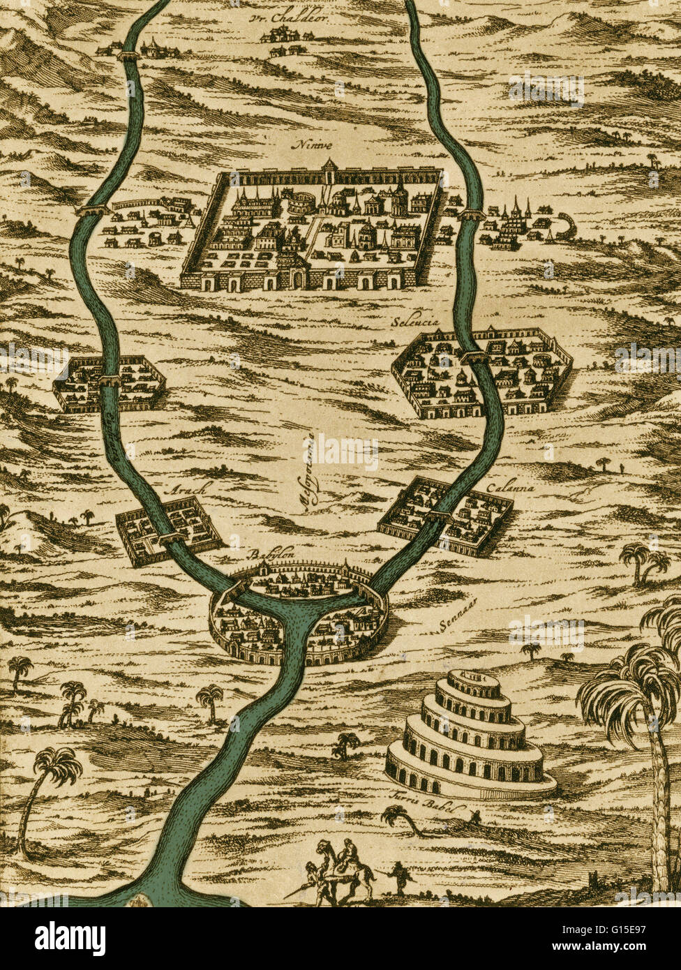 Tigris and Euphrates valleys: Nineveh, Babylon and the Tower of Babel. Stock Photohttps://www.alamy.com/image-license-details/?v=1https://www.alamy.com/stock-photo-tigris-and-euphrates-valleys-nineveh-babylon-and-the-tower-of-babel-103997859.html
RMG15E97–Tigris and Euphrates valleys: Nineveh, Babylon and the Tower of Babel.
