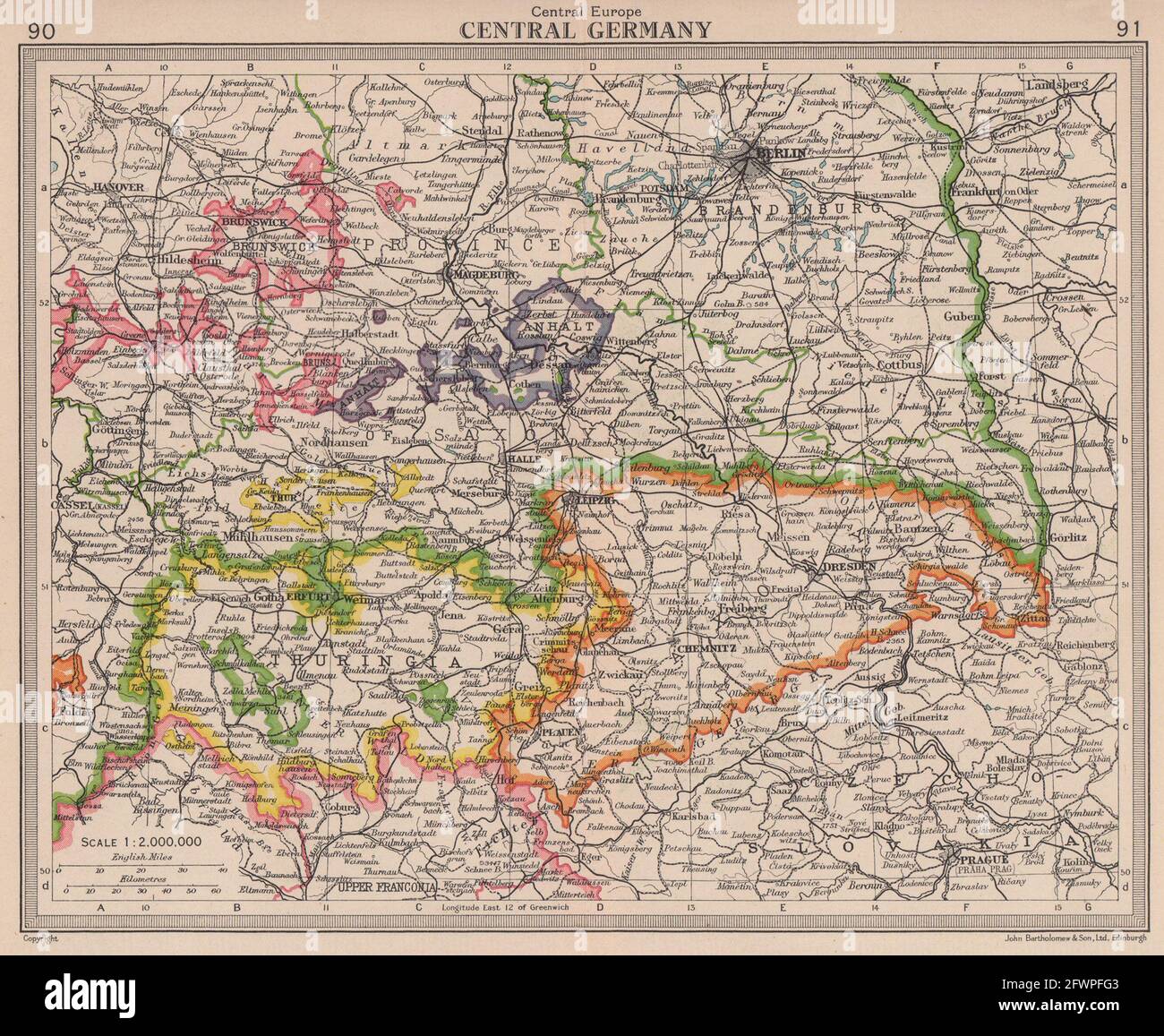
Central london map 20th century Stock Photos and Images
(709)See central london map 20th century stock video clipsQuick filters:
Central london map 20th century Stock Photos and Images
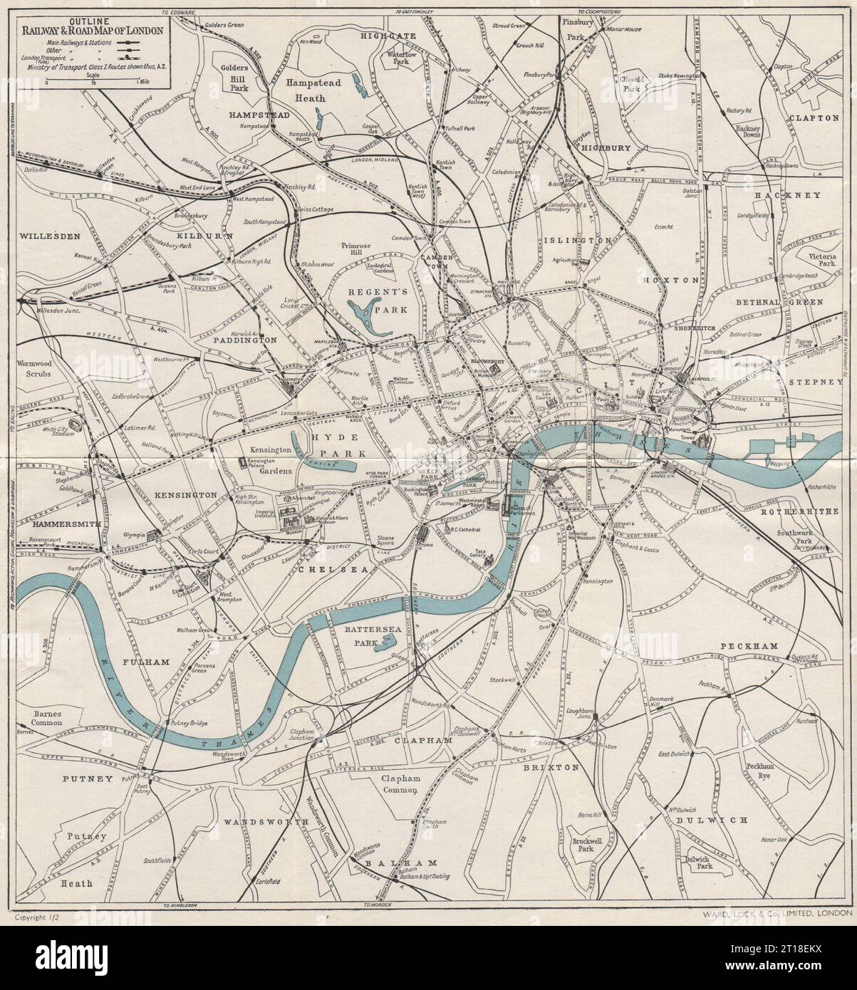 CENTRAL LONDON RAILWAY & ROAD MAP. Tube underground. WARD LOCK 1951 old Stock Photohttps://www.alamy.com/image-license-details/?v=1https://www.alamy.com/central-london-railway-road-map-tube-underground-ward-lock-1951-old-image568743950.html
RF2T18EKX–CENTRAL LONDON RAILWAY & ROAD MAP. Tube underground. WARD LOCK 1951 old
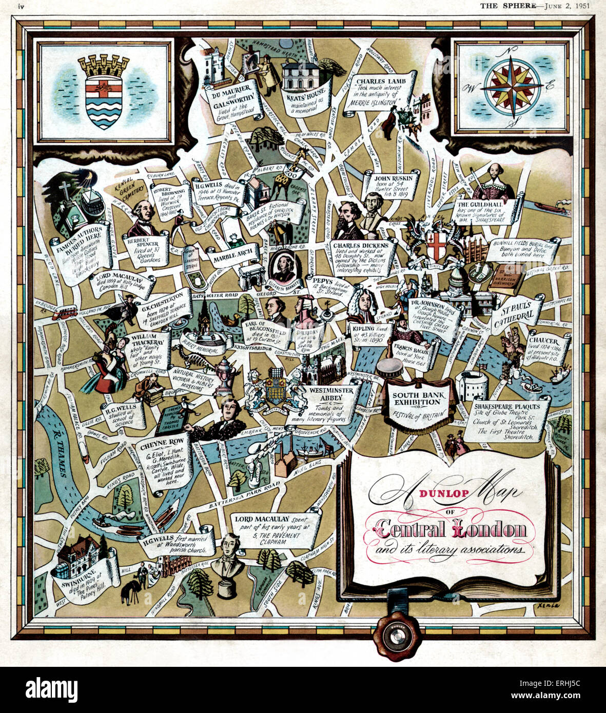 Central London and its literary associations. Illustrated map shows where famous writers and authors lived and worked: Keats, Stock Photohttps://www.alamy.com/image-license-details/?v=1https://www.alamy.com/stock-photo-central-london-and-its-literary-associations-illustrated-map-shows-83366008.html
RMERHJ5C–Central London and its literary associations. Illustrated map shows where famous writers and authors lived and worked: Keats,
 Mr Alan Cobham with lady Copham , consulting the map in his London Offfice before leaving on a Survey Expedition to Central Africa. 17 July 1931 Stock Photohttps://www.alamy.com/image-license-details/?v=1https://www.alamy.com/mr-alan-cobham-with-lady-copham-consulting-the-map-in-his-london-offfice-before-leaving-on-a-survey-expedition-to-central-africa-17-july-1931-image359631343.html
RM2BW2HCF–Mr Alan Cobham with lady Copham , consulting the map in his London Offfice before leaving on a Survey Expedition to Central Africa. 17 July 1931
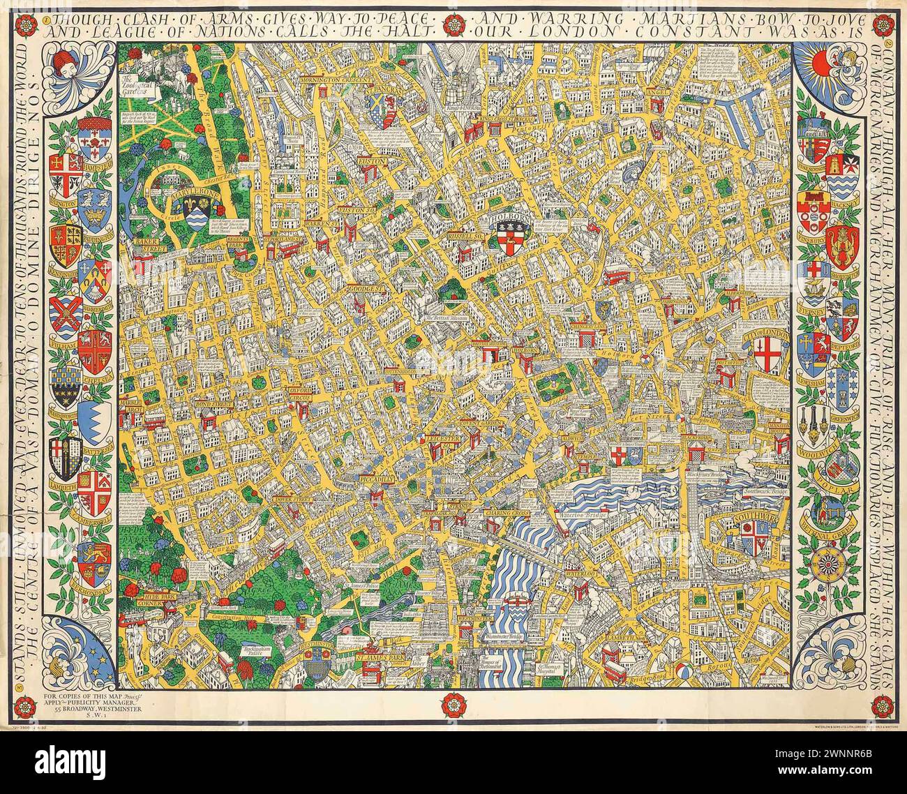 Vintage Illustrated Specialised Map. Central London Clash of Arms, by MacDonald Gill lithograph in colours, 1932, printed by Dobson, Molle & Co. Ltd., London, Stock Photohttps://www.alamy.com/image-license-details/?v=1https://www.alamy.com/vintage-illustrated-specialised-map-central-london-clash-of-arms-by-macdonald-gill-lithograph-in-colours-1932-printed-by-dobson-molle-co-ltd-london-image598539491.html
RM2WNNR6B–Vintage Illustrated Specialised Map. Central London Clash of Arms, by MacDonald Gill lithograph in colours, 1932, printed by Dobson, Molle & Co. Ltd., London,
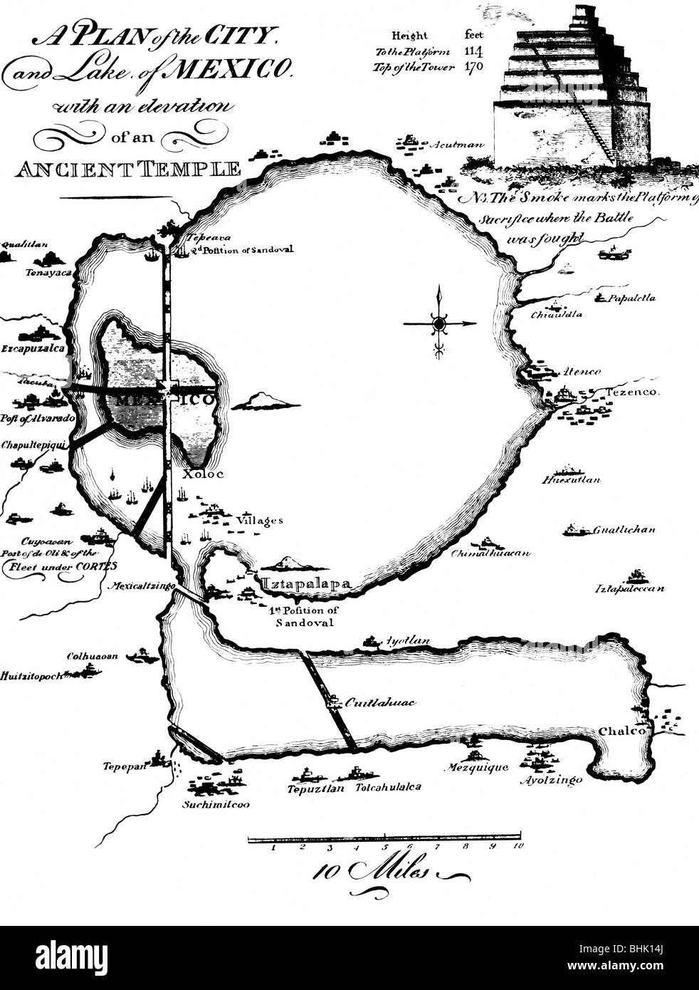 geography/travel, Mexico, Mexico City, city views / cityscapes, a plan of the city and lake Mexico with an elevation of an ancient temple, from 'The Conquest of Mexico', London, 1908, Stock Photohttps://www.alamy.com/image-license-details/?v=1https://www.alamy.com/stock-photo-geographytravel-mexico-mexico-city-city-views-cityscapes-a-plan-of-28077522.html
RMBHK14J–geography/travel, Mexico, Mexico City, city views / cityscapes, a plan of the city and lake Mexico with an elevation of an ancient temple, from 'The Conquest of Mexico', London, 1908,
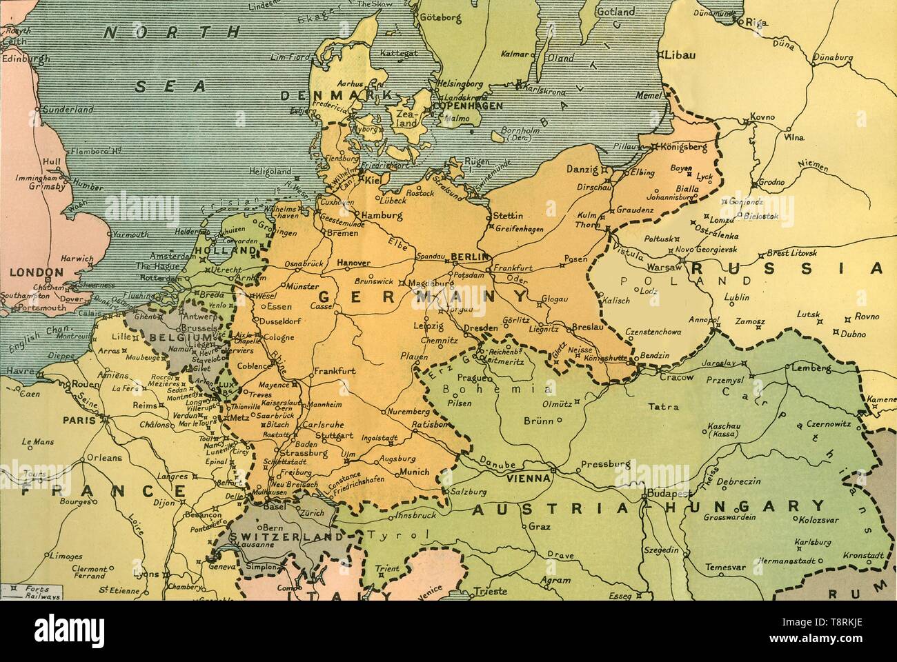 'Map of Central Europe, Showing the Principal Theatre of War', 1919. Creator: London Geographical Institute. Stock Photohttps://www.alamy.com/image-license-details/?v=1https://www.alamy.com/map-of-central-europe-showing-the-principal-theatre-of-war-1919-creator-london-geographical-institute-image246382710.html
RMT8RKJE–'Map of Central Europe, Showing the Principal Theatre of War', 1919. Creator: London Geographical Institute.
 Map tenth division railway mail service. Copyright assigned to the International Textbook Company. 'Entered at Stationers' Hall, London -- Printed in the United States.' 'ICSRL 129B-3242.' Part of the I.C.S. reference library maps set.. Map showing railway mail service lines in North Central states Michigan, Wisconsin, Illinois (partial), Iowa (partial), Minnesota, North Dakota, South Dakota, Nebraska (partial), Wyoming (partial), Montana, Idaho (partial); boundaries for Yellowstone National Park marked out) in the early 20th century.. Tenth Division railway mail service Div. 10. Tenth Divisio Stock Photohttps://www.alamy.com/image-license-details/?v=1https://www.alamy.com/map-tenth-division-railway-mail-service-copyright-assigned-to-the-international-textbook-company-entered-at-stationers-hall-london-printed-in-the-united-states-icsrl-129b-3242-part-of-the-ics-reference-library-maps-set-map-showing-railway-mail-service-lines-in-north-central-states-michigan-wisconsin-illinois-partial-iowa-partial-minnesota-north-dakota-south-dakota-nebraska-partial-wyoming-partial-montana-idaho-partial-boundaries-for-yellowstone-national-park-marked-out-in-the-early-20th-century-tenth-division-railway-mail-service-div-10-tenth-divisio-image502728393.html
RM2M5W75D–Map tenth division railway mail service. Copyright assigned to the International Textbook Company. 'Entered at Stationers' Hall, London -- Printed in the United States.' 'ICSRL 129B-3242.' Part of the I.C.S. reference library maps set.. Map showing railway mail service lines in North Central states Michigan, Wisconsin, Illinois (partial), Iowa (partial), Minnesota, North Dakota, South Dakota, Nebraska (partial), Wyoming (partial), Montana, Idaho (partial); boundaries for Yellowstone National Park marked out) in the early 20th century.. Tenth Division railway mail service Div. 10. Tenth Divisio
![Map of Central Europe, c1914. Europe as it looked at the beginning of the First World War. From "The Great World War - A History" Volume I, edited by Frank A Mumby. [The Gresham Publishing Company Ltd, London, c1920] Stock Photo Map of Central Europe, c1914. Europe as it looked at the beginning of the First World War. From "The Great World War - A History" Volume I, edited by Frank A Mumby. [The Gresham Publishing Company Ltd, London, c1920] Stock Photo](https://c8.alamy.com/comp/W6P7XT/map-of-central-europe-c1914-europe-as-it-looked-at-the-beginning-of-the-first-world-war-from-quotthe-great-world-war-a-historyquot-volume-i-edited-by-frank-a-mumby-the-gresham-publishing-company-ltd-london-c1920-W6P7XT.jpg) Map of Central Europe, c1914. Europe as it looked at the beginning of the First World War. From "The Great World War - A History" Volume I, edited by Frank A Mumby. [The Gresham Publishing Company Ltd, London, c1920] Stock Photohttps://www.alamy.com/image-license-details/?v=1https://www.alamy.com/map-of-central-europe-c1914-europe-as-it-looked-at-the-beginning-of-the-first-world-war-from-quotthe-great-world-war-a-historyquot-volume-i-edited-by-frank-a-mumby-the-gresham-publishing-company-ltd-london-c1920-image262332640.html
Map of Central Europe, c1914. Europe as it looked at the beginning of the First World War. From "The Great World War - A History" Volume I, edited by Frank A Mumby. [The Gresham Publishing Company Ltd, London, c1920] Stock Photohttps://www.alamy.com/image-license-details/?v=1https://www.alamy.com/map-of-central-europe-c1914-europe-as-it-looked-at-the-beginning-of-the-first-world-war-from-quotthe-great-world-war-a-historyquot-volume-i-edited-by-frank-a-mumby-the-gresham-publishing-company-ltd-london-c1920-image262332640.htmlRMW6P7XT–Map of Central Europe, c1914. Europe as it looked at the beginning of the First World War. From "The Great World War - A History" Volume I, edited by Frank A Mumby. [The Gresham Publishing Company Ltd, London, c1920]
 Cover of 'Map in Five Colours of Central London' . Central London. Scale, 1 : 12,672. London : Cribb & Co., 1923. Source: Maps 3480.(349.). Language: English. Stock Photohttps://www.alamy.com/image-license-details/?v=1https://www.alamy.com/cover-of-map-in-five-colours-of-central-london-central-london-scale-1-12672-london-cribb-co-1923-source-maps-3480349-language-english-image227109070.html
RMR5DKX6–Cover of 'Map in Five Colours of Central London' . Central London. Scale, 1 : 12,672. London : Cribb & Co., 1923. Source: Maps 3480.(349.). Language: English.
!['General Map of the Balkan Operations in the Autumn of 1916', 1917. The Balkans campaign was fought between the Central Powers and the Allies, hostility between Serbia and Austria-Hungary was the prime cause of World War I. From "The War Illustrated Album De Luxe - Volume VII. The Autumn Campaign of 1916", edited by J. A. Hammerton. [The Amalgamated Press, Limited, London, 1917] Stock Photo 'General Map of the Balkan Operations in the Autumn of 1916', 1917. The Balkans campaign was fought between the Central Powers and the Allies, hostility between Serbia and Austria-Hungary was the prime cause of World War I. From "The War Illustrated Album De Luxe - Volume VII. The Autumn Campaign of 1916", edited by J. A. Hammerton. [The Amalgamated Press, Limited, London, 1917] Stock Photo](https://c8.alamy.com/comp/2A8E9MT/general-map-of-the-balkan-operations-in-the-autumn-of-1916-1917-the-balkans-campaign-was-fought-between-the-central-powers-and-the-allies-hostility-between-serbia-and-austria-hungary-was-the-prime-cause-of-world-war-i-from-quotthe-war-illustrated-album-de-luxe-volume-vii-the-autumn-campaign-of-1916quot-edited-by-j-a-hammerton-the-amalgamated-press-limited-london-1917-2A8E9MT.jpg) 'General Map of the Balkan Operations in the Autumn of 1916', 1917. The Balkans campaign was fought between the Central Powers and the Allies, hostility between Serbia and Austria-Hungary was the prime cause of World War I. From "The War Illustrated Album De Luxe - Volume VII. The Autumn Campaign of 1916", edited by J. A. Hammerton. [The Amalgamated Press, Limited, London, 1917] Stock Photohttps://www.alamy.com/image-license-details/?v=1https://www.alamy.com/general-map-of-the-balkan-operations-in-the-autumn-of-1916-1917-the-balkans-campaign-was-fought-between-the-central-powers-and-the-allies-hostility-between-serbia-and-austria-hungary-was-the-prime-cause-of-world-war-i-from-quotthe-war-illustrated-album-de-luxe-volume-vii-the-autumn-campaign-of-1916quot-edited-by-j-a-hammerton-the-amalgamated-press-limited-london-1917-image332229208.html
'General Map of the Balkan Operations in the Autumn of 1916', 1917. The Balkans campaign was fought between the Central Powers and the Allies, hostility between Serbia and Austria-Hungary was the prime cause of World War I. From "The War Illustrated Album De Luxe - Volume VII. The Autumn Campaign of 1916", edited by J. A. Hammerton. [The Amalgamated Press, Limited, London, 1917] Stock Photohttps://www.alamy.com/image-license-details/?v=1https://www.alamy.com/general-map-of-the-balkan-operations-in-the-autumn-of-1916-1917-the-balkans-campaign-was-fought-between-the-central-powers-and-the-allies-hostility-between-serbia-and-austria-hungary-was-the-prime-cause-of-world-war-i-from-quotthe-war-illustrated-album-de-luxe-volume-vii-the-autumn-campaign-of-1916quot-edited-by-j-a-hammerton-the-amalgamated-press-limited-london-1917-image332229208.htmlRM2A8E9MT–'General Map of the Balkan Operations in the Autumn of 1916', 1917. The Balkans campaign was fought between the Central Powers and the Allies, hostility between Serbia and Austria-Hungary was the prime cause of World War I. From "The War Illustrated Album De Luxe - Volume VII. The Autumn Campaign of 1916", edited by J. A. Hammerton. [The Amalgamated Press, Limited, London, 1917]
 Air Ministry weather charts in Kingsway , central London, England . Interested holidaymakers anxiously study them . 4 August 1922 Stock Photohttps://www.alamy.com/image-license-details/?v=1https://www.alamy.com/air-ministry-weather-charts-in-kingsway-central-london-england-interested-holidaymakers-anxiously-study-them-4-august-1922-image623677490.html
RM2Y6JY02–Air Ministry weather charts in Kingsway , central London, England . Interested holidaymakers anxiously study them . 4 August 1922
!['The Ypres Salient before and after the Second Battle of Ypres, April 22-May 13', First World War, 1915, (c1920). Map showing positions of the allied forces around Ypres in Belgium: French, Canadian and British, the 'Cavalry Corps which took the place of the Central Division on May13', and '"A Division (British; originally Colonel Geddes' mixed brigade)'. The shaded area indicates 'ground won by the Germans as a result of the first great gas attack.' From "The Great World War - A History" Volume III, edited by Frank A Mumby. [The Gresham Publishing Company Ltd, London, c1920] Stock Photo 'The Ypres Salient before and after the Second Battle of Ypres, April 22-May 13', First World War, 1915, (c1920). Map showing positions of the allied forces around Ypres in Belgium: French, Canadian and British, the 'Cavalry Corps which took the place of the Central Division on May13', and '"A Division (British; originally Colonel Geddes' mixed brigade)'. The shaded area indicates 'ground won by the Germans as a result of the first great gas attack.' From "The Great World War - A History" Volume III, edited by Frank A Mumby. [The Gresham Publishing Company Ltd, London, c1920] Stock Photo](https://c8.alamy.com/comp/W6P8HP/the-ypres-salient-before-and-after-the-second-battle-of-ypres-april-22-may-13-first-world-war-1915-c1920-map-showing-positions-of-the-allied-forces-around-ypres-in-belgium-french-canadian-and-british-the-cavalry-corps-which-took-the-place-of-the-central-division-on-may13-and-quota-division-british-originally-colonel-geddes-mixed-brigade-the-shaded-area-indicates-ground-won-by-the-germans-as-a-result-of-the-first-great-gas-attack-from-quotthe-great-world-war-a-historyquot-volume-iii-edited-by-frank-a-mumby-the-gresham-publishing-company-ltd-london-c1920-W6P8HP.jpg) 'The Ypres Salient before and after the Second Battle of Ypres, April 22-May 13', First World War, 1915, (c1920). Map showing positions of the allied forces around Ypres in Belgium: French, Canadian and British, the 'Cavalry Corps which took the place of the Central Division on May13', and '"A Division (British; originally Colonel Geddes' mixed brigade)'. The shaded area indicates 'ground won by the Germans as a result of the first great gas attack.' From "The Great World War - A History" Volume III, edited by Frank A Mumby. [The Gresham Publishing Company Ltd, London, c1920] Stock Photohttps://www.alamy.com/image-license-details/?v=1https://www.alamy.com/the-ypres-salient-before-and-after-the-second-battle-of-ypres-april-22-may-13-first-world-war-1915-c1920-map-showing-positions-of-the-allied-forces-around-ypres-in-belgium-french-canadian-and-british-the-cavalry-corps-which-took-the-place-of-the-central-division-on-may13-and-quota-division-british-originally-colonel-geddes-mixed-brigade-the-shaded-area-indicates-ground-won-by-the-germans-as-a-result-of-the-first-great-gas-attack-from-quotthe-great-world-war-a-historyquot-volume-iii-edited-by-frank-a-mumby-the-gresham-publishing-company-ltd-london-c1920-image262333170.html
'The Ypres Salient before and after the Second Battle of Ypres, April 22-May 13', First World War, 1915, (c1920). Map showing positions of the allied forces around Ypres in Belgium: French, Canadian and British, the 'Cavalry Corps which took the place of the Central Division on May13', and '"A Division (British; originally Colonel Geddes' mixed brigade)'. The shaded area indicates 'ground won by the Germans as a result of the first great gas attack.' From "The Great World War - A History" Volume III, edited by Frank A Mumby. [The Gresham Publishing Company Ltd, London, c1920] Stock Photohttps://www.alamy.com/image-license-details/?v=1https://www.alamy.com/the-ypres-salient-before-and-after-the-second-battle-of-ypres-april-22-may-13-first-world-war-1915-c1920-map-showing-positions-of-the-allied-forces-around-ypres-in-belgium-french-canadian-and-british-the-cavalry-corps-which-took-the-place-of-the-central-division-on-may13-and-quota-division-british-originally-colonel-geddes-mixed-brigade-the-shaded-area-indicates-ground-won-by-the-germans-as-a-result-of-the-first-great-gas-attack-from-quotthe-great-world-war-a-historyquot-volume-iii-edited-by-frank-a-mumby-the-gresham-publishing-company-ltd-london-c1920-image262333170.htmlRMW6P8HP–'The Ypres Salient before and after the Second Battle of Ypres, April 22-May 13', First World War, 1915, (c1920). Map showing positions of the allied forces around Ypres in Belgium: French, Canadian and British, the 'Cavalry Corps which took the place of the Central Division on May13', and '"A Division (British; originally Colonel Geddes' mixed brigade)'. The shaded area indicates 'ground won by the Germans as a result of the first great gas attack.' From "The Great World War - A History" Volume III, edited by Frank A Mumby. [The Gresham Publishing Company Ltd, London, c1920]
 The first General Assembly of the United Nations Orginisation opens at the Central Hall, Westminster, London, on 17 January, Thursday. Photo shows, the 'Great Hall' of the Central Hall being prepared for the conference. The colour scheme is blue and gold and the photo shows the presidential platform. 6 January 1946 Stock Photohttps://www.alamy.com/image-license-details/?v=1https://www.alamy.com/the-first-general-assembly-of-the-united-nations-orginisation-opens-at-the-central-hall-westminster-london-on-17-january-thursday-photo-shows-the-great-hall-of-the-central-hall-being-prepared-for-the-conference-the-colour-scheme-is-blue-and-gold-and-the-photo-shows-the-presidential-platform-6-january-1946-image623939227.html
RM2Y72TRR–The first General Assembly of the United Nations Orginisation opens at the Central Hall, Westminster, London, on 17 January, Thursday. Photo shows, the 'Great Hall' of the Central Hall being prepared for the conference. The colour scheme is blue and gold and the photo shows the presidential platform. 6 January 1946
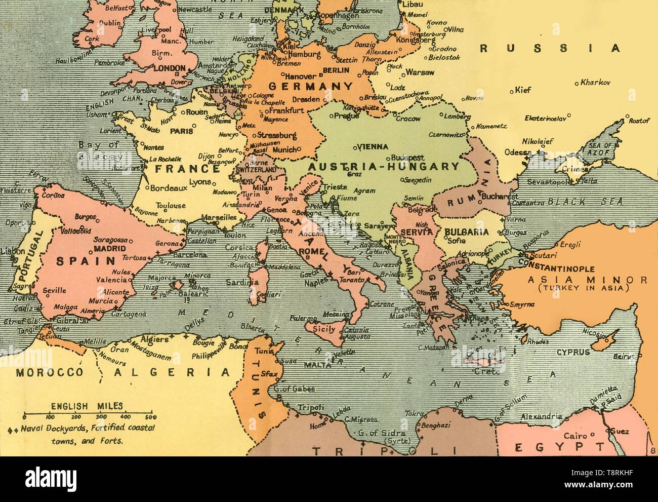 'Central Europe and the Mediterranean', 1919. Creator: London Geographical Institute. Stock Photohttps://www.alamy.com/image-license-details/?v=1https://www.alamy.com/central-europe-and-the-mediterranean-1919-creator-london-geographical-institute-image246382683.html
RMT8RKHF–'Central Europe and the Mediterranean', 1919. Creator: London Geographical Institute.
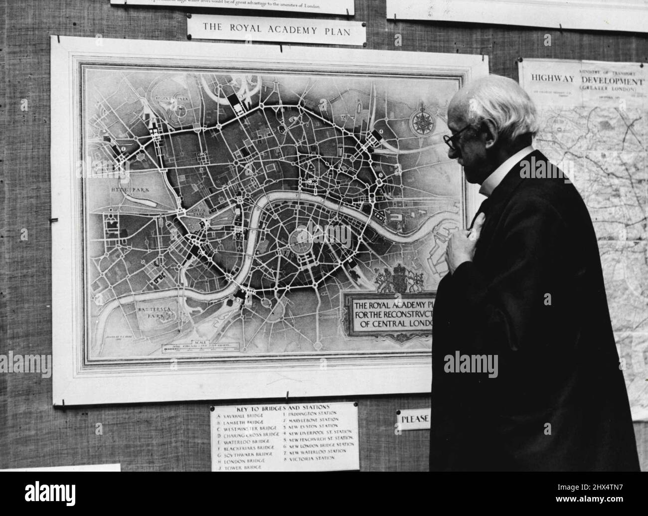 Plans For A New London -- Sir Edwin Lutyens looking at the Royal Academy map of the new Central London which many of Edwins ideas have been introduced.Royal Academy plans for a new London will be revealed at an exhibition to be opened at Burlington House, Piccadilly, next Thursday. This great scheme has grown out of the Greater London Highway Development Survey, better known as the Bressey Plan. It was prepared by Sir Charles ***** Bressey in consultation with Sir Edwin Lutyens, for the Ministry of Transport between 1934 and 1938. For the first three years a Royal Academy Committee of 15 archi Stock Photohttps://www.alamy.com/image-license-details/?v=1https://www.alamy.com/plans-for-a-new-london-sir-edwin-lutyens-looking-at-the-royal-academy-map-of-the-new-central-london-which-many-of-edwins-ideas-have-been-introducedroyal-academy-plans-for-a-new-london-will-be-revealed-at-an-exhibition-to-be-opened-at-burlington-house-piccadilly-next-thursday-this-great-scheme-has-grown-out-of-the-greater-london-highway-development-survey-better-known-as-the-bressey-plan-it-was-prepared-by-sir-charles-bressey-in-consultation-with-sir-edwin-lutyens-for-the-ministry-of-transport-between-1934-and-1938-for-the-first-three-years-a-royal-academy-committee-of-15-archi-image463557843.html
RM2HX4TN7–Plans For A New London -- Sir Edwin Lutyens looking at the Royal Academy map of the new Central London which many of Edwins ideas have been introduced.Royal Academy plans for a new London will be revealed at an exhibition to be opened at Burlington House, Piccadilly, next Thursday. This great scheme has grown out of the Greater London Highway Development Survey, better known as the Bressey Plan. It was prepared by Sir Charles ***** Bressey in consultation with Sir Edwin Lutyens, for the Ministry of Transport between 1934 and 1938. For the first three years a Royal Academy Committee of 15 archi
![Map of the border between Russia and Turkey, First World War, (c1920). 'Map illustrating Turkey's disastrous Advance in the Caucasus and her Invasion of Persia - December, 1914 - January, 1915'. From "The Great World War - A History" Volume II, edited by Frank A Mumby. [The Gresham Publishing Company Ltd, London, c1920] Stock Photo Map of the border between Russia and Turkey, First World War, (c1920). 'Map illustrating Turkey's disastrous Advance in the Caucasus and her Invasion of Persia - December, 1914 - January, 1915'. From "The Great World War - A History" Volume II, edited by Frank A Mumby. [The Gresham Publishing Company Ltd, London, c1920] Stock Photo](https://c8.alamy.com/comp/W6P860/map-of-the-border-between-russia-and-turkey-first-world-war-c1920-map-illustrating-turkeys-disastrous-advance-in-the-caucasus-and-her-invasion-of-persia-december-1914-january-1915-from-quotthe-great-world-war-a-historyquot-volume-ii-edited-by-frank-a-mumby-the-gresham-publishing-company-ltd-london-c1920-W6P860.jpg) Map of the border between Russia and Turkey, First World War, (c1920). 'Map illustrating Turkey's disastrous Advance in the Caucasus and her Invasion of Persia - December, 1914 - January, 1915'. From "The Great World War - A History" Volume II, edited by Frank A Mumby. [The Gresham Publishing Company Ltd, London, c1920] Stock Photohttps://www.alamy.com/image-license-details/?v=1https://www.alamy.com/map-of-the-border-between-russia-and-turkey-first-world-war-c1920-map-illustrating-turkeys-disastrous-advance-in-the-caucasus-and-her-invasion-of-persia-december-1914-january-1915-from-quotthe-great-world-war-a-historyquot-volume-ii-edited-by-frank-a-mumby-the-gresham-publishing-company-ltd-london-c1920-image262332840.html
Map of the border between Russia and Turkey, First World War, (c1920). 'Map illustrating Turkey's disastrous Advance in the Caucasus and her Invasion of Persia - December, 1914 - January, 1915'. From "The Great World War - A History" Volume II, edited by Frank A Mumby. [The Gresham Publishing Company Ltd, London, c1920] Stock Photohttps://www.alamy.com/image-license-details/?v=1https://www.alamy.com/map-of-the-border-between-russia-and-turkey-first-world-war-c1920-map-illustrating-turkeys-disastrous-advance-in-the-caucasus-and-her-invasion-of-persia-december-1914-january-1915-from-quotthe-great-world-war-a-historyquot-volume-ii-edited-by-frank-a-mumby-the-gresham-publishing-company-ltd-london-c1920-image262332840.htmlRMW6P860–Map of the border between Russia and Turkey, First World War, (c1920). 'Map illustrating Turkey's disastrous Advance in the Caucasus and her Invasion of Persia - December, 1914 - January, 1915'. From "The Great World War - A History" Volume II, edited by Frank A Mumby. [The Gresham Publishing Company Ltd, London, c1920]
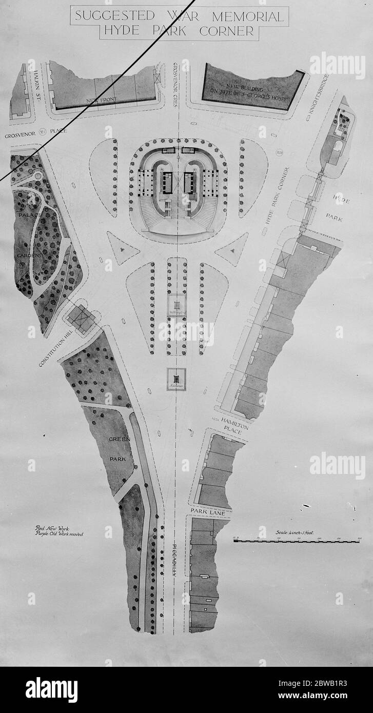 Proposed National war memorial for Hyde Park corner . 14 July 1920 Stock Photohttps://www.alamy.com/image-license-details/?v=1https://www.alamy.com/proposed-national-war-memorial-for-hyde-park-corner-14-july-1920-image359816663.html
RM2BWB1R3–Proposed National war memorial for Hyde Park corner . 14 July 1920
![Black Sea: Bosphorus and Dardanelles, c1914, (c1920). Map of the Black Sea and parts of surrounding countries at the start of the First World War, showing Russia and the Crimea, Romania, Bulgaria and Turkey, with insets of the coast at Gallipoli and Constantinople (Istanbul). From "The Great World War - A History" Volume I, edited by Frank A Mumby. [The Gresham Publishing Company Ltd, London, c1920] Stock Photo Black Sea: Bosphorus and Dardanelles, c1914, (c1920). Map of the Black Sea and parts of surrounding countries at the start of the First World War, showing Russia and the Crimea, Romania, Bulgaria and Turkey, with insets of the coast at Gallipoli and Constantinople (Istanbul). From "The Great World War - A History" Volume I, edited by Frank A Mumby. [The Gresham Publishing Company Ltd, London, c1920] Stock Photo](https://c8.alamy.com/comp/W6P873/black-sea-bosphorus-and-dardanelles-c1914-c1920-map-of-the-black-sea-and-parts-of-surrounding-countries-at-the-start-of-the-first-world-war-showing-russia-and-the-crimea-romania-bulgaria-and-turkey-with-insets-of-the-coast-at-gallipoli-and-constantinople-istanbul-from-quotthe-great-world-war-a-historyquot-volume-i-edited-by-frank-a-mumby-the-gresham-publishing-company-ltd-london-c1920-W6P873.jpg) Black Sea: Bosphorus and Dardanelles, c1914, (c1920). Map of the Black Sea and parts of surrounding countries at the start of the First World War, showing Russia and the Crimea, Romania, Bulgaria and Turkey, with insets of the coast at Gallipoli and Constantinople (Istanbul). From "The Great World War - A History" Volume I, edited by Frank A Mumby. [The Gresham Publishing Company Ltd, London, c1920] Stock Photohttps://www.alamy.com/image-license-details/?v=1https://www.alamy.com/black-sea-bosphorus-and-dardanelles-c1914-c1920-map-of-the-black-sea-and-parts-of-surrounding-countries-at-the-start-of-the-first-world-war-showing-russia-and-the-crimea-romania-bulgaria-and-turkey-with-insets-of-the-coast-at-gallipoli-and-constantinople-istanbul-from-quotthe-great-world-war-a-historyquot-volume-i-edited-by-frank-a-mumby-the-gresham-publishing-company-ltd-london-c1920-image262332871.html
Black Sea: Bosphorus and Dardanelles, c1914, (c1920). Map of the Black Sea and parts of surrounding countries at the start of the First World War, showing Russia and the Crimea, Romania, Bulgaria and Turkey, with insets of the coast at Gallipoli and Constantinople (Istanbul). From "The Great World War - A History" Volume I, edited by Frank A Mumby. [The Gresham Publishing Company Ltd, London, c1920] Stock Photohttps://www.alamy.com/image-license-details/?v=1https://www.alamy.com/black-sea-bosphorus-and-dardanelles-c1914-c1920-map-of-the-black-sea-and-parts-of-surrounding-countries-at-the-start-of-the-first-world-war-showing-russia-and-the-crimea-romania-bulgaria-and-turkey-with-insets-of-the-coast-at-gallipoli-and-constantinople-istanbul-from-quotthe-great-world-war-a-historyquot-volume-i-edited-by-frank-a-mumby-the-gresham-publishing-company-ltd-london-c1920-image262332871.htmlRMW6P873–Black Sea: Bosphorus and Dardanelles, c1914, (c1920). Map of the Black Sea and parts of surrounding countries at the start of the First World War, showing Russia and the Crimea, Romania, Bulgaria and Turkey, with insets of the coast at Gallipoli and Constantinople (Istanbul). From "The Great World War - A History" Volume I, edited by Frank A Mumby. [The Gresham Publishing Company Ltd, London, c1920]
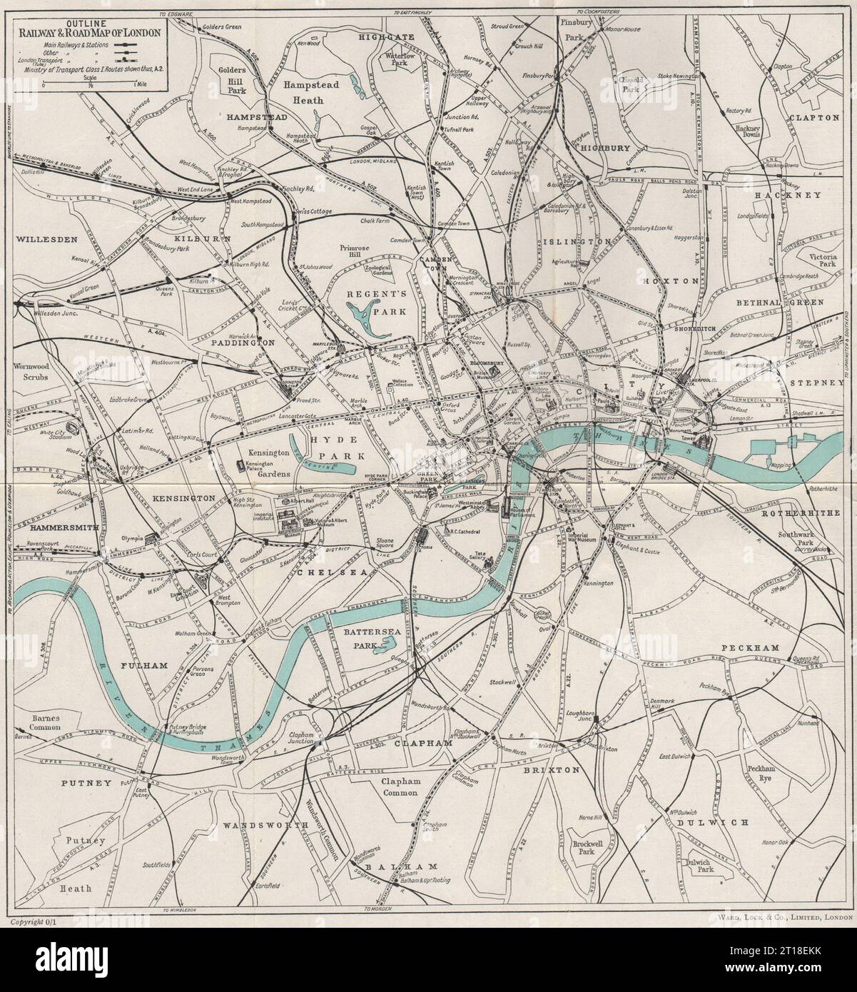 CENTRAL LONDON RAILWAY & ROAD MAP. Underground tube. WARD LOCK 1951 old Stock Photohttps://www.alamy.com/image-license-details/?v=1https://www.alamy.com/central-london-railway-road-map-underground-tube-ward-lock-1951-old-image568743943.html
RF2T18EKK–CENTRAL LONDON RAILWAY & ROAD MAP. Underground tube. WARD LOCK 1951 old
![Colonial possessions in East Africa during the First World War, c1916, (c1920). Map showing German East Africa, British East Africa, the Belgian Congo, Rhodesia, Uganda, Nyasaland Protectorate and Mozambique (Portuguese East Africa). Also shown are the various positions of the combatant armies. From "The Great World War: A History", Volume VI, edited by Frank A Mumby. [The Gresham Publishing Company Ltd, London, c1920] Stock Photo Colonial possessions in East Africa during the First World War, c1916, (c1920). Map showing German East Africa, British East Africa, the Belgian Congo, Rhodesia, Uganda, Nyasaland Protectorate and Mozambique (Portuguese East Africa). Also shown are the various positions of the combatant armies. From "The Great World War: A History", Volume VI, edited by Frank A Mumby. [The Gresham Publishing Company Ltd, London, c1920] Stock Photo](https://c8.alamy.com/comp/2A8E7KM/colonial-possessions-in-east-africa-during-the-first-world-war-c1916-c1920-map-showing-german-east-africa-british-east-africa-the-belgian-congo-rhodesia-uganda-nyasaland-protectorate-and-mozambique-portuguese-east-africa-also-shown-are-the-various-positions-of-the-combatant-armies-from-quotthe-great-world-war-a-historyquot-volume-vi-edited-by-frank-a-mumby-the-gresham-publishing-company-ltd-london-c1920-2A8E7KM.jpg) Colonial possessions in East Africa during the First World War, c1916, (c1920). Map showing German East Africa, British East Africa, the Belgian Congo, Rhodesia, Uganda, Nyasaland Protectorate and Mozambique (Portuguese East Africa). Also shown are the various positions of the combatant armies. From "The Great World War: A History", Volume VI, edited by Frank A Mumby. [The Gresham Publishing Company Ltd, London, c1920] Stock Photohttps://www.alamy.com/image-license-details/?v=1https://www.alamy.com/colonial-possessions-in-east-africa-during-the-first-world-war-c1916-c1920-map-showing-german-east-africa-british-east-africa-the-belgian-congo-rhodesia-uganda-nyasaland-protectorate-and-mozambique-portuguese-east-africa-also-shown-are-the-various-positions-of-the-combatant-armies-from-quotthe-great-world-war-a-historyquot-volume-vi-edited-by-frank-a-mumby-the-gresham-publishing-company-ltd-london-c1920-image332227608.html
Colonial possessions in East Africa during the First World War, c1916, (c1920). Map showing German East Africa, British East Africa, the Belgian Congo, Rhodesia, Uganda, Nyasaland Protectorate and Mozambique (Portuguese East Africa). Also shown are the various positions of the combatant armies. From "The Great World War: A History", Volume VI, edited by Frank A Mumby. [The Gresham Publishing Company Ltd, London, c1920] Stock Photohttps://www.alamy.com/image-license-details/?v=1https://www.alamy.com/colonial-possessions-in-east-africa-during-the-first-world-war-c1916-c1920-map-showing-german-east-africa-british-east-africa-the-belgian-congo-rhodesia-uganda-nyasaland-protectorate-and-mozambique-portuguese-east-africa-also-shown-are-the-various-positions-of-the-combatant-armies-from-quotthe-great-world-war-a-historyquot-volume-vi-edited-by-frank-a-mumby-the-gresham-publishing-company-ltd-london-c1920-image332227608.htmlRM2A8E7KM–Colonial possessions in East Africa during the First World War, c1916, (c1920). Map showing German East Africa, British East Africa, the Belgian Congo, Rhodesia, Uganda, Nyasaland Protectorate and Mozambique (Portuguese East Africa). Also shown are the various positions of the combatant armies. From "The Great World War: A History", Volume VI, edited by Frank A Mumby. [The Gresham Publishing Company Ltd, London, c1920]
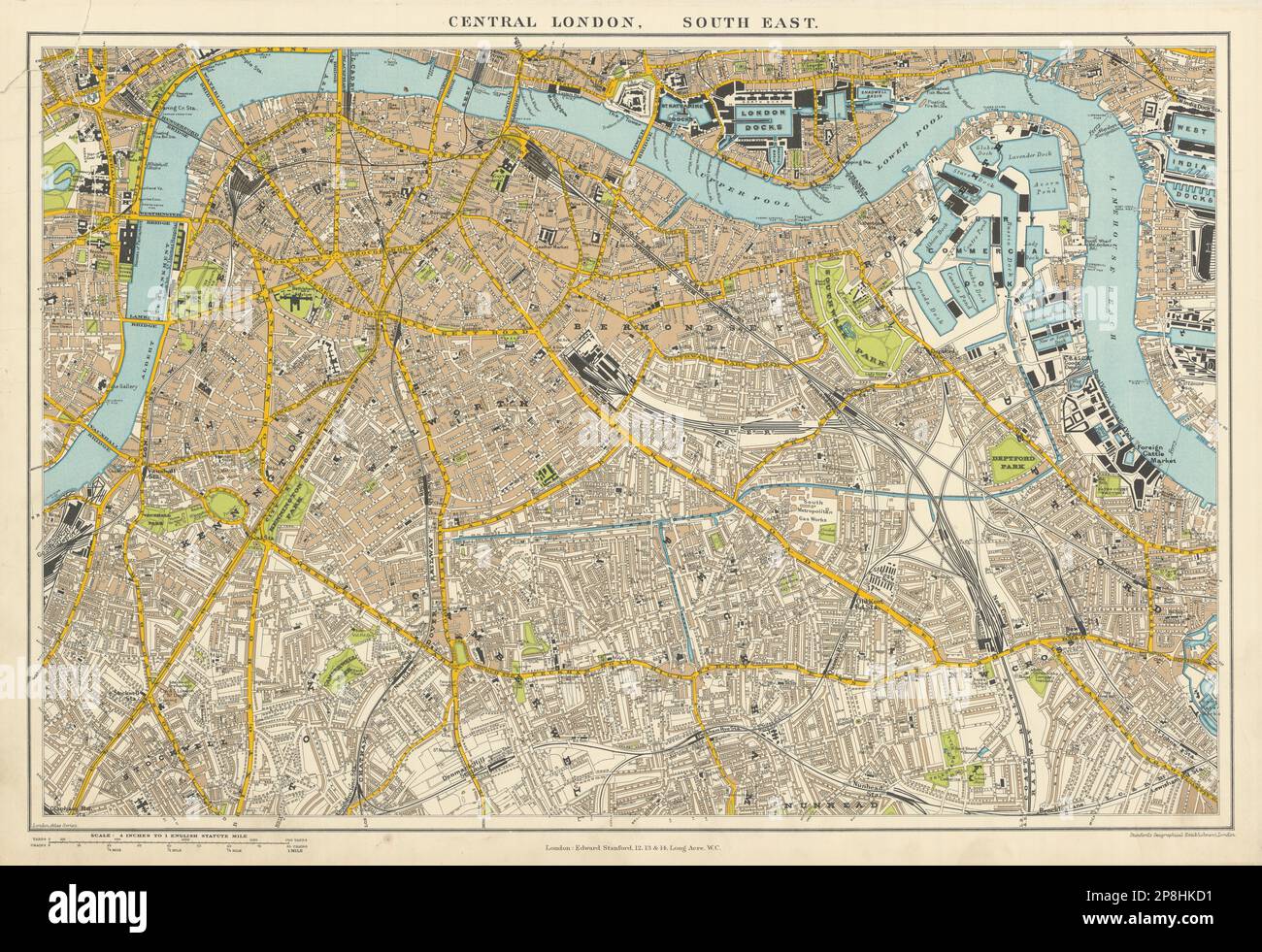 Central London S.E. Southwark Bermondsey Camberwell Deptford. STANFORD 1904 map Stock Photohttps://www.alamy.com/image-license-details/?v=1https://www.alamy.com/central-london-se-southwark-bermondsey-camberwell-deptford-stanford-1904-map-image538827101.html
RF2P8HKD1–Central London S.E. Southwark Bermondsey Camberwell Deptford. STANFORD 1904 map
 Map eleventh division railway mail service. Inset: Enlarged portion in vicinity of Houston, Texas. Copyright by the International Textbook Company. 'Entered at Stationers' Hall, London -- Printed in the United States.' 'ICSRL 129B-3242.' Part of the I.C.S. reference library maps set.. Map showing railway mail service lines in South Central states (principally Oklahoma, Arkansas, Texas, and Louisiana, with portions of surrounding states) in the early 20th century.. Eleventh Division railway mail service Div. 11. Eleventh Division railway mail service Div. 11, Oklahoma Arkansas Texas Louisiana Stock Photohttps://www.alamy.com/image-license-details/?v=1https://www.alamy.com/map-eleventh-division-railway-mail-service-inset-enlarged-portion-in-vicinity-of-houston-texas-copyright-by-the-international-textbook-company-entered-at-stationers-hall-london-printed-in-the-united-states-icsrl-129b-3242-part-of-the-ics-reference-library-maps-set-map-showing-railway-mail-service-lines-in-south-central-states-principally-oklahoma-arkansas-texas-and-louisiana-with-portions-of-surrounding-states-in-the-early-20th-century-eleventh-division-railway-mail-service-div-11-eleventh-division-railway-mail-service-div-11-oklahoma-arkansas-texas-louisiana-image502732571.html
RM2M5WCEK–Map eleventh division railway mail service. Inset: Enlarged portion in vicinity of Houston, Texas. Copyright by the International Textbook Company. 'Entered at Stationers' Hall, London -- Printed in the United States.' 'ICSRL 129B-3242.' Part of the I.C.S. reference library maps set.. Map showing railway mail service lines in South Central states (principally Oklahoma, Arkansas, Texas, and Louisiana, with portions of surrounding states) in the early 20th century.. Eleventh Division railway mail service Div. 11. Eleventh Division railway mail service Div. 11, Oklahoma Arkansas Texas Louisiana
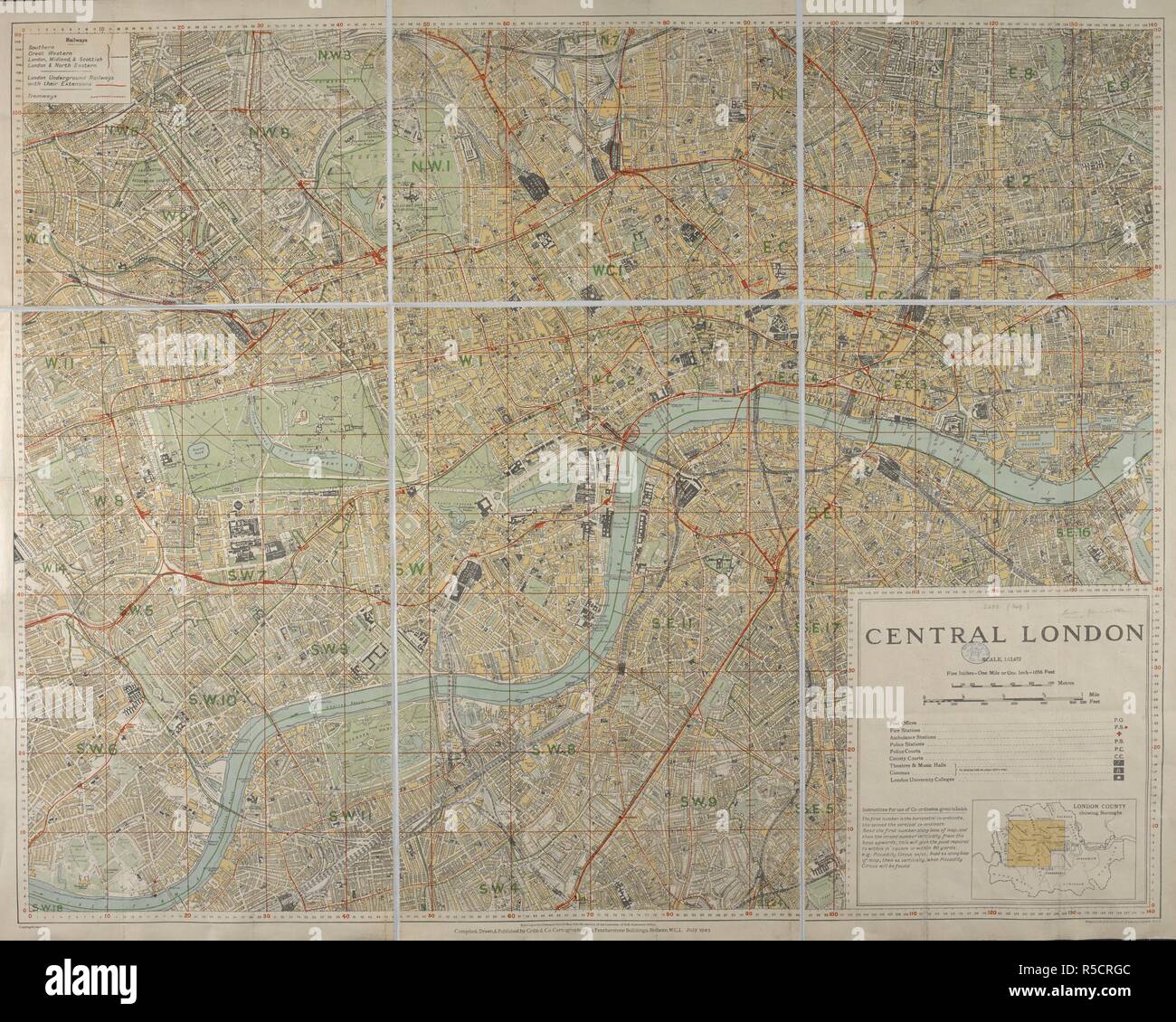 A map of Central London featuring a numerical grid system. Central London. Scale, 1 : 12,672. London : Cribb & Co., 1923. Source: Maps 3480.(349.). Language: English. Stock Photohttps://www.alamy.com/image-license-details/?v=1https://www.alamy.com/a-map-of-central-london-featuring-a-numerical-grid-system-central-london-scale-1-12672-london-cribb-co-1923-source-maps-3480349-language-english-image227089980.html
RMR5CRGC–A map of Central London featuring a numerical grid system. Central London. Scale, 1 : 12,672. London : Cribb & Co., 1923. Source: Maps 3480.(349.). Language: English.
!['The Hour of Fate on the Tigris', 1916. The Mesopotamian campaign on the Middle Eastern front was fought between the Allies and the Central Powers of the Ottoman Empire. From "The War Illustrated Album De Luxe - Volume VI. The Spring and Summer Campaign of 1916", edited by J. A. Hammerton. [The Amalgamated Press, Limited, London, 1916] Stock Photo 'The Hour of Fate on the Tigris', 1916. The Mesopotamian campaign on the Middle Eastern front was fought between the Allies and the Central Powers of the Ottoman Empire. From "The War Illustrated Album De Luxe - Volume VI. The Spring and Summer Campaign of 1916", edited by J. A. Hammerton. [The Amalgamated Press, Limited, London, 1916] Stock Photo](https://c8.alamy.com/comp/2A8E9KP/the-hour-of-fate-on-the-tigris-1916-the-mesopotamian-campaign-on-the-middle-eastern-front-was-fought-between-the-allies-and-the-central-powers-of-the-ottoman-empire-from-quotthe-war-illustrated-album-de-luxe-volume-vi-the-spring-and-summer-campaign-of-1916quot-edited-by-j-a-hammerton-the-amalgamated-press-limited-london-1916-2A8E9KP.jpg) 'The Hour of Fate on the Tigris', 1916. The Mesopotamian campaign on the Middle Eastern front was fought between the Allies and the Central Powers of the Ottoman Empire. From "The War Illustrated Album De Luxe - Volume VI. The Spring and Summer Campaign of 1916", edited by J. A. Hammerton. [The Amalgamated Press, Limited, London, 1916] Stock Photohttps://www.alamy.com/image-license-details/?v=1https://www.alamy.com/the-hour-of-fate-on-the-tigris-1916-the-mesopotamian-campaign-on-the-middle-eastern-front-was-fought-between-the-allies-and-the-central-powers-of-the-ottoman-empire-from-quotthe-war-illustrated-album-de-luxe-volume-vi-the-spring-and-summer-campaign-of-1916quot-edited-by-j-a-hammerton-the-amalgamated-press-limited-london-1916-image332229178.html
'The Hour of Fate on the Tigris', 1916. The Mesopotamian campaign on the Middle Eastern front was fought between the Allies and the Central Powers of the Ottoman Empire. From "The War Illustrated Album De Luxe - Volume VI. The Spring and Summer Campaign of 1916", edited by J. A. Hammerton. [The Amalgamated Press, Limited, London, 1916] Stock Photohttps://www.alamy.com/image-license-details/?v=1https://www.alamy.com/the-hour-of-fate-on-the-tigris-1916-the-mesopotamian-campaign-on-the-middle-eastern-front-was-fought-between-the-allies-and-the-central-powers-of-the-ottoman-empire-from-quotthe-war-illustrated-album-de-luxe-volume-vi-the-spring-and-summer-campaign-of-1916quot-edited-by-j-a-hammerton-the-amalgamated-press-limited-london-1916-image332229178.htmlRM2A8E9KP–'The Hour of Fate on the Tigris', 1916. The Mesopotamian campaign on the Middle Eastern front was fought between the Allies and the Central Powers of the Ottoman Empire. From "The War Illustrated Album De Luxe - Volume VI. The Spring and Summer Campaign of 1916", edited by J. A. Hammerton. [The Amalgamated Press, Limited, London, 1916]
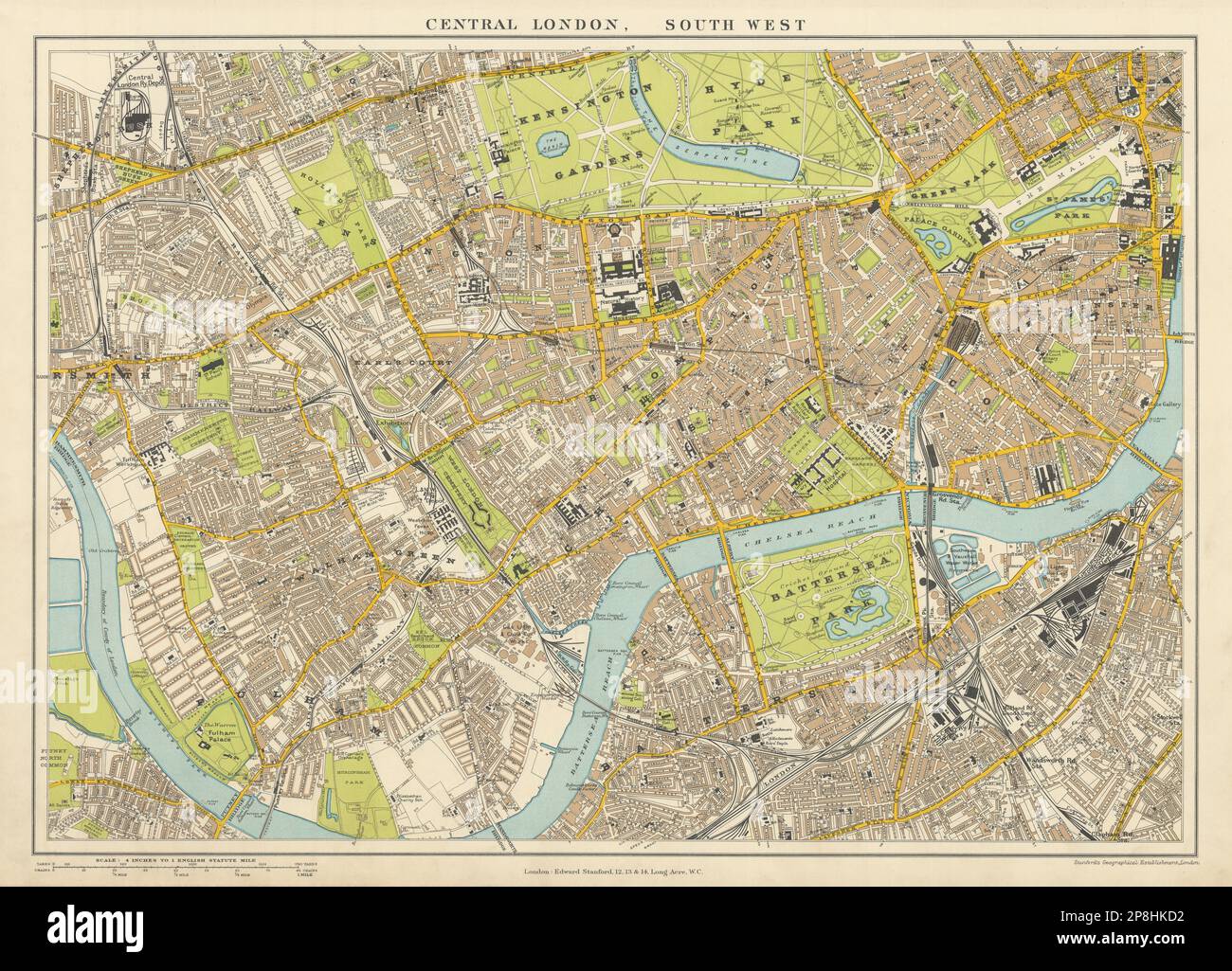 Central London S.W. Battersea Chelsea Kensington Westminster. STANFORD 1904 map Stock Photohttps://www.alamy.com/image-license-details/?v=1https://www.alamy.com/central-london-sw-battersea-chelsea-kensington-westminster-stanford-1904-map-image538827102.html
RF2P8HKD2–Central London S.W. Battersea Chelsea Kensington Westminster. STANFORD 1904 map
!['Zone map of Dresden.'. Zone maps, Series GSGS 4399. [London] : War Office, 1943-1944. Produced by: Great Britain. Air Ministry. Coverage of large towns throughout Germany, Italy and major occupied cities in other countries of central Europe. Small-scale town area maps overprinted to show vulnerability to high explosive and incendiary bombing. All originally classified 'Secret'. Source: Maps MOD GSGS 4399. Stock Photo 'Zone map of Dresden.'. Zone maps, Series GSGS 4399. [London] : War Office, 1943-1944. Produced by: Great Britain. Air Ministry. Coverage of large towns throughout Germany, Italy and major occupied cities in other countries of central Europe. Small-scale town area maps overprinted to show vulnerability to high explosive and incendiary bombing. All originally classified 'Secret'. Source: Maps MOD GSGS 4399. Stock Photo](https://c8.alamy.com/comp/R555H5/zone-map-of-dresden-zone-maps-series-gsgs-4399-london-war-office-1943-1944-produced-by-great-britain-air-ministry-coverage-of-large-towns-throughout-germany-italy-and-major-occupied-cities-in-other-countries-of-central-europe-small-scale-town-area-maps-overprinted-to-show-vulnerability-to-high-explosive-and-incendiary-bombing-all-originally-classified-secret-source-maps-mod-gsgs-4399-R555H5.jpg) 'Zone map of Dresden.'. Zone maps, Series GSGS 4399. [London] : War Office, 1943-1944. Produced by: Great Britain. Air Ministry. Coverage of large towns throughout Germany, Italy and major occupied cities in other countries of central Europe. Small-scale town area maps overprinted to show vulnerability to high explosive and incendiary bombing. All originally classified 'Secret'. Source: Maps MOD GSGS 4399. Stock Photohttps://www.alamy.com/image-license-details/?v=1https://www.alamy.com/zone-map-of-dresden-zone-maps-series-gsgs-4399-london-war-office-1943-1944-produced-by-great-britain-air-ministry-coverage-of-large-towns-throughout-germany-italy-and-major-occupied-cities-in-other-countries-of-central-europe-small-scale-town-area-maps-overprinted-to-show-vulnerability-to-high-explosive-and-incendiary-bombing-all-originally-classified-secret-source-maps-mod-gsgs-4399-image226922225.html
'Zone map of Dresden.'. Zone maps, Series GSGS 4399. [London] : War Office, 1943-1944. Produced by: Great Britain. Air Ministry. Coverage of large towns throughout Germany, Italy and major occupied cities in other countries of central Europe. Small-scale town area maps overprinted to show vulnerability to high explosive and incendiary bombing. All originally classified 'Secret'. Source: Maps MOD GSGS 4399. Stock Photohttps://www.alamy.com/image-license-details/?v=1https://www.alamy.com/zone-map-of-dresden-zone-maps-series-gsgs-4399-london-war-office-1943-1944-produced-by-great-britain-air-ministry-coverage-of-large-towns-throughout-germany-italy-and-major-occupied-cities-in-other-countries-of-central-europe-small-scale-town-area-maps-overprinted-to-show-vulnerability-to-high-explosive-and-incendiary-bombing-all-originally-classified-secret-source-maps-mod-gsgs-4399-image226922225.htmlRMR555H5–'Zone map of Dresden.'. Zone maps, Series GSGS 4399. [London] : War Office, 1943-1944. Produced by: Great Britain. Air Ministry. Coverage of large towns throughout Germany, Italy and major occupied cities in other countries of central Europe. Small-scale town area maps overprinted to show vulnerability to high explosive and incendiary bombing. All originally classified 'Secret'. Source: Maps MOD GSGS 4399.
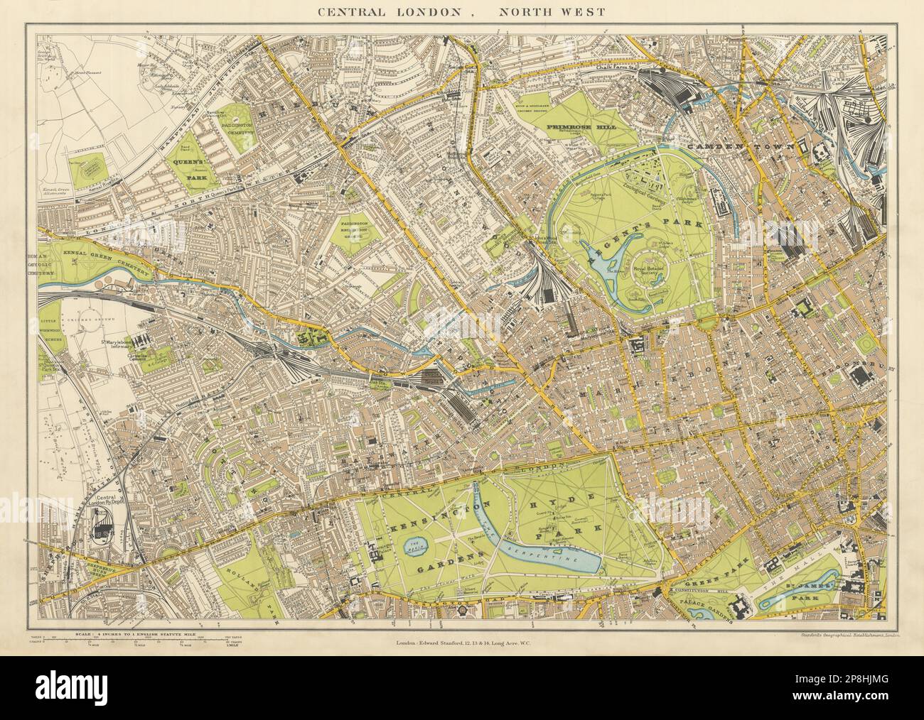 Central London N.W. Camden Marylebone Mayfair Notting Hill. STANFORD 1904 map Stock Photohttps://www.alamy.com/image-license-details/?v=1https://www.alamy.com/central-london-nw-camden-marylebone-mayfair-notting-hill-stanford-1904-map-image538826528.html
RF2P8HJMG–Central London N.W. Camden Marylebone Mayfair Notting Hill. STANFORD 1904 map
![A pictorial map of the First World War. Knock out Germany. An instructive partial map of Europe with Germany silhouetted, etc. [London] : S[p]ecially prepared for the Toy Target Company, [1914]. 345 x 365 mm. . Source: Maps.1078.(41). Stock Photo A pictorial map of the First World War. Knock out Germany. An instructive partial map of Europe with Germany silhouetted, etc. [London] : S[p]ecially prepared for the Toy Target Company, [1914]. 345 x 365 mm. . Source: Maps.1078.(41). Stock Photo](https://c8.alamy.com/comp/R5AY65/a-pictorial-map-of-the-first-world-war-knock-out-germany-an-instructive-partial-map-of-europe-with-germany-silhouetted-etc-london-s-p-ecially-prepared-for-the-toy-target-company-1914-345-x-365-mm-source-maps107841-R5AY65.jpg) A pictorial map of the First World War. Knock out Germany. An instructive partial map of Europe with Germany silhouetted, etc. [London] : S[p]ecially prepared for the Toy Target Company, [1914]. 345 x 365 mm. . Source: Maps.1078.(41). Stock Photohttps://www.alamy.com/image-license-details/?v=1https://www.alamy.com/a-pictorial-map-of-the-first-world-war-knock-out-germany-an-instructive-partial-map-of-europe-with-germany-silhouetted-etc-london-s-p-ecially-prepared-for-the-toy-target-company-1914-345-x-365-mm-source-maps107841-image227048925.html
A pictorial map of the First World War. Knock out Germany. An instructive partial map of Europe with Germany silhouetted, etc. [London] : S[p]ecially prepared for the Toy Target Company, [1914]. 345 x 365 mm. . Source: Maps.1078.(41). Stock Photohttps://www.alamy.com/image-license-details/?v=1https://www.alamy.com/a-pictorial-map-of-the-first-world-war-knock-out-germany-an-instructive-partial-map-of-europe-with-germany-silhouetted-etc-london-s-p-ecially-prepared-for-the-toy-target-company-1914-345-x-365-mm-source-maps107841-image227048925.htmlRMR5AY65–A pictorial map of the First World War. Knock out Germany. An instructive partial map of Europe with Germany silhouetted, etc. [London] : S[p]ecially prepared for the Toy Target Company, [1914]. 345 x 365 mm. . Source: Maps.1078.(41).
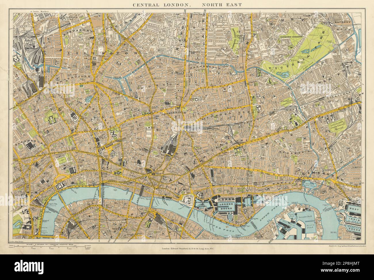 Central London N.E. City Clerkenwell Islington Hackney. STANFORD 1904 old map Stock Photohttps://www.alamy.com/image-license-details/?v=1https://www.alamy.com/central-london-ne-city-clerkenwell-islington-hackney-stanford-1904-old-map-image538826536.html
RF2P8HJMT–Central London N.E. City Clerkenwell Islington Hackney. STANFORD 1904 old map
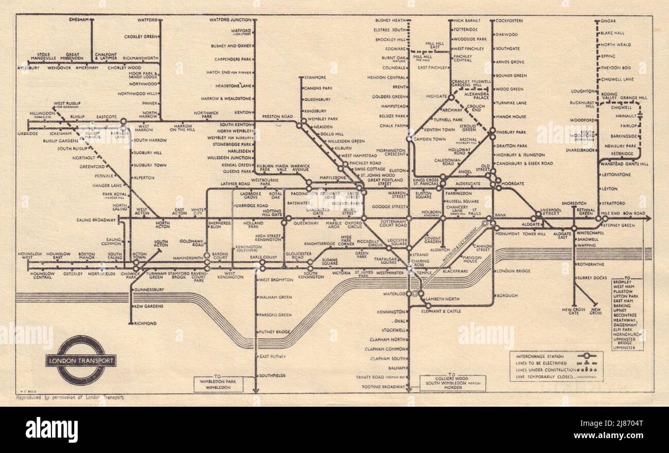 LONDON UNDERGROUND Tube map. Central Line extension U/C. HARRY BECK 1948 Stock Photohttps://www.alamy.com/image-license-details/?v=1https://www.alamy.com/london-underground-tube-map-central-line-extension-uc-harry-beck-1948-image469750984.html
RF2J8704T–LONDON UNDERGROUND Tube map. Central Line extension U/C. HARRY BECK 1948
 CENTRAL LONDON: Inset map of The West End , 1910 Stock Photohttps://www.alamy.com/image-license-details/?v=1https://www.alamy.com/stock-photo-central-london-inset-map-of-the-west-end-1910-109644043.html
RFGAAM2K–CENTRAL LONDON: Inset map of The West End , 1910
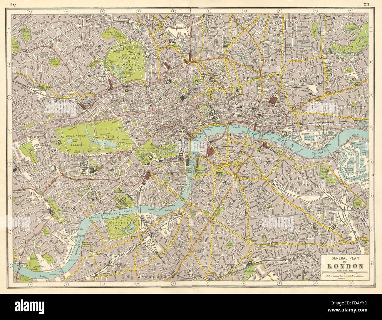 LONDON: Central London plan. HARMSWORTH, 1920 vintage map Stock Photohttps://www.alamy.com/image-license-details/?v=1https://www.alamy.com/stock-photo-london-central-london-plan-harmsworth-1920-vintage-map-94283825.html
RFFDAYYD–LONDON: Central London plan. HARMSWORTH, 1920 vintage map
![A map of Russia and near countries, dated 1940. The map shows the western borders of the USSR. Russia in Europe and its border States. Scale 1 : 6,526,000, etc. London : G. Philip & Son, [1940]. 510 x 610 mm.; Scale 1: 6 526 000. Source: Maps.35830.(110). Stock Photo A map of Russia and near countries, dated 1940. The map shows the western borders of the USSR. Russia in Europe and its border States. Scale 1 : 6,526,000, etc. London : G. Philip & Son, [1940]. 510 x 610 mm.; Scale 1: 6 526 000. Source: Maps.35830.(110). Stock Photo](https://c8.alamy.com/comp/R52TMK/a-map-of-russia-and-near-countries-dated-1940-the-map-shows-the-western-borders-of-the-ussr-russia-in-europe-and-its-border-states-scale-1-6526000-etc-london-g-philip-son-1940-510-x-610-mm-scale-1-6-526-000-source-maps35830110-R52TMK.jpg) A map of Russia and near countries, dated 1940. The map shows the western borders of the USSR. Russia in Europe and its border States. Scale 1 : 6,526,000, etc. London : G. Philip & Son, [1940]. 510 x 610 mm.; Scale 1: 6 526 000. Source: Maps.35830.(110). Stock Photohttps://www.alamy.com/image-license-details/?v=1https://www.alamy.com/a-map-of-russia-and-near-countries-dated-1940-the-map-shows-the-western-borders-of-the-ussr-russia-in-europe-and-its-border-states-scale-1-6526000-etc-london-g-philip-son-1940-510-x-610-mm-scale-1-6-526-000-source-maps35830110-image226871363.html
A map of Russia and near countries, dated 1940. The map shows the western borders of the USSR. Russia in Europe and its border States. Scale 1 : 6,526,000, etc. London : G. Philip & Son, [1940]. 510 x 610 mm.; Scale 1: 6 526 000. Source: Maps.35830.(110). Stock Photohttps://www.alamy.com/image-license-details/?v=1https://www.alamy.com/a-map-of-russia-and-near-countries-dated-1940-the-map-shows-the-western-borders-of-the-ussr-russia-in-europe-and-its-border-states-scale-1-6526000-etc-london-g-philip-son-1940-510-x-610-mm-scale-1-6-526-000-source-maps35830110-image226871363.htmlRMR52TMK–A map of Russia and near countries, dated 1940. The map shows the western borders of the USSR. Russia in Europe and its border States. Scale 1 : 6,526,000, etc. London : G. Philip & Son, [1940]. 510 x 610 mm.; Scale 1: 6 526 000. Source: Maps.35830.(110).
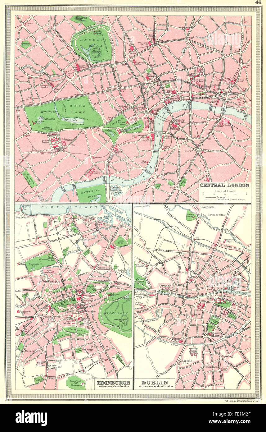 UK: Central London; Edinburgh; Dublin, 1907 antique map Stock Photohttps://www.alamy.com/image-license-details/?v=1https://www.alamy.com/stock-photo-uk-central-london-edinburgh-dublin-1907-antique-map-94694727.html
RFFE1M2F–UK: Central London; Edinburgh; Dublin, 1907 antique map
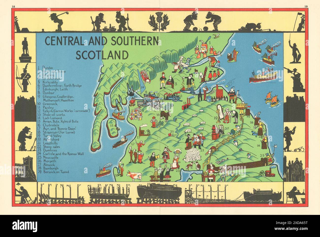 Central and Southern Scotland pictorial map. ALNWICK 1937 old vintage Stock Photohttps://www.alamy.com/image-license-details/?v=1https://www.alamy.com/central-and-southern-scotland-pictorial-map-alnwick-1937-old-vintage-image610577796.html
RF2XDA65T–Central and Southern Scotland pictorial map. ALNWICK 1937 old vintage
 First World War map of the Austro-Italian Frontier, 1915. Stanford's War Maps. No. 14. The Seat of War on the Austro-Italian Frontier. Scale, 1 : 1,140,000 = 18 English miles to 1 inch. London, 30 June 1915. Source: Maps 1035.(90.) no.14. Stock Photohttps://www.alamy.com/image-license-details/?v=1https://www.alamy.com/first-world-war-map-of-the-austro-italian-frontier-1915-stanfords-war-maps-no-14-the-seat-of-war-on-the-austro-italian-frontier-scale-1-1140000-=-18-english-miles-to-1-inch-london-30-june-1915-source-maps-103590-no14-image227199184.html
RMR5HPTG–First World War map of the Austro-Italian Frontier, 1915. Stanford's War Maps. No. 14. The Seat of War on the Austro-Italian Frontier. Scale, 1 : 1,140,000 = 18 English miles to 1 inch. London, 30 June 1915. Source: Maps 1035.(90.) no.14.
 CENTRAL LONDON RAILWAY & ROAD MAP. Underground tube. WARD LOCK, 1937 Stock Photohttps://www.alamy.com/image-license-details/?v=1https://www.alamy.com/stock-photo-central-london-railway-road-map-underground-tube-ward-lock-1937-115418880.html
RFGKNNXT–CENTRAL LONDON RAILWAY & ROAD MAP. Underground tube. WARD LOCK, 1937
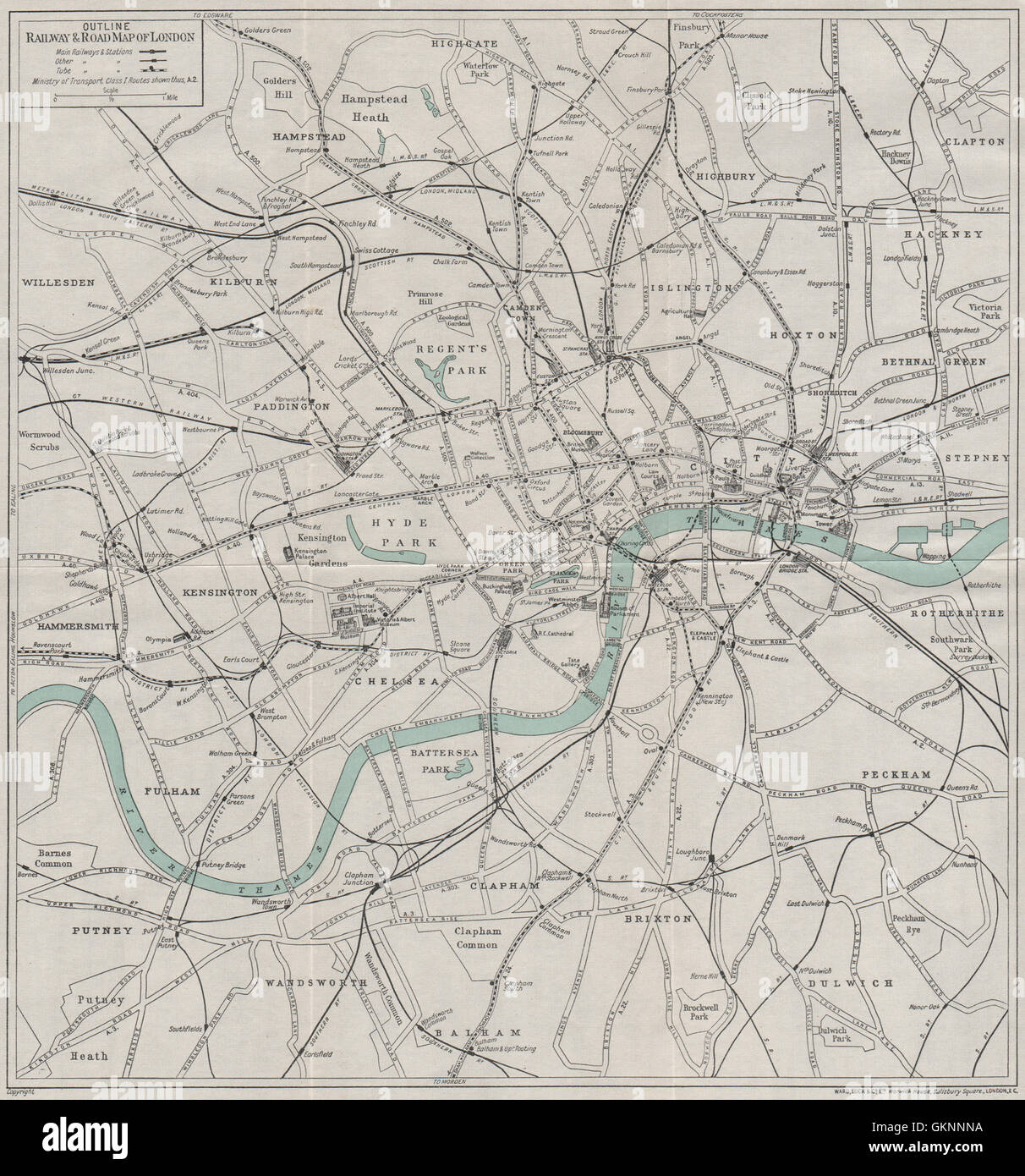 CENTRAL LONDON RAILWAY & ROAD MAP. Underground tube. WARD LOCK, 1933 Stock Photohttps://www.alamy.com/image-license-details/?v=1https://www.alamy.com/stock-photo-central-london-railway-road-map-underground-tube-ward-lock-1933-115418726.html
RFGKNNNA–CENTRAL LONDON RAILWAY & ROAD MAP. Underground tube. WARD LOCK, 1933
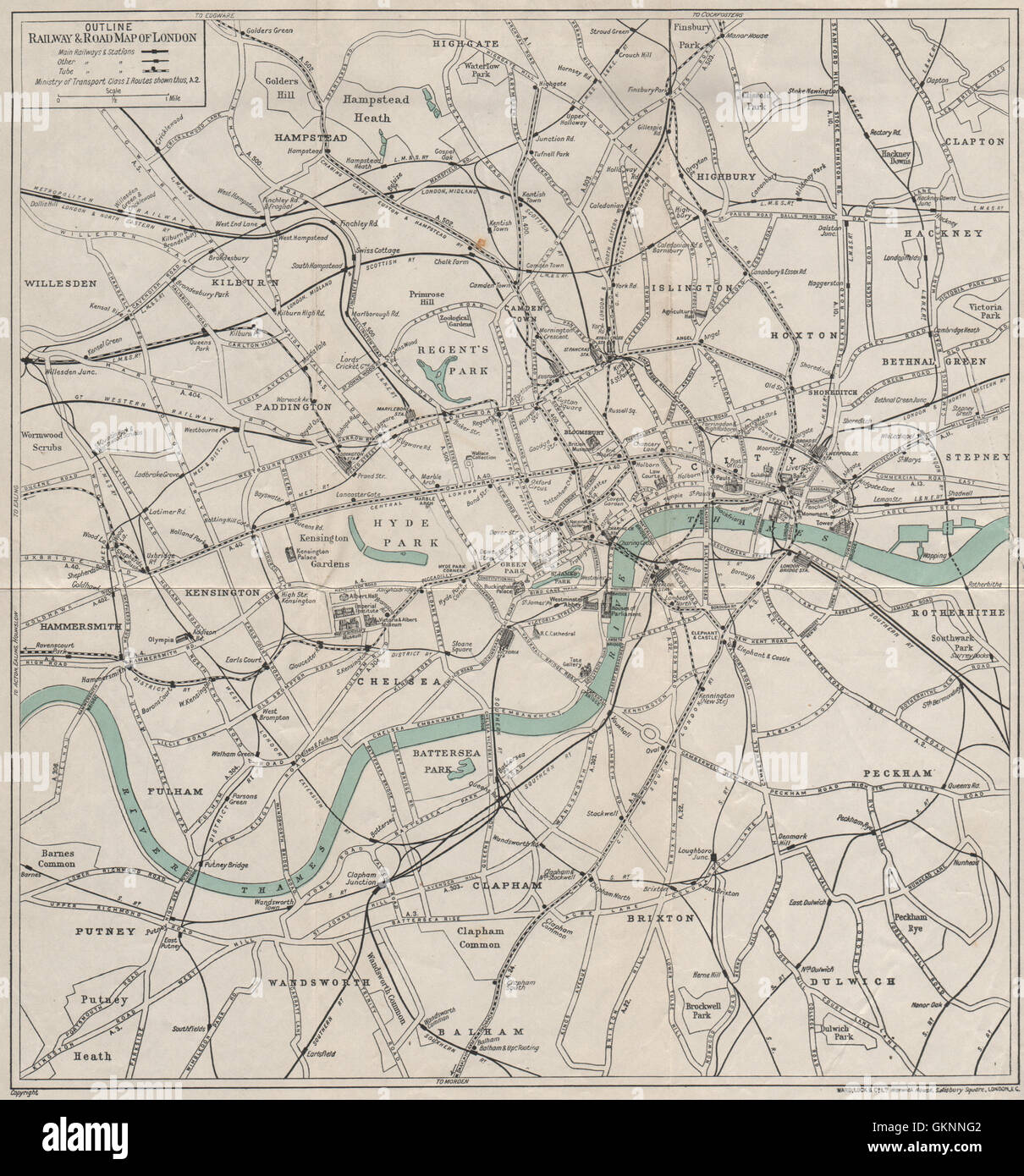 CENTRAL LONDON RAILWAY & ROAD MAP. Underground tube. WARD LOCK, 1932 Stock Photohttps://www.alamy.com/image-license-details/?v=1https://www.alamy.com/stock-photo-central-london-railway-road-map-underground-tube-ward-lock-1932-115418578.html
RFGKNNG2–CENTRAL LONDON RAILWAY & ROAD MAP. Underground tube. WARD LOCK, 1932
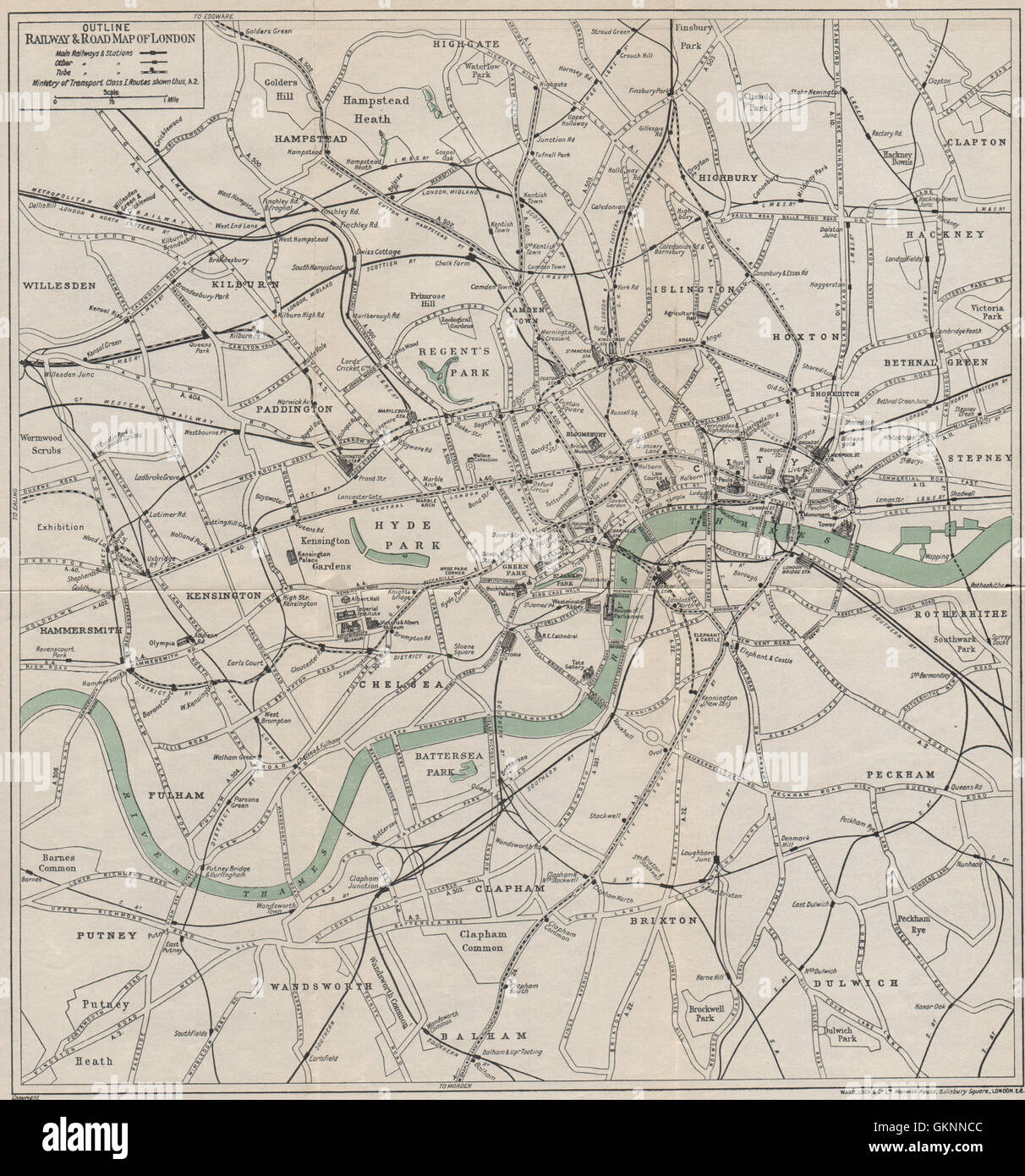 CENTRAL LONDON RAILWAY & ROAD MAP. Underground tube. WARD LOCK, 1930 Stock Photohttps://www.alamy.com/image-license-details/?v=1https://www.alamy.com/stock-photo-central-london-railway-road-map-underground-tube-ward-lock-1930-115418476.html
RFGKNNCC–CENTRAL LONDON RAILWAY & ROAD MAP. Underground tube. WARD LOCK, 1930
 CENTRAL LONDON RAILWAY & ROAD MAP. Underground tube. WARD LOCK, 1927 Stock Photohttps://www.alamy.com/image-license-details/?v=1https://www.alamy.com/stock-photo-central-london-railway-road-map-underground-tube-ward-lock-1927-115418344.html
RFGKNN7M–CENTRAL LONDON RAILWAY & ROAD MAP. Underground tube. WARD LOCK, 1927
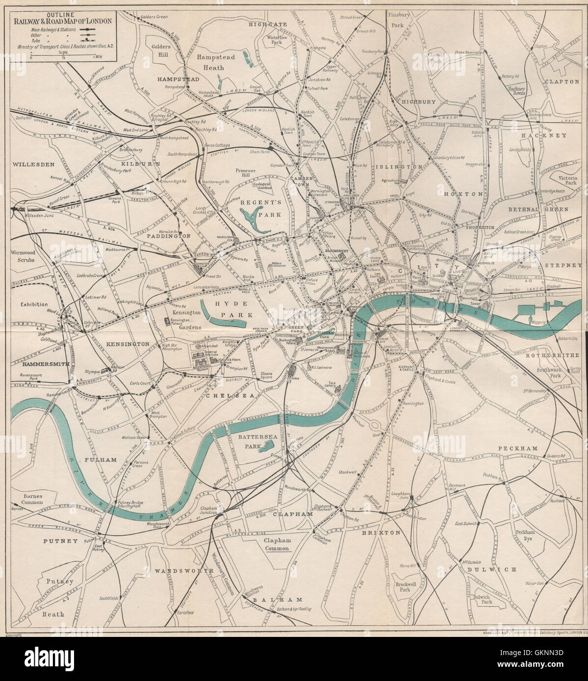 CENTRAL LONDON RAILWAY & ROAD MAP. Underground tube. WARD LOCK, 1925 Stock Photohttps://www.alamy.com/image-license-details/?v=1https://www.alamy.com/stock-photo-central-london-railway-road-map-underground-tube-ward-lock-1925-115418225.html
RFGKNN3D–CENTRAL LONDON RAILWAY & ROAD MAP. Underground tube. WARD LOCK, 1925
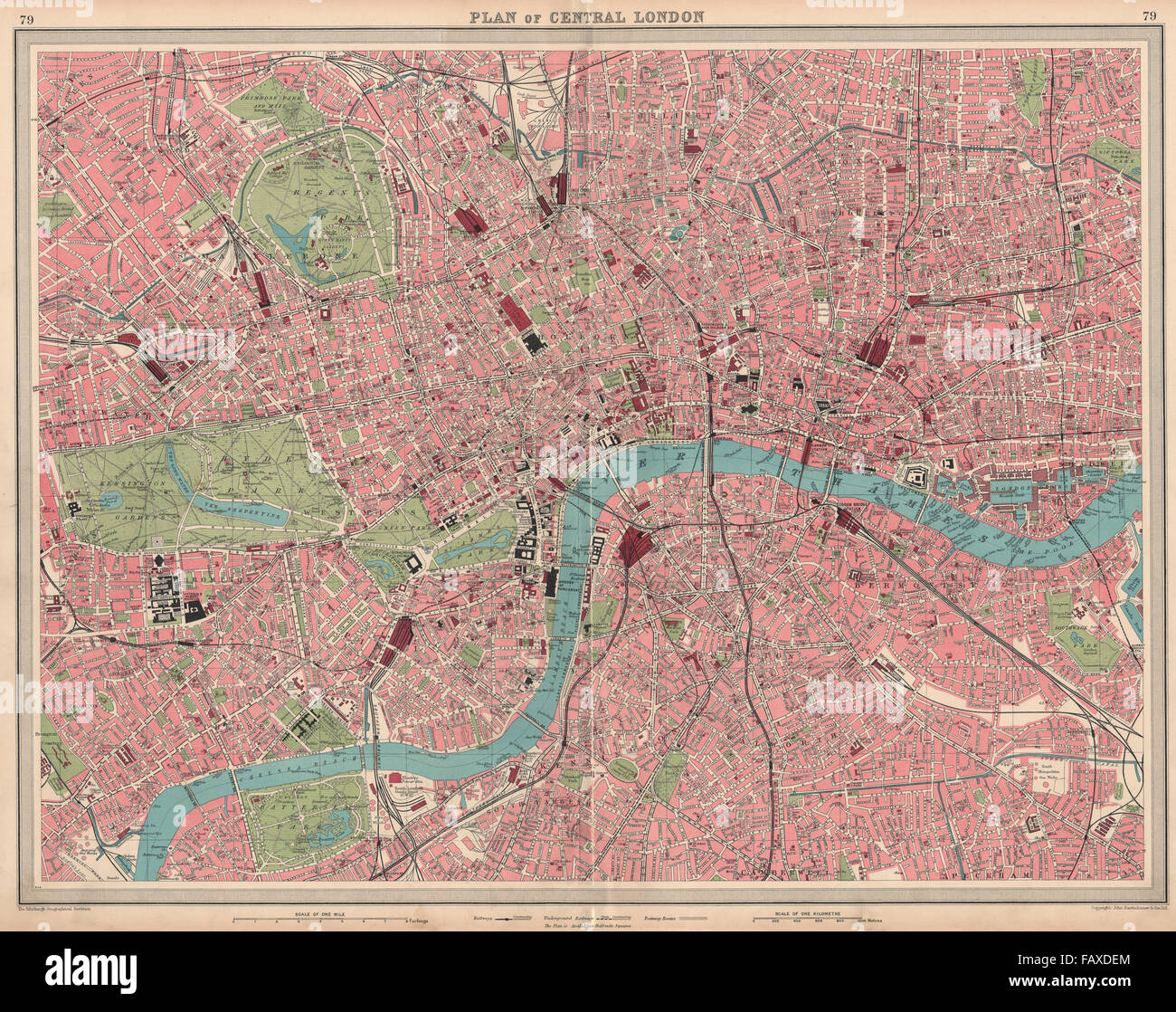 CENTRAL LONDON: Large detailed plan. Railways tube public buildings, 1939 map Stock Photohttps://www.alamy.com/image-license-details/?v=1https://www.alamy.com/stock-photo-central-london-large-detailed-plan-railways-tube-public-buildings-92779756.html
RFFAXDEM–CENTRAL LONDON: Large detailed plan. Railways tube public buildings, 1939 map
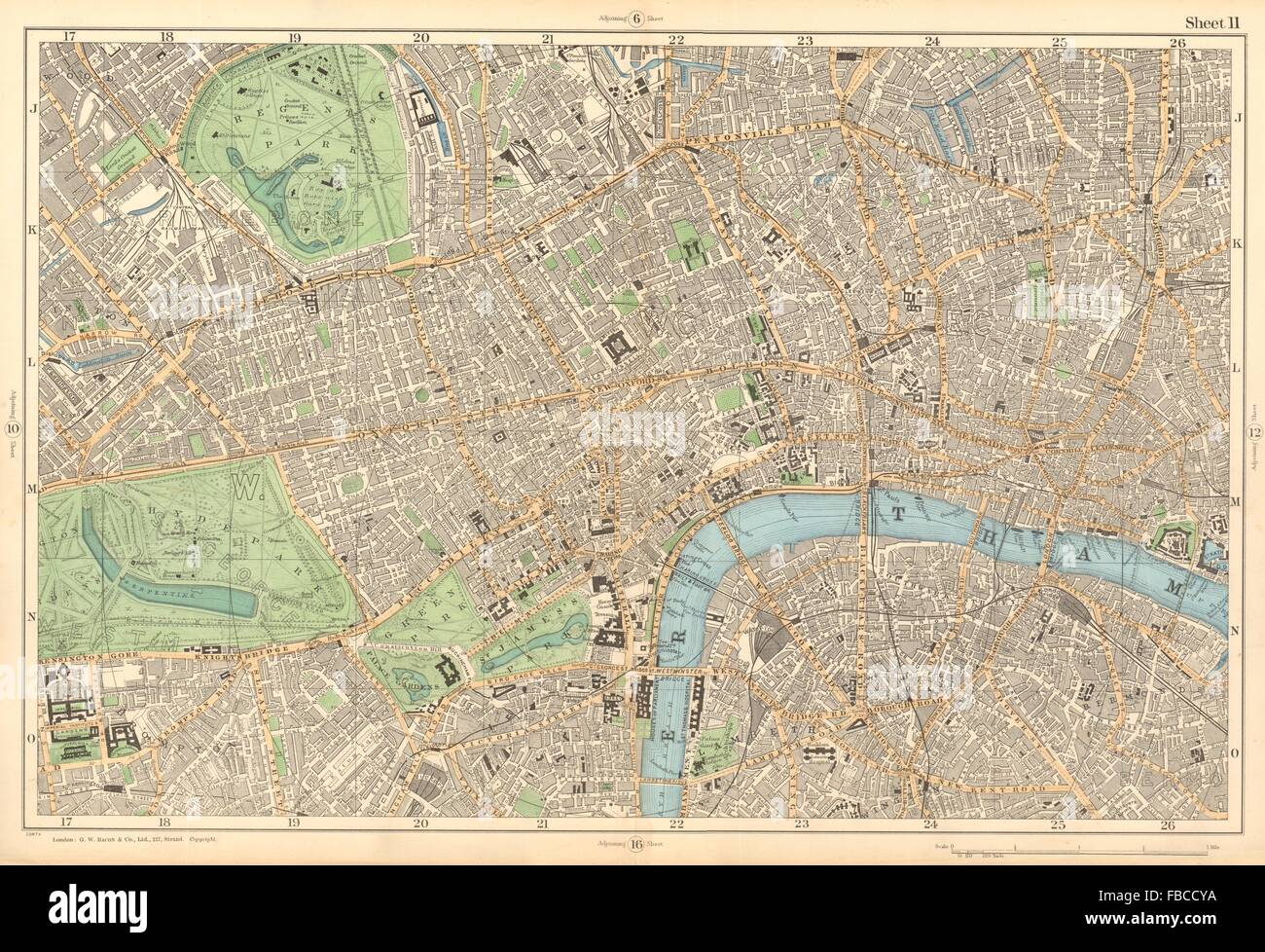 CENTRAL LONDON West End City Southwark Westminster Shoreditch. BACON , 1903 map Stock Photohttps://www.alamy.com/image-license-details/?v=1https://www.alamy.com/stock-photo-central-london-west-end-city-southwark-westminster-shoreditch-bacon-93086654.html
RFFBCCYA–CENTRAL LONDON West End City Southwark Westminster Shoreditch. BACON , 1903 map
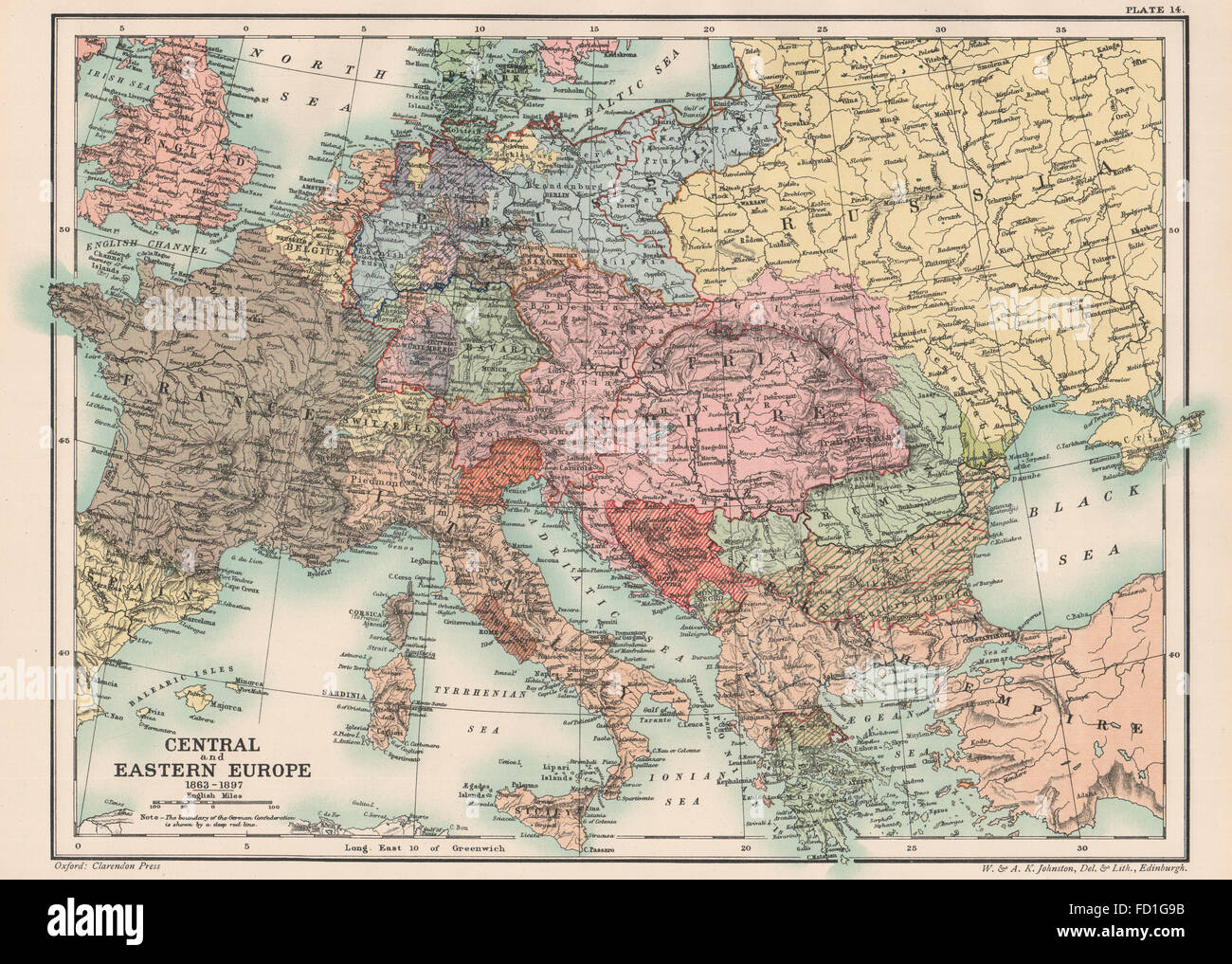 LATE 19TH CENTURY EUROPE: Central and Eastern Europe 1863-1897, 1902 old map Stock Photohttps://www.alamy.com/image-license-details/?v=1https://www.alamy.com/stock-photo-late-19th-century-europe-central-and-eastern-europe-1863-1897-1902-94077127.html
RFFD1G9B–LATE 19TH CENTURY EUROPE: Central and Eastern Europe 1863-1897, 1902 old map
!['Land use zones of Cologne (Koln). Zone maps, Series GSGS 4399. [London] : War Office, 1943-1944. Produced by: Great Britain. Air Ministry. Coverage of large towns throughout Germany, Italy and major occupied cities in other countries of central Europe. Small-scale town area maps overprinted to show vulnerability to high explosive and incendiary bombing. All originally classified 'Secret'. Source: Maps MOD GSGS 4399. Stock Photo 'Land use zones of Cologne (Koln). Zone maps, Series GSGS 4399. [London] : War Office, 1943-1944. Produced by: Great Britain. Air Ministry. Coverage of large towns throughout Germany, Italy and major occupied cities in other countries of central Europe. Small-scale town area maps overprinted to show vulnerability to high explosive and incendiary bombing. All originally classified 'Secret'. Source: Maps MOD GSGS 4399. Stock Photo](https://c8.alamy.com/comp/R52W0G/land-use-zones-of-cologne-koln-zone-maps-series-gsgs-4399-london-war-office-1943-1944-produced-by-great-britain-air-ministry-coverage-of-large-towns-throughout-germany-italy-and-major-occupied-cities-in-other-countries-of-central-europe-small-scale-town-area-maps-overprinted-to-show-vulnerability-to-high-explosive-and-incendiary-bombing-all-originally-classified-secret-source-maps-mod-gsgs-4399-R52W0G.jpg) 'Land use zones of Cologne (Koln). Zone maps, Series GSGS 4399. [London] : War Office, 1943-1944. Produced by: Great Britain. Air Ministry. Coverage of large towns throughout Germany, Italy and major occupied cities in other countries of central Europe. Small-scale town area maps overprinted to show vulnerability to high explosive and incendiary bombing. All originally classified 'Secret'. Source: Maps MOD GSGS 4399. Stock Photohttps://www.alamy.com/image-license-details/?v=1https://www.alamy.com/land-use-zones-of-cologne-koln-zone-maps-series-gsgs-4399-london-war-office-1943-1944-produced-by-great-britain-air-ministry-coverage-of-large-towns-throughout-germany-italy-and-major-occupied-cities-in-other-countries-of-central-europe-small-scale-town-area-maps-overprinted-to-show-vulnerability-to-high-explosive-and-incendiary-bombing-all-originally-classified-secret-source-maps-mod-gsgs-4399-image226871584.html
'Land use zones of Cologne (Koln). Zone maps, Series GSGS 4399. [London] : War Office, 1943-1944. Produced by: Great Britain. Air Ministry. Coverage of large towns throughout Germany, Italy and major occupied cities in other countries of central Europe. Small-scale town area maps overprinted to show vulnerability to high explosive and incendiary bombing. All originally classified 'Secret'. Source: Maps MOD GSGS 4399. Stock Photohttps://www.alamy.com/image-license-details/?v=1https://www.alamy.com/land-use-zones-of-cologne-koln-zone-maps-series-gsgs-4399-london-war-office-1943-1944-produced-by-great-britain-air-ministry-coverage-of-large-towns-throughout-germany-italy-and-major-occupied-cities-in-other-countries-of-central-europe-small-scale-town-area-maps-overprinted-to-show-vulnerability-to-high-explosive-and-incendiary-bombing-all-originally-classified-secret-source-maps-mod-gsgs-4399-image226871584.htmlRMR52W0G–'Land use zones of Cologne (Koln). Zone maps, Series GSGS 4399. [London] : War Office, 1943-1944. Produced by: Great Britain. Air Ministry. Coverage of large towns throughout Germany, Italy and major occupied cities in other countries of central Europe. Small-scale town area maps overprinted to show vulnerability to high explosive and incendiary bombing. All originally classified 'Secret'. Source: Maps MOD GSGS 4399.
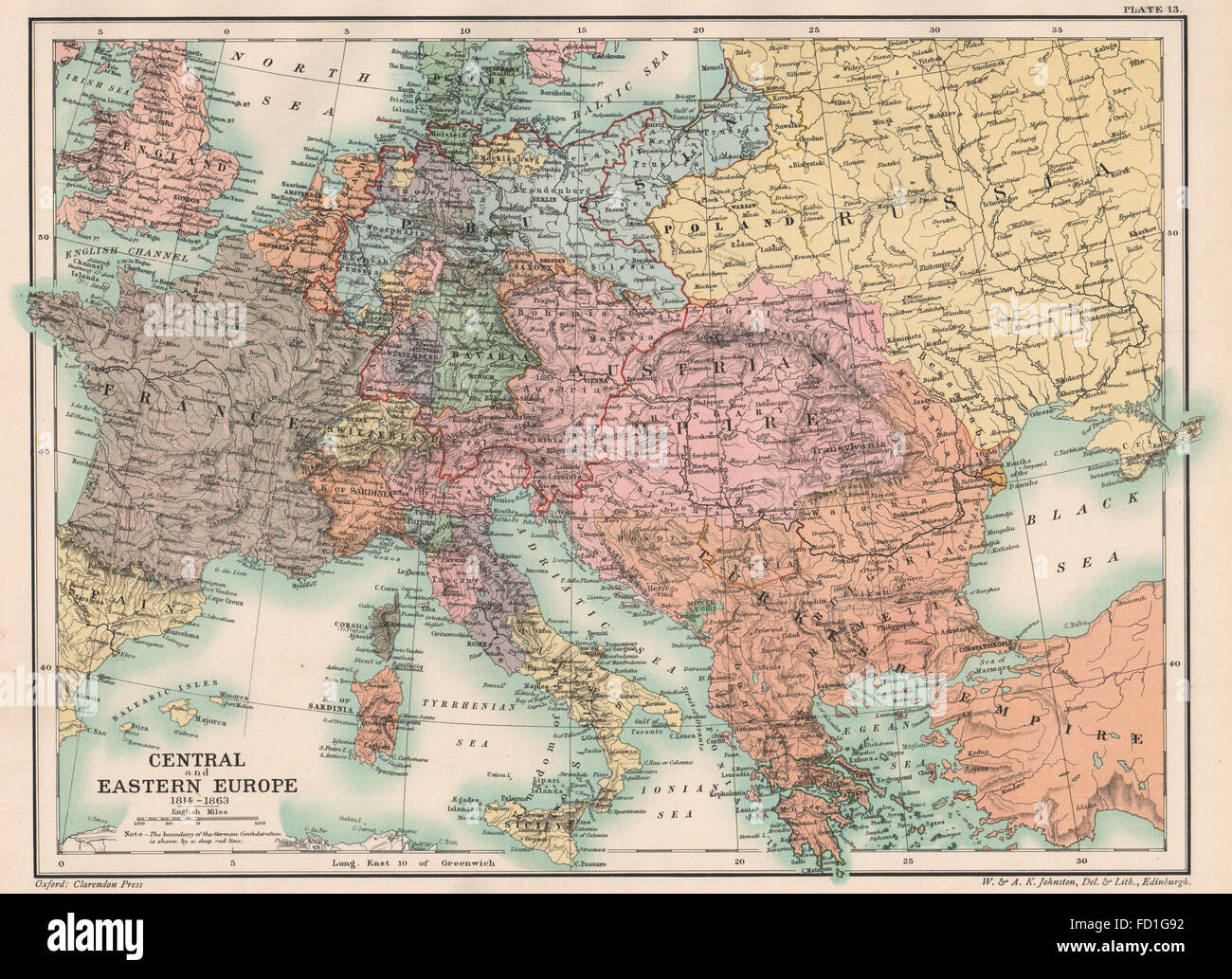 EARLY 19TH CENTURY EUROPE: Central and Eastern Europe 1814-1863, 1902 old map Stock Photohttps://www.alamy.com/image-license-details/?v=1https://www.alamy.com/stock-photo-early-19th-century-europe-central-and-eastern-europe-1814-1863-1902-94077118.html
RFFD1G92–EARLY 19TH CENTURY EUROPE: Central and Eastern Europe 1814-1863, 1902 old map
!['Latest plan of the North Sea island of Borkum'. Borkum is the largest and westernmost of the East Frisian Islands in the North Sea, off the coast of East Frisia in Lower Saxony, Germany. . The Riddle of the Sands. A record of secret service. T. Nelson & Sons: London & Edinburgh, [1910.]. With picture postcard illustrations inserted. The story is set in the Frisian Islands. The 'Riddle of the Sands' is an early example of the espionage novel and is one of the 'invasion' novels that raised British public's awareness of the potential threat of Imperial Germany, and as a result the Royal Navy dev Stock Photo 'Latest plan of the North Sea island of Borkum'. Borkum is the largest and westernmost of the East Frisian Islands in the North Sea, off the coast of East Frisia in Lower Saxony, Germany. . The Riddle of the Sands. A record of secret service. T. Nelson & Sons: London & Edinburgh, [1910.]. With picture postcard illustrations inserted. The story is set in the Frisian Islands. The 'Riddle of the Sands' is an early example of the espionage novel and is one of the 'invasion' novels that raised British public's awareness of the potential threat of Imperial Germany, and as a result the Royal Navy dev Stock Photo](https://c8.alamy.com/comp/R5AETC/latest-plan-of-the-north-sea-island-of-borkum-borkum-is-the-largest-and-westernmost-of-the-east-frisian-islands-in-the-north-sea-off-the-coast-of-east-frisia-in-lower-saxony-germany-the-riddle-of-the-sands-a-record-of-secret-service-t-nelson-sons-london-edinburgh-1910-with-picture-postcard-illustrations-inserted-the-story-is-set-in-the-frisian-islands-the-riddle-of-the-sands-is-an-early-example-of-the-espionage-novel-and-is-one-of-the-invasion-novels-that-raised-british-publics-awareness-of-the-potential-threat-of-imperial-germany-and-as-a-result-the-royal-navy-dev-R5AETC.jpg) 'Latest plan of the North Sea island of Borkum'. Borkum is the largest and westernmost of the East Frisian Islands in the North Sea, off the coast of East Frisia in Lower Saxony, Germany. . The Riddle of the Sands. A record of secret service. T. Nelson & Sons: London & Edinburgh, [1910.]. With picture postcard illustrations inserted. The story is set in the Frisian Islands. The 'Riddle of the Sands' is an early example of the espionage novel and is one of the 'invasion' novels that raised British public's awareness of the potential threat of Imperial Germany, and as a result the Royal Navy dev Stock Photohttps://www.alamy.com/image-license-details/?v=1https://www.alamy.com/latest-plan-of-the-north-sea-island-of-borkum-borkum-is-the-largest-and-westernmost-of-the-east-frisian-islands-in-the-north-sea-off-the-coast-of-east-frisia-in-lower-saxony-germany-the-riddle-of-the-sands-a-record-of-secret-service-t-nelson-sons-london-edinburgh-1910-with-picture-postcard-illustrations-inserted-the-story-is-set-in-the-frisian-islands-the-riddle-of-the-sands-is-an-early-example-of-the-espionage-novel-and-is-one-of-the-invasion-novels-that-raised-british-publics-awareness-of-the-potential-threat-of-imperial-germany-and-as-a-result-the-royal-navy-dev-image227039244.html
'Latest plan of the North Sea island of Borkum'. Borkum is the largest and westernmost of the East Frisian Islands in the North Sea, off the coast of East Frisia in Lower Saxony, Germany. . The Riddle of the Sands. A record of secret service. T. Nelson & Sons: London & Edinburgh, [1910.]. With picture postcard illustrations inserted. The story is set in the Frisian Islands. The 'Riddle of the Sands' is an early example of the espionage novel and is one of the 'invasion' novels that raised British public's awareness of the potential threat of Imperial Germany, and as a result the Royal Navy dev Stock Photohttps://www.alamy.com/image-license-details/?v=1https://www.alamy.com/latest-plan-of-the-north-sea-island-of-borkum-borkum-is-the-largest-and-westernmost-of-the-east-frisian-islands-in-the-north-sea-off-the-coast-of-east-frisia-in-lower-saxony-germany-the-riddle-of-the-sands-a-record-of-secret-service-t-nelson-sons-london-edinburgh-1910-with-picture-postcard-illustrations-inserted-the-story-is-set-in-the-frisian-islands-the-riddle-of-the-sands-is-an-early-example-of-the-espionage-novel-and-is-one-of-the-invasion-novels-that-raised-british-publics-awareness-of-the-potential-threat-of-imperial-germany-and-as-a-result-the-royal-navy-dev-image227039244.htmlRMR5AETC–'Latest plan of the North Sea island of Borkum'. Borkum is the largest and westernmost of the East Frisian Islands in the North Sea, off the coast of East Frisia in Lower Saxony, Germany. . The Riddle of the Sands. A record of secret service. T. Nelson & Sons: London & Edinburgh, [1910.]. With picture postcard illustrations inserted. The story is set in the Frisian Islands. The 'Riddle of the Sands' is an early example of the espionage novel and is one of the 'invasion' novels that raised British public's awareness of the potential threat of Imperial Germany, and as a result the Royal Navy dev
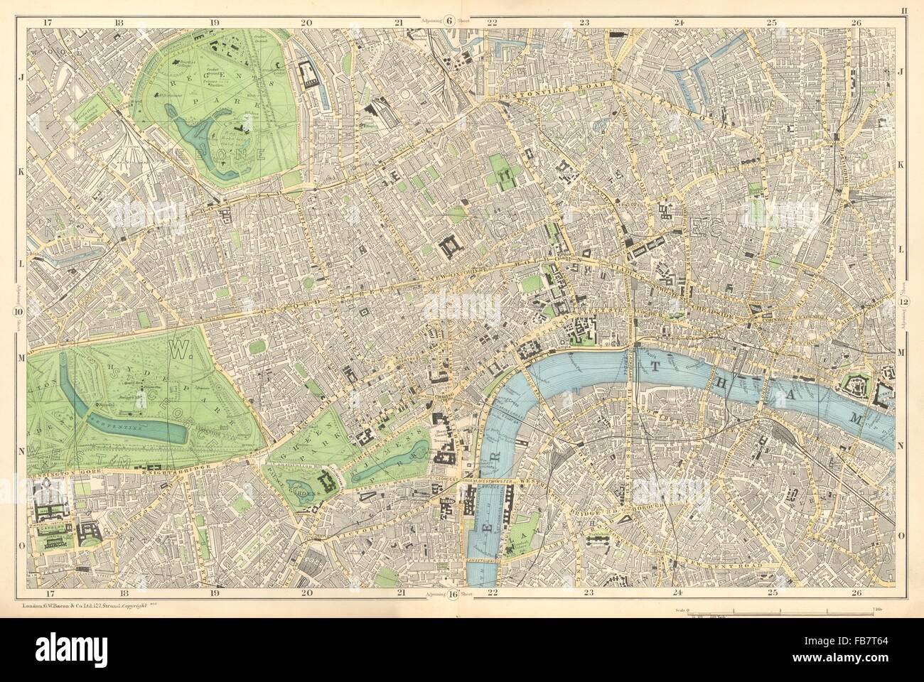 CENTRAL LONDON: West End, City, Southwark,Westminster,Shoreditch.BACON, 1902 map Stock Photohttps://www.alamy.com/image-license-details/?v=1https://www.alamy.com/stock-photo-central-london-west-end-city-southwarkwestminstershoreditchbacon-1902-92985708.html
RFFB7T64–CENTRAL LONDON: West End, City, Southwark,Westminster,Shoreditch.BACON, 1902 map
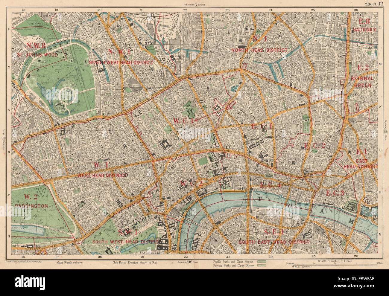 LONDON CENTRAL Westminster West End City Islington Southwark. BACON, 1927 map Stock Photohttps://www.alamy.com/image-license-details/?v=1https://www.alamy.com/stock-photo-london-central-westminster-west-end-city-islington-southwark-bacon-93373911.html
RFFBWFAF–LONDON CENTRAL Westminster West End City Islington Southwark. BACON, 1927 map
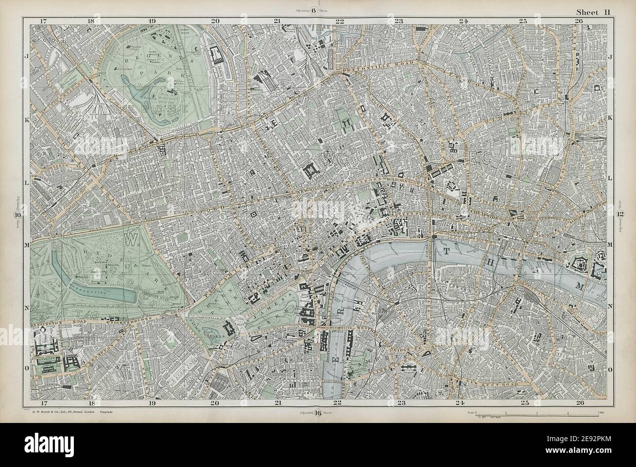 CENTRAL LONDON West End City Southwark Westminster Shoreditch. BACON 1906 map Stock Photohttps://www.alamy.com/image-license-details/?v=1https://www.alamy.com/central-london-west-end-city-southwark-westminster-shoreditch-bacon-1906-map-image401432072.html
RF2E92PKM–CENTRAL LONDON West End City Southwark Westminster Shoreditch. BACON 1906 map
 CENTRAL LONDON-SECTION I vintage town/city plan. London. WARD LOCK 1953 map Stock Photohttps://www.alamy.com/image-license-details/?v=1https://www.alamy.com/central-london-section-i-vintage-towncity-plan-london-ward-lock-1953-map-image568743952.html
RF2T18EM0–CENTRAL LONDON-SECTION I vintage town/city plan. London. WARD LOCK 1953 map
 CENTRAL LONDON-SECTION I vintage city/town plan. London. WARD LOCK 1951 map Stock Photohttps://www.alamy.com/image-license-details/?v=1https://www.alamy.com/central-london-section-i-vintage-citytown-plan-london-ward-lock-1951-map-image568743956.html
RF2T18EM4–CENTRAL LONDON-SECTION I vintage city/town plan. London. WARD LOCK 1951 map
 CENTRAL LONDON-SECTION I vintage town/city plan. London. WARD LOCK 1951 map Stock Photohttps://www.alamy.com/image-license-details/?v=1https://www.alamy.com/central-london-section-i-vintage-towncity-plan-london-ward-lock-1951-map-image568743847.html
RF2T18EG7–CENTRAL LONDON-SECTION I vintage town/city plan. London. WARD LOCK 1951 map
 CENTRAL LONDON-SECTION 3 vintage town/city plan. London. WARD LOCK 1936 map Stock Photohttps://www.alamy.com/image-license-details/?v=1https://www.alamy.com/central-london-section-3-vintage-towncity-plan-london-ward-lock-1936-map-image568745033.html
RF2T18G2H–CENTRAL LONDON-SECTION 3 vintage town/city plan. London. WARD LOCK 1936 map
 CENTRAL LONDON-SECTION II vintage town/city plan. London. WARD LOCK 1953 map Stock Photohttps://www.alamy.com/image-license-details/?v=1https://www.alamy.com/central-london-section-ii-vintage-towncity-plan-london-ward-lock-1953-map-image568743887.html
RF2T18EHK–CENTRAL LONDON-SECTION II vintage town/city plan. London. WARD LOCK 1953 map
 CENTRAL LONDON-SECTION II vintage city/town plan. London. WARD LOCK 1951 map Stock Photohttps://www.alamy.com/image-license-details/?v=1https://www.alamy.com/central-london-section-ii-vintage-citytown-plan-london-ward-lock-1951-map-image568743874.html
RF2T18EH6–CENTRAL LONDON-SECTION II vintage city/town plan. London. WARD LOCK 1951 map
 CENTRAL LONDON-SECTION II vintage town/city plan. London. WARD LOCK 1951 map Stock Photohttps://www.alamy.com/image-license-details/?v=1https://www.alamy.com/central-london-section-ii-vintage-towncity-plan-london-ward-lock-1951-map-image568743953.html
RF2T18EM1–CENTRAL LONDON-SECTION II vintage town/city plan. London. WARD LOCK 1951 map
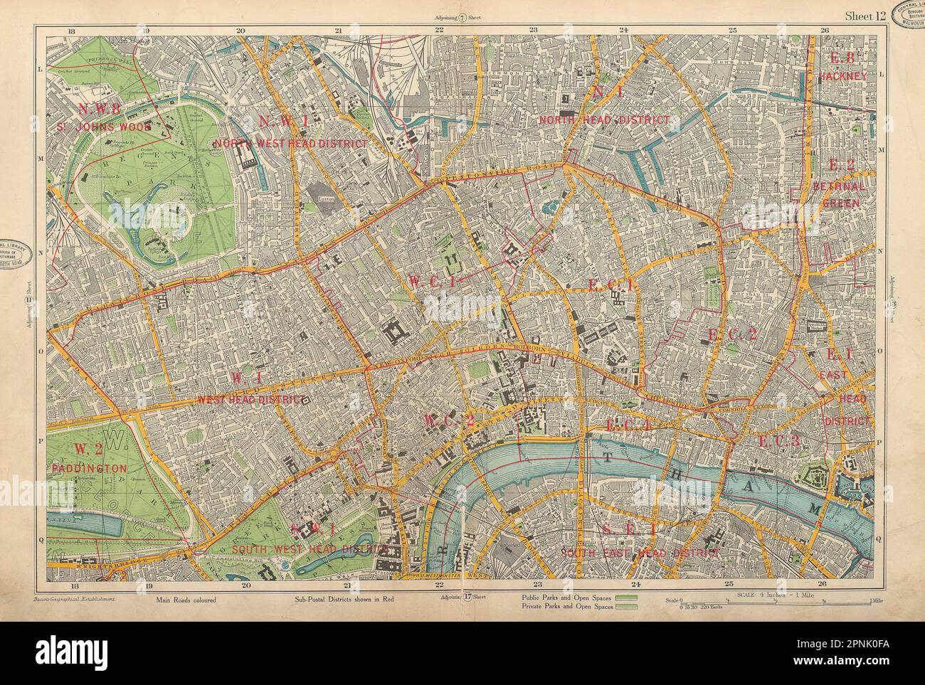 LONDON CENTRAL Westminster West End City Southwark Islington. BACON 1934 map Stock Photohttps://www.alamy.com/image-license-details/?v=1https://www.alamy.com/london-central-westminster-west-end-city-southwark-islington-bacon-1934-map-image546846702.html
RF2PNK0FA–LONDON CENTRAL Westminster West End City Southwark Islington. BACON 1934 map
 Royal Commission on London Traffic. Central line tube station at Bank 1906 map Stock Photohttps://www.alamy.com/image-license-details/?v=1https://www.alamy.com/royal-commission-on-london-traffic-central-line-tube-station-at-bank-1906-map-image623239819.html
RF2Y5Y0MY–Royal Commission on London Traffic. Central line tube station at Bank 1906 map
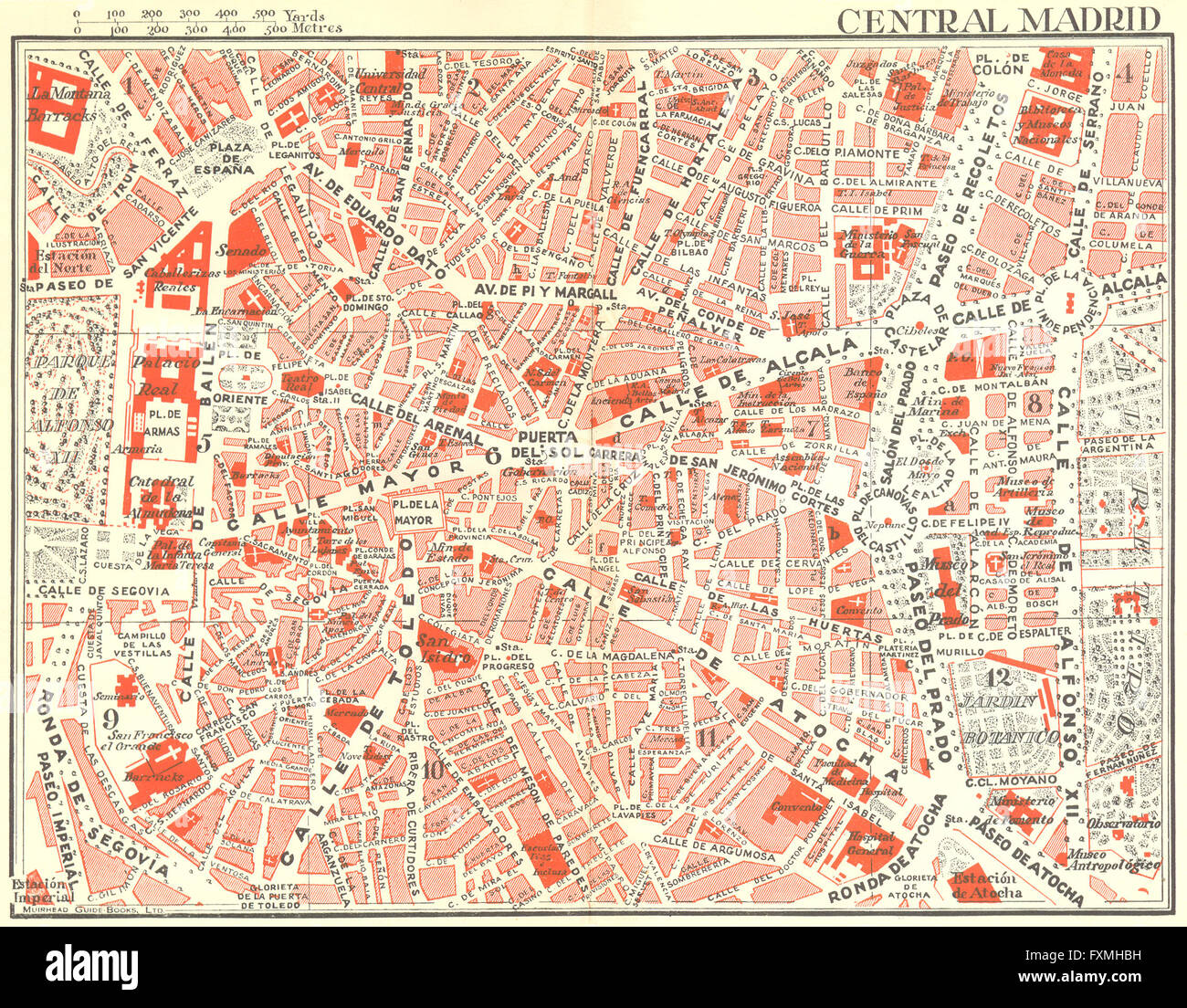 SPAIN: Central Madrid, 1929 vintage map Stock Photohttps://www.alamy.com/image-license-details/?v=1https://www.alamy.com/stock-photo-spain-central-madrid-1929-vintage-map-102485589.html
RFFXMHBH–SPAIN: Central Madrid, 1929 vintage map
 Central Japan. BARTHOLOMEW, 1904 antique map Stock Photohttps://www.alamy.com/image-license-details/?v=1https://www.alamy.com/stock-photo-central-japan-bartholomew-1904-antique-map-115385562.html
RFGKM7CX–Central Japan. BARTHOLOMEW, 1904 antique map
 BELGIUM: Ghent(central), 1929 vintage map Stock Photohttps://www.alamy.com/image-license-details/?v=1https://www.alamy.com/stock-photo-belgium-ghentcentral-1929-vintage-map-102483561.html
RFFXMER5–BELGIUM: Ghent(central), 1929 vintage map
 BELGIUM: Antwerp(central), 1929 vintage map Stock Photohttps://www.alamy.com/image-license-details/?v=1https://www.alamy.com/stock-photo-belgium-antwerpcentral-1929-vintage-map-102483576.html
RFFXMERM–BELGIUM: Antwerp(central), 1929 vintage map
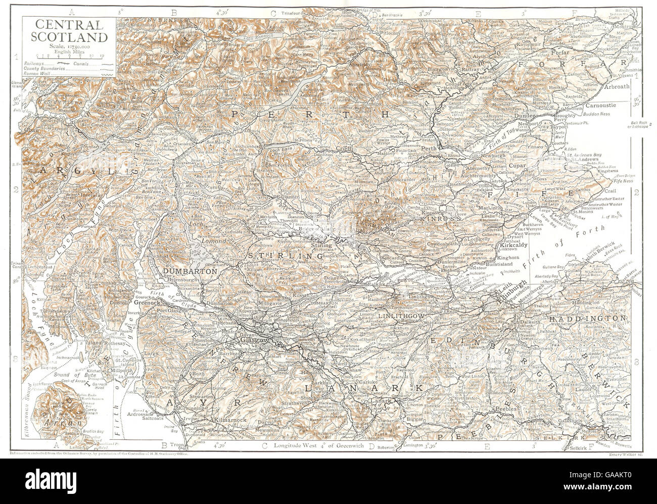 SCOTLAND: Central Scotland, 1910 antique map Stock Photohttps://www.alamy.com/image-license-details/?v=1https://www.alamy.com/stock-photo-scotland-central-scotland-1910-antique-map-109643856.html
RFGAAKT0–SCOTLAND: Central Scotland, 1910 antique map
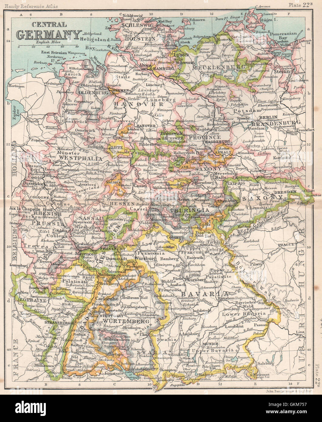 Central Germany showing states. BARTHOLOMEW, 1904 antique map Stock Photohttps://www.alamy.com/image-license-details/?v=1https://www.alamy.com/stock-photo-central-germany-showing-states-bartholomew-1904-antique-map-115385347.html
RFGKM757–Central Germany showing states. BARTHOLOMEW, 1904 antique map
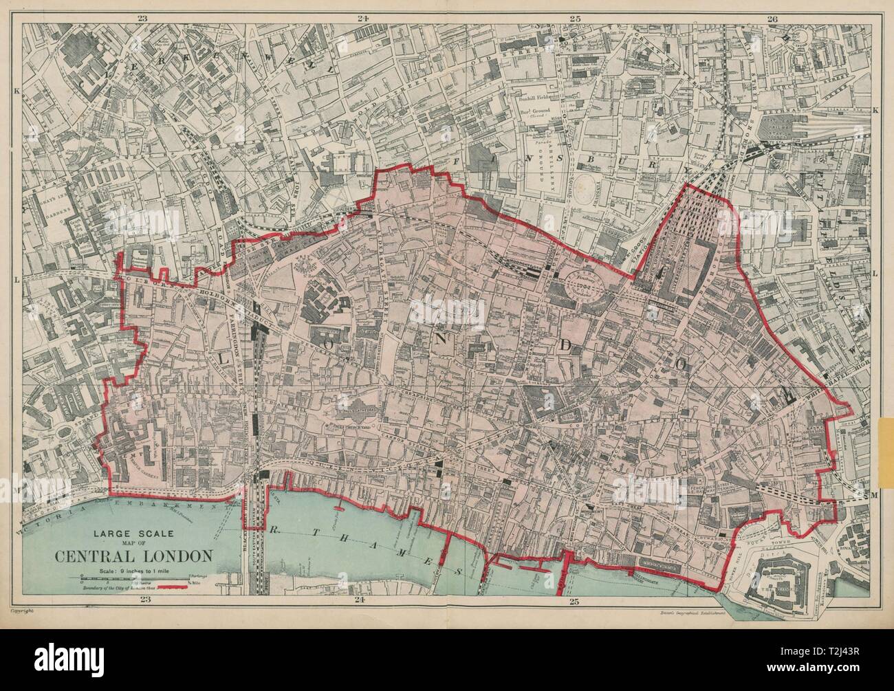 The CITY OF LONDON. The Square Mile. BACON 1919 old vintage map plan chart Stock Photohttps://www.alamy.com/image-license-details/?v=1https://www.alamy.com/the-city-of-london-the-square-mile-bacon-1919-old-vintage-map-plan-chart-image242572843.html
RFT2J43R–The CITY OF LONDON. The Square Mile. BACON 1919 old vintage map plan chart
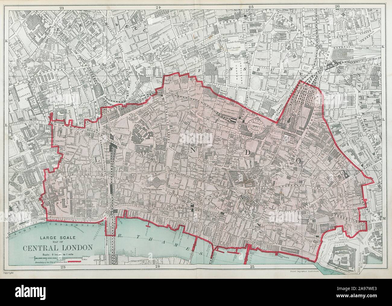 The CITY OF LONDON. The Square Mile. BACON 1920 old vintage map plan chart Stock Photohttps://www.alamy.com/image-license-details/?v=1https://www.alamy.com/the-city-of-london-the-square-mile-bacon-1920-old-vintage-map-plan-chart-image332702555.html
RF2A97WE3–The CITY OF LONDON. The Square Mile. BACON 1920 old vintage map plan chart
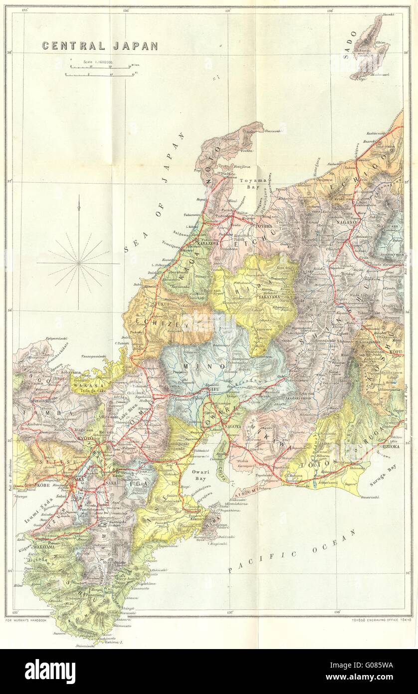 JAPAN: Central, 1907 antique map Stock Photohttps://www.alamy.com/image-license-details/?v=1https://www.alamy.com/stock-photo-japan-central-1907-antique-map-103442454.html
RFG085WA–JAPAN: Central, 1907 antique map
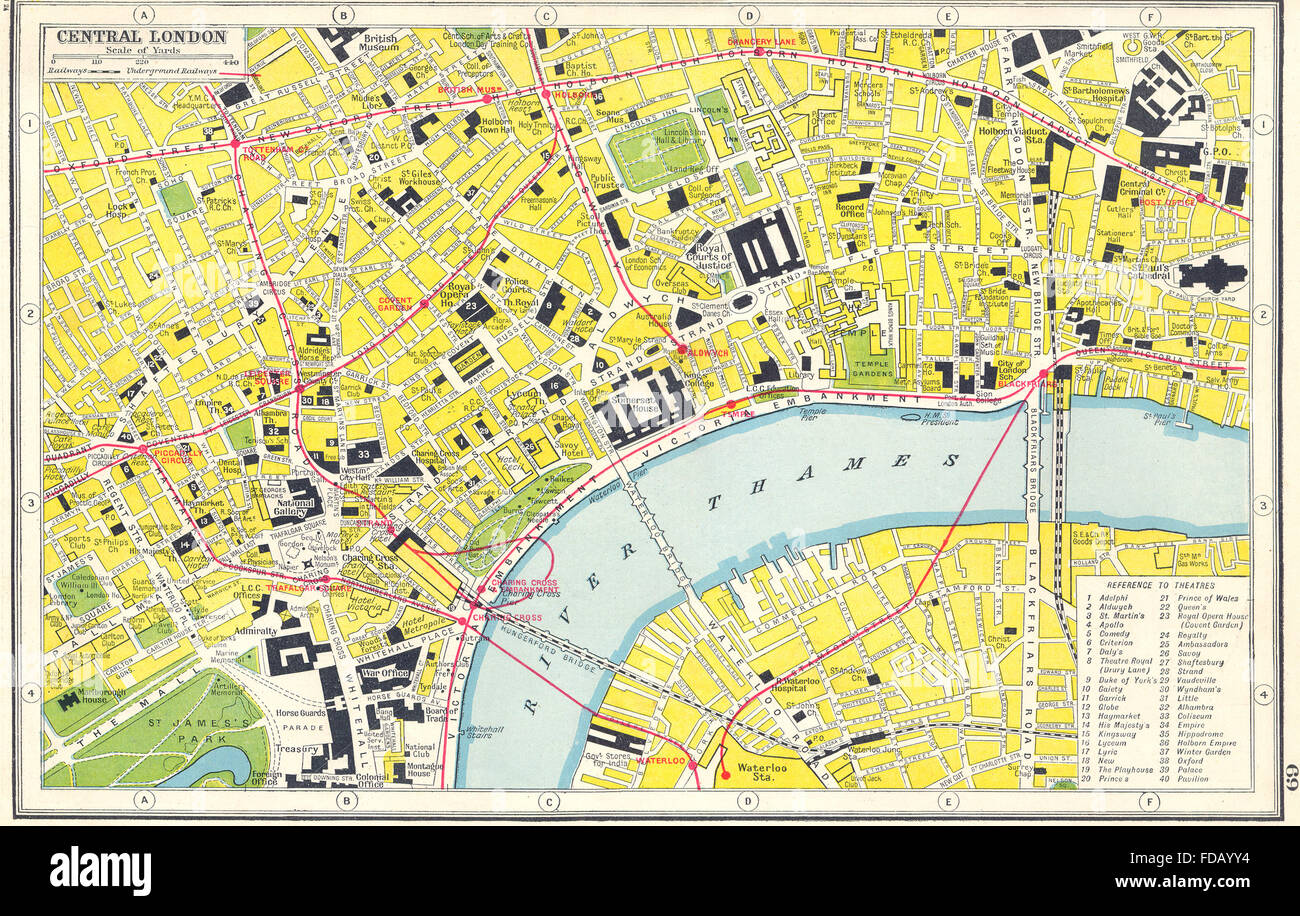 WEST END THEATRES: Central London. HARMSWORTH, 1920 vintage map Stock Photohttps://www.alamy.com/image-license-details/?v=1https://www.alamy.com/stock-photo-west-end-theatres-central-london-harmsworth-1920-vintage-map-94283816.html
RFFDAYY4–WEST END THEATRES: Central London. HARMSWORTH, 1920 vintage map
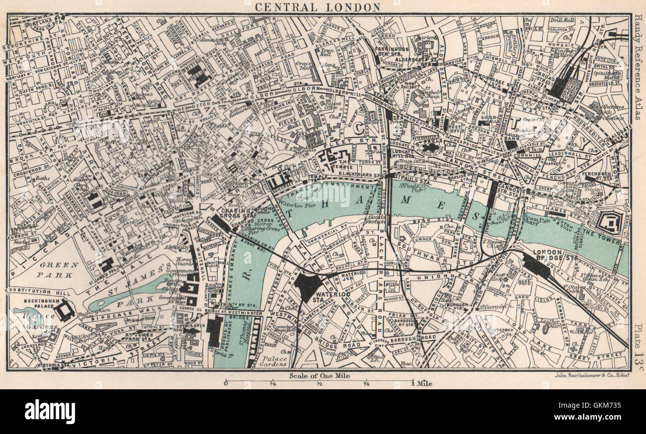 Central London town/city plan. BARTHOLOMEW, 1904 antique map Stock Photohttps://www.alamy.com/image-license-details/?v=1https://www.alamy.com/stock-photo-central-london-towncity-plan-bartholomew-1904-antique-map-115385289.html
RFGKM735–Central London town/city plan. BARTHOLOMEW, 1904 antique map
 CENTRAL LONDON antique town/city plan. BARTHOLOMEW, 1904 antique map Stock Photohttps://www.alamy.com/image-license-details/?v=1https://www.alamy.com/stock-photo-central-london-antique-towncity-plan-bartholomew-1904-antique-map-114921343.html
RFGJY39K–CENTRAL LONDON antique town/city plan. BARTHOLOMEW, 1904 antique map
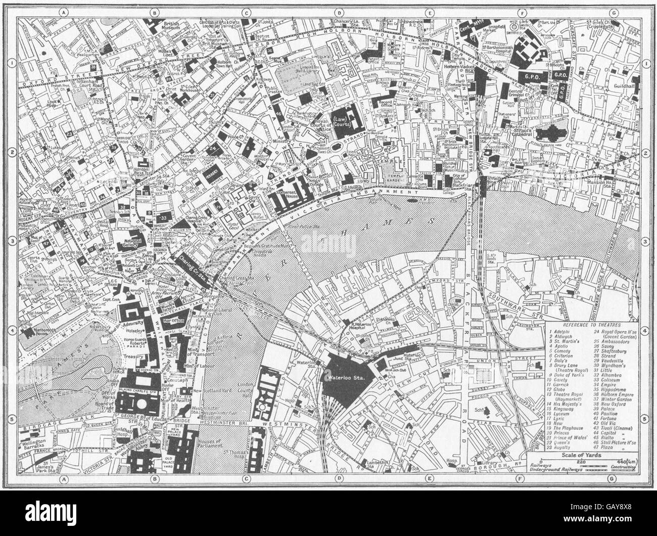 LONDON: Central: guide to theatres & main Cinemas, 1926 vintage map Stock Photohttps://www.alamy.com/image-license-details/?v=1https://www.alamy.com/stock-photo-london-central-guide-to-theatres-main-cinemas-1926-vintage-map-110008480.html
RFGAY8X8–LONDON: Central: guide to theatres & main Cinemas, 1926 vintage map
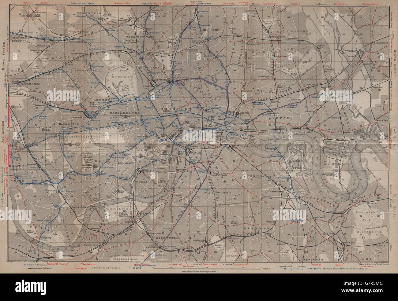 CENTRAL LONDON TRANSPORT. Railways tramways underground tube lines, 1930 map Stock Photohttps://www.alamy.com/image-license-details/?v=1https://www.alamy.com/stock-photo-central-london-transport-railways-tramways-underground-tube-lines-108074192.html
RFG7R5MG–CENTRAL LONDON TRANSPORT. Railways tramways underground tube lines, 1930 map
 CENTRAL LONDON TRANSPORT. Railways & underground tube lines. BAEDEKER, 1905 map Stock Photohttps://www.alamy.com/image-license-details/?v=1https://www.alamy.com/stock-photo-central-london-transport-railways-underground-tube-lines-baedeker-108072677.html
RFG7R3PD–CENTRAL LONDON TRANSPORT. Railways & underground tube lines. BAEDEKER, 1905 map
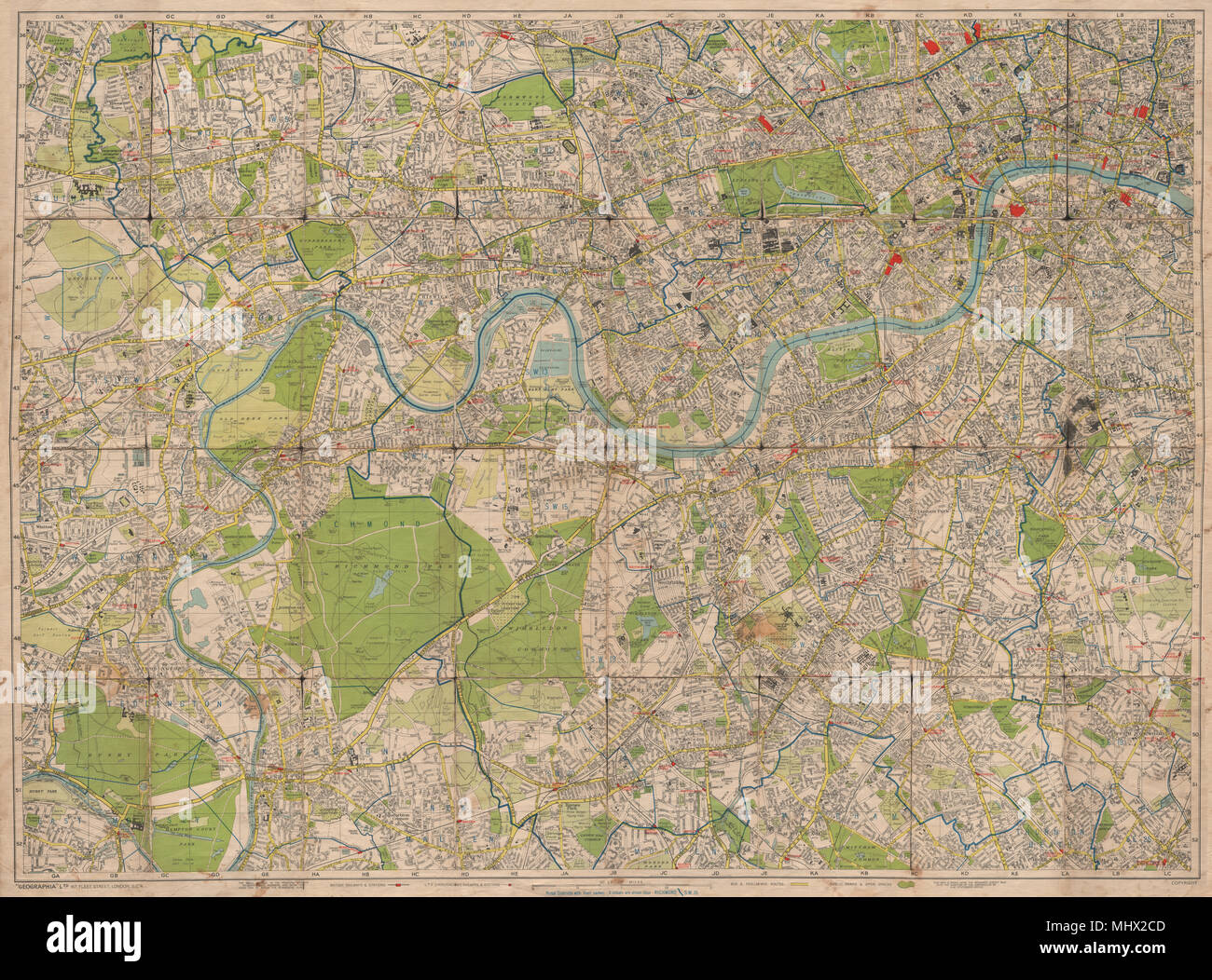 SOUTH WEST & CENTRAL LONDON. Railways stations tube.LARGE. GEOGRAPHIA c1947 map Stock Photohttps://www.alamy.com/image-license-details/?v=1https://www.alamy.com/south-west-central-london-railways-stations-tubelarge-geographia-c1947-map-image183125501.html
RFMHX2CD–SOUTH WEST & CENTRAL LONDON. Railways stations tube.LARGE. GEOGRAPHIA c1947 map
 CENTRAL LONDON TRANSPORT. Railways & underground tube lines. BAEDEKER 1906 map Stock Photohttps://www.alamy.com/image-license-details/?v=1https://www.alamy.com/stock-photo-central-london-transport-railways-underground-tube-lines-baedeker-122811301.html
RFH3PF1W–CENTRAL LONDON TRANSPORT. Railways & underground tube lines. BAEDEKER 1906 map
 CENTRAL LONDON Bayswater Kensington Mayfair Southwark City Docks, 1930 old map Stock Photohttps://www.alamy.com/image-license-details/?v=1https://www.alamy.com/stock-photo-central-london-bayswater-kensington-mayfair-southwark-city-docks-1930-108073746.html
RFG7R54J–CENTRAL LONDON Bayswater Kensington Mayfair Southwark City Docks, 1930 old map
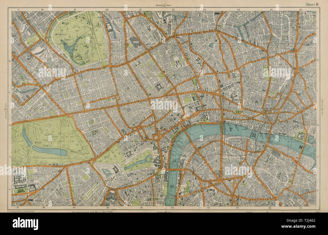 CENTRAL LONDON West End City Southwark Westminster Shoreditch. BACON 1919 map Stock Photohttps://www.alamy.com/image-license-details/?v=1https://www.alamy.com/central-london-west-end-city-southwark-westminster-shoreditch-bacon-1919-map-image242572906.html
RFT2J462–CENTRAL LONDON West End City Southwark Westminster Shoreditch. BACON 1919 map
 CENTRAL LONDON Bayswater Kensington Mayfair Southwark City Docks, 1905 old map Stock Photohttps://www.alamy.com/image-license-details/?v=1https://www.alamy.com/stock-photo-central-london-bayswater-kensington-mayfair-southwark-city-docks-1905-108072571.html
RFG7R3JK–CENTRAL LONDON Bayswater Kensington Mayfair Southwark City Docks, 1905 old map
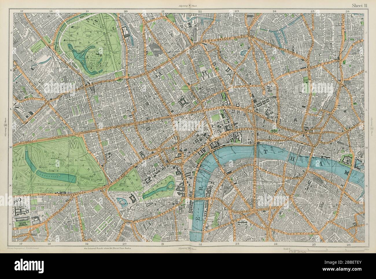 CENTRAL LONDON West End City Southwark Westminster Shoreditch. BACON 1913 map Stock Photohttps://www.alamy.com/image-license-details/?v=1https://www.alamy.com/central-london-west-end-city-southwark-westminster-shoreditch-bacon-1913-map-image351295139.html
RF2BBETEY–CENTRAL LONDON West End City Southwark Westminster Shoreditch. BACON 1913 map
 CENTRAL LONDON TRANSPORT. Railways & underground tube lines. BAEDEKER 1927 map Stock Photohttps://www.alamy.com/image-license-details/?v=1https://www.alamy.com/stock-photo-central-london-transport-railways-underground-tube-lines-baedeker-122812082.html
RFH3PG1P–CENTRAL LONDON TRANSPORT. Railways & underground tube lines. BAEDEKER 1927 map
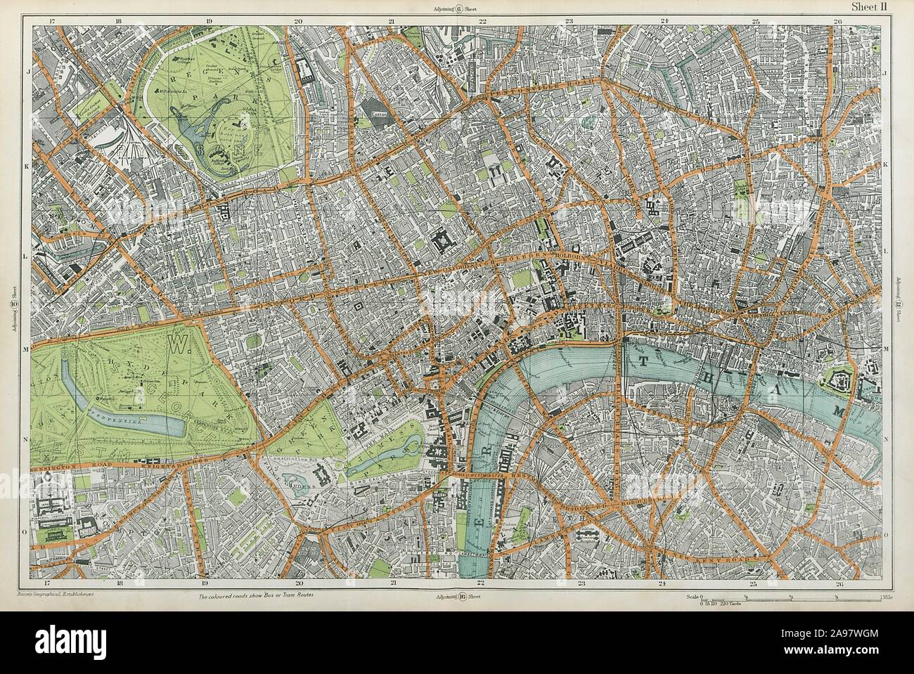 CENTRAL LONDON West End City Southwark Westminster Shoreditch. BACON 1920 map Stock Photohttps://www.alamy.com/image-license-details/?v=1https://www.alamy.com/central-london-west-end-city-southwark-westminster-shoreditch-bacon-1920-map-image332702628.html
RF2A97WGM–CENTRAL LONDON West End City Southwark Westminster Shoreditch. BACON 1920 map
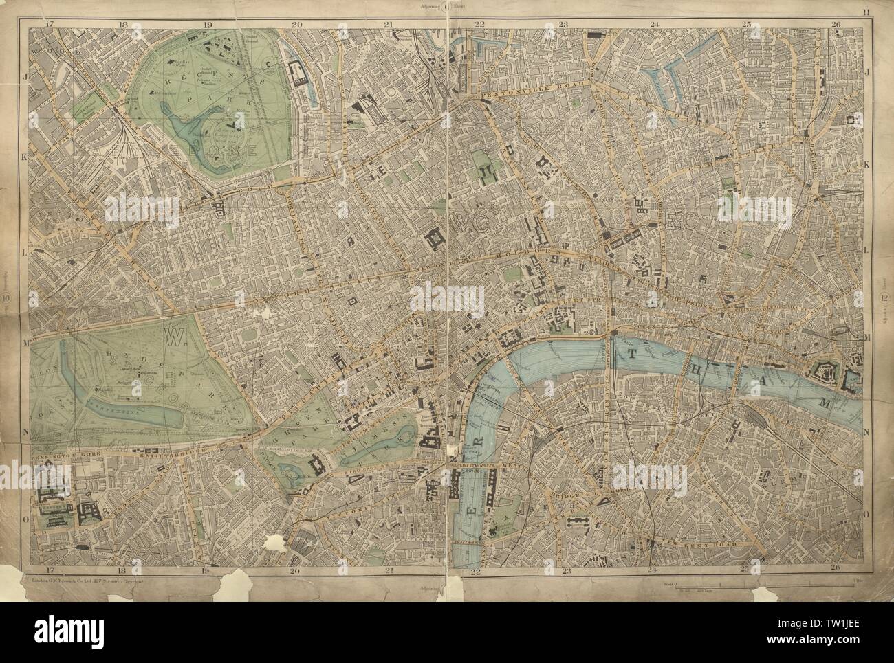 CENTRAL LONDON West End City Westminster Southwark Shoreditch BACON 1900 map Stock Photohttps://www.alamy.com/image-license-details/?v=1https://www.alamy.com/central-london-west-end-city-westminster-southwark-shoreditch-bacon-1900-map-image256348022.html
RFTW1JEE–CENTRAL LONDON West End City Westminster Southwark Shoreditch BACON 1900 map
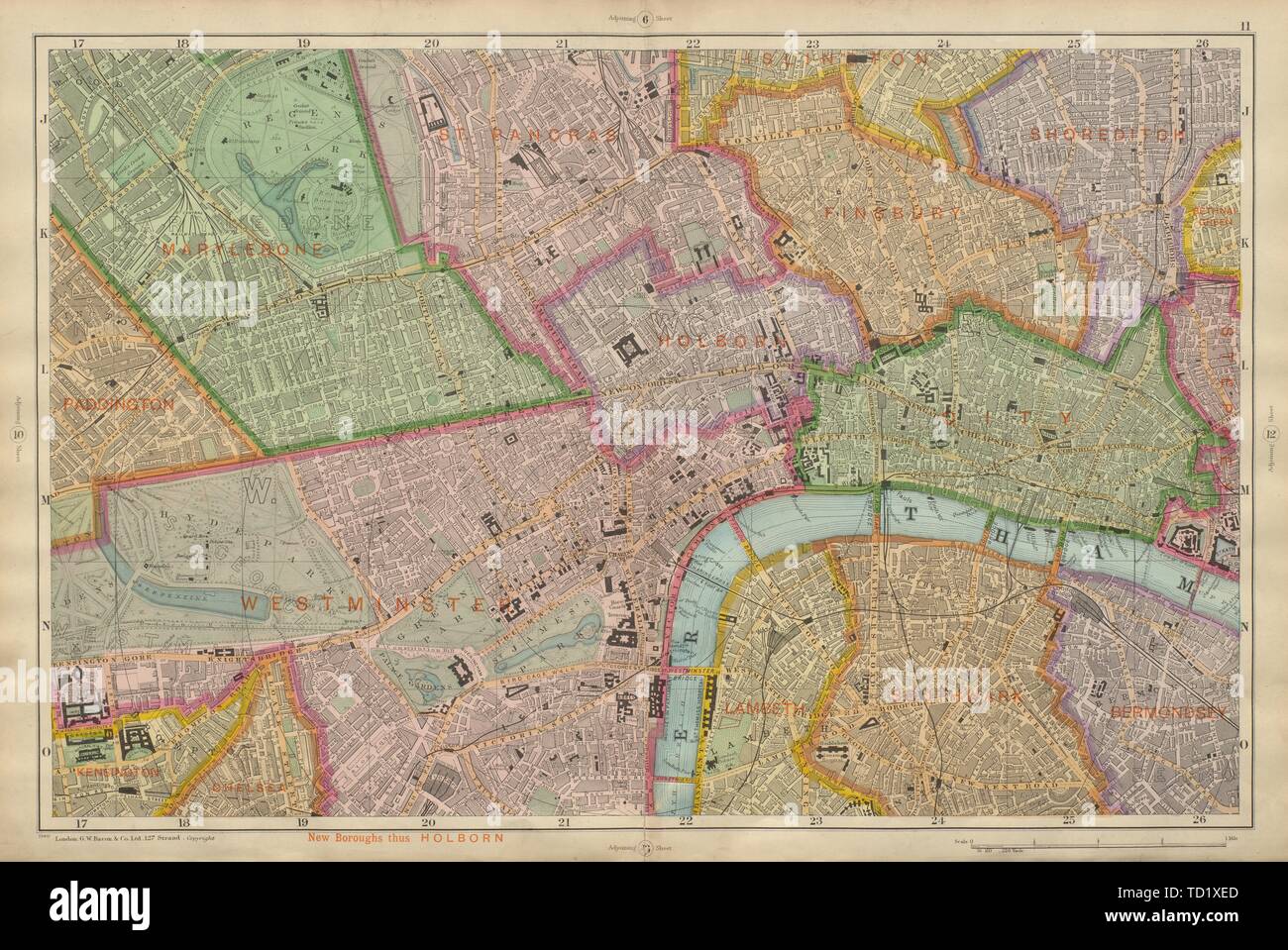 CENTRAL LONDON West End City Southwark Westminster Shoreditch BACON 1900 map Stock Photohttps://www.alamy.com/image-license-details/?v=1https://www.alamy.com/central-london-west-end-city-southwark-westminster-shoreditch-bacon-1900-map-image248978421.html
RFTD1XED–CENTRAL LONDON West End City Southwark Westminster Shoreditch BACON 1900 map
 CENTRAL LONDON-SECTION 2 vintage town/city plan. London. WARD LOCK, 1937 map Stock Photohttps://www.alamy.com/image-license-details/?v=1https://www.alamy.com/stock-photo-central-london-section-2-vintage-towncity-plan-london-ward-lock-1937-115418861.html
RFGKNNX5–CENTRAL LONDON-SECTION 2 vintage town/city plan. London. WARD LOCK, 1937 map
 CENTRAL LONDON-SECTION 3 vintage town/city plan. London. WARD LOCK, 1937 map Stock Photohttps://www.alamy.com/image-license-details/?v=1https://www.alamy.com/stock-photo-central-london-section-3-vintage-towncity-plan-london-ward-lock-1937-115418970.html
RFGKNP22–CENTRAL LONDON-SECTION 3 vintage town/city plan. London. WARD LOCK, 1937 map
 CENTRAL LONDON-SECTION 2 vintage town/city plan. London. WARD LOCK, 1933 map Stock Photohttps://www.alamy.com/image-license-details/?v=1https://www.alamy.com/stock-photo-central-london-section-2-vintage-towncity-plan-london-ward-lock-1933-115418705.html
RFGKNNMH–CENTRAL LONDON-SECTION 2 vintage town/city plan. London. WARD LOCK, 1933 map
 CENTRAL LONDON-SECTION 3 vintage town/city plan. London. WARD LOCK, 1933 map Stock Photohttps://www.alamy.com/image-license-details/?v=1https://www.alamy.com/stock-photo-central-london-section-3-vintage-towncity-plan-london-ward-lock-1933-115418776.html
RFGKNNR4–CENTRAL LONDON-SECTION 3 vintage town/city plan. London. WARD LOCK, 1933 map
 CENTRAL LONDON-SECTION 2 vintage town/city plan. London. WARD LOCK, 1932 map Stock Photohttps://www.alamy.com/image-license-details/?v=1https://www.alamy.com/stock-photo-central-london-section-2-vintage-towncity-plan-london-ward-lock-1932-115418557.html
RFGKNNF9–CENTRAL LONDON-SECTION 2 vintage town/city plan. London. WARD LOCK, 1932 map
 CENTRAL LONDON-SECTION 3 vintage town/city plan. London. WARD LOCK, 1932 map Stock Photohttps://www.alamy.com/image-license-details/?v=1https://www.alamy.com/stock-photo-central-london-section-3-vintage-towncity-plan-london-ward-lock-1932-115418614.html
RFGKNNHA–CENTRAL LONDON-SECTION 3 vintage town/city plan. London. WARD LOCK, 1932 map
 CENTRAL LONDON-SECTION 2 vintage town/city plan. London. WARD LOCK, 1930 map Stock Photohttps://www.alamy.com/image-license-details/?v=1https://www.alamy.com/stock-photo-central-london-section-2-vintage-towncity-plan-london-ward-lock-1930-115418464.html
RFGKNNC0–CENTRAL LONDON-SECTION 2 vintage town/city plan. London. WARD LOCK, 1930 map
 CENTRAL LONDON-SECTION 3 vintage town/city plan. London. WARD LOCK, 1930 map Stock Photohttps://www.alamy.com/image-license-details/?v=1https://www.alamy.com/stock-photo-central-london-section-3-vintage-towncity-plan-london-ward-lock-1930-115418522.html
RFGKNNE2–CENTRAL LONDON-SECTION 3 vintage town/city plan. London. WARD LOCK, 1930 map
 CENTRAL LONDON-SECTION 2 vintage town/city plan. London. WARD LOCK, 1927 map Stock Photohttps://www.alamy.com/image-license-details/?v=1https://www.alamy.com/stock-photo-central-london-section-2-vintage-towncity-plan-london-ward-lock-1927-115418333.html
RFGKNN79–CENTRAL LONDON-SECTION 2 vintage town/city plan. London. WARD LOCK, 1927 map
 CENTRAL LONDON-SECTION 3 vintage town/city plan. London. WARD LOCK, 1927 map Stock Photohttps://www.alamy.com/image-license-details/?v=1https://www.alamy.com/stock-photo-central-london-section-3-vintage-towncity-plan-london-ward-lock-1927-115418378.html
RFGKNN8X–CENTRAL LONDON-SECTION 3 vintage town/city plan. London. WARD LOCK, 1927 map
 CENTRAL LONDON-SECTION 2 vintage town/city plan. London. WARD LOCK, 1925 map Stock Photohttps://www.alamy.com/image-license-details/?v=1https://www.alamy.com/stock-photo-central-london-section-2-vintage-towncity-plan-london-ward-lock-1925-115418195.html
RFGKNN2B–CENTRAL LONDON-SECTION 2 vintage town/city plan. London. WARD LOCK, 1925 map
 CENTRAL LONDON-SECTION 3 vintage town/city plan. London. WARD LOCK, 1925 map Stock Photohttps://www.alamy.com/image-license-details/?v=1https://www.alamy.com/stock-photo-central-london-section-3-vintage-towncity-plan-london-ward-lock-1925-115418306.html
RFGKNN6A–CENTRAL LONDON-SECTION 3 vintage town/city plan. London. WARD LOCK, 1925 map
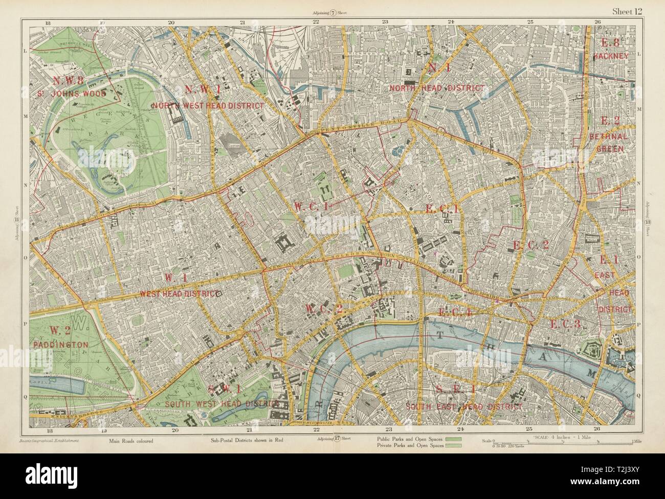 LONDON CENTRAL Westminster West End City Islington Southwark. BACON 1934 map Stock Photohttps://www.alamy.com/image-license-details/?v=1https://www.alamy.com/london-central-westminster-west-end-city-islington-southwark-bacon-1934-map-image242572707.html
RFT2J3XY–LONDON CENTRAL Westminster West End City Islington Southwark. BACON 1934 map
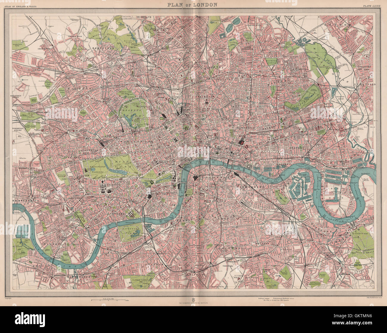 CENTRAL LONDON. Large detailed plan. Railways tube public buildings, 1903 map Stock Photohttps://www.alamy.com/image-license-details/?v=1https://www.alamy.com/stock-photo-central-london-large-detailed-plan-railways-tube-public-buildings-115483794.html
RFGKTMN6–CENTRAL LONDON. Large detailed plan. Railways tube public buildings, 1903 map
