Quick filters:
Cortambert Stock Photos and Images
 Theatre-historique - Un drame au fond de la mer, par MM. F. Dugué et R. Cortambert - L'assassinat du 3e acte Stock Photohttps://www.alamy.com/image-license-details/?v=1https://www.alamy.com/stock-photo-theatre-historique-un-drame-au-fond-de-la-mer-par-mm-f-dugu-et-r-cortambert-171715802.html
RMKYA976–Theatre-historique - Un drame au fond de la mer, par MM. F. Dugué et R. Cortambert - L'assassinat du 3e acte
 Theatre-historique - Un drame au fond de la mer, par MM. F. Dugué et R. Cortambert - L'assassinat du 3e acte Stock Photohttps://www.alamy.com/image-license-details/?v=1https://www.alamy.com/theatre-historique-un-drame-au-fond-de-la-mer-par-mm-f-dugu-et-r-cortambert-lassassinat-du-3e-acte-image478776014.html
RM2JPX3KA–Theatre-historique - Un drame au fond de la mer, par MM. F. Dugué et R. Cortambert - L'assassinat du 3e acte
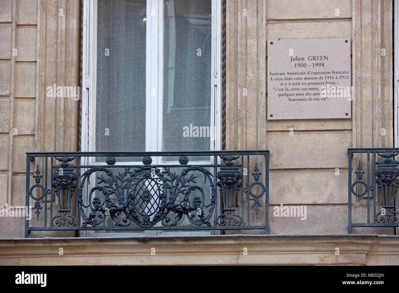 Paris, 16th arrondissement, 16 rue cortambert, building where lived Julien Green, Stock Photohttps://www.alamy.com/image-license-details/?v=1https://www.alamy.com/paris-16th-arrondissement-16-rue-cortambert-building-where-lived-julien-green-image180710953.html
RMME02JH–Paris, 16th arrondissement, 16 rue cortambert, building where lived Julien Green,
 Cortambert, Saône-et-Loire, FR, France, Bourgogne-Franche-Comté, N 46 28' 41'', N 4 42' 51'', map, Cartascapes Map published in 2024. Explore Cartascapes, a map revealing Earth's diverse landscapes, cultures, and ecosystems. Journey through time and space, discovering the interconnectedness of our planet's past, present, and future. Stock Photohttps://www.alamy.com/image-license-details/?v=1https://www.alamy.com/cortambert-sane-et-loire-fr-france-bourgogne-franche-comt-n-46-28-41-n-4-42-51-map-cartascapes-map-published-in-2024-explore-cartascapes-a-map-revealing-earths-diverse-landscapes-cultures-and-ecosystems-journey-through-time-and-space-discovering-the-interconnectedness-of-our-planets-past-present-and-future-image614305047.html
RM2XKC09Y–Cortambert, Saône-et-Loire, FR, France, Bourgogne-Franche-Comté, N 46 28' 41'', N 4 42' 51'', map, Cartascapes Map published in 2024. Explore Cartascapes, a map revealing Earth's diverse landscapes, cultures, and ecosystems. Journey through time and space, discovering the interconnectedness of our planet's past, present, and future.
 OLYMPUS DIGITAL CAMERA Stock Photohttps://www.alamy.com/image-license-details/?v=1https://www.alamy.com/olympus-digital-camera-image593115093.html
RM2WCXM9W–OLYMPUS DIGITAL CAMERA
 Cortambert Bineteau Guerre de sécession des Etats-Unis 2 Stock Photohttps://www.alamy.com/image-license-details/?v=1https://www.alamy.com/stock-photo-cortambert-bineteau-guerre-de-scession-des-etats-unis-2-137909276.html
RMJ0A8K8–Cortambert Bineteau Guerre de sécession des Etats-Unis 2
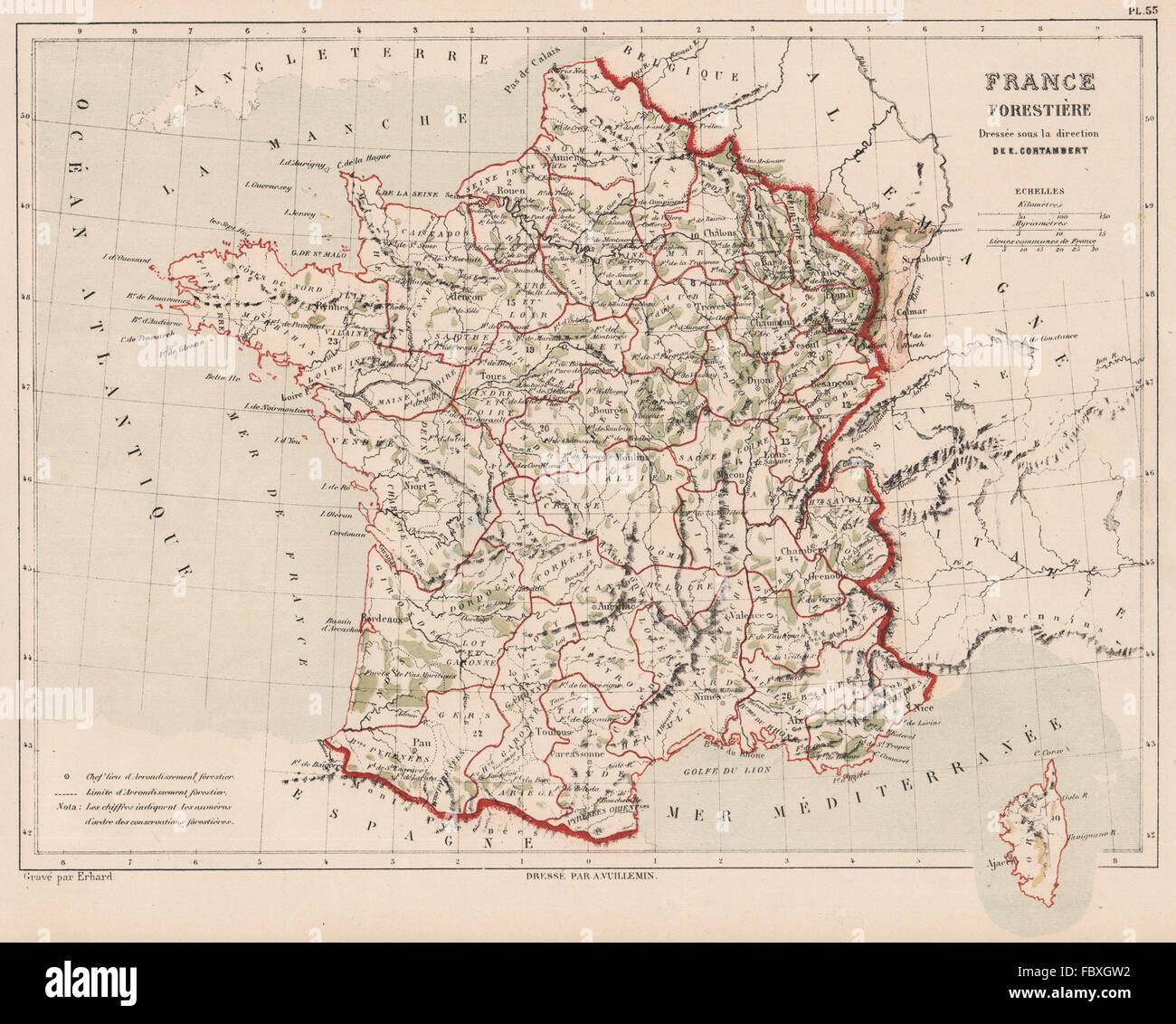 FRANCE FORESTS. Forestière. CORTAMBERT, 1880 antique map Stock Photohttps://www.alamy.com/image-license-details/?v=1https://www.alamy.com/stock-photo-france-forests-forestire-cortambert-1880-antique-map-93397054.html
RFFBXGW2–FRANCE FORESTS. Forestière. CORTAMBERT, 1880 antique map
 . Bulletin de la Socit dendrologique de France. Trees; Trees -- France. NOUVEAUX ADHÉRENTS 225 Miguel A. de Quevedo, Iiio-énieur civil, Prés^ de la Junta central de Bosques y arbolados, 29 Galle del Eliseo Mexico (Mexique). Henri Riousse, paysagiste, 13, rue Cortambert, Paris I6«. Saint-Léger, jardinier en chef de la ville, Lille. Emile Teuntz. 6 bis, place de la Bibliothèque, Moulins (Allier). D'" Turuuet, préparateiu- au Muséum d'Histoire naturelle, 74, rue Mazarine, Paris.. Please note that these images are extracted from scanned page images that may have been digitally enhanced for re Stock Photohttps://www.alamy.com/image-license-details/?v=1https://www.alamy.com/bulletin-de-la-socit-dendrologique-de-france-trees-trees-france-nouveaux-adhrents-225-miguel-a-de-quevedo-iiio-nieur-civil-prs-de-la-junta-central-de-bosques-y-arbolados-29-galle-del-eliseo-mexico-mexique-henri-riousse-paysagiste-13-rue-cortambert-paris-i6-saint-lger-jardinier-en-chef-de-la-ville-lille-emile-teuntz-6-bis-place-de-la-bibliothque-moulins-allier-dquot-turuuet-prparateiu-au-musum-dhistoire-naturelle-74-rue-mazarine-paris-please-note-that-these-images-are-extracted-from-scanned-page-images-that-may-have-been-digitally-enhanced-for-re-image234098985.html
RMRGT3J1–. Bulletin de la Socit dendrologique de France. Trees; Trees -- France. NOUVEAUX ADHÉRENTS 225 Miguel A. de Quevedo, Iiio-énieur civil, Prés^ de la Junta central de Bosques y arbolados, 29 Galle del Eliseo Mexico (Mexique). Henri Riousse, paysagiste, 13, rue Cortambert, Paris I6«. Saint-Léger, jardinier en chef de la ville, Lille. Emile Teuntz. 6 bis, place de la Bibliothèque, Moulins (Allier). D'" Turuuet, préparateiu- au Muséum d'Histoire naturelle, 74, rue Mazarine, Paris.. Please note that these images are extracted from scanned page images that may have been digitally enhanced for re
 Paris, 16th arrondissement, 16 rue cortambert, building where lived Julien Green, Stock Photohttps://www.alamy.com/image-license-details/?v=1https://www.alamy.com/paris-16th-arrondissement-16-rue-cortambert-building-where-lived-julien-green-image180710951.html
RMME02JF–Paris, 16th arrondissement, 16 rue cortambert, building where lived Julien Green,
 Cortambert, Saône-et-Loire, France, Bourgogne-Franche-Comté, N 46 28' 41'', E 4 42' 46'', map, Timeless Map published in 2021. Travelers, explorers and adventurers like Florence Nightingale, David Livingstone, Ernest Shackleton, Lewis and Clark and Sherlock Holmes relied on maps to plan travels to the world's most remote corners, Timeless Maps is mapping most locations on the globe, showing the achievement of great dreams Stock Photohttps://www.alamy.com/image-license-details/?v=1https://www.alamy.com/cortambert-sane-et-loire-france-bourgogne-franche-comt-n-46-28-41-e-4-42-46-map-timeless-map-published-in-2021-travelers-explorers-and-adventurers-like-florence-nightingale-david-livingstone-ernest-shackleton-lewis-and-clark-and-sherlock-holmes-relied-on-maps-to-plan-travels-to-the-worlds-most-remote-corners-timeless-maps-is-mapping-most-locations-on-the-globe-showing-the-achievement-of-great-dreams-image445217391.html
RM2GT9B93–Cortambert, Saône-et-Loire, France, Bourgogne-Franche-Comté, N 46 28' 41'', E 4 42' 46'', map, Timeless Map published in 2021. Travelers, explorers and adventurers like Florence Nightingale, David Livingstone, Ernest Shackleton, Lewis and Clark and Sherlock Holmes relied on maps to plan travels to the world's most remote corners, Timeless Maps is mapping most locations on the globe, showing the achievement of great dreams
 Cortambert Bineteau Guerre de sécession des Etats-Unis 1 Stock Photohttps://www.alamy.com/image-license-details/?v=1https://www.alamy.com/stock-photo-cortambert-bineteau-guerre-de-scession-des-etats-unis-1-137882327.html
RMJ0928R–Cortambert Bineteau Guerre de sécession des Etats-Unis 1
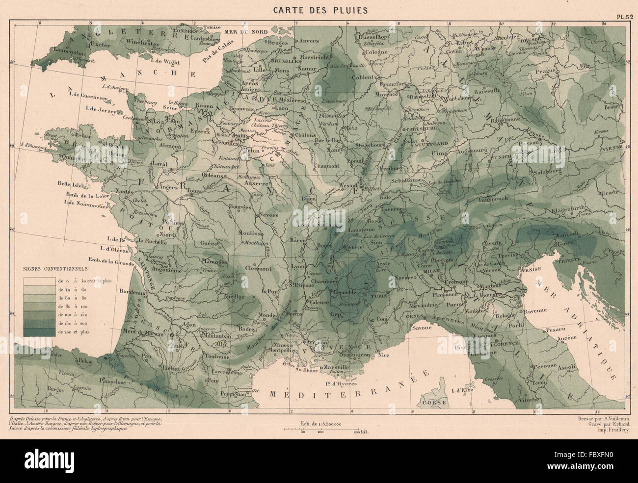 FRANCE RAINFALL. Precipitation. CORTAMBERT, 1880 antique map Stock Photohttps://www.alamy.com/image-license-details/?v=1https://www.alamy.com/stock-photo-france-rainfall-precipitation-cortambert-1880-antique-map-93396156.html
RFFBXFN0–FRANCE RAINFALL. Precipitation. CORTAMBERT, 1880 antique map
 Paris, 16th arrondissement, 16 rue cortambert, building where lived Julien Green, Stock Photohttps://www.alamy.com/image-license-details/?v=1https://www.alamy.com/paris-16th-arrondissement-16-rue-cortambert-building-where-lived-julien-green-image180710947.html
RMME02JB–Paris, 16th arrondissement, 16 rue cortambert, building where lived Julien Green,
 Image taken from page 435 of 'Nouvelle histoire des voyages et des grandes découvertes géographiques ... Ouvrage illustré ... d'après les dessins de Sahib, etc' Image taken from page 435 of 'Nouvelle histoire des voyages Stock Photohttps://www.alamy.com/image-license-details/?v=1https://www.alamy.com/stock-photo-image-taken-from-page-435-of-nouvelle-histoire-des-voyages-et-des-127871372.html
RMHC116M–Image taken from page 435 of 'Nouvelle histoire des voyages et des grandes découvertes géographiques ... Ouvrage illustré ... d'après les dessins de Sahib, etc' Image taken from page 435 of 'Nouvelle histoire des voyages
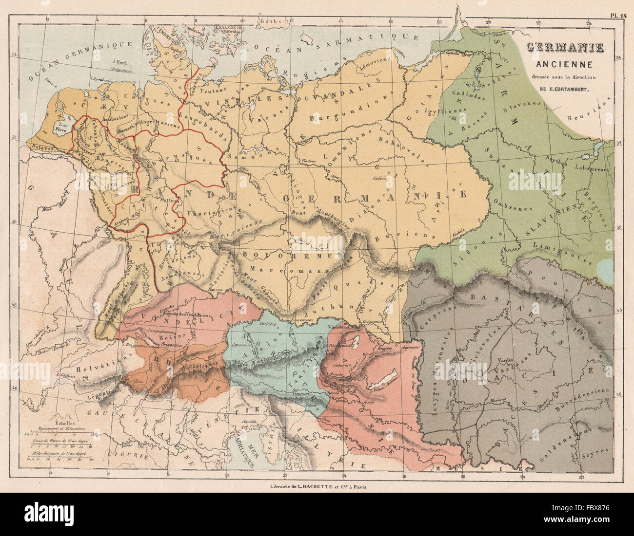 ANCIENT GERMANIA. Germany Germanie. CORTAMBERT, 1880 antique map Stock Photohttps://www.alamy.com/image-license-details/?v=1https://www.alamy.com/stock-photo-ancient-germania-germany-germanie-cortambert-1880-antique-map-93390282.html
RFFBX876–ANCIENT GERMANIA. Germany Germanie. CORTAMBERT, 1880 antique map
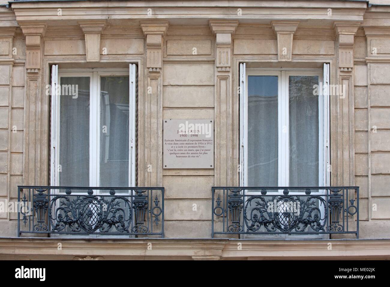 Paris, 16th arrondissement, 16 rue cortambert, building where lived Julien Green, Stock Photohttps://www.alamy.com/image-license-details/?v=1https://www.alamy.com/paris-16th-arrondissement-16-rue-cortambert-building-where-lived-julien-green-image180710955.html
RMME02JK–Paris, 16th arrondissement, 16 rue cortambert, building where lived Julien Green,
![Image taken from page 209 of 'Mœurs et caractères des peuples, Asie-Amérique-Océanie. Morceaux extraits de divers auteurs. [With illustrations.]' Image taken from page 209 of 'Mœurs et caractères des Stock Photo Image taken from page 209 of 'Mœurs et caractères des peuples, Asie-Amérique-Océanie. Morceaux extraits de divers auteurs. [With illustrations.]' Image taken from page 209 of 'Mœurs et caractères des Stock Photo](https://c8.alamy.com/comp/HBR38W/image-taken-from-page-209-of-murs-et-caracteres-des-peuples-asie-amerique-HBR38W.jpg) Image taken from page 209 of 'Mœurs et caractères des peuples, Asie-Amérique-Océanie. Morceaux extraits de divers auteurs. [With illustrations.]' Image taken from page 209 of 'Mœurs et caractères des Stock Photohttps://www.alamy.com/image-license-details/?v=1https://www.alamy.com/stock-photo-image-taken-from-page-209-of-murs-et-caracteres-des-peuples-asie-amerique-127741289.html
Image taken from page 209 of 'Mœurs et caractères des peuples, Asie-Amérique-Océanie. Morceaux extraits de divers auteurs. [With illustrations.]' Image taken from page 209 of 'Mœurs et caractères des Stock Photohttps://www.alamy.com/image-license-details/?v=1https://www.alamy.com/stock-photo-image-taken-from-page-209-of-murs-et-caracteres-des-peuples-asie-amerique-127741289.htmlRMHBR38W–Image taken from page 209 of 'Mœurs et caractères des peuples, Asie-Amérique-Océanie. Morceaux extraits de divers auteurs. [With illustrations.]' Image taken from page 209 of 'Mœurs et caractères des
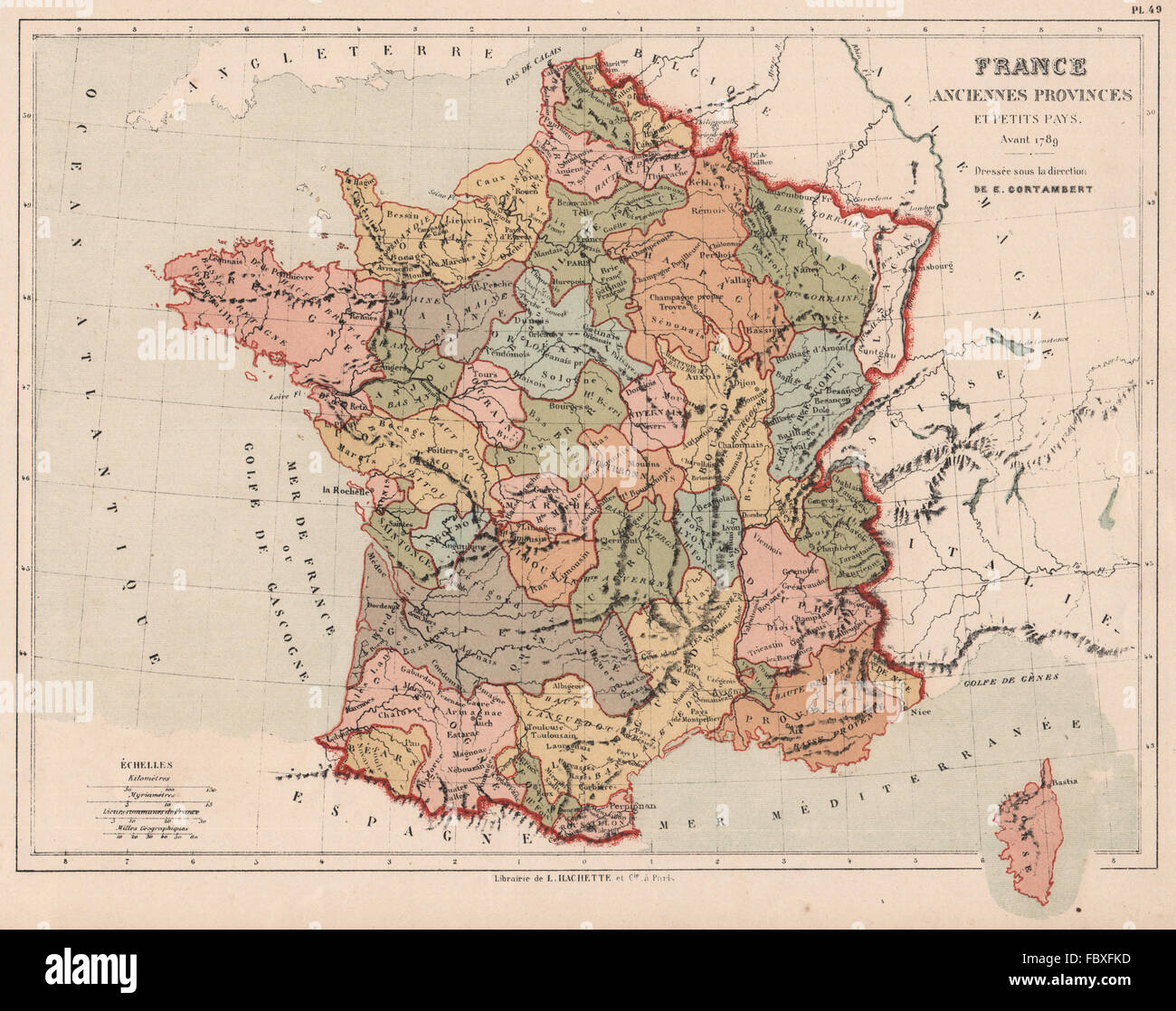 FRANCE showing provinces <1789. CORTAMBERT, 1880 antique map Stock Photohttps://www.alamy.com/image-license-details/?v=1https://www.alamy.com/stock-photo-france-showing-provinces-1789-cortambert-1880-antique-map-93396113.html
RFFBXFKD–FRANCE showing provinces <1789. CORTAMBERT, 1880 antique map
 Image taken from page 59 of 'Le Globe illustré. Géographie générale à l'usage des écoles et des familles ... Ouvrage illustré de nombreuses gravures intercalées dans le texte et accompagné de 16 cartes tirées en couleur' Image taken from page 59 of 'Le Globe illustré Stock Photohttps://www.alamy.com/image-license-details/?v=1https://www.alamy.com/stock-photo-image-taken-from-page-59-of-le-globe-illustre-geographie-generale-132347241.html
RMHK8X75–Image taken from page 59 of 'Le Globe illustré. Géographie générale à l'usage des écoles et des familles ... Ouvrage illustré de nombreuses gravures intercalées dans le texte et accompagné de 16 cartes tirées en couleur' Image taken from page 59 of 'Le Globe illustré
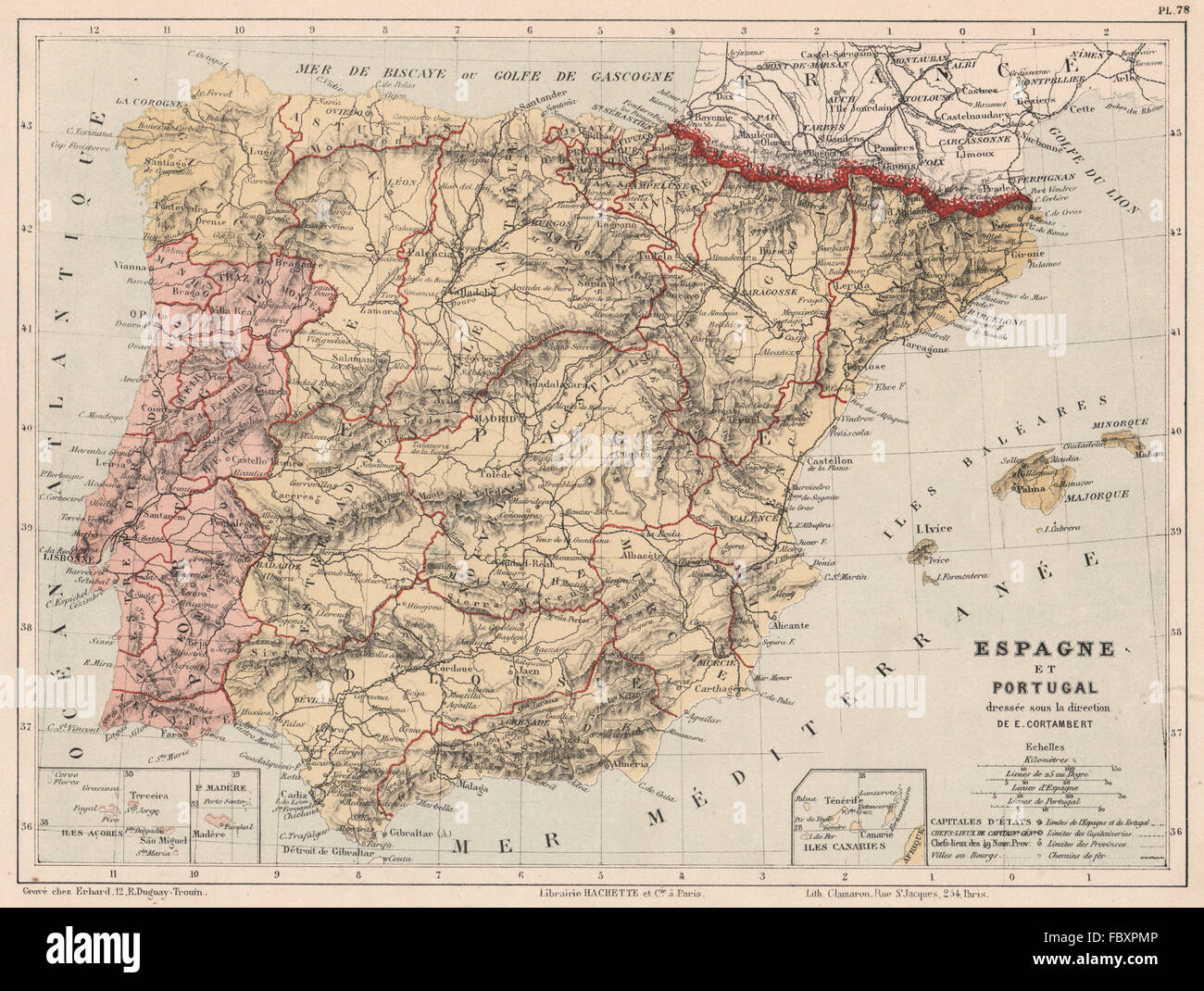 Spain and Portugal. Iberia. Provinces. CORTAMBERT, 1880 antique map Stock Photohttps://www.alamy.com/image-license-details/?v=1https://www.alamy.com/stock-photo-spain-and-portugal-iberia-provinces-cortambert-1880-antique-map-93401638.html
RFFBXPMP–Spain and Portugal. Iberia. Provinces. CORTAMBERT, 1880 antique map
![Image taken from page 181 of 'Mœurs et caractères des peuples, Asie-Amérique-Océanie. Morceaux extraits de divers auteurs. [With illustrations.]' Image taken from page 181 of 'Mœurs et caractères des Stock Photo Image taken from page 181 of 'Mœurs et caractères des peuples, Asie-Amérique-Océanie. Morceaux extraits de divers auteurs. [With illustrations.]' Image taken from page 181 of 'Mœurs et caractères des Stock Photo](https://c8.alamy.com/comp/HFHT1M/image-taken-from-page-181-of-murs-et-caracteres-des-peuples-asie-amerique-HFHT1M.jpg) Image taken from page 181 of 'Mœurs et caractères des peuples, Asie-Amérique-Océanie. Morceaux extraits de divers auteurs. [With illustrations.]' Image taken from page 181 of 'Mœurs et caractères des Stock Photohttps://www.alamy.com/image-license-details/?v=1https://www.alamy.com/stock-photo-image-taken-from-page-181-of-murs-et-caracteres-des-peuples-asie-amerique-130084464.html
Image taken from page 181 of 'Mœurs et caractères des peuples, Asie-Amérique-Océanie. Morceaux extraits de divers auteurs. [With illustrations.]' Image taken from page 181 of 'Mœurs et caractères des Stock Photohttps://www.alamy.com/image-license-details/?v=1https://www.alamy.com/stock-photo-image-taken-from-page-181-of-murs-et-caracteres-des-peuples-asie-amerique-130084464.htmlRMHFHT1M–Image taken from page 181 of 'Mœurs et caractères des peuples, Asie-Amérique-Océanie. Morceaux extraits de divers auteurs. [With illustrations.]' Image taken from page 181 of 'Mœurs et caractères des
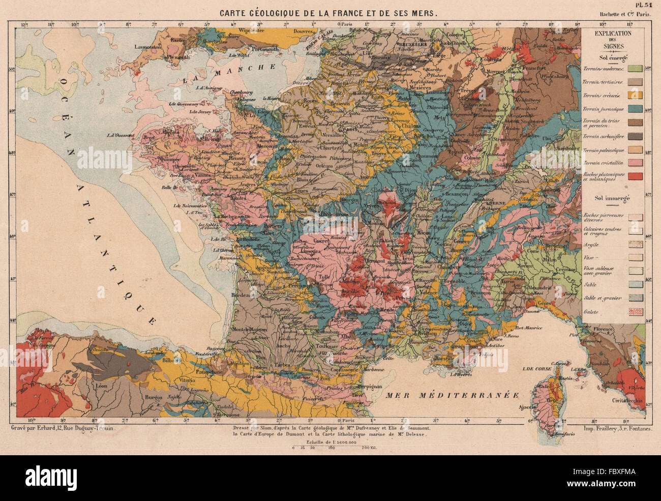 FRANCE GEOLOGICAL. Geological map of France and its seas. CORTAMBERT, 1880 Stock Photohttps://www.alamy.com/image-license-details/?v=1https://www.alamy.com/stock-photo-france-geological-geological-map-of-france-and-its-seas-cortambert-93396138.html
RFFBXFMA–FRANCE GEOLOGICAL. Geological map of France and its seas. CORTAMBERT, 1880
![Image taken from page 171 of 'Mœurs et caractères des peuples, Asie-Amérique-Océanie. Morceaux extraits de divers auteurs. [With illustrations.]' Image taken from page 171 of 'Mœurs et caractères des Stock Photo Image taken from page 171 of 'Mœurs et caractères des peuples, Asie-Amérique-Océanie. Morceaux extraits de divers auteurs. [With illustrations.]' Image taken from page 171 of 'Mœurs et caractères des Stock Photo](https://c8.alamy.com/comp/HFHM5T/image-taken-from-page-171-of-murs-et-caracteres-des-peuples-asie-amerique-HFHM5T.jpg) Image taken from page 171 of 'Mœurs et caractères des peuples, Asie-Amérique-Océanie. Morceaux extraits de divers auteurs. [With illustrations.]' Image taken from page 171 of 'Mœurs et caractères des Stock Photohttps://www.alamy.com/image-license-details/?v=1https://www.alamy.com/stock-photo-image-taken-from-page-171-of-murs-et-caracteres-des-peuples-asie-amerique-130081444.html
Image taken from page 171 of 'Mœurs et caractères des peuples, Asie-Amérique-Océanie. Morceaux extraits de divers auteurs. [With illustrations.]' Image taken from page 171 of 'Mœurs et caractères des Stock Photohttps://www.alamy.com/image-license-details/?v=1https://www.alamy.com/stock-photo-image-taken-from-page-171-of-murs-et-caracteres-des-peuples-asie-amerique-130081444.htmlRMHFHM5T–Image taken from page 171 of 'Mœurs et caractères des peuples, Asie-Amérique-Océanie. Morceaux extraits de divers auteurs. [With illustrations.]' Image taken from page 171 of 'Mœurs et caractères des
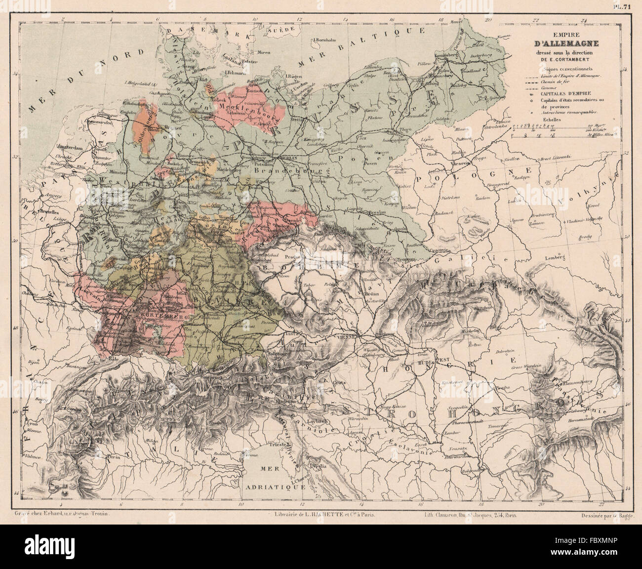 German Empire showing states/provinces. CORTAMBERT, 1880 antique map Stock Photohttps://www.alamy.com/image-license-details/?v=1https://www.alamy.com/stock-photo-german-empire-showing-statesprovinces-cortambert-1880-antique-map-93400098.html
RFFBXMNP–German Empire showing states/provinces. CORTAMBERT, 1880 antique map
 Image taken from page 299 of 'Nouvelle histoire des voyages et des grandes découvertes géographiques ... Ouvrage illustré ... d'après les dessins de Sahib, etc' Image taken from page 299 of 'Nouvelle histoire des voyages Stock Photohttps://www.alamy.com/image-license-details/?v=1https://www.alamy.com/stock-photo-image-taken-from-page-299-of-nouvelle-histoire-des-voyages-et-des-130134282.html
RMHFM3GX–Image taken from page 299 of 'Nouvelle histoire des voyages et des grandes découvertes géographiques ... Ouvrage illustré ... d'après les dessins de Sahib, etc' Image taken from page 299 of 'Nouvelle histoire des voyages
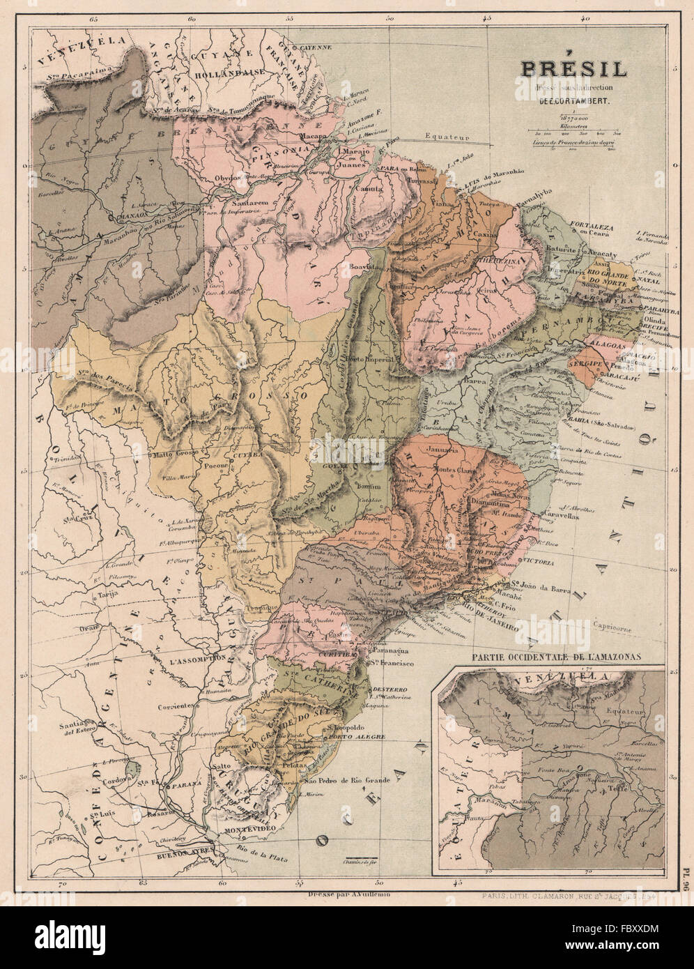 BRAZIL Brésil Brasil in provinces. CORTAMBERT, 1880 antique map Stock Photohttps://www.alamy.com/image-license-details/?v=1https://www.alamy.com/stock-photo-brazil-brsil-brasil-in-provinces-cortambert-1880-antique-map-93404576.html
RFFBXXDM–BRAZIL Brésil Brasil in provinces. CORTAMBERT, 1880 antique map
 Image taken from page 727 of 'Nouvelle histoire des voyages et des grandes découvertes géographiques ... Ouvrage illustré ... d'après les dessins de Sahib, etc' Image taken from page 727 of 'Nouvelle histoire des voyages Stock Photohttps://www.alamy.com/image-license-details/?v=1https://www.alamy.com/stock-photo-image-taken-from-page-727-of-nouvelle-histoire-des-voyages-et-des-130181457.html
RMHFP7NN–Image taken from page 727 of 'Nouvelle histoire des voyages et des grandes découvertes géographiques ... Ouvrage illustré ... d'après les dessins de Sahib, etc' Image taken from page 727 of 'Nouvelle histoire des voyages
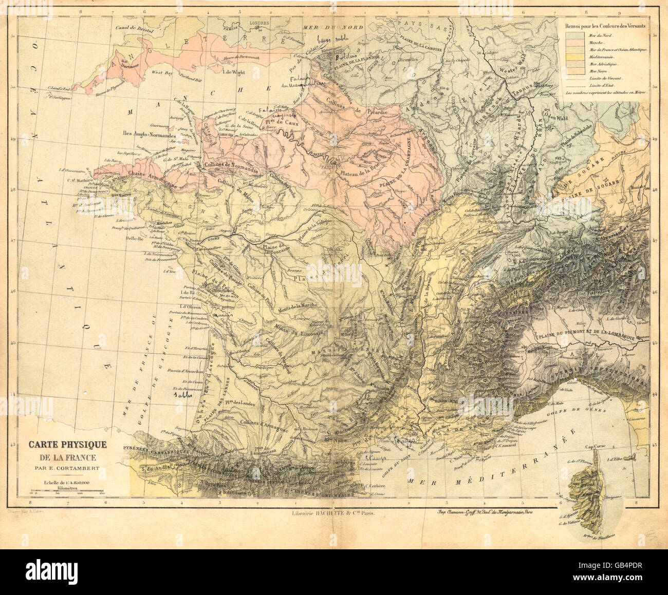 FRANCE: Carte Physique de la France, 1880 antique map Stock Photohttps://www.alamy.com/image-license-details/?v=1https://www.alamy.com/stock-photo-france-carte-physique-de-la-france-1880-antique-map-110128867.html
RFGB4PDR–FRANCE: Carte Physique de la France, 1880 antique map
![Image taken from page 117 of 'Mœurs et caractères des peuples, Asie-Amérique-Océanie. Morceaux extraits de divers auteurs. [With illustrations.]' Image taken from page 117 of 'Mœurs et caractères des Stock Photo Image taken from page 117 of 'Mœurs et caractères des peuples, Asie-Amérique-Océanie. Morceaux extraits de divers auteurs. [With illustrations.]' Image taken from page 117 of 'Mœurs et caractères des Stock Photo](https://c8.alamy.com/comp/HFKB1B/image-taken-from-page-117-of-murs-et-caracteres-des-peuples-asie-amerique-HFKB1B.jpg) Image taken from page 117 of 'Mœurs et caractères des peuples, Asie-Amérique-Océanie. Morceaux extraits de divers auteurs. [With illustrations.]' Image taken from page 117 of 'Mœurs et caractères des Stock Photohttps://www.alamy.com/image-license-details/?v=1https://www.alamy.com/stock-photo-image-taken-from-page-117-of-murs-et-caracteres-des-peuples-asie-amerique-130118167.html
Image taken from page 117 of 'Mœurs et caractères des peuples, Asie-Amérique-Océanie. Morceaux extraits de divers auteurs. [With illustrations.]' Image taken from page 117 of 'Mœurs et caractères des Stock Photohttps://www.alamy.com/image-license-details/?v=1https://www.alamy.com/stock-photo-image-taken-from-page-117-of-murs-et-caracteres-des-peuples-asie-amerique-130118167.htmlRMHFKB1B–Image taken from page 117 of 'Mœurs et caractères des peuples, Asie-Amérique-Océanie. Morceaux extraits de divers auteurs. [With illustrations.]' Image taken from page 117 of 'Mœurs et caractères des
 ALGERIA: Algérie dressée sous la direction, 1880 antique map Stock Photohttps://www.alamy.com/image-license-details/?v=1https://www.alamy.com/stock-photo-algeria-algrie-dresse-sous-la-direction-1880-antique-map-110131072.html
RFGB4W8G–ALGERIA: Algérie dressée sous la direction, 1880 antique map
 Image taken from page 507 of 'Nouvelle histoire des voyages et des grandes découvertes géographiques ... Ouvrage illustré ... d'après les dessins de Sahib, etc' Image taken from page 507 of 'Nouvelle histoire des voyages Stock Photohttps://www.alamy.com/image-license-details/?v=1https://www.alamy.com/stock-photo-image-taken-from-page-507-of-nouvelle-histoire-des-voyages-et-des-130163805.html
RMHFND79–Image taken from page 507 of 'Nouvelle histoire des voyages et des grandes découvertes géographiques ... Ouvrage illustré ... d'après les dessins de Sahib, etc' Image taken from page 507 of 'Nouvelle histoire des voyages
 France by departments. Canals Prefectures. CORTAMBERT, 1880 antique map Stock Photohttps://www.alamy.com/image-license-details/?v=1https://www.alamy.com/stock-photo-france-by-departments-canals-prefectures-cortambert-1880-antique-map-93396129.html
RFFBXFM1–France by departments. Canals Prefectures. CORTAMBERT, 1880 antique map
 Image taken from page 811 of 'Nouvelle histoire des voyages et des grandes découvertes géographiques ... Ouvrage illustré ... d'après les dessins de Sahib, etc' Image taken from page 811 of 'Nouvelle histoire des voyages Stock Photohttps://www.alamy.com/image-license-details/?v=1https://www.alamy.com/stock-photo-image-taken-from-page-811-of-nouvelle-histoire-des-voyages-et-des-130186316.html
RMHFPDY8–Image taken from page 811 of 'Nouvelle histoire des voyages et des grandes découvertes géographiques ... Ouvrage illustré ... d'après les dessins de Sahib, etc' Image taken from page 811 of 'Nouvelle histoire des voyages
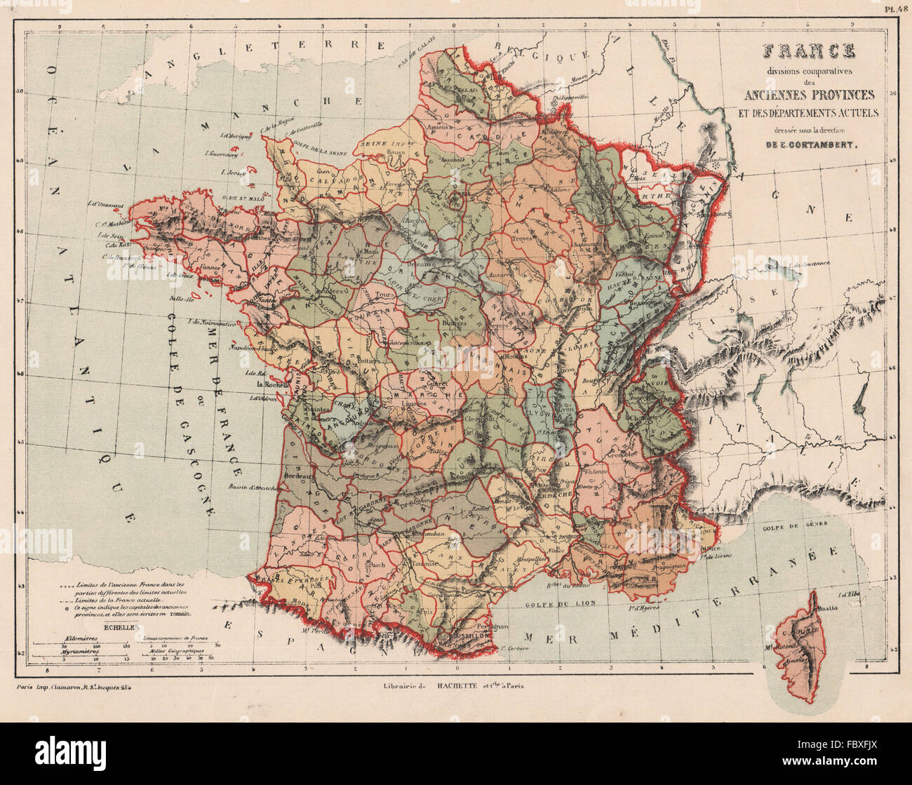 FRANCE showing provinces <1789 and departements. CORTAMBERT, 1880 antique map Stock Photohttps://www.alamy.com/image-license-details/?v=1https://www.alamy.com/stock-photo-france-showing-provinces-1789-and-departements-cortambert-1880-antique-93396098.html
RFFBXFJX–FRANCE showing provinces <1789 and departements. CORTAMBERT, 1880 antique map
 Image taken from page 185 of 'Nouvelle histoire des voyages et des grandes découvertes géographiques ... Ouvrage illustré ... d'après les dessins de Sahib, etc' Image taken from page 185 of 'Nouvelle histoire des voyages Stock Photohttps://www.alamy.com/image-license-details/?v=1https://www.alamy.com/stock-photo-image-taken-from-page-185-of-nouvelle-histoire-des-voyages-et-des-130085592.html
RMHFHWE0–Image taken from page 185 of 'Nouvelle histoire des voyages et des grandes découvertes géographiques ... Ouvrage illustré ... d'après les dessins de Sahib, etc' Image taken from page 185 of 'Nouvelle histoire des voyages
 ALGERIA. Provinces. Oran Constantine Alger. Algérie. CORTAMBERT, 1880 old map Stock Photohttps://www.alamy.com/image-license-details/?v=1https://www.alamy.com/stock-photo-algeria-provinces-oran-constantine-alger-algrie-cortambert-1880-old-93402560.html
RFFBXRWM–ALGERIA. Provinces. Oran Constantine Alger. Algérie. CORTAMBERT, 1880 old map
 Image taken from page 247 of 'Nouvelle histoire des voyages et des grandes découvertes géographiques ... Ouvrage illustré ... d'après les dessins de Sahib, etc' Image taken from page 247 of 'Nouvelle histoire des voyages Stock Photohttps://www.alamy.com/image-license-details/?v=1https://www.alamy.com/stock-photo-image-taken-from-page-247-of-nouvelle-histoire-des-voyages-et-des-130112299.html
RMHFK3FR–Image taken from page 247 of 'Nouvelle histoire des voyages et des grandes découvertes géographiques ... Ouvrage illustré ... d'après les dessins de Sahib, etc' Image taken from page 247 of 'Nouvelle histoire des voyages
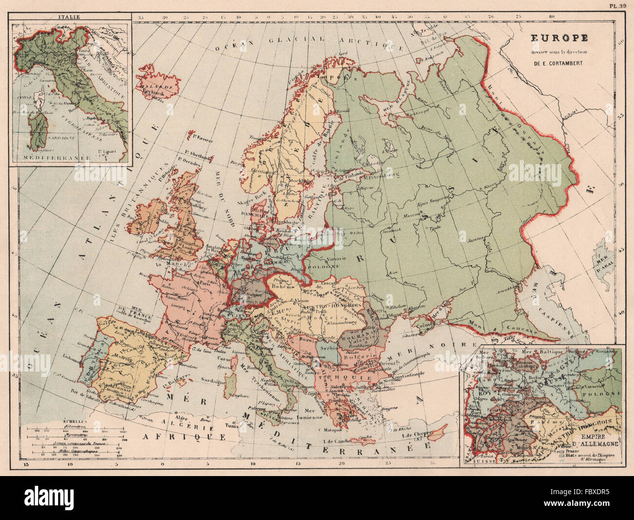 EUROPE POLITICAL. Inset Italy; German Empire. CORTAMBERT, 1880 antique map Stock Photohttps://www.alamy.com/image-license-details/?v=1https://www.alamy.com/stock-photo-europe-political-inset-italy-german-empire-cortambert-1880-antique-93394649.html
RFFBXDR5–EUROPE POLITICAL. Inset Italy; German Empire. CORTAMBERT, 1880 antique map
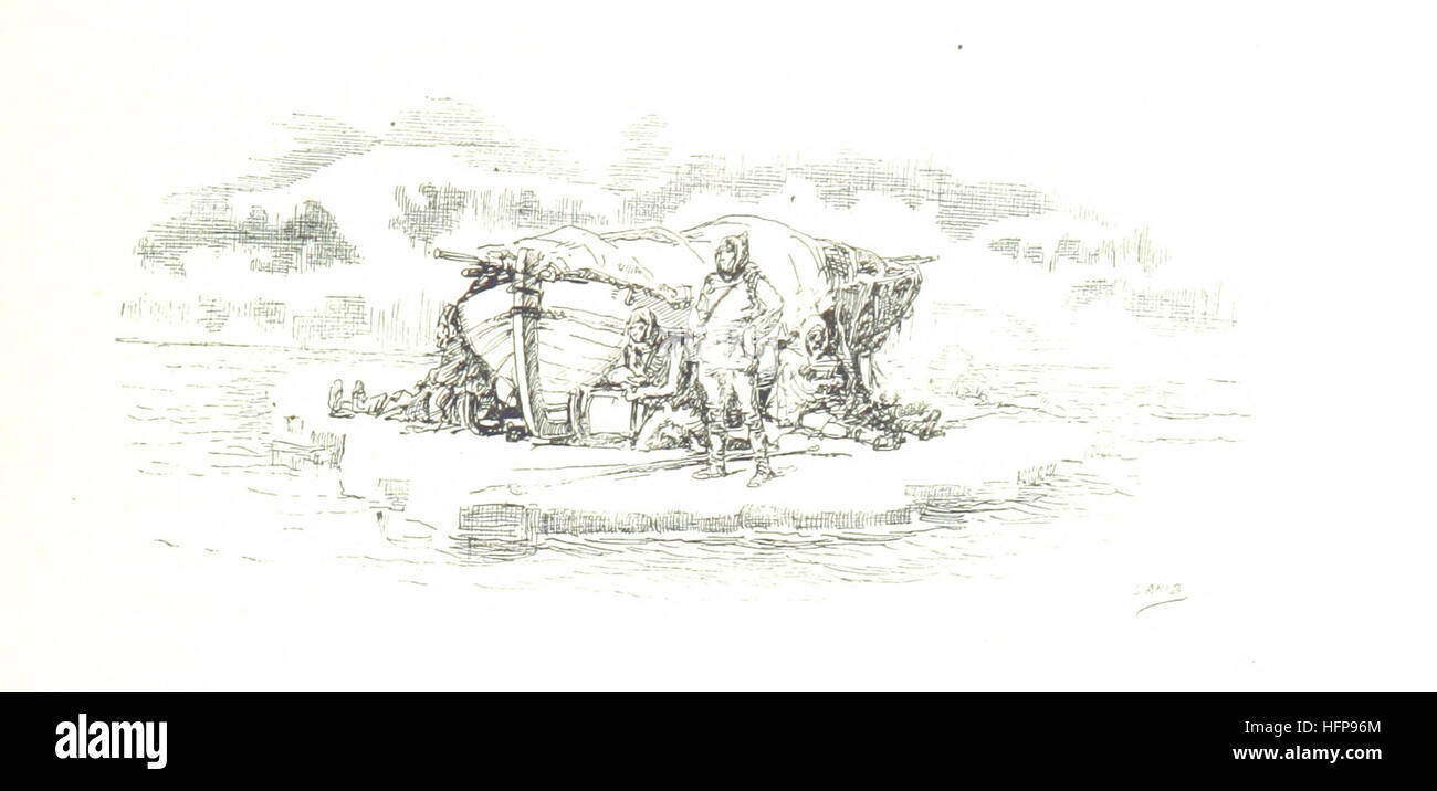 Image taken from page 749 of 'Nouvelle histoire des voyages et des grandes découvertes géographiques ... Ouvrage illustré ... d'après les dessins de Sahib, etc' Image taken from page 749 of 'Nouvelle histoire des voyages Stock Photohttps://www.alamy.com/image-license-details/?v=1https://www.alamy.com/stock-photo-image-taken-from-page-749-of-nouvelle-histoire-des-voyages-et-des-130182604.html
RMHFP96M–Image taken from page 749 of 'Nouvelle histoire des voyages et des grandes découvertes géographiques ... Ouvrage illustré ... d'après les dessins de Sahib, etc' Image taken from page 749 of 'Nouvelle histoire des voyages
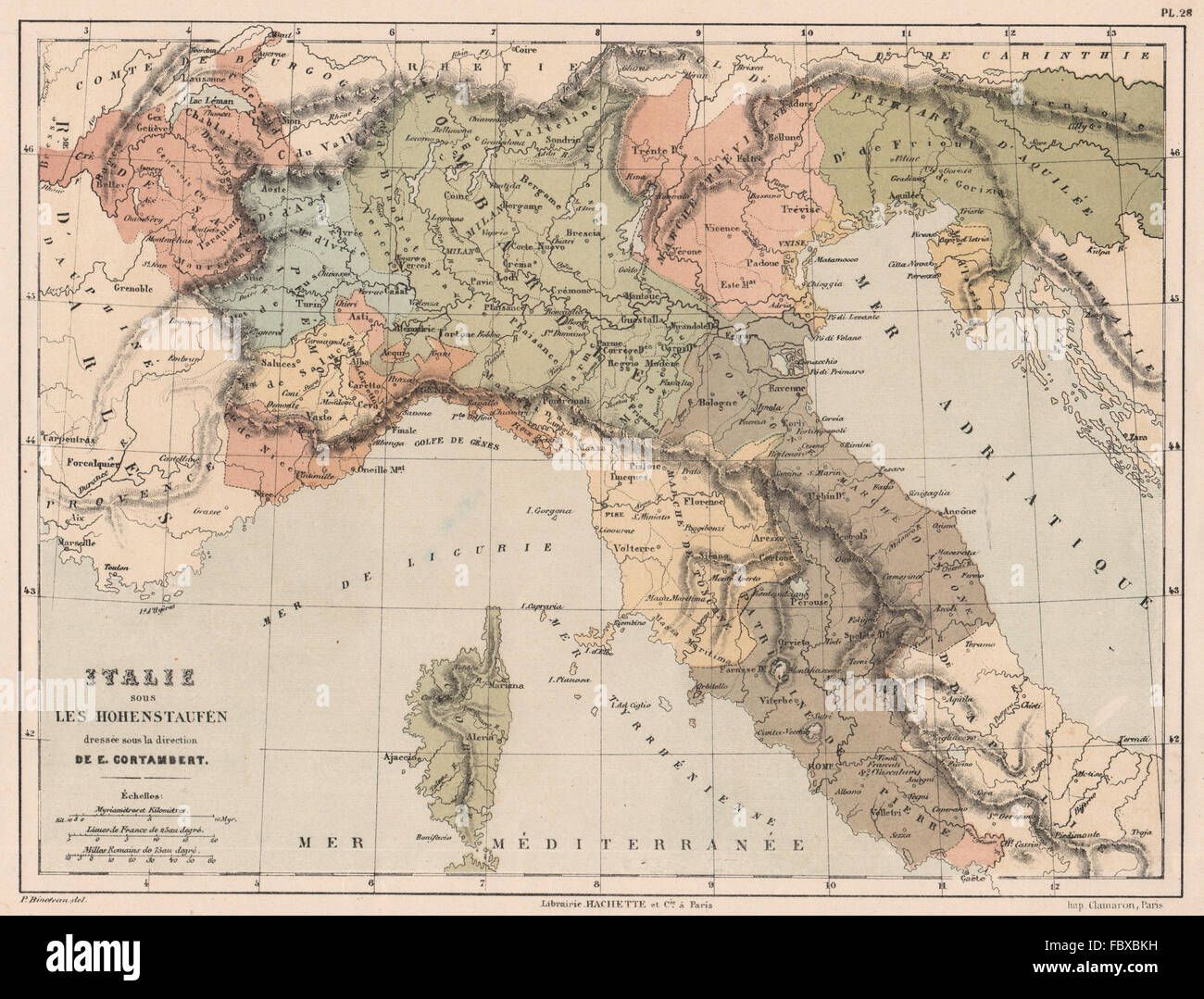 HOHENSTAUFEN ITALY. Northern Italy. 12th century. Swabia. CORTAMBERT, 1880 map Stock Photohttps://www.alamy.com/image-license-details/?v=1https://www.alamy.com/stock-photo-hohenstaufen-italy-northern-italy-12th-century-swabia-cortambert-1880-93392981.html
RFFBXBKH–HOHENSTAUFEN ITALY. Northern Italy. 12th century. Swabia. CORTAMBERT, 1880 map
 Image taken from page 426 of 'Nouvelle histoire des voyages et des grandes découvertes géographiques ... Ouvrage illustré ... d'après les dessins de Sahib, etc' Image taken from page 426 of 'Nouvelle histoire des voyages Stock Photohttps://www.alamy.com/image-license-details/?v=1https://www.alamy.com/stock-photo-image-taken-from-page-426-of-nouvelle-histoire-des-voyages-et-des-130154793.html
RMHFN1ND–Image taken from page 426 of 'Nouvelle histoire des voyages et des grandes découvertes géographiques ... Ouvrage illustré ... d'après les dessins de Sahib, etc' Image taken from page 426 of 'Nouvelle histoire des voyages
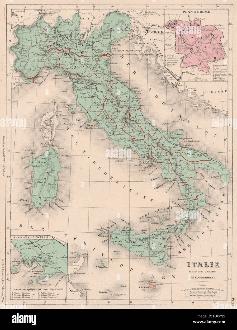 ITALY. Inset plan of Rome. Naples environs. CORTAMBERT, 1880 antique map Stock Photohttps://www.alamy.com/image-license-details/?v=1https://www.alamy.com/stock-photo-italy-inset-plan-of-rome-naples-environs-cortambert-1880-antique-map-93401649.html
RFFBXPN5–ITALY. Inset plan of Rome. Naples environs. CORTAMBERT, 1880 antique map
 GREECE divided into 13 provinces. Cyclades. Ionian Islands. CORTAMBERT, 1880 map Stock Photohttps://www.alamy.com/image-license-details/?v=1https://www.alamy.com/stock-photo-greece-divided-into-13-provinces-cyclades-ionian-islands-cortambert-93401804.html
RFFBXPXM–GREECE divided into 13 provinces. Cyclades. Ionian Islands. CORTAMBERT, 1880 map
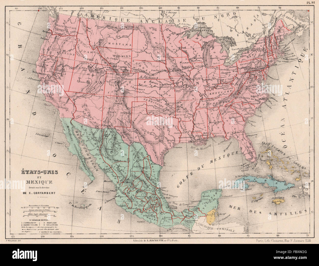 United States and Mexico. Bahamas Cuba. North America. CORTAMBERT, 1880 map Stock Photohttps://www.alamy.com/image-license-details/?v=1https://www.alamy.com/stock-photo-united-states-and-mexico-bahamas-cuba-north-america-cortambert-1880-93403480.html
RFFBXW2G–United States and Mexico. Bahamas Cuba. North America. CORTAMBERT, 1880 map
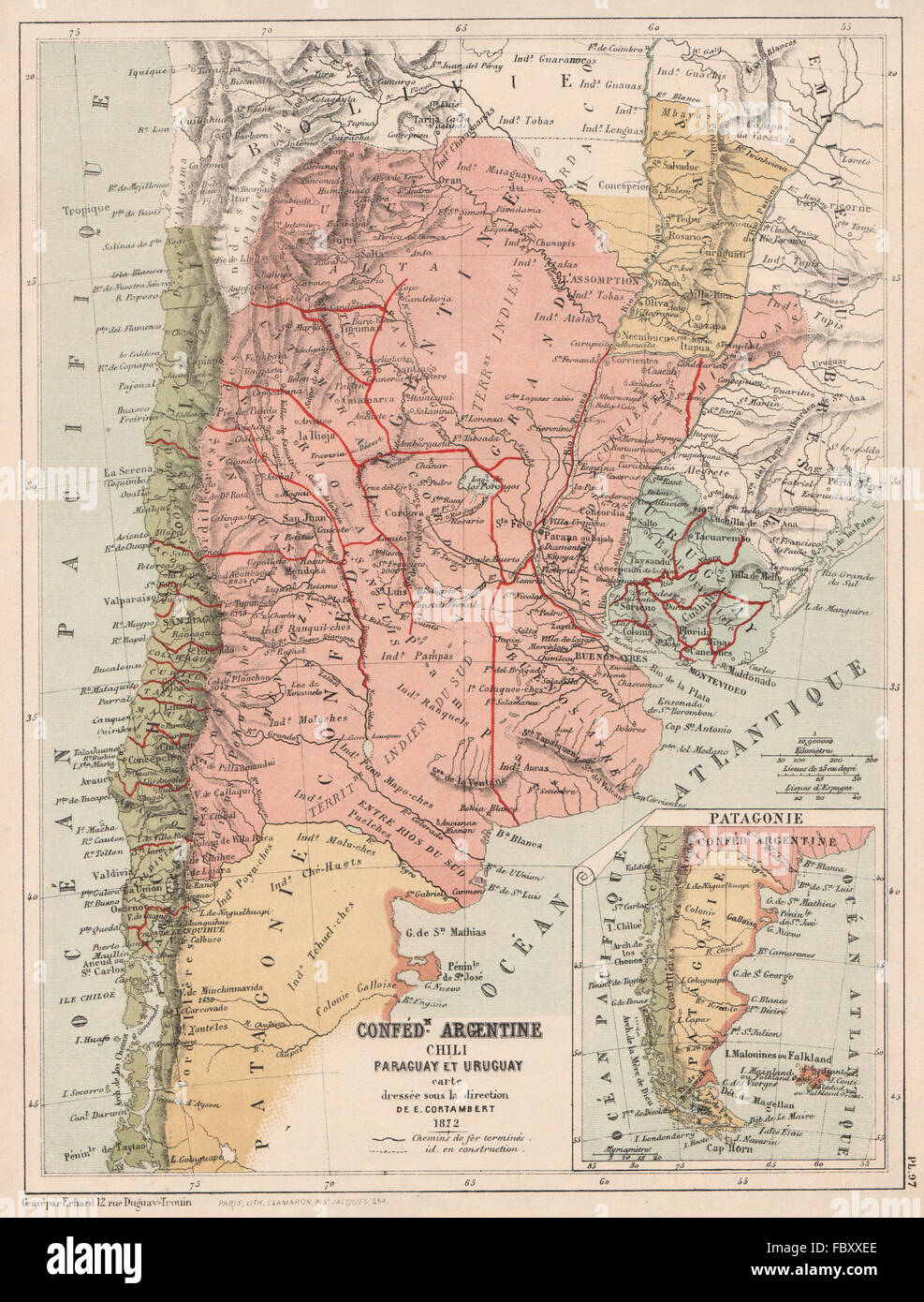 SOUTH AMERICA. Argentina Chile Paraguay Uruguay Patagonia. CORTAMBERT, 1880 map Stock Photohttps://www.alamy.com/image-license-details/?v=1https://www.alamy.com/stock-photo-south-america-argentina-chile-paraguay-uruguay-patagonia-cortambert-93404598.html
RFFBXXEE–SOUTH AMERICA. Argentina Chile Paraguay Uruguay Patagonia. CORTAMBERT, 1880 map
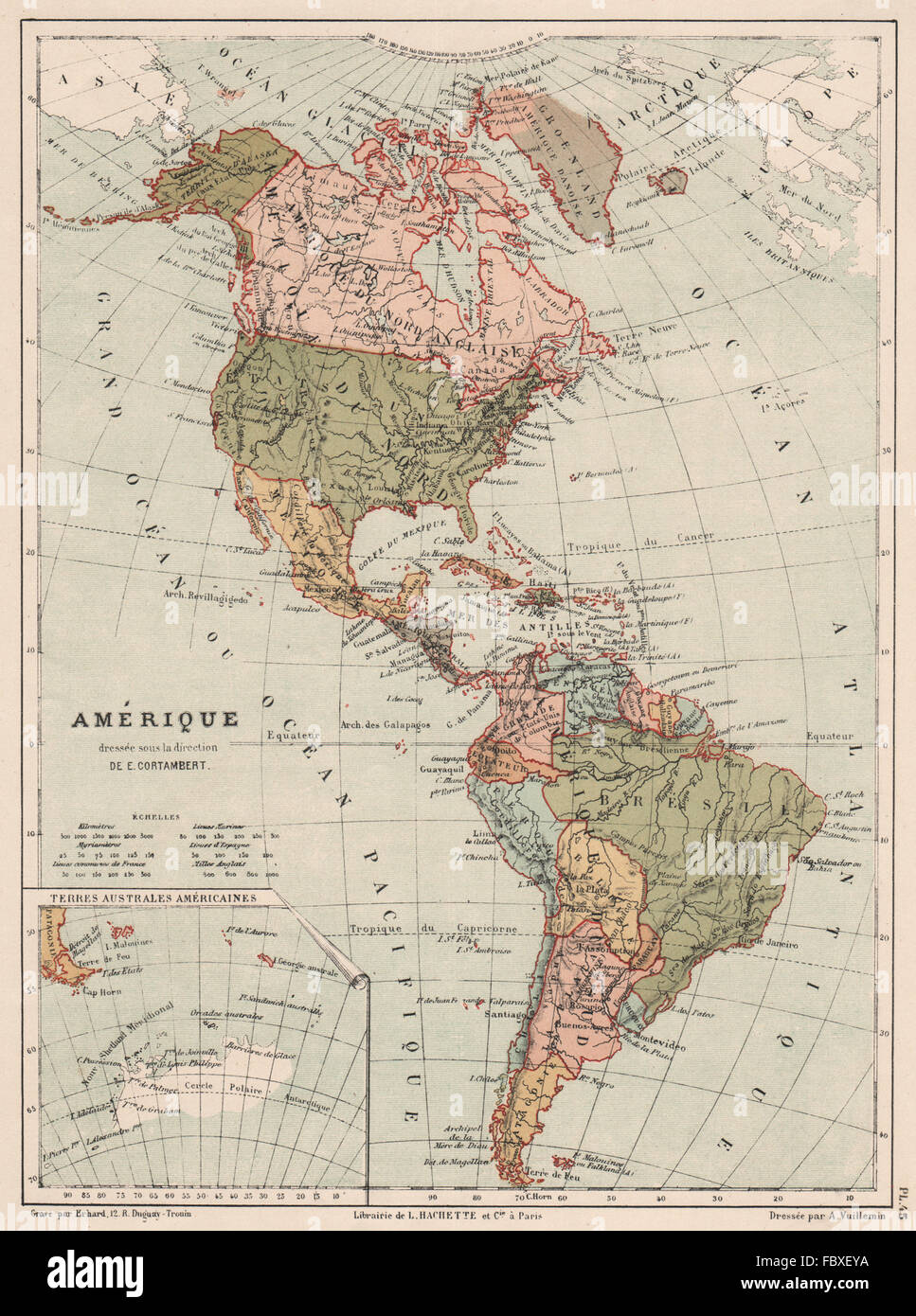 AMERICAS POLITICAL. North & South America. CORTAMBERT, 1880 antique map Stock Photohttps://www.alamy.com/image-license-details/?v=1https://www.alamy.com/stock-photo-americas-political-north-south-america-cortambert-1880-antique-map-93395550.html
RFFBXEYA–AMERICAS POLITICAL. North & South America. CORTAMBERT, 1880 antique map
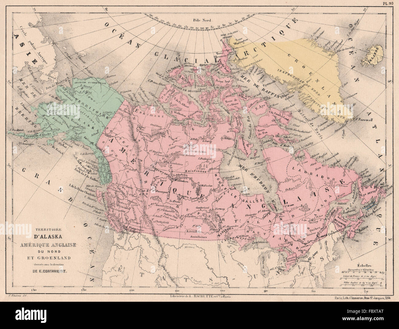 BRITISH AMERICA, GREENLAND & ALASKA. Canada. North America. CORTAMBERT, 1880 map Stock Photohttps://www.alamy.com/image-license-details/?v=1https://www.alamy.com/stock-photo-british-america-greenland-alaska-canada-north-america-cortambert-1880-93402928.html
RFFBXTAT–BRITISH AMERICA, GREENLAND & ALASKA. Canada. North America. CORTAMBERT, 1880 map
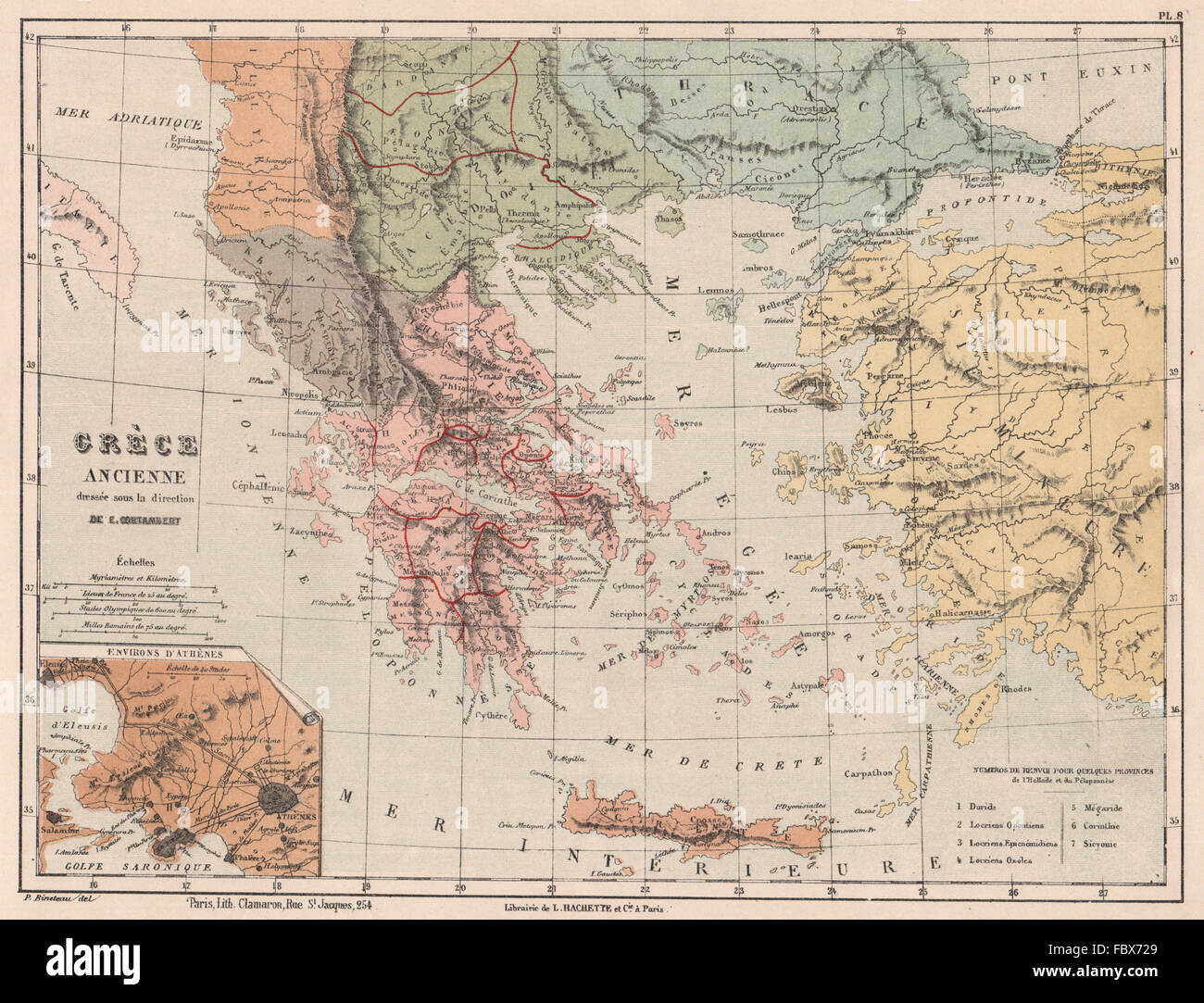 ANCIENT GREECE in provinces. Thrace Thessaly Macedonia &c. CORTAMBERT, 1880 map Stock Photohttps://www.alamy.com/image-license-details/?v=1https://www.alamy.com/stock-photo-ancient-greece-in-provinces-thrace-thessaly-macedonia-c-cortambert-93389361.html
RFFBX729–ANCIENT GREECE in provinces. Thrace Thessaly Macedonia &c. CORTAMBERT, 1880 map
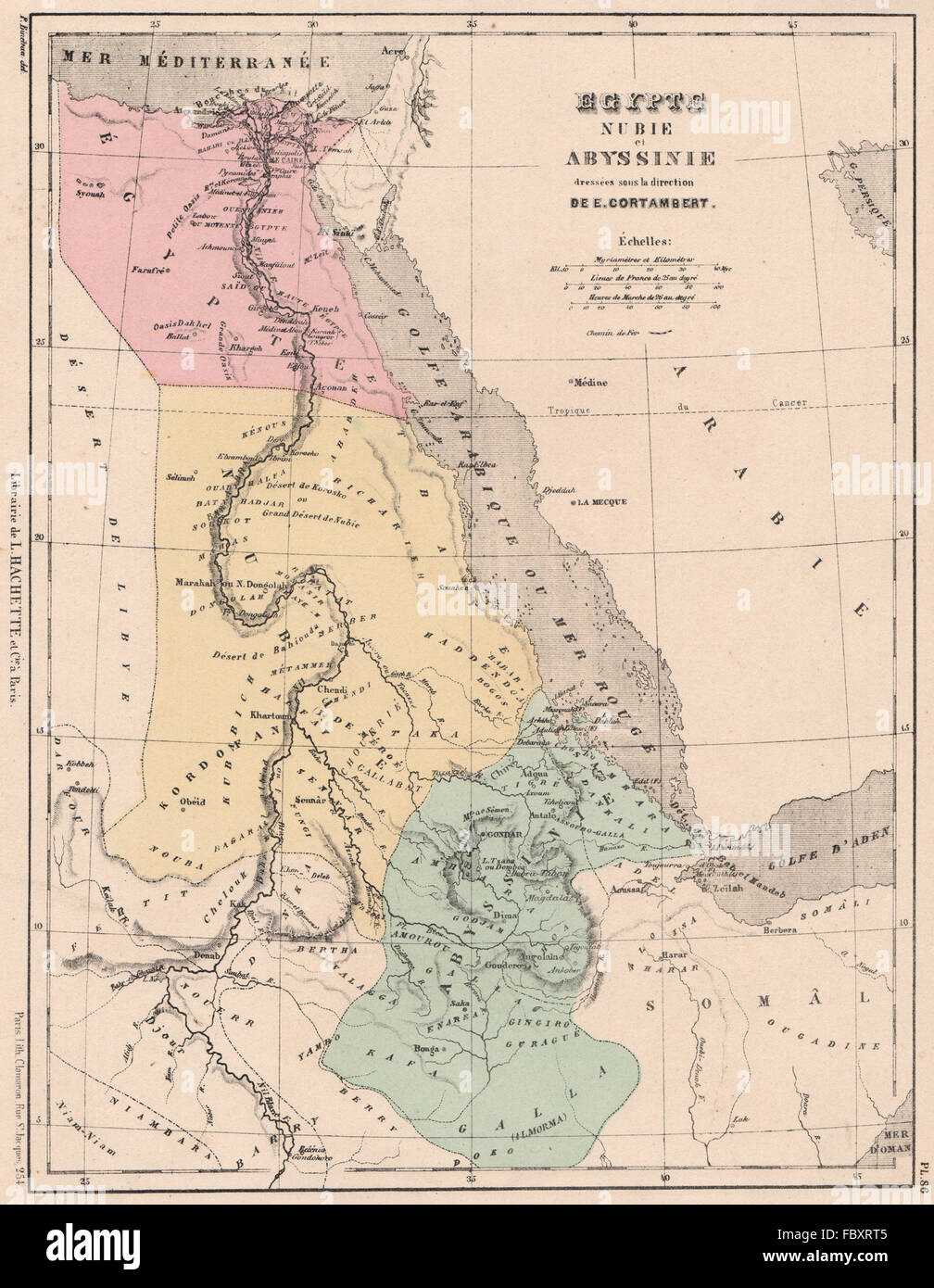 NILE VALLEY & RED SEA. Egypt Nubia and Abyssinia. CORTAMBERT, 1880 antique map Stock Photohttps://www.alamy.com/image-license-details/?v=1https://www.alamy.com/stock-photo-nile-valley-red-sea-egypt-nubia-and-abyssinia-cortambert-1880-antique-93402517.html
RFFBXRT5–NILE VALLEY & RED SEA. Egypt Nubia and Abyssinia. CORTAMBERT, 1880 antique map
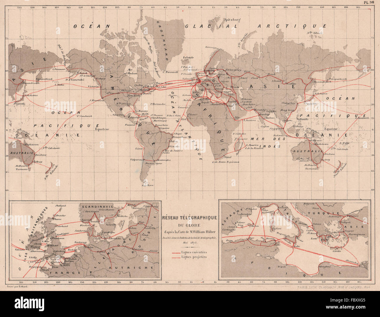 WORLD TELEGRAPH CABLES. Network. In operation & projected. CORTAMBERT, 1880 map Stock Photohttps://www.alamy.com/image-license-details/?v=1https://www.alamy.com/stock-photo-world-telegraph-cables-network-in-operation-projected-cortambert-1880-93404645.html
RFFBXXG5–WORLD TELEGRAPH CABLES. Network. In operation & projected. CORTAMBERT, 1880 map
 NORTH ASIA. Russia in Asia Turkestan Chinese Empire Japan. CORTAMBERT, 1880 map Stock Photohttps://www.alamy.com/image-license-details/?v=1https://www.alamy.com/stock-photo-north-asia-russia-in-asia-turkestan-chinese-empire-japan-cortambert-93402467.html
RFFBXRPB–NORTH ASIA. Russia in Asia Turkestan Chinese Empire Japan. CORTAMBERT, 1880 map
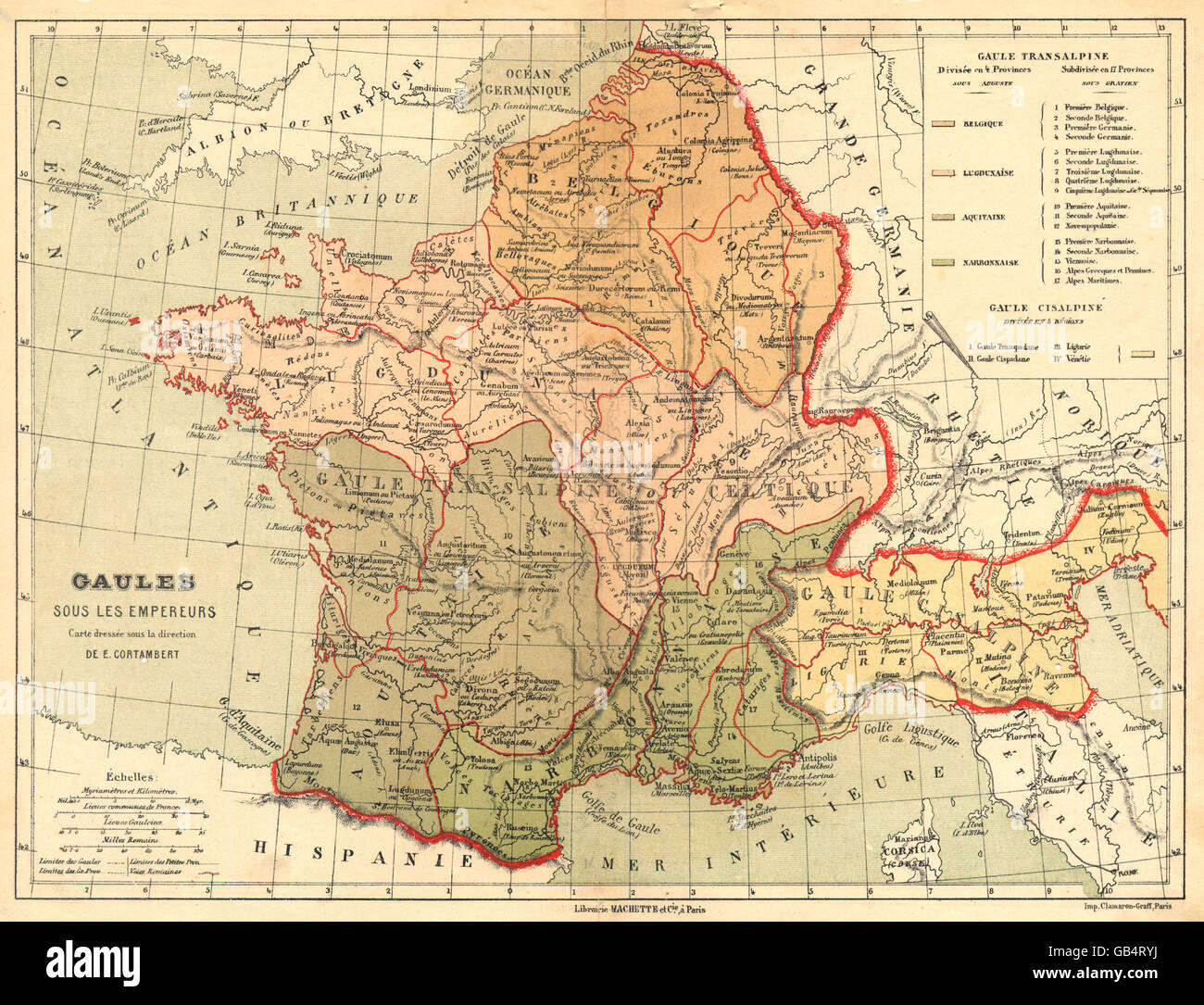 FRANCE: Gaules sous les Empereurs carte dressée sous la direction, 1880 map Stock Photohttps://www.alamy.com/image-license-details/?v=1https://www.alamy.com/stock-photo-france-gaules-sous-les-empereurs-carte-dresse-sous-la-direction-1880-110130038.html
RFGB4RYJ–FRANCE: Gaules sous les Empereurs carte dressée sous la direction, 1880 map
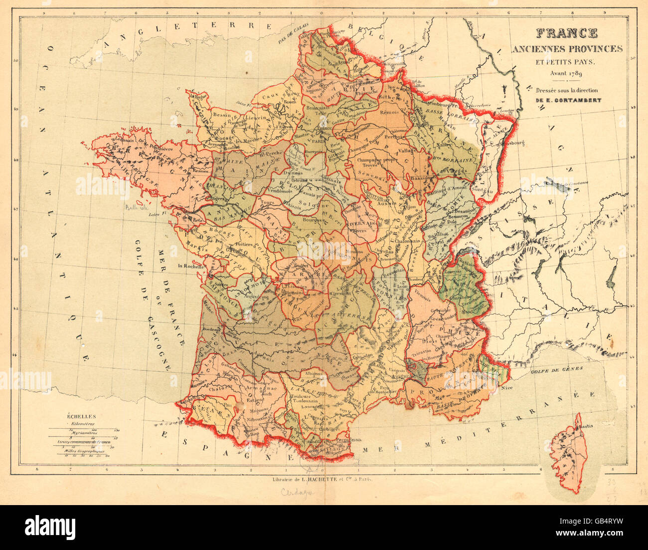 FRANCE: France Anciennes Provinces et Petits Pays Avant 1789, 1880 antique map Stock Photohttps://www.alamy.com/image-license-details/?v=1https://www.alamy.com/stock-photo-france-france-anciennes-provinces-et-petits-pays-avant-1789-1880-antique-110130045.html
RFGB4RYW–FRANCE: France Anciennes Provinces et Petits Pays Avant 1789, 1880 antique map
 WORLD: Mappemonde sur la projection de Mercator dressée sous la direction 1880 Stock Photohttps://www.alamy.com/image-license-details/?v=1https://www.alamy.com/stock-photo-world-mappemonde-sur-la-projection-de-mercator-dresse-sous-la-direction-110132688.html
RFGB4YA8–WORLD: Mappemonde sur la projection de Mercator dressée sous la direction 1880
 FRANCE: France Versant de la Mer Loire Garonne; Bordeaux; Nantes, 1880 old map Stock Photohttps://www.alamy.com/image-license-details/?v=1https://www.alamy.com/stock-photo-france-france-versant-de-la-mer-loire-garonne-bordeaux-nantes-1880-110131036.html
RFGB4W78–FRANCE: France Versant de la Mer Loire Garonne; Bordeaux; Nantes, 1880 old map
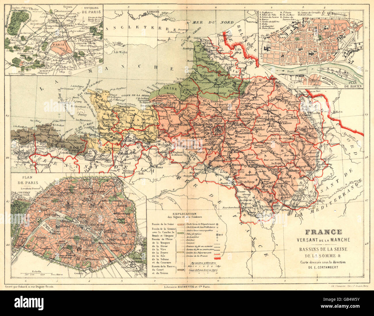 FRANCE: France Versant de la Manche Seine Somme; Paris; Rouen, 1880 old map Stock Photohttps://www.alamy.com/image-license-details/?v=1https://www.alamy.com/stock-photo-france-france-versant-de-la-manche-seine-somme-paris-rouen-1880-old-110130999.html
RFGB4W5Y–FRANCE: France Versant de la Manche Seine Somme; Paris; Rouen, 1880 old map
 FRANCE: Divisions comparatives Anciennes provinces Départements Actuels 1880 map Stock Photohttps://www.alamy.com/image-license-details/?v=1https://www.alamy.com/stock-photo-france-divisions-comparatives-anciennes-provinces-dpartements-actuels-110130047.html
RFGB4RYY–FRANCE: Divisions comparatives Anciennes provinces Départements Actuels 1880 map
 FRANCE: Carte Hypsométrique de la France; Inset map of Sardaigne, 1880 Stock Photohttps://www.alamy.com/image-license-details/?v=1https://www.alamy.com/stock-photo-france-carte-hypsomtrique-de-la-france-inset-map-of-sardaigne-1880-110128902.html
RFGB4PF2–FRANCE: Carte Hypsométrique de la France; Inset map of Sardaigne, 1880
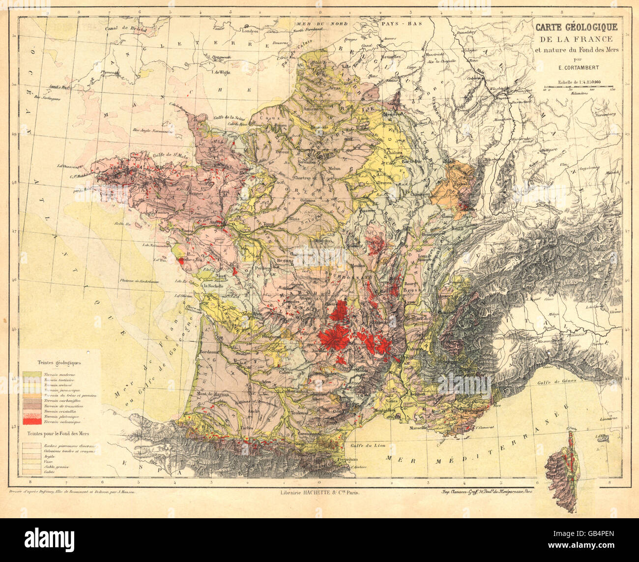 FRANCE: Carte Géologique de la France et nature du fond des Mers, 1880 old map Stock Photohttps://www.alamy.com/image-license-details/?v=1https://www.alamy.com/stock-photo-france-carte-gologique-de-la-france-et-nature-du-fond-des-mers-1880-110128893.html
RFGB4PEN–FRANCE: Carte Géologique de la France et nature du fond des Mers, 1880 old map
 EUROPEAN RUSSIA showing railways & oblasts. Russia in Europe, 1880 antique map Stock Photohttps://www.alamy.com/image-license-details/?v=1https://www.alamy.com/stock-photo-european-russia-showing-railways-oblasts-russia-in-europe-1880-antique-93401108.html
RFFBXP1T–EUROPEAN RUSSIA showing railways & oblasts. Russia in Europe, 1880 antique map
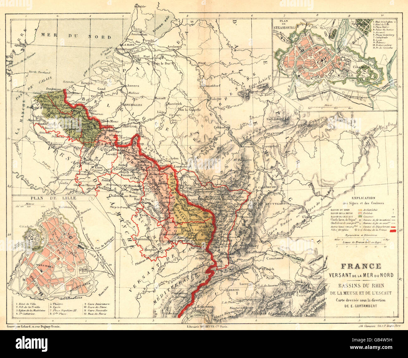 FRANCE: Versant Mer Nord Bassins Rhin Meuse Escaut; Strasbourg; Lille, 1880 map Stock Photohttps://www.alamy.com/image-license-details/?v=1https://www.alamy.com/stock-photo-france-versant-mer-nord-bassins-rhin-meuse-escaut-strasbourg-lille-110130989.html
RFGB4W5H–FRANCE: Versant Mer Nord Bassins Rhin Meuse Escaut; Strasbourg; Lille, 1880 map
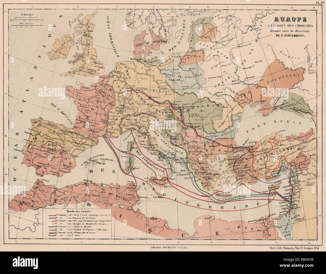 CRUSADES 1096-1270. Showing the 1st-8th Crusades. Europe to Holy Land, 1880 map Stock Photohttps://www.alamy.com/image-license-details/?v=1https://www.alamy.com/stock-photo-crusades-1096-1270-showing-the-1st-8th-crusades-europe-to-holy-land-93392415.html
RFFBXAYB–CRUSADES 1096-1270. Showing the 1st-8th Crusades. Europe to Holy Land, 1880 map
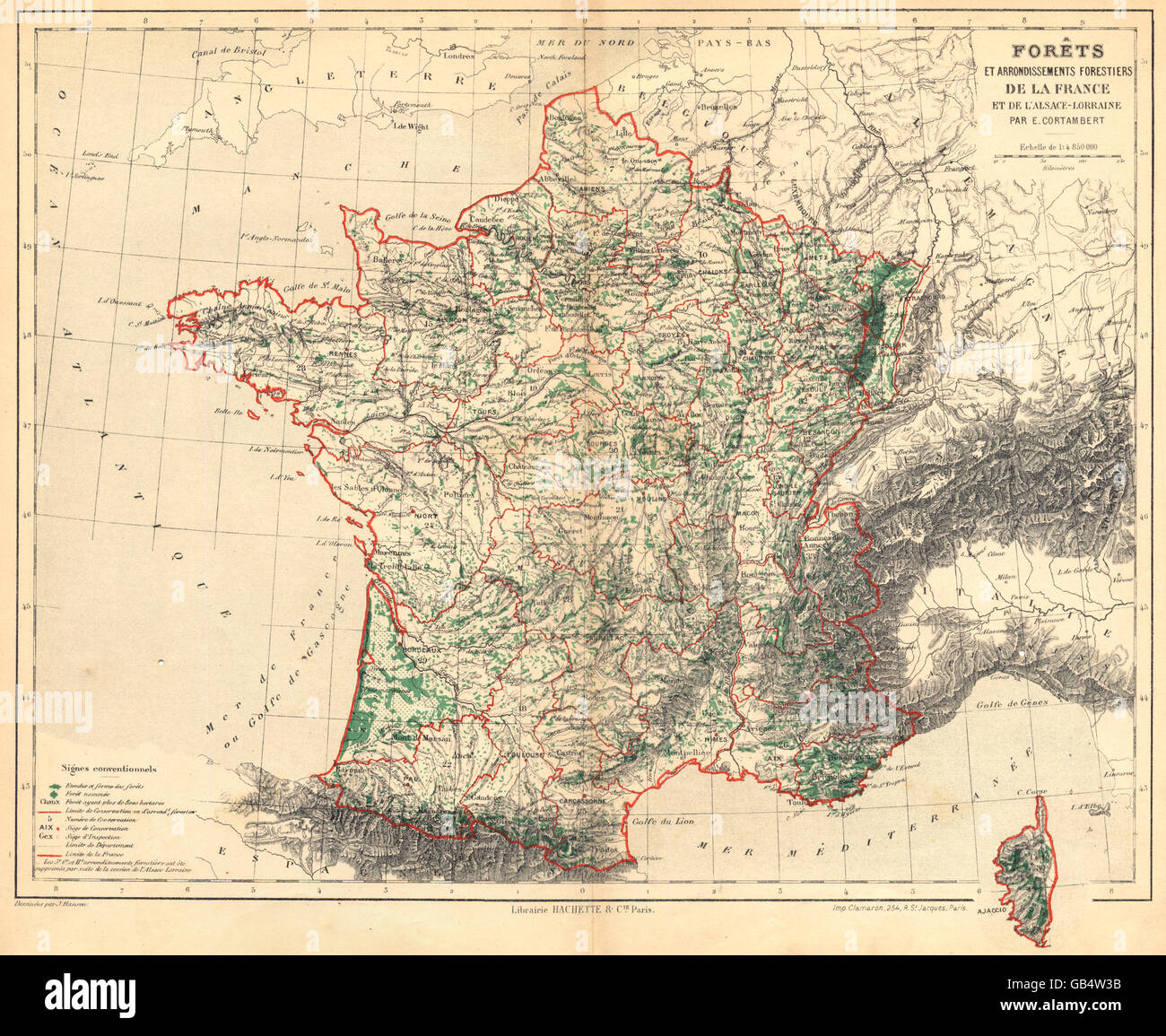 FRANCE: Forêts Arrondissements Forestiers de L'alsace- Lorraine, 1880 old map Stock Photohttps://www.alamy.com/image-license-details/?v=1https://www.alamy.com/stock-photo-france-forts-arrondissements-forestiers-de-lalsace-lorraine-1880-old-110130927.html
RFGB4W3B–FRANCE: Forêts Arrondissements Forestiers de L'alsace- Lorraine, 1880 old map
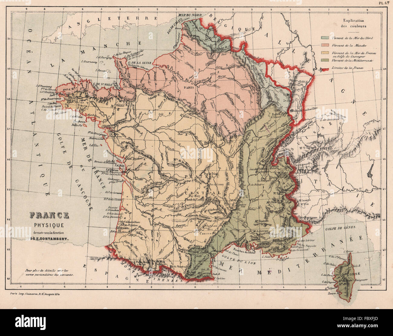 FRANCE WATERSHEDS Bay of Biscay English Channel Mediterranean North Sea 1880 map Stock Photohttps://www.alamy.com/image-license-details/?v=1https://www.alamy.com/stock-photo-france-watersheds-bay-of-biscay-english-channel-mediterranean-north-93396085.html
RFFBXFJD–FRANCE WATERSHEDS Bay of Biscay English Channel Mediterranean North Sea 1880 map
 FRANCE: Chemins fer; maps Lille; Paris; Corse (Corsica) , 1880 Stock Photohttps://www.alamy.com/image-license-details/?v=1https://www.alamy.com/stock-photo-france-chemins-fer-maps-lille-paris-corse-corsica-1880-110130974.html
RFGB4W52–FRANCE: Chemins fer; maps Lille; Paris; Corse (Corsica) , 1880
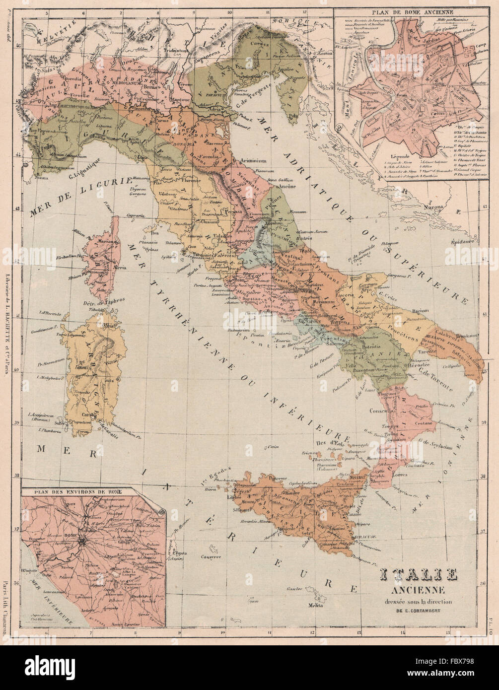 ANCIENT ITALY under the Romans. Inset Ancient Rome, environs, 1880 antique map Stock Photohttps://www.alamy.com/image-license-details/?v=1https://www.alamy.com/stock-photo-ancient-italy-under-the-romans-inset-ancient-rome-environs-1880-antique-93389556.html
RFFBX798–ANCIENT ITALY under the Romans. Inset Ancient Rome, environs, 1880 antique map
 FRANCE: Versant Méditerranée Bassins Rhône Aude Hèrault Var; Marseille, 1880 map Stock Photohttps://www.alamy.com/image-license-details/?v=1https://www.alamy.com/stock-photo-france-versant-mditerrane-bassins-rhne-aude-hrault-var-marseille-1880-110131054.html
RFGB4W7X–FRANCE: Versant Méditerranée Bassins Rhône Aude Hèrault Var; Marseille, 1880 map
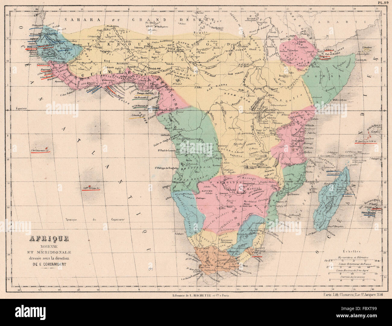 SUB-SAHARAN AFRICA showing French British Portuguese Spanish colonies, 1880 map Stock Photohttps://www.alamy.com/image-license-details/?v=1https://www.alamy.com/stock-photo-sub-saharan-africa-showing-french-british-portuguese-spanish-colonies-93402885.html
RFFBXT99–SUB-SAHARAN AFRICA showing French British Portuguese Spanish colonies, 1880 map
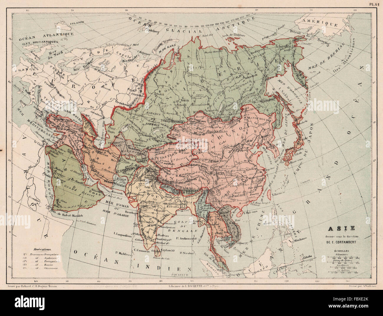 ASIA POLITICAL showing British French Portuguese Ottoman possessions, 1880 map Stock Photohttps://www.alamy.com/image-license-details/?v=1https://www.alamy.com/stock-photo-asia-political-showing-british-french-portuguese-ottoman-possessions-93394859.html
RFFBXE2K–ASIA POLITICAL showing British French Portuguese Ottoman possessions, 1880 map
 EUROPE WATERSHEDS/drainage divide. Mountain profiles. Physical, 1880 old map Stock Photohttps://www.alamy.com/image-license-details/?v=1https://www.alamy.com/stock-photo-europe-watershedsdrainage-divide-mountain-profiles-physical-1880-old-93394593.html
RFFBXDN5–EUROPE WATERSHEDS/drainage divide. Mountain profiles. Physical, 1880 old map
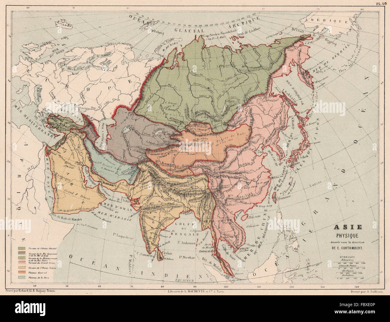 ASIA WATERSHEDS into Arctic Indian Pacific Oceans Mediterranean, 1880 old map Stock Photohttps://www.alamy.com/image-license-details/?v=1https://www.alamy.com/stock-photo-asia-watersheds-into-arctic-indian-pacific-oceans-mediterranean-1880-93394806.html
RFFBXE0P–ASIA WATERSHEDS into Arctic Indian Pacific Oceans Mediterranean, 1880 old map
 PALESTINE in the time of Christ.Canaan divided into 12 tribes of israel 1880 map Stock Photohttps://www.alamy.com/image-license-details/?v=1https://www.alamy.com/stock-photo-palestine-in-the-time-of-christcanaan-divided-into-12-tribes-of-israel-93388435.html
RFFBX5W7–PALESTINE in the time of Christ.Canaan divided into 12 tribes of israel 1880 map
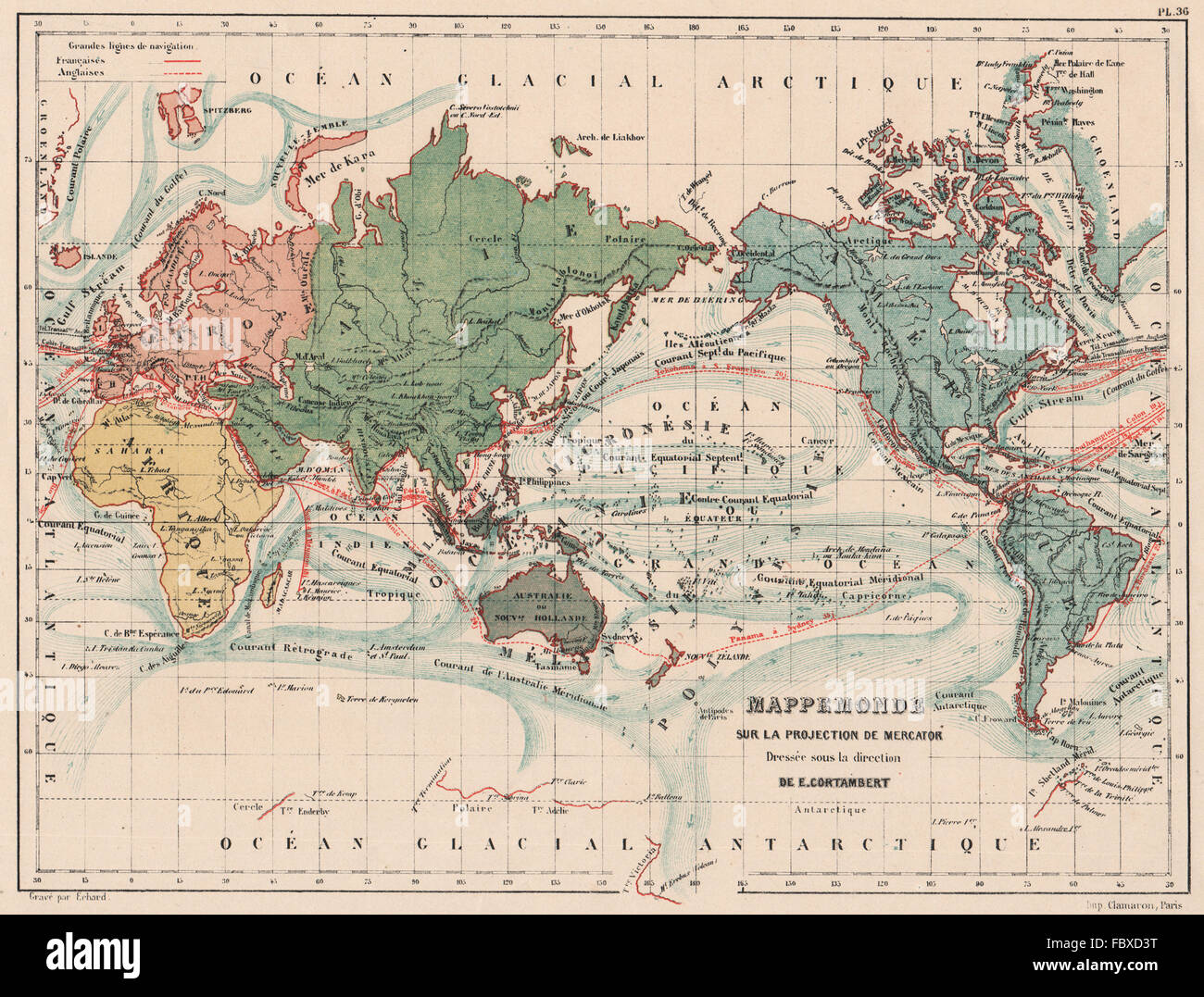 WORLD ON MERCATOR'S PROJECTION showing English & French shipping routes 1880 map Stock Photohttps://www.alamy.com/image-license-details/?v=1https://www.alamy.com/stock-photo-world-on-mercators-projection-showing-english-french-shipping-routes-93394108.html
RFFBXD3T–WORLD ON MERCATOR'S PROJECTION showing English & French shipping routes 1880 map
 FRANCE ROCK TYPES & MINERAL WATER SOURCES. Carrières. Eaux Minérales, 1880 map Stock Photohttps://www.alamy.com/image-license-details/?v=1https://www.alamy.com/stock-photo-france-rock-types-mineral-water-sources-carrires-eaux-minrales-1880-93397502.html
RFFBXHD2–FRANCE ROCK TYPES & MINERAL WATER SOURCES. Carrières. Eaux Minérales, 1880 map
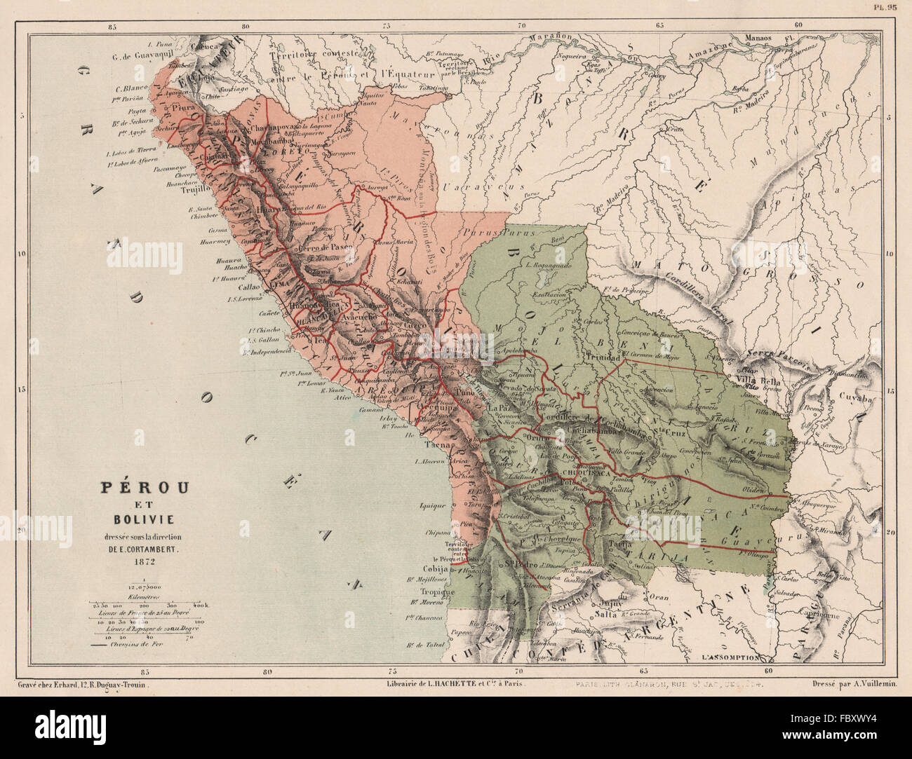 PERU & BOLIVIA with Littoral pre- War of the Pacific. Pérou et Bolivie, 1880 map Stock Photohttps://www.alamy.com/image-license-details/?v=1https://www.alamy.com/stock-photo-peru-bolivia-with-littoral-pre-war-of-the-pacific-prou-et-bolivie-93404168.html
RFFBXWY4–PERU & BOLIVIA with Littoral pre- War of the Pacific. Pérou et Bolivie, 1880 map
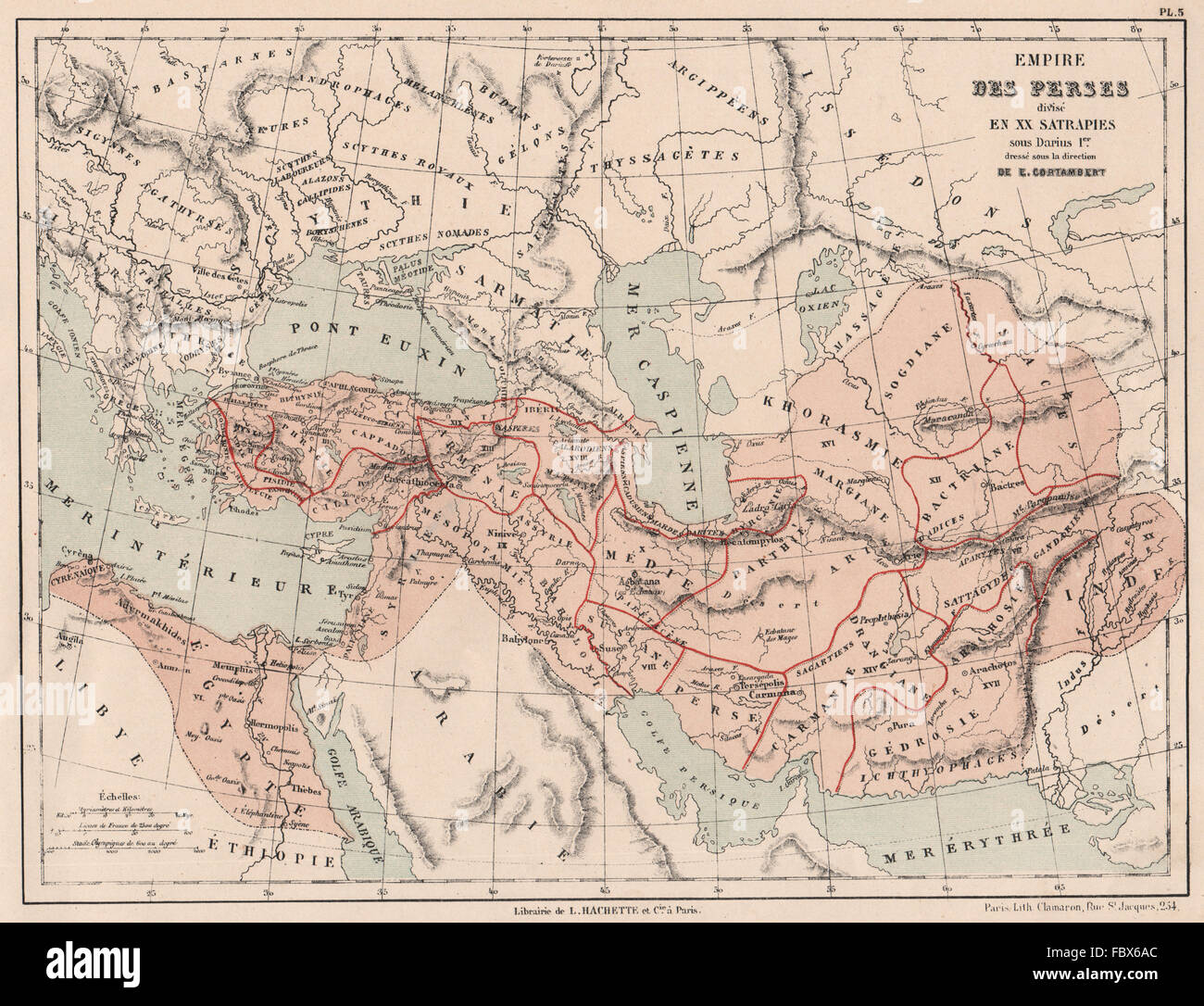 PERSIAN EMPIRE of Darius I divided into Satrapies. Satrapy. 5C BC, 1880 map Stock Photohttps://www.alamy.com/image-license-details/?v=1https://www.alamy.com/stock-photo-persian-empire-of-darius-i-divided-into-satrapies-satrapy-5c-bc-1880-93388804.html
RFFBX6AC–PERSIAN EMPIRE of Darius I divided into Satrapies. Satrapy. 5C BC, 1880 map
 FRANCE:Départements villes principaux Cinaux Chemins de fer;area Paris, 1880 map Stock Photohttps://www.alamy.com/image-license-details/?v=1https://www.alamy.com/stock-photo-francedpartements-villes-principaux-cinaux-chemins-de-ferarea-paris-110130052.html
RFGB4T04–FRANCE:Départements villes principaux Cinaux Chemins de fer;area Paris, 1880 map
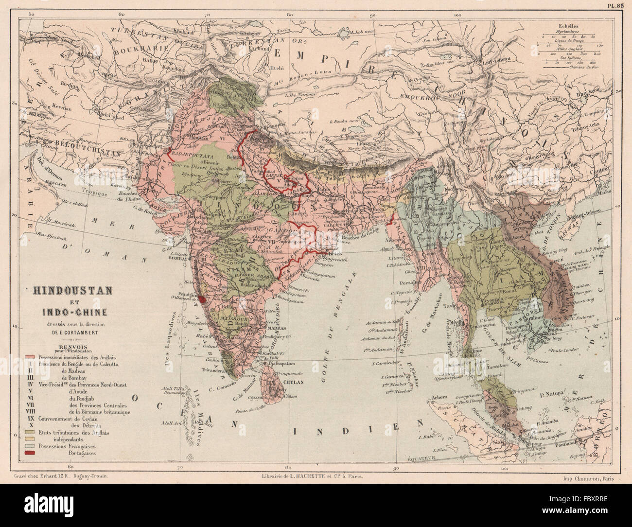 SOUTH ASIA. Hindustan and Indochina. India Siam Cochinchina Burma, 1880 map Stock Photohttps://www.alamy.com/image-license-details/?v=1https://www.alamy.com/stock-photo-south-asia-hindustan-and-indochina-india-siam-cochinchina-burma-1880-93402498.html
RFFBXRRE–SOUTH ASIA. Hindustan and Indochina. India Siam Cochinchina Burma, 1880 map
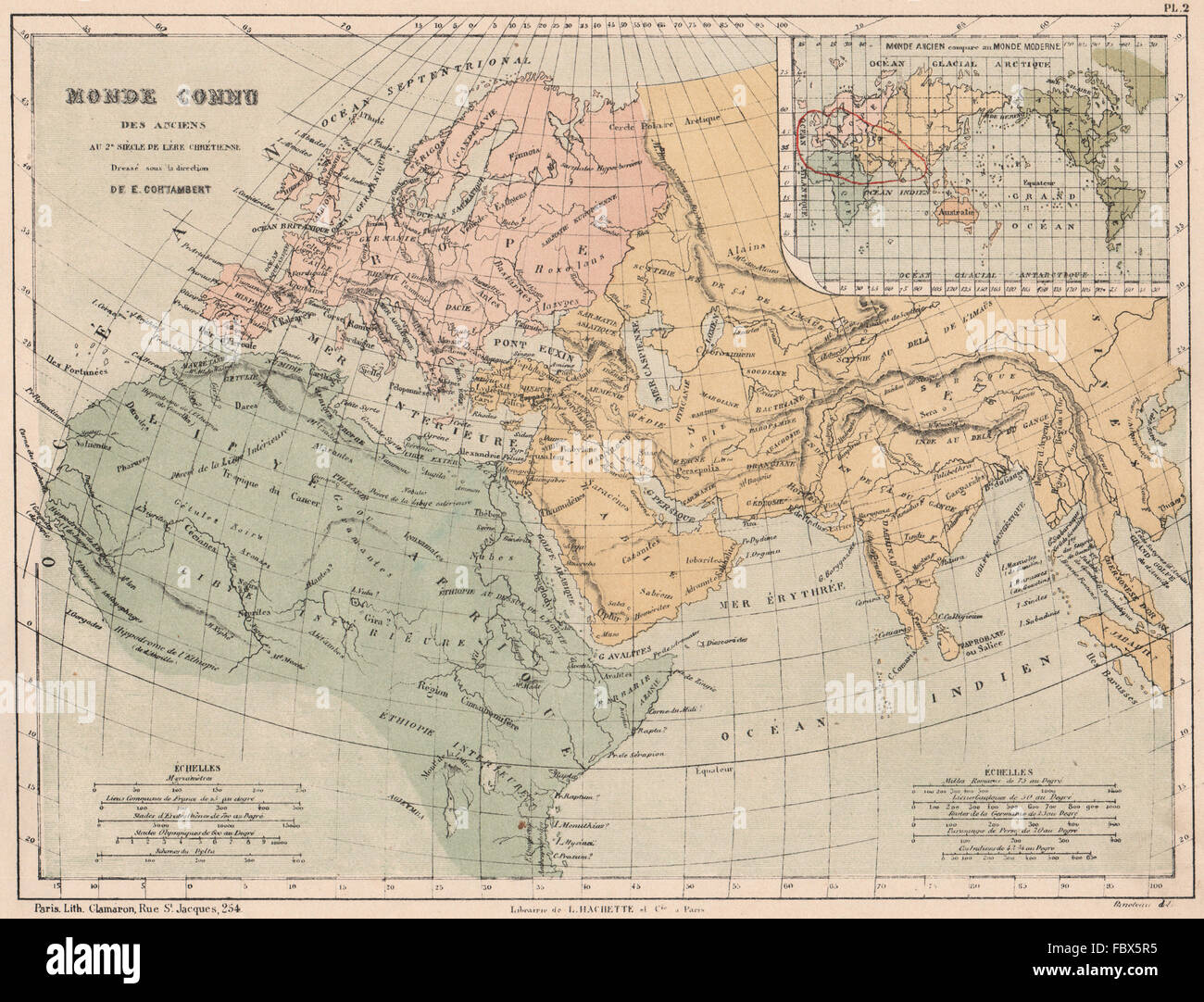 ANCIENT WORLD as known in the 2nd century AD. Cf with Modern World, 1880 map Stock Photohttps://www.alamy.com/image-license-details/?v=1https://www.alamy.com/stock-photo-ancient-world-as-known-in-the-2nd-century-ad-cf-with-modern-world-93388377.html
RFFBX5R5–ANCIENT WORLD as known in the 2nd century AD. Cf with Modern World, 1880 map
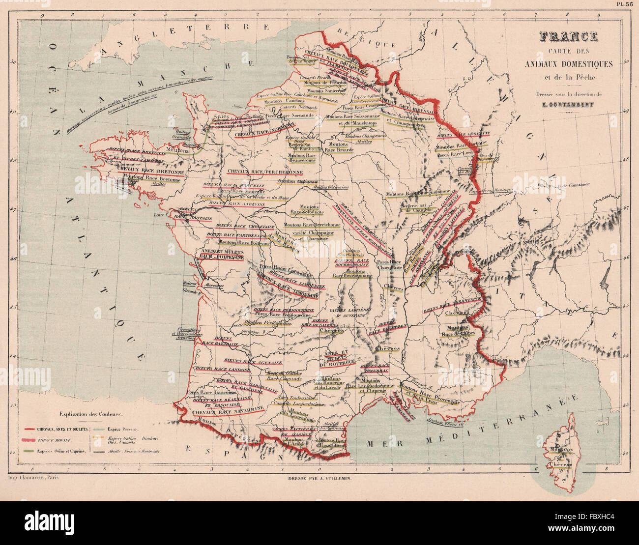 FRANCE FARM ANIMALS. Domesticated. Cows goats sheep geese ducks &c, 1880 map Stock Photohttps://www.alamy.com/image-license-details/?v=1https://www.alamy.com/stock-photo-france-farm-animals-domesticated-cows-goats-sheep-geese-ducks-c-1880-93397476.html
RFFBXHC4–FRANCE FARM ANIMALS. Domesticated. Cows goats sheep geese ducks &c, 1880 map
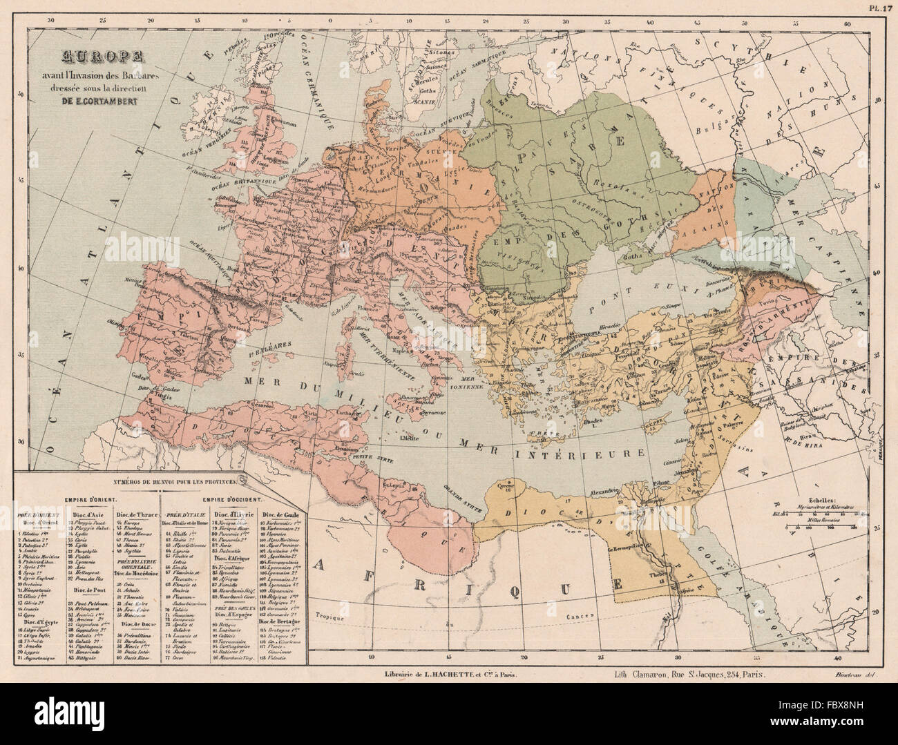 EUROPE BEFORE THE BARBARIAN INVASION. Eastern & Western Roman Empires, 1880 map Stock Photohttps://www.alamy.com/image-license-details/?v=1https://www.alamy.com/stock-photo-europe-before-the-barbarian-invasion-eastern-western-roman-empires-93390685.html
RFFBX8NH–EUROPE BEFORE THE BARBARIAN INVASION. Eastern & Western Roman Empires, 1880 map
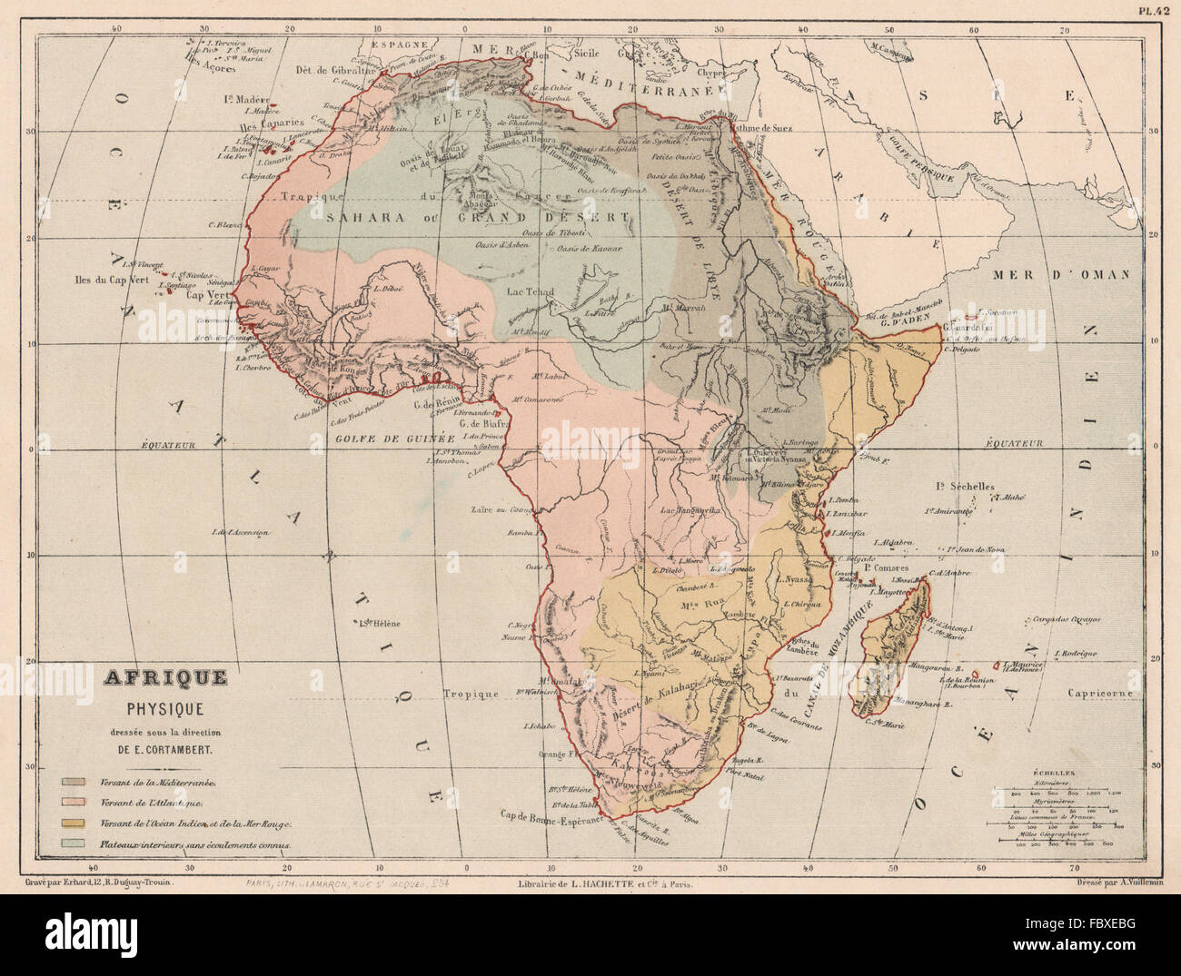 AFRICA WATERSHEDS/drainage divides Atlantic Indian Oceans Mediterranean 1880 map Stock Photohttps://www.alamy.com/image-license-details/?v=1https://www.alamy.com/stock-photo-africa-watershedsdrainage-divides-atlantic-indian-oceans-mediterranean-93395108.html
RFFBXEBG–AFRICA WATERSHEDS/drainage divides Atlantic Indian Oceans Mediterranean 1880 map
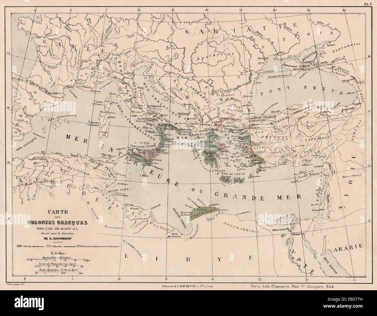 ANCIENT GREECE GREEK COLONIES in 500BC Dorian Aeolian Achaean Ionian, 1880 map Stock Photohttps://www.alamy.com/image-license-details/?v=1https://www.alamy.com/stock-photo-ancient-greece-greek-colonies-in-500bc-dorian-aeolian-achaean-ionian-93389509.html
RFFBX77H–ANCIENT GREECE GREEK COLONIES in 500BC Dorian Aeolian Achaean Ionian, 1880 map
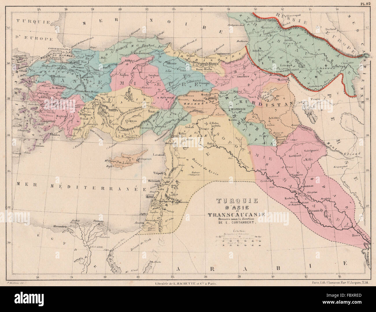 TURKEY IN ASIA. Transcaucasia. Mesopotamia Syria Levant Iraq Cyprus, 1880 map Stock Photohttps://www.alamy.com/image-license-details/?v=1https://www.alamy.com/stock-photo-turkey-in-asia-transcaucasia-mesopotamia-syria-levant-iraq-cyprus-93402245.html
RFFBXRED–TURKEY IN ASIA. Transcaucasia. Mesopotamia Syria Levant Iraq Cyprus, 1880 map
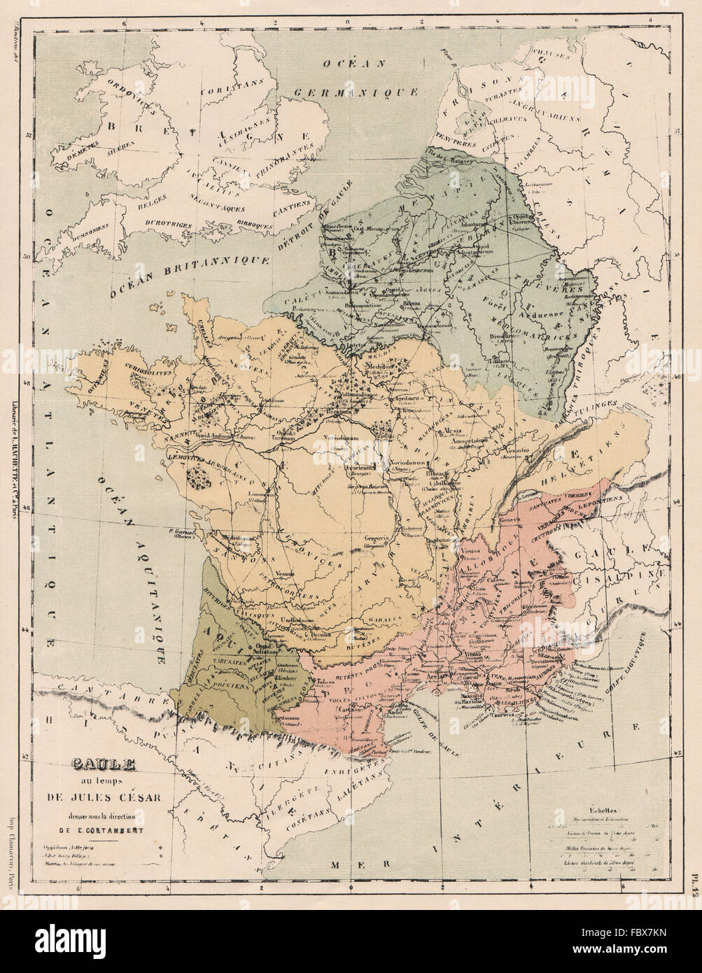 GAULE in the time of Julius Caesar. Gaule. Roman roads.Tribes Provinces 1880 map Stock Photohttps://www.alamy.com/image-license-details/?v=1https://www.alamy.com/stock-photo-gaule-in-the-time-of-julius-caesar-gaule-roman-roadstribes-provinces-93389849.html
RFFBX7KN–GAULE in the time of Julius Caesar. Gaule. Roman roads.Tribes Provinces 1880 map
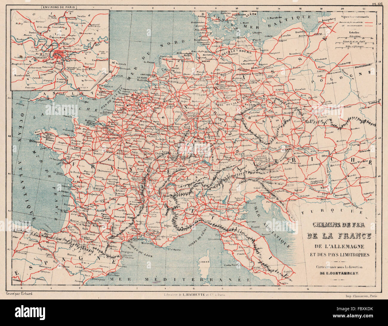 FRANCE & GERMANY RAILWAYS. Western/Central Europe. Chemins de fer, 1880 map Stock Photohttps://www.alamy.com/image-license-details/?v=1https://www.alamy.com/stock-photo-france-germany-railways-westerncentral-europe-chemins-de-fer-1880-93399087.html
RFFBXKDK–FRANCE & GERMANY RAILWAYS. Western/Central Europe. Chemins de fer, 1880 map
 AMERICAS WATERSHEDS/drainage divides into Atlantic Pacific oceans, 1880 map Stock Photohttps://www.alamy.com/image-license-details/?v=1https://www.alamy.com/stock-photo-americas-watershedsdrainage-divides-into-atlantic-pacific-oceans-1880-93395504.html
RFFBXEWM–AMERICAS WATERSHEDS/drainage divides into Atlantic Pacific oceans, 1880 map
 HOLY ROMAN EMPIRE. Germany under Saxon & Franconian Emperors 911-1138, 1880 map Stock Photohttps://www.alamy.com/image-license-details/?v=1https://www.alamy.com/stock-photo-holy-roman-empire-germany-under-saxon-franconian-emperors-911-1138-93392221.html
RFFBXAMD–HOLY ROMAN EMPIRE. Germany under Saxon & Franconian Emperors 911-1138, 1880 map
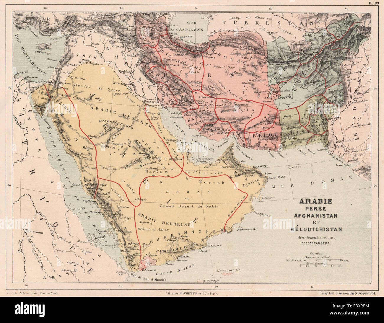 SOUTH WEST ASIA. Arabia Persia Afghanistan Baluchistan Iran Pakistan, 1880 map Stock Photohttps://www.alamy.com/image-license-details/?v=1https://www.alamy.com/stock-photo-south-west-asia-arabia-persia-afghanistan-baluchistan-iran-pakistan-93402252.html
RFFBXREM–SOUTH WEST ASIA. Arabia Persia Afghanistan Baluchistan Iran Pakistan, 1880 map
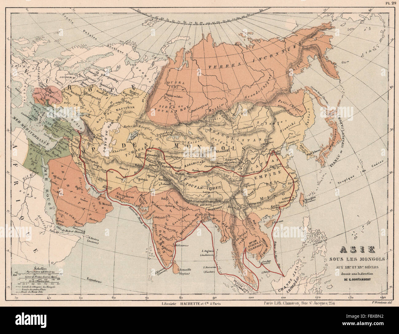 MONGOL EMPIRE. Asia in the 13C & 14C showing the route of MARCO POLO, 1880 map Stock Photohttps://www.alamy.com/image-license-details/?v=1https://www.alamy.com/stock-photo-mongol-empire-asia-in-the-13c-14c-showing-the-route-of-marco-polo-93393022.html
RFFBXBN2–MONGOL EMPIRE. Asia in the 13C & 14C showing the route of MARCO POLO, 1880 map
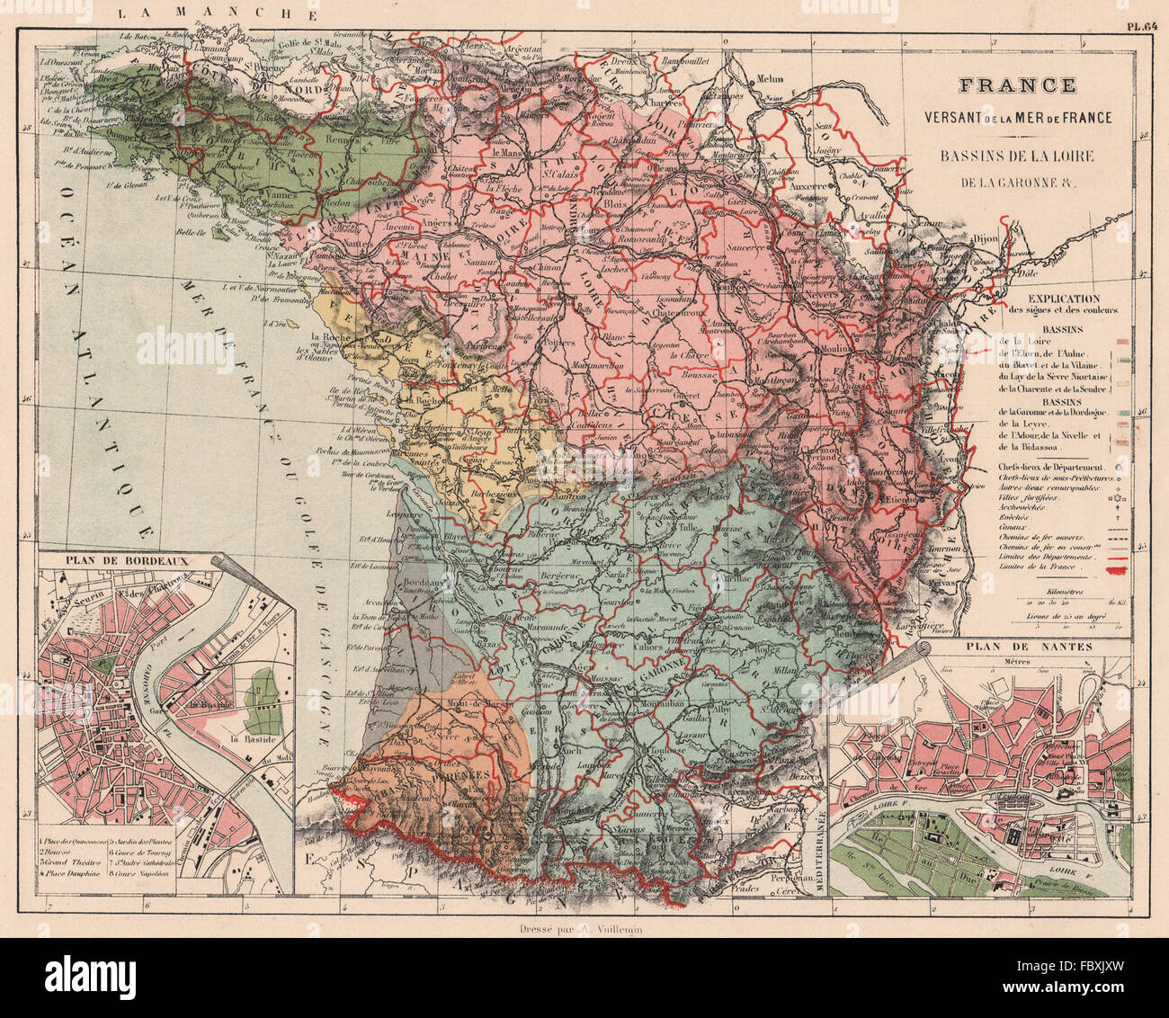 FRANCE BAY OF BISCAY WATERSHED. Loire Garonne Dordogne Leyre basins, 1880 map Stock Photohttps://www.alamy.com/image-license-details/?v=1https://www.alamy.com/stock-photo-france-bay-of-biscay-watershed-loire-garonne-dordogne-leyre-basins-93398673.html
RFFBXJXW–FRANCE BAY OF BISCAY WATERSHED. Loire Garonne Dordogne Leyre basins, 1880 map
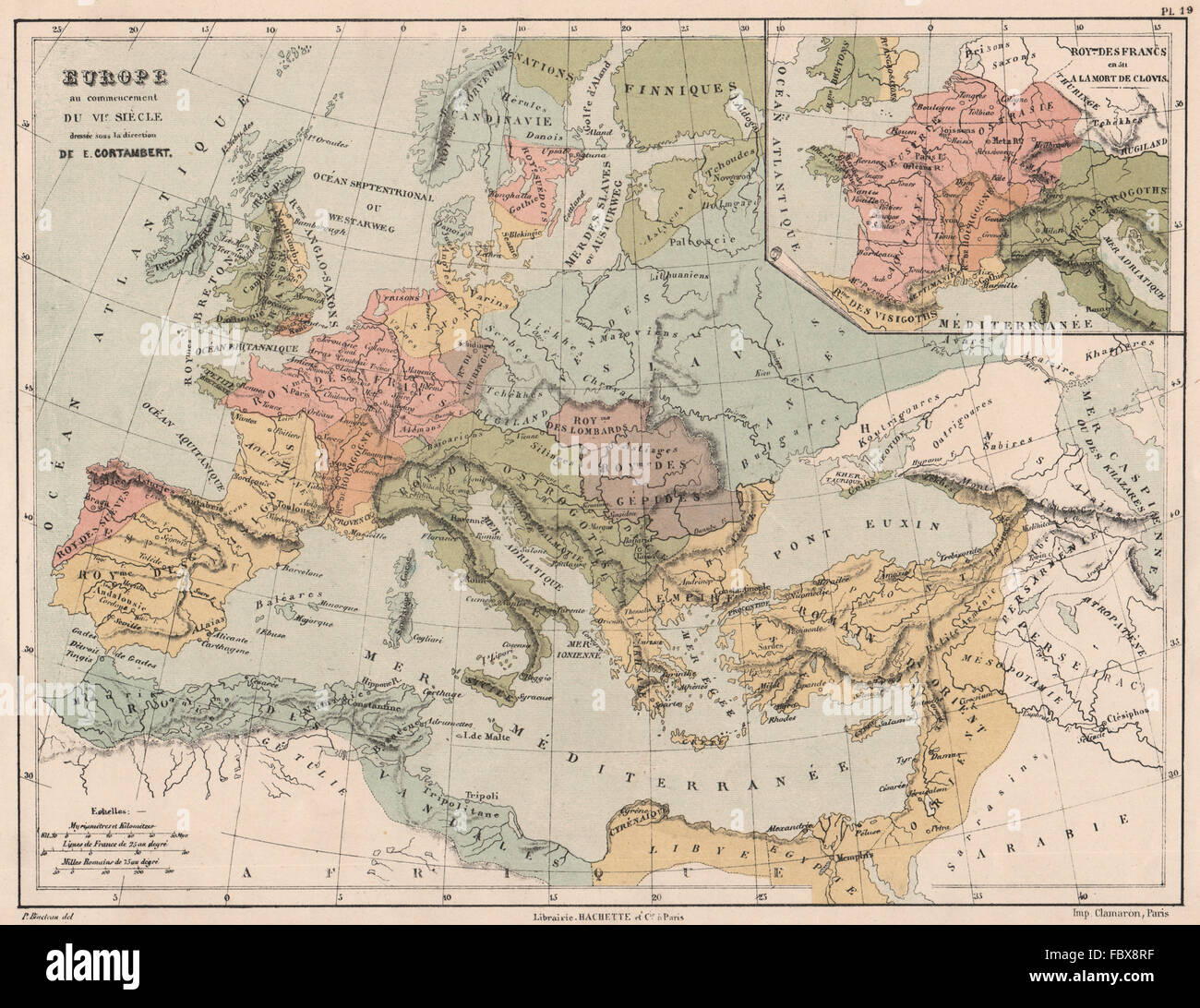 500AD EUROPE & inset Frankish Kingdom at the death of Clovis, 1880 antique map Stock Photohttps://www.alamy.com/image-license-details/?v=1https://www.alamy.com/stock-photo-500ad-europe-inset-frankish-kingdom-at-the-death-of-clovis-1880-antique-93390739.html
RFFBX8RF–500AD EUROPE & inset Frankish Kingdom at the death of Clovis, 1880 antique map
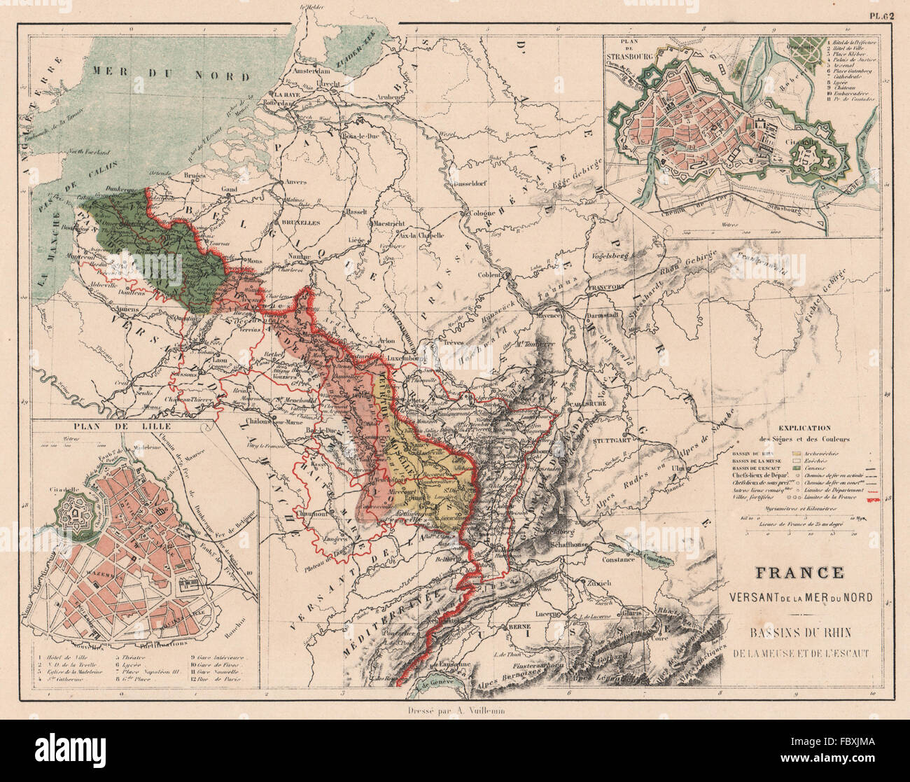 FRANCE NORTH SEA MER DU NORD WATERSHED Rhine Meuse Escaut/Scheldt basin 1880 map Stock Photohttps://www.alamy.com/image-license-details/?v=1https://www.alamy.com/stock-photo-france-north-sea-mer-du-nord-watershed-rhine-meuse-escautscheldt-basin-93398490.html
RFFBXJMA–FRANCE NORTH SEA MER DU NORD WATERSHED Rhine Meuse Escaut/Scheldt basin 1880 map
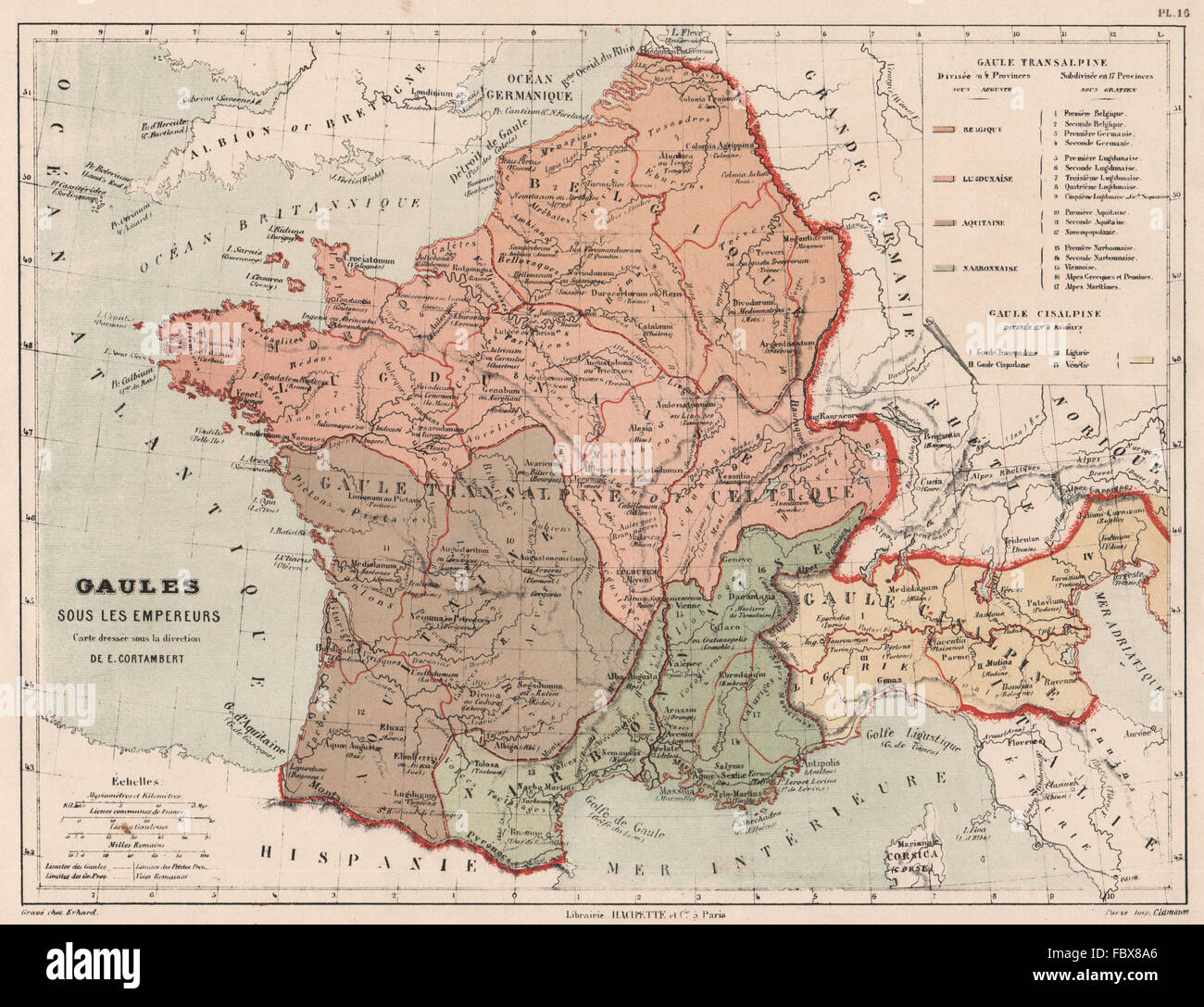 ROMAN GAUL. Gallia Narbonensis Transalpina Cisalpina Belgica Celtica, 1880 map Stock Photohttps://www.alamy.com/image-license-details/?v=1https://www.alamy.com/stock-photo-roman-gaul-gallia-narbonensis-transalpina-cisalpina-belgica-celtica-93390366.html
RFFBX8A6–ROMAN GAUL. Gallia Narbonensis Transalpina Cisalpina Belgica Celtica, 1880 map
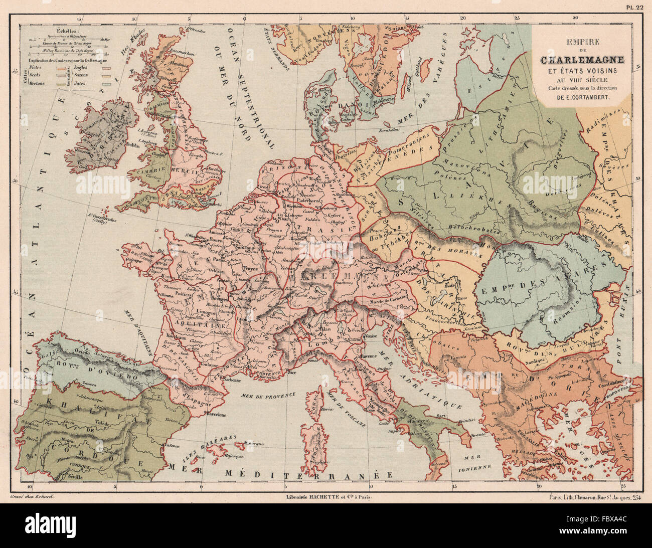 8TH CENTURY EUROPE. CAROLINGIAN EMPIRE. Empire of Charlemagne, 1880 old map Stock Photohttps://www.alamy.com/image-license-details/?v=1https://www.alamy.com/stock-photo-8th-century-europe-carolingian-empire-empire-of-charlemagne-1880-old-93391772.html
RFFBXA4C–8TH CENTURY EUROPE. CAROLINGIAN EMPIRE. Empire of Charlemagne, 1880 old map
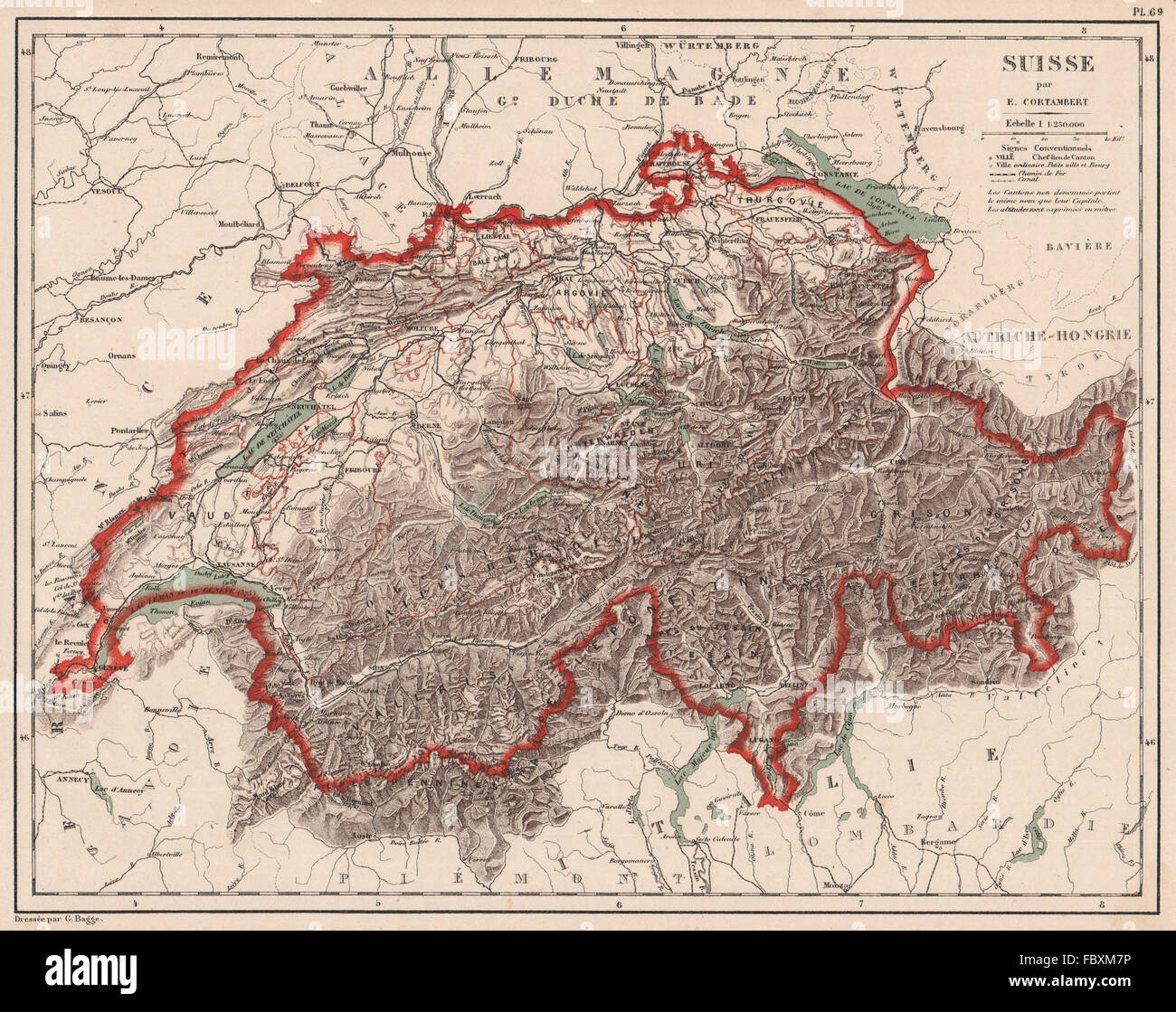 SUISSE Schweiz Switzerland physical. Lakes rivers mountains railways, 1880 map Stock Photohttps://www.alamy.com/image-license-details/?v=1https://www.alamy.com/stock-photo-suisse-schweiz-switzerland-physical-lakes-rivers-mountains-railways-93399706.html
RFFBXM7P–SUISSE Schweiz Switzerland physical. Lakes rivers mountains railways, 1880 map
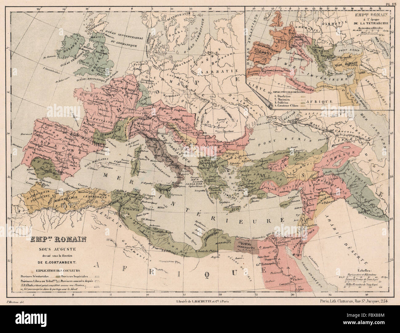 ROMAN EMPIRE under AUGUSTUS & inset under the Tetrarchy. Europe, 1880 old map Stock Photohttps://www.alamy.com/image-license-details/?v=1https://www.alamy.com/stock-photo-roman-empire-under-augustus-inset-under-the-tetrarchy-europe-1880-93390324.html
RFFBX88M–ROMAN EMPIRE under AUGUSTUS & inset under the Tetrarchy. Europe, 1880 old map
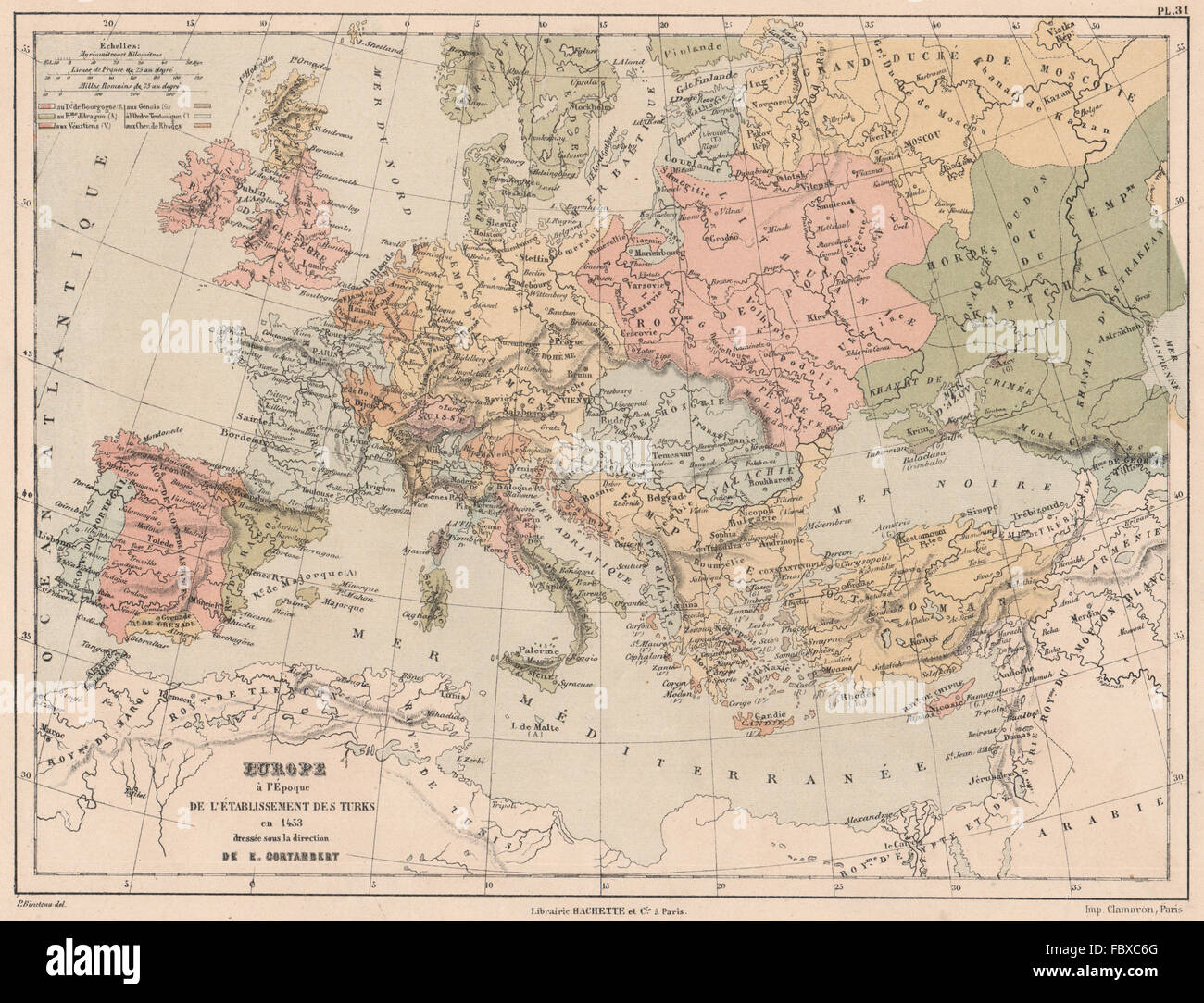 1453 EUROPE upon establishment of the Ottoman Empire.Emirate of Grenada 1880 map Stock Photohttps://www.alamy.com/image-license-details/?v=1https://www.alamy.com/stock-photo-1453-europe-upon-establishment-of-the-ottoman-empireemirate-of-grenada-93393400.html
RFFBXC6G–1453 EUROPE upon establishment of the Ottoman Empire.Emirate of Grenada 1880 map
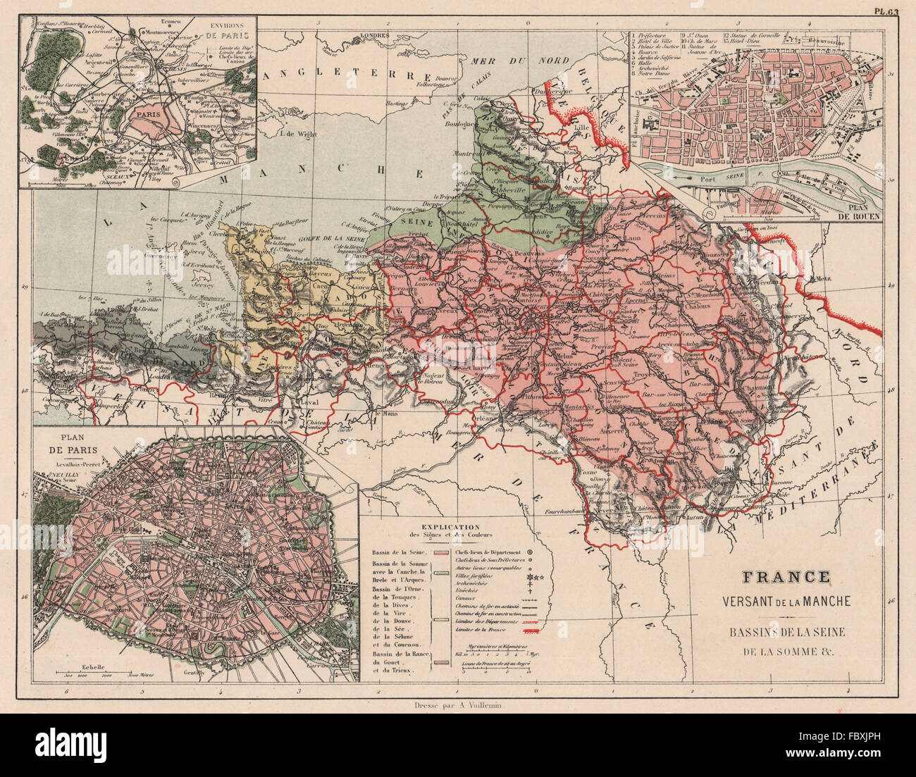 FRANCE MANCHE ENGLISH CHANNEL WATERSHED. Seine Somme Orne Rance basins, 1880 map Stock Photohttps://www.alamy.com/image-license-details/?v=1https://www.alamy.com/stock-photo-france-manche-english-channel-watershed-seine-somme-orne-rance-basins-93398553.html
RFFBXJPH–FRANCE MANCHE ENGLISH CHANNEL WATERSHED. Seine Somme Orne Rance basins, 1880 map
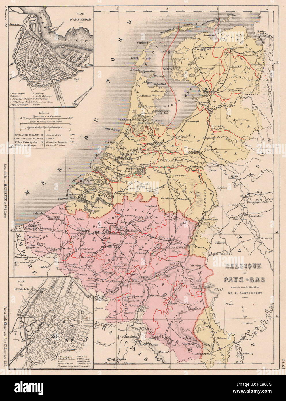 Belgium and the Netherlands. Inset Amsterdam & Brussels plans. Belgique 1880 map Stock Photohttps://www.alamy.com/image-license-details/?v=1https://www.alamy.com/stock-photo-belgium-and-the-netherlands-inset-amsterdam-brussels-plans-belgique-93608048.html
RFFC860G–Belgium and the Netherlands. Inset Amsterdam & Brussels plans. Belgique 1880 map