Italy second world war map Stock Photos and Images
(113)See italy second world war map stock video clipsQuick filters:
Italy second world war map Stock Photos and Images
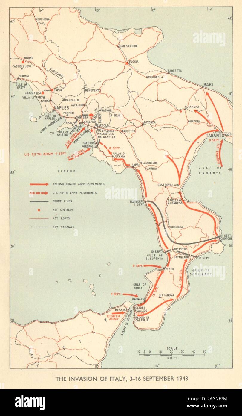 Invasion of Italy September 1943. World War 2 Salerno Taranto Calabria 1954 map Stock Photohttps://www.alamy.com/image-license-details/?v=1https://www.alamy.com/invasion-of-italy-september-1943-world-war-2-salerno-taranto-calabria-1954-map-image337304456.html
RF2AGNF7M–Invasion of Italy September 1943. World War 2 Salerno Taranto Calabria 1954 map
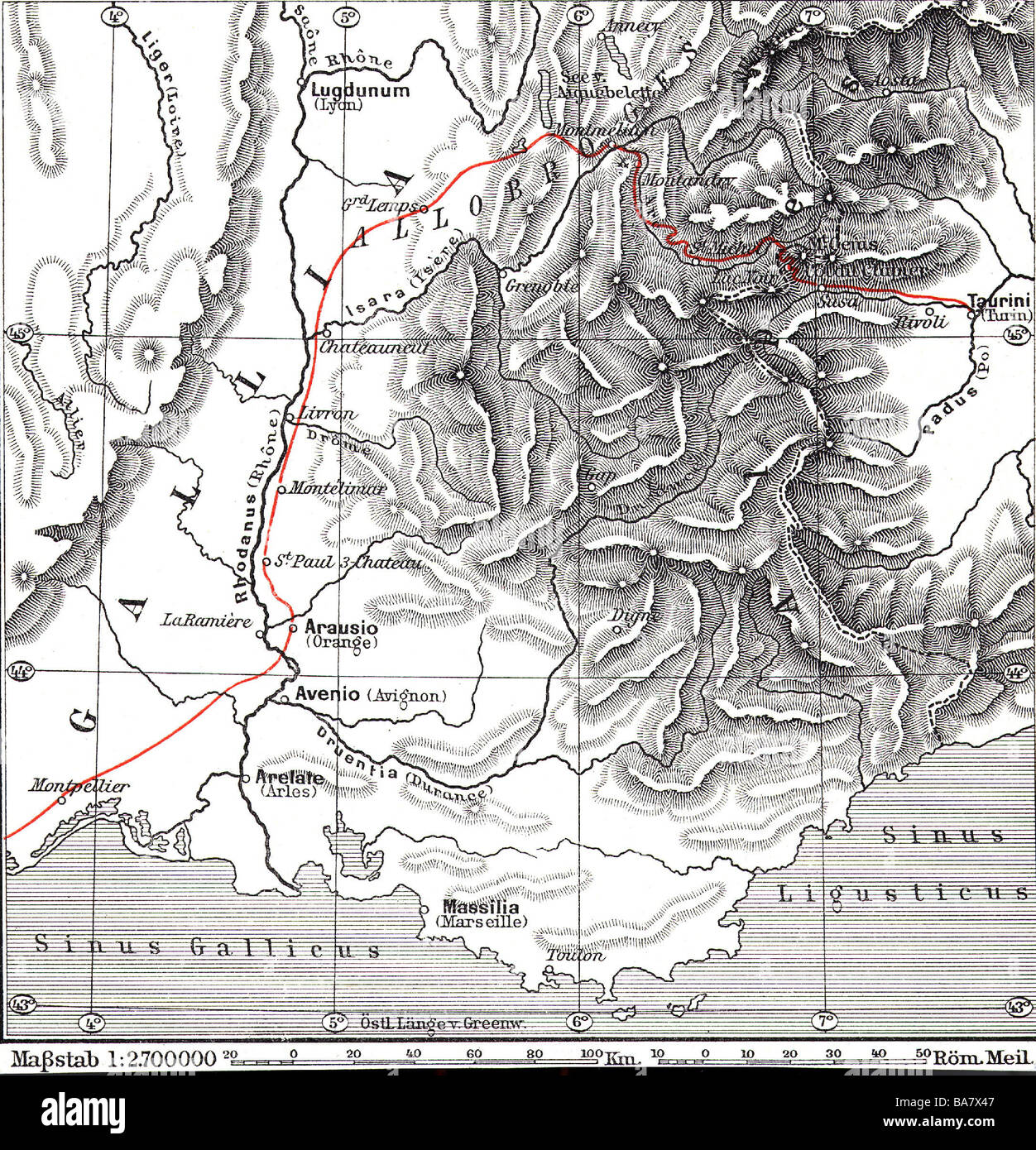 cartography, historical map, ancient world, Second Punic War 218 - 201 BC, route of Hannibal and the Carthaginian army across the Alps, 218 BC, wood engraving, 1896, Stock Photohttps://www.alamy.com/image-license-details/?v=1https://www.alamy.com/stock-photo-cartography-historical-map-ancient-world-second-punic-war-218-201-23531095.html
RMBA7X47–cartography, historical map, ancient world, Second Punic War 218 - 201 BC, route of Hannibal and the Carthaginian army across the Alps, 218 BC, wood engraving, 1896,
 WWII - A pictorial map from 1941 showing events in the Albanian Campaign 1940-1941. Stock Photohttps://www.alamy.com/image-license-details/?v=1https://www.alamy.com/wwii-a-pictorial-map-from-1941-showing-events-in-the-albanian-campaign-1940-1941-image357565093.html
RM2BNMDWW–WWII - A pictorial map from 1941 showing events in the Albanian Campaign 1940-1941.
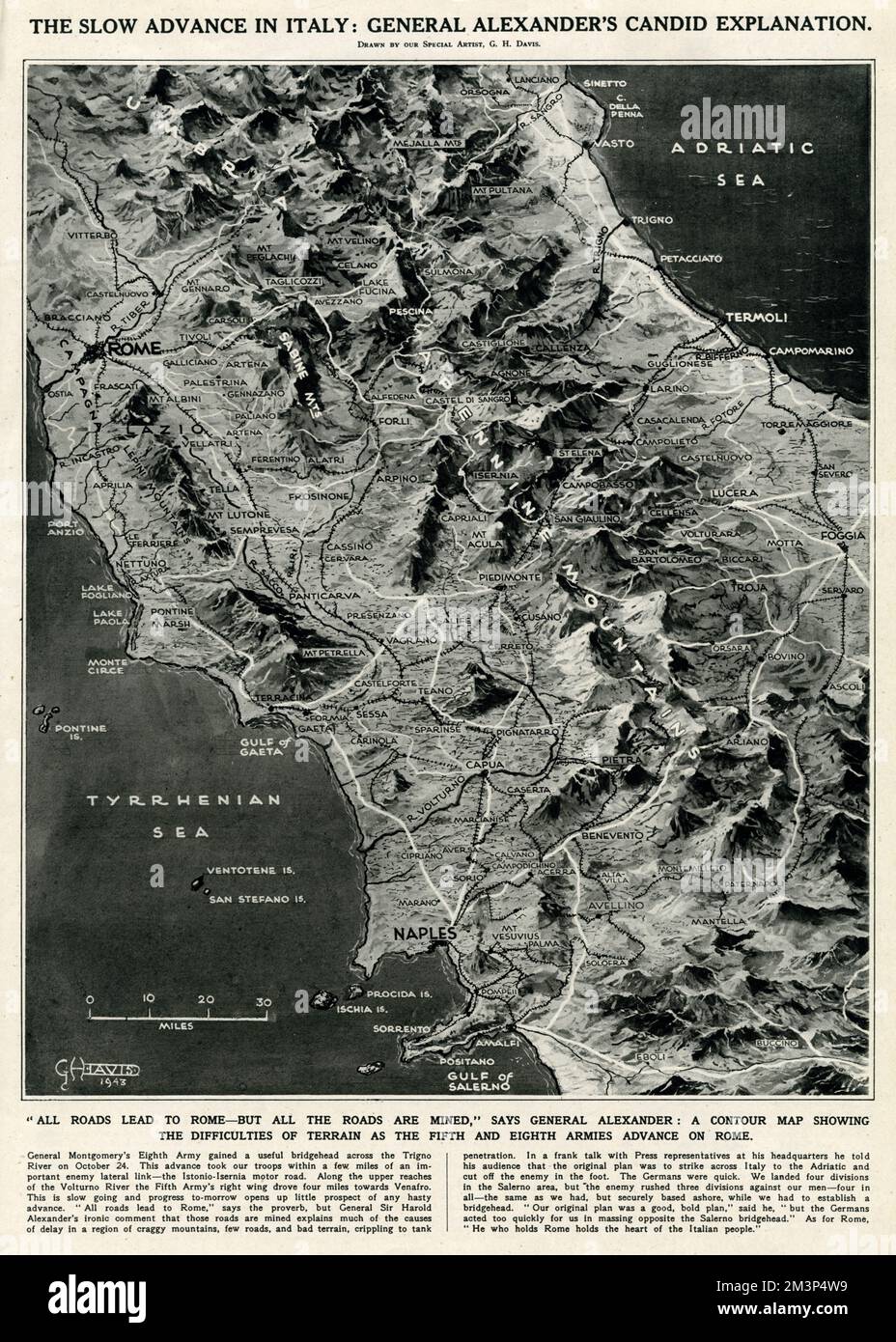 Wartime map of Italy by G. H. Davis Stock Photohttps://www.alamy.com/image-license-details/?v=1https://www.alamy.com/wartime-map-of-italy-by-g-h-davis-image501431429.html
RM2M3P4W9–Wartime map of Italy by G. H. Davis
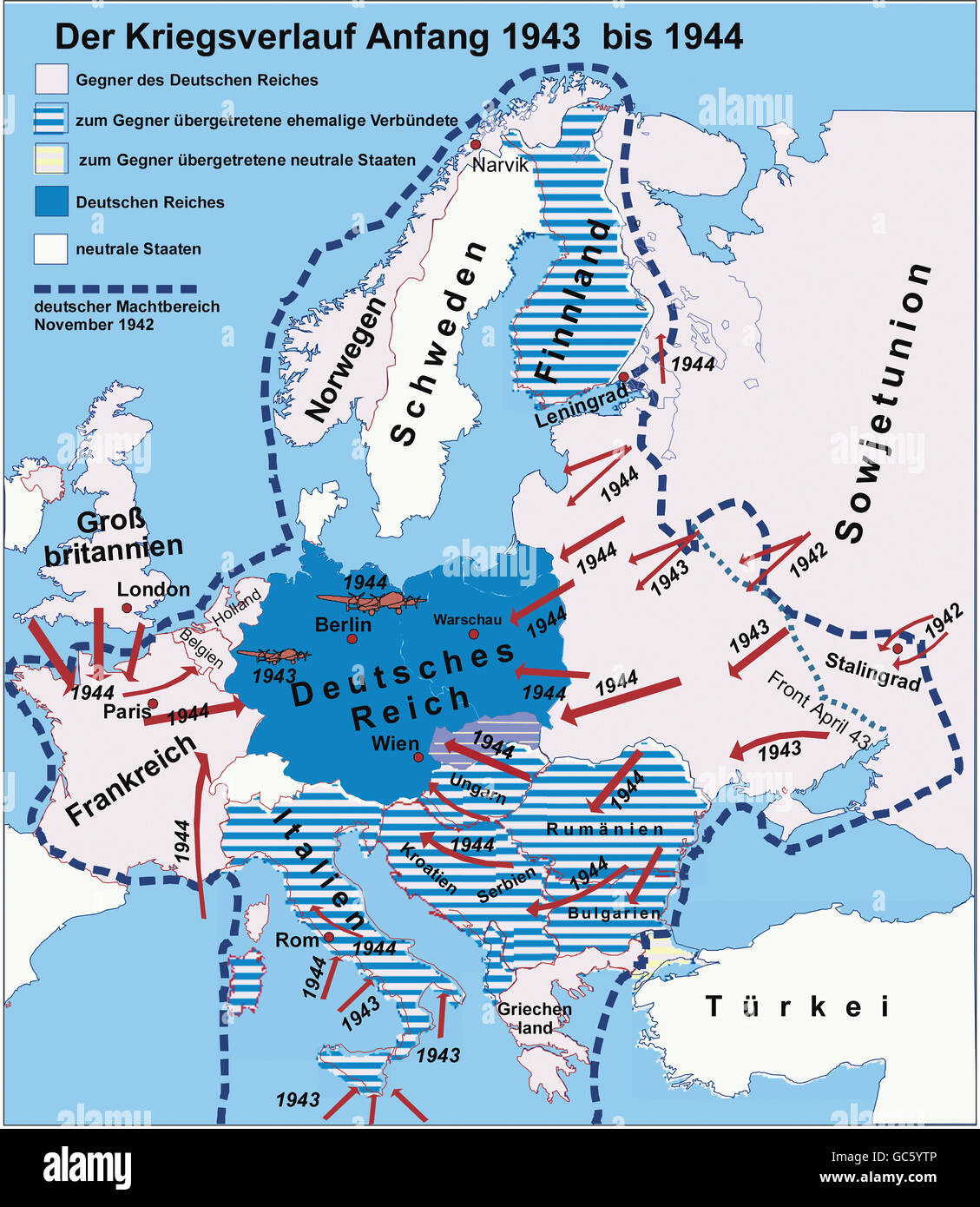 cartography, historical maps, modern times, Second World War/WWII, the war years 1943 -1944, Additional-Rights-Clearences-Not Available Stock Photohttps://www.alamy.com/image-license-details/?v=1https://www.alamy.com/stock-photo-cartography-historical-maps-modern-times-second-world-warwwii-the-110769702.html
RMGC5YTP–cartography, historical maps, modern times, Second World War/WWII, the war years 1943 -1944, Additional-Rights-Clearences-Not Available
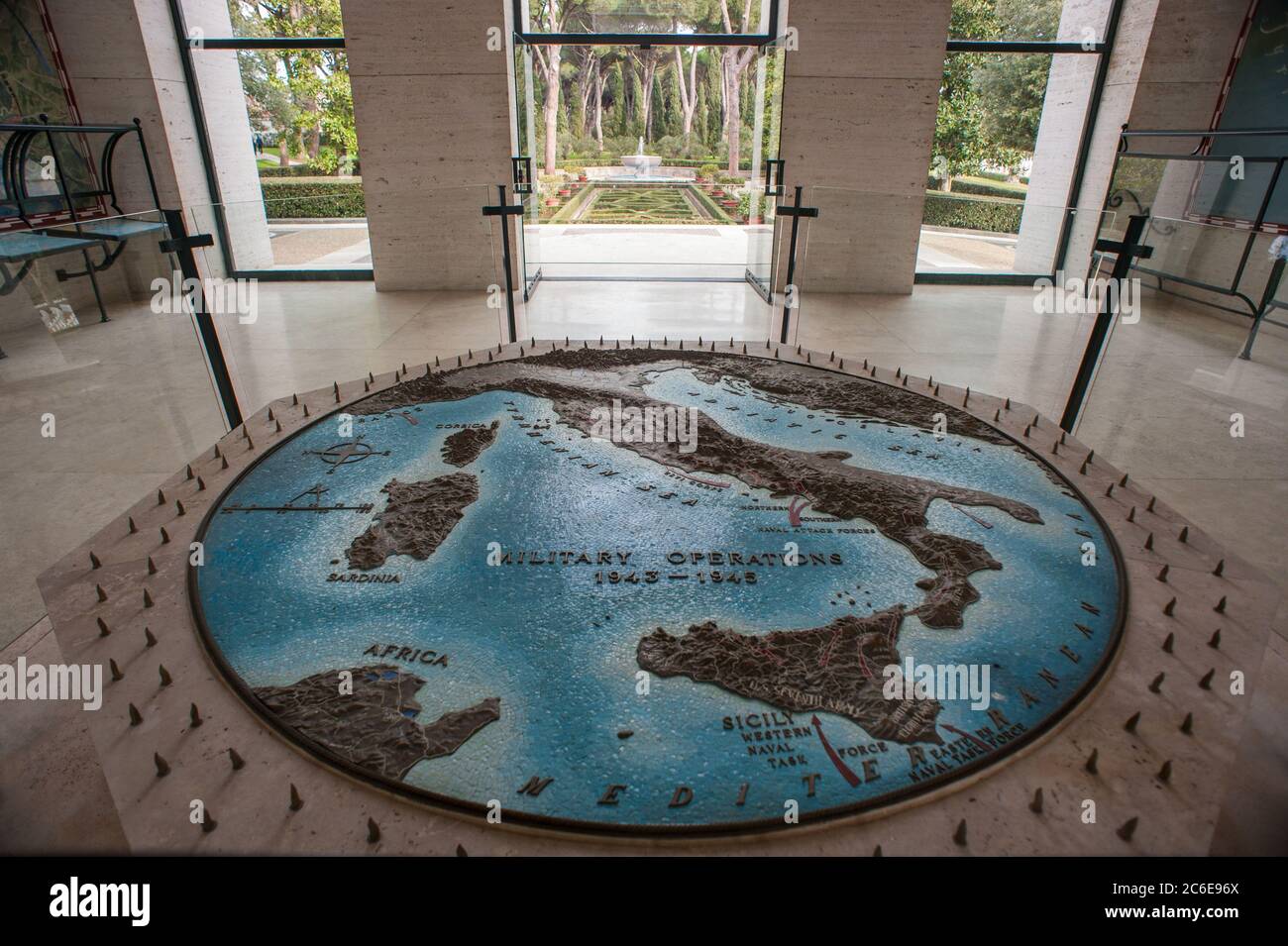 Nettuno, Rome Italy: Sicily-Rome American Cemetery, 73rd Anniversary of the landing of Anzio in 1944. © Andrea Sabbadini Stock Photohttps://www.alamy.com/image-license-details/?v=1https://www.alamy.com/nettuno-rome-italy-sicily-rome-american-cemetery-73rd-anniversary-of-the-landing-of-anzio-in-1944-andrea-sabbadini-image365420242.html
RM2C6E96X–Nettuno, Rome Italy: Sicily-Rome American Cemetery, 73rd Anniversary of the landing of Anzio in 1944. © Andrea Sabbadini
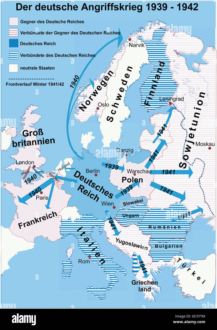 cartography, historical maps, modern times, Second World War/WWII, early years, German invasions, 1939 - 1942, Additional-Rights-Clearences-Not Available Stock Photohttps://www.alamy.com/image-license-details/?v=1https://www.alamy.com/stock-photo-cartography-historical-maps-modern-times-second-world-warwwii-early-110769700.html
RMGC5YTM–cartography, historical maps, modern times, Second World War/WWII, early years, German invasions, 1939 - 1942, Additional-Rights-Clearences-Not Available
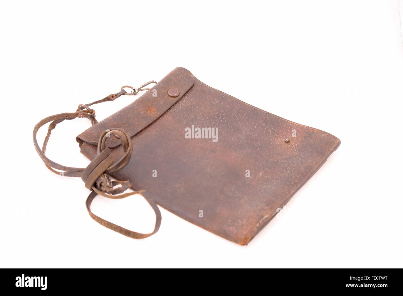 Italian officer map-case from the Second World War (Russia campaign) Stock Photohttps://www.alamy.com/image-license-details/?v=1https://www.alamy.com/stock-photo-italian-officer-map-case-from-the-second-world-war-russia-campaign-94676564.html
RFFE0TWT–Italian officer map-case from the Second World War (Russia campaign)
 Exerpt of Road Map Sheet 13 (1:200000 scale) of Tuscany and Umrbia, Italy from US AMS (Army Map Service) series of 1943. It illustrates the operational area for 6th Armoured Division during late June and early July 1944. Stock Photohttps://www.alamy.com/image-license-details/?v=1https://www.alamy.com/exerpt-of-road-map-sheet-13-1200000-scale-of-tuscany-and-umrbia-italy-from-us-ams-army-map-service-series-of-1943-it-illustrates-the-operational-area-for-6th-armoured-division-during-late-june-and-early-july-1944-image607611493.html
RM2X8F2JD–Exerpt of Road Map Sheet 13 (1:200000 scale) of Tuscany and Umrbia, Italy from US AMS (Army Map Service) series of 1943. It illustrates the operational area for 6th Armoured Division during late June and early July 1944.
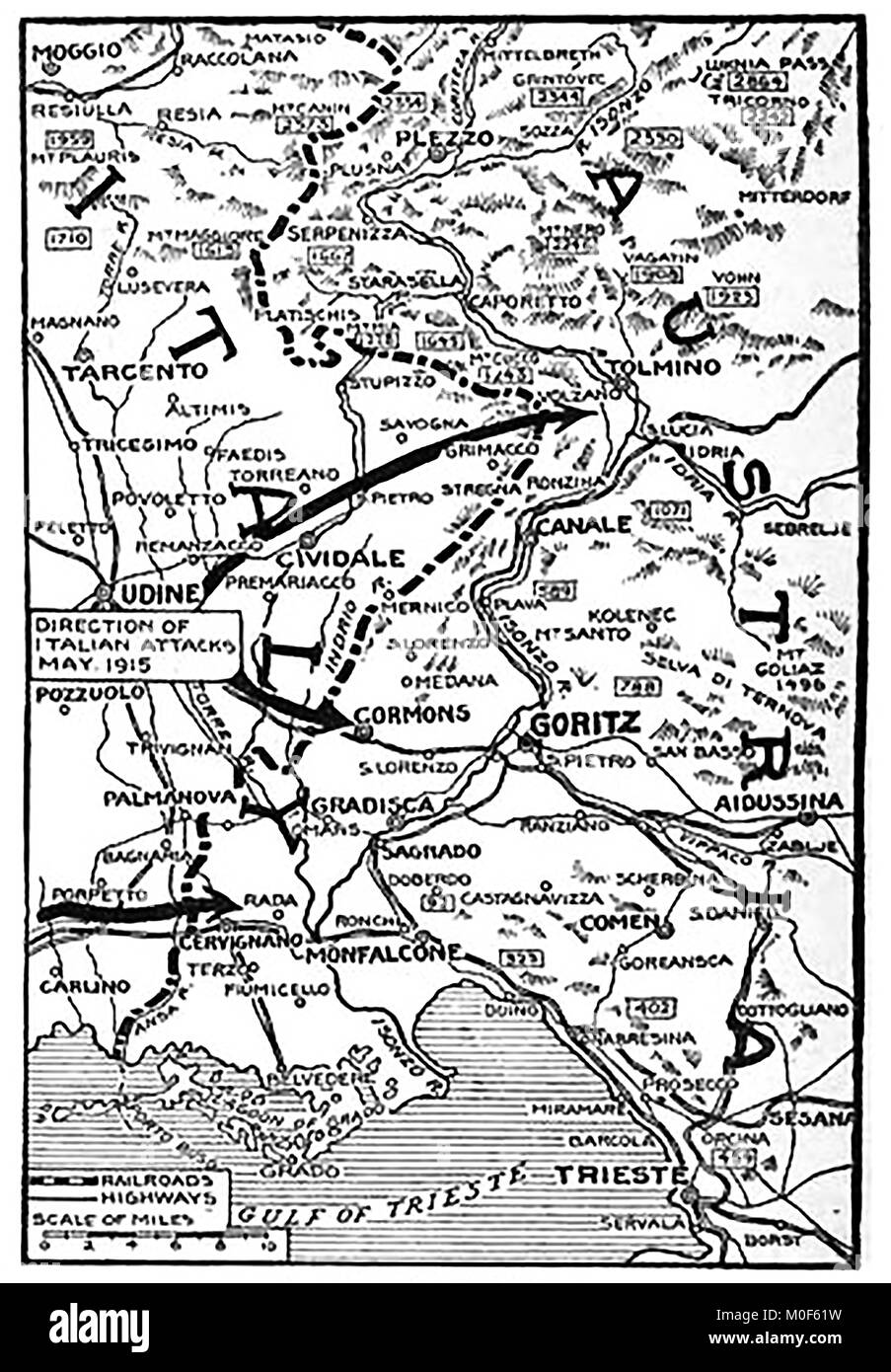 WWI - A 1917 map showing military activity in the 1914-1918 First World War - Map of the Italian attack on Austria Stock Photohttps://www.alamy.com/image-license-details/?v=1https://www.alamy.com/stock-photo-wwi-a-1917-map-showing-military-activity-in-the-1914-1918-first-world-172437717.html
RMM0F61W–WWI - A 1917 map showing military activity in the 1914-1918 First World War - Map of the Italian attack on Austria
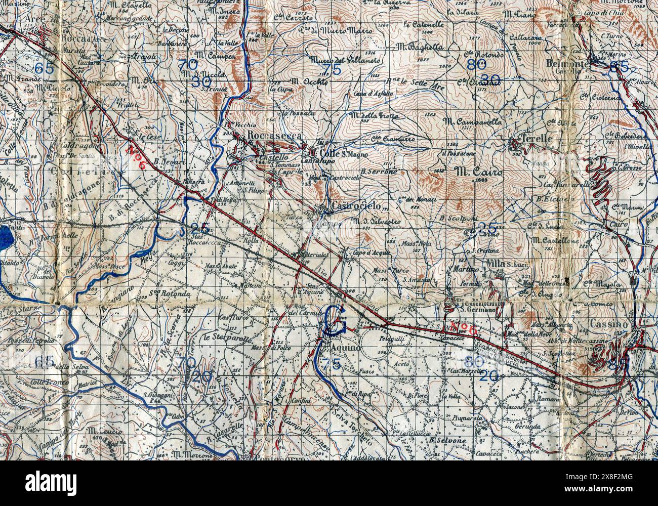 Exerpt of Map Sheet 160 (1:100000) Cassino, Italy from GSGS 4146 Series (Geographical Section General Staff) reproduced by 514 Survey Company, Royal Engineers, April 1944. This section illustrates the operational area for 6th Armoured Division during April and May 1944. Stock Photohttps://www.alamy.com/image-license-details/?v=1https://www.alamy.com/exerpt-of-map-sheet-160-1100000-cassino-italy-from-gsgs-4146-series-geographical-section-general-staff-reproduced-by-514-survey-company-royal-engineers-april-1944-this-section-illustrates-the-operational-area-for-6th-armoured-division-during-april-and-may-1944-image607611552.html
RM2X8F2MG–Exerpt of Map Sheet 160 (1:100000) Cassino, Italy from GSGS 4146 Series (Geographical Section General Staff) reproduced by 514 Survey Company, Royal Engineers, April 1944. This section illustrates the operational area for 6th Armoured Division during April and May 1944.
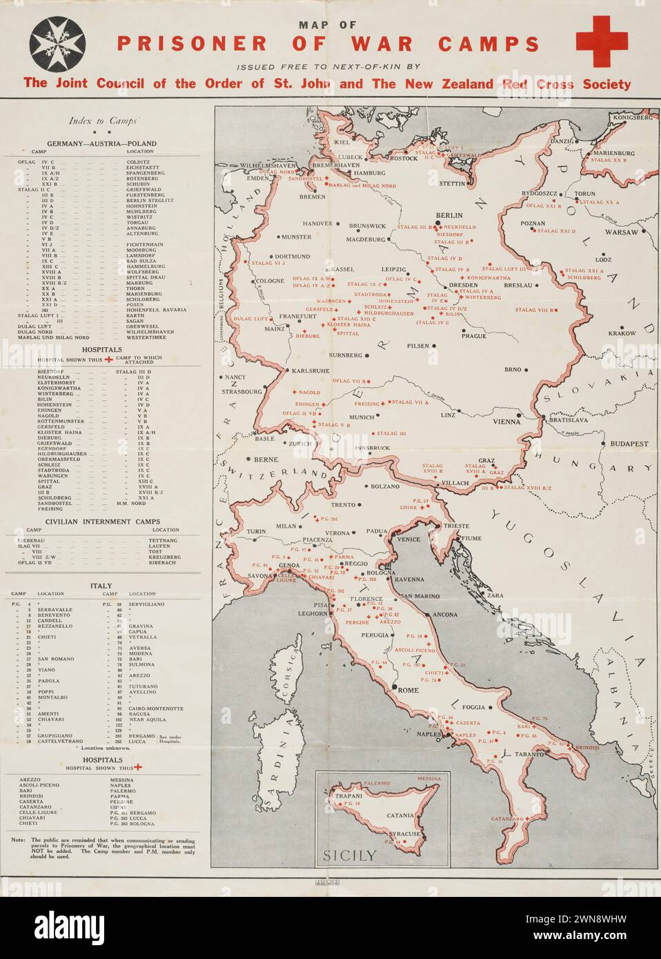 Vintage Map of European Prisoner of War Camps, issued by Order of St,John and Red Cross Society , New Zealand. 1942 Stock Photohttps://www.alamy.com/image-license-details/?v=1https://www.alamy.com/vintage-map-of-european-prisoner-of-war-camps-issued-by-order-of-stjohn-and-red-cross-society-new-zealand-1942-image598256005.html
RM2WN8WHW–Vintage Map of European Prisoner of War Camps, issued by Order of St,John and Red Cross Society , New Zealand. 1942
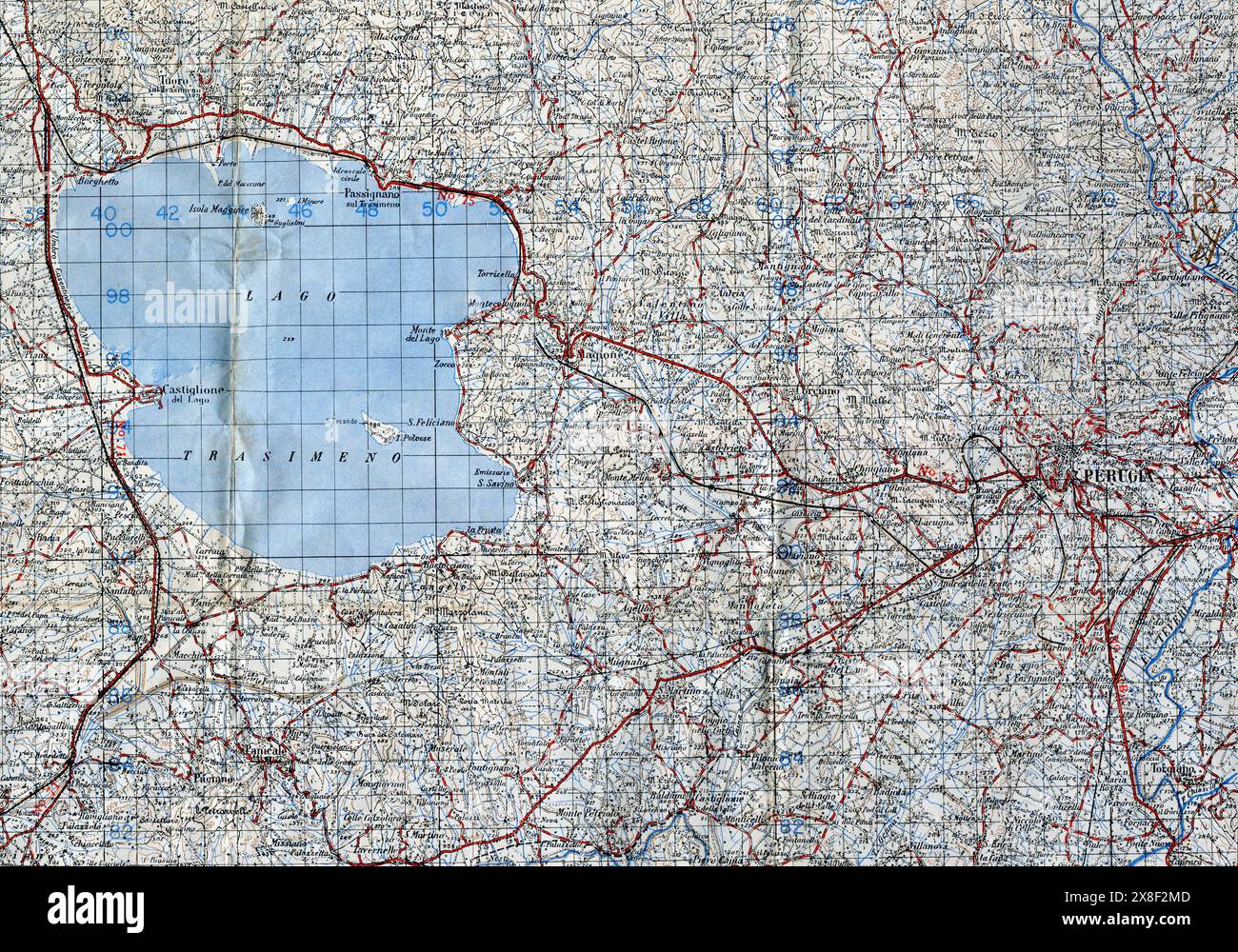 Exerpt of Map Sheet 122(1:100000 scale) of Perugia, Umrbia, Italy from GSGS (Geographical Section, General Staff) 4164 series. It was reproduced by 49 Survey Company S.A.E.C. (South African Survey Company) in April 1944. It illustrates the perational area for 6th Armoured Division during late June and early July 1944. Stock Photohttps://www.alamy.com/image-license-details/?v=1https://www.alamy.com/exerpt-of-map-sheet-1221100000-scale-of-perugia-umrbia-italy-from-gsgs-geographical-section-general-staff-4164-series-it-was-reproduced-by-49-survey-company-saec-south-african-survey-company-in-april-1944-it-illustrates-the-perational-area-for-6th-armoured-division-during-late-june-and-early-july-1944-image607611549.html
RM2X8F2MD–Exerpt of Map Sheet 122(1:100000 scale) of Perugia, Umrbia, Italy from GSGS (Geographical Section, General Staff) 4164 series. It was reproduced by 49 Survey Company S.A.E.C. (South African Survey Company) in April 1944. It illustrates the perational area for 6th Armoured Division during late June and early July 1944.
 Map of Italy with flight route details. William Francis Forbes-Sempill, 19th Lord Sempill AFC, AFRAeS (1893-1965) was a Scottish peer and record-breaking air pioneer who was later shown to have passed secret information to the Imperial Japanese military before the Second World War. In 1921, Sempill led an official military mission to Japan that showcased the latest British aircraft. In subsequent years he continued to aid the Imperial Japanese Navy in developing its Navy Air Service and began giving military secrets to the Japanese. Although his activities were uncovered by British Intellige Stock Photohttps://www.alamy.com/image-license-details/?v=1https://www.alamy.com/map-of-italy-with-flight-route-details-william-francis-forbes-sempill-19th-lord-sempill-afc-afraes-1893-1965-was-a-scottish-peer-and-record-breaking-air-pioneer-who-was-later-shown-to-have-passed-secret-information-to-the-imperial-japanese-military-before-the-second-world-war-in-1921-sempill-led-an-official-military-mission-to-japan-that-showcased-the-latest-british-aircraft-in-subsequent-years-he-continued-to-aid-the-imperial-japanese-navy-in-developing-its-navy-air-service-and-began-giving-military-secrets-to-the-japanese-although-his-activities-were-uncovered-by-british-intellige-image504846821.html
RM2M99N7H–Map of Italy with flight route details. William Francis Forbes-Sempill, 19th Lord Sempill AFC, AFRAeS (1893-1965) was a Scottish peer and record-breaking air pioneer who was later shown to have passed secret information to the Imperial Japanese military before the Second World War. In 1921, Sempill led an official military mission to Japan that showcased the latest British aircraft. In subsequent years he continued to aid the Imperial Japanese Navy in developing its Navy Air Service and began giving military secrets to the Japanese. Although his activities were uncovered by British Intellige
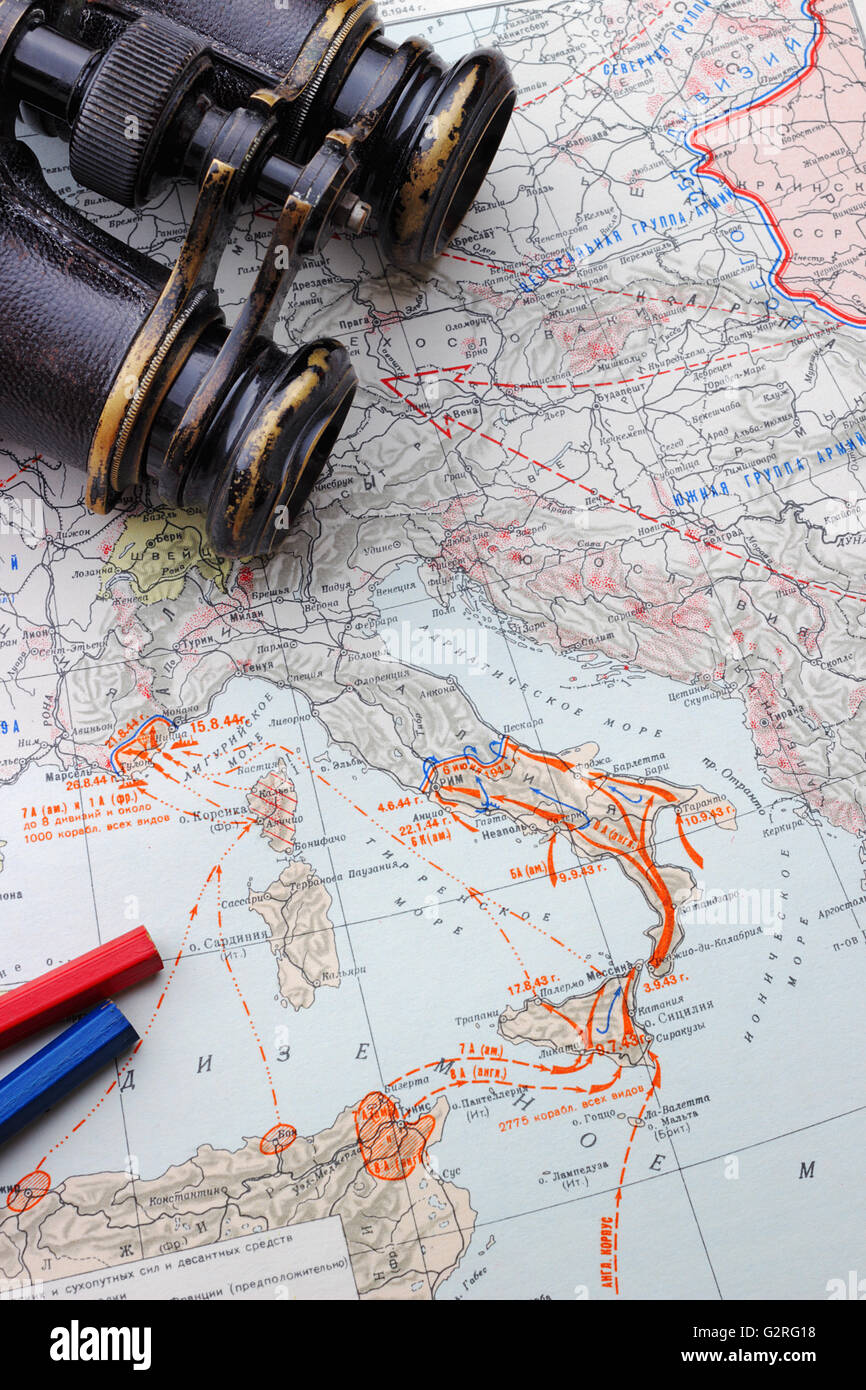 The landing of troops in Italy and France. Military-historical map for Soviet officers in 1947 Stock Photohttps://www.alamy.com/image-license-details/?v=1https://www.alamy.com/stock-photo-the-landing-of-troops-in-italy-and-france-military-historical-map-105008996.html
RMG2RG18–The landing of troops in Italy and France. Military-historical map for Soviet officers in 1947
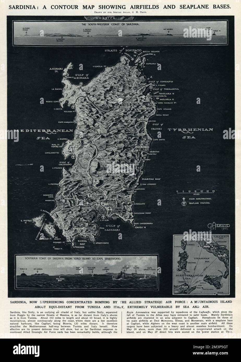 Map of Sardinia by G. H. Davis Stock Photohttps://www.alamy.com/image-license-details/?v=1https://www.alamy.com/map-of-sardinia-by-g-h-davis-image501431976.html
RM2M3P5GT–Map of Sardinia by G. H. Davis
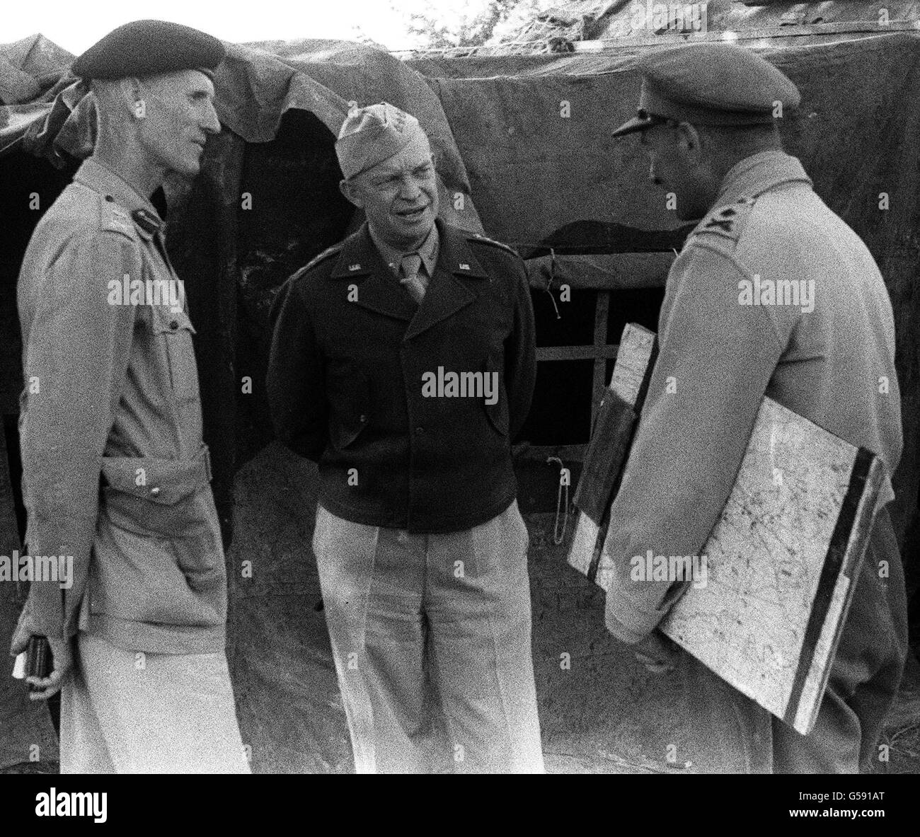 USA Gen Eisenhower Italy 1943 Stock Photohttps://www.alamy.com/image-license-details/?v=1https://www.alamy.com/stock-photo-usa-gen-eisenhower-italy-1943-106534144.html
RMG591AT–USA Gen Eisenhower Italy 1943
 L'Armée des ombres Army of Shadows Year: 1969 France / Italy Simone Signoret Director: Jean-Pierre Melville Stock Photohttps://www.alamy.com/image-license-details/?v=1https://www.alamy.com/larme-des-ombres-army-of-shadows-year-1969-france-italy-simone-signoret-director-jean-pierre-melville-image610219664.html
RM2XCNWBC–L'Armée des ombres Army of Shadows Year: 1969 France / Italy Simone Signoret Director: Jean-Pierre Melville
 Evening Standard front page newspaper headline 'Invasion Fleet Massed in Sicily Ports' 'Roosevelt joins Churchill at Quebec' 18 August 1943 London UK Stock Photohttps://www.alamy.com/image-license-details/?v=1https://www.alamy.com/evening-standard-front-page-newspaper-headline-invasion-fleet-massed-in-sicily-ports-roosevelt-joins-churchill-at-quebec-18-august-1943-london-uk-image355503137.html
RM2BJAFTH–Evening Standard front page newspaper headline 'Invasion Fleet Massed in Sicily Ports' 'Roosevelt joins Churchill at Quebec' 18 August 1943 London UK
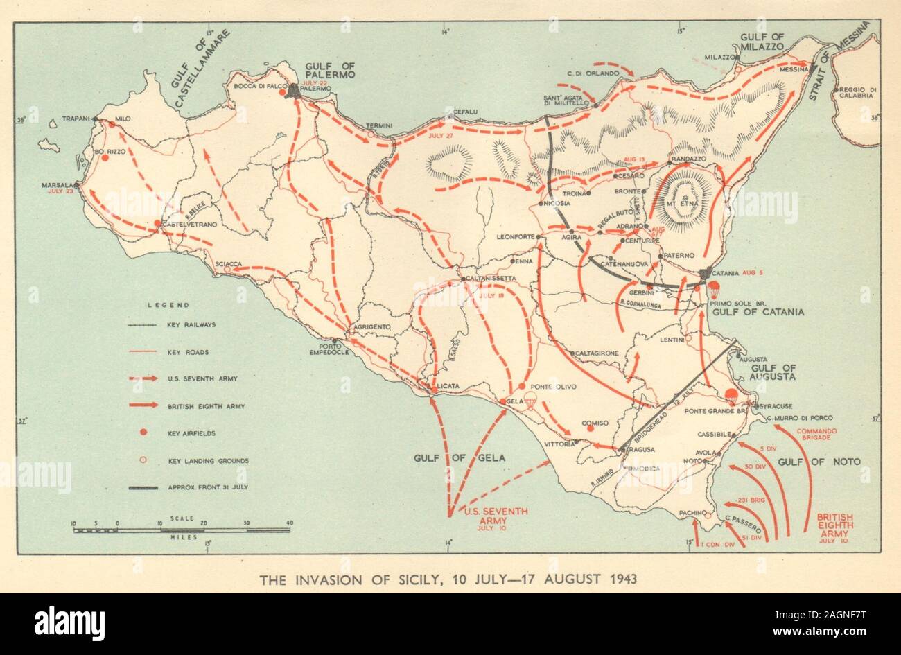 Invasion of Sicily 10 July-17 August 1943. World War 2. Italy 1954 old map Stock Photohttps://www.alamy.com/image-license-details/?v=1https://www.alamy.com/invasion-of-sicily-10-july-17-august-1943-world-war-2-italy-1954-old-map-image337304460.html
RF2AGNF7T–Invasion of Sicily 10 July-17 August 1943. World War 2. Italy 1954 old map
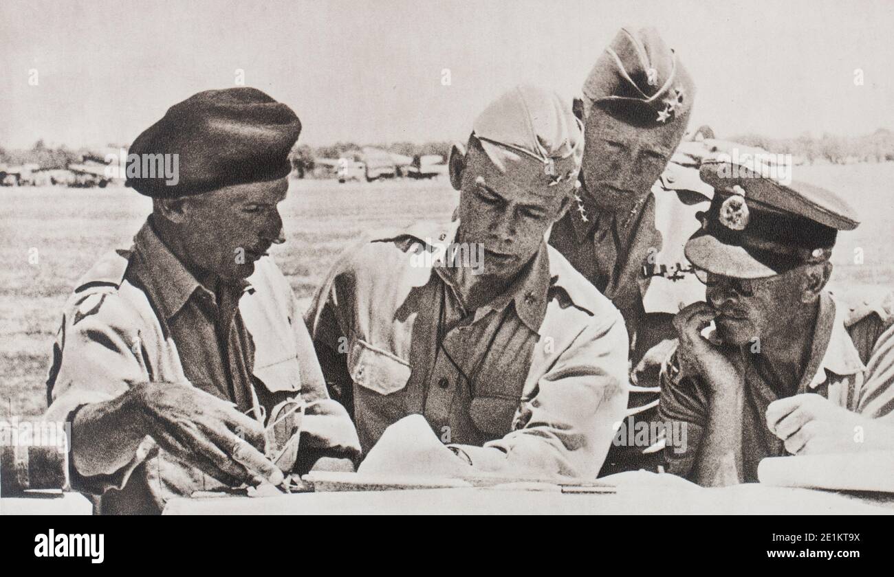 The great leaders who organized victory. General Montgomery, Commander of the glorious VIII Army, General Alexander, commander-in-chief of the Allied Stock Photohttps://www.alamy.com/image-license-details/?v=1https://www.alamy.com/the-great-leaders-who-organized-victory-general-montgomery-commander-of-the-glorious-viii-army-general-alexander-commander-in-chief-of-the-allied-image396889302.html
RM2E1KT9X–The great leaders who organized victory. General Montgomery, Commander of the glorious VIII Army, General Alexander, commander-in-chief of the Allied
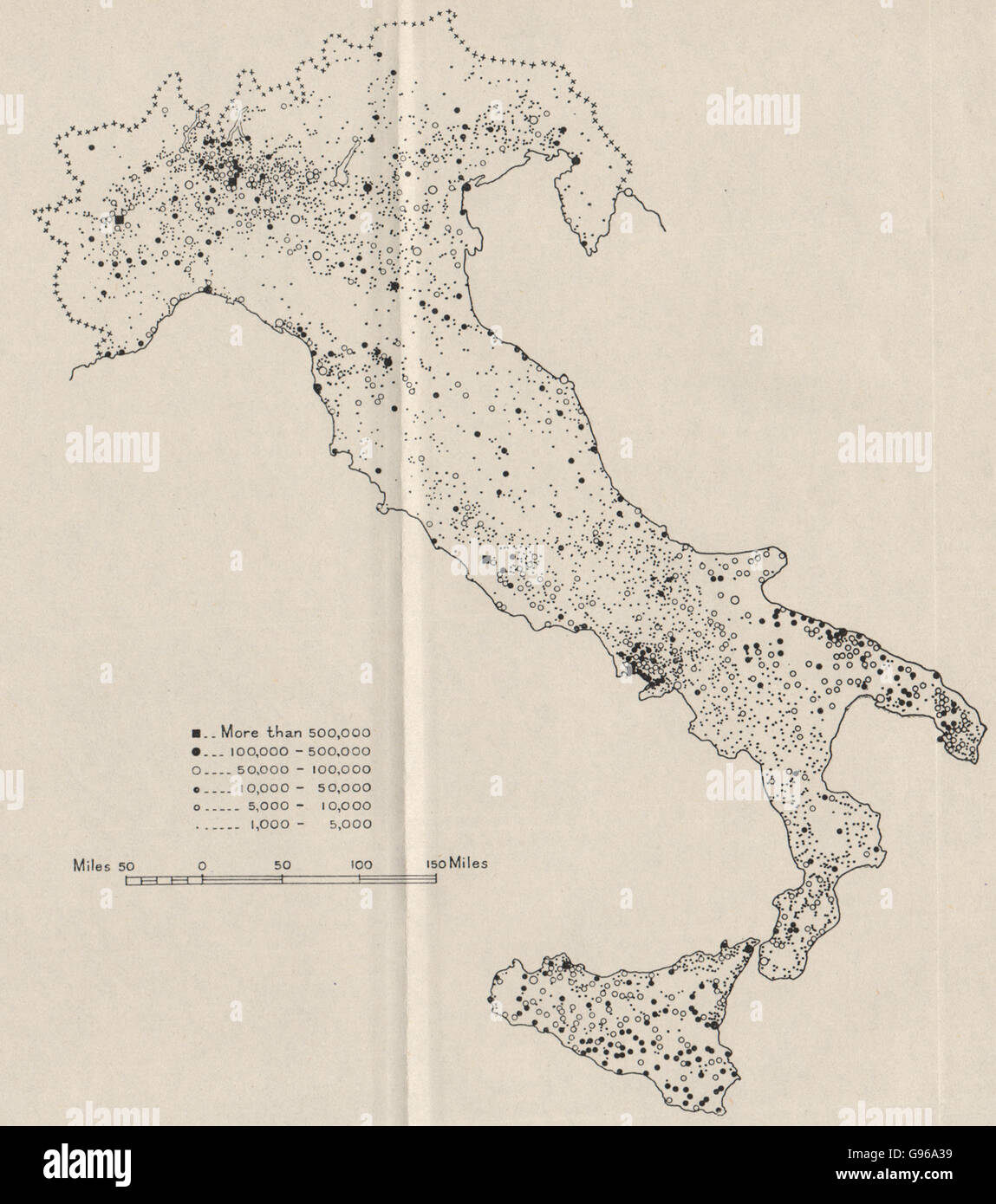 ITALY POPULATION: Towns 1000+ inhabitants. WW2 ROYAL NAVY INTELLIGENCE MAP 1944 Stock Photohttps://www.alamy.com/image-license-details/?v=1https://www.alamy.com/stock-photo-italy-population-towns-1000-inhabitants-ww2-royal-navy-intelligence-108933757.html
RFG96A39–ITALY POPULATION: Towns 1000+ inhabitants. WW2 ROYAL NAVY INTELLIGENCE MAP 1944
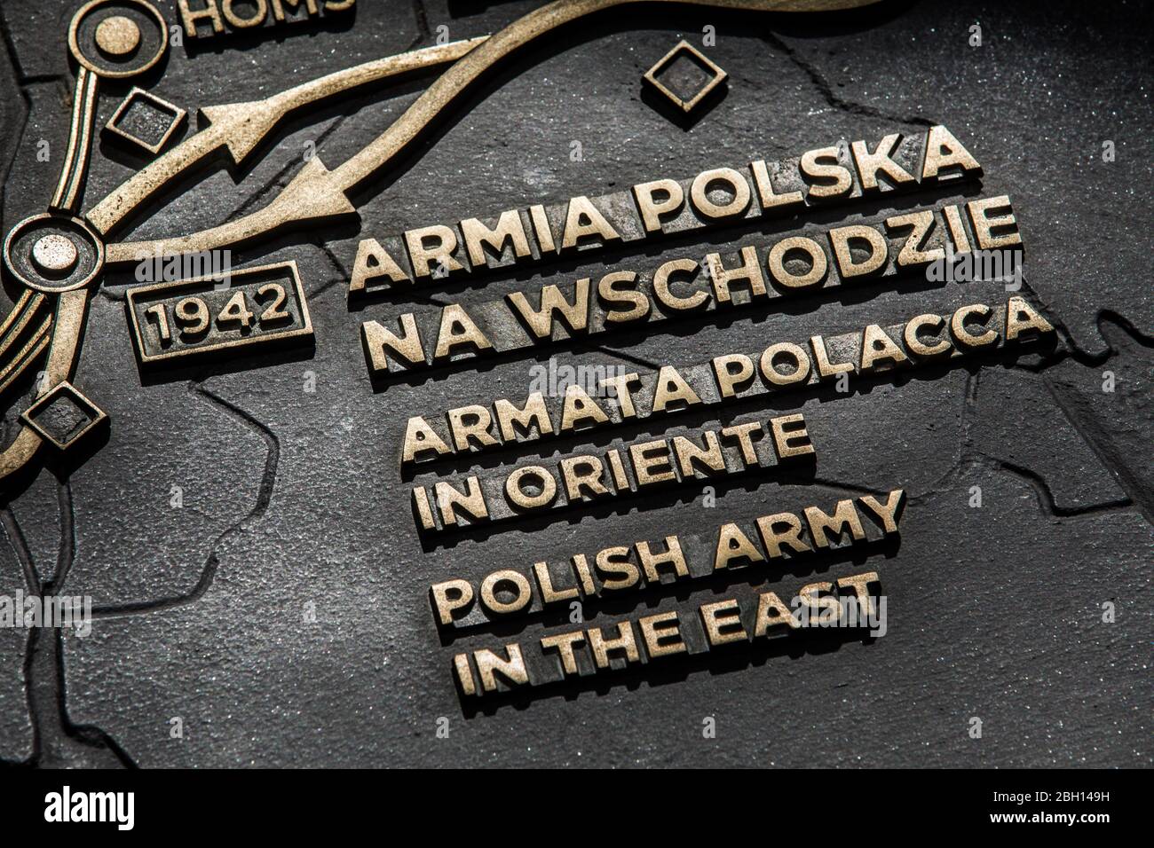 Polish army in the east. Second World War map. Polish monumental cemetery. The Polish war cemetery at Monte Cassino in Italy. Catholic, Jewish and Ort Stock Photohttps://www.alamy.com/image-license-details/?v=1https://www.alamy.com/polish-army-in-the-east-second-world-war-map-polish-monumental-cemetery-the-polish-war-cemetery-at-monte-cassino-in-italy-catholic-jewish-and-ort-image354681869.html
RF2BH149H–Polish army in the east. Second World War map. Polish monumental cemetery. The Polish war cemetery at Monte Cassino in Italy. Catholic, Jewish and Ort
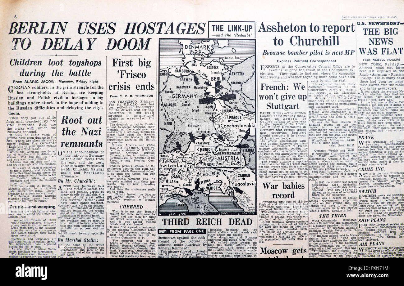 'Third Reich Dead' map 'Berlin Uses Hostages to Delay Doom' in Daily Express Second World War newspaper April 28 1945 historical archive England UK Stock Photohttps://www.alamy.com/image-license-details/?v=1https://www.alamy.com/third-reich-dead-map-berlin-uses-hostages-to-delay-doom-in-daily-express-second-world-war-newspaper-april-28-1945-historical-archive-england-uk-image222972000.html
RMPXN71M–'Third Reich Dead' map 'Berlin Uses Hostages to Delay Doom' in Daily Express Second World War newspaper April 28 1945 historical archive England UK
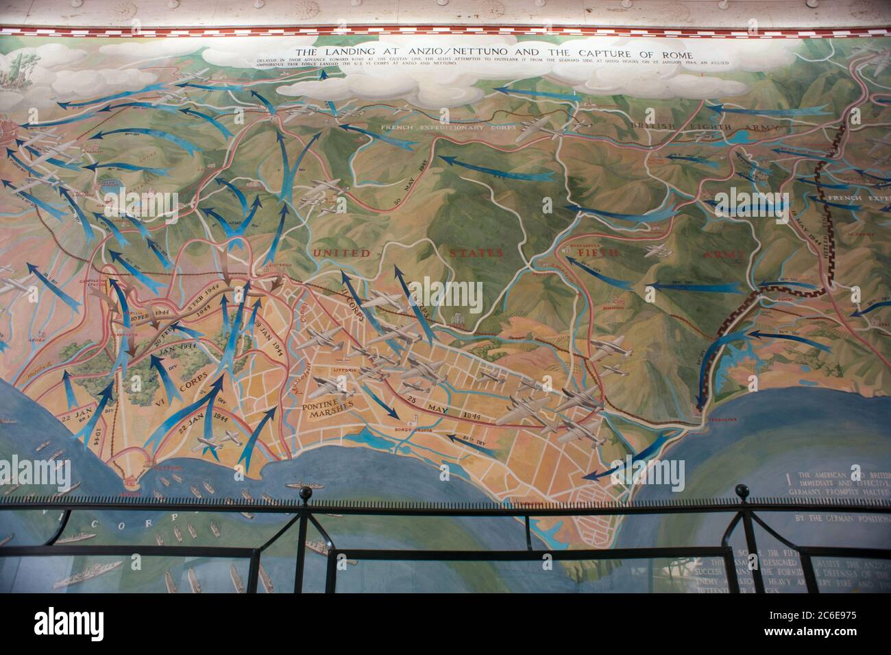 Nettuno, Rome Italy: Sicily-Rome American Cemetery, 73rd Anniversary of the landing of Anzio in 1944. © Andrea Sabbadini Stock Photohttps://www.alamy.com/image-license-details/?v=1https://www.alamy.com/nettuno-rome-italy-sicily-rome-american-cemetery-73rd-anniversary-of-the-landing-of-anzio-in-1944-andrea-sabbadini-image365420249.html
RM2C6E975–Nettuno, Rome Italy: Sicily-Rome American Cemetery, 73rd Anniversary of the landing of Anzio in 1944. © Andrea Sabbadini
 Vintage Italian officer map-case from the Second World War (Russian campaign) Stock Photohttps://www.alamy.com/image-license-details/?v=1https://www.alamy.com/vintage-italian-officer-map-case-from-the-second-world-war-russian-campaign-image415341917.html
RF2F3MCRW–Vintage Italian officer map-case from the Second World War (Russian campaign)
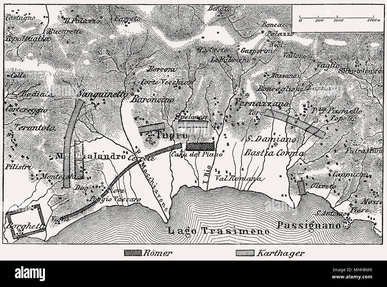 Battle of Lake Trasimene plan, Second Punic War, 217 BC Stock Photohttps://www.alamy.com/image-license-details/?v=1https://www.alamy.com/battle-of-lake-trasimene-plan-second-punic-war-217-bc-image182932857.html
RMMHH8M9–Battle of Lake Trasimene plan, Second Punic War, 217 BC
 The Second World War- Personalities Field Marshal Sir Harold Alexander, the Supreme Allied Commander of the Mediterranean Forces, standing in front of a map of Italy at his Headquarters in the Royal Palace, Caserta, Italy. Stock Photohttps://www.alamy.com/image-license-details/?v=1https://www.alamy.com/the-second-world-war-personalities-field-marshal-sir-harold-alexander-the-supreme-allied-commander-of-the-mediterranean-forces-standing-in-front-of-a-map-of-italy-at-his-headquarters-in-the-royal-palace-caserta-italy-image568987229.html
RM2T1KH0D–The Second World War- Personalities Field Marshal Sir Harold Alexander, the Supreme Allied Commander of the Mediterranean Forces, standing in front of a map of Italy at his Headquarters in the Royal Palace, Caserta, Italy.
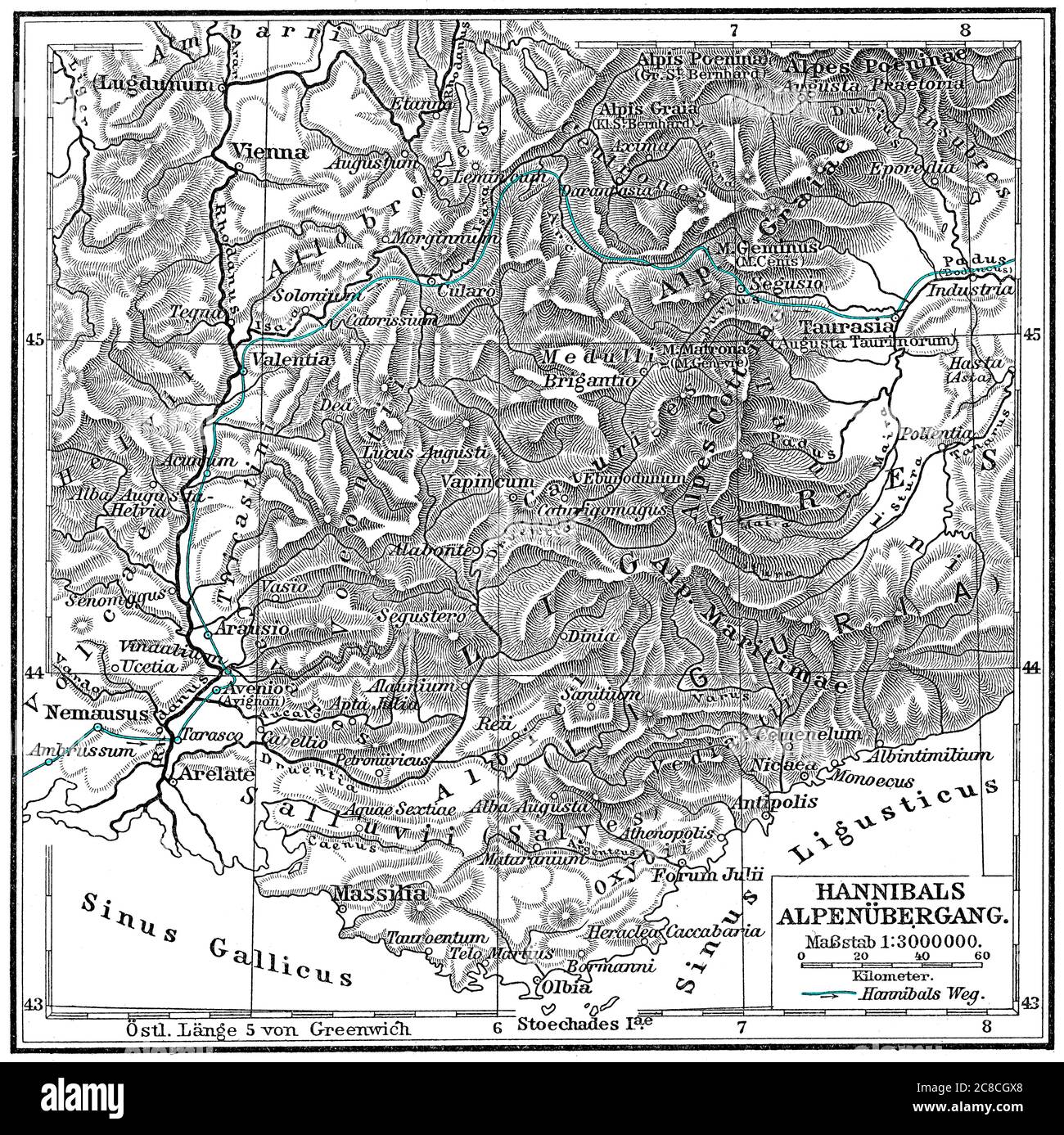 Hannibal Barkas, c. 246-183 BC, Carthaginian military commander trekking across the Alps Stock Photohttps://www.alamy.com/image-license-details/?v=1https://www.alamy.com/hannibal-barkas-c-246-183-bc-carthaginian-military-commander-trekking-across-the-alps-image366611680.html
RM2C8CGX8–Hannibal Barkas, c. 246-183 BC, Carthaginian military commander trekking across the Alps
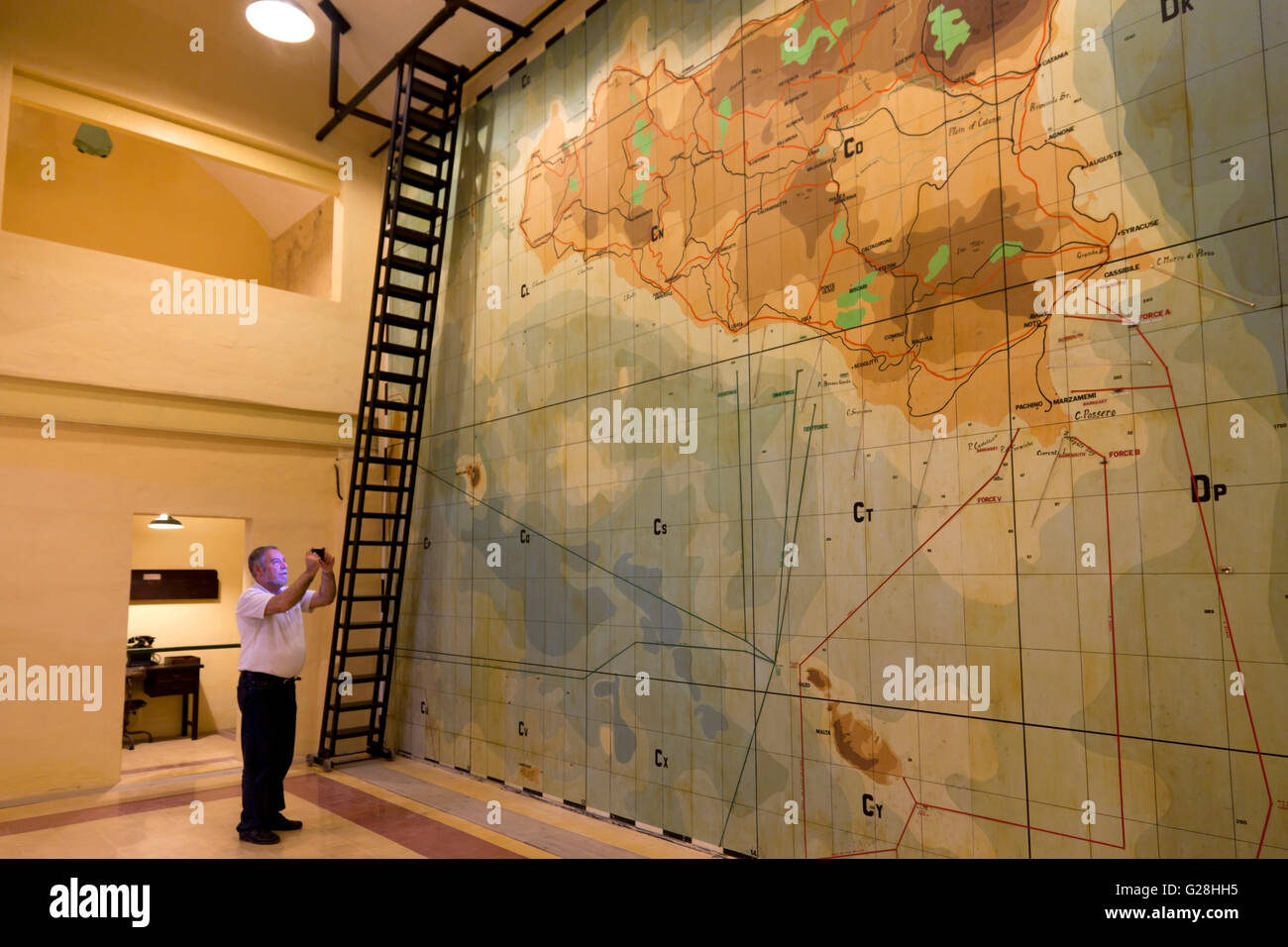 A visitor at the underground complex used to direct World War II in Malta that is now open as a museum. Stock Photohttps://www.alamy.com/image-license-details/?v=1https://www.alamy.com/stock-photo-a-visitor-at-the-underground-complex-used-to-direct-world-war-ii-in-104680945.html
RMG28HH5–A visitor at the underground complex used to direct World War II in Malta that is now open as a museum.
!['Zone map of Dresden.'. Zone maps, Series GSGS 4399. [London] : War Office, 1943-1944. Produced by: Great Britain. Air Ministry. Coverage of large towns throughout Germany, Italy and major occupied cities in other countries of central Europe. Small-scale town area maps overprinted to show vulnerability to high explosive and incendiary bombing. All originally classified 'Secret'. Source: Maps MOD GSGS 4399. Stock Photo 'Zone map of Dresden.'. Zone maps, Series GSGS 4399. [London] : War Office, 1943-1944. Produced by: Great Britain. Air Ministry. Coverage of large towns throughout Germany, Italy and major occupied cities in other countries of central Europe. Small-scale town area maps overprinted to show vulnerability to high explosive and incendiary bombing. All originally classified 'Secret'. Source: Maps MOD GSGS 4399. Stock Photo](https://c8.alamy.com/comp/R555H5/zone-map-of-dresden-zone-maps-series-gsgs-4399-london-war-office-1943-1944-produced-by-great-britain-air-ministry-coverage-of-large-towns-throughout-germany-italy-and-major-occupied-cities-in-other-countries-of-central-europe-small-scale-town-area-maps-overprinted-to-show-vulnerability-to-high-explosive-and-incendiary-bombing-all-originally-classified-secret-source-maps-mod-gsgs-4399-R555H5.jpg) 'Zone map of Dresden.'. Zone maps, Series GSGS 4399. [London] : War Office, 1943-1944. Produced by: Great Britain. Air Ministry. Coverage of large towns throughout Germany, Italy and major occupied cities in other countries of central Europe. Small-scale town area maps overprinted to show vulnerability to high explosive and incendiary bombing. All originally classified 'Secret'. Source: Maps MOD GSGS 4399. Stock Photohttps://www.alamy.com/image-license-details/?v=1https://www.alamy.com/zone-map-of-dresden-zone-maps-series-gsgs-4399-london-war-office-1943-1944-produced-by-great-britain-air-ministry-coverage-of-large-towns-throughout-germany-italy-and-major-occupied-cities-in-other-countries-of-central-europe-small-scale-town-area-maps-overprinted-to-show-vulnerability-to-high-explosive-and-incendiary-bombing-all-originally-classified-secret-source-maps-mod-gsgs-4399-image226922225.html
'Zone map of Dresden.'. Zone maps, Series GSGS 4399. [London] : War Office, 1943-1944. Produced by: Great Britain. Air Ministry. Coverage of large towns throughout Germany, Italy and major occupied cities in other countries of central Europe. Small-scale town area maps overprinted to show vulnerability to high explosive and incendiary bombing. All originally classified 'Secret'. Source: Maps MOD GSGS 4399. Stock Photohttps://www.alamy.com/image-license-details/?v=1https://www.alamy.com/zone-map-of-dresden-zone-maps-series-gsgs-4399-london-war-office-1943-1944-produced-by-great-britain-air-ministry-coverage-of-large-towns-throughout-germany-italy-and-major-occupied-cities-in-other-countries-of-central-europe-small-scale-town-area-maps-overprinted-to-show-vulnerability-to-high-explosive-and-incendiary-bombing-all-originally-classified-secret-source-maps-mod-gsgs-4399-image226922225.htmlRMR555H5–'Zone map of Dresden.'. Zone maps, Series GSGS 4399. [London] : War Office, 1943-1944. Produced by: Great Britain. Air Ministry. Coverage of large towns throughout Germany, Italy and major occupied cities in other countries of central Europe. Small-scale town area maps overprinted to show vulnerability to high explosive and incendiary bombing. All originally classified 'Secret'. Source: Maps MOD GSGS 4399.
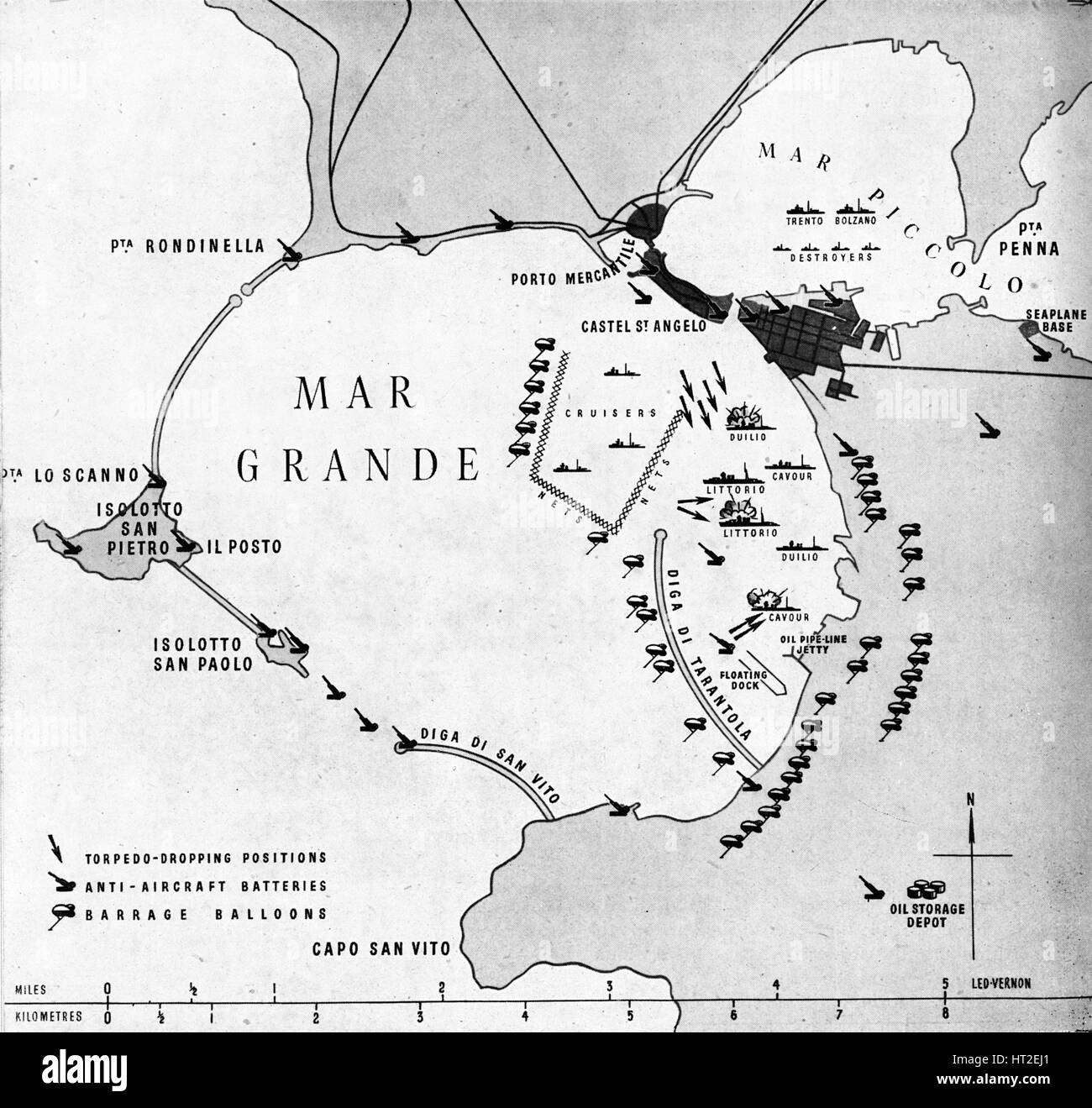 'The enemy's hide-out', 1940 (1943). Artist: Unknown. Stock Photohttps://www.alamy.com/image-license-details/?v=1https://www.alamy.com/stock-photo-the-enemys-hide-out-1940-1943-artist-unknown-135279705.html
RMHT2EJ1–'The enemy's hide-out', 1940 (1943). Artist: Unknown.
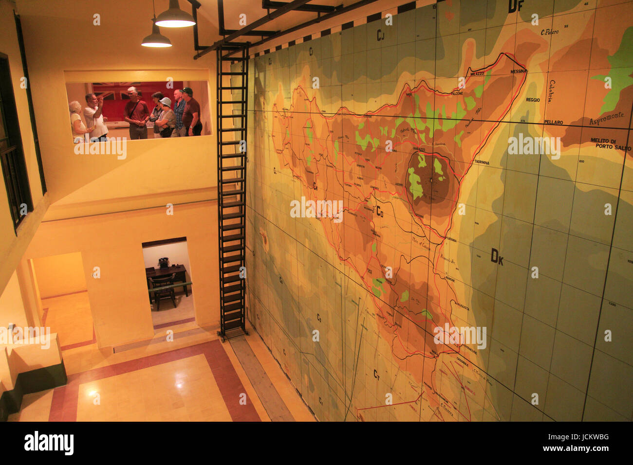 Wartime map planning invasion of Sicily, Lascaris War Rooms underground museum, Valletta, Malta Stock Photohttps://www.alamy.com/image-license-details/?v=1https://www.alamy.com/stock-photo-wartime-map-planning-invasion-of-sicily-lascaris-war-rooms-underground-145495828.html
RMJCKWBG–Wartime map planning invasion of Sicily, Lascaris War Rooms underground museum, Valletta, Malta
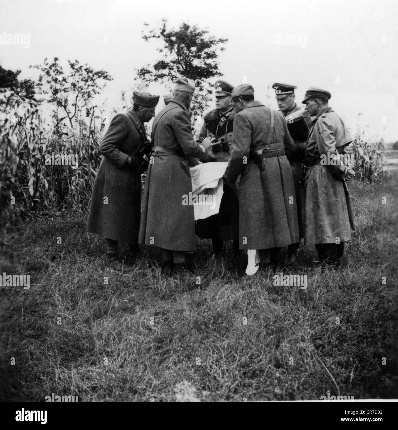 Kleist, Ewald von, 8.8.1881 - 16.10.1954, German general, in a group picture (centre), as commander-in-chief of 1st Panzer Army during Operation 'Barbarossa', Ukraine, summer 1941, briefing with German and Italian officers, Stock Photohttps://www.alamy.com/image-license-details/?v=1https://www.alamy.com/stock-photo-kleist-ewald-von-881881-16101954-german-general-in-a-group-picture-48721682.html
RMCR7D02–Kleist, Ewald von, 8.8.1881 - 16.10.1954, German general, in a group picture (centre), as commander-in-chief of 1st Panzer Army during Operation 'Barbarossa', Ukraine, summer 1941, briefing with German and Italian officers,
 Map of Sicily by G. H. Davis Stock Photohttps://www.alamy.com/image-license-details/?v=1https://www.alamy.com/map-of-sicily-by-g-h-davis-image501431941.html
RM2M3P5FH–Map of Sicily by G. H. Davis
 German historical postal card: Day of Foundation of the European youth organization. Young tree growing from the center of the map of Europe. Germany, Stock Photohttps://www.alamy.com/image-license-details/?v=1https://www.alamy.com/german-historical-postal-card-day-of-foundation-of-the-european-youth-organization-young-tree-growing-from-the-center-of-the-map-of-europe-germany-image240670153.html
RFRYFD6H–German historical postal card: Day of Foundation of the European youth organization. Young tree growing from the center of the map of Europe. Germany,
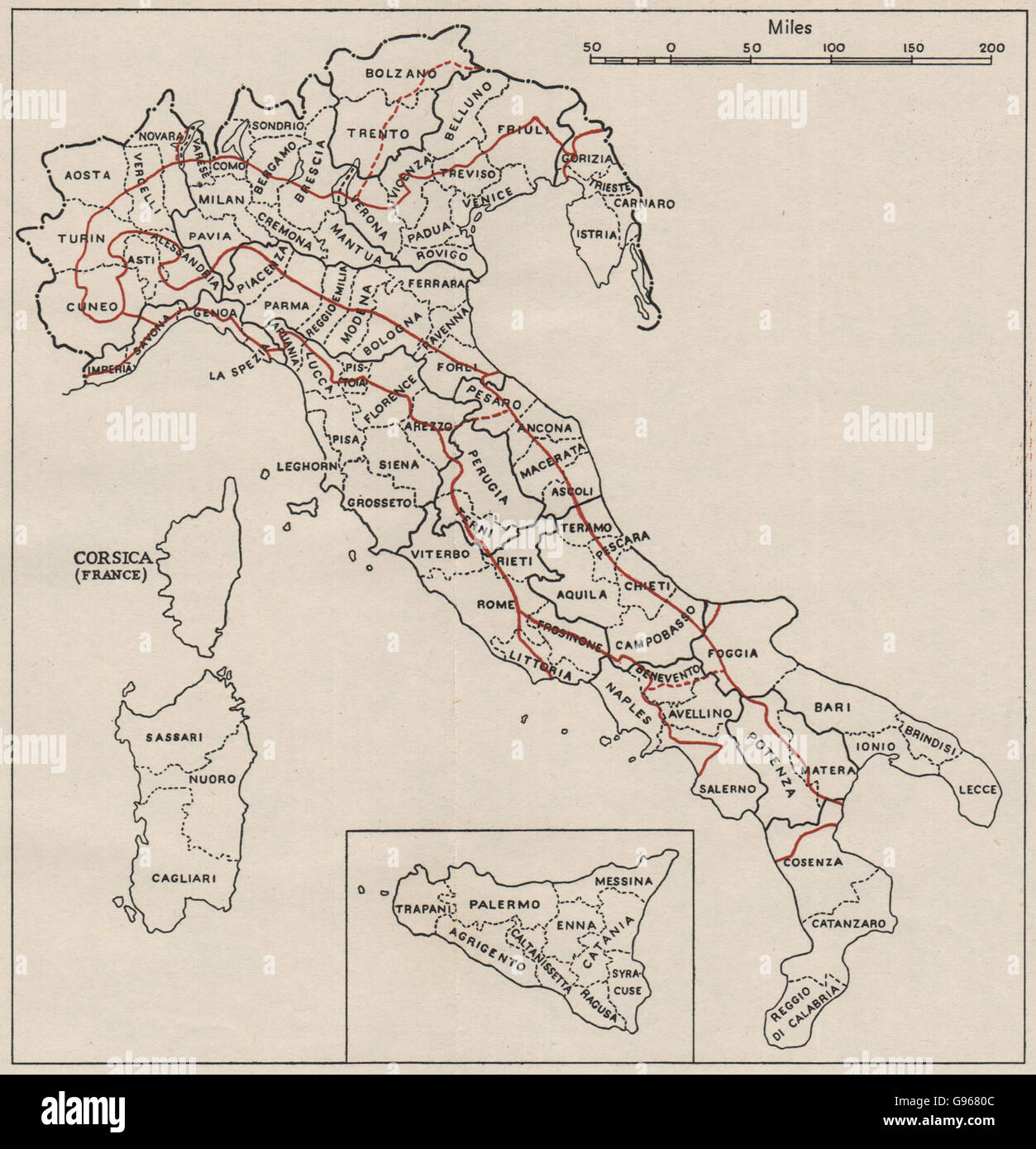 ITALY:Provinces Compartments Physical(red).WW2 ROYAL NAVY INTELLIGENCE MAP 1944 Stock Photohttps://www.alamy.com/image-license-details/?v=1https://www.alamy.com/stock-photo-italyprovinces-compartments-physicalredww2-royal-navy-intelligence-108932108.html
RFG9680C–ITALY:Provinces Compartments Physical(red).WW2 ROYAL NAVY INTELLIGENCE MAP 1944
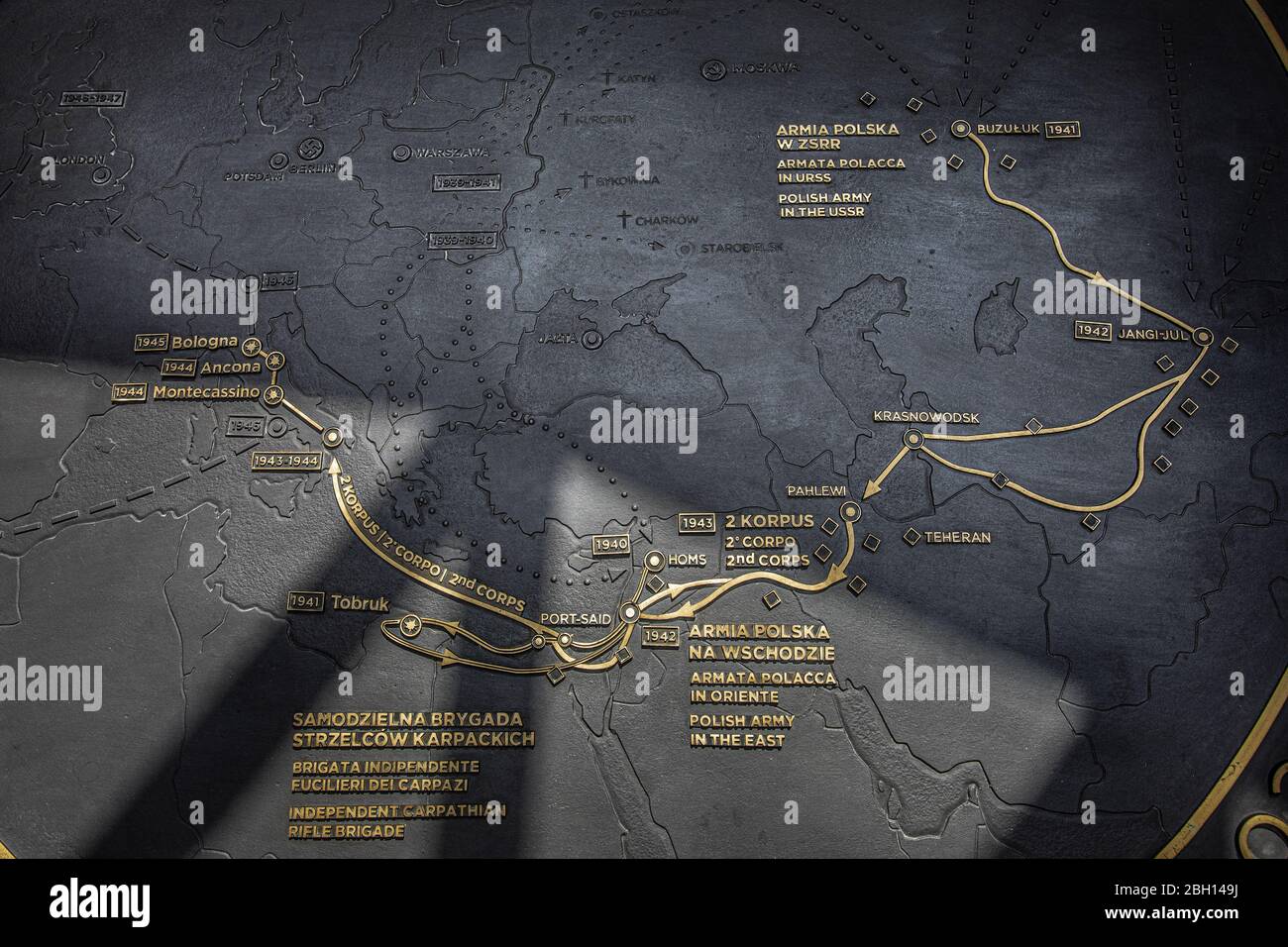 Polish army in the east. Second World War map. Polish monumental cemetery. The Polish war cemetery at Monte Cassino in Italy. Catholic, Jewish and Ort Stock Photohttps://www.alamy.com/image-license-details/?v=1https://www.alamy.com/polish-army-in-the-east-second-world-war-map-polish-monumental-cemetery-the-polish-war-cemetery-at-monte-cassino-in-italy-catholic-jewish-and-ort-image354681870.html
RF2BH149J–Polish army in the east. Second World War map. Polish monumental cemetery. The Polish war cemetery at Monte Cassino in Italy. Catholic, Jewish and Ort
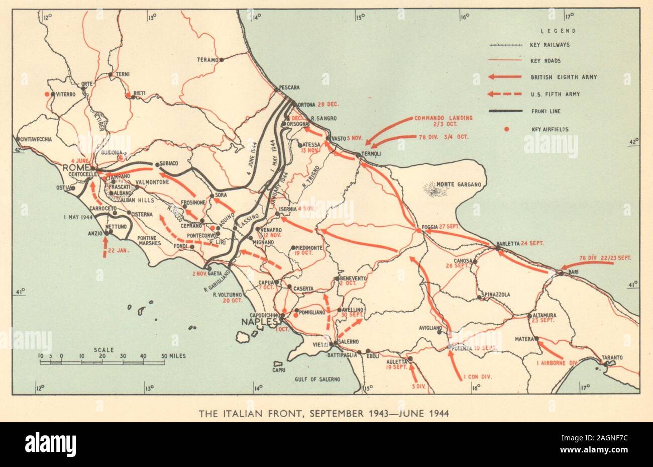 Italian front, September 1943-June 1944. World War 2. Italy. Cassino 1954 map Stock Photohttps://www.alamy.com/image-license-details/?v=1https://www.alamy.com/italian-front-september-1943-june-1944-world-war-2-italy-cassino-1954-map-image337304448.html
RF2AGNF7C–Italian front, September 1943-June 1944. World War 2. Italy. Cassino 1954 map
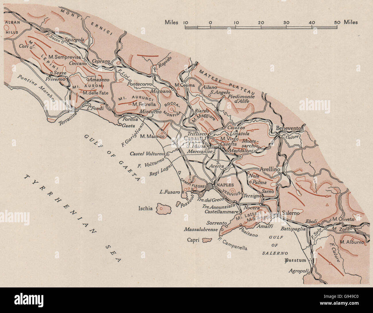 ITALY: Campania. WW2 ROYAL NAVY INTELLIGENCE MAP, 1944 Stock Photohttps://www.alamy.com/image-license-details/?v=1https://www.alamy.com/stock-photo-italy-campania-ww2-royal-navy-intelligence-map-1944-108889312.html
RFG949C0–ITALY: Campania. WW2 ROYAL NAVY INTELLIGENCE MAP, 1944
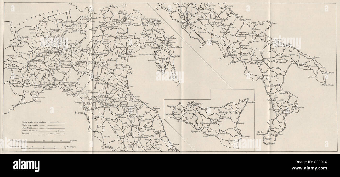 ITALY: Main Roads. WW2 ROYAL NAVY INTELLIGENCE MAP, 1945 Stock Photohttps://www.alamy.com/image-license-details/?v=1https://www.alamy.com/stock-photo-italy-main-roads-ww2-royal-navy-intelligence-map-1945-108991734.html
RFG9901X–ITALY: Main Roads. WW2 ROYAL NAVY INTELLIGENCE MAP, 1945
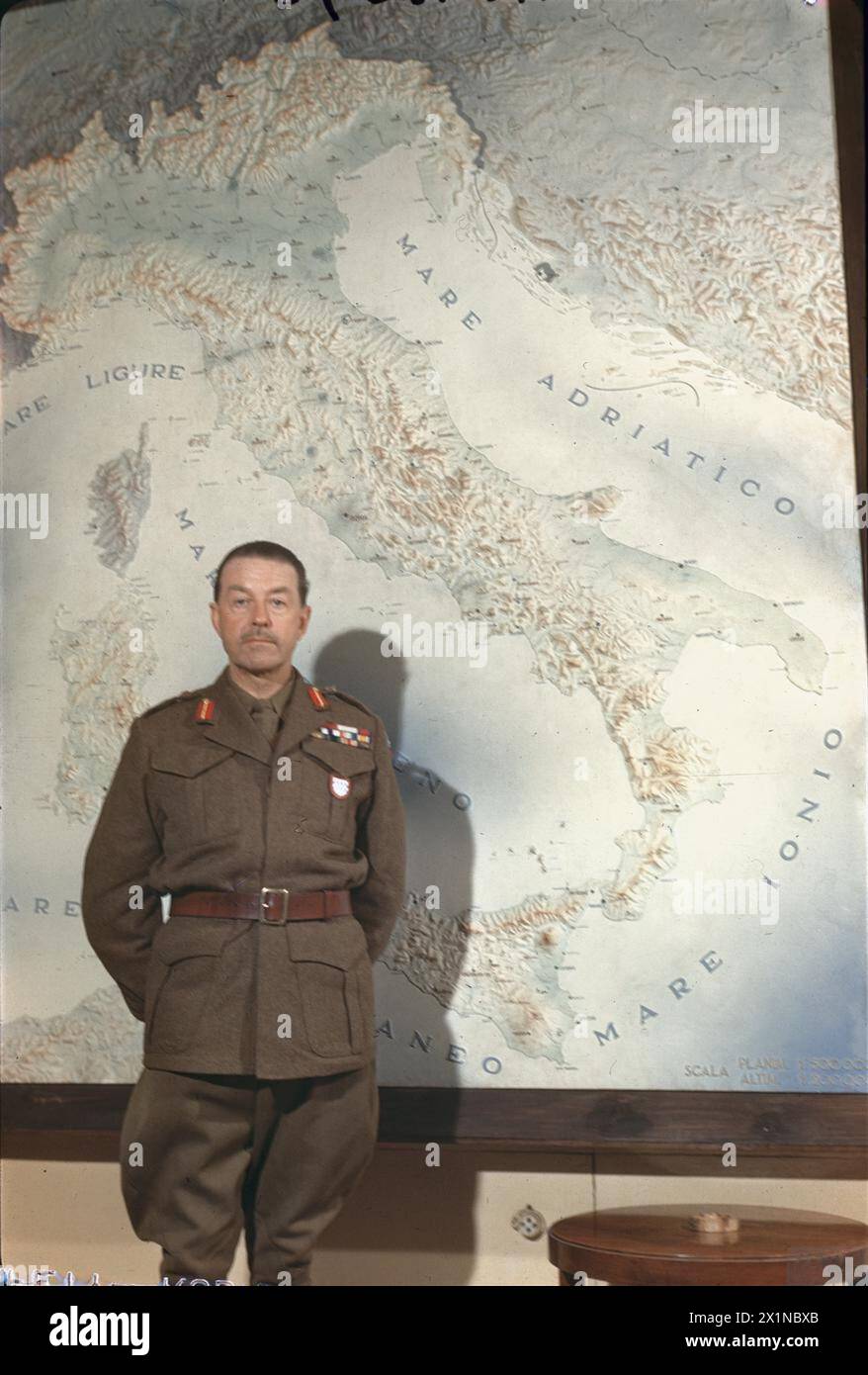 THE SECOND WORLD WAR: PERSONALITIES - Field Marshal Sir Harold Alexander, the Supreme Allied Commander of the Mediterranean Forces, standing in front of a map of Italy at his Headquarters in the Royal Palace, Caserta, Italy, Alexander, Harold Rupert Leofric George Stock Photohttps://www.alamy.com/image-license-details/?v=1https://www.alamy.com/the-second-world-war-personalities-field-marshal-sir-harold-alexander-the-supreme-allied-commander-of-the-mediterranean-forces-standing-in-front-of-a-map-of-italy-at-his-headquarters-in-the-royal-palace-caserta-italy-alexander-harold-rupert-leofric-george-image603447891.html
RM2X1NBXB–THE SECOND WORLD WAR: PERSONALITIES - Field Marshal Sir Harold Alexander, the Supreme Allied Commander of the Mediterranean Forces, standing in front of a map of Italy at his Headquarters in the Royal Palace, Caserta, Italy, Alexander, Harold Rupert Leofric George
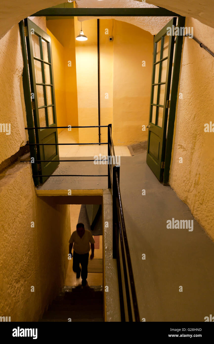 The subterranean military complex in Valletta that was used by British forces in World War II and by NATO is now open as museum. Stock Photohttps://www.alamy.com/image-license-details/?v=1https://www.alamy.com/stock-photo-the-subterranean-military-complex-in-valletta-that-was-used-by-british-104681065.html
RMG28HND–The subterranean military complex in Valletta that was used by British forces in World War II and by NATO is now open as museum.
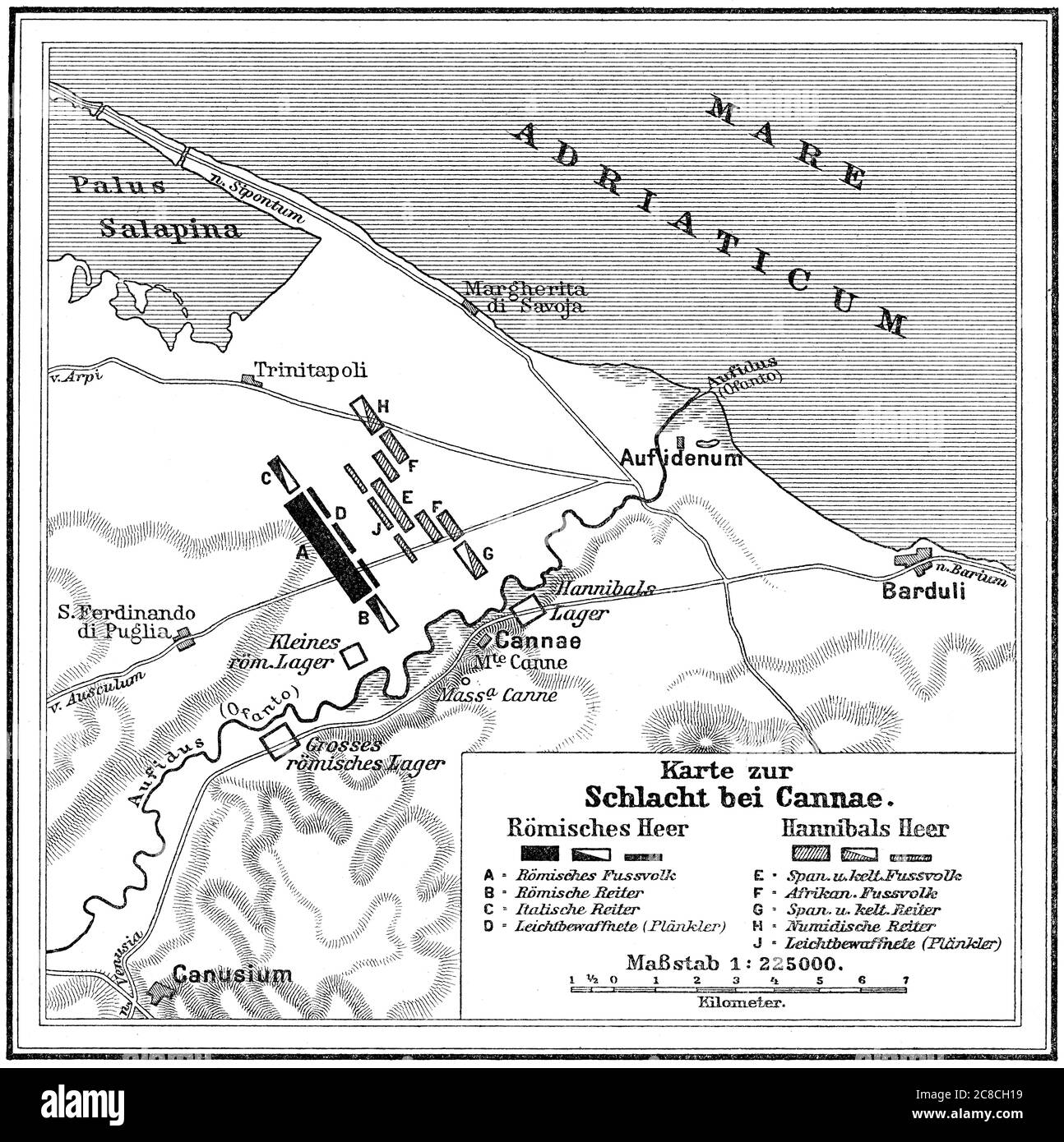 Battle of Cannae, Second Punic War on 2 August 216 BC Stock Photohttps://www.alamy.com/image-license-details/?v=1https://www.alamy.com/battle-of-cannae-second-punic-war-on-2-august-216-bc-image366611765.html
RM2C8CH19–Battle of Cannae, Second Punic War on 2 August 216 BC
!['Land use zones of Cologne (Koln). Zone maps, Series GSGS 4399. [London] : War Office, 1943-1944. Produced by: Great Britain. Air Ministry. Coverage of large towns throughout Germany, Italy and major occupied cities in other countries of central Europe. Small-scale town area maps overprinted to show vulnerability to high explosive and incendiary bombing. All originally classified 'Secret'. Source: Maps MOD GSGS 4399. Stock Photo 'Land use zones of Cologne (Koln). Zone maps, Series GSGS 4399. [London] : War Office, 1943-1944. Produced by: Great Britain. Air Ministry. Coverage of large towns throughout Germany, Italy and major occupied cities in other countries of central Europe. Small-scale town area maps overprinted to show vulnerability to high explosive and incendiary bombing. All originally classified 'Secret'. Source: Maps MOD GSGS 4399. Stock Photo](https://c8.alamy.com/comp/R52W0G/land-use-zones-of-cologne-koln-zone-maps-series-gsgs-4399-london-war-office-1943-1944-produced-by-great-britain-air-ministry-coverage-of-large-towns-throughout-germany-italy-and-major-occupied-cities-in-other-countries-of-central-europe-small-scale-town-area-maps-overprinted-to-show-vulnerability-to-high-explosive-and-incendiary-bombing-all-originally-classified-secret-source-maps-mod-gsgs-4399-R52W0G.jpg) 'Land use zones of Cologne (Koln). Zone maps, Series GSGS 4399. [London] : War Office, 1943-1944. Produced by: Great Britain. Air Ministry. Coverage of large towns throughout Germany, Italy and major occupied cities in other countries of central Europe. Small-scale town area maps overprinted to show vulnerability to high explosive and incendiary bombing. All originally classified 'Secret'. Source: Maps MOD GSGS 4399. Stock Photohttps://www.alamy.com/image-license-details/?v=1https://www.alamy.com/land-use-zones-of-cologne-koln-zone-maps-series-gsgs-4399-london-war-office-1943-1944-produced-by-great-britain-air-ministry-coverage-of-large-towns-throughout-germany-italy-and-major-occupied-cities-in-other-countries-of-central-europe-small-scale-town-area-maps-overprinted-to-show-vulnerability-to-high-explosive-and-incendiary-bombing-all-originally-classified-secret-source-maps-mod-gsgs-4399-image226871584.html
'Land use zones of Cologne (Koln). Zone maps, Series GSGS 4399. [London] : War Office, 1943-1944. Produced by: Great Britain. Air Ministry. Coverage of large towns throughout Germany, Italy and major occupied cities in other countries of central Europe. Small-scale town area maps overprinted to show vulnerability to high explosive and incendiary bombing. All originally classified 'Secret'. Source: Maps MOD GSGS 4399. Stock Photohttps://www.alamy.com/image-license-details/?v=1https://www.alamy.com/land-use-zones-of-cologne-koln-zone-maps-series-gsgs-4399-london-war-office-1943-1944-produced-by-great-britain-air-ministry-coverage-of-large-towns-throughout-germany-italy-and-major-occupied-cities-in-other-countries-of-central-europe-small-scale-town-area-maps-overprinted-to-show-vulnerability-to-high-explosive-and-incendiary-bombing-all-originally-classified-secret-source-maps-mod-gsgs-4399-image226871584.htmlRMR52W0G–'Land use zones of Cologne (Koln). Zone maps, Series GSGS 4399. [London] : War Office, 1943-1944. Produced by: Great Britain. Air Ministry. Coverage of large towns throughout Germany, Italy and major occupied cities in other countries of central Europe. Small-scale town area maps overprinted to show vulnerability to high explosive and incendiary bombing. All originally classified 'Secret'. Source: Maps MOD GSGS 4399.
 Wartime map planning invasion of Sicily, Lascaris War Rooms underground museum, Valletta, Malta Stock Photohttps://www.alamy.com/image-license-details/?v=1https://www.alamy.com/stock-photo-wartime-map-planning-invasion-of-sicily-lascaris-war-rooms-underground-145495818.html
RMJCKWB6–Wartime map planning invasion of Sicily, Lascaris War Rooms underground museum, Valletta, Malta
 Kleist, Ewald von, 8.8.1881 - 16.10.1954, German general, in a group picture (centre), as commander-in-chief of 1st Panzer Army during Operation 'Barbarossa', Ukraine, summer 1941, briefing with German and Italian officers, Stock Photohttps://www.alamy.com/image-license-details/?v=1https://www.alamy.com/stock-photo-kleist-ewald-von-881881-16101954-german-general-in-a-group-picture-48721761.html
RMCR7D2W–Kleist, Ewald von, 8.8.1881 - 16.10.1954, German general, in a group picture (centre), as commander-in-chief of 1st Panzer Army during Operation 'Barbarossa', Ukraine, summer 1941, briefing with German and Italian officers,
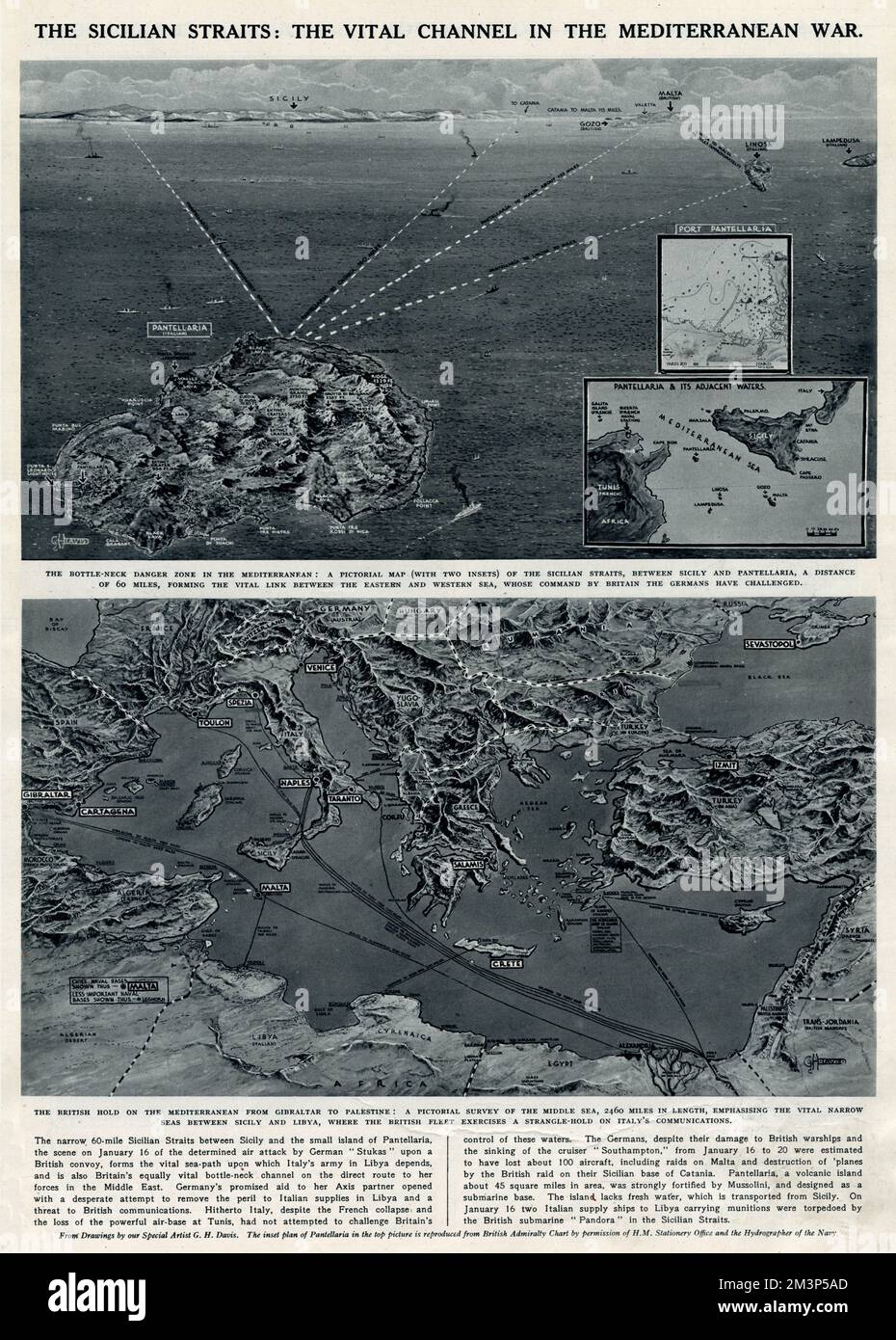 A map of the Sicilian Straits: the vital channel in the Mediterranean War. Also a map of the general Mediterranean area. Date: 1941 Stock Photohttps://www.alamy.com/image-license-details/?v=1https://www.alamy.com/a-map-of-the-sicilian-straits-the-vital-channel-in-the-mediterranean-war-also-a-map-of-the-general-mediterranean-area-date-1941-image501431797.html
RM2M3P5AD–A map of the Sicilian Straits: the vital channel in the Mediterranean War. Also a map of the general Mediterranean area. Date: 1941
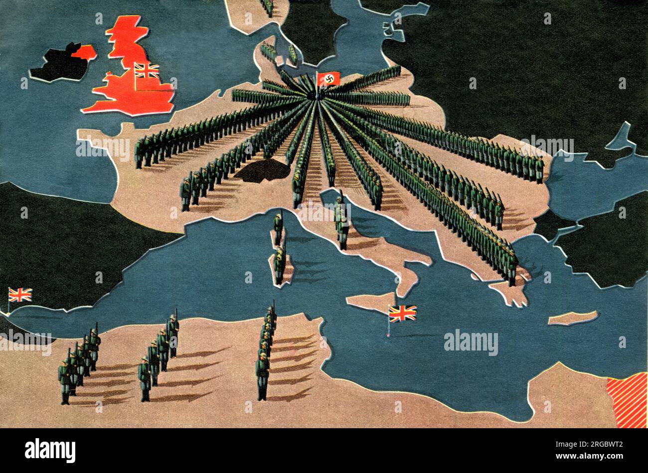 Turning Points of WW2, After the Fall of France Stock Photohttps://www.alamy.com/image-license-details/?v=1https://www.alamy.com/turning-points-of-ww2-after-the-fall-of-france-image560828018.html
RM2RGBWT2–Turning Points of WW2, After the Fall of France
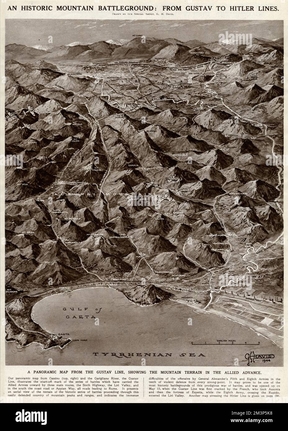 From Gustav to Hitler Lines by G. H. Davis Stock Photohttps://www.alamy.com/image-license-details/?v=1https://www.alamy.com/from-gustav-to-hitler-lines-by-g-h-davis-image501432044.html
RM2M3P5K8–From Gustav to Hitler Lines by G. H. Davis
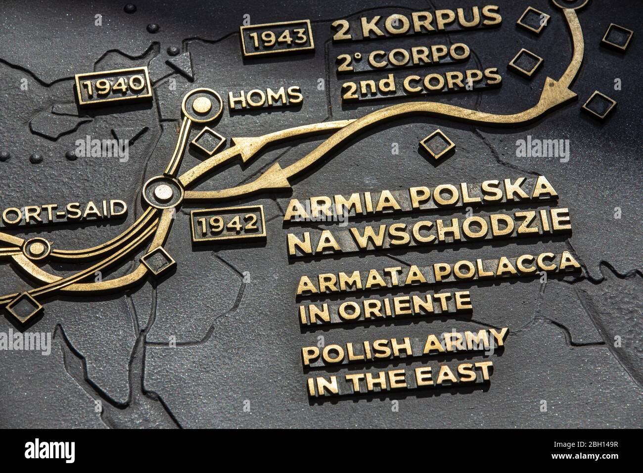 Polish army in the east. Second World War map. Polish monumental cemetery. The Polish war cemetery at Monte Cassino in Italy. Catholic, Jewish and Ort Stock Photohttps://www.alamy.com/image-license-details/?v=1https://www.alamy.com/polish-army-in-the-east-second-world-war-map-polish-monumental-cemetery-the-polish-war-cemetery-at-monte-cassino-in-italy-catholic-jewish-and-ort-image354681875.html
RF2BH149R–Polish army in the east. Second World War map. Polish monumental cemetery. The Polish war cemetery at Monte Cassino in Italy. Catholic, Jewish and Ort
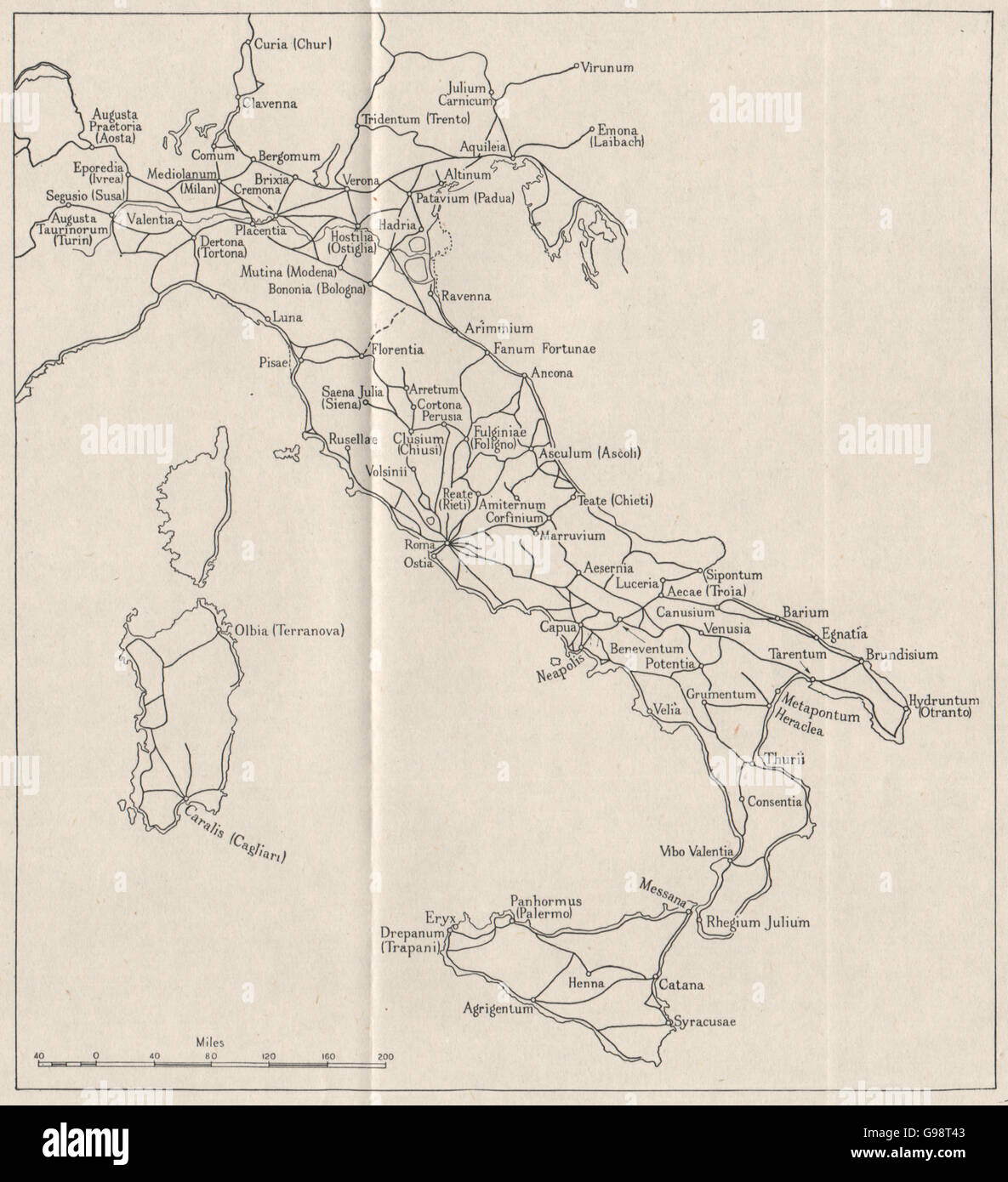 ITALY: Roman roads. WW2 ROYAL NAVY INTELLIGENCE MAP, 1945 Stock Photohttps://www.alamy.com/image-license-details/?v=1https://www.alamy.com/stock-photo-italy-roman-roads-ww2-royal-navy-intelligence-map-1945-108988659.html
RFG98T43–ITALY: Roman roads. WW2 ROYAL NAVY INTELLIGENCE MAP, 1945
 Lieutenant General W D Morgan, the Chief of Staff to the Supreme Allied Commander of the Mediterranean Forces, Field Marshal Alexander, at his desk in front of a map showing the Mediterranean area at AFHQ, Caserta, Italy. Stock Photohttps://www.alamy.com/image-license-details/?v=1https://www.alamy.com/lieutenant-general-w-d-morgan-the-chief-of-staff-to-the-supreme-allied-commander-of-the-mediterranean-forces-field-marshal-alexander-at-his-desk-in-front-of-a-map-showing-the-mediterranean-area-at-afhq-caserta-italy-image568986553.html
RM2T1KG49–Lieutenant General W D Morgan, the Chief of Staff to the Supreme Allied Commander of the Mediterranean Forces, Field Marshal Alexander, at his desk in front of a map showing the Mediterranean area at AFHQ, Caserta, Italy.
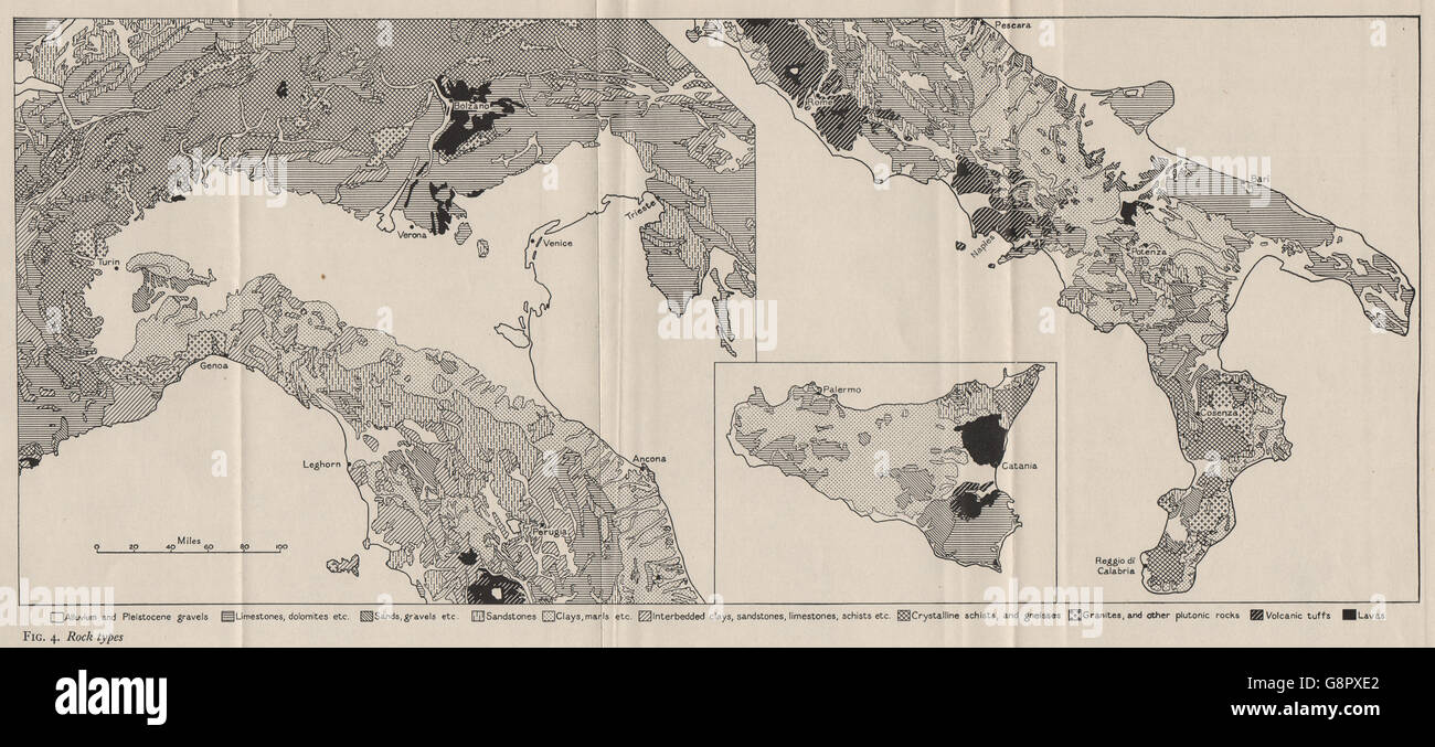 ITALY: Rock Types. WW2 ROYAL NAVY INTELLIGENCE MAP, 1944 Stock Photohttps://www.alamy.com/image-license-details/?v=1https://www.alamy.com/stock-photo-italy-rock-types-ww2-royal-navy-intelligence-map-1944-108683178.html
RFG8PXE2–ITALY: Rock Types. WW2 ROYAL NAVY INTELLIGENCE MAP, 1944
 A group of visitors at the underground complex used to direct World War II in Malta that is now open as a museum. Stock Photohttps://www.alamy.com/image-license-details/?v=1https://www.alamy.com/stock-photo-a-group-of-visitors-at-the-underground-complex-used-to-direct-world-104680949.html
RMG28HH9–A group of visitors at the underground complex used to direct World War II in Malta that is now open as a museum.
 Office and map planning invasion of Sicily, Lascaris War Rooms underground museum, Valletta, Malta Stock Photohttps://www.alamy.com/image-license-details/?v=1https://www.alamy.com/stock-photo-office-and-map-planning-invasion-of-sicily-lascaris-war-rooms-underground-145495815.html
RMJCKWB3–Office and map planning invasion of Sicily, Lascaris War Rooms underground museum, Valletta, Malta
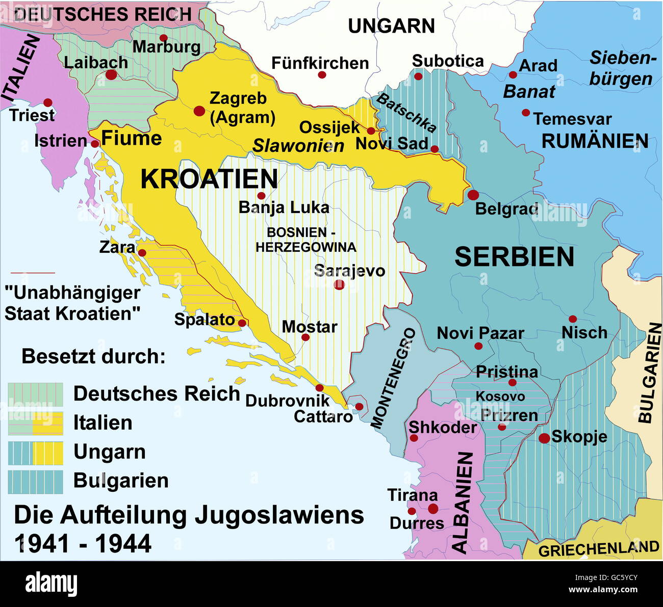 cartography, historical maps, modern times, Europe, Yugoslavia, division, 1941 - 1944, Additional-Rights-Clearences-Not Available Stock Photohttps://www.alamy.com/image-license-details/?v=1https://www.alamy.com/stock-photo-cartography-historical-maps-modern-times-europe-yugoslavia-division-110769371.html
RMGC5YCY–cartography, historical maps, modern times, Europe, Yugoslavia, division, 1941 - 1944, Additional-Rights-Clearences-Not Available
 Onward roads to Rome by G. H. Davis Stock Photohttps://www.alamy.com/image-license-details/?v=1https://www.alamy.com/onward-roads-to-rome-by-g-h-davis-image501432033.html
RM2M3P5JW–Onward roads to Rome by G. H. Davis
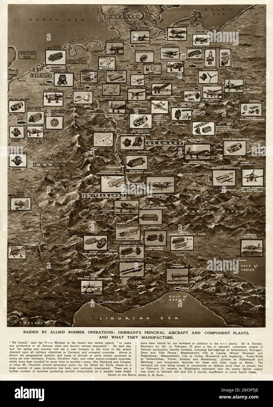 German plants raided by Allied bombing, by G. H. Davis Stock Photohttps://www.alamy.com/image-license-details/?v=1https://www.alamy.com/german-plants-raided-by-allied-bombing-by-g-h-davis-image501432022.html
RM2M3P5JE–German plants raided by Allied bombing, by G. H. Davis
 Polish army in the east. Second World War map. Polish monumental cemetery. The Polish war cemetery at Monte Cassino in Italy. Catholic, Jewish and Ort Stock Photohttps://www.alamy.com/image-license-details/?v=1https://www.alamy.com/polish-army-in-the-east-second-world-war-map-polish-monumental-cemetery-the-polish-war-cemetery-at-monte-cassino-in-italy-catholic-jewish-and-ort-image354681866.html
RF2BH149E–Polish army in the east. Second World War map. Polish monumental cemetery. The Polish war cemetery at Monte Cassino in Italy. Catholic, Jewish and Ort
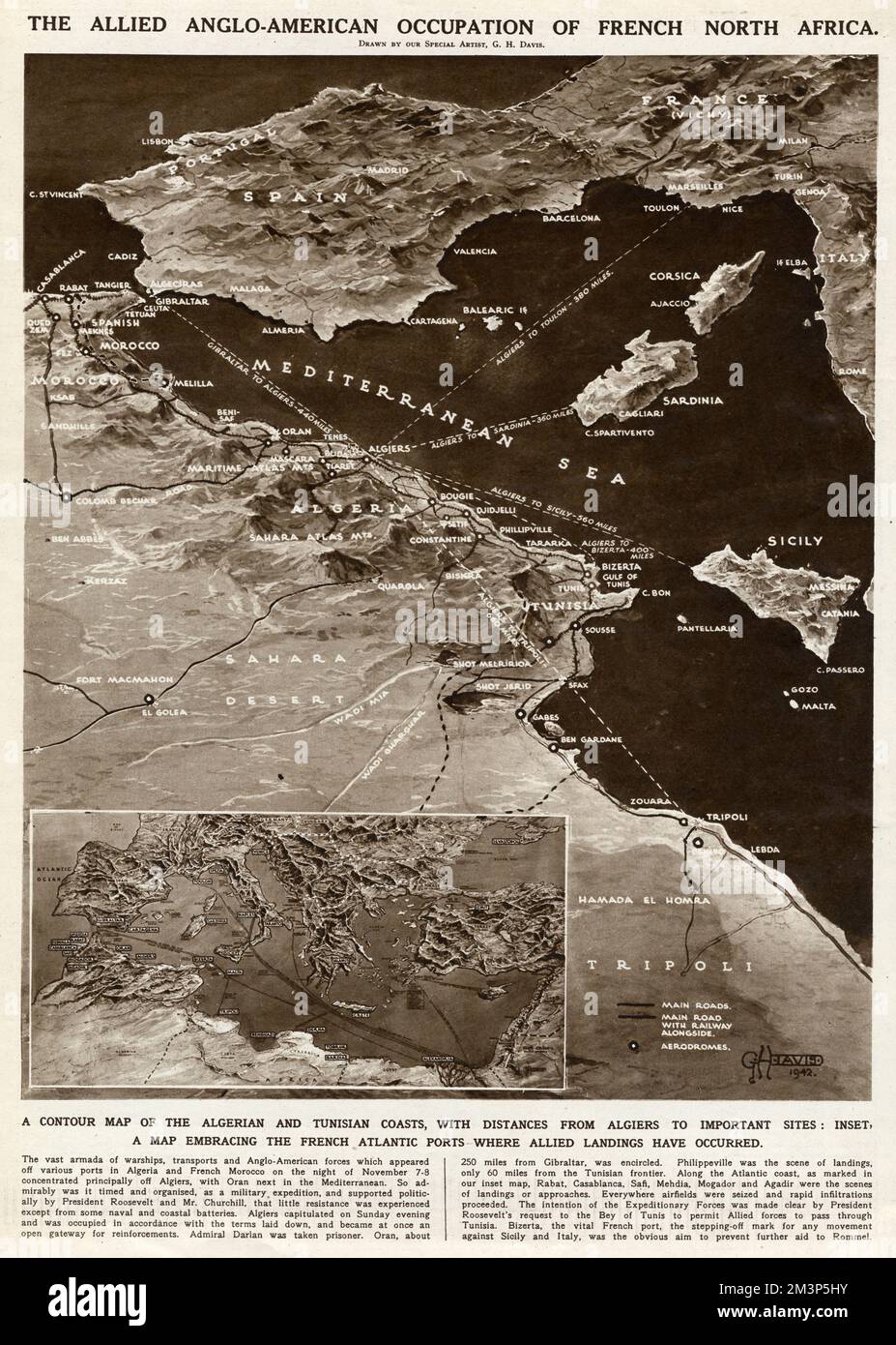 Allied occupation of French North Africa by G. H. Davis Stock Photohttps://www.alamy.com/image-license-details/?v=1https://www.alamy.com/allied-occupation-of-french-north-africa-by-g-h-davis-image501432007.html
RM2M3P5HY–Allied occupation of French North Africa by G. H. Davis
 The British Army in Italy, March 1945 Lieutenant General W D Morgan, the Chief of Staff to the Supreme Allied Commander of the Mediterranean Forces, Field Marshal Alexander, at his desk in front of a map showing the Mediterranean area at AFHQ, Caserta, Italy. Stock Photohttps://www.alamy.com/image-license-details/?v=1https://www.alamy.com/the-british-army-in-italy-march-1945-lieutenant-general-w-d-morgan-the-chief-of-staff-to-the-supreme-allied-commander-of-the-mediterranean-forces-field-marshal-alexander-at-his-desk-in-front-of-a-map-showing-the-mediterranean-area-at-afhq-caserta-italy-image568986746.html
RM2T1KGB6–The British Army in Italy, March 1945 Lieutenant General W D Morgan, the Chief of Staff to the Supreme Allied Commander of the Mediterranean Forces, Field Marshal Alexander, at his desk in front of a map showing the Mediterranean area at AFHQ, Caserta, Italy.
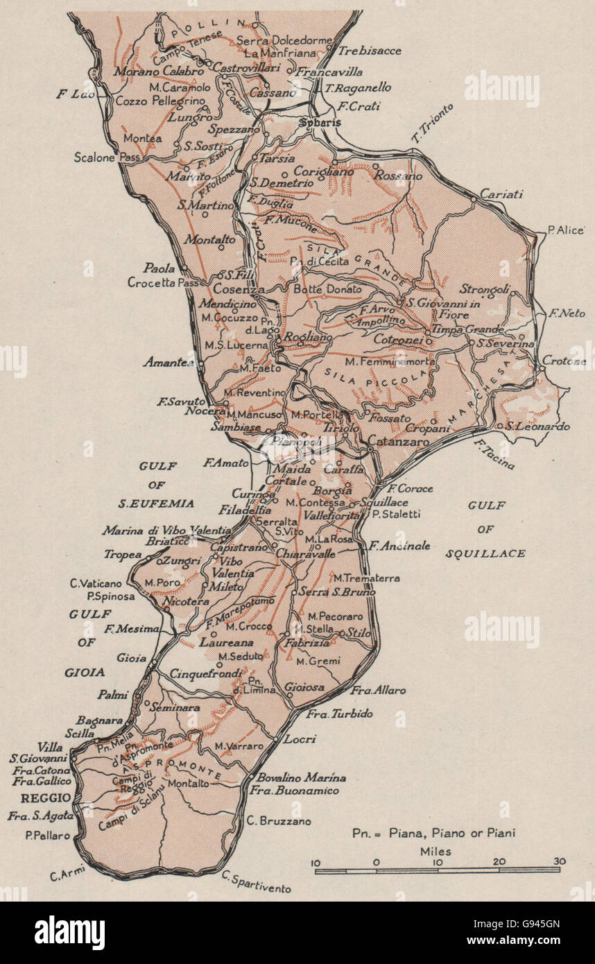 ITALY: Calabria sketch map. WW2 ROYAL NAVY INTELLIGENCE MAP, 1944 Stock Photohttps://www.alamy.com/image-license-details/?v=1https://www.alamy.com/stock-photo-italy-calabria-sketch-map-ww2-royal-navy-intelligence-map-1944-108886309.html
RFG945GN–ITALY: Calabria sketch map. WW2 ROYAL NAVY INTELLIGENCE MAP, 1944
 The subterranean military complex in Valletta that was used by British forces in World War II and by NATO is now open as museum. Stock Photohttps://www.alamy.com/image-license-details/?v=1https://www.alamy.com/stock-photo-the-subterranean-military-complex-in-valletta-that-was-used-by-british-104681068.html
RMG28HNG–The subterranean military complex in Valletta that was used by British forces in World War II and by NATO is now open as museum.
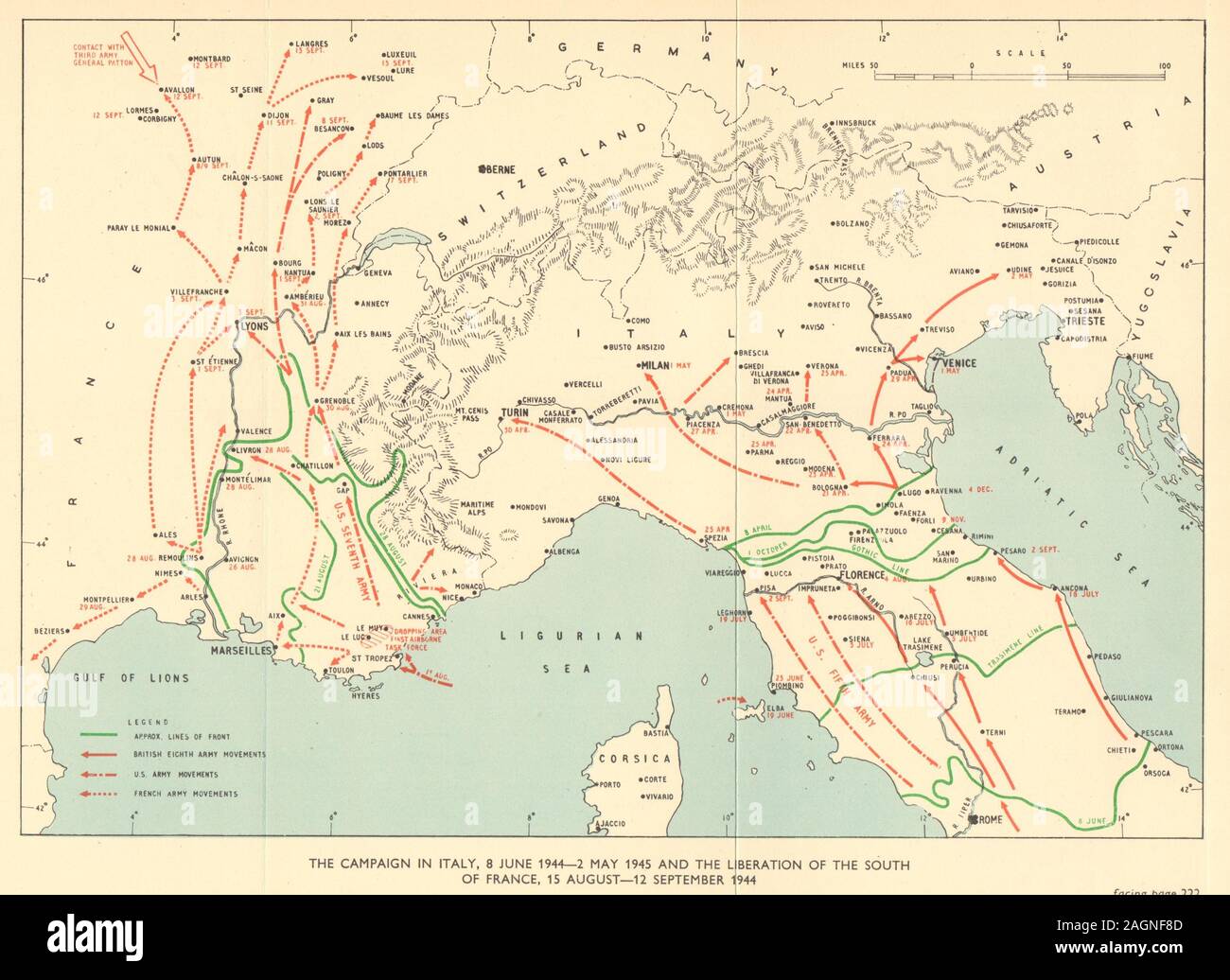 Campaign in Italy & South of France June 1944 - Sept 1945. World War 2 1954 map Stock Photohttps://www.alamy.com/image-license-details/?v=1https://www.alamy.com/campaign-in-italy-south-of-france-june-1944-sept-1945-world-war-2-1954-map-image337304477.html
RF2AGNF8D–Campaign in Italy & South of France June 1944 - Sept 1945. World War 2 1954 map
 Office and map planning invasion of Sicily, Lascaris War Rooms underground museum, Valletta, Malta Stock Photohttps://www.alamy.com/image-license-details/?v=1https://www.alamy.com/stock-photo-office-and-map-planning-invasion-of-sicily-lascaris-war-rooms-underground-145495801.html
RMJCKWAH–Office and map planning invasion of Sicily, Lascaris War Rooms underground museum, Valletta, Malta
 ITALY. Sicily and Sardinia Sardegna. Aeolian islands. BARTHOLOMEW 1944 old map Stock Photohttps://www.alamy.com/image-license-details/?v=1https://www.alamy.com/stock-photo-italy-sicily-and-sardinia-sardegna-aeolian-islands-bartholomew-1944-123162647.html
RFH4AF5Y–ITALY. Sicily and Sardinia Sardegna. Aeolian islands. BARTHOLOMEW 1944 old map
 The British Army in Italy, March 1945 Lieutenant General W D Morgan, the Chief of Staff to the Supreme Allied Commander of the Mediterranean Forces, Field Marshal Alexander, at his desk in front of a map showing the Mediterranean area at AFHQ, Caserta, Italy. Stock Photohttps://www.alamy.com/image-license-details/?v=1https://www.alamy.com/the-british-army-in-italy-march-1945-lieutenant-general-w-d-morgan-the-chief-of-staff-to-the-supreme-allied-commander-of-the-mediterranean-forces-field-marshal-alexander-at-his-desk-in-front-of-a-map-showing-the-mediterranean-area-at-afhq-caserta-italy-image568986743.html
RM2T1KGB3–The British Army in Italy, March 1945 Lieutenant General W D Morgan, the Chief of Staff to the Supreme Allied Commander of the Mediterranean Forces, Field Marshal Alexander, at his desk in front of a map showing the Mediterranean area at AFHQ, Caserta, Italy.
 The subterranean military complex in Valletta that was used by British forces in World War II and by NATO is now open as museum. Stock Photohttps://www.alamy.com/image-license-details/?v=1https://www.alamy.com/stock-photo-the-subterranean-military-complex-in-valletta-that-was-used-by-british-104681062.html
RMG28HNA–The subterranean military complex in Valletta that was used by British forces in World War II and by NATO is now open as museum.
 Lascaris War Rooms underground museum, Valletta, Malta Stock Photohttps://www.alamy.com/image-license-details/?v=1https://www.alamy.com/stock-photo-lascaris-war-rooms-underground-museum-valletta-malta-145495690.html
RMJCKW6J–Lascaris War Rooms underground museum, Valletta, Malta
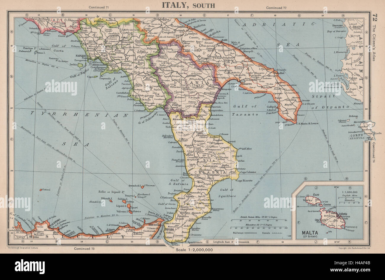 ITALY SOUTH. Calabria Campania Lucania Puglia. inset Malta. BARTHOLOMEW 1944 map Stock Photohttps://www.alamy.com/image-license-details/?v=1https://www.alamy.com/stock-photo-italy-south-calabria-campania-lucania-puglia-inset-malta-bartholomew-123162603.html
RFH4AF4B–ITALY SOUTH. Calabria Campania Lucania Puglia. inset Malta. BARTHOLOMEW 1944 map
 The British Army in Italy, March 1945 Lieutenant General W D Morgan, the Chief of Staff to the Supreme Allied Commander of the Mediterranean Forces, Field Marshal Alexander, at his desk in front of a map showing the Mediterranean area at AFHQ, Caserta, Italy. Stock Photohttps://www.alamy.com/image-license-details/?v=1https://www.alamy.com/the-british-army-in-italy-march-1945-lieutenant-general-w-d-morgan-the-chief-of-staff-to-the-supreme-allied-commander-of-the-mediterranean-forces-field-marshal-alexander-at-his-desk-in-front-of-a-map-showing-the-mediterranean-area-at-afhq-caserta-italy-image568986808.html
RM2T1KGDC–The British Army in Italy, March 1945 Lieutenant General W D Morgan, the Chief of Staff to the Supreme Allied Commander of the Mediterranean Forces, Field Marshal Alexander, at his desk in front of a map showing the Mediterranean area at AFHQ, Caserta, Italy.
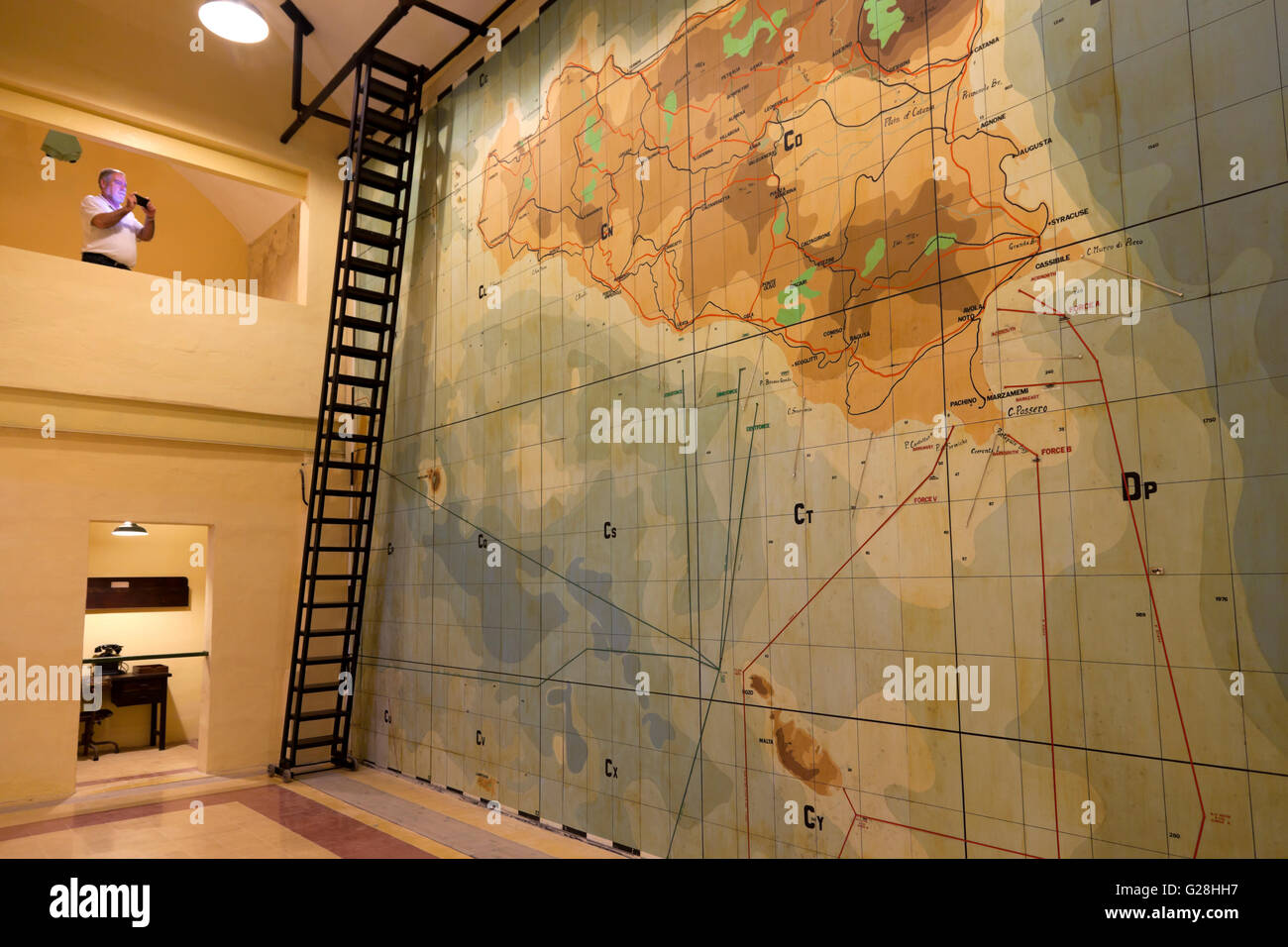 A visitor at the underground complex used to direct World War II in Malta that is now open as a museum. Stock Photohttps://www.alamy.com/image-license-details/?v=1https://www.alamy.com/stock-photo-a-visitor-at-the-underground-complex-used-to-direct-world-war-ii-in-104680947.html
RMG28HH7–A visitor at the underground complex used to direct World War II in Malta that is now open as a museum.
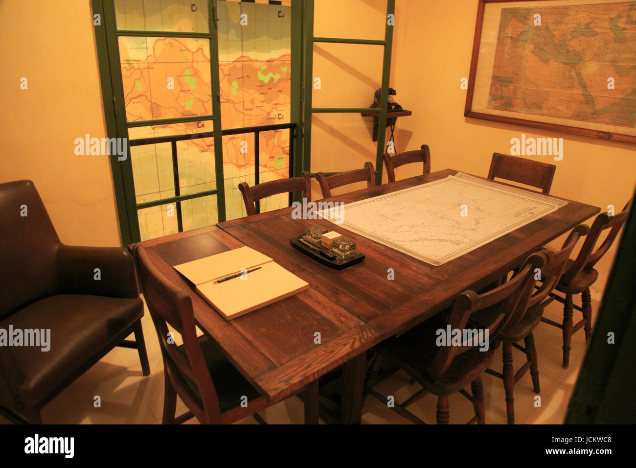 Lascaris War Rooms underground museum, Valletta, Malta Stock Photohttps://www.alamy.com/image-license-details/?v=1https://www.alamy.com/stock-photo-lascaris-war-rooms-underground-museum-valletta-malta-145495848.html
RMJCKWC8–Lascaris War Rooms underground museum, Valletta, Malta
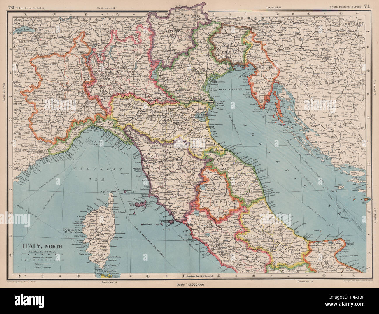 ITALY NORTH. Includes Istria Tende Mt Cenis. Pre-1947 border changes 1944 map Stock Photohttps://www.alamy.com/image-license-details/?v=1https://www.alamy.com/stock-photo-italy-north-includes-istria-tende-mt-cenis-pre-1947-border-changes-123162586.html
RFH4AF3P–ITALY NORTH. Includes Istria Tende Mt Cenis. Pre-1947 border changes 1944 map
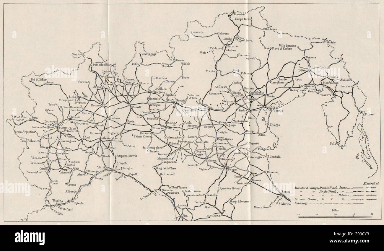 NORTHERN ITALY: Railways. WW2 ROYAL NAVY INTELLIGENCE MAP, 1945 Stock Photohttps://www.alamy.com/image-license-details/?v=1https://www.alamy.com/stock-photo-northern-italy-railways-ww2-royal-navy-intelligence-map-1945-108992439.html
RFG990Y3–NORTHERN ITALY: Railways. WW2 ROYAL NAVY INTELLIGENCE MAP, 1945
 The British Army in Italy, March 1945 Lieutenant General W D Morgan, the Chief of Staff to the Supreme Allied Commander of the Mediterranean Forces, Field Marshal Alexander, at his desk in front of a map showing the Mediterranean area at AFHQ, Caserta, Italy. Stock Photohttps://www.alamy.com/image-license-details/?v=1https://www.alamy.com/the-british-army-in-italy-march-1945-lieutenant-general-w-d-morgan-the-chief-of-staff-to-the-supreme-allied-commander-of-the-mediterranean-forces-field-marshal-alexander-at-his-desk-in-front-of-a-map-showing-the-mediterranean-area-at-afhq-caserta-italy-image568986788.html
RM2T1KGCM–The British Army in Italy, March 1945 Lieutenant General W D Morgan, the Chief of Staff to the Supreme Allied Commander of the Mediterranean Forces, Field Marshal Alexander, at his desk in front of a map showing the Mediterranean area at AFHQ, Caserta, Italy.
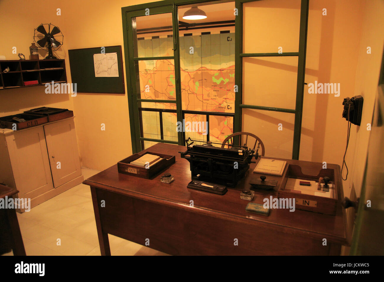 Lascaris War Rooms underground museum, Valletta, Malta Stock Photohttps://www.alamy.com/image-license-details/?v=1https://www.alamy.com/stock-photo-lascaris-war-rooms-underground-museum-valletta-malta-145495845.html
RMJCKWC5–Lascaris War Rooms underground museum, Valletta, Malta
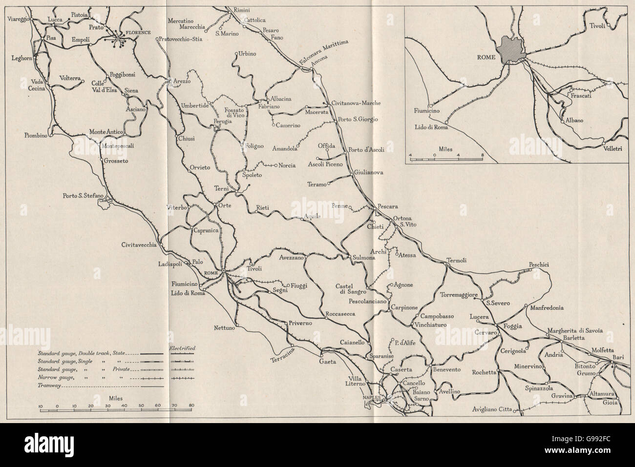 CENTRAL ITALY: Railways. WW2 ROYAL NAVY INTELLIGENCE MAP, 1945 Stock Photohttps://www.alamy.com/image-license-details/?v=1https://www.alamy.com/stock-photo-central-italy-railways-ww2-royal-navy-intelligence-map-1945-108993680.html
RFG992FC–CENTRAL ITALY: Railways. WW2 ROYAL NAVY INTELLIGENCE MAP, 1945
 The British Army in Italy, March 1945 Lieutenant General W D Morgan, the Chief of Staff to the Supreme Allied Commander of the Mediterranean Forces, Field Marshal Alexander, standing, wearing a cap, in front of a map showing the Mediterranean area at AFHQ, Caserta, Italy. Stock Photohttps://www.alamy.com/image-license-details/?v=1https://www.alamy.com/the-british-army-in-italy-march-1945-lieutenant-general-w-d-morgan-the-chief-of-staff-to-the-supreme-allied-commander-of-the-mediterranean-forces-field-marshal-alexander-standing-wearing-a-cap-in-front-of-a-map-showing-the-mediterranean-area-at-afhq-caserta-italy-image568986747.html
RM2T1KGB7–The British Army in Italy, March 1945 Lieutenant General W D Morgan, the Chief of Staff to the Supreme Allied Commander of the Mediterranean Forces, Field Marshal Alexander, standing, wearing a cap, in front of a map showing the Mediterranean area at AFHQ, Caserta, Italy.
 SOUTHERN ITALY: Railways. WW2 ROYAL NAVY INTELLIGENCE MAP, 1945 Stock Photohttps://www.alamy.com/image-license-details/?v=1https://www.alamy.com/stock-photo-southern-italy-railways-ww2-royal-navy-intelligence-map-1945-108995481.html
RFG994RN–SOUTHERN ITALY: Railways. WW2 ROYAL NAVY INTELLIGENCE MAP, 1945
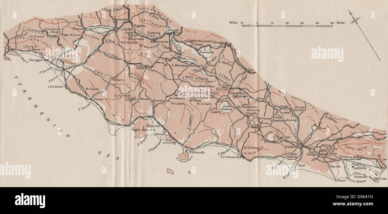 ITALY: The Pre-Apennines. WW2 ROYAL NAVY INTELLIGENCE MAP, 1944 Stock Photohttps://www.alamy.com/image-license-details/?v=1https://www.alamy.com/stock-photo-italy-the-pre-apennines-ww2-royal-navy-intelligence-map-1944-108929009.html
RFG9641N–ITALY: The Pre-Apennines. WW2 ROYAL NAVY INTELLIGENCE MAP, 1944
 The British Army in Italy, March 1945 Lieutenant General W D Morgan, the Chief of Staff to the Supreme Allied Commander of the Mediterranean Forces, Field Marshal Alexander, standing, wearing a cap, in front of a map showing the Mediterranean area at AFHQ, Caserta, Italy. Stock Photohttps://www.alamy.com/image-license-details/?v=1https://www.alamy.com/the-british-army-in-italy-march-1945-lieutenant-general-w-d-morgan-the-chief-of-staff-to-the-supreme-allied-commander-of-the-mediterranean-forces-field-marshal-alexander-standing-wearing-a-cap-in-front-of-a-map-showing-the-mediterranean-area-at-afhq-caserta-italy-image568986744.html
RM2T1KGB4–The British Army in Italy, March 1945 Lieutenant General W D Morgan, the Chief of Staff to the Supreme Allied Commander of the Mediterranean Forces, Field Marshal Alexander, standing, wearing a cap, in front of a map showing the Mediterranean area at AFHQ, Caserta, Italy.
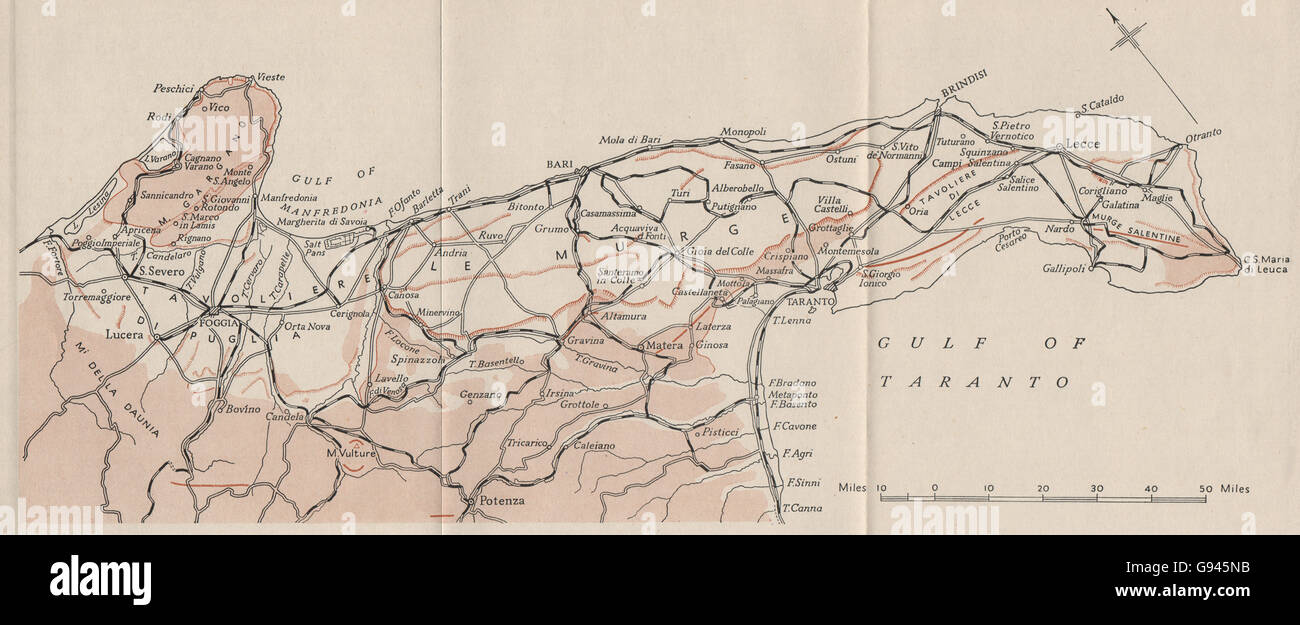 ITALY: The Apulian region. WW2 ROYAL NAVY INTELLIGENCE MAP, 1944 Stock Photohttps://www.alamy.com/image-license-details/?v=1https://www.alamy.com/stock-photo-italy-the-apulian-region-ww2-royal-navy-intelligence-map-1944-108886439.html
RFG945NB–ITALY: The Apulian region. WW2 ROYAL NAVY INTELLIGENCE MAP, 1944
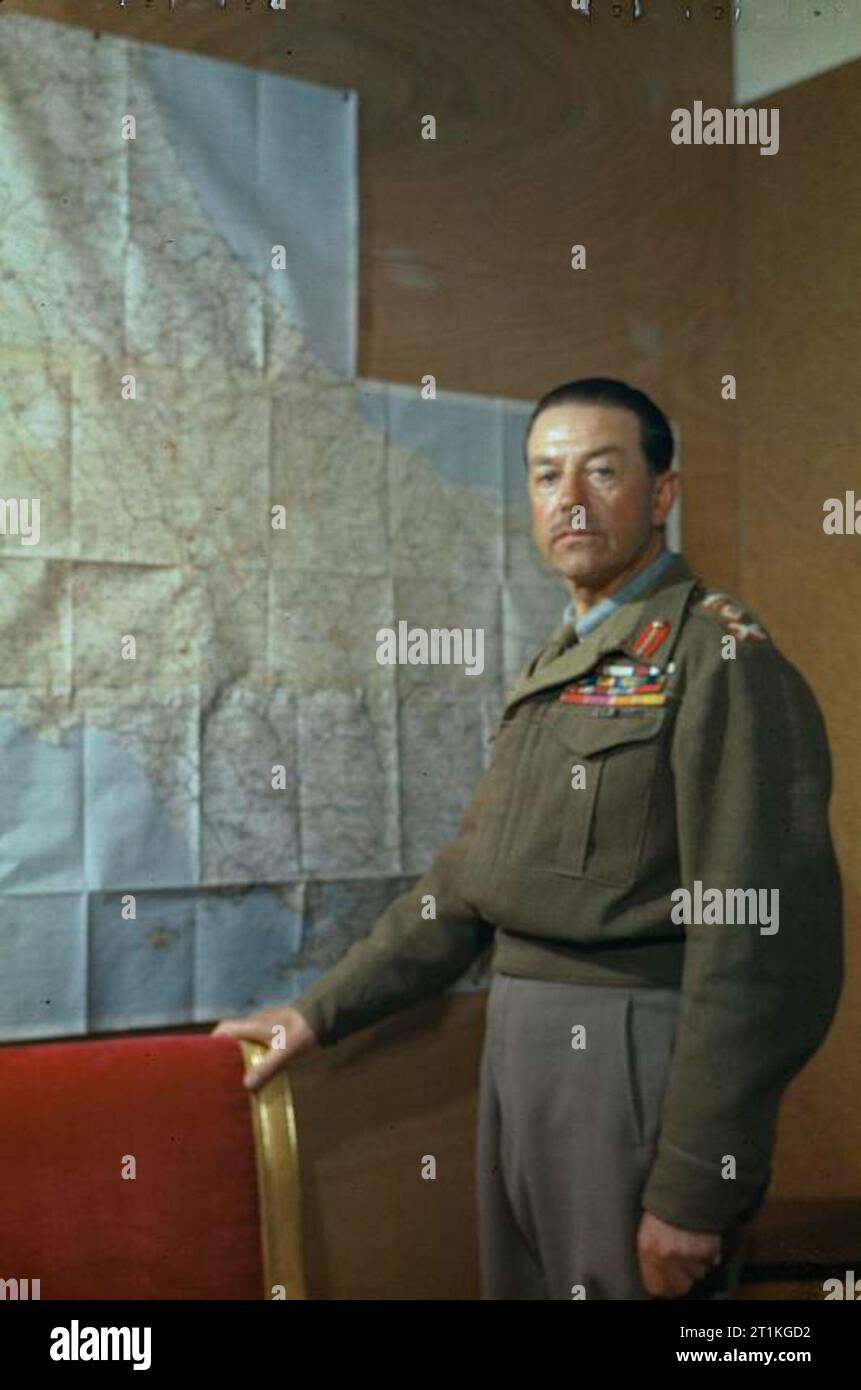 The Commander in Chief, Allied Armies in Italy, General Sir Harold Alexander, in Caserta, Italy, 4 May 1944 Three quarter length portrait of General Sir Harold Alexander, GCB, KCB, CB, CSI, DSO, MC, standing in front of a map of Italy at his headquarters in Caserta. Stock Photohttps://www.alamy.com/image-license-details/?v=1https://www.alamy.com/the-commander-in-chief-allied-armies-in-italy-general-sir-harold-alexander-in-caserta-italy-4-may-1944-three-quarter-length-portrait-of-general-sir-harold-alexander-gcb-kcb-cb-csi-dso-mc-standing-in-front-of-a-map-of-italy-at-his-headquarters-in-caserta-image568986798.html
RM2T1KGD2–The Commander in Chief, Allied Armies in Italy, General Sir Harold Alexander, in Caserta, Italy, 4 May 1944 Three quarter length portrait of General Sir Harold Alexander, GCB, KCB, CB, CSI, DSO, MC, standing in front of a map of Italy at his headquarters in Caserta.
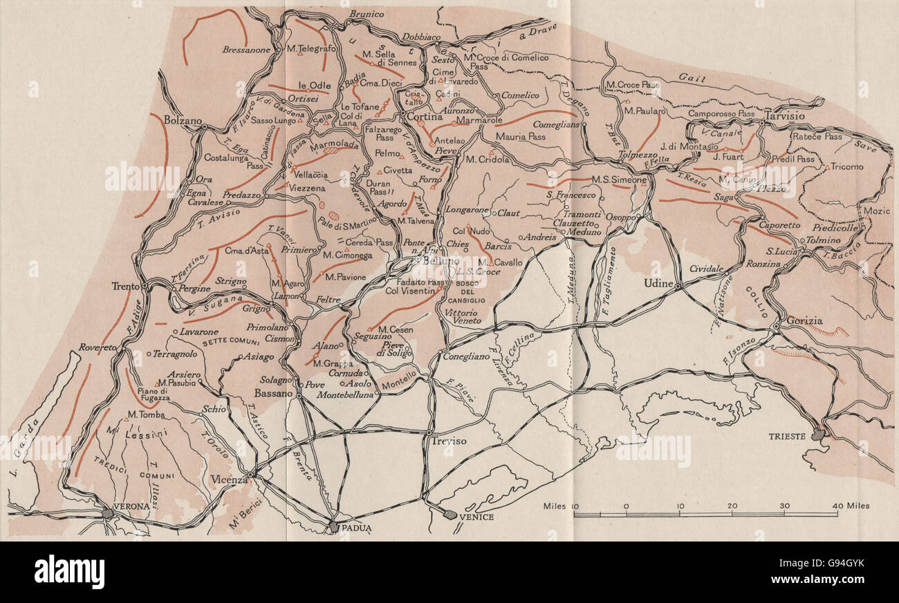 ITALY: The Eastern Alps. WW2 ROYAL NAVY INTELLIGENCE MAP, 1944 Stock Photohttps://www.alamy.com/image-license-details/?v=1https://www.alamy.com/stock-photo-italy-the-eastern-alps-ww2-royal-navy-intelligence-map-1944-108895239.html
RFG94GYK–ITALY: The Eastern Alps. WW2 ROYAL NAVY INTELLIGENCE MAP, 1944
 Royal Air Force- Italy, the Balkans and South-east Europe, 1942-1945. A tattooed sergeant-major glider pilot of the Army Air Corps and a glider-tug pilot of No. 296 Squadron RAF studying a map of Sicily at Goubrine II, Tunisia, in preparation for the 1st Airborne Division landings in Sicily (Operations FUSTIAN and MARSTON). Stock Photohttps://www.alamy.com/image-license-details/?v=1https://www.alamy.com/royal-air-force-italy-the-balkans-and-south-east-europe-1942-1945-a-tattooed-sergeant-major-glider-pilot-of-the-army-air-corps-and-a-glider-tug-pilot-of-no-296-squadron-raf-studying-a-map-of-sicily-at-goubrine-ii-tunisia-in-preparation-for-the-1st-airborne-division-landings-in-sicily-operations-fustian-and-marston-image479146917.html
RM2JRF0NW–Royal Air Force- Italy, the Balkans and South-east Europe, 1942-1945. A tattooed sergeant-major glider pilot of the Army Air Corps and a glider-tug pilot of No. 296 Squadron RAF studying a map of Sicily at Goubrine II, Tunisia, in preparation for the 1st Airborne Division landings in Sicily (Operations FUSTIAN and MARSTON).
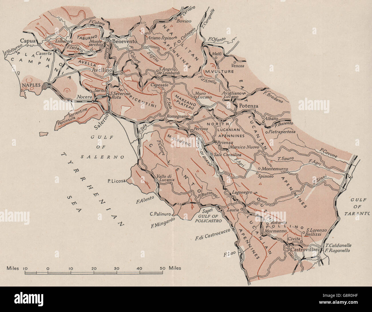 ITALY: The Southern Apennines. WW2 ROYAL NAVY INTELLIGENCE MAP, 1944 Stock Photohttps://www.alamy.com/image-license-details/?v=1https://www.alamy.com/stock-photo-italy-the-southern-apennines-ww2-royal-navy-intelligence-map-1944-108684843.html
RFG8R0HF–ITALY: The Southern Apennines. WW2 ROYAL NAVY INTELLIGENCE MAP, 1944
 Royal Air Force- Italy, the Balkans and South-east Europe, 1942-1945. A tattooed sergeant-major glider pilot of the Army Air Corps and a glider-tug pilot of No. 296 Squadron RAF studying a map of Sicily at Goubrine II, Tunisia, in preparation for the 1st Airborne Division landings in Sicily (Operations FUSTIAN and MARSTON). Stock Photohttps://www.alamy.com/image-license-details/?v=1https://www.alamy.com/royal-air-force-italy-the-balkans-and-south-east-europe-1942-1945-a-tattooed-sergeant-major-glider-pilot-of-the-army-air-corps-and-a-glider-tug-pilot-of-no-296-squadron-raf-studying-a-map-of-sicily-at-goubrine-ii-tunisia-in-preparation-for-the-1st-airborne-division-landings-in-sicily-operations-fustian-and-marston-image568983572.html
RM2T1KC9T–Royal Air Force- Italy, the Balkans and South-east Europe, 1942-1945. A tattooed sergeant-major glider pilot of the Army Air Corps and a glider-tug pilot of No. 296 Squadron RAF studying a map of Sicily at Goubrine II, Tunisia, in preparation for the 1st Airborne Division landings in Sicily (Operations FUSTIAN and MARSTON).
 ITALY: The Central Apennines. WW2 ROYAL NAVY INTELLIGENCE MAP, 1944 Stock Photohttps://www.alamy.com/image-license-details/?v=1https://www.alamy.com/stock-photo-italy-the-central-apennines-ww2-royal-navy-intelligence-map-1944-108887130.html
RFG946J2–ITALY: The Central Apennines. WW2 ROYAL NAVY INTELLIGENCE MAP, 1944
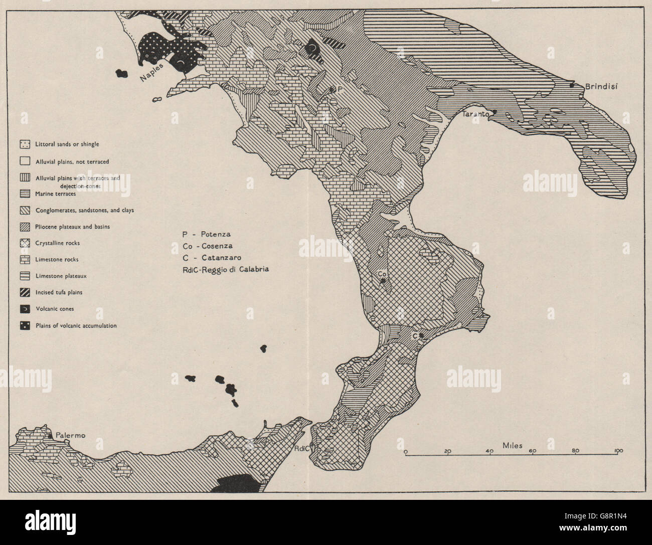 SOUTHERN ITALY: Landform types. WW2 ROYAL NAVY INTELLIGENCE MAP, 1944 Stock Photohttps://www.alamy.com/image-license-details/?v=1https://www.alamy.com/stock-photo-southern-italy-landform-types-ww2-royal-navy-intelligence-map-1944-108685728.html
RFG8R1N4–SOUTHERN ITALY: Landform types. WW2 ROYAL NAVY INTELLIGENCE MAP, 1944
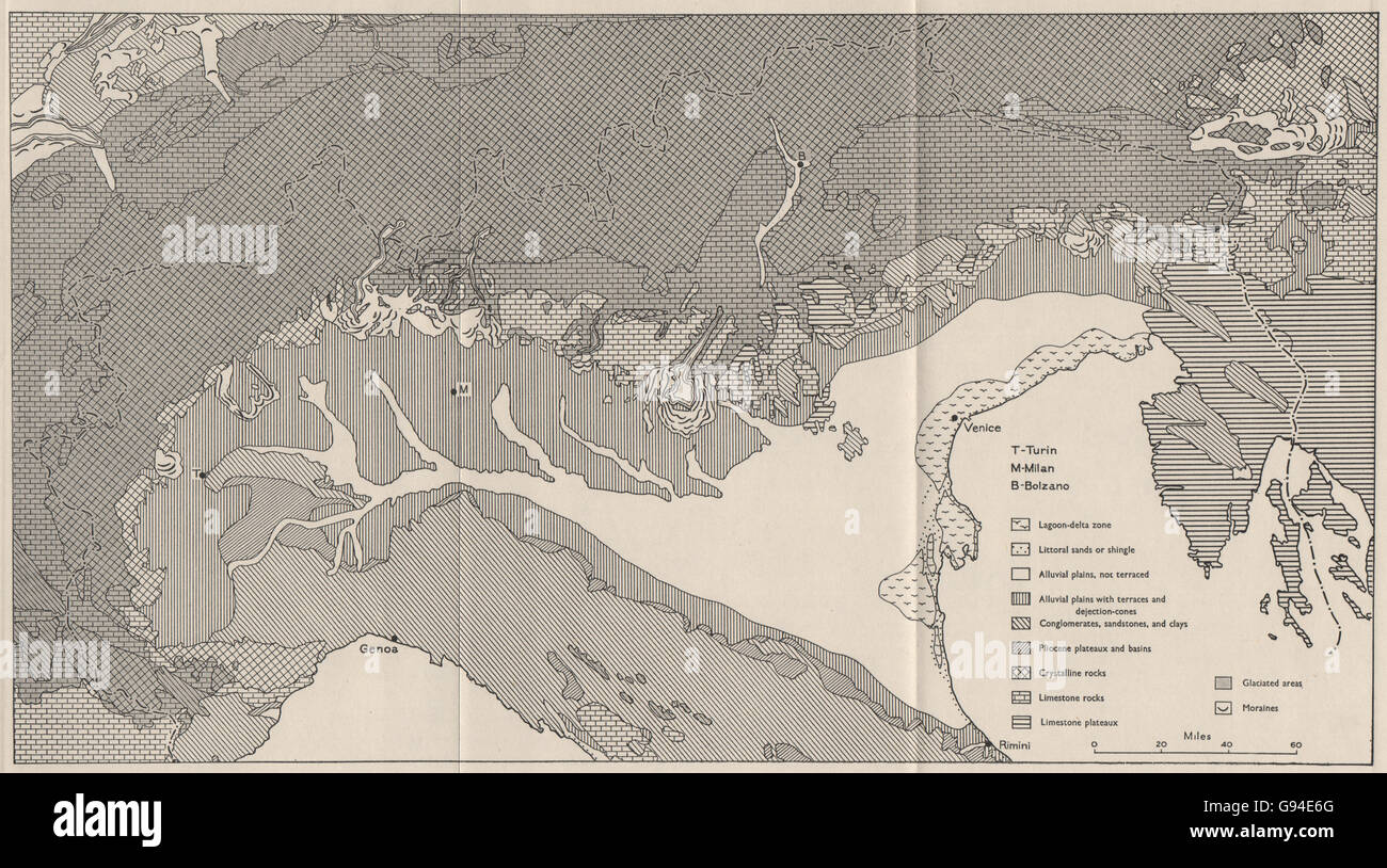 NORTHERN ITALY: Landform types. WW2 ROYAL NAVY INTELLIGENCE MAP, 1944 Stock Photohttps://www.alamy.com/image-license-details/?v=1https://www.alamy.com/stock-photo-northern-italy-landform-types-ww2-royal-navy-intelligence-map-1944-108893080.html
RFG94E6G–NORTHERN ITALY: Landform types. WW2 ROYAL NAVY INTELLIGENCE MAP, 1944
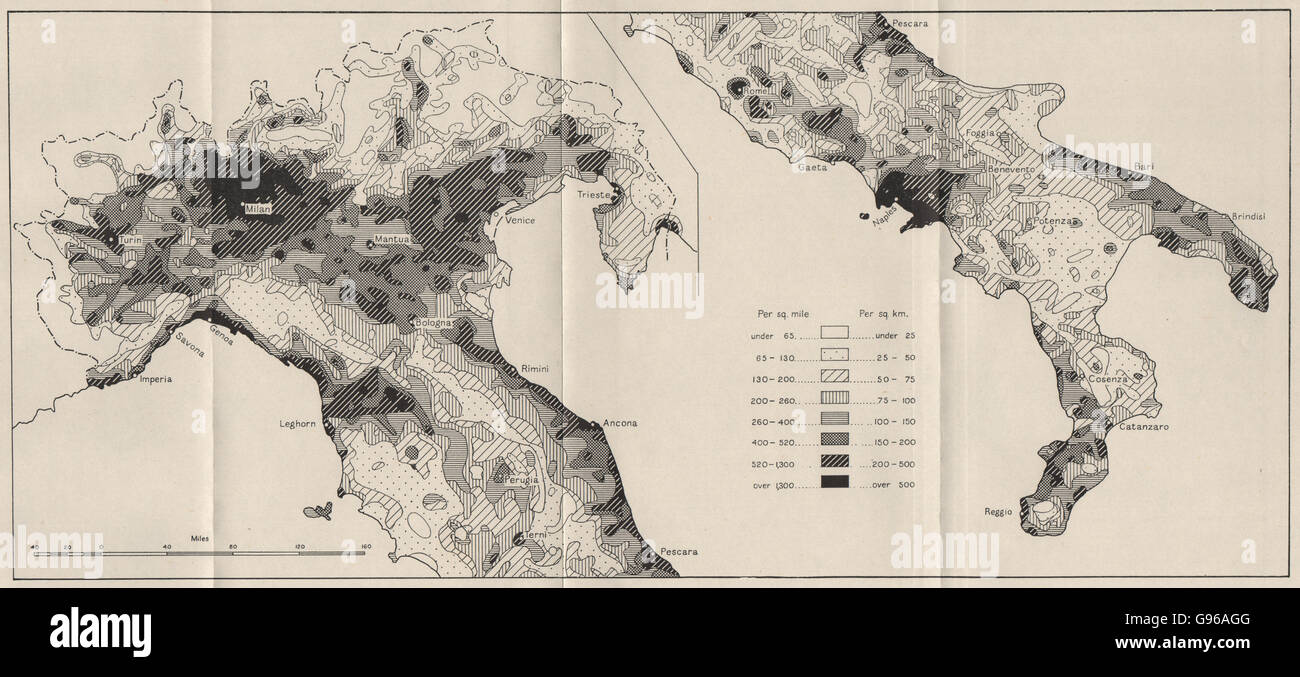 ITALY: Density of population, 1931. WW2 ROYAL NAVY INTELLIGENCE MAP, 1944 Stock Photohttps://www.alamy.com/image-license-details/?v=1https://www.alamy.com/stock-photo-italy-density-of-population-1931-ww2-royal-navy-intelligence-map-1944-108934128.html
RFG96AGG–ITALY: Density of population, 1931. WW2 ROYAL NAVY INTELLIGENCE MAP, 1944
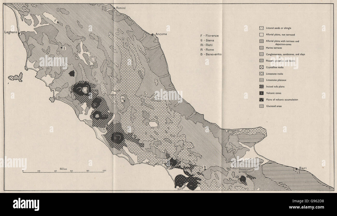 CENTRAL ITALY: Landform types. WW2 ROYAL NAVY INTELLIGENCE MAP, 1944 Stock Photohttps://www.alamy.com/image-license-details/?v=1https://www.alamy.com/stock-photo-central-italy-landform-types-ww2-royal-navy-intelligence-map-1944-108927764.html
RFG962D8–CENTRAL ITALY: Landform types. WW2 ROYAL NAVY INTELLIGENCE MAP, 1944
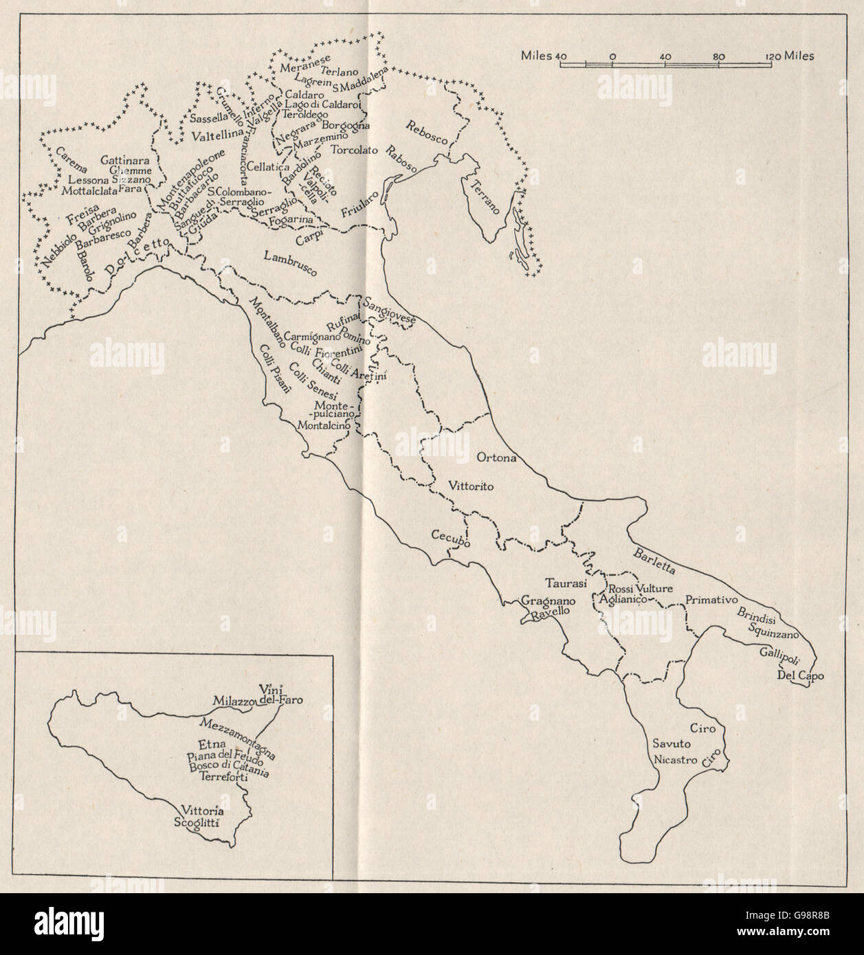 ITALY: Red wine regions. WW2 ROYAL NAVY INTELLIGENCE MAP, 1945 Stock Photohttps://www.alamy.com/image-license-details/?v=1https://www.alamy.com/stock-photo-italy-red-wine-regions-ww2-royal-navy-intelligence-map-1945-108987995.html
RFG98R8B–ITALY: Red wine regions. WW2 ROYAL NAVY INTELLIGENCE MAP, 1945
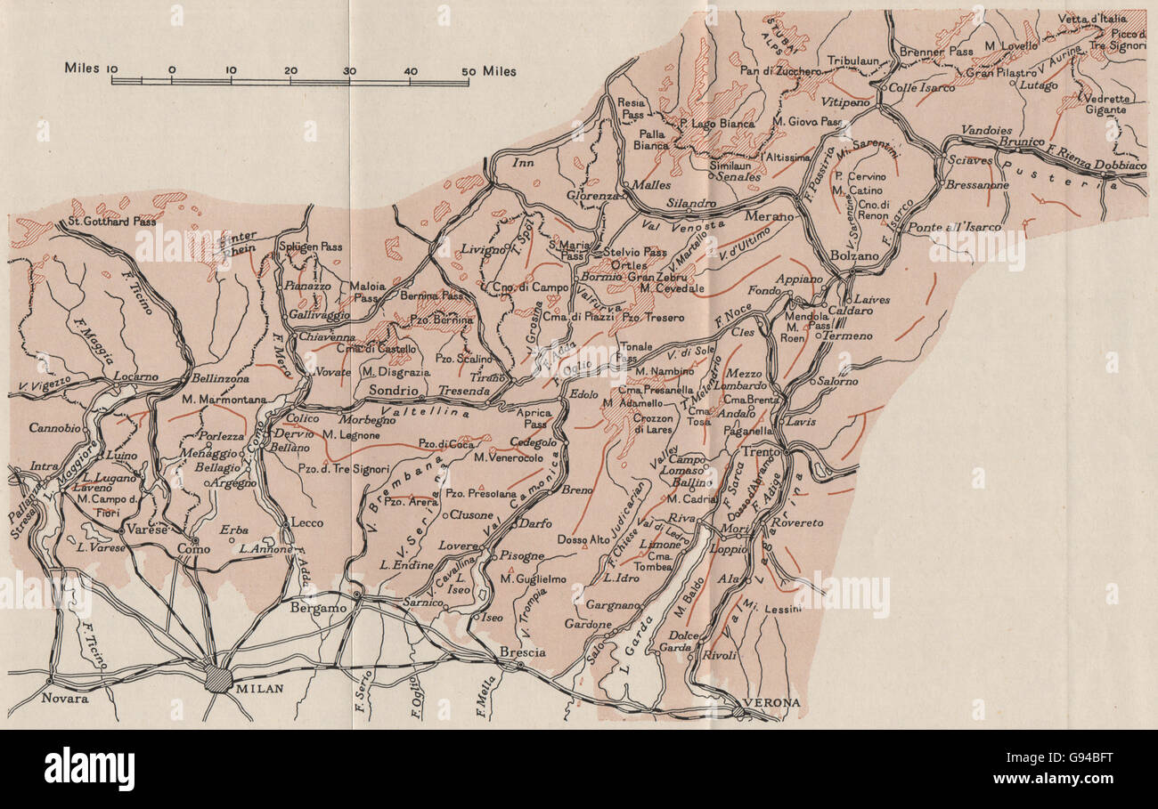 ITALY: The Central Alps. Milan. WW2 ROYAL NAVY INTELLIGENCE MAP, 1944 Stock Photohttps://www.alamy.com/image-license-details/?v=1https://www.alamy.com/stock-photo-italy-the-central-alps-milan-ww2-royal-navy-intelligence-map-1944-108890988.html
RFG94BFT–ITALY: The Central Alps. Milan. WW2 ROYAL NAVY INTELLIGENCE MAP, 1944
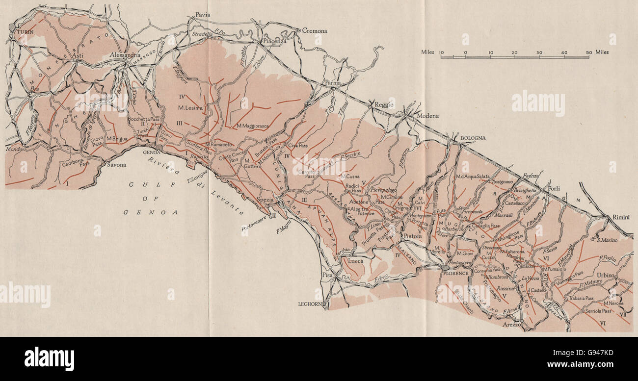 ITALY: The Northern Apennines. Genoa. WW2 ROYAL NAVY INTELLIGENCE MAP, 1944 Stock Photohttps://www.alamy.com/image-license-details/?v=1https://www.alamy.com/stock-photo-italy-the-northern-apennines-genoa-ww2-royal-navy-intelligence-map-108887953.html
RFG947KD–ITALY: The Northern Apennines. Genoa. WW2 ROYAL NAVY INTELLIGENCE MAP, 1944
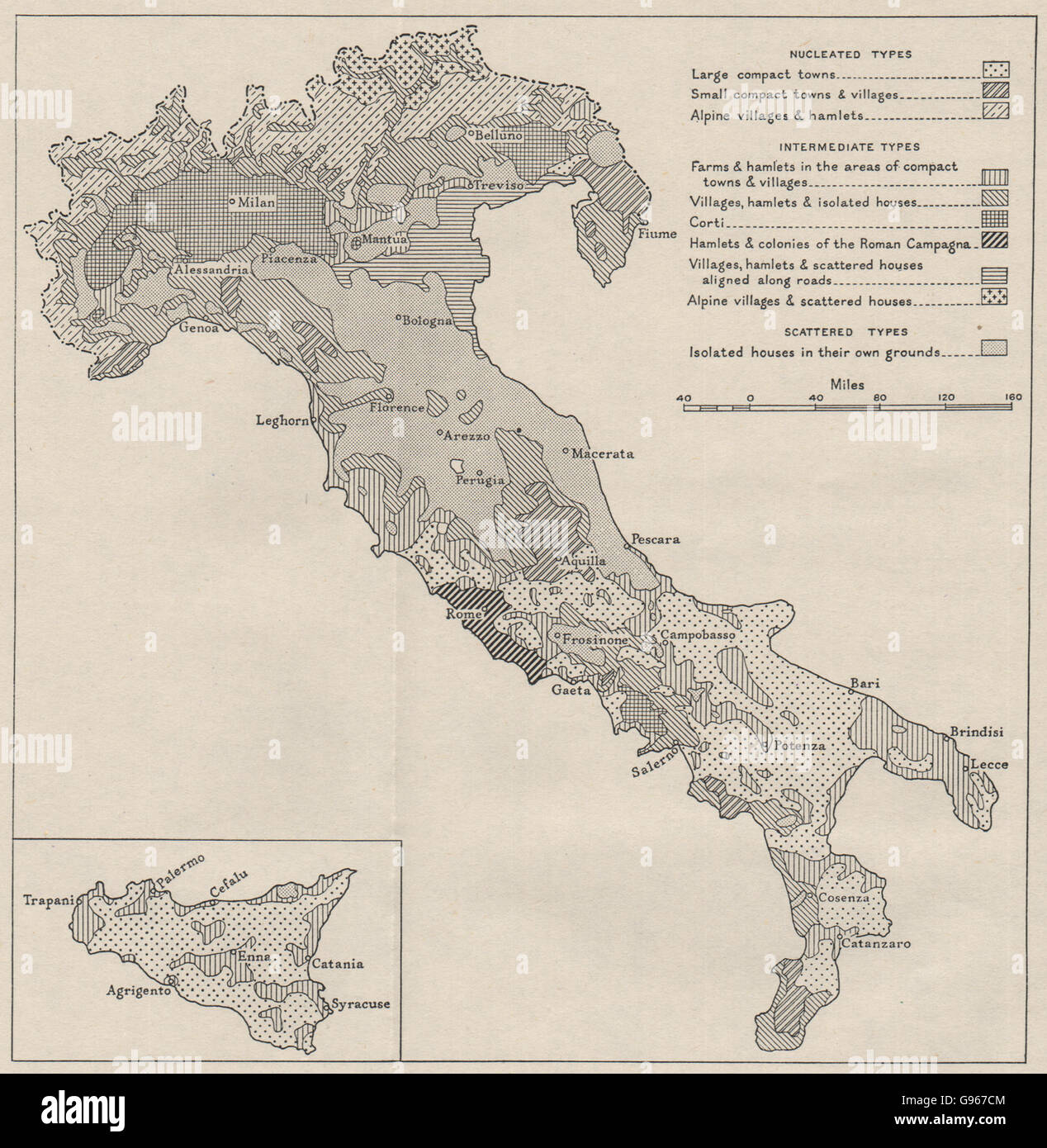 ITALY: Types of rural settlement. WW2 ROYAL NAVY INTELLIGENCE MAP, 1944 Stock Photohttps://www.alamy.com/image-license-details/?v=1https://www.alamy.com/stock-photo-italy-types-of-rural-settlement-ww2-royal-navy-intelligence-map-1944-108931668.html
RFG967CM–ITALY: Types of rural settlement. WW2 ROYAL NAVY INTELLIGENCE MAP, 1944
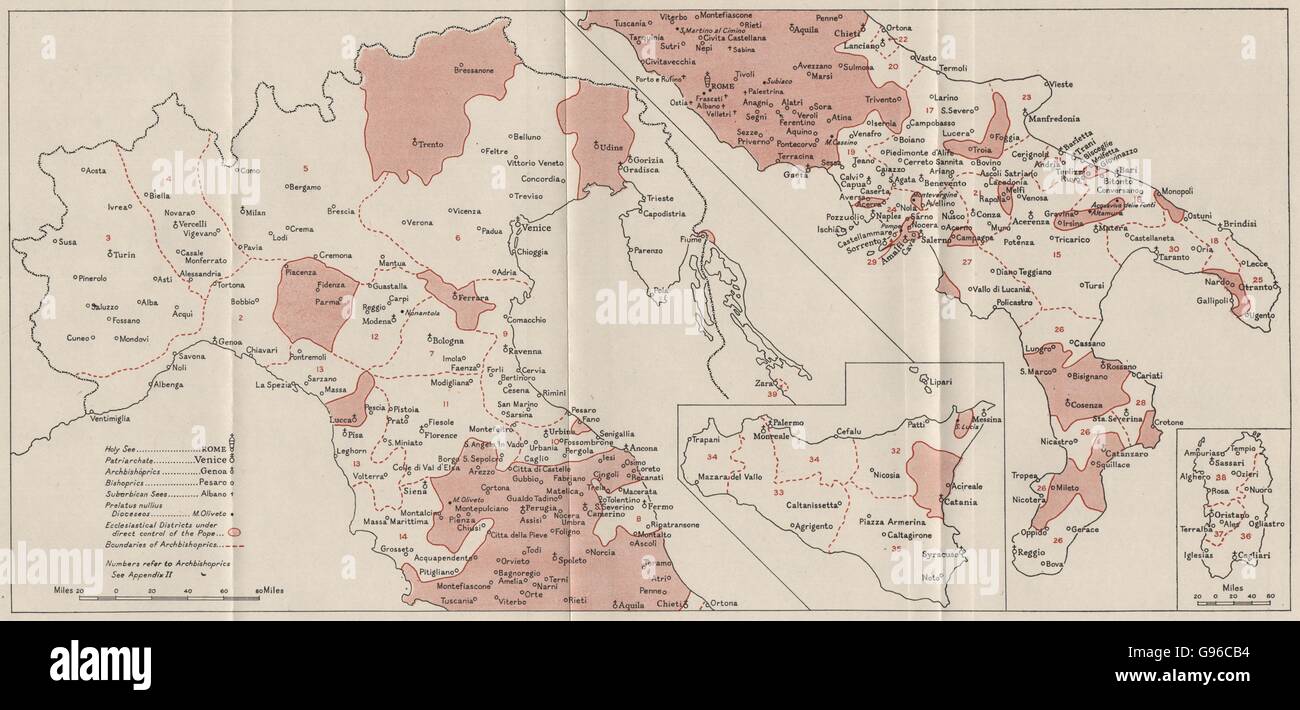 ITALY: Bishoprics Ecclesiastical divisions. WW2 ROYAL NAVY INTELLIGENCE MAP 1944 Stock Photohttps://www.alamy.com/image-license-details/?v=1https://www.alamy.com/stock-photo-italy-bishoprics-ecclesiastical-divisions-ww2-royal-navy-intelligence-108935544.html
RFG96CB4–ITALY: Bishoprics Ecclesiastical divisions. WW2 ROYAL NAVY INTELLIGENCE MAP 1944
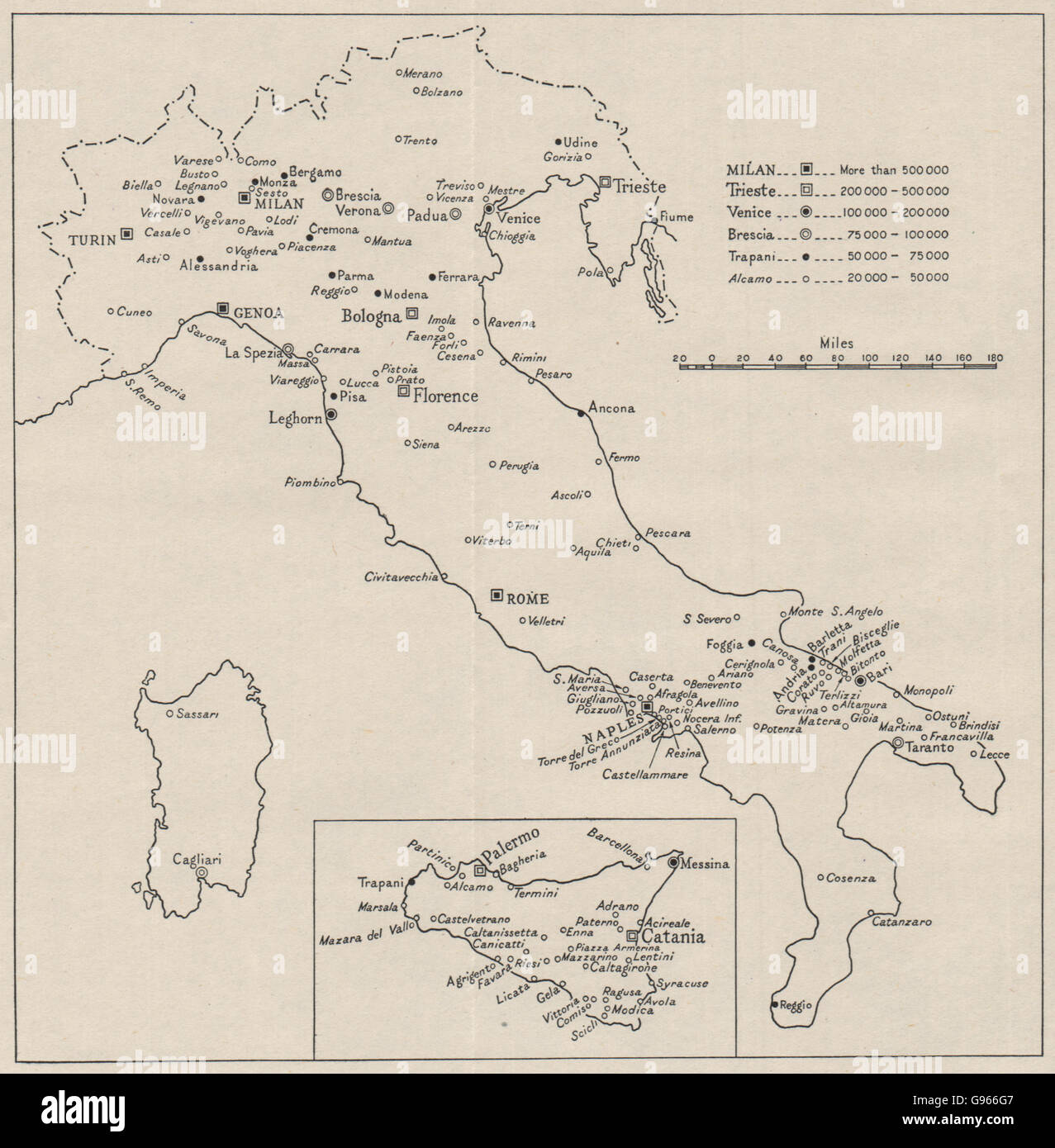 ITALY: Major towns by population. WW2 ROYAL NAVY INTELLIGENCE MAP, 1944 Stock Photohttps://www.alamy.com/image-license-details/?v=1https://www.alamy.com/stock-photo-italy-major-towns-by-population-ww2-royal-navy-intelligence-map-1944-108930983.html
RFG966G7–ITALY: Major towns by population. WW2 ROYAL NAVY INTELLIGENCE MAP, 1944