Quick filters:
Map of humboldt Stock Photos and Images
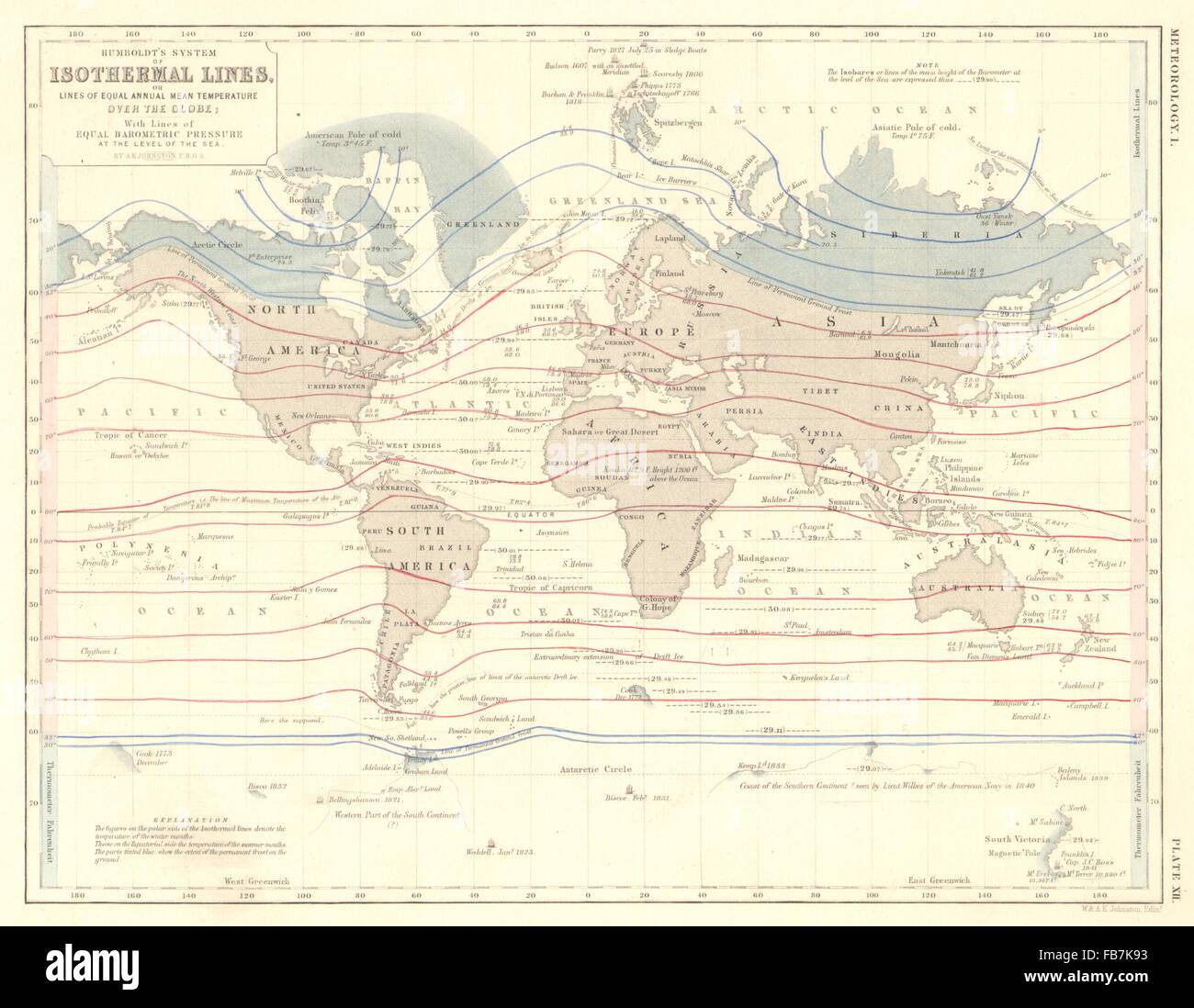 WORLD: Humboldt's isothermal lines (equal annual mean temperature), 1850 map Stock Photohttps://www.alamy.com/image-license-details/?v=1https://www.alamy.com/stock-photo-world-humboldts-isothermal-lines-equal-annual-mean-temperature-1850-92981871.html
RFFB7K93–WORLD: Humboldt's isothermal lines (equal annual mean temperature), 1850 map
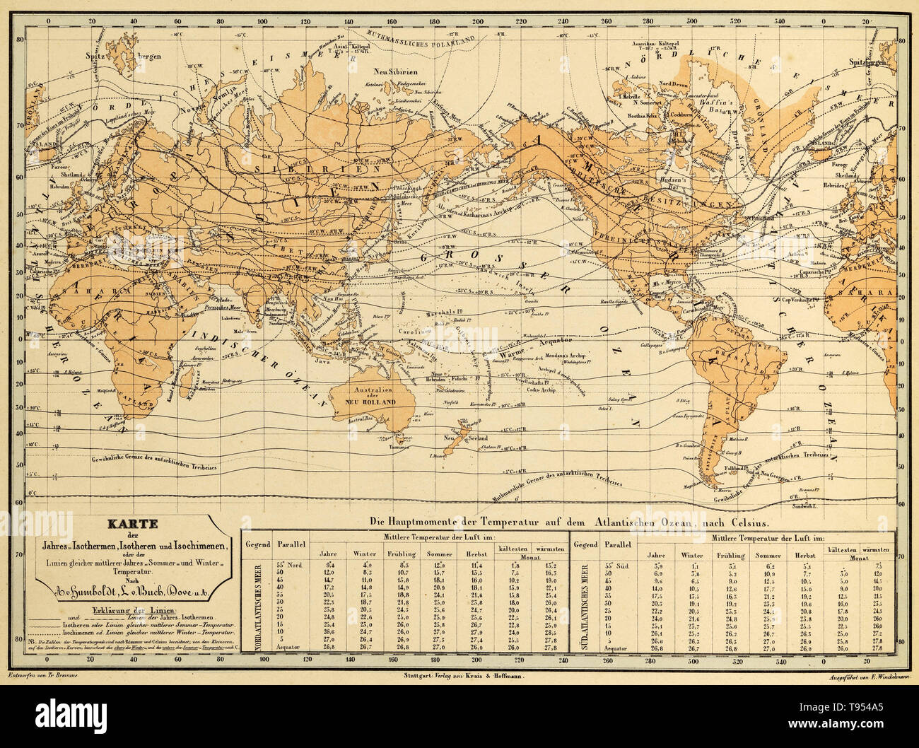 Isothermal map of the world from Alexander von Humboldt's Kosmos. Humboldt (1769-1859), who invented the use of isotherms, was a Prussian geographer, naturalist and explorer. His quantitative work on botanical geography laid the foundation for the field of biogeography. Between 1799 and 1804, Humboldt travelled extensively in Latin America, exploring and describing it for the first time in a manner generally considered to be a modern scientific point of view. Stock Photohttps://www.alamy.com/image-license-details/?v=1https://www.alamy.com/isothermal-map-of-the-world-from-alexander-von-humboldts-kosmos-humboldt-1769-1859-who-invented-the-use-of-isotherms-was-a-prussian-geographer-naturalist-and-explorer-his-quantitative-work-on-botanical-geography-laid-the-foundation-for-the-field-of-biogeography-between-1799-and-1804-humboldt-travelled-extensively-in-latin-america-exploring-and-describing-it-for-the-first-time-in-a-manner-generally-considered-to-be-a-modern-scientific-point-of-view-image246590237.html
RMT954A5–Isothermal map of the world from Alexander von Humboldt's Kosmos. Humboldt (1769-1859), who invented the use of isotherms, was a Prussian geographer, naturalist and explorer. His quantitative work on botanical geography laid the foundation for the field of biogeography. Between 1799 and 1804, Humboldt travelled extensively in Latin America, exploring and describing it for the first time in a manner generally considered to be a modern scientific point of view.
 Map of Humboldt in Iowa Stock Photohttps://www.alamy.com/image-license-details/?v=1https://www.alamy.com/map-of-humboldt-in-iowa-image402446879.html
RF2EAN12R–Map of Humboldt in Iowa
 Humboldt Kansas USA shown on a Geography map or Road Map Stock Photohttps://www.alamy.com/image-license-details/?v=1https://www.alamy.com/humboldt-kansas-usa-shown-on-a-geography-map-or-road-map-image425933428.html
RM2FMXXC4–Humboldt Kansas USA shown on a Geography map or Road Map
 1811, Humboldt Map of Mexico, Texas, Louisiana, and Florida Stock Photohttps://www.alamy.com/image-license-details/?v=1https://www.alamy.com/stock-image-1811-humboldt-map-of-mexico-texas-louisiana-and-florida-162568056.html
RMKCDH60–1811, Humboldt Map of Mexico, Texas, Louisiana, and Florida
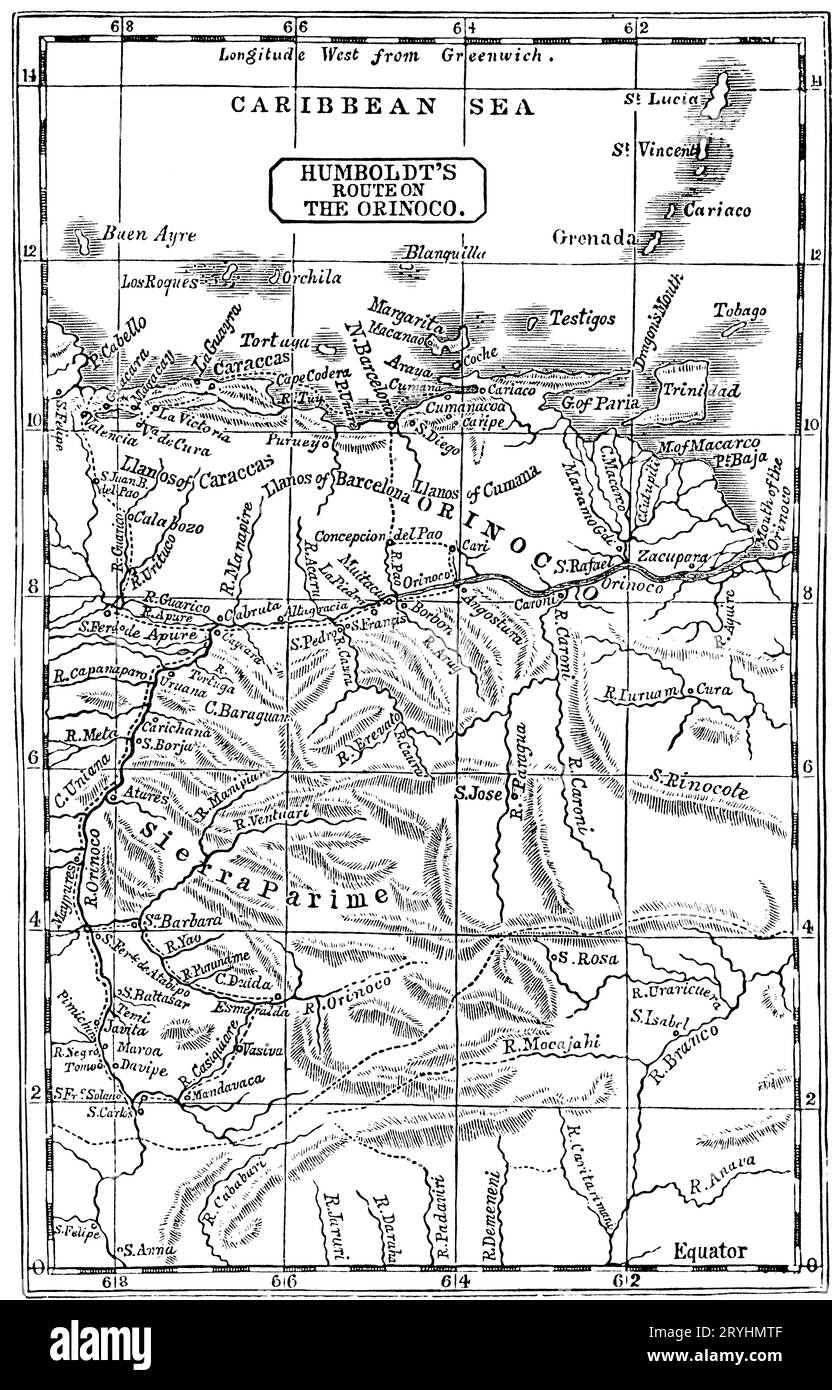 Humboldt's Route on the Orinoco, 1800. Friedrich Wilhelm Heinrich Alexander von Humboldt (1769-1859) was a German polymath, geographer, naturalist and explorer. In February 1800, Humboldt explored the course of the Orinoco River and its tributaries. This trip, which lasted four months and covered 1,725 miles (2,776 km), had an aim of establishing the existence of the Casiquiare canal. Stock Photohttps://www.alamy.com/image-license-details/?v=1https://www.alamy.com/humboldts-route-on-the-orinoco-1800-friedrich-wilhelm-heinrich-alexander-von-humboldt-1769-1859-was-a-german-polymath-geographer-naturalist-and-explorer-in-february-1800-humboldt-explored-the-course-of-theorinoco-riverand-its-tributaries-this-trip-which-lasted-four-months-and-covered-1725-miles-2776km-had-an-aim-of-establishing-the-existence-of-thecasiquiare-canal-image567717039.html
RM2RYHMTF–Humboldt's Route on the Orinoco, 1800. Friedrich Wilhelm Heinrich Alexander von Humboldt (1769-1859) was a German polymath, geographer, naturalist and explorer. In February 1800, Humboldt explored the course of the Orinoco River and its tributaries. This trip, which lasted four months and covered 1,725 miles (2,776 km), had an aim of establishing the existence of the Casiquiare canal.
 1811 Humboldt Map of Mexico, Texas, Louisiana, and Florida Stock Photohttps://www.alamy.com/image-license-details/?v=1https://www.alamy.com/stock-photo-1811-humboldt-map-of-mexico-texas-louisiana-and-florida-50533641.html
RMCX604W–1811 Humboldt Map of Mexico, Texas, Louisiana, and Florida
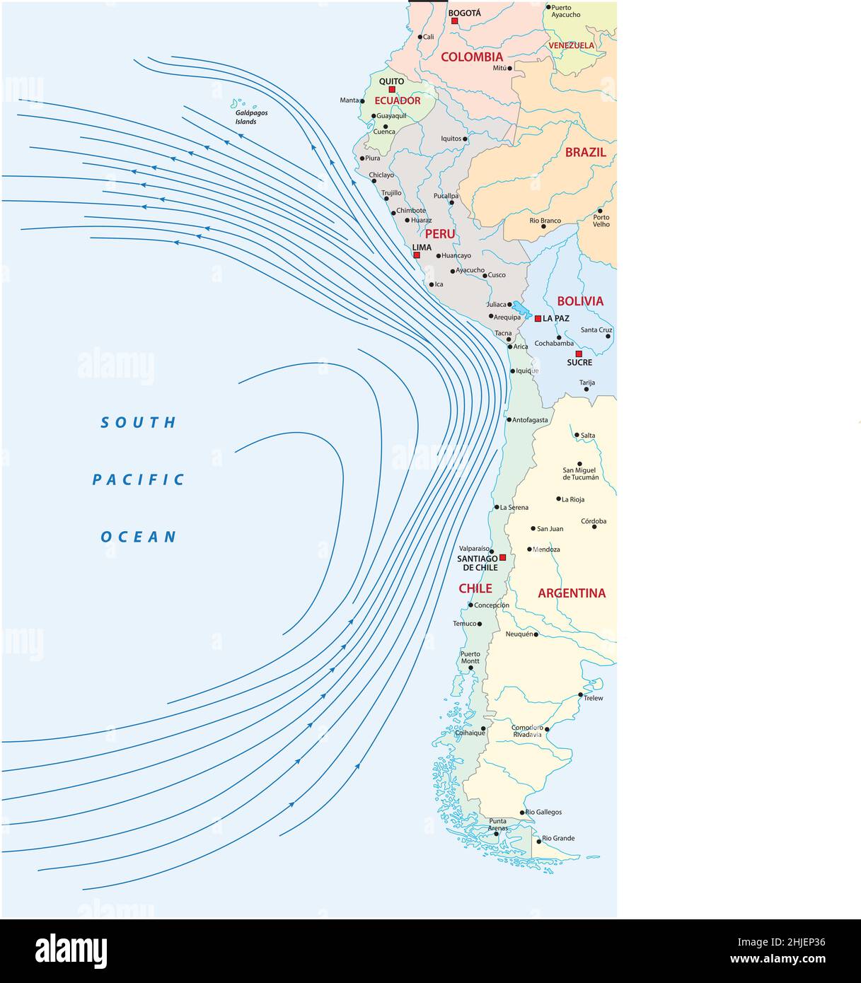 Map of the Humboldt or Peru Current on the west coast of South America Stock Vectorhttps://www.alamy.com/image-license-details/?v=1https://www.alamy.com/map-of-the-humboldt-or-peru-current-on-the-west-coast-of-south-america-image458858042.html
RF2HJEP36–Map of the Humboldt or Peru Current on the west coast of South America
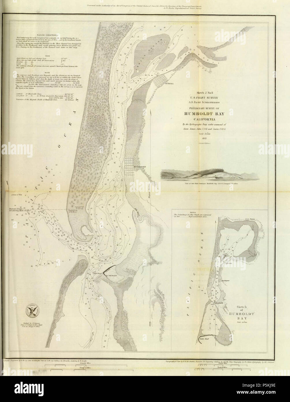 1852 U.S. Coast Survey Map of Humboldt Bay, California. Stock Photohttps://www.alamy.com/image-license-details/?v=1https://www.alamy.com/1852-us-coast-survey-map-of-humboldt-bay-california-image210029162.html
RMP5KJ9E–1852 U.S. Coast Survey Map of Humboldt Bay, California.
 Humboldt County, California outline map set Stock Vectorhttps://www.alamy.com/image-license-details/?v=1https://www.alamy.com/humboldt-county-california-outline-map-set-image179746002.html
RFMCC3T2–Humboldt County, California outline map set
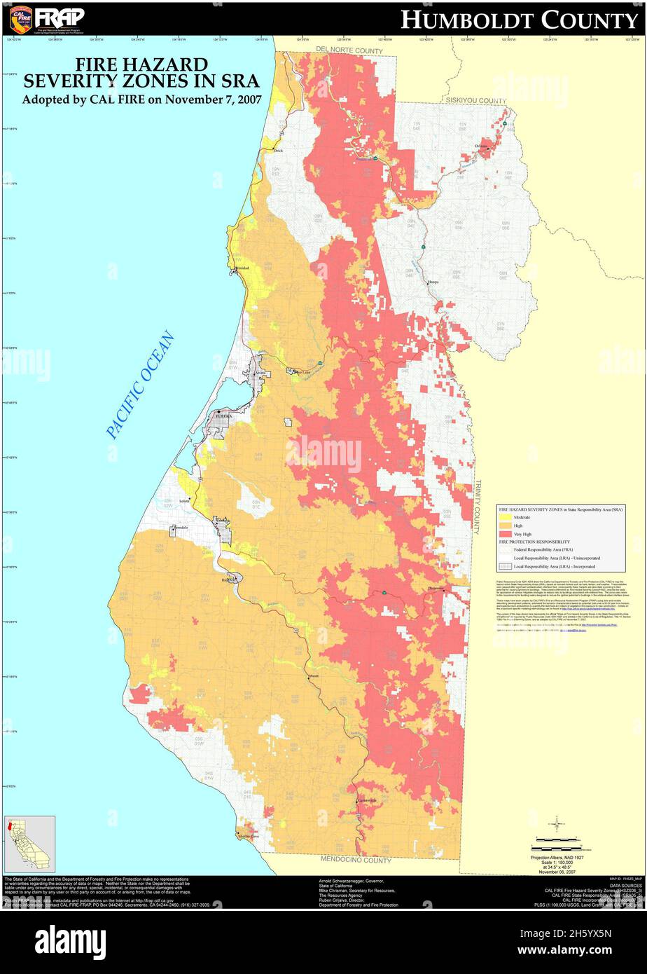 Fire Hazard map for Humboldt County, California as of 2007 Stock Photohttps://www.alamy.com/image-license-details/?v=1https://www.alamy.com/fire-hazard-map-for-humboldt-county-california-as-of-2007-image451156097.html
RM2H5YX5N–Fire Hazard map for Humboldt County, California as of 2007
 Humboldt Hafen, DE, Germany, Berlin, N 52 31' 0'', N 13 24' 0'', map, Cartascapes Map published in 2024. Explore Cartascapes, a map revealing Earth's diverse landscapes, cultures, and ecosystems. Journey through time and space, discovering the interconnectedness of our planet's past, present, and future. Stock Photohttps://www.alamy.com/image-license-details/?v=1https://www.alamy.com/humboldt-hafen-de-germany-berlin-n-52-31-0-n-13-24-0-map-cartascapes-map-published-in-2024-explore-cartascapes-a-map-revealing-earths-diverse-landscapes-cultures-and-ecosystems-journey-through-time-and-space-discovering-the-interconnectedness-of-our-planets-past-present-and-future-image629411604.html
RM2YG04WT–Humboldt Hafen, DE, Germany, Berlin, N 52 31' 0'', N 13 24' 0'', map, Cartascapes Map published in 2024. Explore Cartascapes, a map revealing Earth's diverse landscapes, cultures, and ecosystems. Journey through time and space, discovering the interconnectedness of our planet's past, present, and future.
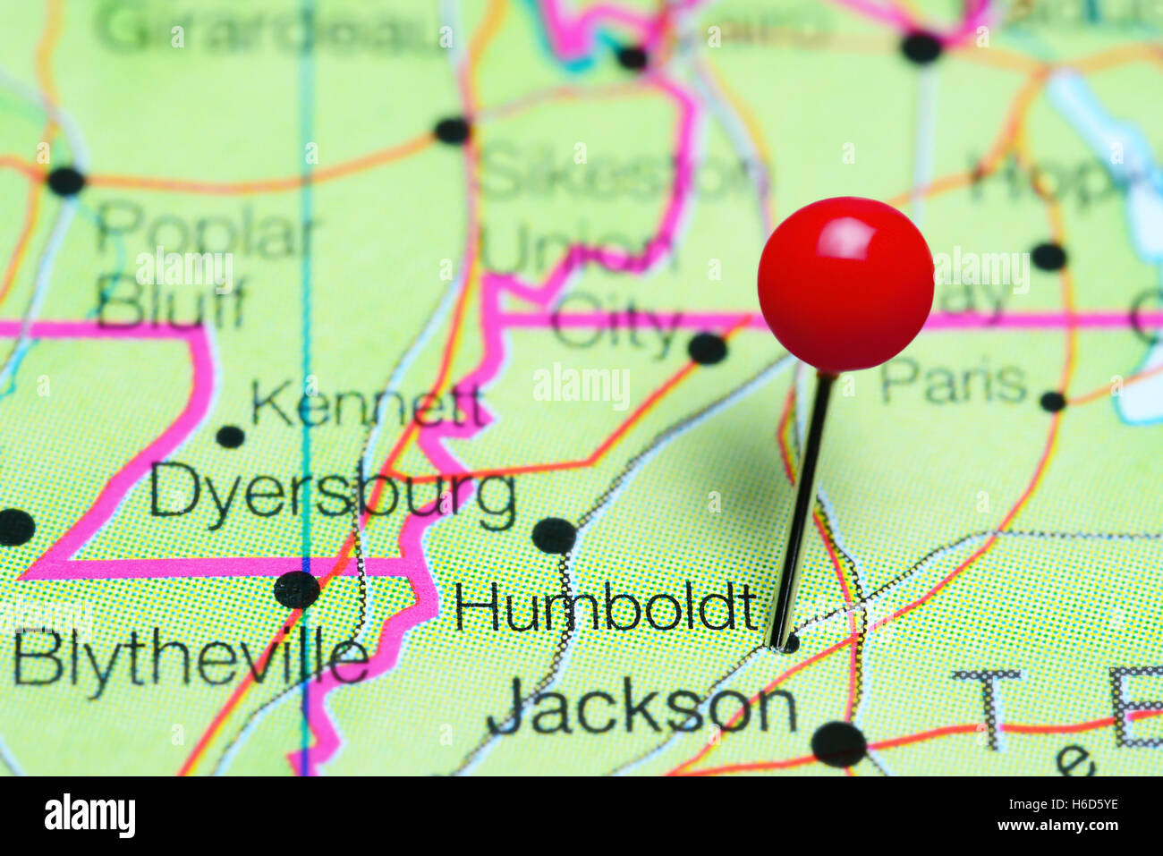 Humboldt pinned on a map of Tennessee, USA Stock Photohttps://www.alamy.com/image-license-details/?v=1https://www.alamy.com/stock-photo-humboldt-pinned-on-a-map-of-tennessee-usa-124450578.html
RFH6D5YE–Humboldt pinned on a map of Tennessee, USA
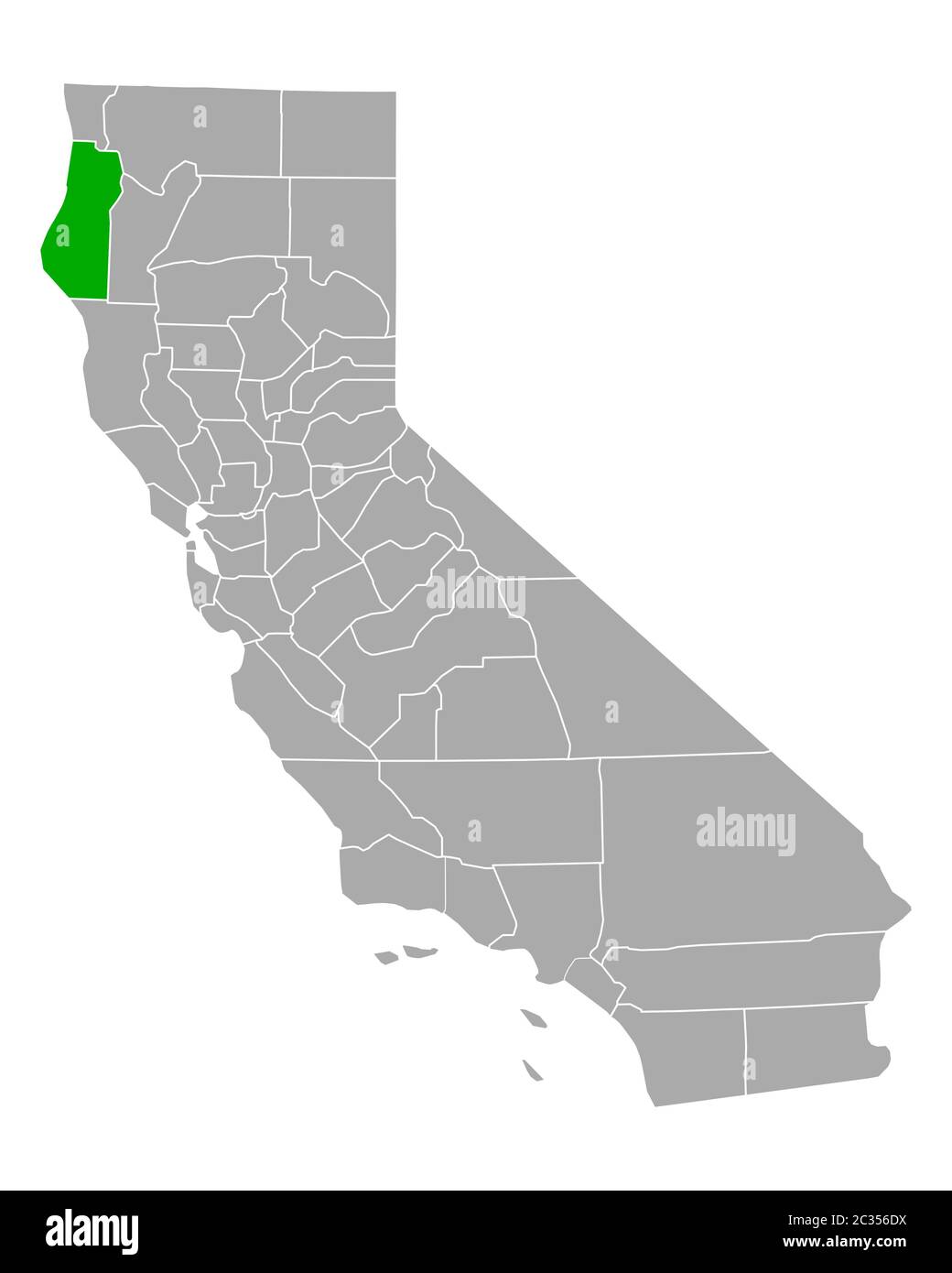 Map of Humboldt in California Stock Photohttps://www.alamy.com/image-license-details/?v=1https://www.alamy.com/map-of-humboldt-in-california-image363376550.html
RF2C356DX–Map of Humboldt in California
 United States Western half of the first map of the New Discoveries, drawn on ox - hide in colours by the pilot, Juan de la Cosa, 1500 AD, now in the Navel Museuam, Madrid. The map was discovered by Humboldt . Stock Photohttps://www.alamy.com/image-license-details/?v=1https://www.alamy.com/united-states-western-half-of-the-first-map-of-the-new-discoveries-drawn-on-ox-hide-in-colours-by-the-pilot-juan-de-la-cosa-1500-ad-now-in-the-navel-museuam-madrid-the-map-was-discovered-by-humboldt-image179628457.html
RMMC6NX1–United States Western half of the first map of the New Discoveries, drawn on ox - hide in colours by the pilot, Juan de la Cosa, 1500 AD, now in the Navel Museuam, Madrid. The map was discovered by Humboldt .
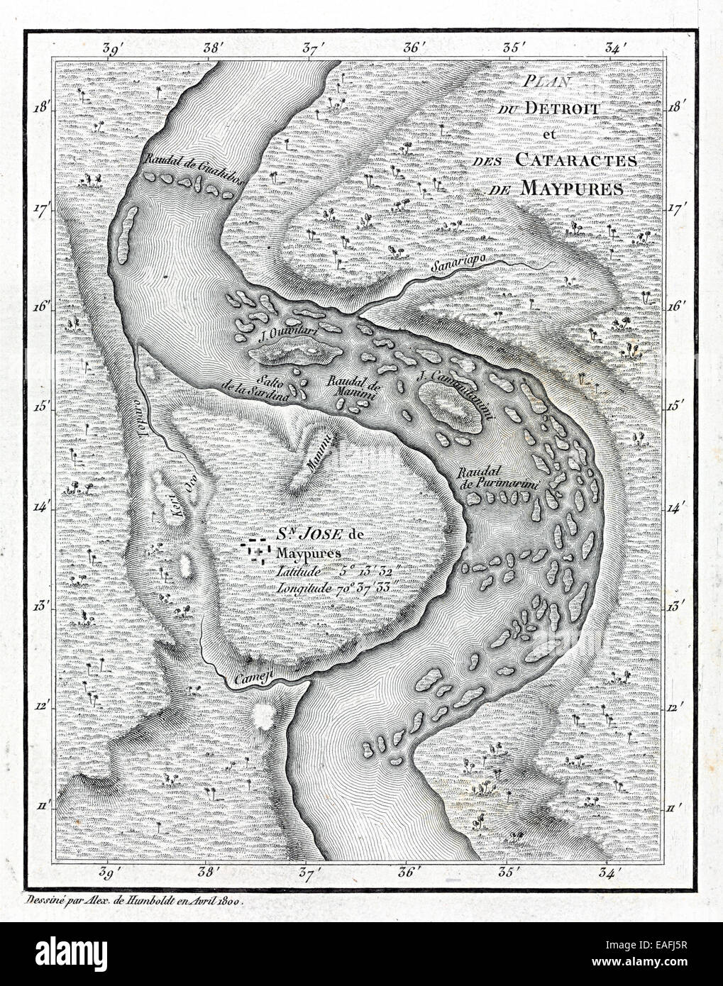 Cataracts of Maypures map Stock Photohttps://www.alamy.com/image-license-details/?v=1https://www.alamy.com/stock-photo-cataracts-of-maypures-map-75331587.html
RMEAFJ5R–Cataracts of Maypures map
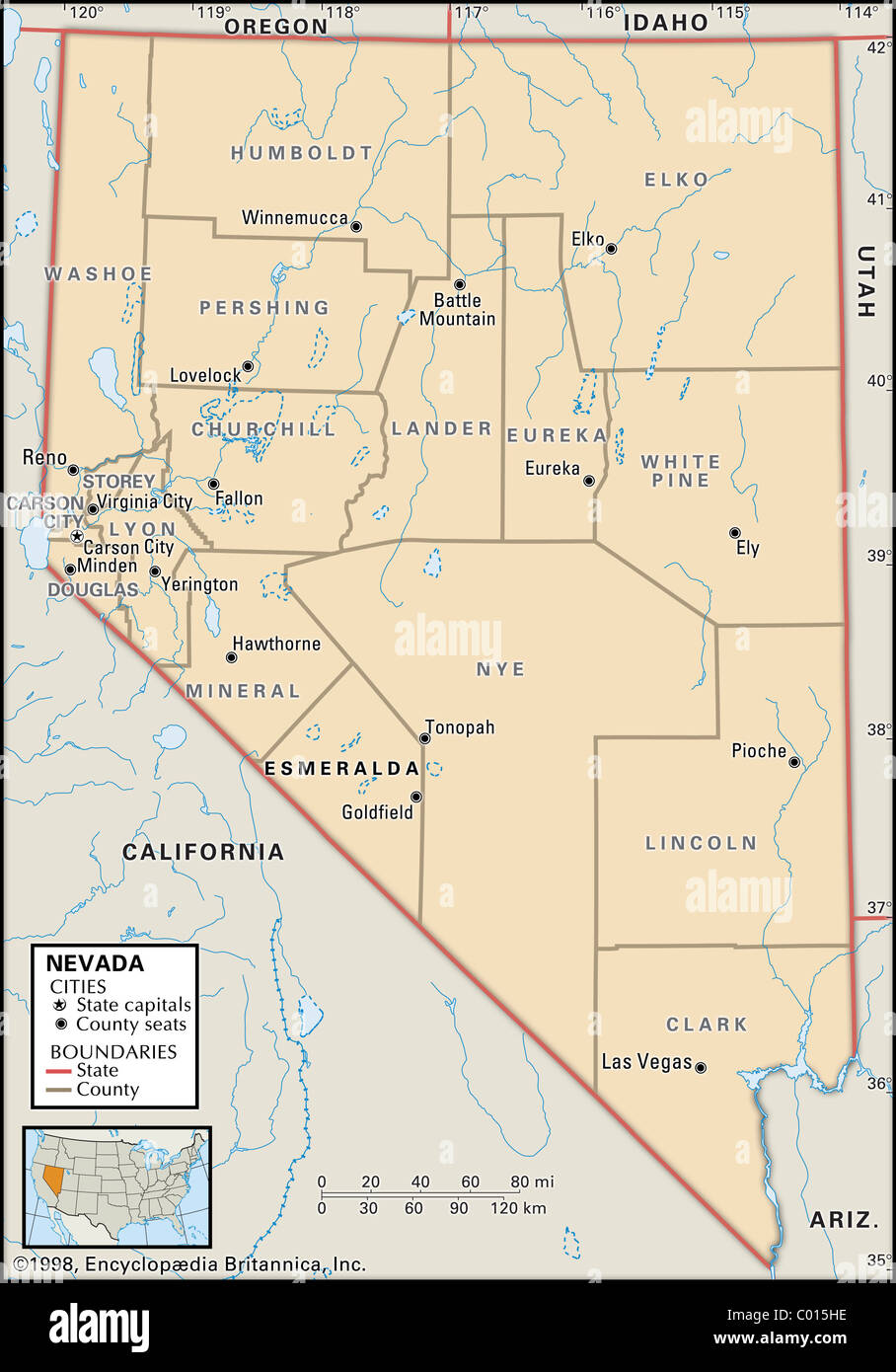 Political map of Nevada Stock Photohttps://www.alamy.com/image-license-details/?v=1https://www.alamy.com/stock-photo-political-map-of-nevada-34447098.html
RMC015HE–Political map of Nevada
 HUMBOLDT/HILDEBRANDT Stock Photohttps://www.alamy.com/image-license-details/?v=1https://www.alamy.com/stock-photo-humboldthildebrandt-105288343.html
RMG3889Y–HUMBOLDT/HILDEBRANDT
 Eureka, Humboldt County, California. 1902 Stock Photohttps://www.alamy.com/image-license-details/?v=1https://www.alamy.com/stock-photo-eureka-humboldt-county-california-1902-36033689.html
RMC2HD9D–Eureka, Humboldt County, California. 1902
 Humboldt Glacier. Greenland, 1885 antique map Stock Photohttps://www.alamy.com/image-license-details/?v=1https://www.alamy.com/stock-photo-humboldt-glacier-greenland-1885-antique-map-114302747.html
RFGHXX8Y–Humboldt Glacier. Greenland, 1885 antique map
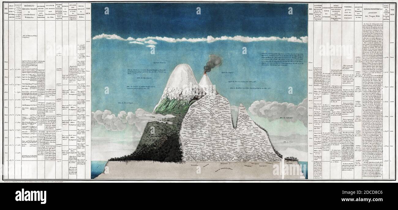 Alexander von Humboldt, Chimborazo Map Stock Photohttps://www.alamy.com/image-license-details/?v=1https://www.alamy.com/alexander-von-humboldt-chimborazo-map-image386295958.html
RM2DCD8C6–Alexander von Humboldt, Chimborazo Map
 Map of Humboldt in California Stock Photohttps://www.alamy.com/image-license-details/?v=1https://www.alamy.com/map-of-humboldt-in-california-image385555007.html
RF2DB7F9K–Map of Humboldt in California
 Humboldt Iowa USA Shown on a Geography map or road map Stock Photohttps://www.alamy.com/image-license-details/?v=1https://www.alamy.com/humboldt-iowa-usa-shown-on-a-geography-map-or-road-map-image425462637.html
RM2FM5DX5–Humboldt Iowa USA Shown on a Geography map or road map
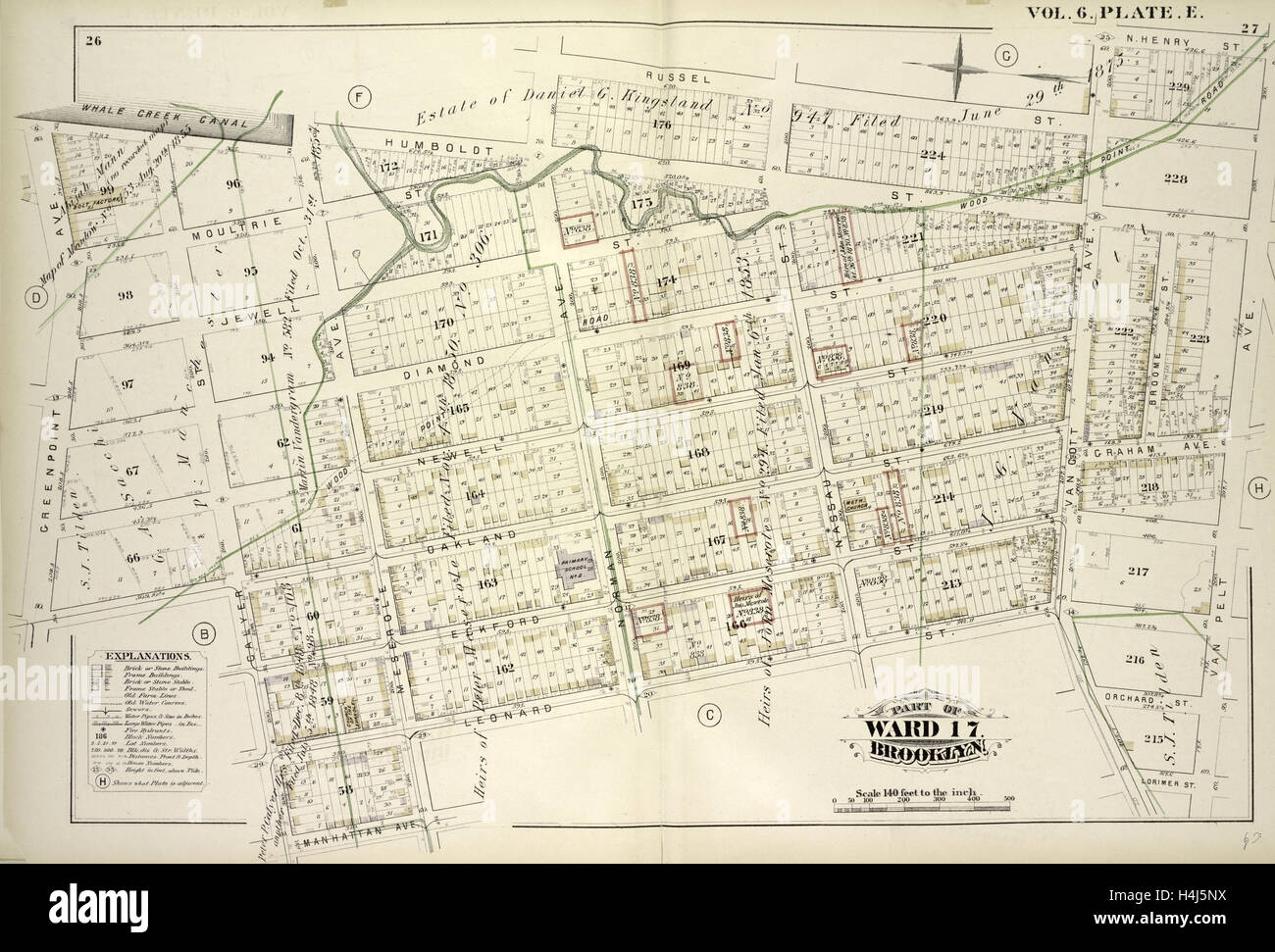 Vol. 6. Plate, E. Map bound by Whale Creek Canal, Humboldt St., Norman Ave., Russell St., Van Cott Ave., N.Henry St. Stock Photohttps://www.alamy.com/image-license-details/?v=1https://www.alamy.com/stock-photo-vol-6-plate-e-map-bound-by-whale-creek-canal-humboldt-st-norman-ave-123330870.html
RMH4J5NX–Vol. 6. Plate, E. Map bound by Whale Creek Canal, Humboldt St., Norman Ave., Russell St., Van Cott Ave., N.Henry St.
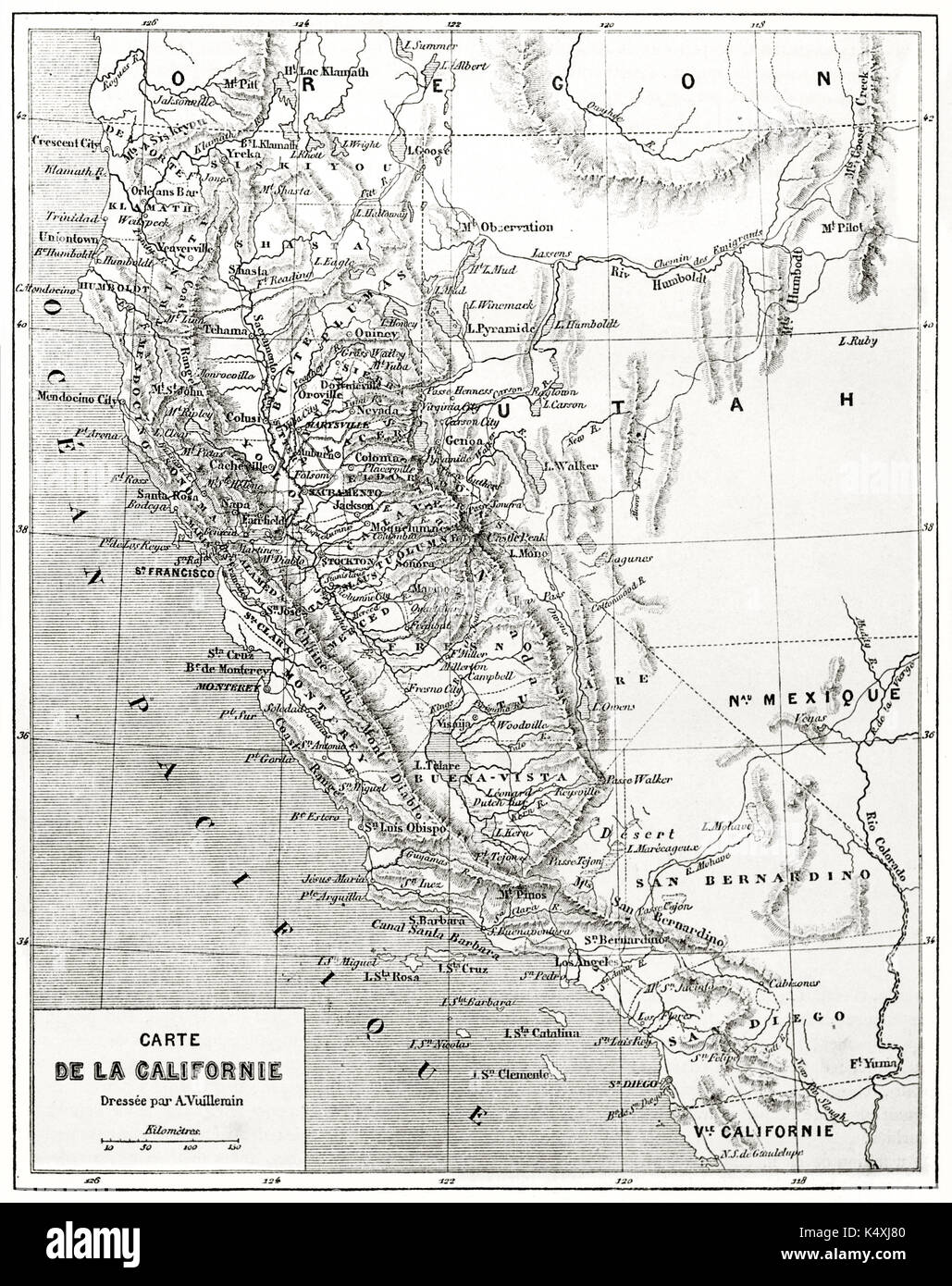 Ancient grayscale California map. Created by Erhard and Bonaparte published on Le Tour du Monde Paris 1862 Stock Photohttps://www.alamy.com/image-license-details/?v=1https://www.alamy.com/ancient-grayscale-california-map-created-by-erhard-and-bonaparte-published-image157937024.html
RFK4XJ80–Ancient grayscale California map. Created by Erhard and Bonaparte published on Le Tour du Monde Paris 1862
![Brooklyn V. 3, Plate No. 44 [Map bounded by Seigel, Bushwick Ave., Debevoise, Humboldt] 1884 - 1936 Stock Photo Brooklyn V. 3, Plate No. 44 [Map bounded by Seigel, Bushwick Ave., Debevoise, Humboldt] 1884 - 1936 Stock Photo](https://c8.alamy.com/comp/2YP944Y/brooklyn-v-3-plate-no-44-map-bounded-by-seigel-bushwick-ave-debevoise-humboldt-1884-1936-2YP944Y.jpg) Brooklyn V. 3, Plate No. 44 [Map bounded by Seigel, Bushwick Ave., Debevoise, Humboldt] 1884 - 1936 Stock Photohttps://www.alamy.com/image-license-details/?v=1https://www.alamy.com/brooklyn-v-3-plate-no-44-map-bounded-by-seigel-bushwick-ave-debevoise-humboldt-1884-1936-image633296523.html
Brooklyn V. 3, Plate No. 44 [Map bounded by Seigel, Bushwick Ave., Debevoise, Humboldt] 1884 - 1936 Stock Photohttps://www.alamy.com/image-license-details/?v=1https://www.alamy.com/brooklyn-v-3-plate-no-44-map-bounded-by-seigel-bushwick-ave-debevoise-humboldt-1884-1936-image633296523.htmlRM2YP944Y–Brooklyn V. 3, Plate No. 44 [Map bounded by Seigel, Bushwick Ave., Debevoise, Humboldt] 1884 - 1936
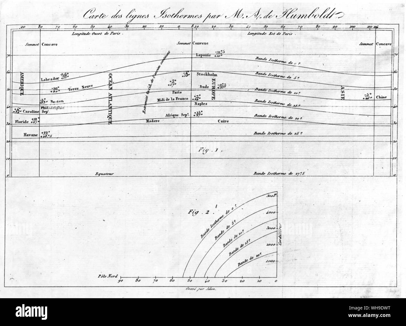 World chart showing isothermal lines, first devised by Humboldt in 1817 Stock Photohttps://www.alamy.com/image-license-details/?v=1https://www.alamy.com/world-chart-showing-isothermal-lines-first-devised-by-humboldt-in-1817-image268813156.html
RMWH9DWT–World chart showing isothermal lines, first devised by Humboldt in 1817
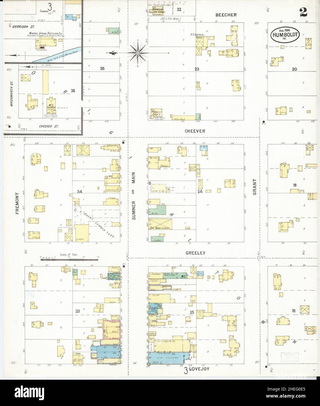 Sanborn Fire Insurance Map from Humboldt, Humboldt County, Iowa. Stock Photohttps://www.alamy.com/image-license-details/?v=1https://www.alamy.com/sanborn-fire-insurance-map-from-humboldt-humboldt-county-iowa-image456426381.html
RM2HEG0E5–Sanborn Fire Insurance Map from Humboldt, Humboldt County, Iowa.
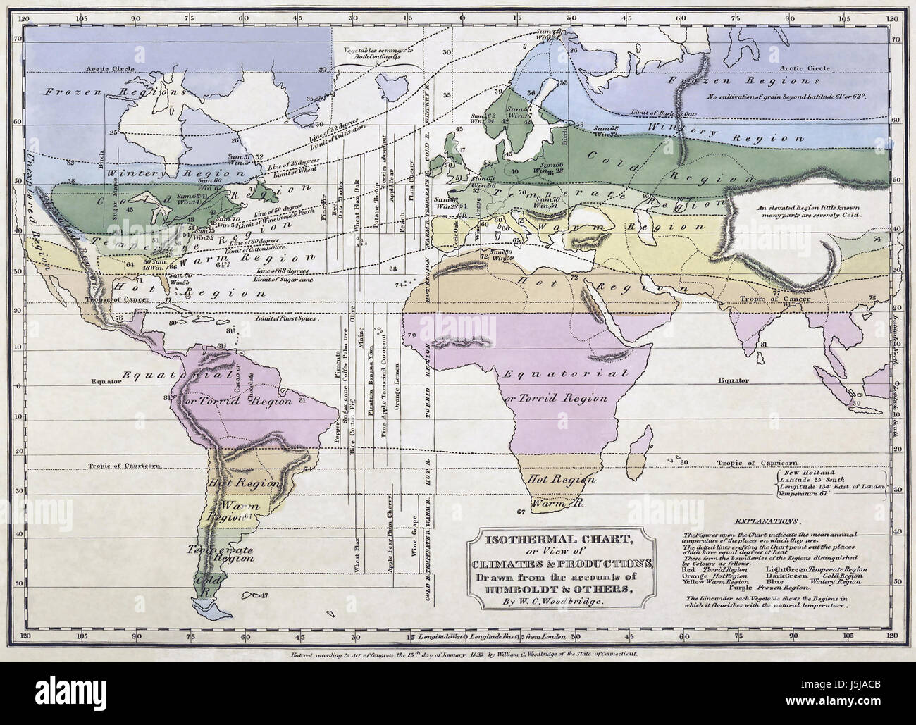 ALEXANDER von HUMBOLDT (1769-1859) An 1823 world map of plant zones by American cartographer William Woodbridge based on isothermal data supplied by von Humboldt Stock Photohttps://www.alamy.com/image-license-details/?v=1https://www.alamy.com/stock-photo-alexander-von-humboldt-1769-1859-an-1823-world-map-of-plant-zones-141159547.html
RMJ5JACB–ALEXANDER von HUMBOLDT (1769-1859) An 1823 world map of plant zones by American cartographer William Woodbridge based on isothermal data supplied by von Humboldt
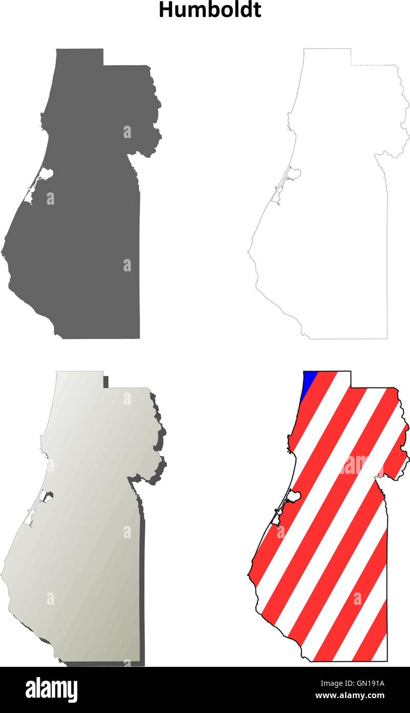 Humboldt County, California outline map set Stock Vectorhttps://www.alamy.com/image-license-details/?v=1https://www.alamy.com/stock-photo-humboldt-county-california-outline-map-set-116199030.html
RFGN191A–Humboldt County, California outline map set
 Humboldt River, , AU, Australia, Tasmania, S 42 43' 59'', N 146 40' 0'', map, Cartascapes Map published in 2024. Explore Cartascapes, a map revealing Earth's diverse landscapes, cultures, and ecosystems. Journey through time and space, discovering the interconnectedness of our planet's past, present, and future. Stock Photohttps://www.alamy.com/image-license-details/?v=1https://www.alamy.com/humboldt-river-au-australia-tasmania-s-42-43-59-n-146-40-0-map-cartascapes-map-published-in-2024-explore-cartascapes-a-map-revealing-earths-diverse-landscapes-cultures-and-ecosystems-journey-through-time-and-space-discovering-the-interconnectedness-of-our-planets-past-present-and-future-image625808874.html
RM2YA41GX–Humboldt River, , AU, Australia, Tasmania, S 42 43' 59'', N 146 40' 0'', map, Cartascapes Map published in 2024. Explore Cartascapes, a map revealing Earth's diverse landscapes, cultures, and ecosystems. Journey through time and space, discovering the interconnectedness of our planet's past, present, and future.
 Street roads map of the HUMBOLDT PARK COMMUNITY AREA, CHICAGO Stock Vectorhttps://www.alamy.com/image-license-details/?v=1https://www.alamy.com/street-roads-map-of-the-humboldt-park-community-area-chicago-image575715247.html
RF2TCJ2JR–Street roads map of the HUMBOLDT PARK COMMUNITY AREA, CHICAGO
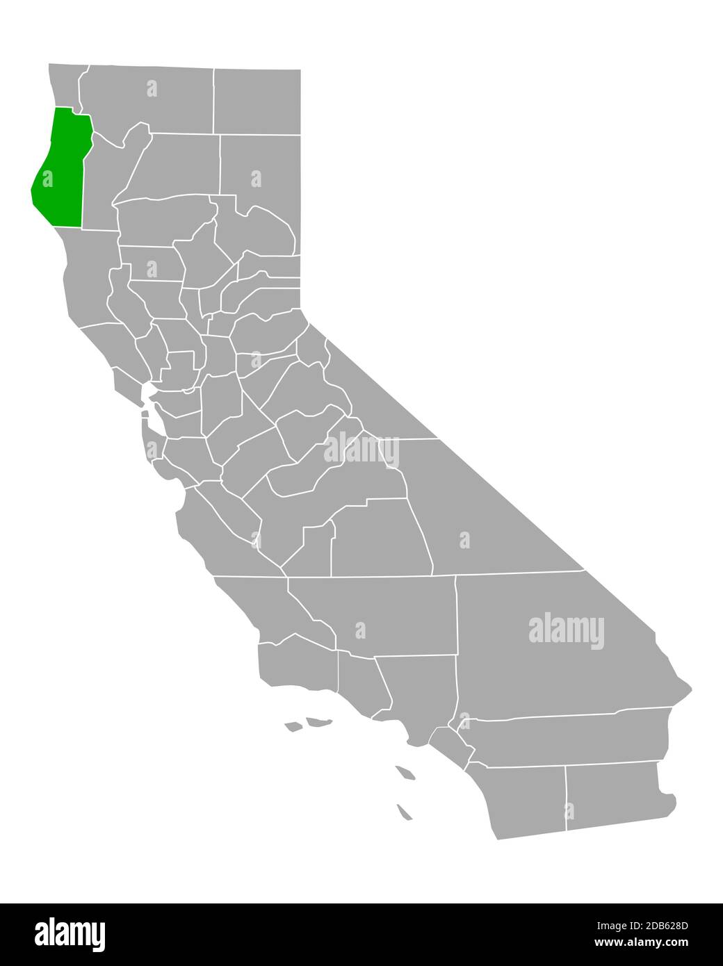 Map of Humboldt in California Stock Photohttps://www.alamy.com/image-license-details/?v=1https://www.alamy.com/map-of-humboldt-in-california-image385522829.html
RF2DB628D–Map of Humboldt in California
 Humboldt county, California. Set of generic stamps and signs including Humboldt county map and seal elements. Stock Photohttps://www.alamy.com/image-license-details/?v=1https://www.alamy.com/stock-photo-humboldt-county-california-set-of-generic-stamps-and-signs-including-122690504.html
RFH3H0YM–Humboldt county, California. Set of generic stamps and signs including Humboldt county map and seal elements.
 1885 Humboldt Park Map personal photograph, by myself, of my map Stock Photohttps://www.alamy.com/image-license-details/?v=1https://www.alamy.com/stock-image-1885-humboldt-park-map-personal-photograph-by-myself-of-my-map-162249076.html
RMKBY29T–1885 Humboldt Park Map personal photograph, by myself, of my map
 Eureka, Humboldt County, California. 1902 Stock Photohttps://www.alamy.com/image-license-details/?v=1https://www.alamy.com/eureka-humboldt-county-california-1902-image370865602.html
RM2CFAAT2–Eureka, Humboldt County, California. 1902
 Map of Humboldt in California Stock Photohttps://www.alamy.com/image-license-details/?v=1https://www.alamy.com/map-of-humboldt-in-california-image348974406.html
RF2B7N4BJ–Map of Humboldt in California
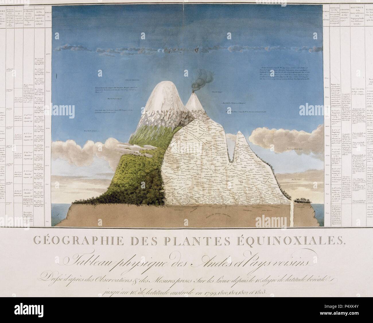 CHILE. Physical map of the Andes. Illustration of the book 'Des cordilleres et monuments des peuples de l'Amerique' by Alexander Humboldt (1769-1835). Ppublished in Paris in 1810. Stock Photohttps://www.alamy.com/image-license-details/?v=1https://www.alamy.com/chile-physical-map-of-the-andes-illustration-of-the-book-des-cordilleres-et-monuments-des-peuples-de-lamerique-by-alexander-humboldt-1769-1835-ppublished-in-paris-in-1810-image209568827.html
RMP4XK4Y–CHILE. Physical map of the Andes. Illustration of the book 'Des cordilleres et monuments des peuples de l'Amerique' by Alexander Humboldt (1769-1835). Ppublished in Paris in 1810.
 El Jorullo, according to Humboldt. Mexico, 1885 antique map Stock Photohttps://www.alamy.com/image-license-details/?v=1https://www.alamy.com/stock-photo-el-jorullo-according-to-humboldt-mexico-1885-antique-map-114688353.html
RFGJGE4H–El Jorullo, according to Humboldt. Mexico, 1885 antique map
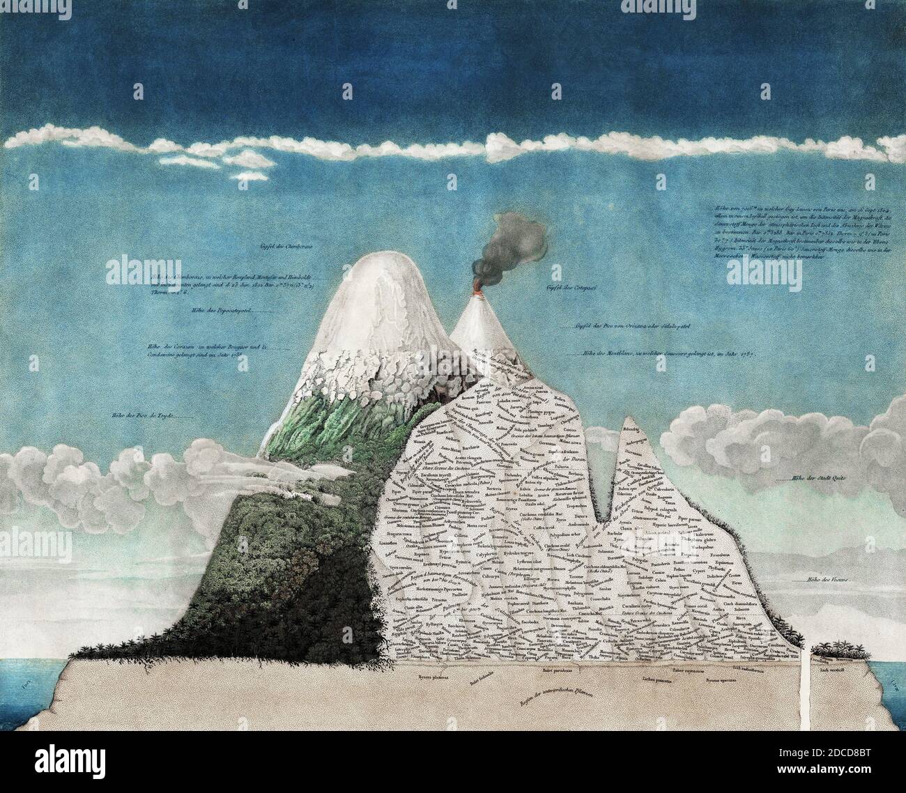 Alexander von Humboldt, Chimborazo Map Stock Photohttps://www.alamy.com/image-license-details/?v=1https://www.alamy.com/alexander-von-humboldt-chimborazo-map-image386295948.html
RM2DCD8BT–Alexander von Humboldt, Chimborazo Map
 Map of Humboldt in California Stock Photohttps://www.alamy.com/image-license-details/?v=1https://www.alamy.com/map-of-humboldt-in-california-image363388581.html
RF2C35NRH–Map of Humboldt in California
 Stadt der Vielfalt - City of Diversity. Pins People Map Berlin Germany Stock Photohttps://www.alamy.com/image-license-details/?v=1https://www.alamy.com/stadt-der-vielfalt-city-of-diversity-pins-people-map-berlin-germany-image64802120.html
RMDNBYNC–Stadt der Vielfalt - City of Diversity. Pins People Map Berlin Germany
 Vol. 2. Plate, D. Map bound by Frost St., Kingsland Ave., Parker Pl., Vandervoort, Grant St., Bushwick Ave., Humboldt St. Stock Photohttps://www.alamy.com/image-license-details/?v=1https://www.alamy.com/stock-photo-vol-2-plate-d-map-bound-by-frost-st-kingsland-ave-parker-pl-vandervoort-123330789.html
RMH4J5K1–Vol. 2. Plate, D. Map bound by Frost St., Kingsland Ave., Parker Pl., Vandervoort, Grant St., Bushwick Ave., Humboldt St.
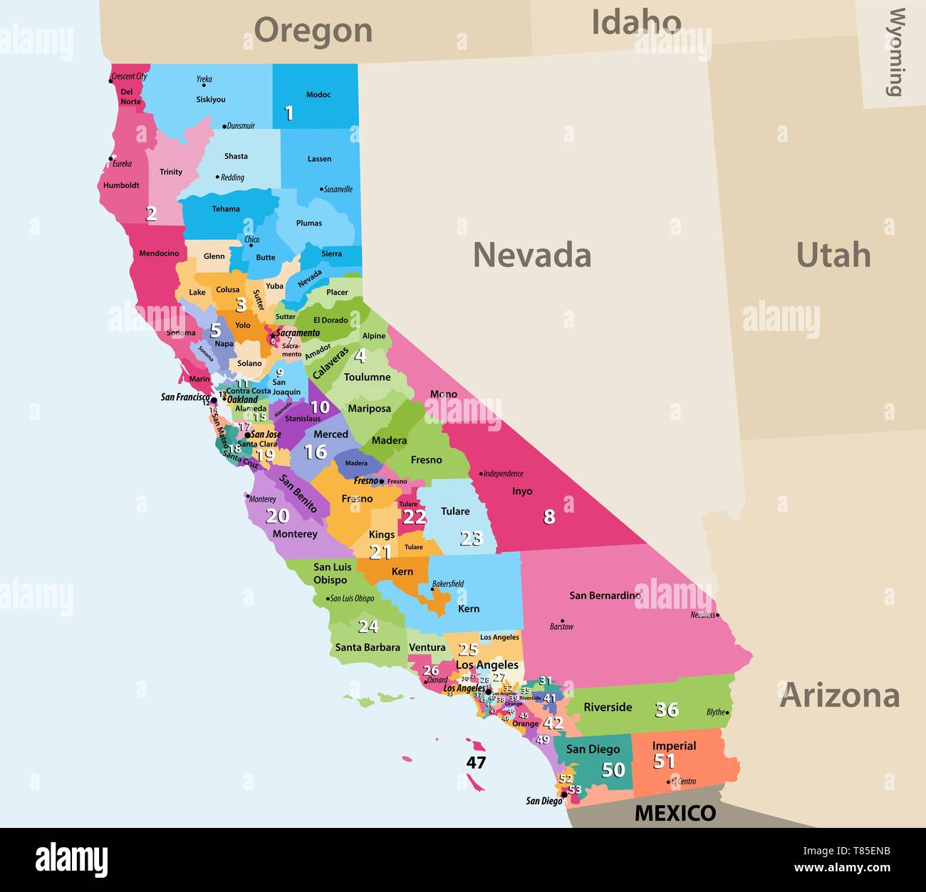 vector high detailed map of California's Congressional districts since 2013. Stock Vectorhttps://www.alamy.com/image-license-details/?v=1https://www.alamy.com/vector-high-detailed-map-of-californias-congressional-districts-since-2013-image245983735.html
RFT85ENB–vector high detailed map of California's Congressional districts since 2013.
![Brooklyn V. 3, Plate No. 43 [Map bounded by Seigel, Humboldt, Debevoise, Cook, Manhattan Ave.] 1884 - 1936 Stock Photo Brooklyn V. 3, Plate No. 43 [Map bounded by Seigel, Humboldt, Debevoise, Cook, Manhattan Ave.] 1884 - 1936 Stock Photo](https://c8.alamy.com/comp/2YP944X/brooklyn-v-3-plate-no-43-map-bounded-by-seigel-humboldt-debevoise-cook-manhattan-ave-1884-1936-2YP944X.jpg) Brooklyn V. 3, Plate No. 43 [Map bounded by Seigel, Humboldt, Debevoise, Cook, Manhattan Ave.] 1884 - 1936 Stock Photohttps://www.alamy.com/image-license-details/?v=1https://www.alamy.com/brooklyn-v-3-plate-no-43-map-bounded-by-seigel-humboldt-debevoise-cook-manhattan-ave-1884-1936-image633296522.html
Brooklyn V. 3, Plate No. 43 [Map bounded by Seigel, Humboldt, Debevoise, Cook, Manhattan Ave.] 1884 - 1936 Stock Photohttps://www.alamy.com/image-license-details/?v=1https://www.alamy.com/brooklyn-v-3-plate-no-43-map-bounded-by-seigel-humboldt-debevoise-cook-manhattan-ave-1884-1936-image633296522.htmlRM2YP944X–Brooklyn V. 3, Plate No. 43 [Map bounded by Seigel, Humboldt, Debevoise, Cook, Manhattan Ave.] 1884 - 1936
 Humboldt's map of the Casiquiare canal from his Atlas geographique et physique du Nouveau Continent. Stock Photohttps://www.alamy.com/image-license-details/?v=1https://www.alamy.com/humboldts-map-of-the-casiquiare-canal-from-his-atlas-geographique-et-physique-du-nouveau-continent-image268813182.html
RMWH9DXP–Humboldt's map of the Casiquiare canal from his Atlas geographique et physique du Nouveau Continent.
 Sanborn Fire Insurance Map from Humboldt, Richardson County, Nebraska. Stock Photohttps://www.alamy.com/image-license-details/?v=1https://www.alamy.com/sanborn-fire-insurance-map-from-humboldt-richardson-county-nebraska-image456426512.html
RM2HEG0JT–Sanborn Fire Insurance Map from Humboldt, Richardson County, Nebraska.
 21 1885 Humboldt Park Map personal photograph, by myself, of my map Stock Photohttps://www.alamy.com/image-license-details/?v=1https://www.alamy.com/21-1885-humboldt-park-map-personal-photograph-by-myself-of-my-map-image212764172.html
RMPA46TC–21 1885 Humboldt Park Map personal photograph, by myself, of my map
 Humboldt County (California) outline map set Stock Vectorhttps://www.alamy.com/image-license-details/?v=1https://www.alamy.com/humboldt-county-california-outline-map-set-image620805517.html
RF2Y203NH–Humboldt County (California) outline map set
 Humboldt Creek, , AU, Australia, Queensland, S 24 4' 4'', N 148 33' 1'', map, Cartascapes Map published in 2024. Explore Cartascapes, a map revealing Earth's diverse landscapes, cultures, and ecosystems. Journey through time and space, discovering the interconnectedness of our planet's past, present, and future. Stock Photohttps://www.alamy.com/image-license-details/?v=1https://www.alamy.com/humboldt-creek-au-australia-queensland-s-24-4-4-n-148-33-1-map-cartascapes-map-published-in-2024-explore-cartascapes-a-map-revealing-earths-diverse-landscapes-cultures-and-ecosystems-journey-through-time-and-space-discovering-the-interconnectedness-of-our-planets-past-present-and-future-image625817871.html
RM2YA4D27–Humboldt Creek, , AU, Australia, Queensland, S 24 4' 4'', N 148 33' 1'', map, Cartascapes Map published in 2024. Explore Cartascapes, a map revealing Earth's diverse landscapes, cultures, and ecosystems. Journey through time and space, discovering the interconnectedness of our planet's past, present, and future.
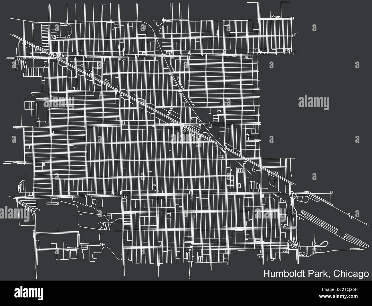 Street roads map of the HUMBOLDT PARK COMMUNITY AREA, CHICAGO Stock Vectorhttps://www.alamy.com/image-license-details/?v=1https://www.alamy.com/street-roads-map-of-the-humboldt-park-community-area-chicago-image575714905.html
RF2TCJ26H–Street roads map of the HUMBOLDT PARK COMMUNITY AREA, CHICAGO
 1811 Humboldt Map of Mexico, Texas, Louisiana, and Florida - Geographicus - Mexique-humboldt-1811 Stock Photohttps://www.alamy.com/image-license-details/?v=1https://www.alamy.com/stock-photo-1811-humboldt-map-of-mexico-texas-louisiana-and-florida-geographicus-132589522.html
RMHKKY82–1811 Humboldt Map of Mexico, Texas, Louisiana, and Florida - Geographicus - Mexique-humboldt-1811
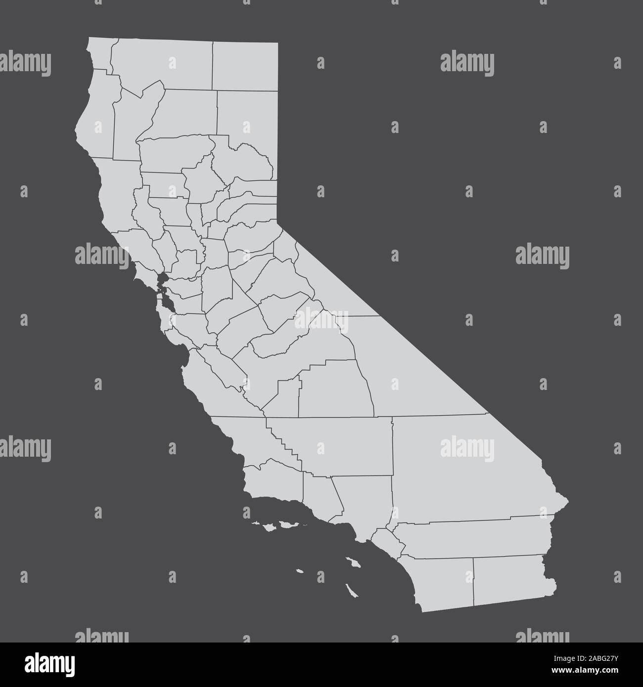 California counties map Stock Vectorhttps://www.alamy.com/image-license-details/?v=1https://www.alamy.com/california-counties-map-image334111231.html
RF2ABG27Y–California counties map
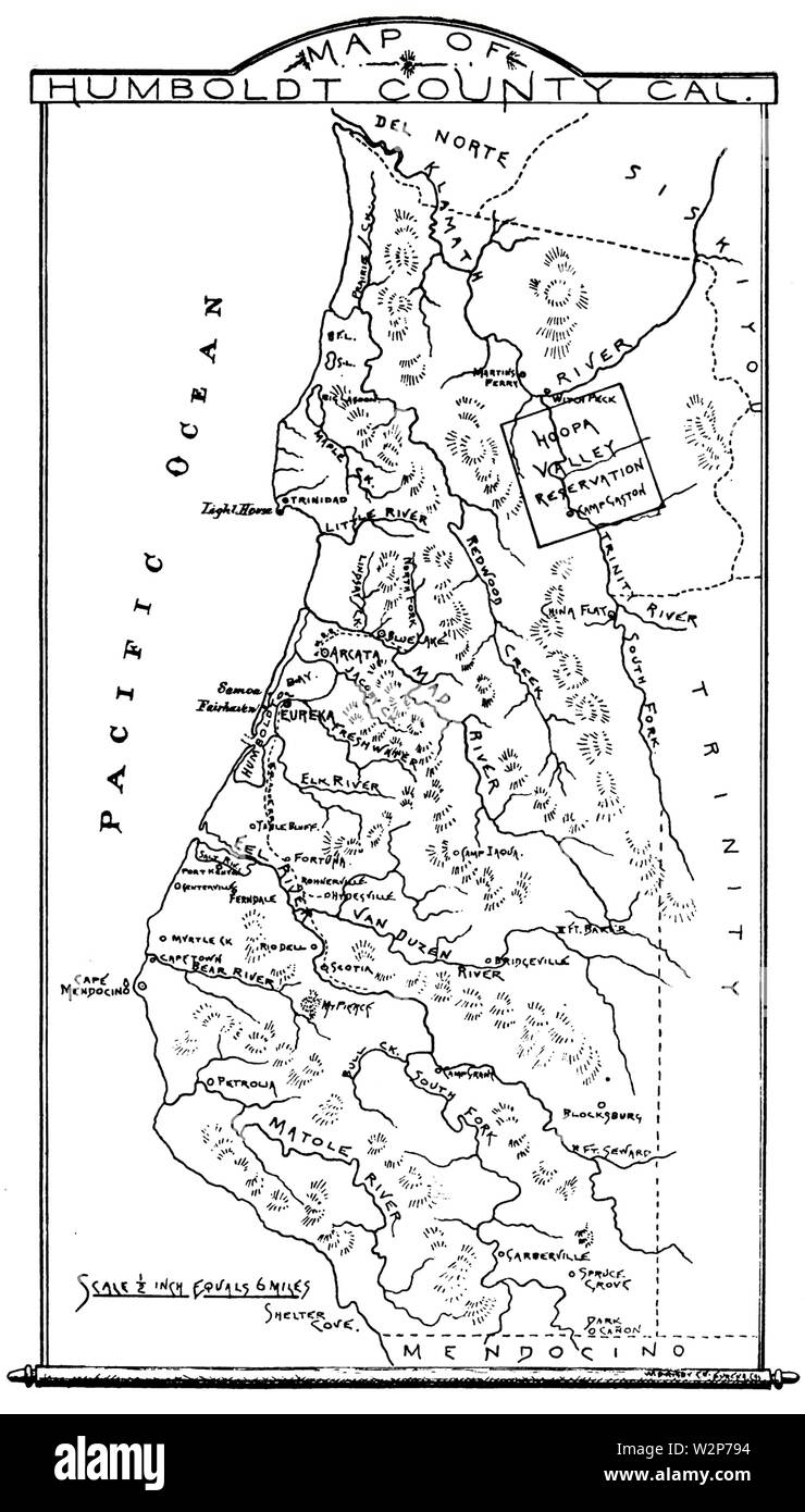 1893 Map Humboldt County, California Stock Photohttps://www.alamy.com/image-license-details/?v=1https://www.alamy.com/1893-map-humboldt-county-california-image259873520.html
RMW2P794–1893 Map Humboldt County, California
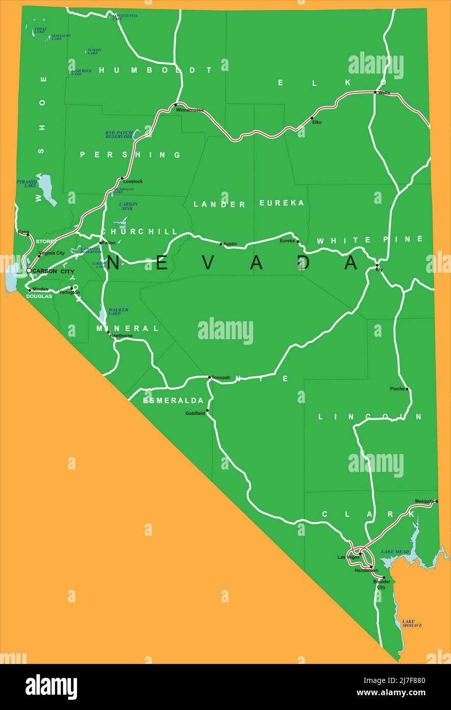 Highly detailed vector map of Nevada with county,main cities and roads. Stock Vectorhttps://www.alamy.com/image-license-details/?v=1https://www.alamy.com/highly-detailed-vector-map-of-nevada-with-countymain-cities-and-roads-image469318304.html
RF2J7F880–Highly detailed vector map of Nevada with county,main cities and roads.
 Map of Humboldt in California Stock Photohttps://www.alamy.com/image-license-details/?v=1https://www.alamy.com/map-of-humboldt-in-california-image350853926.html
RF2BAPNNA–Map of Humboldt in California
 Nevada ridgeline map showcasing diverse topography from Great Basin to Sierra Nevada Stock Vectorhttps://www.alamy.com/image-license-details/?v=1https://www.alamy.com/nevada-ridgeline-map-showcasing-diverse-topography-from-great-basin-to-sierra-nevada-image626024814.html
RF2YADW12–Nevada ridgeline map showcasing diverse topography from Great Basin to Sierra Nevada
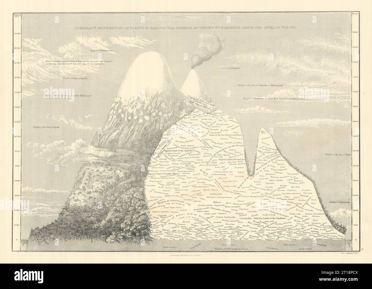 Humboldt's plant distribution in Equinoctial America. SIDNEY HALL 1854 map Stock Photohttps://www.alamy.com/image-license-details/?v=1https://www.alamy.com/humboldts-plant-distribution-in-equinoctial-america-sidney-hall-1854-map-image568750026.html
RF2T18PCX–Humboldt's plant distribution in Equinoctial America. SIDNEY HALL 1854 map
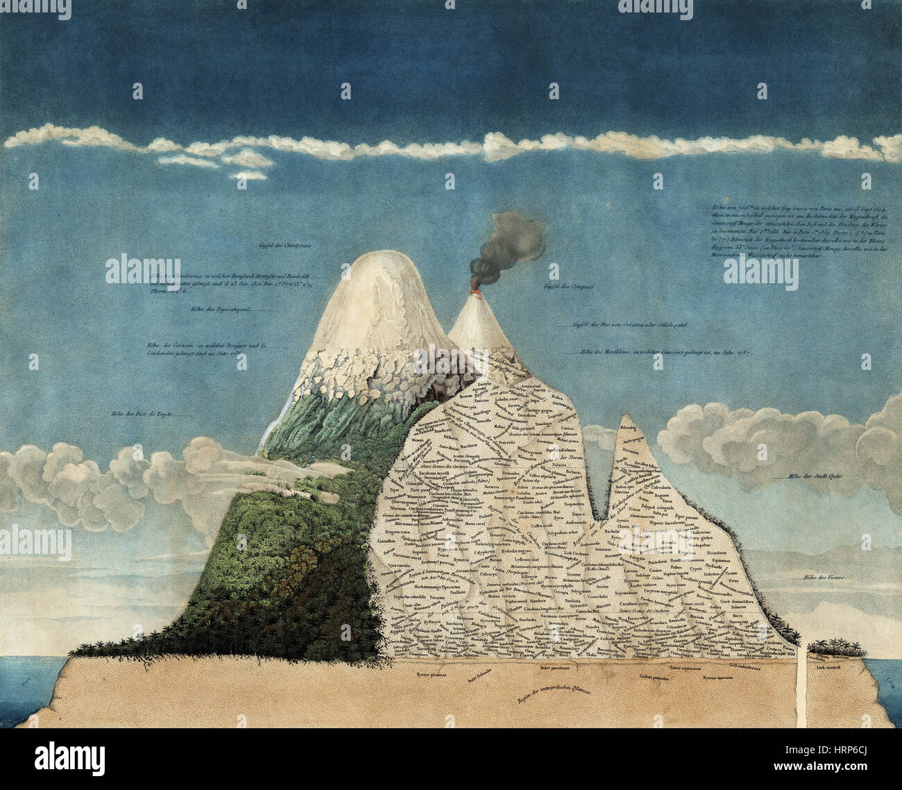 Alexander von Humboldt's Chimborazo Map, 1807 Stock Photohttps://www.alamy.com/image-license-details/?v=1https://www.alamy.com/stock-photo-alexander-von-humboldts-chimborazo-map-1807-135097666.html
RMHRP6CJ–Alexander von Humboldt's Chimborazo Map, 1807
 Map of Humboldt in California Stock Photohttps://www.alamy.com/image-license-details/?v=1https://www.alamy.com/map-of-humboldt-in-california-image385534606.html
RF2DB6H92–Map of Humboldt in California
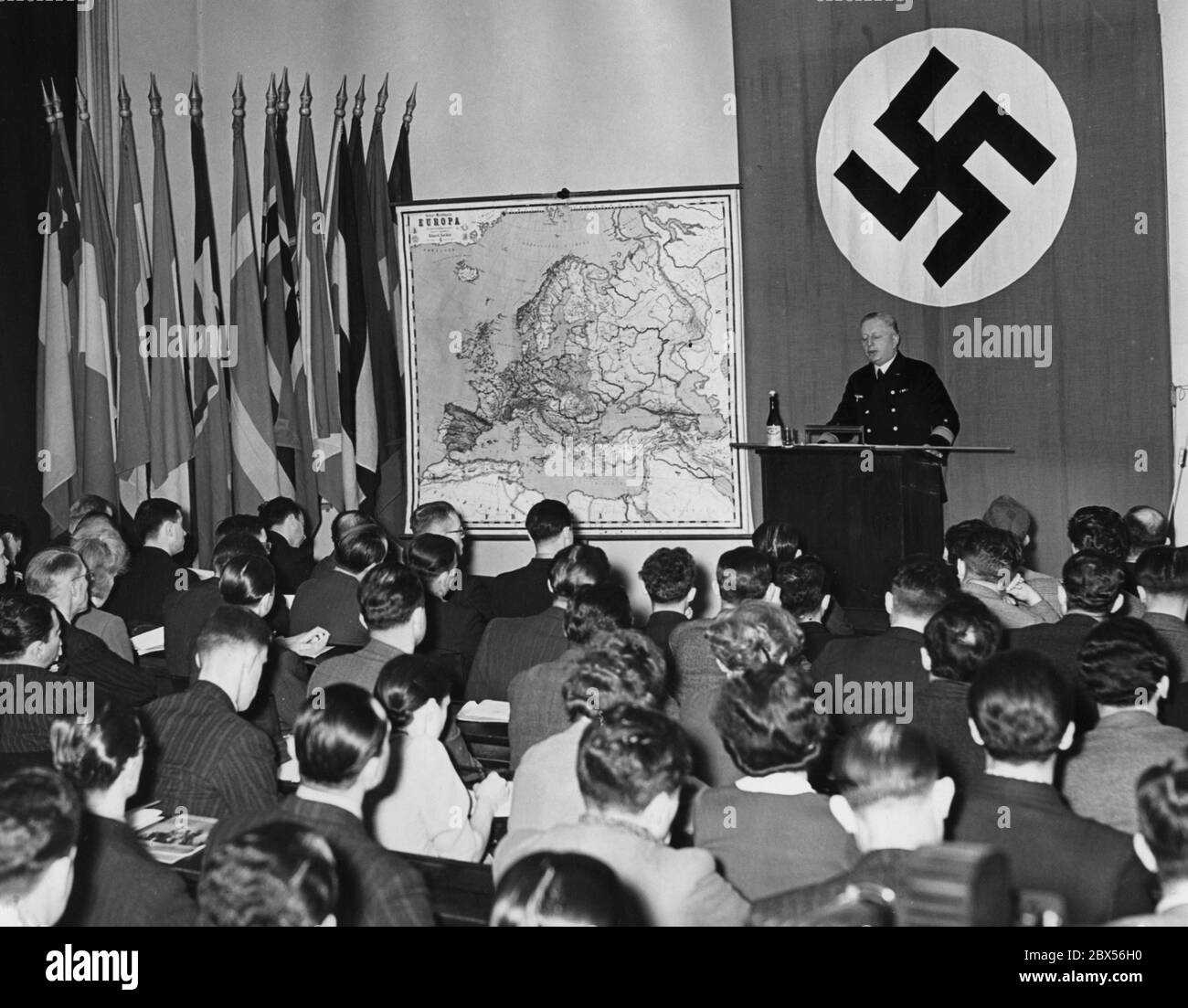 The Institute for International Studies at the University of Berlin organized a holiday course named 'Germany at War', in which more than 200 foreign students from 36 different nations are participating. Here a view into the lecture hall during a lecture by Rear Admiral Gladow. On the wall to the left of a swastika flag is a map of Europe and several national flags. Stock Photohttps://www.alamy.com/image-license-details/?v=1https://www.alamy.com/the-institute-for-international-studies-at-the-university-of-berlin-organized-a-holiday-course-named-germany-at-war-in-which-more-than-200-foreign-students-from-36-different-nations-are-participating-here-a-view-into-the-lecture-hall-during-a-lecture-by-rear-admiral-gladow-on-the-wall-to-the-left-of-a-swastika-flag-is-a-map-of-europe-and-several-national-flags-image360303356.html
RM2BX56H0–The Institute for International Studies at the University of Berlin organized a holiday course named 'Germany at War', in which more than 200 foreign students from 36 different nations are participating. Here a view into the lecture hall during a lecture by Rear Admiral Gladow. On the wall to the left of a swastika flag is a map of Europe and several national flags.
 Vol. 6. Plate, H. Map bound by Van Cott Ave., Van Pelt Ave., Monitor St., Meeker Ave., Richardson St., Humboldt St. Stock Photohttps://www.alamy.com/image-license-details/?v=1https://www.alamy.com/stock-photo-vol-6-plate-h-map-bound-by-van-cott-ave-van-pelt-ave-monitor-st-meeker-123330874.html
RMH4J5P2–Vol. 6. Plate, H. Map bound by Van Cott Ave., Van Pelt Ave., Monitor St., Meeker Ave., Richardson St., Humboldt St.
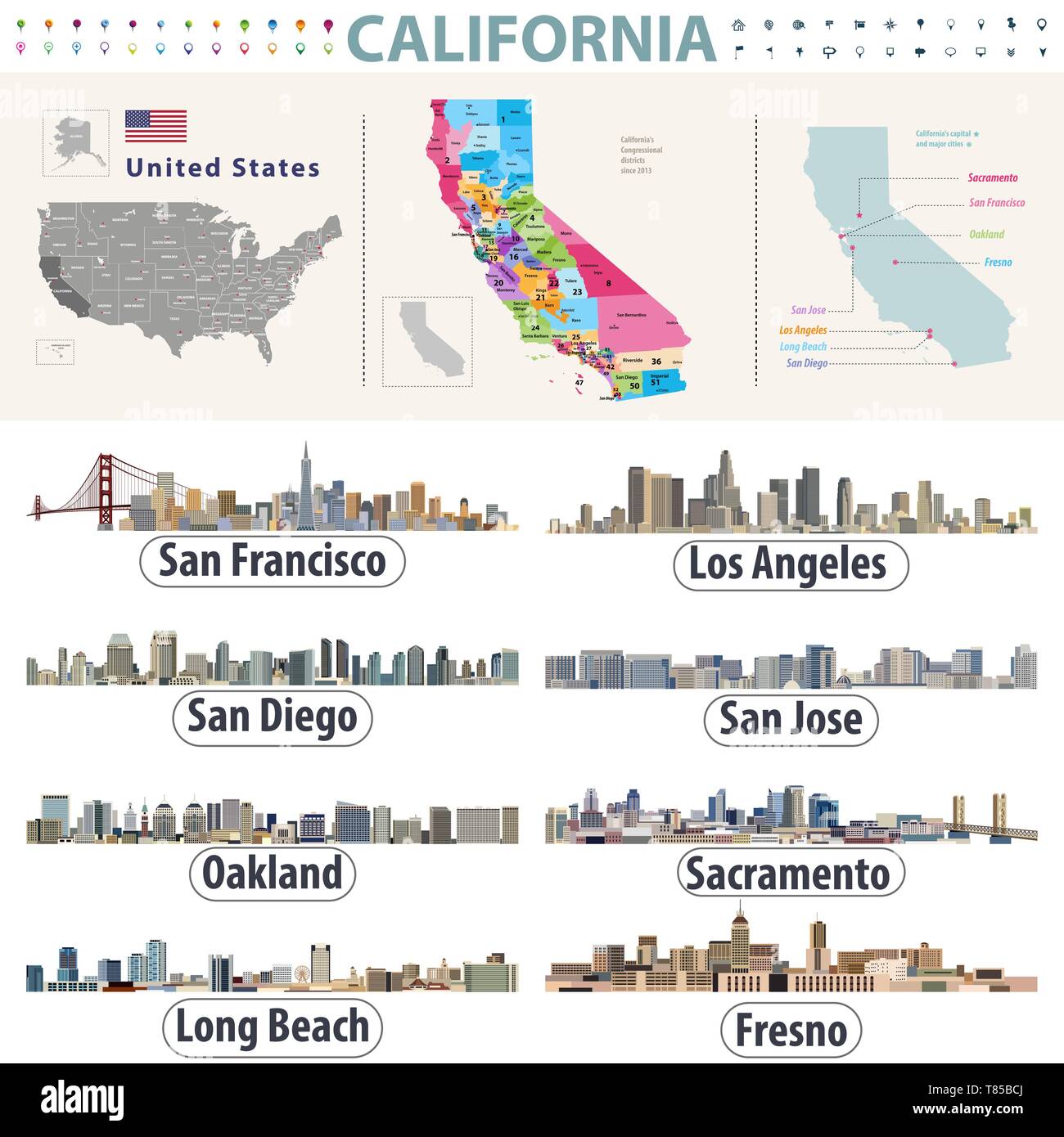 California's vector high detailed map showing counties formations. Skylines of major cities of California Stock Vectorhttps://www.alamy.com/image-license-details/?v=1https://www.alamy.com/californias-vector-high-detailed-map-showing-counties-formations-skylines-of-major-cities-of-california-image245981138.html
RFT85BCJ–California's vector high detailed map showing counties formations. Skylines of major cities of California
![Buffalo, Double Page Plate No. 28 [Map bounded by Rooney Ave., Eggert St., Ferry St., Humboldt Parkway] 1891 Stock Photo Buffalo, Double Page Plate No. 28 [Map bounded by Rooney Ave., Eggert St., Ferry St., Humboldt Parkway] 1891 Stock Photo](https://c8.alamy.com/comp/2YP9730/buffalo-double-page-plate-no-28-map-bounded-by-rooney-ave-eggert-st-ferry-st-humboldt-parkway-1891-2YP9730.jpg) Buffalo, Double Page Plate No. 28 [Map bounded by Rooney Ave., Eggert St., Ferry St., Humboldt Parkway] 1891 Stock Photohttps://www.alamy.com/image-license-details/?v=1https://www.alamy.com/buffalo-double-page-plate-no-28-map-bounded-by-rooney-ave-eggert-st-ferry-st-humboldt-parkway-1891-image633298820.html
Buffalo, Double Page Plate No. 28 [Map bounded by Rooney Ave., Eggert St., Ferry St., Humboldt Parkway] 1891 Stock Photohttps://www.alamy.com/image-license-details/?v=1https://www.alamy.com/buffalo-double-page-plate-no-28-map-bounded-by-rooney-ave-eggert-st-ferry-st-humboldt-parkway-1891-image633298820.htmlRM2YP9730–Buffalo, Double Page Plate No. 28 [Map bounded by Rooney Ave., Eggert St., Ferry St., Humboldt Parkway] 1891
 Two young women reading a map below the marble statue of Wilhelm von Humboldt, founder of Humboldt University, Berlin Stock Photohttps://www.alamy.com/image-license-details/?v=1https://www.alamy.com/stock-photo-two-young-women-reading-a-map-below-the-marble-statue-of-wilhelm-von-82260032.html
RMENR7E8–Two young women reading a map below the marble statue of Wilhelm von Humboldt, founder of Humboldt University, Berlin
 Sanborn Fire Insurance Map from Humboldt, Richardson County, Nebraska. Stock Photohttps://www.alamy.com/image-license-details/?v=1https://www.alamy.com/sanborn-fire-insurance-map-from-humboldt-richardson-county-nebraska-image456426511.html
RM2HEG0JR–Sanborn Fire Insurance Map from Humboldt, Richardson County, Nebraska.
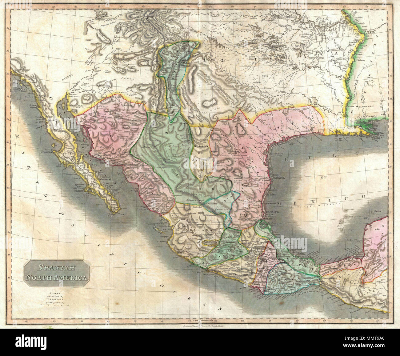 . English: This beautiful 1814 map, along with Pinkerton’s similar map, is most likely the most important large format English atlas map of the American Southwest to be produced in the 19th century. The map depicts Mexico from the Yucatan north to what would soon become the Republic of Texas, the Louisiana Territory, and what would eventually be the U.S. States of New Mexico, Arizona, Texas, California, Nevada, Utah, Louisiana, Oklahoma and Colorado. This map is based largely on the maps of Alexander von Humboldt and Zebulon Pike. The general treatment of the Rocky Mountains is drawn directly Stock Photohttps://www.alamy.com/image-license-details/?v=1https://www.alamy.com/english-this-beautiful-1814-map-along-with-pinkertons-similar-map-is-most-likely-the-most-important-large-format-english-atlas-map-of-the-american-southwest-to-be-produced-in-the-19th-century-the-map-depicts-mexico-from-the-yucatan-north-to-what-would-soon-become-the-republic-of-texas-the-louisiana-territory-and-what-would-eventually-be-the-us-states-of-new-mexico-arizona-texas-california-nevada-utah-louisiana-oklahoma-and-colorado-this-map-is-based-largely-on-the-maps-of-alexander-von-humboldt-and-zebulon-pike-the-general-treatment-of-the-rocky-mountains-is-drawn-directly-image184930984.html
RMMMT9A0–. English: This beautiful 1814 map, along with Pinkerton’s similar map, is most likely the most important large format English atlas map of the American Southwest to be produced in the 19th century. The map depicts Mexico from the Yucatan north to what would soon become the Republic of Texas, the Louisiana Territory, and what would eventually be the U.S. States of New Mexico, Arizona, Texas, California, Nevada, Utah, Louisiana, Oklahoma and Colorado. This map is based largely on the maps of Alexander von Humboldt and Zebulon Pike. The general treatment of the Rocky Mountains is drawn directly
 Humboldt County (Nevada) outline map set Stock Vectorhttps://www.alamy.com/image-license-details/?v=1https://www.alamy.com/humboldt-county-nevada-outline-map-set-image621155607.html
RF2Y2G28R–Humboldt County (Nevada) outline map set
 Humboldt, Central Highlands, AU, Australia, Queensland, S 24 5' 43'', N 148 49' 25'', map, Cartascapes Map published in 2024. Explore Cartascapes, a map revealing Earth's diverse landscapes, cultures, and ecosystems. Journey through time and space, discovering the interconnectedness of our planet's past, present, and future. Stock Photohttps://www.alamy.com/image-license-details/?v=1https://www.alamy.com/humboldt-central-highlands-au-australia-queensland-s-24-5-43-n-148-49-25-map-cartascapes-map-published-in-2024-explore-cartascapes-a-map-revealing-earths-diverse-landscapes-cultures-and-ecosystems-journey-through-time-and-space-discovering-the-interconnectedness-of-our-planets-past-present-and-future-image625499802.html
RM2Y9HYAJ–Humboldt, Central Highlands, AU, Australia, Queensland, S 24 5' 43'', N 148 49' 25'', map, Cartascapes Map published in 2024. Explore Cartascapes, a map revealing Earth's diverse landscapes, cultures, and ecosystems. Journey through time and space, discovering the interconnectedness of our planet's past, present, and future.
 A chart prepared by Alexander von Humboldt. It shows the variation and the change of species with altitude in the Andes, from sea level to the summits of the mountains Stock Photohttps://www.alamy.com/image-license-details/?v=1https://www.alamy.com/a-chart-prepared-by-alexander-von-humboldt-it-shows-the-variation-and-the-change-of-species-with-altitude-in-the-andes-from-sea-level-to-the-summits-of-the-mountains-image451421263.html
RM2H6C0BY–A chart prepared by Alexander von Humboldt. It shows the variation and the change of species with altitude in the Andes, from sea level to the summits of the mountains
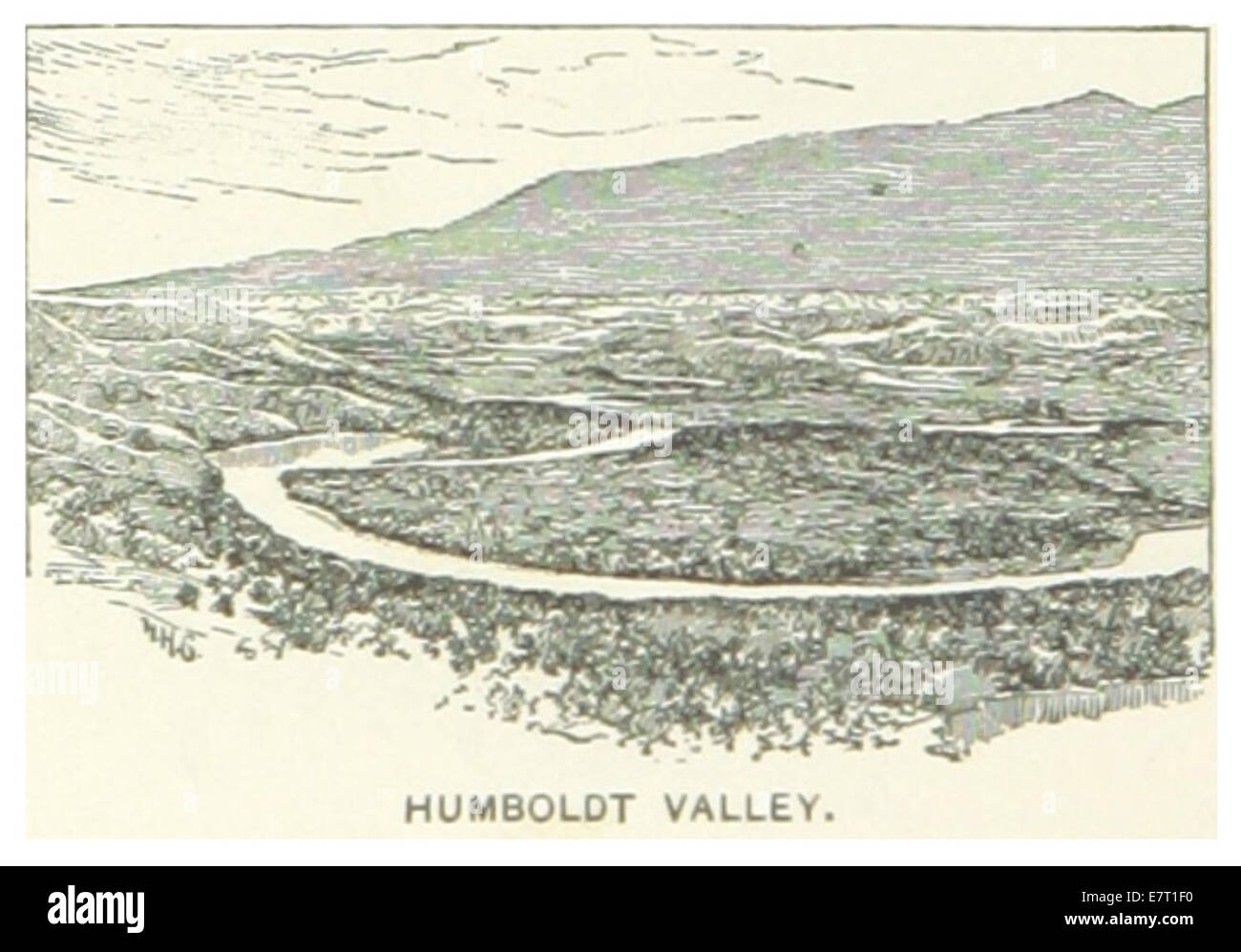 US-NV(1891) p536 HUMBOLDT VALLEY Stock Photohttps://www.alamy.com/image-license-details/?v=1https://www.alamy.com/stock-photo-us-nv1891-p536-humboldt-valley-73672116.html
RME7T1F0–US-NV(1891) p536 HUMBOLDT VALLEY
 The City of Chicago 1874 Stock Photohttps://www.alamy.com/image-license-details/?v=1https://www.alamy.com/stock-photo-the-city-of-chicago-1874-15665047.html
RMAP3MRM–The City of Chicago 1874
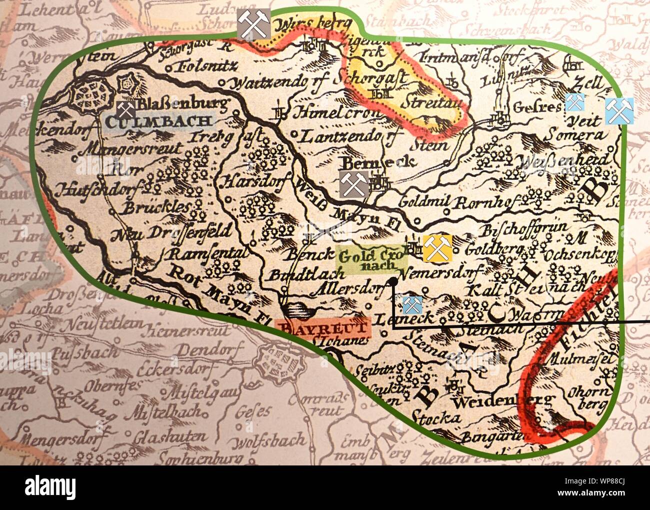 Goldkronach, Germany. 02nd Sep, 2019. In the Gold mining museum Goldkronach you can see a section of a map from 1707 which shows the mining sites around Goldkronach. In the years 1792-1797 the well-known natural scientist Alexander von Humboldt worked in today's Upper Franconia. Credit: Nicolas Armer/dpa/Alamy Live News Stock Photohttps://www.alamy.com/image-license-details/?v=1https://www.alamy.com/goldkronach-germany-02nd-sep-2019-in-the-gold-mining-museum-goldkronach-you-can-see-a-section-of-a-map-from-1707-which-shows-the-mining-sites-around-goldkronach-in-the-years-1792-1797-the-well-known-natural-scientist-alexander-von-humboldt-worked-in-todays-upper-franconia-credit-nicolas-armerdpaalamy-live-news-image271860194.html
RMWP88CJ–Goldkronach, Germany. 02nd Sep, 2019. In the Gold mining museum Goldkronach you can see a section of a map from 1707 which shows the mining sites around Goldkronach. In the years 1792-1797 the well-known natural scientist Alexander von Humboldt worked in today's Upper Franconia. Credit: Nicolas Armer/dpa/Alamy Live News
 Three aspects of the Jorullo volcano. From Atlas geographique et physique du Royaume de la Nouvello-Espagne by Humboldt and Bonpland Stock Photohttps://www.alamy.com/image-license-details/?v=1https://www.alamy.com/three-aspects-of-the-jorullo-volcano-from-atlas-geographique-et-physique-du-royaume-de-la-nouvello-espagne-by-humboldt-and-bonpland-image268813160.html
RMWH9DX0–Three aspects of the Jorullo volcano. From Atlas geographique et physique du Royaume de la Nouvello-Espagne by Humboldt and Bonpland
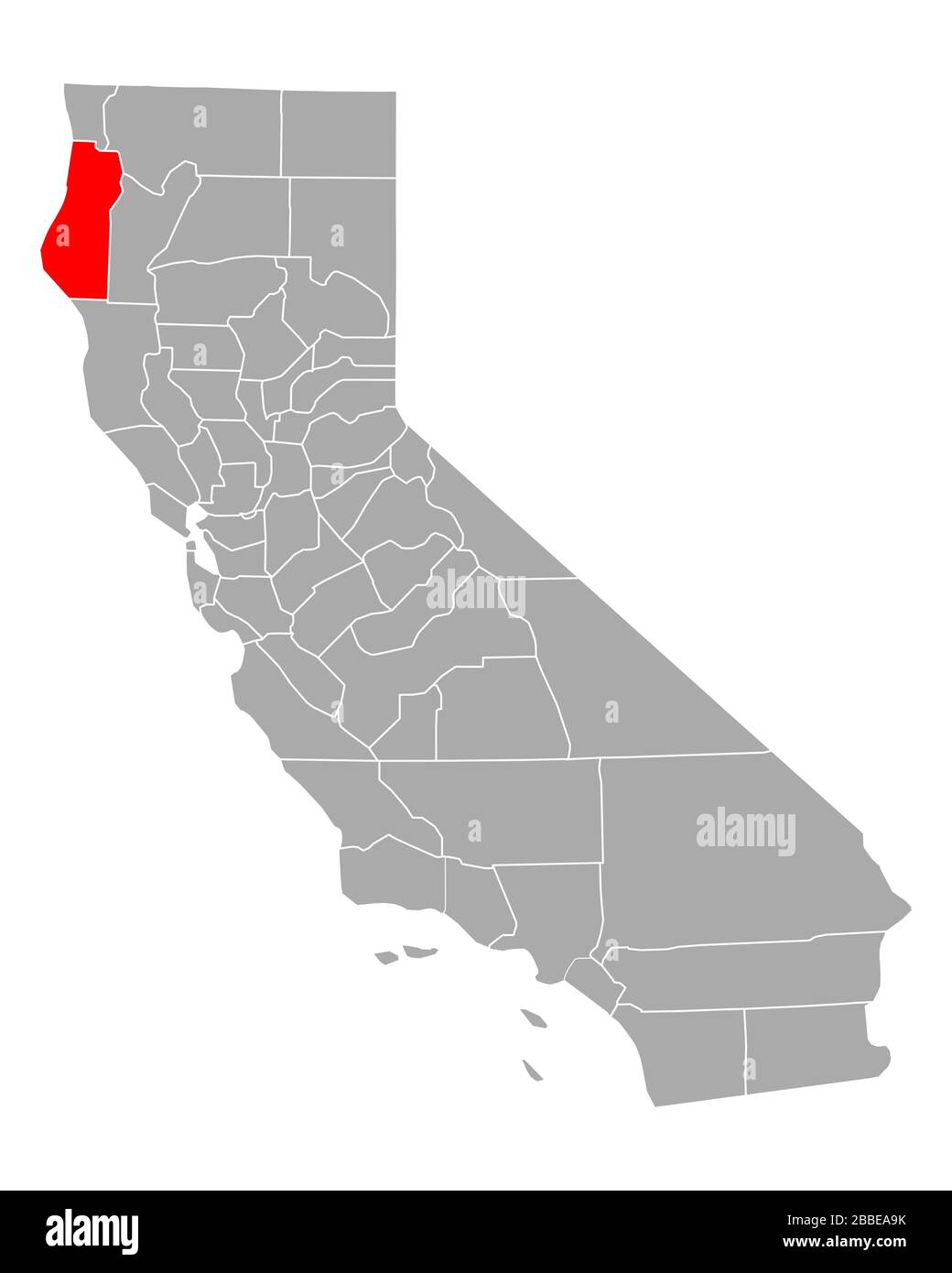 Map of Humboldt in California Stock Photohttps://www.alamy.com/image-license-details/?v=1https://www.alamy.com/map-of-humboldt-in-california-image351284015.html
RF2BBEA9K–Map of Humboldt in California
 Humboldt stor Stock Photohttps://www.alamy.com/image-license-details/?v=1https://www.alamy.com/stock-photo-humboldt-stor-139968253.html
RMJ3M2X5–Humboldt stor
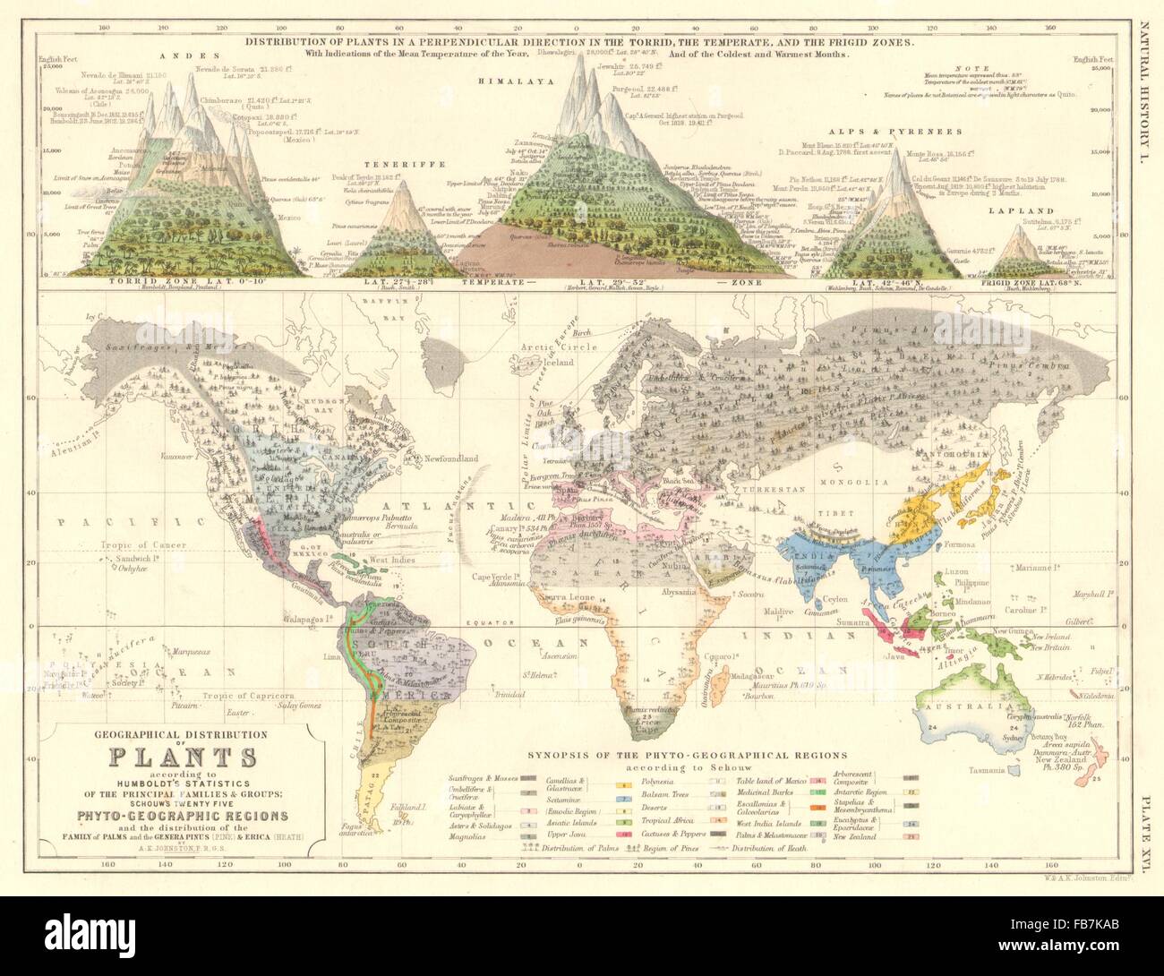 WORLD:Geographical & perpendicular Plant distribution.Humboldt Schouw, 1850 map Stock Photohttps://www.alamy.com/image-license-details/?v=1https://www.alamy.com/stock-photo-worldgeographical-perpendicular-plant-distributionhumboldt-schouw-92981907.html
RFFB7KAB–WORLD:Geographical & perpendicular Plant distribution.Humboldt Schouw, 1850 map
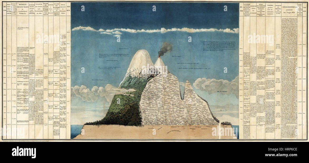 Alexander von Humboldt's Chimborazo Map, 1807 Stock Photohttps://www.alamy.com/image-license-details/?v=1https://www.alamy.com/stock-photo-alexander-von-humboldts-chimborazo-map-1807-135097662.html
RMHRP6CE–Alexander von Humboldt's Chimborazo Map, 1807
 Map of Humboldt in California Stock Photohttps://www.alamy.com/image-license-details/?v=1https://www.alamy.com/map-of-humboldt-in-california-image363423186.html
RF2C379YE–Map of Humboldt in California
 Alexander von Humboldt (1769-1859) on engraving from the 1800s. German naturalist and explorer. Stock Photohttps://www.alamy.com/image-license-details/?v=1https://www.alamy.com/stock-photo-alexander-von-humboldt-1769-1859-on-engraving-from-the-1800s-german-29285571.html
RFBKJ217–Alexander von Humboldt (1769-1859) on engraving from the 1800s. German naturalist and explorer.
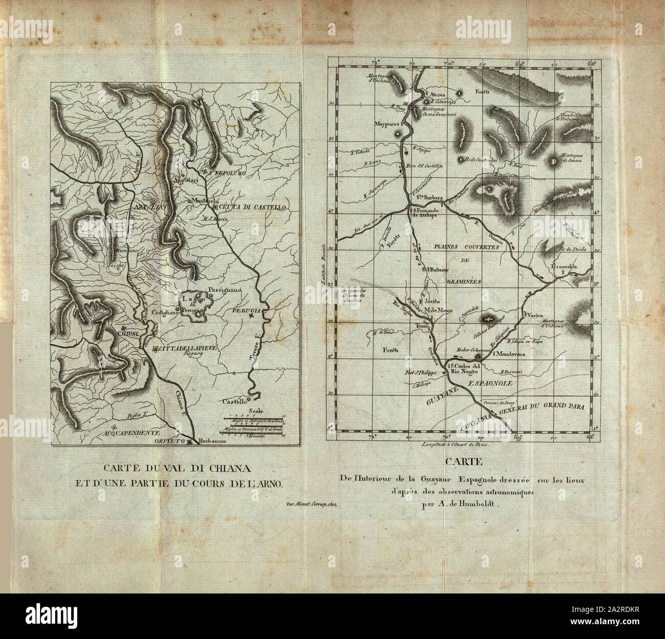 Map of Val di Chiana and part of the course of the Arno and Map of the Interior of the Spanish Guayane ..., Cards of the Chianatal in Italy and of Spanish Guiana, Signed: Dressée sur le lieux d'après les observations ... par A. de Humboldt, fig. 1, Humboldt, Alexander von (d'après), 1812, Monatliche Correspondenz zur Beförderung der Erd- und Himmelskunde. Jg. 26. Gotha: Becker, 1812 Stock Photohttps://www.alamy.com/image-license-details/?v=1https://www.alamy.com/map-of-val-di-chiana-and-part-of-the-course-of-the-arno-and-map-of-the-interior-of-the-spanish-guayane-cards-of-the-chianatal-in-italy-and-of-spanish-guiana-signed-dresse-sur-le-lieux-daprs-les-observations-par-a-de-humboldt-fig-1-humboldt-alexander-von-daprs-1812-monatliche-correspondenz-zur-befrderung-der-erd-und-himmelskunde-jg-26-gotha-becker-1812-image328741947.html
RM2A2RDKR–Map of Val di Chiana and part of the course of the Arno and Map of the Interior of the Spanish Guayane ..., Cards of the Chianatal in Italy and of Spanish Guiana, Signed: Dressée sur le lieux d'après les observations ... par A. de Humboldt, fig. 1, Humboldt, Alexander von (d'après), 1812, Monatliche Correspondenz zur Beförderung der Erd- und Himmelskunde. Jg. 26. Gotha: Becker, 1812
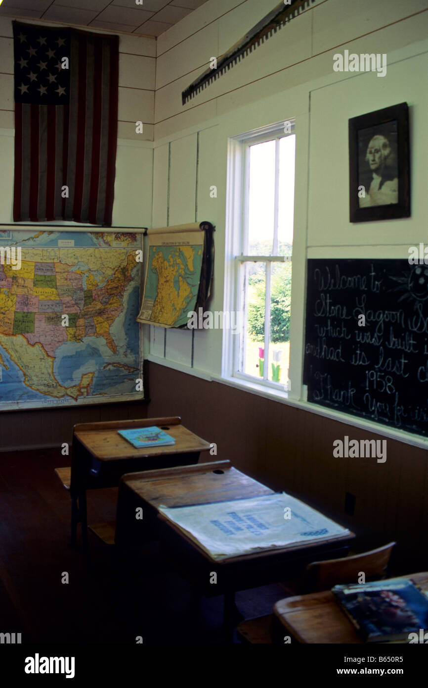 Interior of old one room red school house at Stone Lagoon Humboldt County California Stock Photohttps://www.alamy.com/image-license-details/?v=1https://www.alamy.com/stock-photo-interior-of-old-one-room-red-school-house-at-stone-lagoon-humboldt-21008713.html
RMB650R5–Interior of old one room red school house at Stone Lagoon Humboldt County California
![Brooklyn V. 4, Plate No. 29 [Map bounded by Leonard St., Engert Ave., Humboldt St., Bayard St.] 1884 - 1936 Stock Photo Brooklyn V. 4, Plate No. 29 [Map bounded by Leonard St., Engert Ave., Humboldt St., Bayard St.] 1884 - 1936 Stock Photo](https://c8.alamy.com/comp/2YP949N/brooklyn-v-4-plate-no-29-map-bounded-by-leonard-st-engert-ave-humboldt-st-bayard-st-1884-1936-2YP949N.jpg) Brooklyn V. 4, Plate No. 29 [Map bounded by Leonard St., Engert Ave., Humboldt St., Bayard St.] 1884 - 1936 Stock Photohttps://www.alamy.com/image-license-details/?v=1https://www.alamy.com/brooklyn-v-4-plate-no-29-map-bounded-by-leonard-st-engert-ave-humboldt-st-bayard-st-1884-1936-image633296657.html
Brooklyn V. 4, Plate No. 29 [Map bounded by Leonard St., Engert Ave., Humboldt St., Bayard St.] 1884 - 1936 Stock Photohttps://www.alamy.com/image-license-details/?v=1https://www.alamy.com/brooklyn-v-4-plate-no-29-map-bounded-by-leonard-st-engert-ave-humboldt-st-bayard-st-1884-1936-image633296657.htmlRM2YP949N–Brooklyn V. 4, Plate No. 29 [Map bounded by Leonard St., Engert Ave., Humboldt St., Bayard St.] 1884 - 1936
 Mitte, Berlin, Germany.The Charité Hospital Campus Map,Teaching hospital affiliated with Humboldt University and Freie Universität Berlin. Stock Photohttps://www.alamy.com/image-license-details/?v=1https://www.alamy.com/mitte-berlin-germanythe-charit-hospital-campus-mapteaching-hospital-affiliated-with-humboldt-university-and-freie-universitt-berlin-image560537171.html
RM2RFXJTK–Mitte, Berlin, Germany.The Charité Hospital Campus Map,Teaching hospital affiliated with Humboldt University and Freie Universität Berlin.
 Sanborn Fire Insurance Map from Humboldt, Humboldt County, Iowa. Stock Photohttps://www.alamy.com/image-license-details/?v=1https://www.alamy.com/sanborn-fire-insurance-map-from-humboldt-humboldt-county-iowa-image456426501.html
RM2HEG0JD–Sanborn Fire Insurance Map from Humboldt, Humboldt County, Iowa.
 . English: A rare and important 1818 map of the Northern Hemisphere by John Pinkerton. On a Polar projection, this map depicts North America, Asia, the East Indies, and North Africa. In North America, thanks primarily to the work of Cook in the Pacific Northwest, the coasts are rendered with considerable accuracy. The interior of North America, particularly the American West, is still rather vague, though much of the cartography is clearly derived from the exploration of Humboldt and the Louis and Clark expedition. Notes the apocryphal River Buenaventura as well as a conjectural placement of Stock Photohttps://www.alamy.com/image-license-details/?v=1https://www.alamy.com/english-a-rare-and-important-1818-map-of-the-northern-hemisphere-by-john-pinkerton-on-a-polar-projection-this-map-depicts-north-america-asia-the-east-indies-and-north-africa-in-north-america-thanks-primarily-to-the-work-of-cook-in-the-pacific-northwest-the-coasts-are-rendered-with-considerable-accuracy-the-interior-of-north-america-particularly-the-american-west-is-still-rather-vague-though-much-of-the-cartography-is-clearly-derived-from-the-exploration-of-humboldt-and-the-louis-and-clark-expedition-notes-the-apocryphal-river-buenaventura-as-well-as-a-conjectural-placement-of-image184933051.html
RMMMTBYR–. English: A rare and important 1818 map of the Northern Hemisphere by John Pinkerton. On a Polar projection, this map depicts North America, Asia, the East Indies, and North Africa. In North America, thanks primarily to the work of Cook in the Pacific Northwest, the coasts are rendered with considerable accuracy. The interior of North America, particularly the American West, is still rather vague, though much of the cartography is clearly derived from the exploration of Humboldt and the Louis and Clark expedition. Notes the apocryphal River Buenaventura as well as a conjectural placement of
 Humboldt County (Iowa) outline map set Stock Vectorhttps://www.alamy.com/image-license-details/?v=1https://www.alamy.com/humboldt-county-iowa-outline-map-set-image620885434.html
RF2Y23NKP–Humboldt County (Iowa) outline map set
 Humboldt, Central Highlands, AU, Australia, Queensland, S 24 5' 43'', N 148 49' 25'', map, Cartascapes Map published in 2024. Explore Cartascapes, a map revealing Earth's diverse landscapes, cultures, and ecosystems. Journey through time and space, discovering the interconnectedness of our planet's past, present, and future. Stock Photohttps://www.alamy.com/image-license-details/?v=1https://www.alamy.com/humboldt-central-highlands-au-australia-queensland-s-24-5-43-n-148-49-25-map-cartascapes-map-published-in-2024-explore-cartascapes-a-map-revealing-earths-diverse-landscapes-cultures-and-ecosystems-journey-through-time-and-space-discovering-the-interconnectedness-of-our-planets-past-present-and-future-image625362802.html
RM2Y9BMHP–Humboldt, Central Highlands, AU, Australia, Queensland, S 24 5' 43'', N 148 49' 25'', map, Cartascapes Map published in 2024. Explore Cartascapes, a map revealing Earth's diverse landscapes, cultures, and ecosystems. Journey through time and space, discovering the interconnectedness of our planet's past, present, and future.
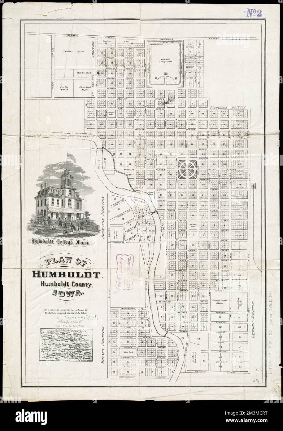 Plan of Humboldt, Humboldt County, Iowa , Humboldt Iowa, Maps Norman B. Leventhal Map Center Collection Stock Photohttps://www.alamy.com/image-license-details/?v=1https://www.alamy.com/plan-of-humboldt-humboldt-county-iowa-humboldt-iowa-maps-norman-b-leventhal-map-center-collection-image501393756.html
RM2M3MCRT–Plan of Humboldt, Humboldt County, Iowa , Humboldt Iowa, Maps Norman B. Leventhal Map Center Collection
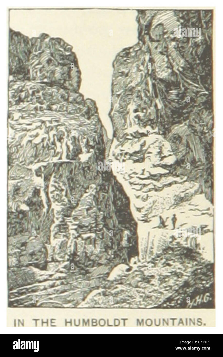 US-NV(1891) p536 IN THE HUMBOLDT MOUNTAINS Stock Photohttps://www.alamy.com/image-license-details/?v=1https://www.alamy.com/stock-photo-us-nv1891-p536-in-the-humboldt-mountains-73672117.html
RME7T1F1–US-NV(1891) p536 IN THE HUMBOLDT MOUNTAINS
 U.S. states - map of Nevada. Hand made. Rivers and lakes are shown. Please look at my other images of cartographic series - they are all very detailed Stock Vectorhttps://www.alamy.com/image-license-details/?v=1https://www.alamy.com/us-states-map-of-nevada-hand-made-rivers-and-lakes-are-shown-please-look-at-my-other-images-of-cartographic-series-they-are-all-very-detailed-image186929023.html
RFMT39TF–U.S. states - map of Nevada. Hand made. Rivers and lakes are shown. Please look at my other images of cartographic series - they are all very detailed
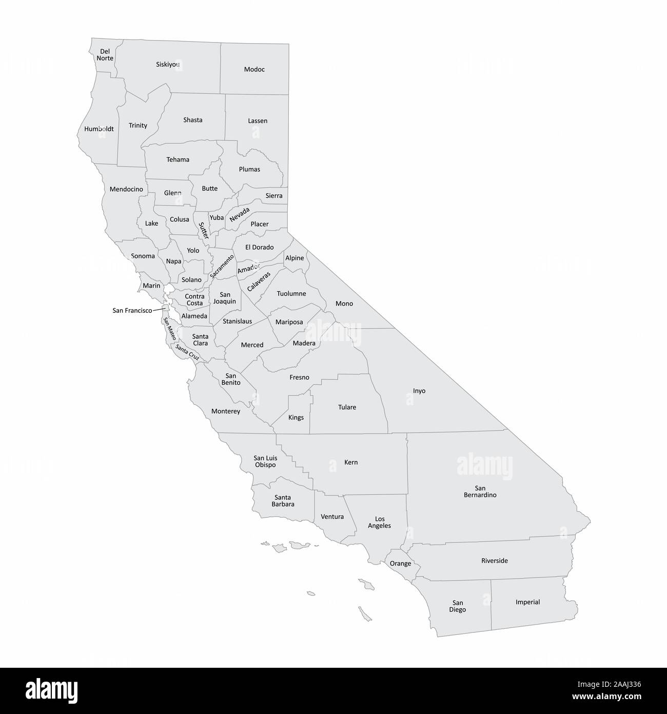 California and its counties Stock Vectorhttps://www.alamy.com/image-license-details/?v=1https://www.alamy.com/california-and-its-counties-image333541130.html
RF2AAJ336–California and its counties
 1811, Humboldt Map of Mexico, Texas, Louisiana, and Florida. Reimagined by Gibon. Classic art with a modern twist reimagined Stock Photohttps://www.alamy.com/image-license-details/?v=1https://www.alamy.com/1811-humboldt-map-of-mexico-texas-louisiana-and-florida-reimagined-by-gibon-classic-art-with-a-modern-twist-reimagined-image230087682.html
RFRA9B56–1811, Humboldt Map of Mexico, Texas, Louisiana, and Florida. Reimagined by Gibon. Classic art with a modern twist reimagined
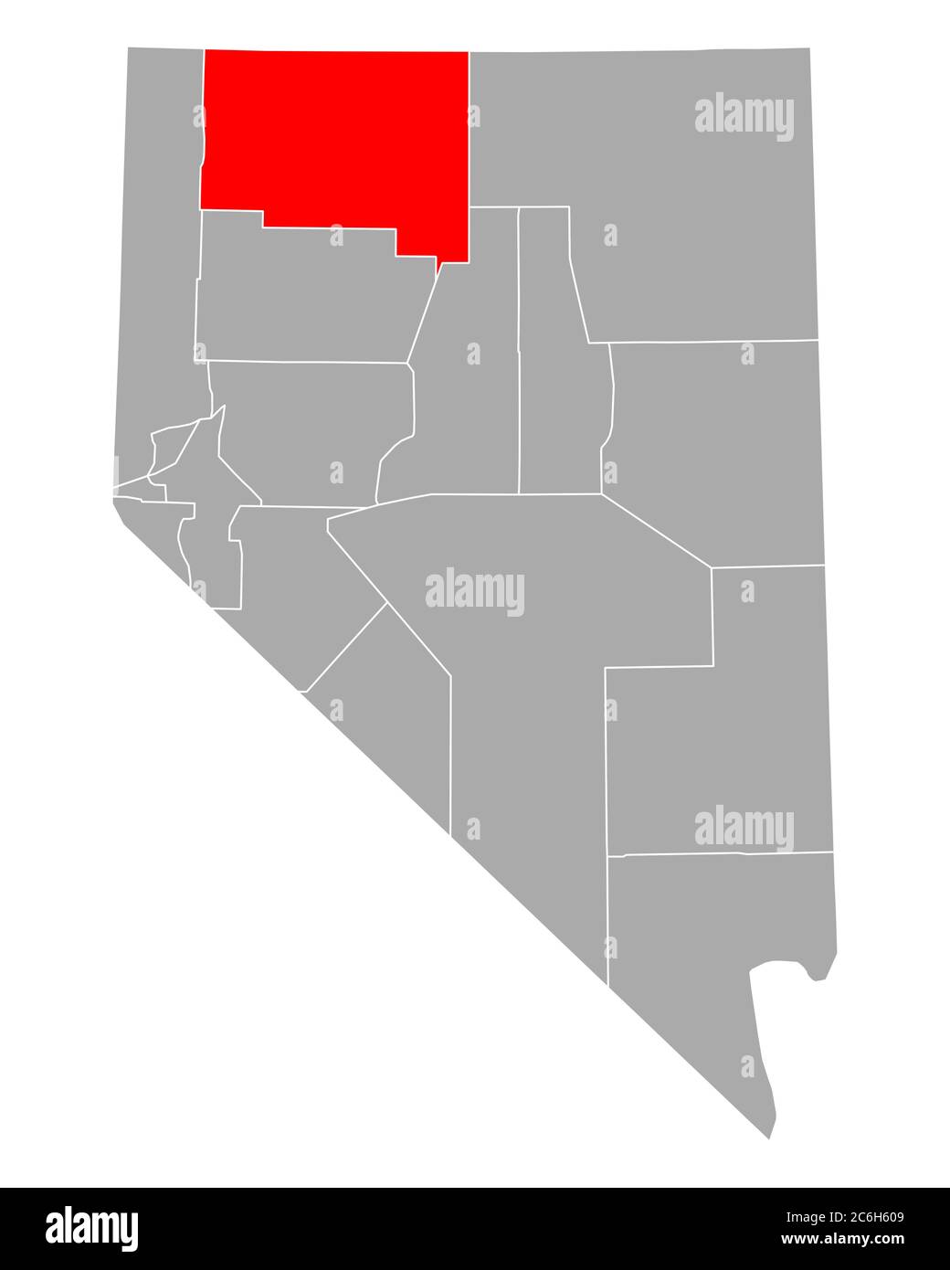 Map of Humboldt in Nevada Stock Photohttps://www.alamy.com/image-license-details/?v=1https://www.alamy.com/map-of-humboldt-in-nevada-image365483561.html
RF2C6H609–Map of Humboldt in Nevada
 Bolton-humboldt Stock Photohttps://www.alamy.com/image-license-details/?v=1https://www.alamy.com/stock-photo-bolton-humboldt-139504403.html
RMJ2XY83–Bolton-humboldt
 WORLD. Plant crop distribution. Humboldt Schouws;Palm pines Erica food, 1886 map Stock Photohttps://www.alamy.com/image-license-details/?v=1https://www.alamy.com/stock-photo-world-plant-crop-distribution-humboldt-schouwspalm-pines-erica-food-114756349.html
RFGJKGW1–WORLD. Plant crop distribution. Humboldt Schouws;Palm pines Erica food, 1886 map
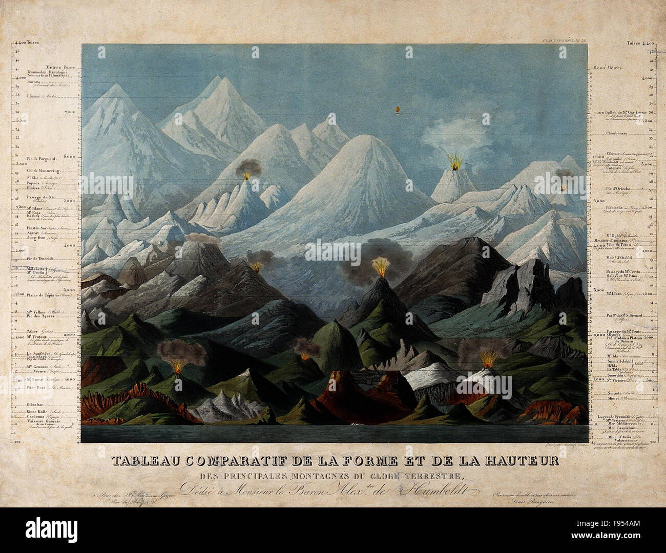 Geology: comparative shapes and heights of mountains. Coloured aquatint by A. Tardieu after L. Brugiere, 1817, and dedicated to Humboldt. The idea of comparative geology originated with Prussian geographer, naturalist and explorer Alexander von Humboldt (1769-1859). Between 1799 and 1804, Humboldt travelled extensively in Latin America, exploring and describing it for the first time in a manner generally considered to be a modern scientific point of view. Stock Photohttps://www.alamy.com/image-license-details/?v=1https://www.alamy.com/geology-comparative-shapes-and-heights-of-mountains-coloured-aquatint-by-a-tardieu-after-l-brugiere-1817-and-dedicated-to-humboldt-the-idea-of-comparative-geology-originated-with-prussian-geographer-naturalist-and-explorer-alexander-von-humboldt-1769-1859-between-1799-and-1804-humboldt-travelled-extensively-in-latin-america-exploring-and-describing-it-for-the-first-time-in-a-manner-generally-considered-to-be-a-modern-scientific-point-of-view-image246590252.html
RMT954AM–Geology: comparative shapes and heights of mountains. Coloured aquatint by A. Tardieu after L. Brugiere, 1817, and dedicated to Humboldt. The idea of comparative geology originated with Prussian geographer, naturalist and explorer Alexander von Humboldt (1769-1859). Between 1799 and 1804, Humboldt travelled extensively in Latin America, exploring and describing it for the first time in a manner generally considered to be a modern scientific point of view.
 Map of Humboldt in Iowa Stock Photohttps://www.alamy.com/image-license-details/?v=1https://www.alamy.com/map-of-humboldt-in-iowa-image443778110.html
RF2GNYRE6–Map of Humboldt in Iowa
 Justin Karp, right, an engineer with the Department of Forestry and Fire Protection (CAL FIRE) and assistant military liaison, discusses a map route with members of Task Force Alpha, California Army National Guard, Aug. 9 near he mountains of Wildcat Butte, Humboldt County, California. (U.S. Army National Guard photo/Staff Sgt. Eddie Siguenza) Stock Photohttps://www.alamy.com/image-license-details/?v=1https://www.alamy.com/stock-photo-justin-karp-right-an-engineer-with-the-department-of-forestry-and-172947368.html
RMM1AC3M–Justin Karp, right, an engineer with the Department of Forestry and Fire Protection (CAL FIRE) and assistant military liaison, discusses a map route with members of Task Force Alpha, California Army National Guard, Aug. 9 near he mountains of Wildcat Butte, Humboldt County, California. (U.S. Army National Guard photo/Staff Sgt. Eddie Siguenza)
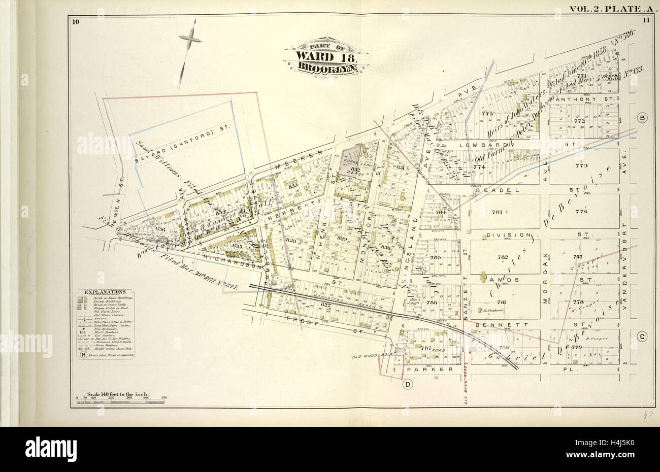 Vol. 2. Plate, A. Map bound by Bayard Sanford St., Meeker Ave., Vandervoort Ave., Parker Pl., Kingsland Ave., Frost St. Stock Photohttps://www.alamy.com/image-license-details/?v=1https://www.alamy.com/stock-photo-vol-2-plate-a-map-bound-by-bayard-sanford-st-meeker-ave-vandervoort-123330788.html
RMH4J5K0–Vol. 2. Plate, A. Map bound by Bayard Sanford St., Meeker Ave., Vandervoort Ave., Parker Pl., Kingsland Ave., Frost St.