Waltham abbey map Stock Photos and Images
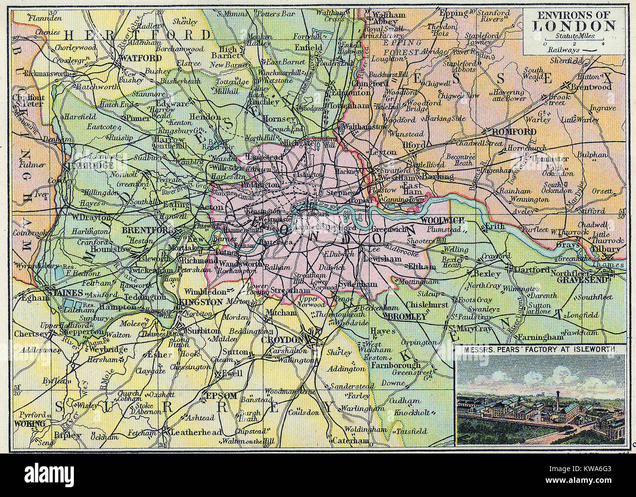 A coloured map of London, environs and surrounding towns and villages in 1923 with an advert for Pear Soap showing their factory at Islington and the main railway lines and roads. Stock Photohttps://www.alamy.com/image-license-details/?v=1https://www.alamy.com/stock-photo-a-coloured-map-of-london-environs-and-surrounding-towns-and-villages-170484387.html
RMKWA6G3–A coloured map of London, environs and surrounding towns and villages in 1923 with an advert for Pear Soap showing their factory at Islington and the main railway lines and roads.
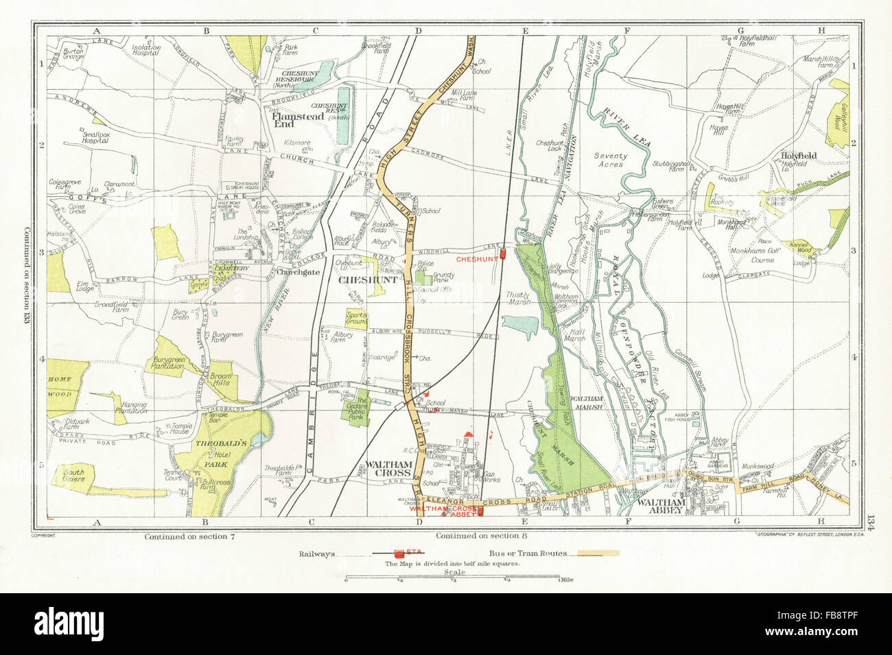 CHESHUNT. Waltham Cross, Waltham Abbey, Flamstead End, Hammond Street, 1933 map Stock Photohttps://www.alamy.com/image-license-details/?v=1https://www.alamy.com/stock-photo-cheshunt-waltham-cross-waltham-abbey-flamstead-end-hammond-street-93008119.html
RFFB8TPF–CHESHUNT. Waltham Cross, Waltham Abbey, Flamstead End, Hammond Street, 1933 map
 Cornmill Meadow in Waltham Abbey, part of the Lee Valley Park on the Essex/Hertfordshire border in southern England, UK Stock Photohttps://www.alamy.com/image-license-details/?v=1https://www.alamy.com/cornmill-meadow-in-waltham-abbey-part-of-the-lee-valley-park-on-the-essexhertfordshire-border-in-southern-england-uk-image230364310.html
RMRAP00P–Cornmill Meadow in Waltham Abbey, part of the Lee Valley Park on the Essex/Hertfordshire border in southern England, UK
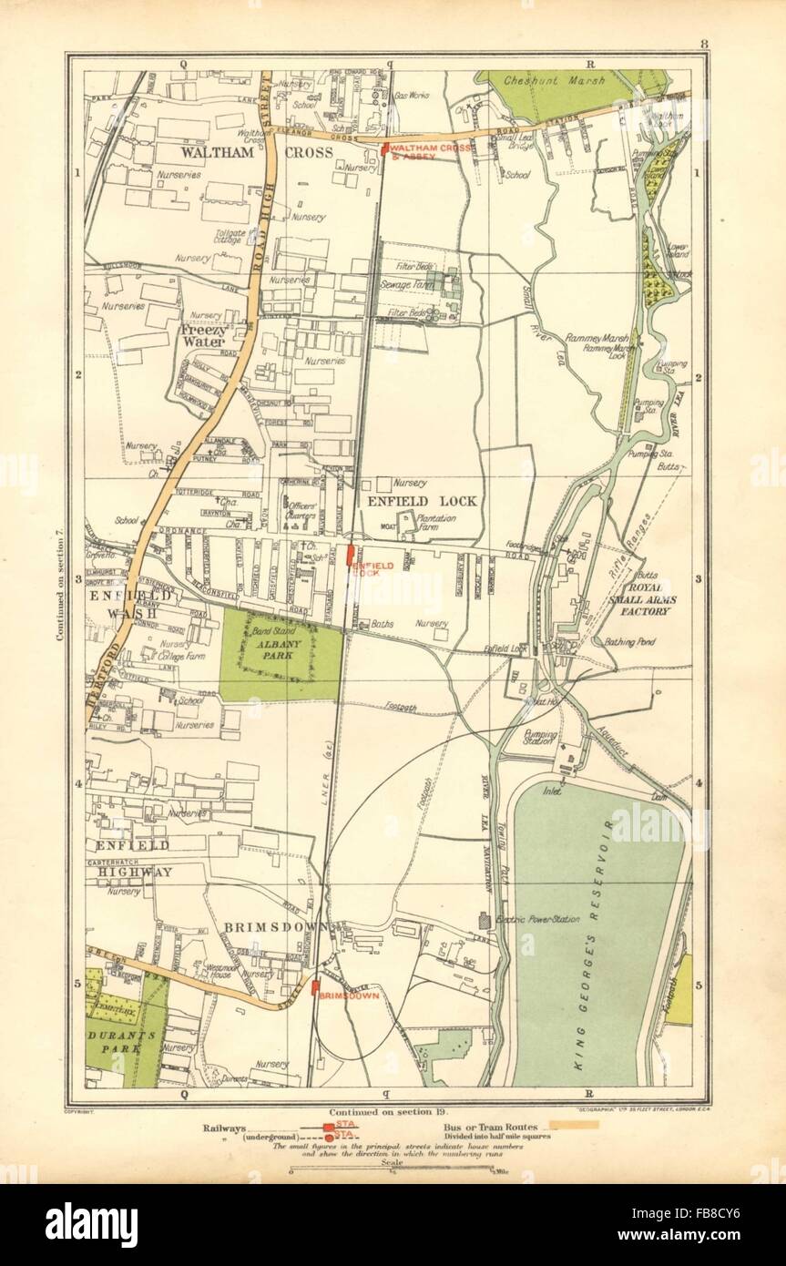 ENFIELD: Lock, Wash, Highway; Waltham Cross, Brimsdown, Freezy Water, 1928 map Stock Photohttps://www.alamy.com/image-license-details/?v=1https://www.alamy.com/stock-photo-enfield-lock-wash-highway-waltham-cross-brimsdown-freezy-water-1928-92998842.html
RFFB8CY6–ENFIELD: Lock, Wash, Highway; Waltham Cross, Brimsdown, Freezy Water, 1928 map
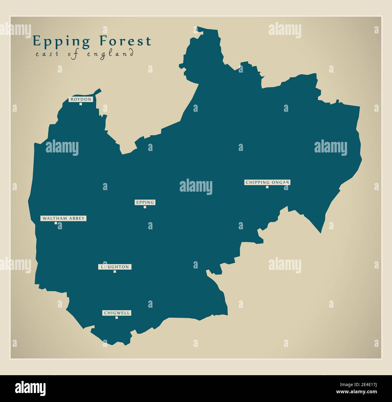 Epping Forest district map - England UK Stock Vectorhttps://www.alamy.com/image-license-details/?v=1https://www.alamy.com/epping-forest-district-map-england-uk-image398605414.html
RF2E4E17J–Epping Forest district map - England UK
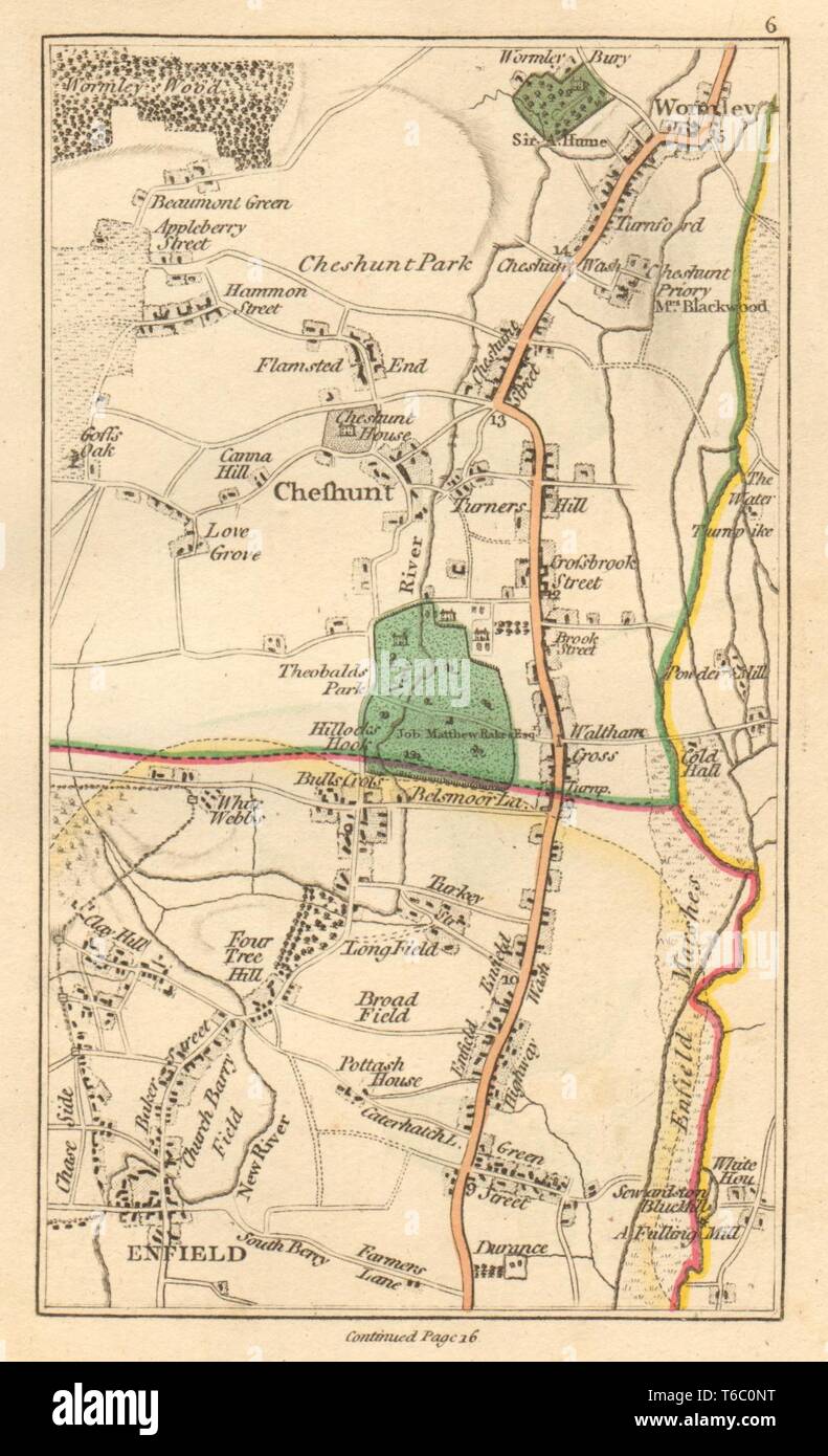 ENFIELD. Cheshunt, Waltham Cross, Waltham Abbey, Wormley, Goff's Oak 1811 map Stock Photohttps://www.alamy.com/image-license-details/?v=1https://www.alamy.com/enfield-cheshunt-waltham-cross-waltham-abbey-wormley-goffs-oak-1811-map-image244897124.html
RFT6C0NT–ENFIELD. Cheshunt, Waltham Cross, Waltham Abbey, Wormley, Goff's Oak 1811 map
 Waltham Abbey, Essex, GB, United Kingdom, England, N 51 40' 49'', N 0 1' 50'', map, Cartascapes Map published in 2024. Explore Cartascapes, a map revealing Earth's diverse landscapes, cultures, and ecosystems. Journey through time and space, discovering the interconnectedness of our planet's past, present, and future. Stock Photohttps://www.alamy.com/image-license-details/?v=1https://www.alamy.com/waltham-abbey-essex-gb-united-kingdom-england-n-51-40-49-n-0-1-50-map-cartascapes-map-published-in-2024-explore-cartascapes-a-map-revealing-earths-diverse-landscapes-cultures-and-ecosystems-journey-through-time-and-space-discovering-the-interconnectedness-of-our-planets-past-present-and-future-image604252328.html
RM2X32208–Waltham Abbey, Essex, GB, United Kingdom, England, N 51 40' 49'', N 0 1' 50'', map, Cartascapes Map published in 2024. Explore Cartascapes, a map revealing Earth's diverse landscapes, cultures, and ecosystems. Journey through time and space, discovering the interconnectedness of our planet's past, present, and future.
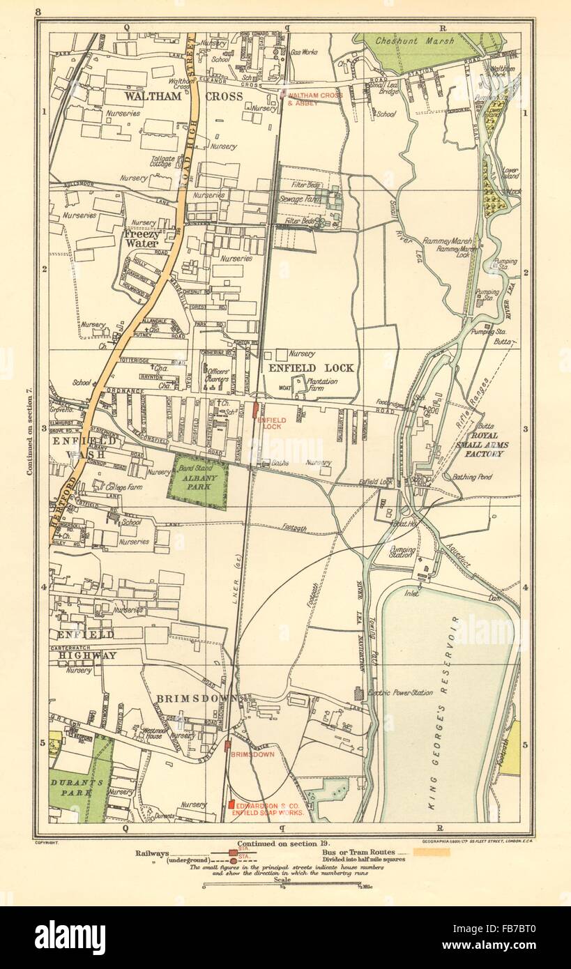 ENFIELD: Lock, Wash, Highway; Waltham Cross, Brimsdown, Freezy Water, 1923 map Stock Photohttps://www.alamy.com/image-license-details/?v=1https://www.alamy.com/stock-photo-enfield-lock-wash-highway-waltham-cross-brimsdown-freezy-water-1923-92976016.html
RFFB7BT0–ENFIELD: Lock, Wash, Highway; Waltham Cross, Brimsdown, Freezy Water, 1923 map
 Waltham Abbey Stock Photohttps://www.alamy.com/image-license-details/?v=1https://www.alamy.com/stock-photo-waltham-abbey-140704126.html
RMJ4WHFA–Waltham Abbey
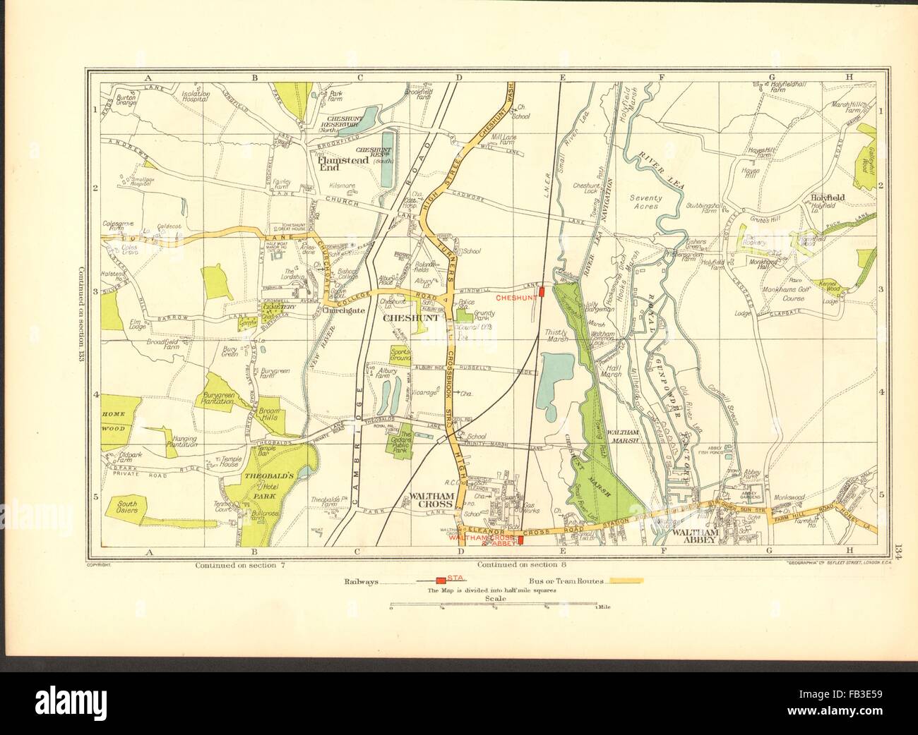 CHESHUNT: Waltham Cross, Waltham Abbey, Flamstead End, Hammond Street, 1937 map Stock Photohttps://www.alamy.com/image-license-details/?v=1https://www.alamy.com/stock-photo-cheshunt-waltham-cross-waltham-abbey-flamstead-end-hammond-street-92890037.html
RFFB3E59–CHESHUNT: Waltham Cross, Waltham Abbey, Flamstead End, Hammond Street, 1937 map
![WALTHAM ABBEY, ESSEX, SW. Author Jukes, Francis 13.18.1.a. Place of publication: [England] Publisher: [publisher not identified] Date of publication: [about 1794] Item type: 1 print Medium: aquatint and etching with hand-colouring Dimensions: platemark 17.1 x 24.1 cm, on sheet 25 x 33.2 cm Former owner: George III, King of Great Britain, 1738-1820 Stock Photo WALTHAM ABBEY, ESSEX, SW. Author Jukes, Francis 13.18.1.a. Place of publication: [England] Publisher: [publisher not identified] Date of publication: [about 1794] Item type: 1 print Medium: aquatint and etching with hand-colouring Dimensions: platemark 17.1 x 24.1 cm, on sheet 25 x 33.2 cm Former owner: George III, King of Great Britain, 1738-1820 Stock Photo](https://c8.alamy.com/comp/2E9GWN4/waltham-abbey-essex-sw-author-jukes-francis-13181a-place-of-publication-england-publisher-publisher-not-identified-date-of-publication-about-1794-item-type-1-print-medium-aquatint-and-etching-with-hand-colouring-dimensions-platemark-171-x-241-cm-on-sheet-25-x-332-cm-former-owner-george-iii-king-of-great-britain-1738-1820-2E9GWN4.jpg) WALTHAM ABBEY, ESSEX, SW. Author Jukes, Francis 13.18.1.a. Place of publication: [England] Publisher: [publisher not identified] Date of publication: [about 1794] Item type: 1 print Medium: aquatint and etching with hand-colouring Dimensions: platemark 17.1 x 24.1 cm, on sheet 25 x 33.2 cm Former owner: George III, King of Great Britain, 1738-1820 Stock Photohttps://www.alamy.com/image-license-details/?v=1https://www.alamy.com/waltham-abbey-essex-sw-author-jukes-francis-13181a-place-of-publication-england-publisher-publisher-not-identified-date-of-publication-about-1794-item-type-1-print-medium-aquatint-and-etching-with-hand-colouring-dimensions-platemark-171-x-241-cm-on-sheet-25-x-332-cm-former-owner-george-iii-king-of-great-britain-1738-1820-image401741792.html
WALTHAM ABBEY, ESSEX, SW. Author Jukes, Francis 13.18.1.a. Place of publication: [England] Publisher: [publisher not identified] Date of publication: [about 1794] Item type: 1 print Medium: aquatint and etching with hand-colouring Dimensions: platemark 17.1 x 24.1 cm, on sheet 25 x 33.2 cm Former owner: George III, King of Great Britain, 1738-1820 Stock Photohttps://www.alamy.com/image-license-details/?v=1https://www.alamy.com/waltham-abbey-essex-sw-author-jukes-francis-13181a-place-of-publication-england-publisher-publisher-not-identified-date-of-publication-about-1794-item-type-1-print-medium-aquatint-and-etching-with-hand-colouring-dimensions-platemark-171-x-241-cm-on-sheet-25-x-332-cm-former-owner-george-iii-king-of-great-britain-1738-1820-image401741792.htmlRM2E9GWN4–WALTHAM ABBEY, ESSEX, SW. Author Jukes, Francis 13.18.1.a. Place of publication: [England] Publisher: [publisher not identified] Date of publication: [about 1794] Item type: 1 print Medium: aquatint and etching with hand-colouring Dimensions: platemark 17.1 x 24.1 cm, on sheet 25 x 33.2 cm Former owner: George III, King of Great Britain, 1738-1820
 ENFIELD: Cheshunt, Waltham Cross, Waltham Abbey, Wormley, Goff's Oak, 1786 map Stock Photohttps://www.alamy.com/image-license-details/?v=1https://www.alamy.com/stock-photo-enfield-cheshunt-waltham-cross-waltham-abbey-wormley-goffs-oak-1786-102709354.html
RFFY2PR6–ENFIELD: Cheshunt, Waltham Cross, Waltham Abbey, Wormley, Goff's Oak, 1786 map
 . The Street railway journal . Street Ry.Jdur MAP OF LONDON BY BOROUGHS, SHOWING POPULATION PER ACRE franchises to do this class of work, would necessarily offer,can only be performed if the railway companies ihemselvesrealize their duty and seriously put their hand to the plowand effect a change rationally and not piecemeal, as, un-fortunately, seems to be quite probable. What is requiredis an interurban service between the towns which surroundLondon, such as Tilbury, Chelmsford, Brentford, Rom-ford, Epping Forest, Waltham Abbey, St. Albans, Wat-ford, Richmond, Rickmansworth, Uxbridge, Staine Stock Photohttps://www.alamy.com/image-license-details/?v=1https://www.alamy.com/the-street-railway-journal-street-ryjdur-map-of-london-by-boroughs-showing-population-per-acre-franchises-to-do-this-class-of-work-would-necessarily-offercan-only-be-performed-if-the-railway-companies-ihemselvesrealize-their-duty-and-seriously-put-their-hand-to-the-plowand-effect-a-change-rationally-and-not-piecemeal-as-un-fortunately-seems-to-be-quite-probable-what-is-requiredis-an-interurban-service-between-the-towns-which-surroundlondon-such-as-tilbury-chelmsford-brentford-rom-ford-epping-forest-waltham-abbey-st-albans-wat-ford-richmond-rickmansworth-uxbridge-staine-image371860167.html
RM2CGYKC7–. The Street railway journal . Street Ry.Jdur MAP OF LONDON BY BOROUGHS, SHOWING POPULATION PER ACRE franchises to do this class of work, would necessarily offer,can only be performed if the railway companies ihemselvesrealize their duty and seriously put their hand to the plowand effect a change rationally and not piecemeal, as, un-fortunately, seems to be quite probable. What is requiredis an interurban service between the towns which surroundLondon, such as Tilbury, Chelmsford, Brentford, Rom-ford, Epping Forest, Waltham Abbey, St. Albans, Wat-ford, Richmond, Rickmansworth, Uxbridge, Staine
 ECR(1851) p22b - Waltham Abbey Stock Photohttps://www.alamy.com/image-license-details/?v=1https://www.alamy.com/stock-photo-ecr1851-p22b-waltham-abbey-73513184.html
RME7GPPT–ECR(1851) p22b - Waltham Abbey
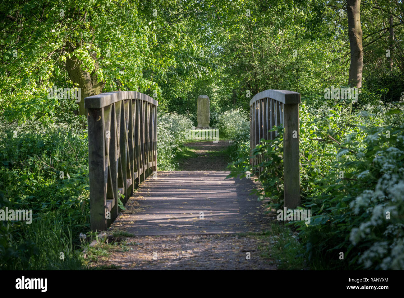 Cornmill Meadow in Waltham Abbey, part of the Lee Valley Park on the Essex/Hertfordshire border in southern England, UK Stock Photohttps://www.alamy.com/image-license-details/?v=1https://www.alamy.com/cornmill-meadow-in-waltham-abbey-part-of-the-lee-valley-park-on-the-essexhertfordshire-border-in-southern-england-uk-image230364252.html
RMRANYXM–Cornmill Meadow in Waltham Abbey, part of the Lee Valley Park on the Essex/Hertfordshire border in southern England, UK
 Waltham Abbey, Essex, GB, United Kingdom, England, N 51 40' 49'', N 0 1' 50'', map, Cartascapes Map published in 2024. Explore Cartascapes, a map revealing Earth's diverse landscapes, cultures, and ecosystems. Journey through time and space, discovering the interconnectedness of our planet's past, present, and future. Stock Photohttps://www.alamy.com/image-license-details/?v=1https://www.alamy.com/waltham-abbey-essex-gb-united-kingdom-england-n-51-40-49-n-0-1-50-map-cartascapes-map-published-in-2024-explore-cartascapes-a-map-revealing-earths-diverse-landscapes-cultures-and-ecosystems-journey-through-time-and-space-discovering-the-interconnectedness-of-our-planets-past-present-and-future-image604252327.html
RM2X32207–Waltham Abbey, Essex, GB, United Kingdom, England, N 51 40' 49'', N 0 1' 50'', map, Cartascapes Map published in 2024. Explore Cartascapes, a map revealing Earth's diverse landscapes, cultures, and ecosystems. Journey through time and space, discovering the interconnectedness of our planet's past, present, and future.
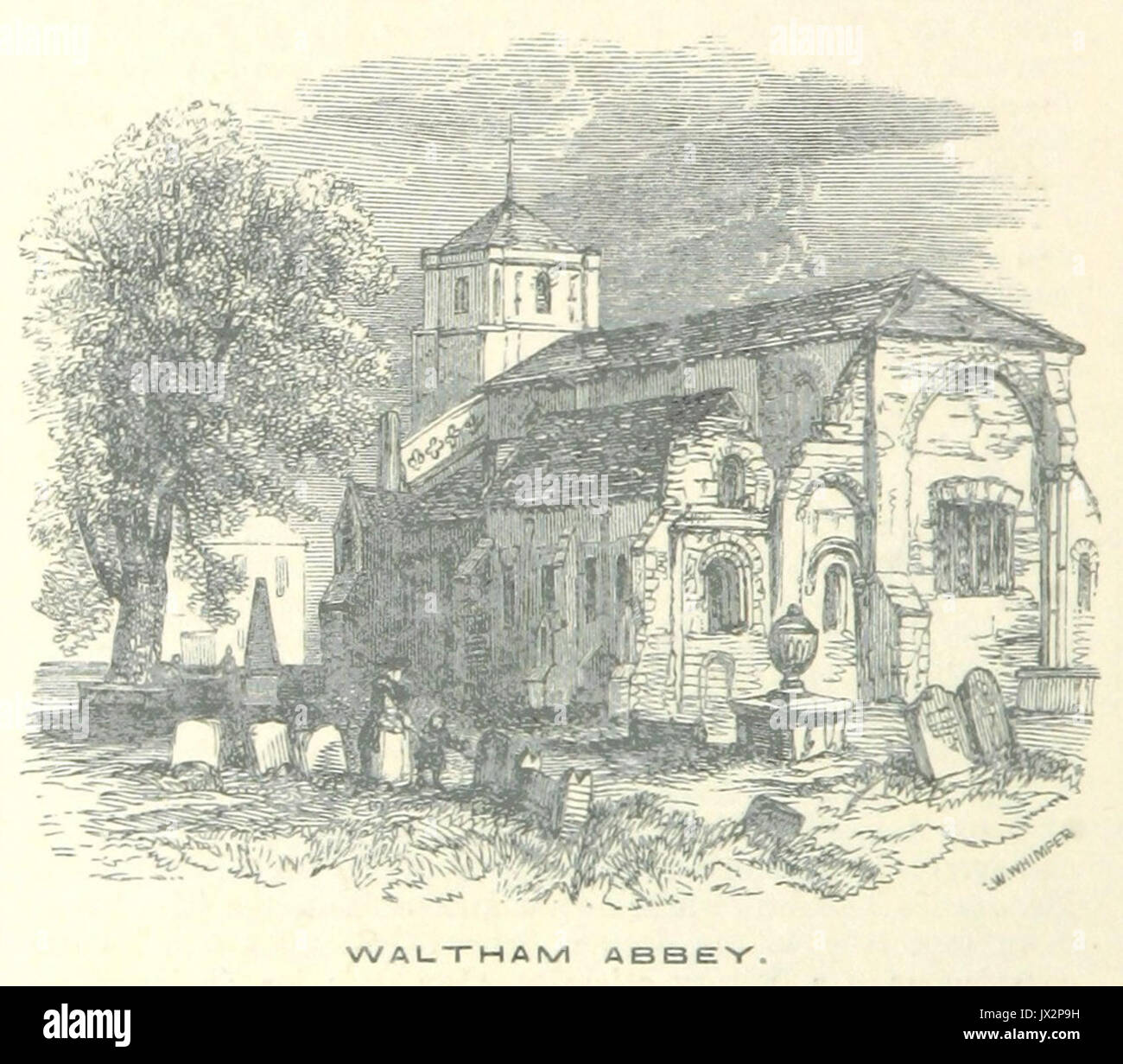 ECR(1851) p22b Waltham Abbey Stock Photohttps://www.alamy.com/image-license-details/?v=1https://www.alamy.com/ecr1851-p22b-waltham-abbey-image153725421.html
RMJX2P9H–ECR(1851) p22b Waltham Abbey
![WALTHAM ABBEY, ESSEX, NW. Author Jukes, Francis 13.18.1.b. Place of publication: [England] Publisher: [publisher not identified] Date of publication: [about 1794] Item type: 1 print Medium: aquatint and etching with hand-colouring Dimensions: platemark 17.1 x 24.1 cm, on sheet 24.8 x 33.4 cm Former owner: George III, King of Great Britain, 1738-1820 Stock Photo WALTHAM ABBEY, ESSEX, NW. Author Jukes, Francis 13.18.1.b. Place of publication: [England] Publisher: [publisher not identified] Date of publication: [about 1794] Item type: 1 print Medium: aquatint and etching with hand-colouring Dimensions: platemark 17.1 x 24.1 cm, on sheet 24.8 x 33.4 cm Former owner: George III, King of Great Britain, 1738-1820 Stock Photo](https://c8.alamy.com/comp/2E9GWNN/waltham-abbey-essex-nw-author-jukes-francis-13181b-place-of-publication-england-publisher-publisher-not-identified-date-of-publication-about-1794-item-type-1-print-medium-aquatint-and-etching-with-hand-colouring-dimensions-platemark-171-x-241-cm-on-sheet-248-x-334-cm-former-owner-george-iii-king-of-great-britain-1738-1820-2E9GWNN.jpg) WALTHAM ABBEY, ESSEX, NW. Author Jukes, Francis 13.18.1.b. Place of publication: [England] Publisher: [publisher not identified] Date of publication: [about 1794] Item type: 1 print Medium: aquatint and etching with hand-colouring Dimensions: platemark 17.1 x 24.1 cm, on sheet 24.8 x 33.4 cm Former owner: George III, King of Great Britain, 1738-1820 Stock Photohttps://www.alamy.com/image-license-details/?v=1https://www.alamy.com/waltham-abbey-essex-nw-author-jukes-francis-13181b-place-of-publication-england-publisher-publisher-not-identified-date-of-publication-about-1794-item-type-1-print-medium-aquatint-and-etching-with-hand-colouring-dimensions-platemark-171-x-241-cm-on-sheet-248-x-334-cm-former-owner-george-iii-king-of-great-britain-1738-1820-image401741809.html
WALTHAM ABBEY, ESSEX, NW. Author Jukes, Francis 13.18.1.b. Place of publication: [England] Publisher: [publisher not identified] Date of publication: [about 1794] Item type: 1 print Medium: aquatint and etching with hand-colouring Dimensions: platemark 17.1 x 24.1 cm, on sheet 24.8 x 33.4 cm Former owner: George III, King of Great Britain, 1738-1820 Stock Photohttps://www.alamy.com/image-license-details/?v=1https://www.alamy.com/waltham-abbey-essex-nw-author-jukes-francis-13181b-place-of-publication-england-publisher-publisher-not-identified-date-of-publication-about-1794-item-type-1-print-medium-aquatint-and-etching-with-hand-colouring-dimensions-platemark-171-x-241-cm-on-sheet-248-x-334-cm-former-owner-george-iii-king-of-great-britain-1738-1820-image401741809.htmlRM2E9GWNN–WALTHAM ABBEY, ESSEX, NW. Author Jukes, Francis 13.18.1.b. Place of publication: [England] Publisher: [publisher not identified] Date of publication: [about 1794] Item type: 1 print Medium: aquatint and etching with hand-colouring Dimensions: platemark 17.1 x 24.1 cm, on sheet 24.8 x 33.4 cm Former owner: George III, King of Great Britain, 1738-1820
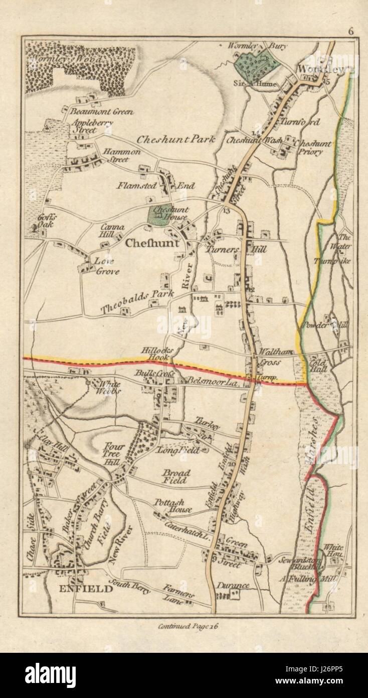 ENFIELD Cheshunt Waltham Cross Waltham Abbey Wormley Goff's Oak CARY 1786 map Stock Photohttps://www.alamy.com/image-license-details/?v=1https://www.alamy.com/stock-photo-enfield-cheshunt-waltham-cross-waltham-abbey-wormley-goffs-oak-cary-139061837.html
RFJ26PP5–ENFIELD Cheshunt Waltham Cross Waltham Abbey Wormley Goff's Oak CARY 1786 map
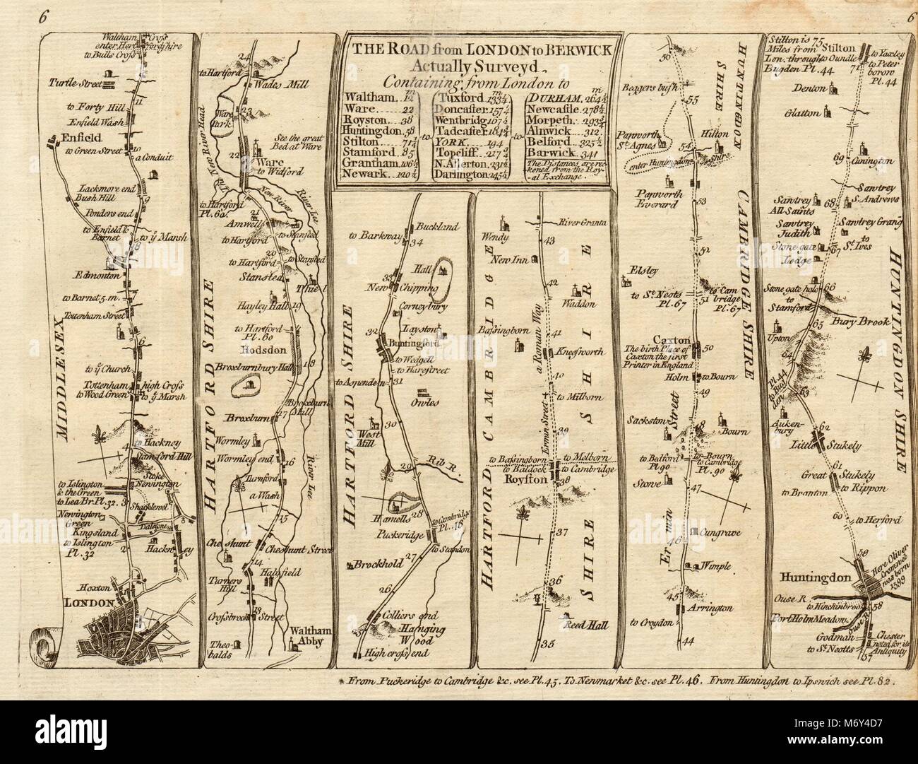 London Tottenham Enfield Waltham Hoddesdon Huntingdon. KITCHIN road map 1767 Stock Photohttps://www.alamy.com/image-license-details/?v=1https://www.alamy.com/stock-photo-london-tottenham-enfield-waltham-hoddesdon-huntingdon-kitchin-road-176387827.html
RFM6Y4D7–London Tottenham Enfield Waltham Hoddesdon Huntingdon. KITCHIN road map 1767
 ECR(1851) p22a - Waltham Abbey Gates Stock Photohttps://www.alamy.com/image-license-details/?v=1https://www.alamy.com/stock-photo-ecr1851-p22a-waltham-abbey-gates-73513183.html
RME7GPPR–ECR(1851) p22a - Waltham Abbey Gates
 London Tottenham Enfield Waltham Hoddesdon Huntingdon SENEX #5 road map 1719 Stock Photohttps://www.alamy.com/image-license-details/?v=1https://www.alamy.com/stock-photo-london-tottenham-enfield-waltham-hoddesdon-huntingdon-senex-5-road-176388001.html
RFM6Y4KD–London Tottenham Enfield Waltham Hoddesdon Huntingdon SENEX #5 road map 1719
 NE LONDON/ESSEX Stratford Barking Romford Epping Waltham Abbey. WELLER, 1862 map Stock Photohttps://www.alamy.com/image-license-details/?v=1https://www.alamy.com/stock-photo-ne-londonessex-stratford-barking-romford-epping-waltham-abbey-weller-92822744.html
RFFB0CA0–NE LONDON/ESSEX Stratford Barking Romford Epping Waltham Abbey. WELLER, 1862 map
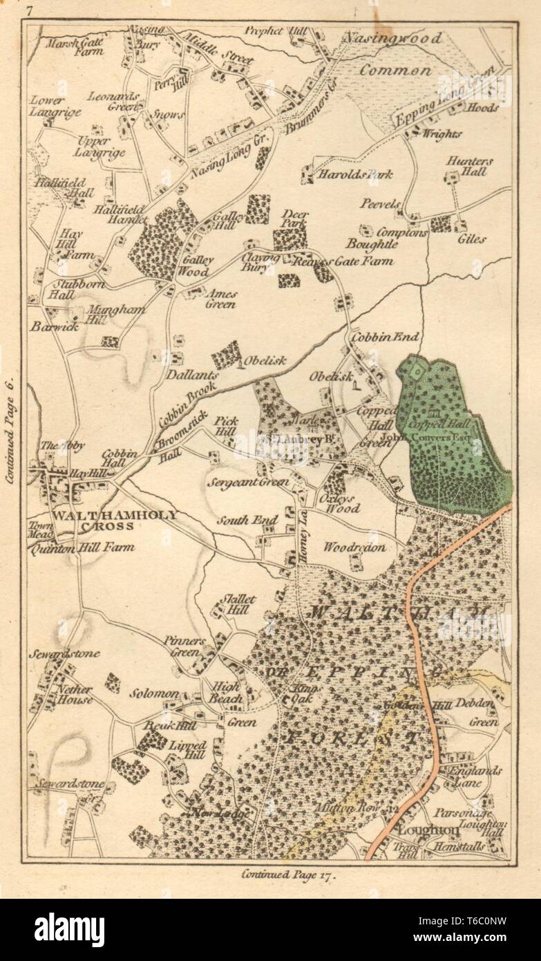 WALTHAM ABBEY. Loughton,Lower Nazeing,Sewardstone,High Beach,Wood Grn 1811 map Stock Photohttps://www.alamy.com/image-license-details/?v=1https://www.alamy.com/waltham-abbey-loughtonlower-nazeingsewardstonehigh-beachwood-grn-1811-map-image244897125.html
RFT6C0NW–WALTHAM ABBEY. Loughton,Lower Nazeing,Sewardstone,High Beach,Wood Grn 1811 map
 Cornmill Meadow in Waltham Abbey, part of the Lee Valley Park on the Essex/Hertfordshire border in southern England, UK Stock Photohttps://www.alamy.com/image-license-details/?v=1https://www.alamy.com/cornmill-meadow-in-waltham-abbey-part-of-the-lee-valley-park-on-the-essexhertfordshire-border-in-southern-england-uk-image230364258.html
RMRANYXX–Cornmill Meadow in Waltham Abbey, part of the Lee Valley Park on the Essex/Hertfordshire border in southern England, UK
 WALTHAM ABBEY Loughton Lower Nazeing Sewardstone High Beach Wood Grn 1786 map Stock Photohttps://www.alamy.com/image-license-details/?v=1https://www.alamy.com/stock-photo-waltham-abbey-loughton-lower-nazeing-sewardstone-high-beach-wood-grn-139061840.html
RFJ26PP8–WALTHAM ABBEY Loughton Lower Nazeing Sewardstone High Beach Wood Grn 1786 map
 Marriott Waltham Abbey, Essex, GB, United Kingdom, England, N 51 40' 53'', N 0 1' 44'', map, Cartascapes Map published in 2024. Explore Cartascapes, a map revealing Earth's diverse landscapes, cultures, and ecosystems. Journey through time and space, discovering the interconnectedness of our planet's past, present, and future. Stock Photohttps://www.alamy.com/image-license-details/?v=1https://www.alamy.com/marriott-waltham-abbey-essex-gb-united-kingdom-england-n-51-40-53-n-0-1-44-map-cartascapes-map-published-in-2024-explore-cartascapes-a-map-revealing-earths-diverse-landscapes-cultures-and-ecosystems-journey-through-time-and-space-discovering-the-interconnectedness-of-our-planets-past-present-and-future-image604201272.html
RM2X2YMTT–Marriott Waltham Abbey, Essex, GB, United Kingdom, England, N 51 40' 53'', N 0 1' 44'', map, Cartascapes Map published in 2024. Explore Cartascapes, a map revealing Earth's diverse landscapes, cultures, and ecosystems. Journey through time and space, discovering the interconnectedness of our planet's past, present, and future.
 ECR(1851) p22a Waltham Abbey Gates Stock Photohttps://www.alamy.com/image-license-details/?v=1https://www.alamy.com/ecr1851-p22a-waltham-abbey-gates-image153725406.html
RMJX2P92–ECR(1851) p22a Waltham Abbey Gates
![Image taken from page 119 of 'The Parish of Waltham Abbey, its history and antiquities. [With illustrations.]' Image taken from page 119 of 'The Paris Stock Photo Image taken from page 119 of 'The Parish of Waltham Abbey, its history and antiquities. [With illustrations.]' Image taken from page 119 of 'The Paris Stock Photo](https://c8.alamy.com/comp/HK4GHP/image-taken-from-page-119-of-the-parish-of-waltham-abbey-its-history-HK4GHP.jpg) Image taken from page 119 of 'The Parish of Waltham Abbey, its history and antiquities. [With illustrations.]' Image taken from page 119 of 'The Paris Stock Photohttps://www.alamy.com/image-license-details/?v=1https://www.alamy.com/stock-photo-image-taken-from-page-119-of-the-parish-of-waltham-abbey-its-history-132251890.html
Image taken from page 119 of 'The Parish of Waltham Abbey, its history and antiquities. [With illustrations.]' Image taken from page 119 of 'The Paris Stock Photohttps://www.alamy.com/image-license-details/?v=1https://www.alamy.com/stock-photo-image-taken-from-page-119-of-the-parish-of-waltham-abbey-its-history-132251890.htmlRMHK4GHP–Image taken from page 119 of 'The Parish of Waltham Abbey, its history and antiquities. [With illustrations.]' Image taken from page 119 of 'The Paris
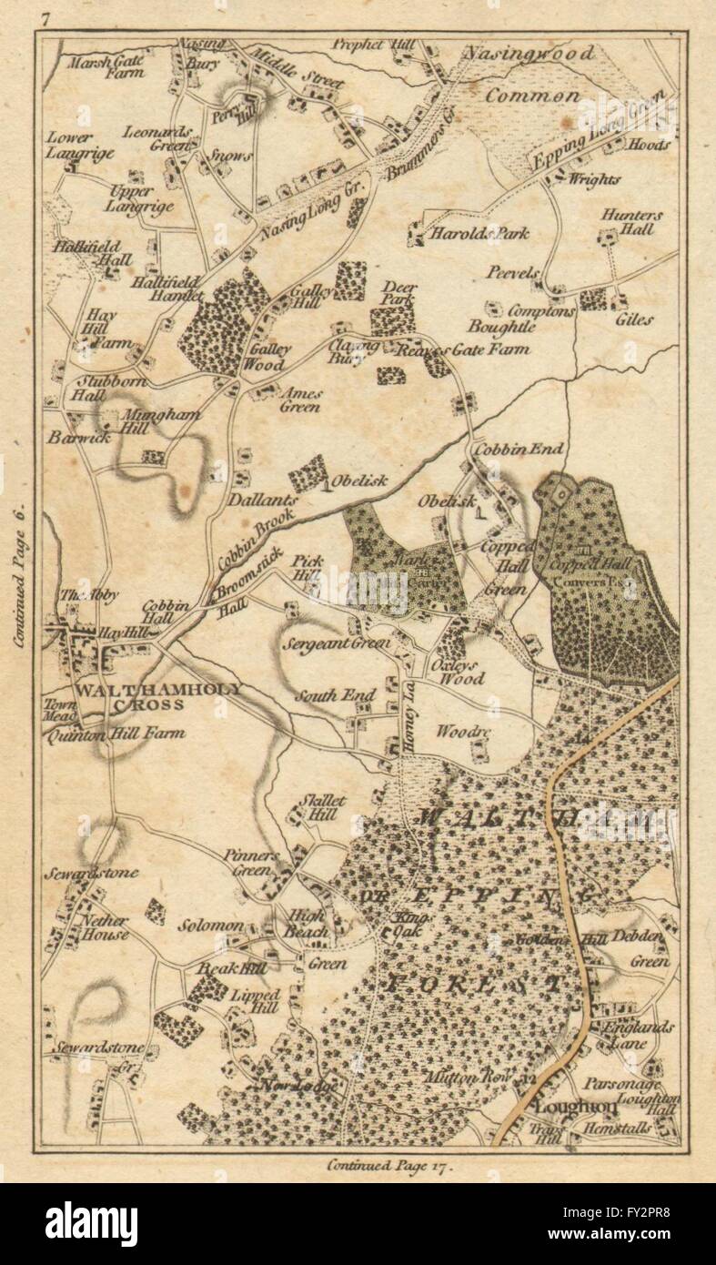 WALTHAM ABBEY: Loughton,Lower Nazeing,Sewardstone,High Beach,Wood Grn, 1786 map Stock Photohttps://www.alamy.com/image-license-details/?v=1https://www.alamy.com/stock-photo-waltham-abbey-loughtonlower-nazeingsewardstonehigh-beachwood-grn-1786-102709356.html
RFFY2PR8–WALTHAM ABBEY: Loughton,Lower Nazeing,Sewardstone,High Beach,Wood Grn, 1786 map
 First World War German Airship raid September 1915 Greenwich Woolwich Waltham Abbey 1930 map Stock Photohttps://www.alamy.com/image-license-details/?v=1https://www.alamy.com/first-world-war-german-airship-raid-september-1915-greenwich-woolwich-waltham-abbey-1930-map-image352330523.html
RF2BD614Y–First World War German Airship raid September 1915 Greenwich Woolwich Waltham Abbey 1930 map
 Waltham Abbey, Essex, GB, United Kingdom, England, N 51 41' 13'', S 0 0' 15'', map, Cartascapes Map published in 2024. Explore Cartascapes, a map revealing Earth's diverse landscapes, cultures, and ecosystems. Journey through time and space, discovering the interconnectedness of our planet's past, present, and future. Stock Photohttps://www.alamy.com/image-license-details/?v=1https://www.alamy.com/waltham-abbey-essex-gb-united-kingdom-england-n-51-41-13-s-0-0-15-map-cartascapes-map-published-in-2024-explore-cartascapes-a-map-revealing-earths-diverse-landscapes-cultures-and-ecosystems-journey-through-time-and-space-discovering-the-interconnectedness-of-our-planets-past-present-and-future-image604144377.html
RM2X2W48W–Waltham Abbey, Essex, GB, United Kingdom, England, N 51 41' 13'', S 0 0' 15'', map, Cartascapes Map published in 2024. Explore Cartascapes, a map revealing Earth's diverse landscapes, cultures, and ecosystems. Journey through time and space, discovering the interconnectedness of our planet's past, present, and future.
 NE LONDON/ESSEX Stratford Barking Romford Epping Waltham Abbey. WELLER, 1863 map Stock Photohttps://www.alamy.com/image-license-details/?v=1https://www.alamy.com/stock-photo-ne-londonessex-stratford-barking-romford-epping-waltham-abbey-weller-115578526.html
RFGM11GE–NE LONDON/ESSEX Stratford Barking Romford Epping Waltham Abbey. WELLER, 1863 map
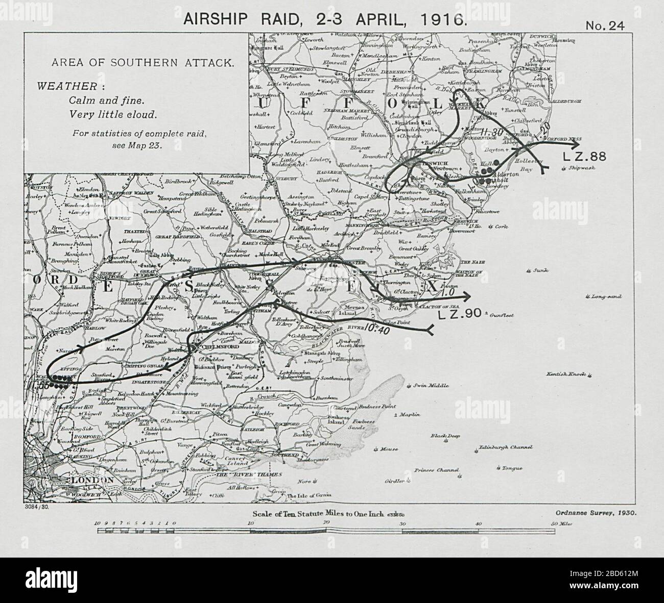 First World War German Airship raid 2-3 April 1916 Waltham Abbey Bawdsey Essex 1930 map Stock Photohttps://www.alamy.com/image-license-details/?v=1https://www.alamy.com/first-world-war-german-airship-raid-2-3-april-1916-waltham-abbey-bawdsey-essex-1930-map-image352330460.html
RF2BD612M–First World War German Airship raid 2-3 April 1916 Waltham Abbey Bawdsey Essex 1930 map
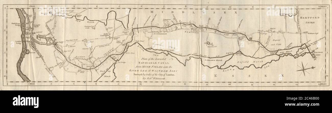 Plan of the intended navigable canal… River Lee Navigation. WHITWORTH 1774 map Stock Photohttps://www.alamy.com/image-license-details/?v=1https://www.alamy.com/plan-of-the-intended-navigable-canal-river-lee-navigation-whitworth-1774-map-image364016688.html
RF2C46B00–Plan of the intended navigable canal… River Lee Navigation. WHITWORTH 1774 map
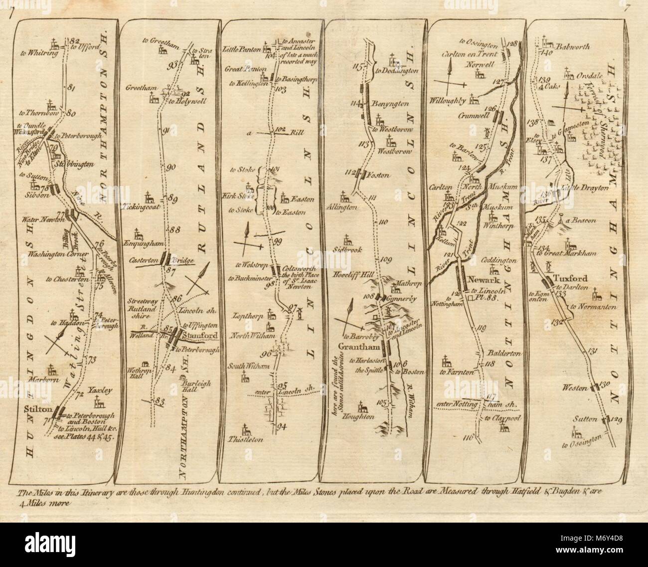 Stilton Stamford Coltsworth Grantham Newark Tuxford. KITCHIN road map 1767 Stock Photohttps://www.alamy.com/image-license-details/?v=1https://www.alamy.com/stock-photo-stilton-stamford-coltsworth-grantham-newark-tuxford-kitchin-road-map-176387828.html
RFM6Y4D8–Stilton Stamford Coltsworth Grantham Newark Tuxford. KITCHIN road map 1767
![The Parish of Waltham Abbey, its history and antiquities. [With illustrations.] Image taken from page 112 of 'The Paris Stock Photo The Parish of Waltham Abbey, its history and antiquities. [With illustrations.] Image taken from page 112 of 'The Paris Stock Photo](https://c8.alamy.com/comp/HK4E3R/the-parish-of-waltham-abbey-its-history-and-antiquities-with-illustrations-HK4E3R.jpg) The Parish of Waltham Abbey, its history and antiquities. [With illustrations.] Image taken from page 112 of 'The Paris Stock Photohttps://www.alamy.com/image-license-details/?v=1https://www.alamy.com/stock-photo-the-parish-of-waltham-abbey-its-history-and-antiquities-with-illustrations-132249931.html
The Parish of Waltham Abbey, its history and antiquities. [With illustrations.] Image taken from page 112 of 'The Paris Stock Photohttps://www.alamy.com/image-license-details/?v=1https://www.alamy.com/stock-photo-the-parish-of-waltham-abbey-its-history-and-antiquities-with-illustrations-132249931.htmlRMHK4E3R–The Parish of Waltham Abbey, its history and antiquities. [With illustrations.] Image taken from page 112 of 'The Paris
 EASTERN COUNTIES RAILWAY 2. London to Cambridge Ely & Norwich. WELLER, 1863 map Stock Photohttps://www.alamy.com/image-license-details/?v=1https://www.alamy.com/stock-photo-eastern-counties-railway-2-london-to-cambridge-ely-norwich-weller-115535187.html
RFGKY28K–EASTERN COUNTIES RAILWAY 2. London to Cambridge Ely & Norwich. WELLER, 1863 map
 LONDON & HOME COUNTIES: Hertfordshire Middlesex Chilterns Luton. CARY, 1794 map Stock Photohttps://www.alamy.com/image-license-details/?v=1https://www.alamy.com/stock-photo-london-home-counties-hertfordshire-middlesex-chilterns-luton-cary-107093868.html
RFG66F90–LONDON & HOME COUNTIES: Hertfordshire Middlesex Chilterns Luton. CARY, 1794 map
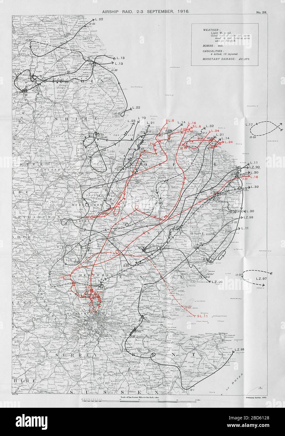 First World War German Airship raid September 1916 Eastern England Norfolk Enfield 1930 map Stock Photohttps://www.alamy.com/image-license-details/?v=1https://www.alamy.com/first-world-war-german-airship-raid-september-1916-eastern-england-norfolk-enfield-1930-map-image352330448.html
RF2BD6128–First World War German Airship raid September 1916 Eastern England Norfolk Enfield 1930 map
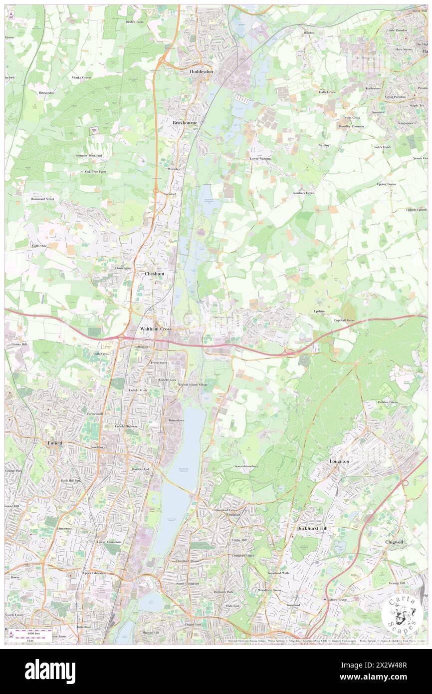 Waltham Abbey, Essex, GB, United Kingdom, England, N 51 41' 13'', S 0 0' 15'', map, Cartascapes Map published in 2024. Explore Cartascapes, a map revealing Earth's diverse landscapes, cultures, and ecosystems. Journey through time and space, discovering the interconnectedness of our planet's past, present, and future. Stock Photohttps://www.alamy.com/image-license-details/?v=1https://www.alamy.com/waltham-abbey-essex-gb-united-kingdom-england-n-51-41-13-s-0-0-15-map-cartascapes-map-published-in-2024-explore-cartascapes-a-map-revealing-earths-diverse-landscapes-cultures-and-ecosystems-journey-through-time-and-space-discovering-the-interconnectedness-of-our-planets-past-present-and-future-image604144375.html
RM2X2W48R–Waltham Abbey, Essex, GB, United Kingdom, England, N 51 41' 13'', S 0 0' 15'', map, Cartascapes Map published in 2024. Explore Cartascapes, a map revealing Earth's diverse landscapes, cultures, and ecosystems. Journey through time and space, discovering the interconnectedness of our planet's past, present, and future.
![The Parish of Waltham Abbey, its history and antiquities. [With illustrations.] Image taken from page 48 of 'The Paris Stock Photo The Parish of Waltham Abbey, its history and antiquities. [With illustrations.] Image taken from page 48 of 'The Paris Stock Photo](https://c8.alamy.com/comp/HK8G9E/the-parish-of-waltham-abbey-its-history-and-antiquities-with-illustrations-HK8G9E.jpg) The Parish of Waltham Abbey, its history and antiquities. [With illustrations.] Image taken from page 48 of 'The Paris Stock Photohttps://www.alamy.com/image-license-details/?v=1https://www.alamy.com/stock-photo-the-parish-of-waltham-abbey-its-history-and-antiquities-with-illustrations-132339466.html
The Parish of Waltham Abbey, its history and antiquities. [With illustrations.] Image taken from page 48 of 'The Paris Stock Photohttps://www.alamy.com/image-license-details/?v=1https://www.alamy.com/stock-photo-the-parish-of-waltham-abbey-its-history-and-antiquities-with-illustrations-132339466.htmlRMHK8G9E–The Parish of Waltham Abbey, its history and antiquities. [With illustrations.] Image taken from page 48 of 'The Paris
 Waltham Abbey, Essex, United Kingdom, England, N 51 41' 13'', W 0 0' 15'', map, Timeless Map published in 2021. Travelers, explorers and adventurers like Florence Nightingale, David Livingstone, Ernest Shackleton, Lewis and Clark and Sherlock Holmes relied on maps to plan travels to the world's most remote corners, Timeless Maps is mapping most locations on the globe, showing the achievement of great dreams Stock Photohttps://www.alamy.com/image-license-details/?v=1https://www.alamy.com/waltham-abbey-essex-united-kingdom-england-n-51-41-13-w-0-0-15-map-timeless-map-published-in-2021-travelers-explorers-and-adventurers-like-florence-nightingale-david-livingstone-ernest-shackleton-lewis-and-clark-and-sherlock-holmes-relied-on-maps-to-plan-travels-to-the-worlds-most-remote-corners-timeless-maps-is-mapping-most-locations-on-the-globe-showing-the-achievement-of-great-dreams-image439417134.html
RM2GEW512–Waltham Abbey, Essex, United Kingdom, England, N 51 41' 13'', W 0 0' 15'', map, Timeless Map published in 2021. Travelers, explorers and adventurers like Florence Nightingale, David Livingstone, Ernest Shackleton, Lewis and Clark and Sherlock Holmes relied on maps to plan travels to the world's most remote corners, Timeless Maps is mapping most locations on the globe, showing the achievement of great dreams
![The Parish of Waltham Abbey, its history and antiquities. [With illustrations.] Image taken from page 8 of 'The Paris Stock Photo The Parish of Waltham Abbey, its history and antiquities. [With illustrations.] Image taken from page 8 of 'The Paris Stock Photo](https://c8.alamy.com/comp/HK9RHF/the-parish-of-waltham-abbey-its-history-and-antiquities-with-illustrations-HK9RHF.jpg) The Parish of Waltham Abbey, its history and antiquities. [With illustrations.] Image taken from page 8 of 'The Paris Stock Photohttps://www.alamy.com/image-license-details/?v=1https://www.alamy.com/stock-photo-the-parish-of-waltham-abbey-its-history-and-antiquities-with-illustrations-132367131.html
The Parish of Waltham Abbey, its history and antiquities. [With illustrations.] Image taken from page 8 of 'The Paris Stock Photohttps://www.alamy.com/image-license-details/?v=1https://www.alamy.com/stock-photo-the-parish-of-waltham-abbey-its-history-and-antiquities-with-illustrations-132367131.htmlRMHK9RHF–The Parish of Waltham Abbey, its history and antiquities. [With illustrations.] Image taken from page 8 of 'The Paris