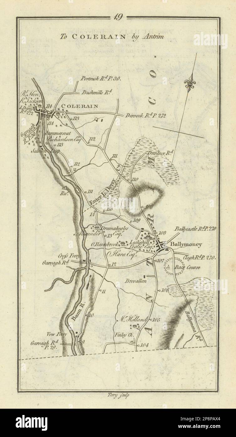
#19 Dublin to Coleraine. Ballymoney Londonderry. TAYLOR/SKINNER 1778 old map
RFID:Image ID:2P8PAX4
Image details
Contributor:
Antiqua Print Gallery / Alamy Stock PhotoImage ID:
2P8PAX4File size:
49 MB (1.8 MB Compressed download)Releases:
Model - no | Property - noDo I need a release?Dimensions:
3150 x 5432 px | 26.7 x 46 cm | 10.5 x 18.1 inches | 300dpiDate taken:
1778Location:
LondonderryMore information:
This image could have imperfections as it’s either historical or reportage.
[Road from Dublin] to Colerain by Antrim. Artist/engraver/cartographer: George Taylor & Andrew Skinner. Provenance: "Taylor and Skinner's maps of the Roads of Ireland", surveyed 1777, published for the authors as the Act directs 14th November 1778. Sold by G. Nicol, Strand; I. Murray, Fleet Street, London and by W. Wilson, No. 6 Dame Street, Dublin. Type: Antique copperplate road map. The map includes the towns of Ballymoney, Coleraine and covers part of the counties of Londonderry, Antrim