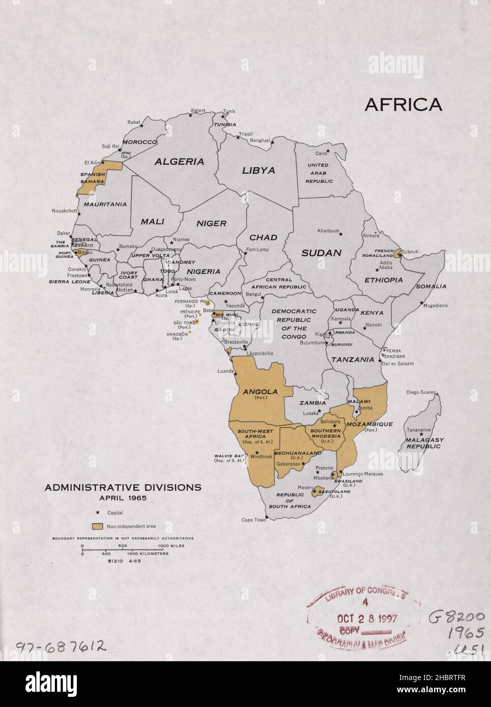
1960s Africa administrative divisions map - shows countries, capitals, and non-independent countries ca. 1965
RMID:Image ID:2HBRTFR
Image details
Contributor:
Hum Images / Alamy Stock PhotoImage ID:
2HBRTFRFile size:
40.4 MB (1.3 MB Compressed download)Releases:
Model - no | Property - noDo I need a release?Dimensions:
3238 x 4359 px | 27.4 x 36.9 cm | 10.8 x 14.5 inches | 300dpiDate taken:
1960More information:
This image could have imperfections as it’s either historical or reportage.