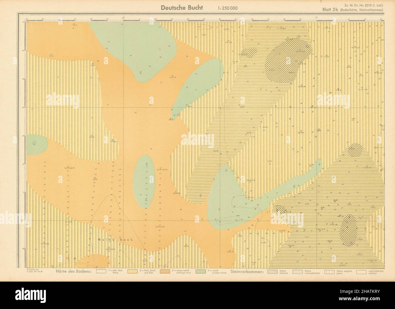
3b. German Bight north. North Sea. KRIEGSMARINE Nazi map 1940 old vintage
RFID:Image ID:2HATKRY
Image details
Contributor:
Antiqua Print Gallery / Alamy Stock PhotoImage ID:
2HATKRYFile size:
80.3 MB (4.4 MB Compressed download)Releases:
Model - no | Property - noDo I need a release?Dimensions:
6280 x 4470 px | 53.2 x 37.8 cm | 20.9 x 14.9 inches | 300dpiDate taken:
1940Location:
North SeaMore information:
This image could have imperfections as it’s either historical or reportage.
Blatt 3b. Bodenhärte. Steinvorkommen. Deutch Bucht [Sheet 3b. Soil hardness. Stone deposits. German Bight]. Artist/engraver/cartographer: . Provenance: Oberkommando der Kriegsmarine. Nr. 2310 - Prüf-Nr. 1036 - Atlas der Bondenbeschaffenheit des Meeres. Südliche Nordsee und Deutsche Bucht. Bearbeitet von der Deutschen Seewarte [High Command of the Navy of Nazi Germany. Atlas of the nature of the seabed. Southern North Sea and German Bight. Edited by the German Naval Observatory]. Type: Vintage Nazi Second World War German naval chart.