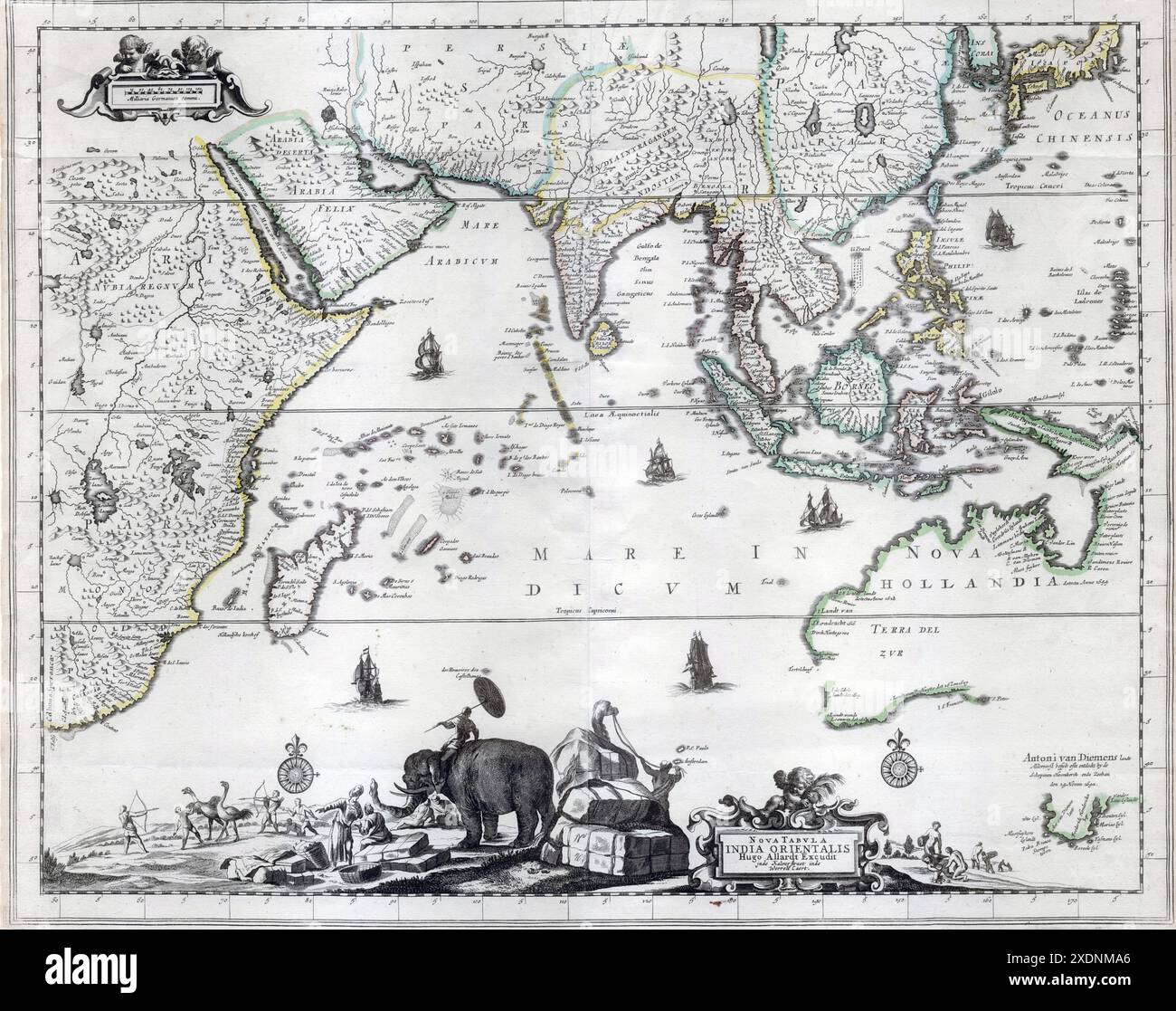
A decorative late 17th century Dutch map of the East Indies and Australia, incorporating the discoveries of Abel Tasman's two voyages (1642-44). The map appeared first in Carel Allard's Atlas Maior in 1697. This second map is from his son Hugo's imprint of circa 1702-1705. The map extends across the whole of the Indian Ocean, from the Cape of Good Hope to the East Indies, Japan and Australia. A decorative catouche at the bottom of the map illustrates Asian merchants, traders, elephants, camels and a native African ostrich hunt. Includes details of the early seventeeth century discoveries in th
Image details
Contributor:
Lakeview Images / Alamy Stock PhotoImage ID:
2XDNMA6File size:
88.6 MB (5.7 MB Compressed download)Releases:
Model - no | Property - noDo I need a release?Dimensions:
6260 x 4947 px | 53 x 41.9 cm | 20.9 x 16.5 inches | 300dpiDate taken:
1850Location:
New ZealandMore information:
This image is a public domain image, which means either that copyright has expired in the image or the copyright holder has waived their copyright. Alamy charges you a fee for access to the high resolution copy of the image.
This image could have imperfections as it’s either historical or reportage.
A decorative late 17th century Dutch map of the East Indies and Australia, incorporating the discoveries of Abel Tasman's two voyages (1642-44). The map appeared first in Carel Allard's Atlas Maior in 1697. This second map is from his son Hugo's imprint of circa 1702-1705. The map extends across the whole of the Indian Ocean, from the Cape of Good Hope to the East Indies, Japan and Australia. A decorative catouche at the bottom of the map illustrates Asian merchants, traders, elephants, camels and a native African ostrich hunt. Includes details of the early seventeeth century discoveries in the West and South West of Australia