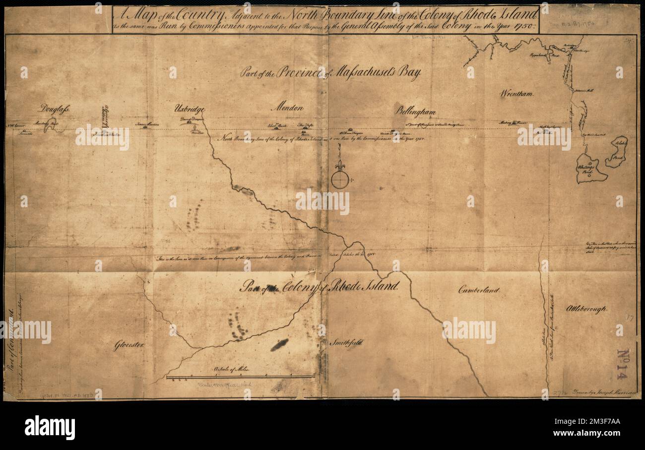
A map of the country adjacent to the north boundary line of the colony of Rhode Island as the same was run by commissioners appointed for that purpose by the general assembly of the said colony in the year 1750 , Massachusetts, Maps, Early works to 1800, Rhode Island, Maps, Early works to 1800 Norman B. Leventhal Map Center Collection
RMID:Image ID:2M3F7AA
Image details
Contributor:
piemags/DCM / Alamy Stock PhotoImage ID:
2M3F7AAFile size:
161.4 MB (6.2 MB Compressed download)Releases:
Model - no | Property - noDo I need a release?Dimensions:
9465 x 5959 px | 80.1 x 50.5 cm | 31.6 x 19.9 inches | 300dpiMore information:
This image is a public domain image, which means either that copyright has expired in the image or the copyright holder has waived their copyright. Alamy charges you a fee for access to the high resolution copy of the image.
This image could have imperfections as it’s either historical or reportage.