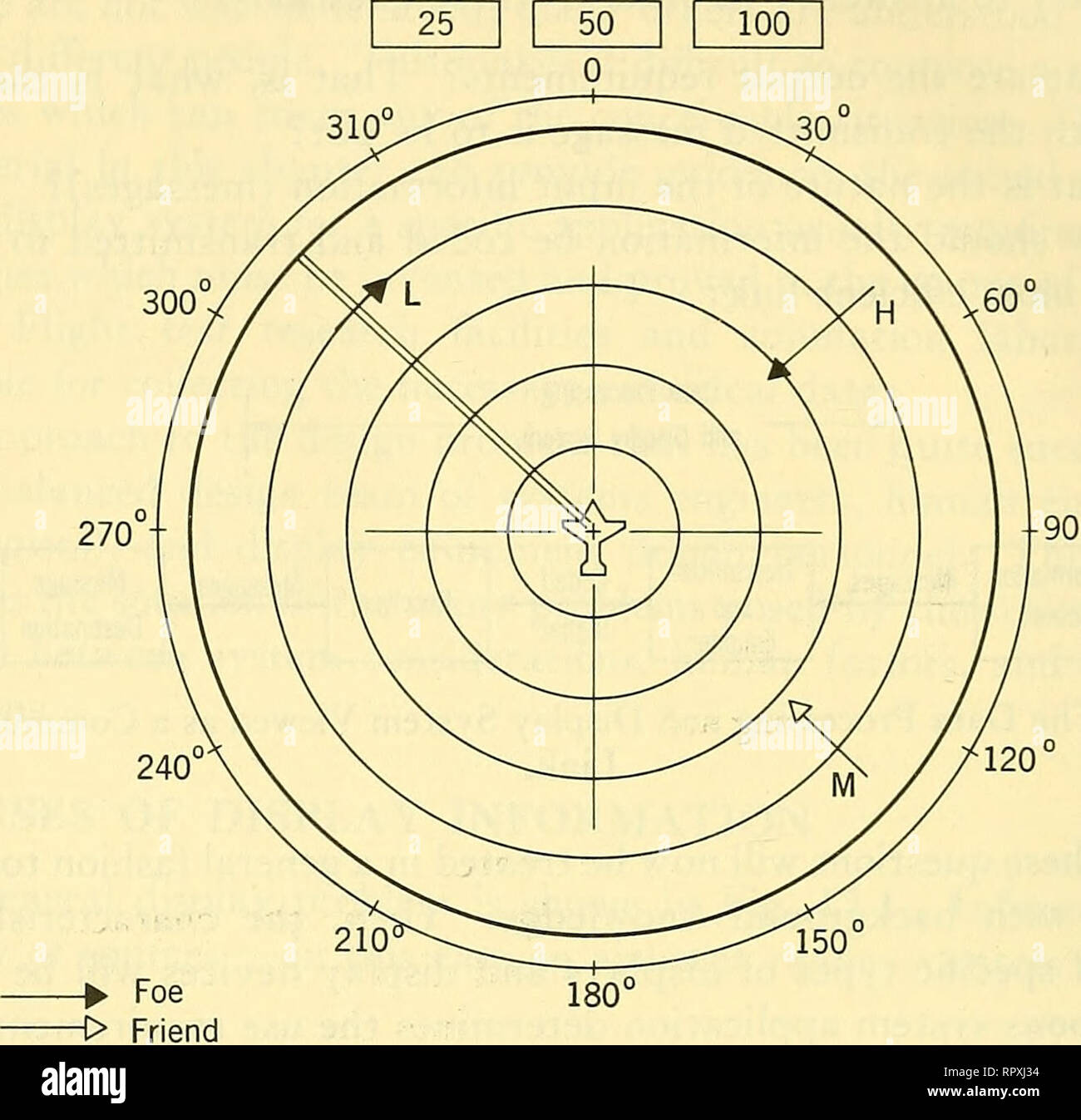
. Airborne radar. Airplanes; Guided missiles. 610 DISPLAY SYSTEM DESIGN PROBLEMS Radar Range. Low Speed - Moderate Speed — High Speed Altitude L - Low M - iVledium H - High Fig. 12-3 Hypothetical Tactical Situation Display. as shown in Fig. 12-3, the position, heading, and speed of targets in a given sector might be displayed as arrows of variable length. Friendly aircraft might be designated in the same manner by arrows of a different color. Additional coding of the symbols might be employed to indicate altitude — in this case the symbols H, M, and L are used to designate high, medium, and lo

Image details
Contributor:
Library Book Collection / Alamy Stock PhotoImage ID:
RPXJ34File size:
7.1 MB (246.6 KB Compressed download)Releases:
Model - no | Property - noDo I need a release?Dimensions:
1607 x 1554 px | 27.2 x 26.3 cm | 10.7 x 10.4 inches | 150dpiMore information:
This image is a public domain image, which means either that copyright has expired in the image or the copyright holder has waived their copyright. Alamy charges you a fee for access to the high resolution copy of the image.
This image could have imperfections as it’s either historical or reportage.
. Airborne radar. Airplanes; Guided missiles. 610 DISPLAY SYSTEM DESIGN PROBLEMS Radar Range. Low Speed - Moderate Speed — High Speed Altitude L - Low M - iVledium H - High Fig. 12-3 Hypothetical Tactical Situation Display. as shown in Fig. 12-3, the position, heading, and speed of targets in a given sector might be displayed as arrows of variable length. Friendly aircraft might be designated in the same manner by arrows of a different color. Additional coding of the symbols might be employed to indicate altitude — in this case the symbols H, M, and L are used to designate high, medium, and low altitudes. In theory, at least, such representations can provide the human operator with information necessary to make the optimum analysis of a given tactical situation. However, the generation of such displays poses difficult mechanization problems. Even more important is the problem of matching the display coding to operator interpretation characteristics. An infinite variety of display codes — all designed to accomplish the same end result as Fig. 12-3—-can be devised. For such applications, it is particularly important to define — in advance — what the operator is expected to do with the tactical display and monitoring information and to compare these use requirements with the "bandwidth" and recognition capabilities of a human being (see Paragraph 12-7). Then, . Please note that these images are extracted from scanned page images that may have been digitally enhanced for readability - coloration and appearance of these illustrations may not perfectly resemble the original work.. Povejsil, Donald J. Princeton, N. J. , Van Nostrand