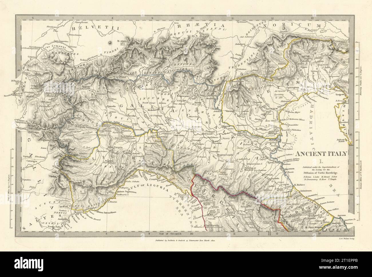
ANCIENT ROMAN ITALY NORTH.Liguria Venetia Gallia Cisalpina.Roads.SDUK 1844 map
RFID:Image ID:2T1EPPB
Image details
Contributor:
Antiqua Print Gallery / Alamy Stock PhotoImage ID:
2T1EPPBFile size:
162.9 MB (10.6 MB Compressed download)Releases:
Model - no | Property - noDo I need a release?Dimensions:
9182 x 6201 px | 77.7 x 52.5 cm | 30.6 x 20.7 inches | 300dpiDate taken:
1844Location:
ItalyMore information:
This image could have imperfections as it’s either historical or reportage.
ANCIENT ITALY, I., North to Arretium. Artist/engraver/cartographer: Engraved by J & C Walker. Provenance: "Maps of the Society for the Diffusion of Useful Knowledge", published by Charles Knight, London, under the Superintendence of the Society for the Diffusion of Useful Knowledge [SDUK Atlas]. Type: Antique steel engraved map with original outline hand colouring (coloring).