ANTWERP ANTWERPEN ANVERS city town map Schelde forts Lillo SDUK 1844 old
RFID:Image ID:2B936JY
Image details
Contributor:
Antiqua Print Gallery / Alamy Stock PhotoImage ID:
2B936JYFile size:
54.8 MB (2.2 MB Compressed download)Releases:
Model - no | Property - noDo I need a release?Dimensions:
4844 x 3952 px | 41 x 33.5 cm | 16.1 x 13.2 inches | 300dpiDate taken:
1844Location:
BelgiumMore information:
This image could have imperfections as it’s either historical or reportage.
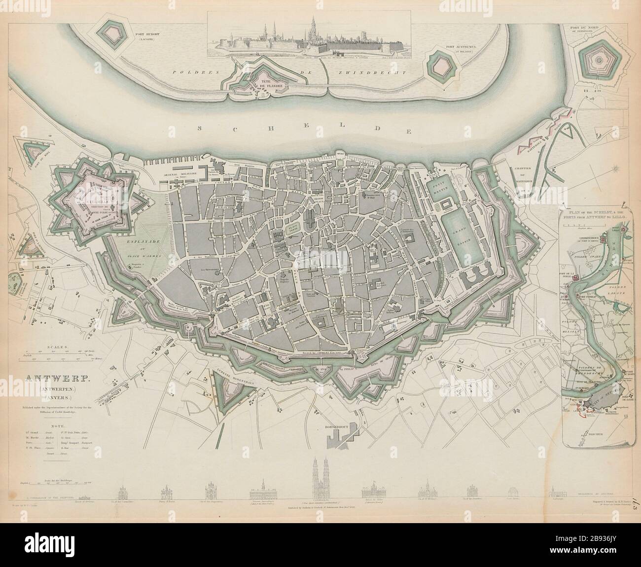
ANTWERP (ANTWERPEN) (ANVERS); inset plan of the Schelde and forts from Antwerp to Lillo. Artist/engraver/cartographer: Cartography by WB Clarke; engraved by BR Davies. Provenance: "Maps of the Society for the Diffusion of Useful Knowledge", published by Chapman & Hall, London, under the superintendance of the Society for the Diffusion of Useful Knowledge [SDUK Atlas]. Type: Antique steel engraved map with original hand colouring (color). Inset: Panaromic vignette view. Diagrammatic comparison showing profiles and height of key buildings and structures.