ASIA China Arabia Tartary Siam Persia India East Indies. RAPKIN/TALLIS 1851 map
Image details
Contributor:
Antiqua Print Gallery / Alamy Stock PhotoImage ID:
2PNK17FFile size:
34.3 MB (1.7 MB Compressed download)Releases:
Model - no | Property - noDo I need a release?Dimensions:
3942 x 3042 px | 33.4 x 25.8 cm | 13.1 x 10.1 inches | 300dpiDate taken:
1851Location:
AsiaMore information:
This image could have imperfections as it’s either historical or reportage.
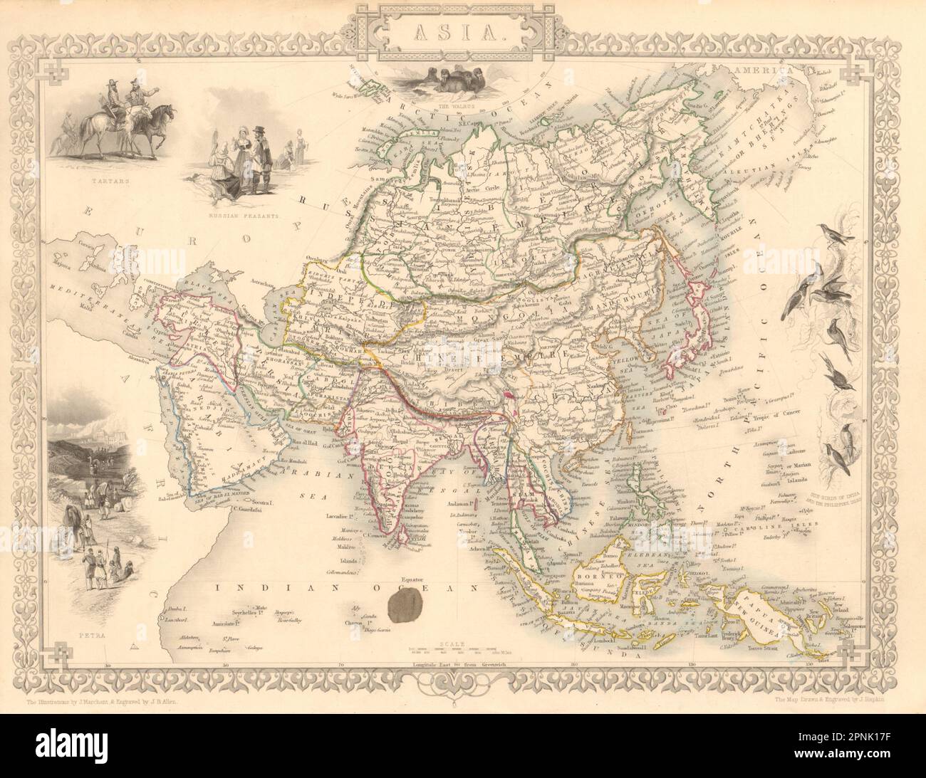
Asia. Artist/engraver/cartographer: Map drawn and engraved by J. Rapkin; vignette illustrations drawn by J Marchant & engraved by JB Allen. Published by John Tallis & Co. Provenance: "Tallis's Illustrated Atlas and Modern History of the World, Geographical, Political, Commercial and Statistical", edited by R Montgomery Martin Esq., published by John Tallis and Company, London & New York [Tallis's Illustrated Atlas]. Type: Antique engraved map by J Rapkin, published by John Tallis. Original outline hand colour, decorative border, and attractive inset vignette views. States marked on the map include Siberia, Cochin China, China, Hindoostan, Cabool (Kabul), Turkey, Arabia, Persia, Beloochistan, Birmah, Siam, Malaya, Independent Tartary, Japan, Dutch East Indies, Philippines, Laos. Vignettes: Tartars; Russian Peasants; Petra; Sun-Birds of India and the Philippine Isles; The Walrus