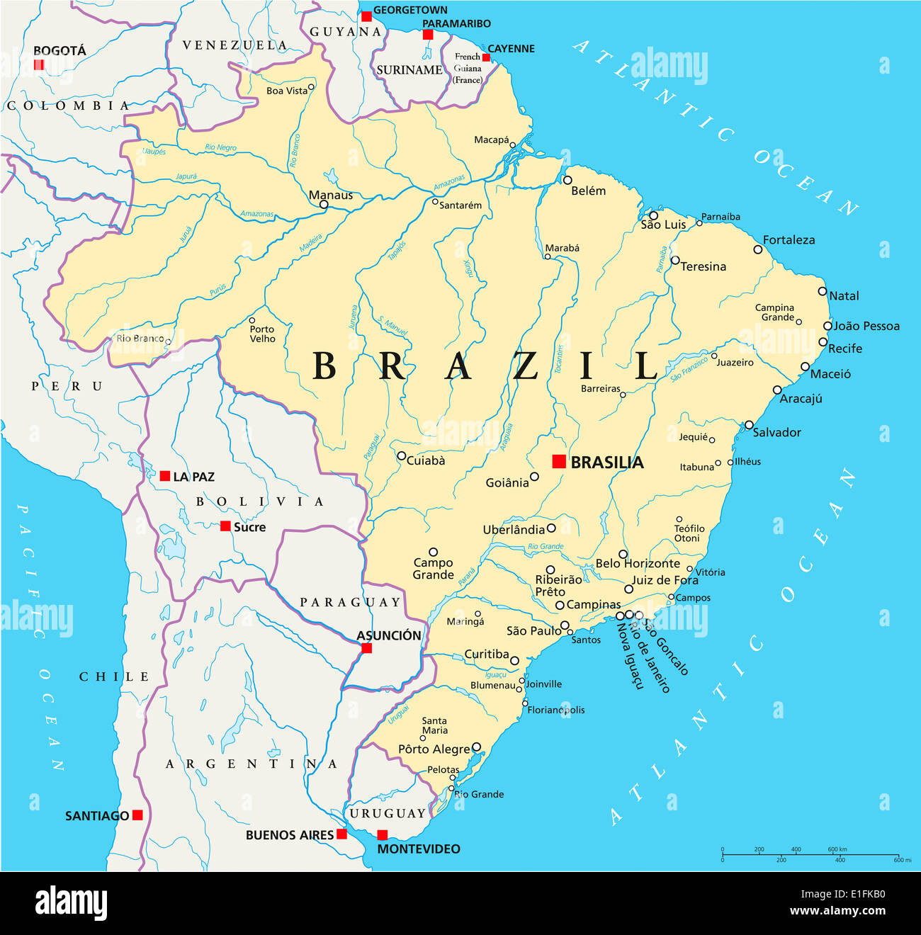
Brazil Political Map with capital Brasilia, national borders, most important cities, rivers and lakes. With English labeling.
RFID:Image ID:E1FKB0
Image details
Contributor:
Peter Hermes Furian / Alamy Stock PhotoImage ID:
E1FKB0File size:
108.8 MB (3.3 MB Compressed download)Releases:
Model - no | Property - noDo I need a release?Dimensions:
6337 x 6000 px | 53.7 x 50.8 cm | 21.1 x 20 inches | 300dpi