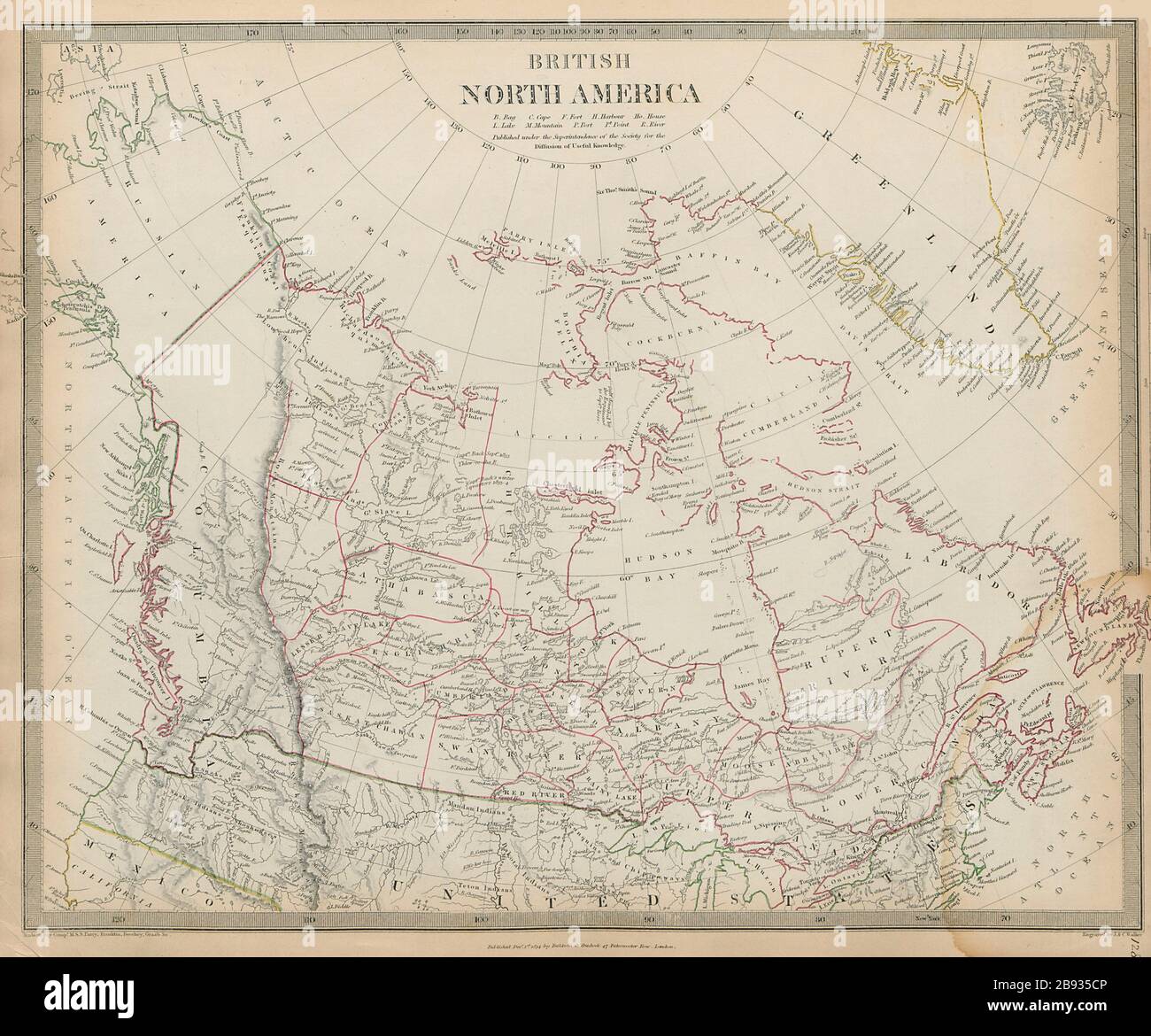
BRITISH NORTH AMERICA. Washington state shown as Canadian. Canada SDUK 1844 map
Image details
Contributor:
Antiqua Print Gallery / Alamy Stock PhotoImage ID:
2B935CPFile size:
57.2 MB (3.1 MB Compressed download)Releases:
Model - no | Property - noDo I need a release?Dimensions:
4904 x 4076 px | 41.5 x 34.5 cm | 16.3 x 13.6 inches | 300dpiDate taken:
1844Location:
CanadaMore information:
This image could have imperfections as it’s either historical or reportage.
BRITISH NORTH AMERICA. Artist/engraver/cartographer: Cartography by Hudson Bay Company; MSS Parry, Franklin, Beechey, Graab etc.; engraved by J & C Walker. Provenance: "Maps of the Society for the Diffusion of Useful Knowledge", published by Chapman & Hall, London, under the superintendance of the Society for the Diffusion of Useful Knowledge [SDUK Atlas]. Type: Antique steel engraved map with original outline hand colouring (coloring). The map shows the border between the United States and British North America (now Canada) as it was before the Oregon Treaty of 1846, and it shows what is now the US state of Alaska as "Russian America" as it was prior to the Alaska purchase of 1867. From the point where the Columbia River meets the 49th parallel, the border between the United States and British North America (now Canada) is shown on the map as following the course of the Course of the Columbia River to the south and west until it reaches the Pacific Ocean. Therefore that part of what is now the US state of Washington to the west of the Columbia River (which includes present-day Seattle-Tacoma) is shown on the map as being part of British North America. The Oregon Treaty of 1846 moved this border to the north, setting the US border with British North America border at the 49th parallel with the exception of Vancouver Island, which was retained in its entirety by the British. The border between Russian America (now Alaska) and British North America (now Canada) is shown to reach the Pacific Ocean further north than its current location; on the map Russian America excludes the island of Revillagigedo Island and adjacent territory, which is now part of Alaska. The border between the United States and Mexico is shown in the lower left hand corner, as it was prior to the Mexican-American war of 1846-1848 with the present US state of California being shown as part of Mexico.