Caledonian Canal Scotland Dochfour Lochy Ness ADMIRALTY chart 1920 (1954) map
Image details
Contributor:
Antiqua Print Gallery / Alamy Stock PhotoImage ID:
2GKEP84File size:
292.1 MB (22.8 MB Compressed download)Releases:
Model - no | Property - noDo I need a release?Dimensions:
8310 x 12285 px | 70.4 x 104 cm | 27.7 x 41 inches | 300dpiDate taken:
1954Location:
ScotlandMore information:
This image could have imperfections as it’s either historical or reportage.
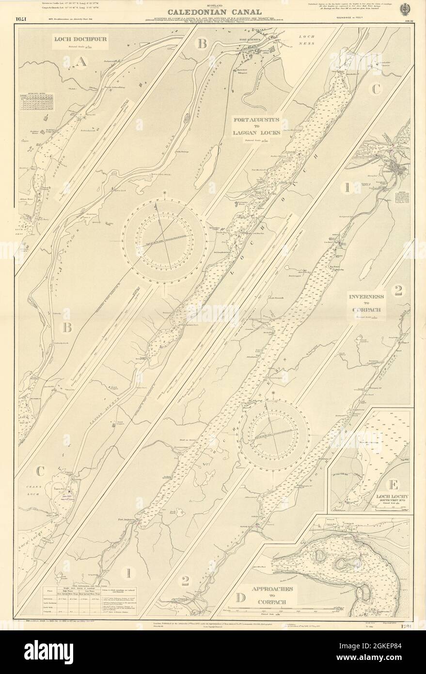
Scotland - Caledonian Canal // Loch Dochfour // Fort Augustus to Laggan Locks // Inverness to Corpach // Loch Lochy - South West End // Approaches to Corpach . Artist/engraver/cartographer: Surveyed by Commr. F.A. Reyne, R.N., and the Officers of H.M. Surveying Ship "Hearty, " 1918. Additional soundings in Loch Ness and Loch Lochy from the surveys under the direction of Sir John Murray, K.C.B., F.R.S., D.Sc., and Mr. Laurence Pullar, E.R.S.E., 1903-1904. The topography is taken from the Ordnance Survey. Provenance: London. Published at the Admiralty under the Superintendence of Rear Admiral Fredk. C. Learmonth. C.B., C.B., E., Hydrographer. Crown Copyright reserved. Type: Large British nautical sea chart. Sea charts such as this were working navigational aids which were commonly updated and corrected during their working lives by hand annotation and/or printed overlays. They may also feature manuscript navigational notes, comments or other markings.