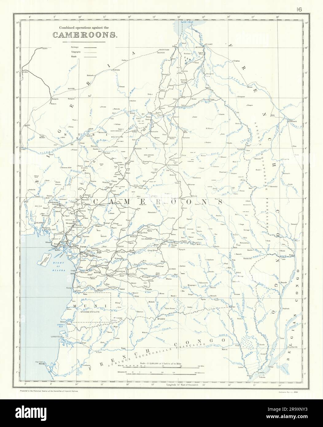
Cameroon operations. Kamerun Campaign. 1914. First World War. 1920 old map
Image details
Contributor:
Antiqua Print Gallery / Alamy Stock PhotoImage ID:
2R9XNY3File size:
446.6 MB (15.6 MB Compressed download)Releases:
Model - no | Property - noDo I need a release?Dimensions:
11241 x 13888 px | 95.2 x 117.6 cm | 37.5 x 46.3 inches | 300dpiDate taken:
1920Location:
CameroonMore information:
This image could have imperfections as it’s either historical or reportage.
Combined operations against the Cameroons [Kamerun Campaign]. Artist/engraver/cartographer: Map compiled by Sir Julian Stafford Corbett. Published by Ordnance Survey 1919. Provenance: "History of the Great War based on Official Documents by the Direction of the Historical Section of the Committee of Imperial Defence. Naval Operations Vol I To the Battle of the Falklands December 1914". By Sir Julian S. Corbett. Published by Longmans, Green and Co. 39 Paternoster Row, London, Fourth Avenue & 30th Street, New York, Bombay, Calcuta and Madras 1920. Type: Antique military history map.