···
Canada political map of administrative divisions - provinces and territories. Yellow shade flat vector map with name labels and dropped shadow isolated on dark grey background. Image details More information:
Canada political map of administrative divisions - provinces and territories. Yellow shade flat vector map with name labels and dropped shadow isolated on dark grey background.
Search stock photos by tags
Similar stock vectors Vector map of Canada with provinces and territories and administrative divisions. Editable and clearly labeled layers. Stock Vector https://www.alamy.com/image-license-details/?v=1 https://www.alamy.com/vector-map-of-canada-with-provinces-and-territories-and-administrative-divisions-editable-and-clearly-labeled-layers-image471881577.html RF 2JBM1ND – Vector map of Canada with provinces and territories and administrative divisions. Editable and clearly labeled layers. 49 of 50 sets, US State Posters with name and Information in 3 Design Styles, Detailed vector art print Alaska map Stock Vector https://www.alamy.com/image-license-details/?v=1 https://www.alamy.com/49-of-50-sets-us-state-posters-with-name-and-information-in-3-design-styles-detailed-vector-art-print-alaska-map-image468879412.html RF 2J6R8D8 – 49 of 50 sets, US State Posters with name and Information in 3 Design Styles, Detailed vector art print Alaska map Vector Canada map illustration with blue neon lightpoints - triangle on dark blue gradient background. Administrative divisions Stock Vector https://www.alamy.com/image-license-details/?v=1 https://www.alamy.com/vector-canada-map-illustration-with-blue-neon-lightpoints-triangle-on-dark-blue-gradient-background-administrative-divisions-image229074065.html RF R8K68H – Vector Canada map illustration with blue neon lightpoints - triangle on dark blue gradient background. Administrative divisions Map of the Canada in the colors of the flag with administrative divisions vector Stock Vector https://www.alamy.com/image-license-details/?v=1 https://www.alamy.com/map-of-the-canada-in-the-colors-of-the-flag-with-administrative-divisions-vector-image358462168.html RF 2BR5A48 – Map of the Canada in the colors of the flag with administrative divisions vector 49 of 50 states of the United States, divided into counties with territory nicknames, Detailed vector Alaska Map with name and date admitted to the Un Stock Vector https://www.alamy.com/image-license-details/?v=1 https://www.alamy.com/49-of-50-states-of-the-united-states-divided-into-counties-with-territory-nicknames-detailed-vector-alaska-map-with-name-and-date-admitted-to-the-un-image469089429.html RF 2J74T9W – 49 of 50 states of the United States, divided into counties with territory nicknames, Detailed vector Alaska Map with name and date admitted to the Un Canada map, administrative divisions whit names regions, blue background vector Stock Vector https://www.alamy.com/image-license-details/?v=1 https://www.alamy.com/canada-map-administrative-divisions-whit-names-regions-blue-background-vector-image450140025.html RF 2H49J5D – Canada map, administrative divisions whit names regions, blue background vector 49 of 50 states of the United States with a name, nickname, and date admitted to the Union, Detailed Vector Alaska Map for printing posters, postcards Stock Vector https://www.alamy.com/image-license-details/?v=1 https://www.alamy.com/49-of-50-states-of-the-united-states-with-a-name-nickname-and-date-admitted-to-the-union-detailed-vector-alaska-map-for-printing-posters-postcards-image468578609.html RF 2J69GP9 – 49 of 50 states of the United States with a name, nickname, and date admitted to the Union, Detailed Vector Alaska Map for printing posters, postcards Canada map, individual regions with names, Infographics and icons vector Stock Vector https://www.alamy.com/image-license-details/?v=1 https://www.alamy.com/canada-map-individual-regions-with-names-infographics-and-icons-vector-image450947986.html RF 2H5JCN6 – Canada map, individual regions with names, Infographics and icons vector Canada political map of administrative divisions Stock Vector https://www.alamy.com/image-license-details/?v=1 https://www.alamy.com/canada-political-map-of-administrative-divisions-image505384820.html RF 2MA67DT – Canada political map of administrative divisions America map, administrative division with names, old paper background vector Stock Vector https://www.alamy.com/image-license-details/?v=1 https://www.alamy.com/america-map-administrative-division-with-names-old-paper-background-vector-image424810144.html RF 2FK3NJT – America map, administrative division with names, old paper background vector Canada, administrative divisions, provinces and territories, political map Stock Vector https://www.alamy.com/image-license-details/?v=1 https://www.alamy.com/canada-administrative-divisions-provinces-and-territories-political-map-image549066468.html RF 2PW83TM – Canada, administrative divisions, provinces and territories, political map Canada map, separate regions with names, infographics blue flat design vector Stock Vector https://www.alamy.com/image-license-details/?v=1 https://www.alamy.com/canada-map-separate-regions-with-names-infographics-blue-flat-design-vector-image450570064.html RF 2H516M0 – Canada map, separate regions with names, infographics blue flat design vector Map of Montreal, satellite view, black and white map. Street directory and city map. Canada Stock Vector https://www.alamy.com/image-license-details/?v=1 https://www.alamy.com/map-of-montreal-satellite-view-black-and-white-map-street-directory-and-city-map-canada-image220152618.html RF PP4PWE – Map of Montreal, satellite view, black and white map. Street directory and city map. Canada 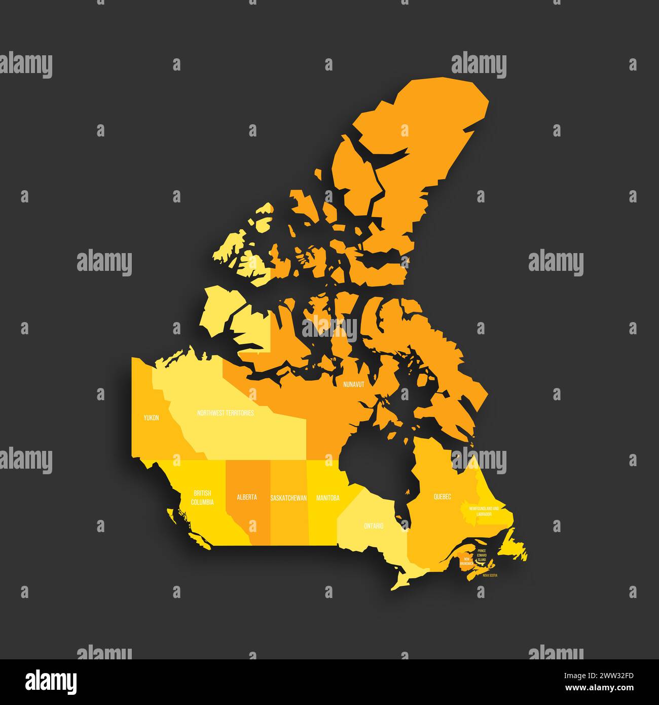