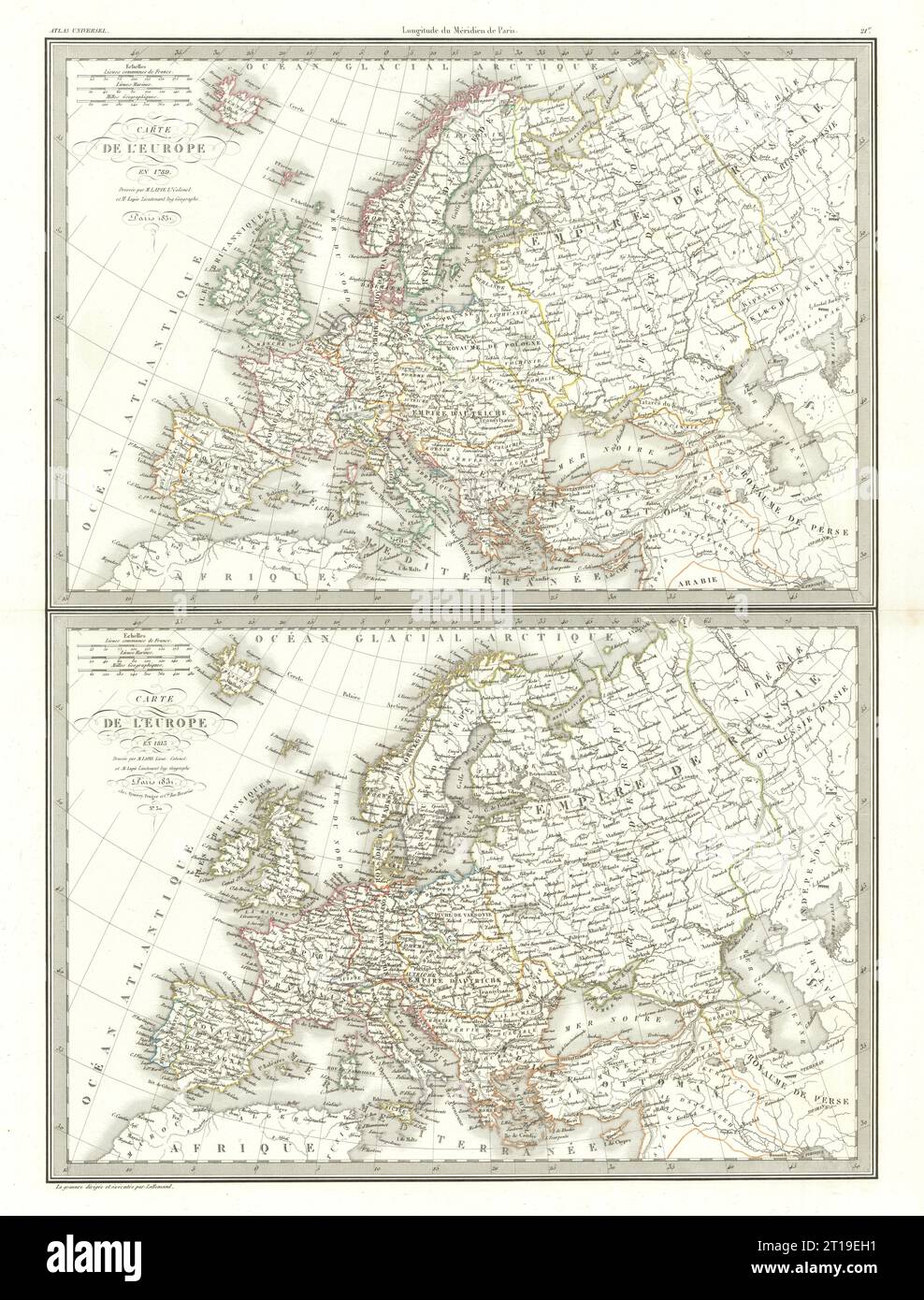
Carte de l'Europe en 1789 & 1813. Napoleonic Europe. LAPIE 1831 old map
RFID:Image ID:2T19EH1
Image details
Contributor:
Antiqua Print Gallery / Alamy Stock PhotoImage ID:
2T19EH1File size:
102.9 MB (7 MB Compressed download)Releases:
Model - no | Property - noDo I need a release?Dimensions:
5230 x 6878 px | 44.3 x 58.2 cm | 17.4 x 22.9 inches | 300dpiDate taken:
1831Location:
EuropeMore information:
This image could have imperfections as it’s either historical or reportage.
Carte de l'Europe en 1789 // Carte de l'Europe en 1813 [Europe in 1789 // Europe in 1813]. Artist/engraver/cartographer: Pierre Lapie, and Alexandre Emile Lapie (fils) . Provenance: "Atlas Universel de Geographie Ancienne et Moderne", Par M. Lapie et M. Lapie Fils. Dédié au Roi. Paris. Eymery, Fruger et Cie., Librairies-Editeurs, Rue Mazarine, No 30. Type: Large (folio) antique atlas map with original hand colour.