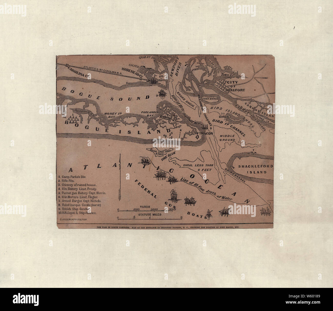
Civil War Maps 1816 The war in North Carolina Map of the entrance to Beaufort harbor NC showing the position of Fort Macon etc Rebuild and Repair
RMID:Image ID:W60189
Image details
Contributor:
Wetdryvac / Alamy Stock PhotoImage ID:
W60189File size:
42.9 MB (1.4 MB Compressed download)Releases:
Model - no | Property - noDo I need a release?Dimensions:
4169 x 3596 px | 35.3 x 30.4 cm | 13.9 x 12 inches | 300dpiDate taken:
10 July 2001More information:
This image could have imperfections as it’s either historical or reportage.