Durham, County Durham, c1955-c1980. Creator: Ursula Clark.
Image details
Contributor:
Heritage Image Partnership Ltd / Alamy Stock PhotoImage ID:
T3K953File size:
67.4 MB (3.1 MB Compressed download)Releases:
Model - no | Property - noDo I need a release?Dimensions:
5896 x 3994 px | 49.9 x 33.8 cm | 19.7 x 13.3 inches | 300dpiDate taken:
30 November 1999Location:
World,Europe,United Kingdom,England,Durham,DurhamPhotographer:
Historic England Archive/Heritage ImagesMore information:
This image could have imperfections as it’s either historical or reportage.
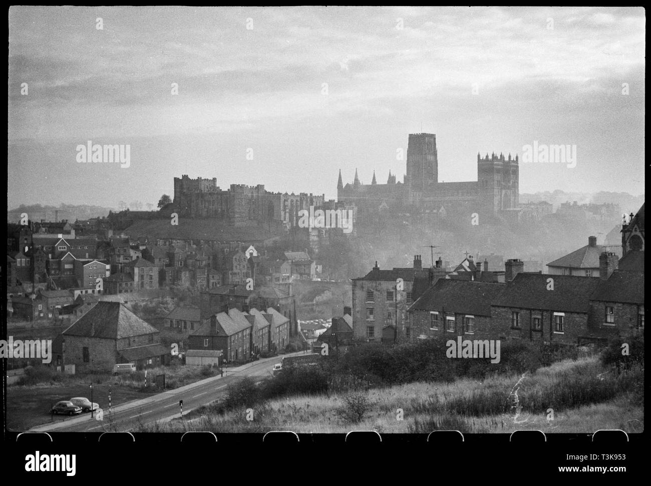
Durham, County Durham, c1955-c1980. A general view of Durham overlooking the River Wear and Framwellgate Bridge, with Durham Castle to the left and the Cathedral Church in the background, seen from a high vantage in the north-west. The cathedral in the distance has a cruciform plan with crossing tower of two stages, large square west towers and short eastern towers with spires. To the left is the castle, showing the exterior elevation of the north and west range, which is now part of Durham college. The north range housed Constable's hall and galleries and the west range included a hall and kitchens. In the midground is a partial view of Framwellgate Bridge, which crosses the River Wear north-west of the castle, and other buildings and houses north of the castle.