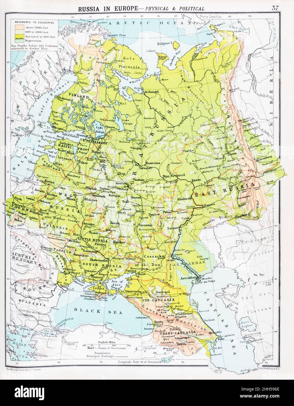
Early 20th century historical atlas map of Old Russia, pre-Soviet USSR. For Russian history, current Ukraine events and Russian Crimea
Image details
Contributor:
Marcus Harrison - geopolitics / Alamy Stock PhotoImage ID:
2HH596EFile size:
108.4 MB (5.3 MB Compressed download)Releases:
Model - no | Property - noDo I need a release?Dimensions:
5415 x 6999 px | 45.8 x 59.3 cm | 18.1 x 23.3 inches | 300dpiDate taken:
21 January 2022Location:
ukMore information:
THE COMPARATIVE ATLAS, 6th Edition, by or Edited by J G Bartholomew. Published in London by Meiklejohn & Holden, Paternoster Square, EC. - There is no published date on the title page but an owner marked an ownership date in February 1909, so publication has to be before this even if it is not the publication year. It is possibly closer to 1900. The price posted on the atlas cover is 2/6d but I have not been able to tally a cost-date connection to establish the proper date. - Possibly out of copyright but you should do due diligence for commercial / advertising use since it is possible that someone who worked on the maps lived to a ripe old age. I have cleaned up surface blemishes such as pencil marks and dirty patches on the map, and in one or two instances retouched minor printed imperfections, but otherwise the digital image is true to the appearance of the original in my possession.