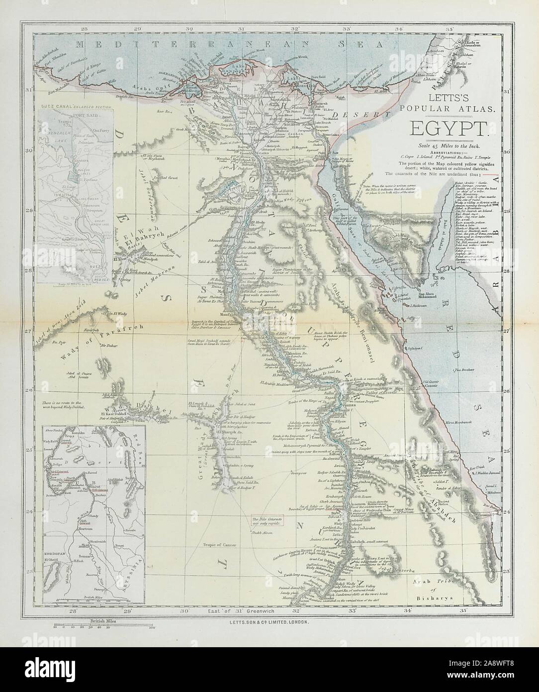
EGYPT. Nile valley. Suez Canal. Red Sea. 'Sherm'/Sharm el-Sheikh. LETTS 1883 map
RFID:Image ID:2A8WFT8
Image details
Contributor:
Antiqua Print Gallery / Alamy Stock PhotoImage ID:
2A8WFT8File size:
57.9 MB (2.8 MB Compressed download)Releases:
Model - no | Property - noDo I need a release?Dimensions:
4108 x 4924 px | 34.8 x 41.7 cm | 13.7 x 16.4 inches | 300dpiDate taken:
1883Location:
EgyptMore information:
This image could have imperfections as it’s either historical or reportage.
Egypt; Inset map of Nubia. Artist/engraver/cartographer: Published by Letts & Co. Most of the plates used for this atlas were original engraved for the SDUK atlas in the mid nineteenth century. The plates were later sold to Thomas Letts, and subsequently to Mason & Payne. Provenance: "Letts's Popular Atlas", published by Letts, son & Co. Limited, 33 King William Street, London Bridge, EC. Type: Antique colour atlas map.