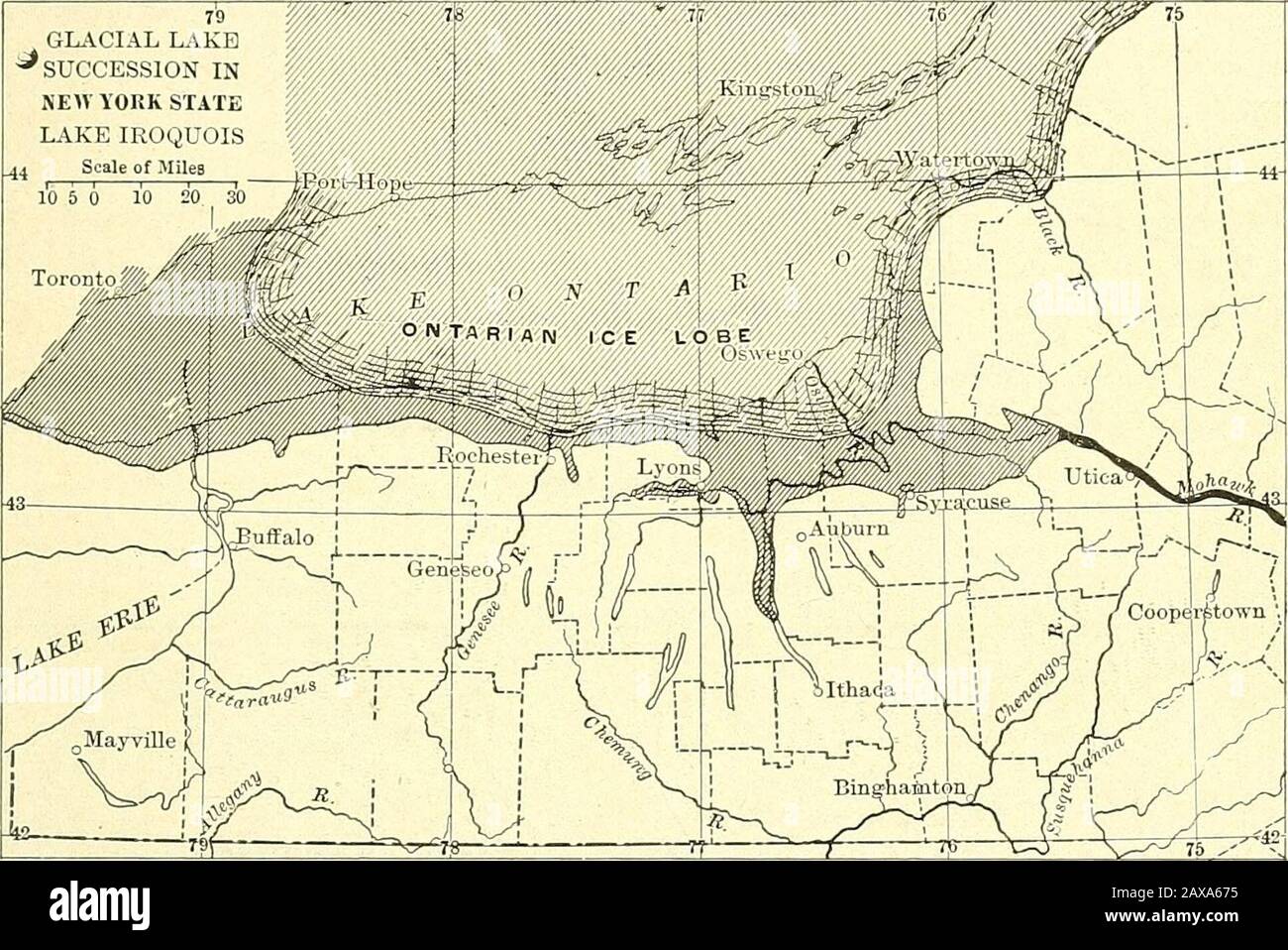
Forest physiography; physiography of the United States and principles of soils in relation to forestry . Fig. 287. —Overflow at this stage was westward to the Mississippi instead of southward to the Susque-hanna. Elevations from 1000 feet on east to goo feet on west. LOWLAND OF CENTRAL NEW YORK 713 true of all the waters held in the Genesee region under about 1200 feet,as well as in several other lake regions. But all the drainage under900 feet at a later period was eastward past Syracuse to the MohawkValley. In the general region of the Finger Lakes between Bataviaand Syracuse at least 13 sep

Image details
Contributor:
The Reading Room / Alamy Stock PhotoImage ID:
2AXA675File size:
7.2 MB (515 KB Compressed download)Releases:
Model - no | Property - noDo I need a release?Dimensions:
1935 x 1292 px | 32.8 x 21.9 cm | 12.9 x 8.6 inches | 150dpiMore information:
This image is a public domain image, which means either that copyright has expired in the image or the copyright holder has waived their copyright. Alamy charges you a fee for access to the high resolution copy of the image.
This image could have imperfections as it’s either historical or reportage.
Forest physiography; physiography of the United States and principles of soils in relation to forestry . Fig. 287. —Overflow at this stage was westward to the Mississippi instead of southward to the Susque-hanna. Elevations from 1000 feet on east to goo feet on west. LOWLAND OF CENTRAL NEW YORK 713 true of all the waters held in the Genesee region under about 1200 feet, as well as in several other lake regions. But all the drainage under900 feet at a later period was eastward past Syracuse to the MohawkValley. In the general region of the Finger Lakes between Bataviaand Syracuse at least 13 separate valleys sloped to the north and theseHe from Oatka Valley on the west to the Onondaga at the east, andinclude such important valleys as the Genesee, Canandaigua, andCayuga. The higher and more local glacial waters in these valleys. GLACIAL LAKESUCCESSION INNE>VyOKK STATE LAKE IROQUOISL44 Scale of Miles Fig. 288. — Overflow eastward to the Mohawk. Elevation under 360 feet. A number of intermediatestages are omitted from this series. The three stages shown here are of chief importance. (AfterFairchild, Bull. N. Y. State Mus.) escaped southward, but at later stages the water of the broad areacollected here mainly into two large lakes, one of which occupied thelarge low central valleys of Seneca, Cayuga, and Keuka, with an outletto the Susquehanna, and another in the Genesee Valley region whichescaped by a different route to the Susquehanna, Allegheny, and Mis-sissippi. In a later stage of development and before the beginning ofthe extensive spur channeling so prominent in central New York, thesetwo bodies of water were united into one extensive lake overflowingwestward into the Mississippi drainage above 900 feet and eastward tothe Hudson below that level. A study of the channels which drained the valleys of