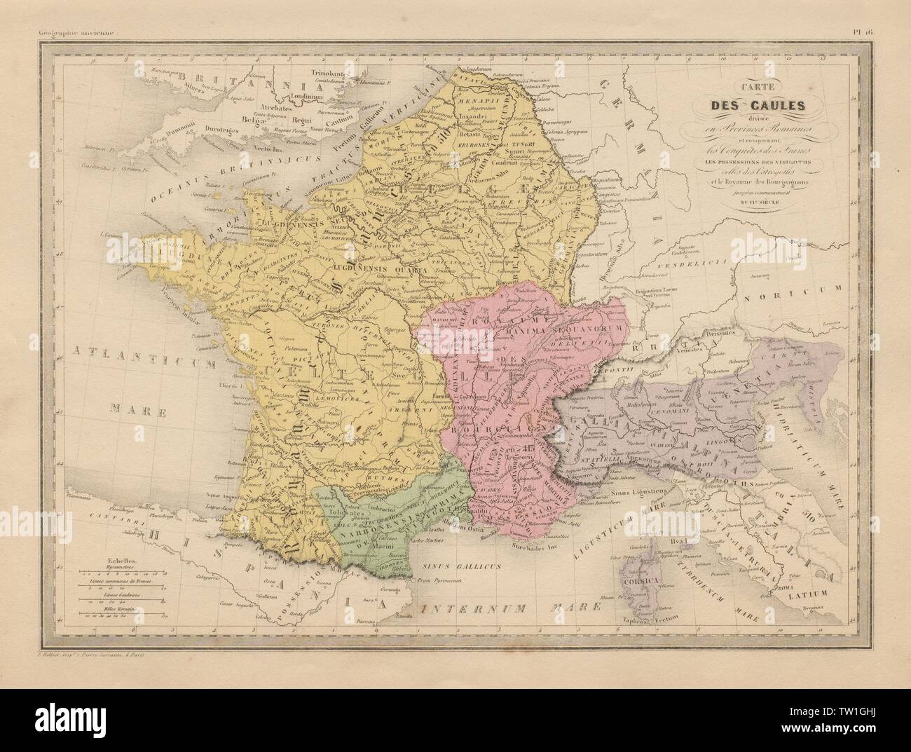
Gaules divisée en Provinces Romaines. Roman Gaul. France. MALTE-BRUN c1871 map
Image details
Contributor:
Antiqua Print Gallery / Alamy Stock PhotoImage ID:
TW1GHJFile size:
60.9 MB (3 MB Compressed download)Releases:
Model - no | Property - noDo I need a release?Dimensions:
5307 x 4014 px | 44.9 x 34 cm | 17.7 x 13.4 inches | 300dpiDate taken:
1871Location:
FranceMore information:
This image could have imperfections as it’s either historical or reportage.
Carte des Gaules divisée en Provinces Romaines et comprenant Les Conquetes des Francs Les Possessions des Visigoths cettes des Ostrogoths et le Royaume des Bourguignons jusqu'au commencement du VI. Siècle [Map of Gaul divided into Roman Provinces and including the conquests of the Francs, the possessions of the Visigoths, those of the Ostrogoths and the Kingdom of the Burgundians until the beginning of the sixth Century]. Artist/engraver/cartographer: P Bellier Impr. Pierre Sarrazin . Provenance: "Atlas de la Géographie Universelle ou Description de Toutes le Parties du Monde sur un Plan Nouveau D'Après les Grandes Divisions Naturelles du Globe", par Malte-Brun nouvelle édition Par M. J.J.N.Huot, Garnier Frères, 6, Rue des Saints-Pères, Palais-Royal, 215 Paris. Type: Antique 19th century engraved atlas map with original colour.