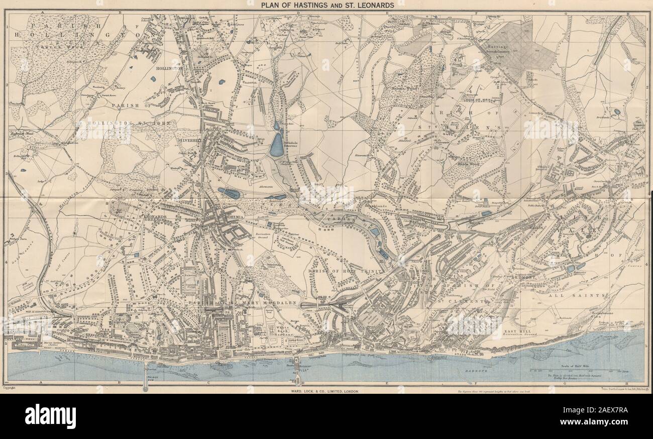
HASTINGS AND ST. LEONARDS vintage town/city plan. Sussex. WARD LOCK 1950 map
RFID:Image ID:2AEX7RA
Image details
Contributor:
Antiqua Print Gallery / Alamy Stock PhotoImage ID:
2AEX7RAFile size:
59.4 MB (4.1 MB Compressed download)Releases:
Model - no | Property - noDo I need a release?Dimensions:
5868 x 3541 px | 49.7 x 30 cm | 19.6 x 11.8 inches | 300dpiDate taken:
1950Location:
SussexMore information:
This image could have imperfections as it’s either historical or reportage.
Plan of Hastings and St. Leonards. Artist/engraver/cartographer: John Bartholomew & Son, Ltd. Edinburgh. Provenance: "Guide to Hastings and St. Leonards, Bexhill, Battle, Rye, Winchelsea, Bodiam, Pevensey, Herstmonceux, etc."; published by Ward, Lock & Co., Limited, London: 12th Edition [Red Guide - Hastings & environs]. Type: Vintage colour tourist map.