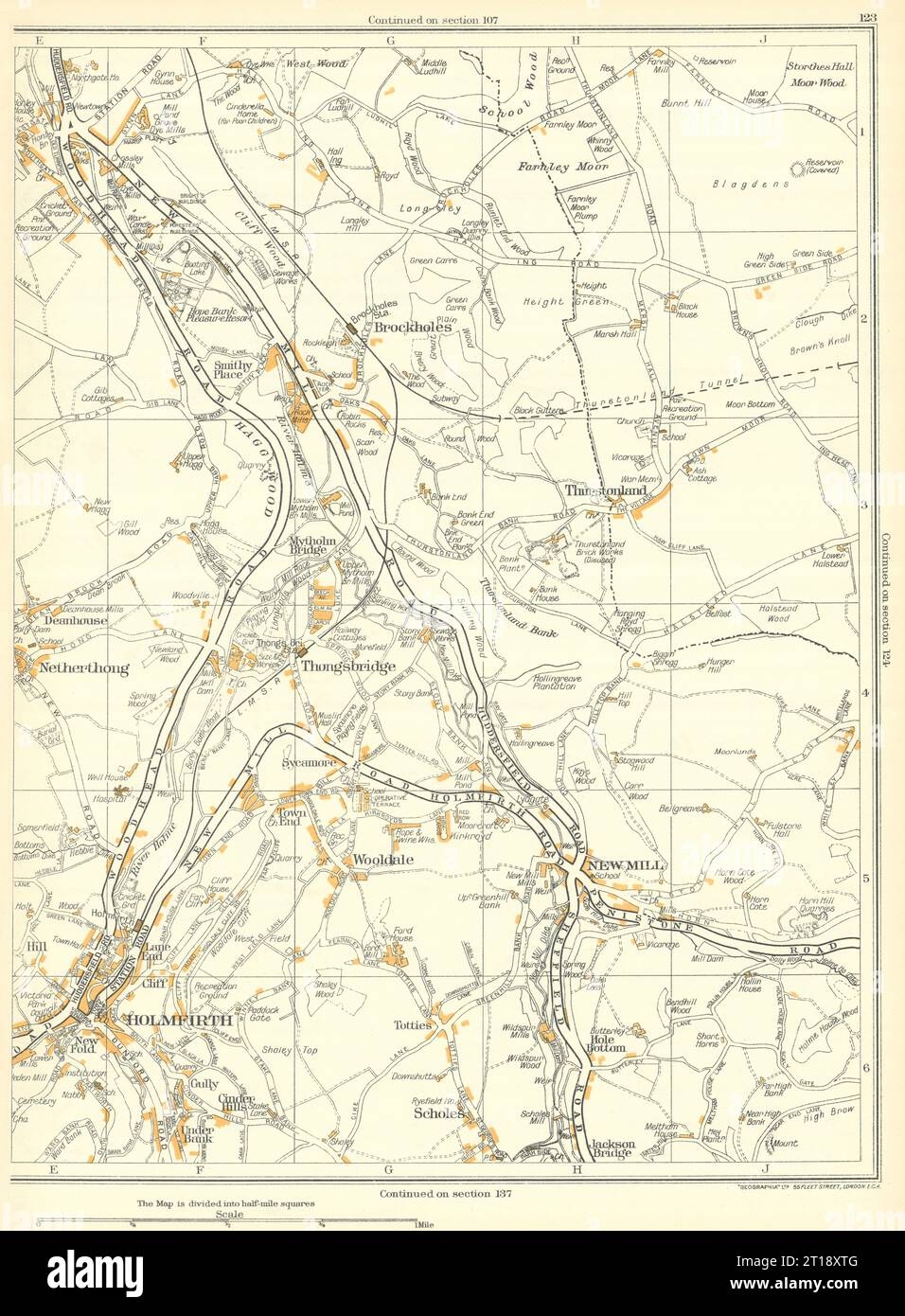
HOLMFIRTH Wooldale New Mill Netherthong Thongsbridge Brockholes 1935 map
RFID:Image ID:2T18XTG
Image details
Contributor:
Antiqua Print Gallery / Alamy Stock PhotoImage ID:
2T18XTGFile size:
130.5 MB (5.2 MB Compressed download)Releases:
Model - no | Property - noDo I need a release?Dimensions:
5793 x 7871 px | 49 x 66.6 cm | 19.3 x 26.2 inches | 300dpiDate taken:
1935Location:
YorkshireMore information:
This image could have imperfections as it’s either historical or reportage.
[Holmfirth, Scholes, Wooldale, New Mill, Netherthong, Thongsbridge, Jakson Bridge]. Artist/engraver/cartographer: Geographers A-Z Map Co / Geographia / Pearsall, Phyllis & Gross, Alexander. Provenance: "The Authentic map directory of South - West Yorkshire"; Produced and published by "Geographia" Ltd, London [Authentic map directory of South-West Yorkshire]. Type: Vintage colour map.