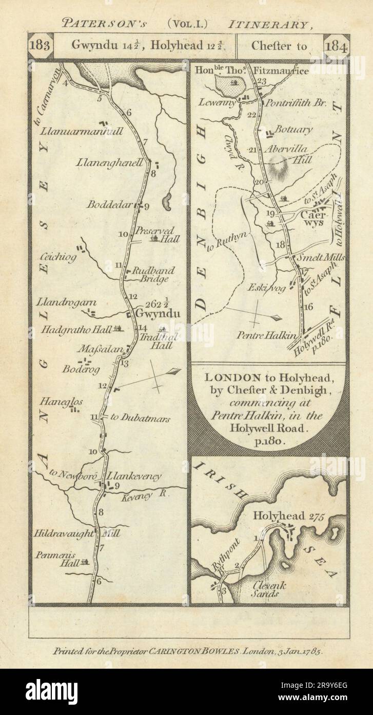
Holyhead Anglesey. Pentre Halkyn-Caerwys road strip map PATERSON 1785 old
RFID:Image ID:2R9Y6EG
Image details
Contributor:
Antiqua Print Gallery / Alamy Stock PhotoImage ID:
2R9Y6EGFile size:
28.8 MB (1.3 MB Compressed download)Releases:
Model - no | Property - noDo I need a release?Dimensions:
2374 x 4243 px | 20.1 x 35.9 cm | 7.9 x 14.1 inches | 300dpiDate taken:
1785Location:
AngleseyMore information:
This image could have imperfections as it’s either historical or reportage.
[London to Holyhead, by Holywell & St. Asaph commencing at Chester] : Llangefni - Holyhead. Anglesey // London to Holyhead, by Chester & Denbigh, commencing at Pentre Halkin in the Holywell Road : Pentre Halkyn - Caerwys. Anglesey. Artist/engraver/cartographer: Daniel Paterson. Provenance: "Paterson's British Itinerary"; By Daniel Paterson, Esq., Printed and sold for by Proprietor, Carington Bowles, 69 St. Paul's Churchyard, London. Type: Antique copperplate road strip map.