···
Image 18 of Sanborn Fire Insurance Map from Hornell, Steuben County, New York. Jul 1893. 21 Sheet(s). Includes Arkport, America, street map with a Nineteenth Century compass Image details File size:
85.3 MB (2.6 MB Compressed download)
Open your image file to the full size using image processing software.
Dimensions:
5000 x 5960 px | 42.3 x 50.5 cm | 16.7 x 19.9 inches | 300dpi
Date taken:
15 November 2019
More information:
This image could have imperfections as it’s either historical or reportage.
Search stock photos by tags
Similar stock images Image 18 of Sanborn Fire Insurance Map from Bridgeport, Fairfield County, Connecticut. 1889. 37 Sheet(s). Bound, America, street map with a Nineteenth Century compass Stock Photo https://www.alamy.com/image-license-details/?v=1 https://www.alamy.com/image-18-of-sanborn-fire-insurance-map-from-bridgeport-fairfield-county-connecticut-1889-37-sheets-bound-america-street-map-with-a-nineteenth-century-compass-image344677663.html RM 2B0NBTF – Image 18 of Sanborn Fire Insurance Map from Bridgeport, Fairfield County, Connecticut. 1889. 37 Sheet(s). Bound, America, street map with a Nineteenth Century compass Image 18 of Sanborn Fire Insurance Map from Johnstown, Cambria County, Pennsylvania. Aug 1891. 21 Sheet(s), America, street map with a Nineteenth Century compass Stock Photo https://www.alamy.com/image-license-details/?v=1 https://www.alamy.com/image-18-of-sanborn-fire-insurance-map-from-johnstown-cambria-county-pennsylvania-aug-1891-21-sheets-america-street-map-with-a-nineteenth-century-compass-image344698550.html RM 2B0PAEE – Image 18 of Sanborn Fire Insurance Map from Johnstown, Cambria County, Pennsylvania. Aug 1891. 21 Sheet(s), America, street map with a Nineteenth Century compass Image 18 of Sanborn Fire Insurance Map from Allentown, Lehigh County, Pennsylvania. Oct 1891. 32 Sheet(s), America, street map with a Nineteenth Century compass Stock Photo https://www.alamy.com/image-license-details/?v=1 https://www.alamy.com/image-18-of-sanborn-fire-insurance-map-from-allentown-lehigh-county-pennsylvania-oct-1891-32-sheets-america-street-map-with-a-nineteenth-century-compass-image344703943.html RM 2B0PHB3 – Image 18 of Sanborn Fire Insurance Map from Allentown, Lehigh County, Pennsylvania. Oct 1891. 32 Sheet(s), America, street map with a Nineteenth Century compass Image 18 of Sanborn Fire Insurance Map from Allentown, Lehigh County, Pennsylvania. Mar 1885. 25 Sheet(s), America, street map with a Nineteenth Century compass Stock Photo https://www.alamy.com/image-license-details/?v=1 https://www.alamy.com/image-18-of-sanborn-fire-insurance-map-from-allentown-lehigh-county-pennsylvania-mar-1885-25-sheets-america-street-map-with-a-nineteenth-century-compass-image344703888.html RM 2B0PH94 – Image 18 of Sanborn Fire Insurance Map from Allentown, Lehigh County, Pennsylvania. Mar 1885. 25 Sheet(s), America, street map with a Nineteenth Century compass Image 18 of Sanborn Fire Insurance Map from Danbury, Fairfield County, Connecticut. Oct 1897. 19 Sheet(s), America, street map with a Nineteenth Century compass Stock Photo https://www.alamy.com/image-license-details/?v=1 https://www.alamy.com/image-18-of-sanborn-fire-insurance-map-from-danbury-fairfield-county-connecticut-oct-1897-19-sheets-america-street-map-with-a-nineteenth-century-compass-image344678006.html RM 2B0NC8P – Image 18 of Sanborn Fire Insurance Map from Danbury, Fairfield County, Connecticut. Oct 1897. 19 Sheet(s), America, street map with a Nineteenth Century compass Image 18 of Sanborn Fire Insurance Map from Chambersburg, Franklin County, Pennsylvania. May 1899. 22 Sheet(s), America, street map with a Nineteenth Century compass Stock Photo https://www.alamy.com/image-license-details/?v=1 https://www.alamy.com/image-18-of-sanborn-fire-insurance-map-from-chambersburg-franklin-county-pennsylvania-may-1899-22-sheets-america-street-map-with-a-nineteenth-century-compass-image344694474.html RM 2B0P58X – Image 18 of Sanborn Fire Insurance Map from Chambersburg, Franklin County, Pennsylvania. May 1899. 22 Sheet(s), America, street map with a Nineteenth Century compass Image 18 of Sanborn Fire Insurance Map from Middletown, Middlesex County, Connecticut. Aug 1895. 21 Sheet(s), America, street map with a Nineteenth Century compass Stock Photo https://www.alamy.com/image-license-details/?v=1 https://www.alamy.com/image-18-of-sanborn-fire-insurance-map-from-middletown-middlesex-county-connecticut-aug-1895-21-sheets-america-street-map-with-a-nineteenth-century-compass-image344678634.html RM 2B0ND36 – Image 18 of Sanborn Fire Insurance Map from Middletown, Middlesex County, Connecticut. Aug 1895. 21 Sheet(s), America, street map with a Nineteenth Century compass Image 18 of Sanborn Fire Insurance Map from Middletown, Middlesex County, Connecticut. Nov 1889. 18 Sheet(s), America, street map with a Nineteenth Century compass Stock Photo https://www.alamy.com/image-license-details/?v=1 https://www.alamy.com/image-18-of-sanborn-fire-insurance-map-from-middletown-middlesex-county-connecticut-nov-1889-18-sheets-america-street-map-with-a-nineteenth-century-compass-image344678592.html RM 2B0ND1M – Image 18 of Sanborn Fire Insurance Map from Middletown, Middlesex County, Connecticut. Nov 1889. 18 Sheet(s), America, street map with a Nineteenth Century compass Image 18 of Sanborn Fire Insurance Map from Portland, Cumberland County, Maine. 1886. 35 Sheet(s). Bound, America, street map with a Nineteenth Century compass Stock Photo https://www.alamy.com/image-license-details/?v=1 https://www.alamy.com/image-18-of-sanborn-fire-insurance-map-from-portland-cumberland-county-maine-1886-35-sheets-bound-america-street-map-with-a-nineteenth-century-compass-image344682458.html RM 2B0NHYP – Image 18 of Sanborn Fire Insurance Map from Portland, Cumberland County, Maine. 1886. 35 Sheet(s). Bound, America, street map with a Nineteenth Century compass Image 18 of Sanborn Fire Insurance Map from Fitchburg, Worcester County, Massachusetts. Mar 1892. 23 Sheet(s), America, street map with a Nineteenth Century compass Stock Photo https://www.alamy.com/image-license-details/?v=1 https://www.alamy.com/image-18-of-sanborn-fire-insurance-map-from-fitchburg-worcester-county-massachusetts-mar-1892-23-sheets-america-street-map-with-a-nineteenth-century-compass-image344679134.html RM 2B0NDN2 – Image 18 of Sanborn Fire Insurance Map from Fitchburg, Worcester County, Massachusetts. Mar 1892. 23 Sheet(s), America, street map with a Nineteenth Century compass Image 18 of Sanborn Fire Insurance Map from Everett, Middlesex County, Massachusetts. Jun 1897. 27 Sheet(s), America, street map with a Nineteenth Century compass Stock Photo https://www.alamy.com/image-license-details/?v=1 https://www.alamy.com/image-18-of-sanborn-fire-insurance-map-from-everett-middlesex-county-massachusetts-jun-1897-27-sheets-america-street-map-with-a-nineteenth-century-compass-image344678893.html RM 2B0NDCD – Image 18 of Sanborn Fire Insurance Map from Everett, Middlesex County, Massachusetts. Jun 1897. 27 Sheet(s), America, street map with a Nineteenth Century compass Image 18 of Sanborn Fire Insurance Map from Columbia, Lancaster County, Pennsylvania. Mar 1899. 18 Sheet(s), America, street map with a Nineteenth Century compass Stock Photo https://www.alamy.com/image-license-details/?v=1 https://www.alamy.com/image-18-of-sanborn-fire-insurance-map-from-columbia-lancaster-county-pennsylvania-mar-1899-18-sheets-america-street-map-with-a-nineteenth-century-compass-image344694978.html RM 2B0P5XX – Image 18 of Sanborn Fire Insurance Map from Columbia, Lancaster County, Pennsylvania. Mar 1899. 18 Sheet(s), America, street map with a Nineteenth Century compass Image 18 of Sanborn Fire Insurance Map from Allegheny, Allegheny County, Pennsylvania. 1893. 125 Sheet(s). Bound, America, street map with a Nineteenth Century compass Stock Photo https://www.alamy.com/image-license-details/?v=1 https://www.alamy.com/image-18-of-sanborn-fire-insurance-map-from-allegheny-allegheny-county-pennsylvania-1893-125-sheets-bound-america-street-map-with-a-nineteenth-century-compass-image344703793.html RM 2B0PH5N – Image 18 of Sanborn Fire Insurance Map from Allegheny, Allegheny County, Pennsylvania. 1893. 125 Sheet(s). Bound, America, street map with a Nineteenth Century compass 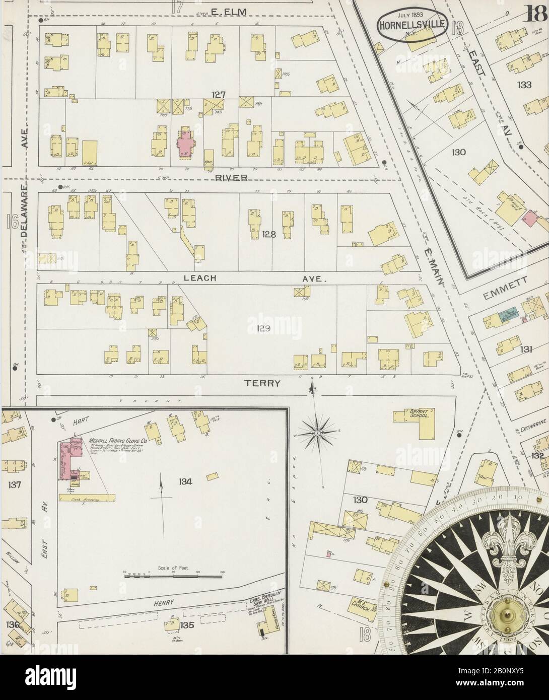