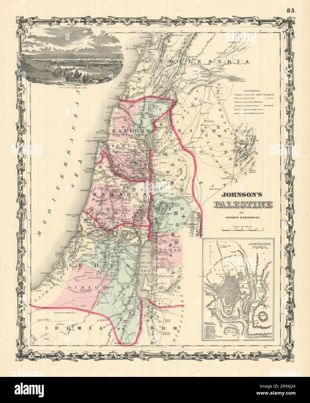
Johnson's Palestine. Jerusalem Damascus. 12 tribes of Israel. Holy Land 1861 map
RFID:Image ID:2R9XJ24
Image details
Contributor:
Antiqua Print Gallery / Alamy Stock PhotoImage ID:
2R9XJ24File size:
239.8 MB (13.7 MB Compressed download)Releases:
Model - no | Property - noDo I need a release?Dimensions:
8303 x 10094 px | 70.3 x 85.5 cm | 27.7 x 33.6 inches | 300dpiDate taken:
1861Location:
PalestineMore information:
This image could have imperfections as it’s either historical or reportage.
Johnson's Palestine // Jerusalem. Artist/engraver/cartographer: Alvin Jewett Johnson. Provenance: "Johnson's New Illustrated Family Atlas", Johnson and Browning, formerly (Successors to J.H. Colton and Company), No. 133 Nassau Street [Johnson's New Illustrated Family Atlas]. Type: Large, decorative hand coloured 19th century atlas map.