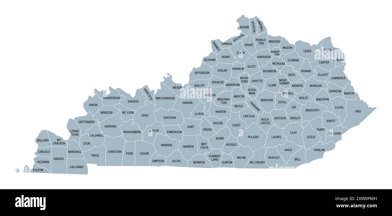
Kentucky, U.S. state subdivided into 120 counties, gray political map with borders and county names. Commonwealth of Kentucky.
RFID:Image ID:2XW0PMH
Image details
Contributor:
Peter Hermes Furian / Alamy Stock PhotoImage ID:
2XW0PMHFile size:
112.1 MB (1.2 MB Compressed download)Releases:
Model - no | Property - noDo I need a release?Dimensions:
9000 x 4352 px | 76.2 x 36.8 cm | 30 x 14.5 inches | 300dpiDate taken:
11 August 2024Location:
KentuckyMore information:
Kentucky, U.S. state subdivided into 120 counties, gray political map with borders and county names. Commonwealth of Kentucky, a state in the Southeastern Region of USA, nicknamed The Bluegrass State.