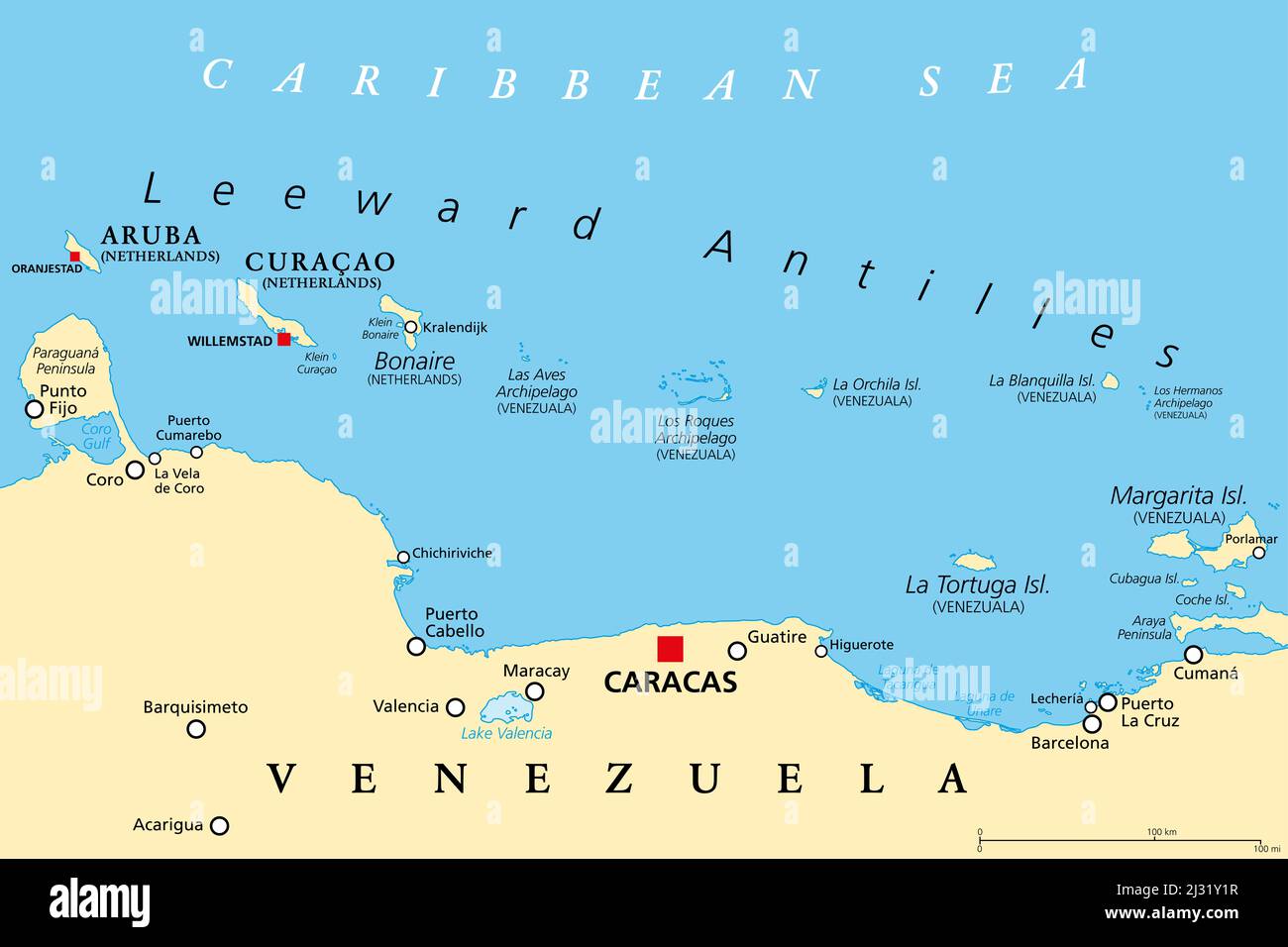
Leeward Antilles political map. Chain of islands in the Caribbean. From Aruba, Curacao and Bonaire to La Tortuga and Margarita Island.
RFID:Image ID:2J31Y1R
Image details
Contributor:
Peter Hermes Furian / Alamy Stock PhotoImage ID:
2J31Y1RFile size:
154.5 MB (1.3 MB Compressed download)Releases:
Model - no | Property - noDo I need a release?Dimensions:
9000 x 6000 px | 76.2 x 50.8 cm | 30 x 20 inches | 300dpiDate taken:
5 April 2022Location:
Leeward AntillesMore information:
Leeward Antilles political map. Chain of islands in the Caribbean. From Aruba, Curacao and Bonaire to La Tortuga and Margarita Island. Southerly islands of Lesser Antilles, north the Venezuelan coast.