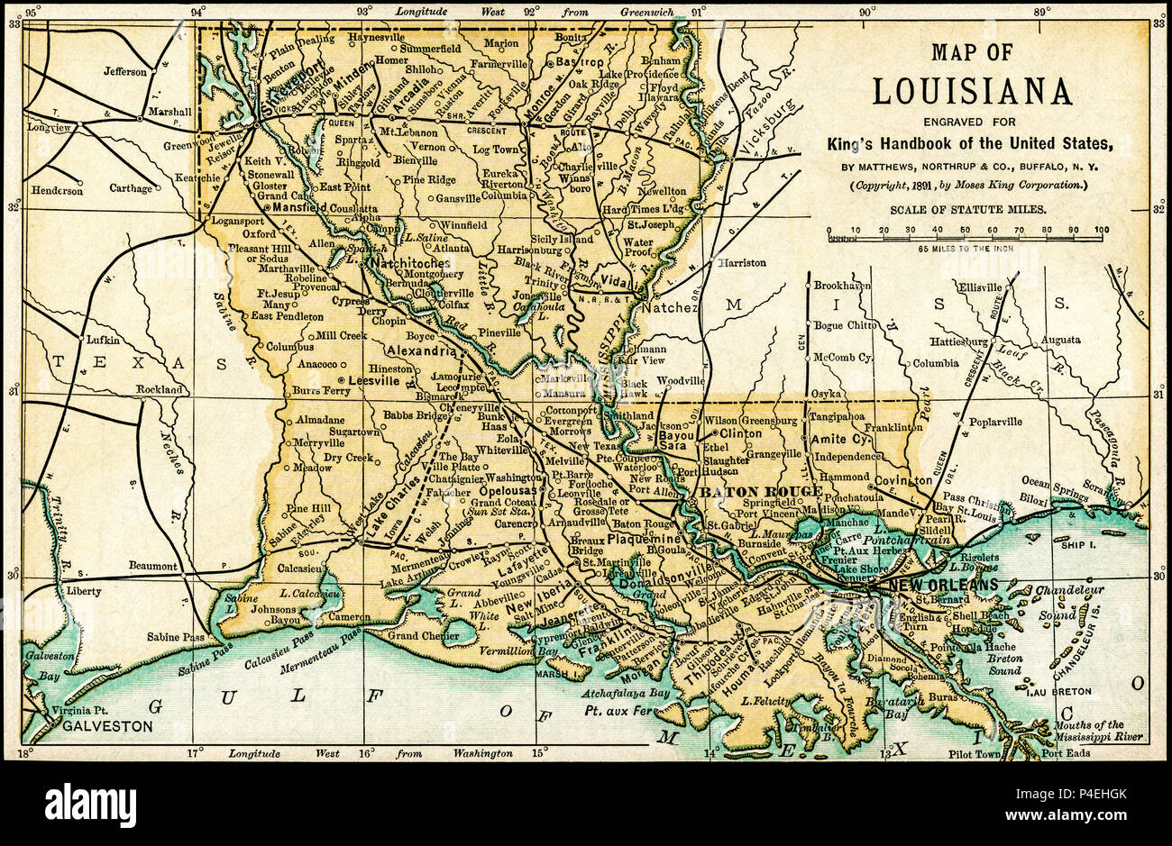
Louisiana Antique Map 1891: Map of Louisiana from an 1891 guidebook: "King's Hand-Book of the United States." Date of Publishing: 1891. Moses King (1853 1909) was an American editor and publisher of travel books.
RFID:Image ID:P4EHGK
Image details
Contributor:
Phil Cardamone / Alamy Stock PhotoImage ID:
P4EHGKFile size:
41 MB (5.1 MB Compressed download)Releases:
Model - no | Property - noDo I need a release?Dimensions:
4681 x 3060 px | 39.6 x 25.9 cm | 15.6 x 10.2 inches | 300dpiDate taken:
12 October 2012More information:
This image could have imperfections as it’s either historical or reportage.
I have selected interesting, old 19th century graphic images for digital restoration and editing. The map was scanned directly from the original source at a high resolution to make this restored, detailed reproduction. The images were then adjusted and brightened to make the images suitable for display and other purposes. The resulting image brings out many details and landmarks