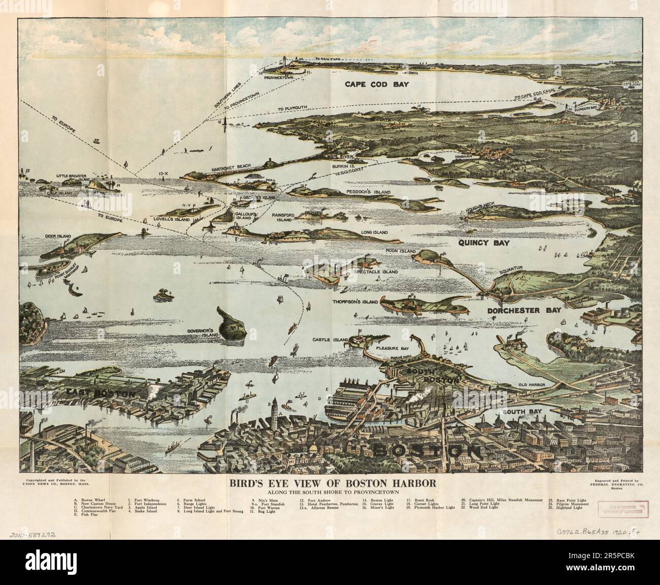
MAP Bird's eye view of Boston Harbor along the South Shore to Plymouth, Cape Cod Canal, and Provincetown : in colors : showing all steamboat routes. B
RFID:Image ID:2R5PCBK
Image details
Contributor:
Carlo Bollo / Alamy Stock PhotoImage ID:
2R5PCBKFile size:
153.9 MB (8.6 MB Compressed download)Releases:
Model - no | Property - noDo I need a release?Dimensions:
8112 x 6632 px | 68.7 x 56.2 cm | 27 x 22.1 inches | 300dpiDate taken:
4 June 2023More information:
MAP Bird's eye view of Boston Harbor along the South Shore to Plymouth, Cape Cod Canal, and Provincetown : in colors : showing all steamboat routes. Bird's eye view of Boston Harbor along the South Shore to Provincetown