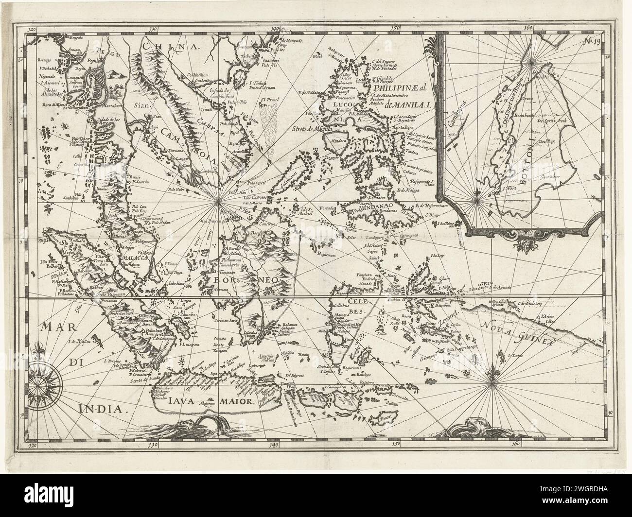
Map of East Indies, 1616, 1646 print Map of the East Indies, 1616. At the top right a bet with a card from the so-called Strait van Botton, near Cambodia. Part of the illustrations in the report of the Joris van Spilbergen journey around the world, 1614-1617, No. 19. Northern Netherlands paper etching exploration, expedition, voyage of discovery. landscapes in tropical and sub-tropical regions. maps of separate countries or regions Street of Taiwan. East-India. Indonesia. China. Philippines. New Guinea. Cambodia. Melaka. Malaysia. Pegu
RMID:Image ID:2WGBDHA
Image details
Contributor:
piemags/rmn / Alamy Stock PhotoImage ID:
2WGBDHAFile size:
83.5 MB (5.7 MB Compressed download)Releases:
Model - no | Property - noDo I need a release?Dimensions:
6240 x 4678 px | 52.8 x 39.6 cm | 20.8 x 15.6 inches | 300dpiMore information:
This image is a public domain image, which means either that copyright has expired in the image or the copyright holder has waived their copyright. Alamy charges you a fee for access to the high resolution copy of the image.
This image could have imperfections as it’s either historical or reportage.