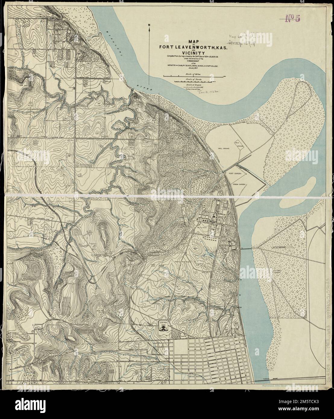
Map of Fort Leavenworth, Kas. and vicinity. Relief shown by contours and spot heights. Contour interval 10 feet.... , Kansas , Leavenworth ,county , Fort Leavenworth ,defense installation
RMID:Image ID:2M5TCK3
Image details
Contributor:
LM/BT / Alamy Stock PhotoImage ID:
2M5TCK3File size:
163.3 MB (9.3 MB Compressed download)Releases:
Model - no | Property - noDo I need a release?Dimensions:
6976 x 8182 px | 59.1 x 69.3 cm | 23.3 x 27.3 inches | 300dpiMore information:
This image is a public domain image, which means either that copyright has expired in the image or the copyright holder has waived their copyright. Alamy charges you a fee for access to the high resolution copy of the image.
This image could have imperfections as it’s either historical or reportage.