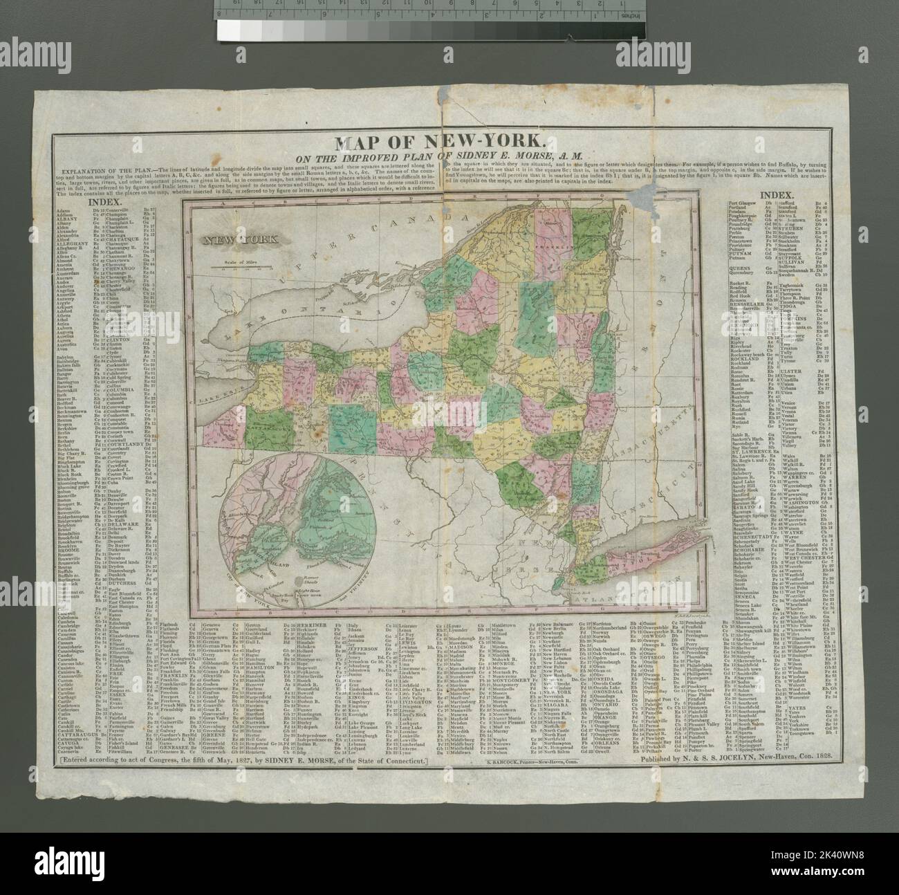
Map of New-York : on the improved plan of Sidney E. Morse ; N. & S.S Jocelyn, sc. Cartographic. Maps. 1828. Lionel Pincus and Princess Firyal Map Division. New York (State), New York Metropolitan Area
RMID:Image ID:2K40WN8
Image details
Contributor:
Ny/piemags / Alamy Stock PhotoImage ID:
2K40WN8File size:
65.8 MB (2.9 MB Compressed download)Releases:
Model - no | Property - noDo I need a release?Dimensions:
4982 x 4615 px | 42.2 x 39.1 cm | 16.6 x 15.4 inches | 300dpiMore information:
This image is a public domain image, which means either that copyright has expired in the image or the copyright holder has waived their copyright. Alamy charges you a fee for access to the high resolution copy of the image.
This image could have imperfections as it’s either historical or reportage.