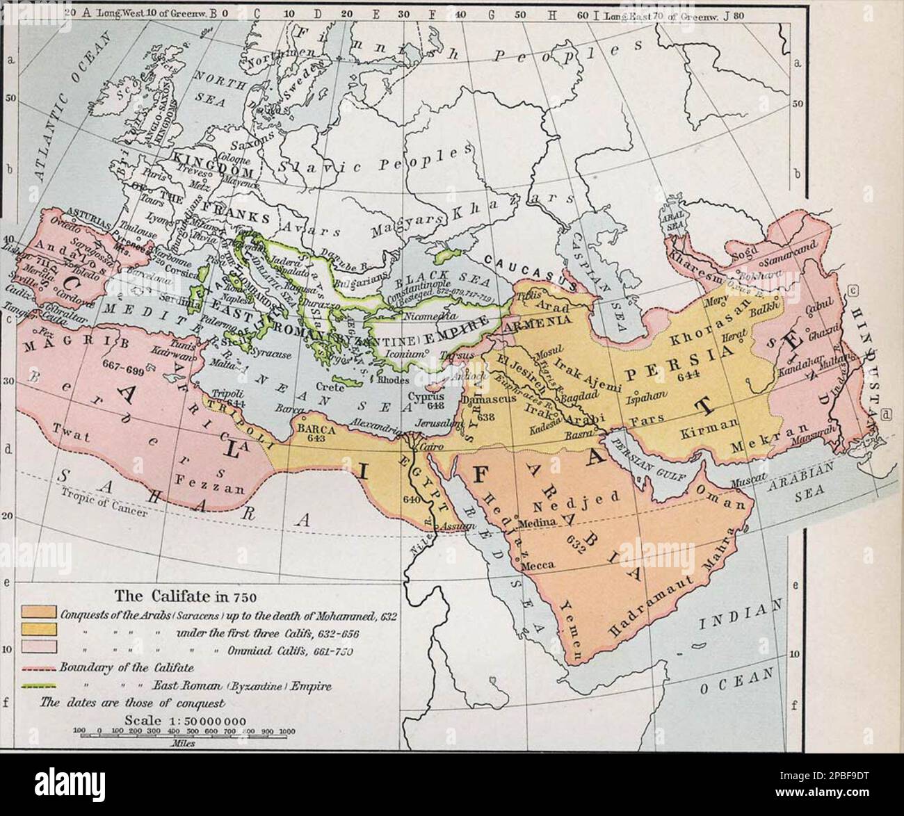
Map of the Umayyad Caliphate in 750 CE.
RMID:Image ID:2PBF9DT
Image details
Contributor:
FLHC MDB5 / Alamy Stock PhotoImage ID:
2PBF9DTFile size:
14.3 MB (593.8 KB Compressed download)Releases:
Model - no | Property - noDo I need a release?Dimensions:
2448 x 2042 px | 41.5 x 34.6 cm | 16.3 x 13.6 inches | 150dpiMore information:
This image could have imperfections as it’s either historical or reportage.
Map of the Umayyad Caliphate in 750 CE.