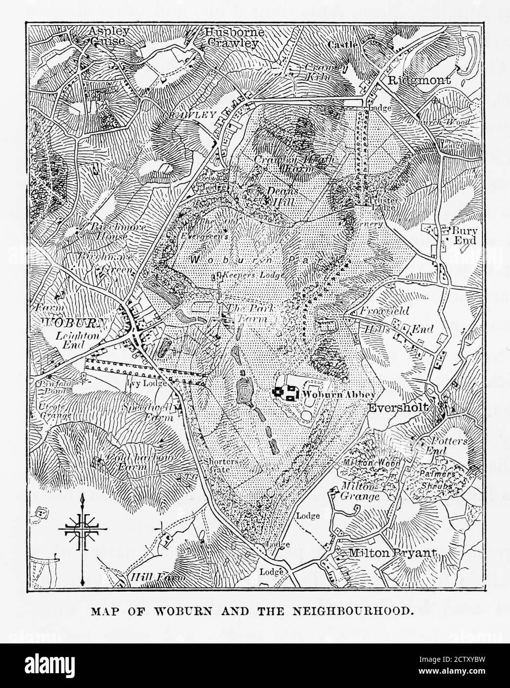
Map of Woburn and Neighborhoods, England Victorian Engraving, Circa 1840
RMID:Image ID:2CTXYBW
Image details
Contributor:
Peacock Graphics / Alamy Stock PhotoImage ID:
2CTXYBWFile size:
226.9 MB (8.9 MB Compressed download)Releases:
Model - no | Property - noDo I need a release?Dimensions:
7931 x 10000 px | 67.1 x 84.7 cm | 26.4 x 33.3 inches | 300dpiDate taken:
20 June 2016Location:
Great Britain, EnglandMore information:
This image is a public domain image, which means either that copyright has expired in the image or the copyright holder has waived their copyright. Alamy charges you a fee for access to the high resolution copy of the image.
Very Rare, Beautifully Illustrated Antique Engraving of Map of Woburn and Neighborhoods, England Victorian Engraving, Circa 1840 from Our Own Country, Great Britain, Descriptive, Historical, Pictorial. Published in 1880. Copyright has expired on this artwork. Digitally restored.