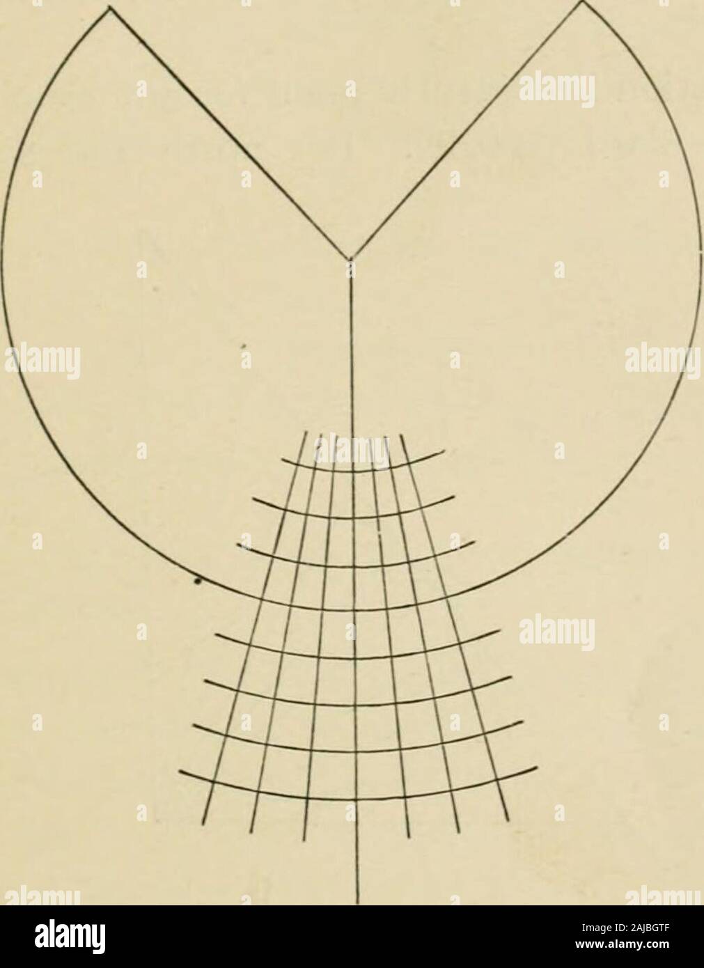
Map projections . e of one-millionth, the length of the complete parallel on the map will beone-millionth of the corresponding terrestrial parallel. This iscalled a Standard parallel. Simple conical projection with one standard parallel. Suppose that we begin by constructing the Conical projectionwith one standard parallel. If R is the radius of the Earth(supposed spherical) and the latitude of the selected parallel,the length of the parallel is 2wR cos . P -i U,- ^ THE PRINCIPAL SYSTEMS OF PROJECTIONS u Describe with radius R cot an arc whose length is 2ttR cos ,the length of the standard par
Image details
Contributor:
The Reading Room / Alamy Stock PhotoImage ID:
2AJBGTFFile size:
7.1 MB (119.3 KB Compressed download)Releases:
Model - no | Property - noDo I need a release?Dimensions:
1394 x 1792 px | 23.6 x 30.3 cm | 9.3 x 11.9 inches | 150dpiMore information:
This image is a public domain image, which means either that copyright has expired in the image or the copyright holder has waived their copyright. Alamy charges you a fee for access to the high resolution copy of the image.
This image could have imperfections as it’s either historical or reportage.
Map projections . e of one-millionth, the length of the complete parallel on the map will beone-millionth of the corresponding terrestrial parallel. This iscalled a Standard parallel. Simple conical projection with one standard parallel. Suppose that we begin by constructing the Conical projectionwith one standard parallel. If R is the radius of the Earth(supposed spherical) and the latitude of the selected parallel, the length of the parallel is 2wR cos . P -i U, - ^ THE PRINCIPAL SYSTEMS OF PROJECTIONS u Describe with radius R cot an arc whose length is 2ttR cos , the length of the standard parallel. This arc will subtend atthe centre of the circle an angle 2tt sin 4>, and the constant ofthe cone is sin . Divide the arc into 36 parts, and join each dividing pointto the centre. These lines will represent the meridians atintervals of io3. Along any one of these meridians lay off distances aboveand below the standard parallel equal to the distances from the. Fig- 3- standard parallel to each parallel of even ten degrees, thedistances being reduced to the scale of the map. Describecircles through the points so obtained, concentric with thestandard parallel. These will be the parallels of our projectionat intervals of io°. Consider briefly the properties of this projection. The scale along every meridian is correct, as is the scalealong the standard parallel. It is easy to show that the scalealong any other parallel is too great, and that the error increasesas we get further away from the standard parallel. 12 THE PRINCIPAL SYSTEMS OF PROJECTIONS The projection is evidently not equal area ; for the meridiansand parallels are at right angles to one another, and the scale iscorrect along the meridians and wrong along all parallels but one.The percentage error in the representation of any small area isevidently the same as the percentage error of the scale of theparallel through it. The projection is evidently not orthomorphic, since the scal