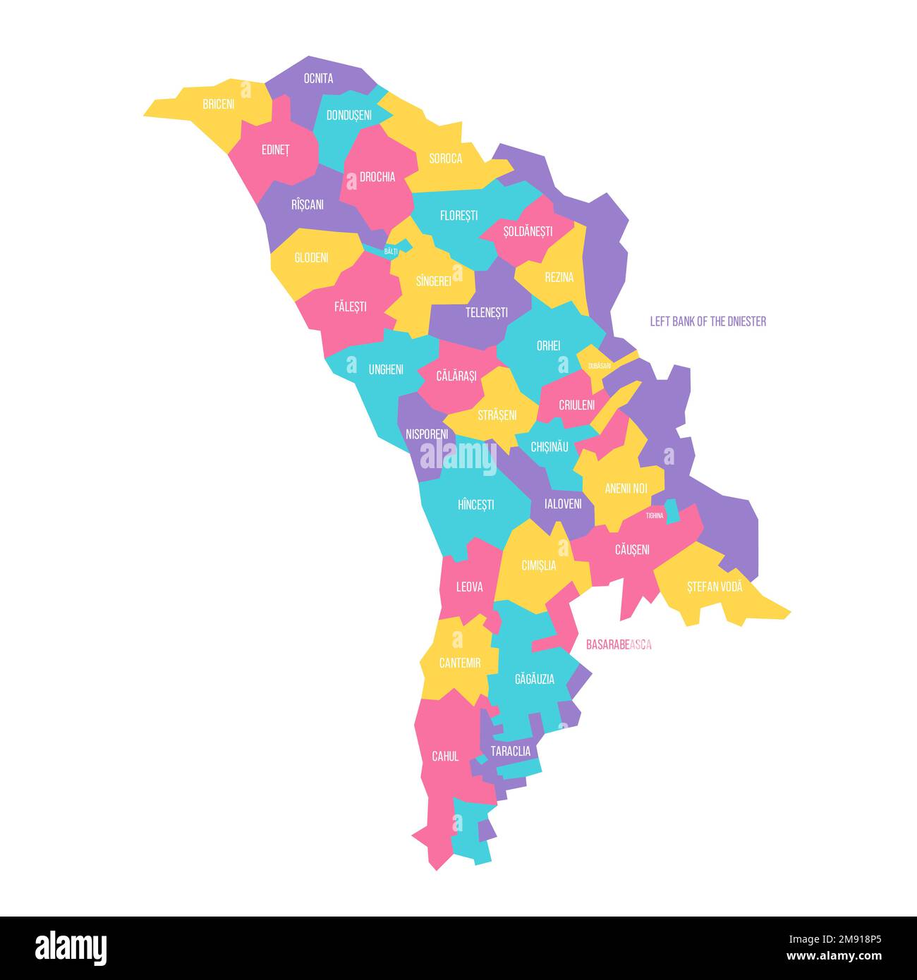
Moldova political map of administrative divisions - districts, municipalities and two autonomous territorial units - Gaugazia and Left Bank of the Dniester. Colorful vector map with labels.
RFID:Image ID:2M918P5
Image details
Contributor:
pytyczech / Alamy Stock VectorImage ID:
2M918P5Releases:
Model - no | Property - noDo I need a release?Location:
Czech RepublicMore information:
Moldova political map of administrative divisions - districts, municipalities and two autonomous territorial units - Gaugazia and Left Bank of the Dniester. Colorful vector map with labels.