···
Myanmar political map of administrative divisions - states, regions and Naypyitaw Union Territory. Colorful spectrum political map with labels and country name. Image details More information:
Myanmar political map of administrative divisions - states, regions and Naypyitaw Union Territory. Colorful spectrum political map with labels and country name.
Search stock photos by tags
Similar stock vectors Vector map of Myanmar with regions, states and administrative divisions. Editable and clearly labeled layers. Stock Vector https://www.alamy.com/licenses-and-pricing/?v=1 https://www.alamy.com/vector-map-of-myanmar-with-regions-states-and-administrative-divisions-editable-and-clearly-labeled-layers-image611948560.html RF 2XFGJHM – Vector map of Myanmar with regions, states and administrative divisions. Editable and clearly labeled layers. Administrative divisions of China Stock Vector https://www.alamy.com/licenses-and-pricing/?v=1 https://www.alamy.com/stock-photo-administrative-divisions-of-china-102094634.html RF FX2PMX – Administrative divisions of China Myanmar political map of administrative divisions Stock Vector https://www.alamy.com/licenses-and-pricing/?v=1 https://www.alamy.com/myanmar-political-map-of-administrative-divisions-image505413694.html RF 2MA7G92 – Myanmar political map of administrative divisions Administrative divisions of China Stock Vector https://www.alamy.com/licenses-and-pricing/?v=1 https://www.alamy.com/stock-photo-administrative-divisions-of-china-96561740.html RF FH2NDG – Administrative divisions of China Stylized vector Myanmar (Burma) map showing big cities, capital Naypyidaw, administrative divisions. Stock Vector https://www.alamy.com/licenses-and-pricing/?v=1 https://www.alamy.com/stylized-vector-myanmar-burma-map-showing-big-cities-capital-naypyidaw-administrative-divisions-image217105378.html RF PH603E – Stylized vector Myanmar (Burma) map showing big cities, capital Naypyidaw, administrative divisions. Vector map of Myanmar with regions, states and administrative divisions. Editable and clearly labeled layers. Stock Vector https://www.alamy.com/licenses-and-pricing/?v=1 https://www.alamy.com/vector-map-of-myanmar-with-regions-states-and-administrative-divisions-editable-and-clearly-labeled-layers-image611948688.html RF 2XFGJP8 – Vector map of Myanmar with regions, states and administrative divisions. Editable and clearly labeled layers. Myanmar political map of administrative divisions Stock Vector https://www.alamy.com/licenses-and-pricing/?v=1 https://www.alamy.com/myanmar-political-map-of-administrative-divisions-image514703748.html RF 2MWANTM – Myanmar political map of administrative divisions Myanmar Burma map with borders, cities, capital and administrative divisions. Infographic vector map. Editable layers clearly labeled. Stock Vector https://www.alamy.com/licenses-and-pricing/?v=1 https://www.alamy.com/myanmar-burma-map-with-borders-cities-capital-and-administrative-divisions-infographic-vector-map-editable-layers-clearly-labeled-image218688592.html RF PKP3ET – Myanmar Burma map with borders, cities, capital and administrative divisions. Infographic vector map. Editable layers clearly labeled. Vector blank map of Myanmar with regions, states and administrative divisions. Editable and clearly labeled layers. Stock Vector https://www.alamy.com/licenses-and-pricing/?v=1 https://www.alamy.com/vector-blank-map-of-myanmar-with-regions-states-and-administrative-divisions-editable-and-clearly-labeled-layers-image611948853.html RF 2XFGK05 – Vector blank map of Myanmar with regions, states and administrative divisions. Editable and clearly labeled layers. Myanmar political map of administrative divisions Stock Vector https://www.alamy.com/licenses-and-pricing/?v=1 https://www.alamy.com/myanmar-political-map-of-administrative-divisions-image515261408.html RF 2MX8554 – Myanmar political map of administrative divisions Isometric 3D Myanmar Burma map. Stylized vector map illustration with cities, borders, capital, administrative divisions and pointer marks; gradient Stock Vector https://www.alamy.com/licenses-and-pricing/?v=1 https://www.alamy.com/isometric-3d-myanmar-burma-map-stylized-vector-map-illustration-with-cities-borders-capital-administrative-divisions-and-pointer-marks-gradient-image220460075.html RF PPJR23 – Isometric 3D Myanmar Burma map. Stylized vector map illustration with cities, borders, capital, administrative divisions and pointer marks; gradient Vector blank map of Myanmar with regions, states and administrative divisions. Editable and clearly labeled layers. Stock Vector https://www.alamy.com/licenses-and-pricing/?v=1 https://www.alamy.com/vector-blank-map-of-myanmar-with-regions-states-and-administrative-divisions-editable-and-clearly-labeled-layers-image611948272.html RF 2XFGJ7C – Vector blank map of Myanmar with regions, states and administrative divisions. Editable and clearly labeled layers. Myanmar political map of administrative divisions Stock Vector https://www.alamy.com/licenses-and-pricing/?v=1 https://www.alamy.com/myanmar-political-map-of-administrative-divisions-image513348914.html RF 2MR51NP – Myanmar political map of administrative divisions 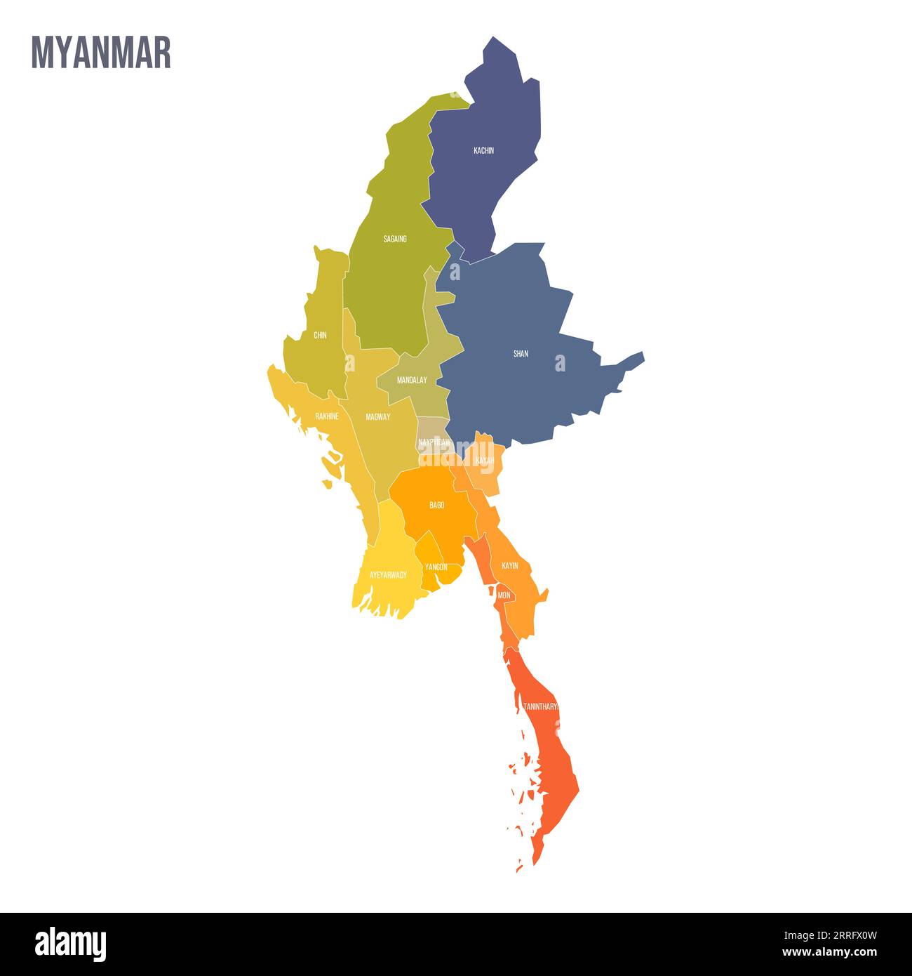