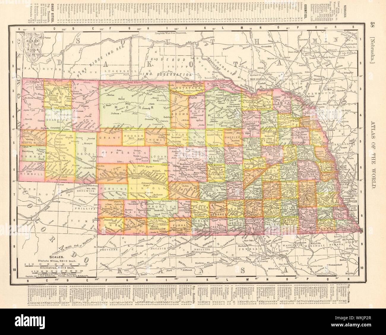
Nebraska state map showing counties. RAND MCNALLY 1906 old antique chart
RFID:Image ID:WKJP2R
Image details
Contributor:
Antiqua Print Gallery / Alamy Stock PhotoImage ID:
WKJP2RFile size:
36.1 MB (2 MB Compressed download)Releases:
Model - no | Property - noDo I need a release?Dimensions:
3974 x 3175 px | 33.6 x 26.9 cm | 13.2 x 10.6 inches | 300dpiDate taken:
1906Location:
NebraskaMore information:
This image could have imperfections as it’s either historical or reportage.
Nebraska. Artist/engraver/cartographer: Rand McNally. Provenance: "Rand Mc Nally's Unrivaled Atlas", Rand McNally, Chicago & New York, USA. Type: Antique colour (color) atlas map.