···
Nicaragua political map of administrative divisions - departments and autonomous regions. Yellow shade flat vector map with name labels and dropped shadow isolated on dark grey background. Image details More information:
Nicaragua political map of administrative divisions - departments and autonomous regions. Yellow shade flat vector map with name labels and dropped shadow isolated on dark grey background.
Search stock photos by tags
Similar stock vectors Nicaragua vector maps with administrative regions, municipalities, departments, borders Stock Vector https://www.alamy.com/image-license-details/?v=1 https://www.alamy.com/nicaragua-vector-maps-with-administrative-regions-municipalities-departments-borders-image358964715.html RF 2BT074B – Nicaragua vector maps with administrative regions, municipalities, departments, borders Central America map, administrative division, separates regions and names individual, card paper 3D natural vector Stock Vector https://www.alamy.com/image-license-details/?v=1 https://www.alamy.com/central-america-map-administrative-division-separates-regions-and-names-individual-card-paper-3d-natural-vector-image456264012.html RF 2HE8HB8 – Central America map, administrative division, separates regions and names individual, card paper 3D natural vector Nicaragua political map of administrative divisions Stock Vector https://www.alamy.com/image-license-details/?v=1 https://www.alamy.com/nicaragua-political-map-of-administrative-divisions-image505396440.html RF 2MA6P8T – Nicaragua political map of administrative divisions Central America map, individual states with names, Infographics and icons vector Stock Vector https://www.alamy.com/image-license-details/?v=1 https://www.alamy.com/central-america-map-individual-states-with-names-infographics-and-icons-vector-image457413111.html RF 2HG4Y2F – Central America map, individual states with names, Infographics and icons vector Stylized vector Nicaragua map showing big cities, capital Managua, administrative divisions. Stock Vector https://www.alamy.com/image-license-details/?v=1 https://www.alamy.com/stylized-vector-nicaragua-map-showing-big-cities-capital-managua-administrative-divisions-image217105400.html RF PH6048 – Stylized vector Nicaragua map showing big cities, capital Managua, administrative divisions. Caribbean islands and Central America map, states and islands and capitals with names, old paper background vector Stock Vector https://www.alamy.com/image-license-details/?v=1 https://www.alamy.com/caribbean-islands-and-central-america-map-states-and-islands-and-capitals-with-names-old-paper-background-vector-image461232242.html RF 2HPAXC2 – Caribbean islands and Central America map, states and islands and capitals with names, old paper background vector Costa Rica political map with capital , cities, towns, national borders, rivers and lakes. labeling Stock Vector https://www.alamy.com/image-license-details/?v=1 https://www.alamy.com/costa-rica-political-map-with-capital-cities-towns-national-borders-rivers-and-lakes-labeling-image619653143.html RF 2Y03HWB – Costa Rica political map with capital , cities, towns, national borders, rivers and lakes. labeling Central America map, separate individual states with state names, color map isolated on white background vector Stock Vector https://www.alamy.com/image-license-details/?v=1 https://www.alamy.com/central-america-map-separate-individual-states-with-state-names-color-map-isolated-on-white-background-vector-image457648132.html RF 2HGFJT4 – Central America map, separate individual states with state names, color map isolated on white background vector Nicaragua political map of administrative divisions Stock Vector https://www.alamy.com/image-license-details/?v=1 https://www.alamy.com/nicaragua-political-map-of-administrative-divisions-image514697739.html RF 2MWAE63 – Nicaragua political map of administrative divisions Nicaragua map with borders, cities, capital and administrative divisions. Infographic vector map. Editable layers clearly labeled. Stock Vector https://www.alamy.com/image-license-details/?v=1 https://www.alamy.com/nicaragua-map-with-borders-cities-capital-and-administrative-divisions-infographic-vector-map-editable-layers-clearly-labeled-image218780371.html RF PKX8GK – Nicaragua map with borders, cities, capital and administrative divisions. Infographic vector map. Editable layers clearly labeled. Nicaragua political map of administrative divisions Stock Vector https://www.alamy.com/image-license-details/?v=1 https://www.alamy.com/nicaragua-political-map-of-administrative-divisions-image513238988.html RF 2MR01FT – Nicaragua political map of administrative divisions Isometric 3D Nicaragua map, vector illustration with cities, borders, capital, administrative divisions and pointer marks; gradient blue background. Stock Vector https://www.alamy.com/image-license-details/?v=1 https://www.alamy.com/isometric-3d-nicaragua-map-vector-illustration-with-cities-borders-capital-administrative-divisions-and-pointer-marks-gradient-blue-background-image235816372.html RF RKJA58 – Isometric 3D Nicaragua map, vector illustration with cities, borders, capital, administrative divisions and pointer marks; gradient blue background. Nicaragua political map of administrative divisions Stock Vector https://www.alamy.com/image-license-details/?v=1 https://www.alamy.com/nicaragua-political-map-of-administrative-divisions-image515182210.html RF 2MX4G4J – Nicaragua political map of administrative divisions 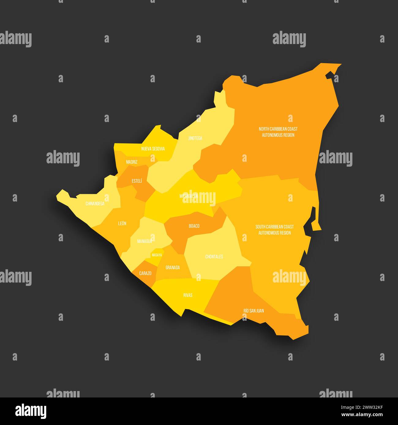